
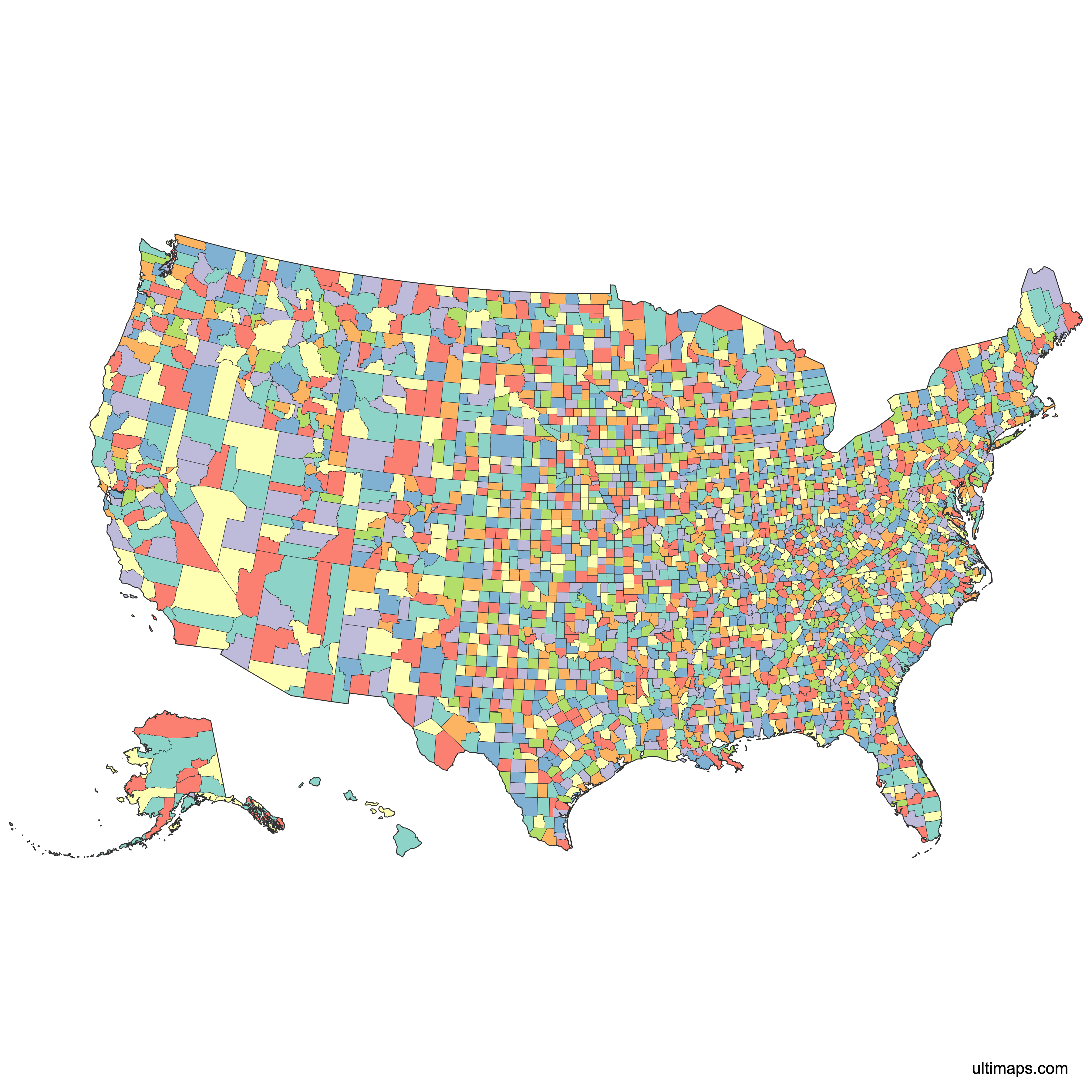
Unstyled Map of the United States Counties

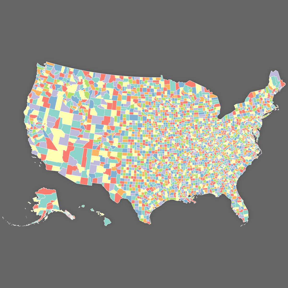
Map of the United States Counties
Create a custom map of the United States counties and export it as a printable format or for use in your publication or presentation.
Color counties based on your data and place pins on the map to highlight specific locations.
Alternatively, develop an interactive map to share or embed on your website.
Map Details
This map supports labels.
This map is divided into 3224 counties:
- Abbeville, SC
- Acadia, LA
- Accomack, VA
- Ada, ID
- Adair, IA
- Adair, KY
- Adair, MO
- Adair, OK
- Adams, CO
- Adams, IA
- Adams, ID
- Adams, IL
- Adams, IN
- Adams, MS
- Adams, ND
- Adams, NE
- Adams, OH
- Adams, PA
- Adams, WA
- Adams, WI
- Addison, VT
- Adjuntas, PR
- Aguada, PR
- Aguadilla, PR
- Aguas Buenas, PR
- Aibonito, PR
- Aiken, SC
- Aitkin, MN
- Alachua, FL
- Alamance, NC
- Alameda, CA
- Alamosa, CO
- Albany, NY
- Albany, WY
- Albemarle, VA
- Alcona, MI
- Alcorn, MS
- Aleutians East, AK
- Aleutians West, AK
- Alexander, IL
- Alexander, NC
- Alexandria, VA
- Alfalfa, OK
- Alger, MI
- Allamakee, IA
- Allegan, MI
- Allegany, MD
- Allegany, NY
- Alleghany, NC
- Alleghany, VA
- Allegheny, PA
- Allen, IN
- Allen, KS
- Allen, KY
- Allen, LA
- Allen, OH
- Allendale, SC
- Alpena, MI
- Alpine, CA
- Amador, CA
- Amelia, VA
- Amherst, VA
- Amite, MS
- Añasco, PR
- Anchorage, AK
- Anderson, KS
- Anderson, KY
- Anderson, SC
- Anderson, TN
- Anderson, TX
- Andrew, MO
- Andrews, TX
- Androscoggin, ME
- Angelina, TX
- Anne Arundel, MD
- Anoka, MN
- Anson, NC
- Antelope, NE
- Antrim, MI
- Apache, AZ
- Appanoose, IA
- Appling, GA
- Appomattox, VA
- Aransas, TX
- Arapahoe, CO
- Archer, TX
- Archuleta, CO
- Arecibo, PR
- Arenac, MI
- Arkansas, AR
- Arlington, VA
- Armstrong, PA
- Armstrong, TX
- Aroostook, ME
- Arroyo, PR
- Arthur, NE
- Ascension, LA
- Ashe, NC
- Ashland, OH
- Ashland, WI
- Ashley, AR
- Ashtabula, OH
- Asotin, WA
- Assumption, LA
- Atascosa, TX
- Atchison, KS
- Atchison, MO
- Athens, OH
- Atkinson, GA
- Atlantic, NJ
- Atoka, OK
- Attala, MS
- Audrain, MO
- Audubon, IA
- Auglaize, OH
- Augusta, VA
- Aurora, SD
- Austin, TX
- Autauga, AL
- Avery, NC
- Avoyelles, LA
- Baca, CO
- Bacon, GA
- Bailey, TX
- Baker, FL
- Baker, GA
- Baker, OR
- Baldwin, AL
- Baldwin, GA
- Ballard, KY
- Baltimore, MD
- Baltimore, MD
- Bamberg, SC
- Bandera, TX
- Banks, GA
- Banner, NE
- Bannock, ID
- Baraga, MI
- Barber, KS
- Barbour, AL
- Barbour, WV
- Barceloneta, PR
- Barnes, ND
- Barnstable, MA
- Barnwell, SC
- Barranquitas, PR
- Barren, KY
- Barron, WI
- Barrow, GA
- Barry, MI
- Barry, MO
- Bartholomew, IN
- Barton, KS
- Barton, MO
- Bartow, GA
- Bastrop, TX
- Bates, MO
- Bath, KY
- Bath, VA
- Baxter, AR
- Bay, FL
- Bay, MI
- Bayamn, PR
- Bayfield, WI
- Baylor, TX
- Beadle, SD
- Bear Lake, ID
- Beaufort, NC
- Beaufort, SC
- Beauregard, LA
- Beaver, OK
- Beaver, PA
- Beaver, UT
- Beaverhead, MT
- Becker, MN
- Beckham, OK
- Bedford, PA
- Bedford, TN
- Bedford, VA
- Bee, TX
- Belknap, NH
- Bell, KY
- Bell, TX
- Belmont, OH
- Beltrami, MN
- Ben Hill, GA
- Benewah, ID
- Bennett, SD
- Bennington, VT
- Benson, ND
- Bent, CO
- Benton, AR
- Benton, IA
- Benton, IN
- Benton, MN
- Benton, MO
- Benton, MS
- Benton, OR
- Benton, TN
- Benton, WA
- Benzie, MI
- Bergen, NJ
- Berkeley, SC
- Berkeley, WV
- Berks, PA
- Berkshire, MA
- Bernalillo, NM
- Berrien, GA
- Berrien, MI
- Bertie, NC
- Bethel, AK
- Bexar, TX
- Bibb, AL
- Bibb, GA
- Bienville, LA
- Big Horn, MT
- Big Horn, WY
- Big Stone, MN
- Billings, ND
- Bingham, ID
- Black Hawk, IA
- Blackford, IN
- Bladen, NC
- Blaine, ID
- Blaine, MT
- Blaine, NE
- Blaine, OK
- Blair, PA
- Blanco, TX
- Bland, VA
- Bleckley, GA
- Bledsoe, TN
- Blount, AL
- Blount, TN
- Blue Earth, MN
- Boise, ID
- Bolivar, MS
- Bollinger, MO
- Bon Homme, SD
- Bond, IL
- Bonner, ID
- Bonneville, ID
- Boone, AR
- Boone, IA
- Boone, IL
- Boone, IN
- Boone, KY
- Boone, MO
- Boone, NE
- Boone, WV
- Borden, TX
- Bosque, TX
- Bossier, LA
- Botetourt, VA
- Bottineau, ND
- Boulder, CO
- Boundary, ID
- Bourbon, KS
- Bourbon, KY
- Bowie, TX
- Bowman, ND
- Box Butte, NE
- Box Elder, UT
- Boyd, KY
- Boyd, NE
- Boyle, KY
- Bracken, KY
- Bradford, FL
- Bradford, PA
- Bradley, AR
- Bradley, TN
- Branch, MI
- Brantley, GA
- Braxton, WV
- Brazoria, TX
- Brazos, TX
- Breathitt, KY
- Breckinridge, KY
- Bremer, IA
- Brevard, FL
- Brewster, TX
- Briscoe, TX
- Bristol Bay, AK
- Bristol, MA
- Bristol, RI
- Bristol, VA
- Broadwater, MT
- Bronx, NY
- Brooke, WV
- Brookings, SD
- Brooks, GA
- Brooks, TX
- Broome, NY
- Broomfield, CO
- Broward, FL
- Brown, IL
- Brown, IN
- Brown, KS
- Brown, MN
- Brown, NE
- Brown, OH
- Brown, SD
- Brown, TX
- Brown, WI
- Brule, SD
- Brunswick, NC
- Brunswick, VA
- Bryan, GA
- Bryan, OK
- Buchanan, IA
- Buchanan, MO
- Buchanan, VA
- Buckingham, VA
- Bucks, PA
- Buena Vista, IA
- Buena Vista, VA
- Buffalo, NE
- Buffalo, SD
- Buffalo, WI
- Bullitt, KY
- Bulloch, GA
- Bullock, AL
- Buncombe, NC
- Bureau, IL
- Burke, GA
- Burke, NC
- Burke, ND
- Burleigh, ND
- Burleson, TX
- Burlington, NJ
- Burnet, TX
- Burnett, WI
- Burt, NE
- Butler, AL
- Butler, IA
- Butler, KS
- Butler, KY
- Butler, MO
- Butler, NE
- Butler, OH
- Butler, PA
- Butte, CA
- Butte, ID
- Butte, SD
- Butts, GA
- Cabarrus, NC
- Cabell, WV
- Cabo Rojo, PR
- Cache, UT
- Caddo, LA
- Caddo, OK
- Caguas, PR
- Calaveras, CA
- Calcasieu, LA
- Caldwell, KY
- Caldwell, LA
- Caldwell, MO
- Caldwell, NC
- Caldwell, TX
- Caledonia, VT
- Calhoun, AL
- Calhoun, AR
- Calhoun, FL
- Calhoun, GA
- Calhoun, IA
- Calhoun, IL
- Calhoun, MI
- Calhoun, MS
- Calhoun, SC
- Calhoun, TX
- Calhoun, WV
- Callahan, TX
- Callaway, MO
- Calloway, KY
- Calumet, WI
- Calvert, MD
- Camas, ID
- Cambria, PA
- Camden, GA
- Camden, MO
- Camden, NC
- Camden, NJ
- Cameron, LA
- Cameron, PA
- Cameron, TX
- Camp, TX
- Campbell, KY
- Campbell, SD
- Campbell, TN
- Campbell, VA
- Campbell, WY
- Camuy, PR
- Canadian, OK
- Candler, GA
- Cannon, TN
- Canvanas, PR
- Canyon, ID
- Cape Girardeau, MO
- Cape May, NJ
- Carbon, MT
- Carbon, PA
- Carbon, UT
- Carbon, WY
- Caribou, ID
- Carlisle, KY
- Carlton, MN
- Carolina, PR
- Caroline, MD
- Caroline, VA
- Carroll, AR
- Carroll, GA
- Carroll, IA
- Carroll, IL
- Carroll, IN
- Carroll, KY
- Carroll, MD
- Carroll, MO
- Carroll, MS
- Carroll, NH
- Carroll, OH
- Carroll, TN
- Carroll, VA
- Carson, NV
- Carson, TX
- Carter, KY
- Carter, MO
- Carter, MT
- Carter, OK
- Carter, TN
- Carteret, NC
- Carver, MN
- Cascade, MT
- Casey, KY
- Cass, IA
- Cass, IL
- Cass, IN
- Cass, MI
- Cass, MN
- Cass, MO
- Cass, ND
- Cass, NE
- Cass, TX
- Cassia, ID
- Castro, TX
- Caswell, NC
- Catahoula, LA
- Cataño, PR
- Catawba, NC
- Catoosa, GA
- Catron, NM
- Cattaraugus, NY
- Cavalier, ND
- Cayey, PR
- Cayuga, NY
- Cecil, MD
- Cedar, IA
- Cedar, MO
- Cedar, NE
- Ceiba, PR
- Centre, PA
- Cerro Gordo, IA
- Chaffee, CO
- Chambers, AL
- Chambers, TX
- Champaign, IL
- Champaign, OH
- Chariton, MO
- Charles City, VA
- Charles Mix, SD
- Charles, MD
- Charleston, SC
- Charlevoix, MI
- Charlotte, FL
- Charlotte, VA
- Charlottesville, VA
- Charlton, GA
- Chase, KS
- Chase, NE
- Chatham, GA
- Chatham, NC
- Chattahoochee, GA
- Chattooga, GA
- Chautauqua, KS
- Chautauqua, NY
- Chaves, NM
- Cheatham, TN
- Cheboygan, MI
- Chelan, WA
- Chemung, NY
- Chenango, NY
- Cherokee, AL
- Cherokee, GA
- Cherokee, IA
- Cherokee, KS
- Cherokee, NC
- Cherokee, OK
- Cherokee, SC
- Cherokee, TX
- Cherry, NE
- Chesapeake, VA
- Cheshire, NH
- Chester, PA
- Chester, SC
- Chester, TN
- Chesterfield, SC
- Chesterfield, VA
- Cheyenne, CO
- Cheyenne, KS
- Cheyenne, NE
- Chickasaw, IA
- Chickasaw, MS
- Chicot, AR
- Childress, TX
- Chilton, AL
- Chippewa, MI
- Chippewa, MN
- Chippewa, WI
- Chisago, MN
- Chittenden, VT
- Choctaw, AL
- Choctaw, MS
- Choctaw, OK
- Chouteau, MT
- Chowan, NC
- Christian, IL
- Christian, KY
- Christian, MO
- Chugach, AK
- Churchill, NV
- Ciales, PR
- Cibola, NM
- Cidra, PR
- Cimarron, OK
- Citrus, FL
- Clackamas, OR
- Claiborne, LA
- Claiborne, MS
- Claiborne, TN
- Clallam, WA
- Clare, MI
- Clarendon, SC
- Clarion, PA
- Clark, AR
- Clark, ID
- Clark, IL
- Clark, IN
- Clark, KS
- Clark, KY
- Clark, MO
- Clark, NV
- Clark, OH
- Clark, SD
- Clark, WA
- Clark, WI
- Clarke, AL
- Clarke, GA
- Clarke, IA
- Clarke, MS
- Clarke, VA
- Clatsop, OR
- Clay, AL
- Clay, AR
- Clay, FL
- Clay, GA
- Clay, IA
- Clay, IL
- Clay, IN
- Clay, KS
- Clay, KY
- Clay, MN
- Clay, MO
- Clay, MS
- Clay, NC
- Clay, NE
- Clay, SD
- Clay, TN
- Clay, TX
- Clay, WV
- Clayton, GA
- Clayton, IA
- Clear Creek, CO
- Clearfield, PA
- Clearwater, ID
- Clearwater, MN
- Cleburne, AL
- Cleburne, AR
- Clermont, OH
- Cleveland, AR
- Cleveland, NC
- Cleveland, OK
- Clinch, GA
- Clinton, IA
- Clinton, IL
- Clinton, IN
- Clinton, KY
- Clinton, MI
- Clinton, MO
- Clinton, NY
- Clinton, OH
- Clinton, PA
- Cloud, KS
- Coahoma, MS
- Coal, OK
- Coamo, PR
- Cobb, GA
- Cochise, AZ
- Cochran, TX
- Cocke, TN
- Coconino, AZ
- Codington, SD
- Coffee, AL
- Coffee, GA
- Coffee, TN
- Coffey, KS
- Coke, TX
- Colbert, AL
- Cole, MO
- Coleman, TX
- Coles, IL
- Colfax, NE
- Colfax, NM
- Colleton, SC
- Collier, FL
- Collin, TX
- Collingsworth, TX
- Colonial Heights, VA
- Colorado, TX
- Colquitt, GA
- Columbia, AR
- Columbia, FL
- Columbia, GA
- Columbia, NY
- Columbia, OR
- Columbia, PA
- Columbia, WA
- Columbia, WI
- Columbiana, OH
- Columbus, NC
- Colusa, CA
- Comal, TX
- Comanche, KS
- Comanche, OK
- Comanche, TX
- Comero, PR
- Concho, TX
- Concordia, LA
- Conecuh, AL
- Conejos, CO
- Contra Costa, CA
- Converse, WY
- Conway, AR
- Cook, GA
- Cook, IL
- Cook, MN
- Cooke, TX
- Cooper, MO
- Coos, NH
- Coos, OR
- Coosa, AL
- Copiah, MS
- Copper River, AK
- Corozal, PR
- Corson, SD
- Cortland, NY
- Coryell, TX
- Coshocton, OH
- Costilla, CO
- Cottle, TX
- Cotton, OK
- Cottonwood, MN
- Covington, AL
- Covington, MS
- Covington, VA
- Coweta, GA
- Cowley, KS
- Cowlitz, WA
- Craig, OK
- Craig, VA
- Craighead, AR
- Crane, TX
- Craven, NC
- Crawford, AR
- Crawford, GA
- Crawford, IA
- Crawford, IL
- Crawford, IN
- Crawford, KS
- Crawford, MI
- Crawford, MO
- Crawford, OH
- Crawford, PA
- Crawford, WI
- Creek, OK
- Crenshaw, AL
- Crisp, GA
- Crittenden, AR
- Crittenden, KY
- Crockett, TN
- Crockett, TX
- Crook, OR
- Crook, WY
- Crosby, TX
- Cross, AR
- Crow Wing, MN
- Crowley, CO
- Culberson, TX
- Culebra, PR
- Cullman, AL
- Culpeper, VA
- Cumberland, IL
- Cumberland, KY
- Cumberland, ME
- Cumberland, NC
- Cumberland, NJ
- Cumberland, PA
- Cumberland, TN
- Cumberland, VA
- Cuming, NE
- Currituck, NC
- Curry, NM
- Curry, OR
- Custer, CO
- Custer, ID
- Custer, MT
- Custer, NE
- Custer, OK
- Custer, SD
- Cuyahoga, OH
- Dade, GA
- Dade, MO
- Daggett, UT
- Dakota, MN
- Dakota, NE
- Dale, AL
- Dallam, TX
- Dallas, AL
- Dallas, AR
- Dallas, IA
- Dallas, MO
- Dallas, TX
- Dane, WI
- Daniels, MT
- Danville, VA
- Dare, NC
- Darke, OH
- Darlington, SC
- Dauphin, PA
- Davidson, NC
- Davidson, TN
- Davie, NC
- Daviess, IN
- Daviess, KY
- Daviess, MO
- Davis, IA
- Davis, UT
- Davison, SD
- Dawes, NE
- Dawson, GA
- Dawson, MT
- Dawson, NE
- Dawson, TX
- Day, SD
- De Soto, LA
- De Witt, IL
- Deaf Smith, TX
- Dearborn, IN
- DeBaca, NM
- Decatur, GA
- Decatur, IA
- Decatur, IN
- Decatur, KS
- Decatur, TN
- Deer Lodge, MT
- Defiance, OH
- DeKalb, AL
- DeKalb, GA
- DeKalb, IL
- DeKalb, IN
- DeKalb, MO
- DeKalb, TN
- Del Norte, CA
- Delaware, IA
- Delaware, IN
- Delaware, NY
- Delaware, OH
- Delaware, OK
- Delaware, PA
- Delta, CO
- Delta, MI
- Delta, TX
- Denali, AK
- Dent, MO
- Denton, TX
- Denver, CO
- Des Moines, IA
- Deschutes, OR
- Desha, AR
- DeSoto, FL
- DeSoto, MS
- Deuel, NE
- Deuel, SD
- Dewey, OK
- Dewey, SD
- DeWitt, TX
- Dickens, TX
- Dickenson, VA
- Dickey, ND
- Dickinson, IA
- Dickinson, KS
- Dickinson, MI
- Dickson, TN
- Dillingham, AK
- Dillon, SC
- Dimmit, TX
- Dinwiddie, VA
- Divide, ND
- Dixie, FL
- Dixon, NE
- Doddridge, WV
- Dodge, GA
- Dodge, MN
- Dodge, NE
- Dodge, WI
- Dolores, CO
- Doña Ana, NM
- Doniphan, KS
- Donley, TX
- Dooly, GA
- Door, WI
- Dorado, PR
- Dorchester, MD
- Dorchester, SC
- Dougherty, GA
- Douglas, CO
- Douglas, GA
- Douglas, IL
- Douglas, KS
- Douglas, MN
- Douglas, MO
- Douglas, NE
- Douglas, NV
- Douglas, OR
- Douglas, SD
- Douglas, WA
- Douglas, WI
- Drew, AR
- Dubois, IN
- Dubuque, IA
- Duchesne, UT
- Dukes, MA
- Dundy, NE
- Dunklin, MO
- Dunn, ND
- Dunn, WI
- DuPage, IL
- Duplin, NC
- Durham, NC
- Dutchess, NY
- Duval, FL
- Duval, TX
- Dyer, TN
- Eagle, CO
- Early, GA
- East Baton Rouge, LA
- East Carroll, LA
- East Feliciana, LA
- Eastland, TX
- Eaton, MI
- Eau Claire, WI
- Echols, GA
- Ector, TX
- Eddy, ND
- Eddy, NM
- Edgar, IL
- Edgecombe, NC
- Edgefield, SC
- Edmonson, KY
- Edmunds, SD
- Edwards, IL
- Edwards, KS
- Edwards, TX
- Effingham, GA
- Effingham, IL
- El Dorado, CA
- El Paso, CO
- El Paso, TX
- Elbert, CO
- Elbert, GA
- Elk, KS
- Elk, PA
- Elkhart, IN
- Elko, NV
- Elliott, KY
- Ellis, KS
- Ellis, OK
- Ellis, TX
- Ellsworth, KS
- Elmore, AL
- Elmore, ID
- Emanuel, GA
- Emery, UT
- Emmet, IA
- Emmet, MI
- Emmons, ND
- Emporia, VA
- Erath, TX
- Erie, NY
- Erie, OH
- Erie, PA
- Escambia, AL
- Escambia, FL
- Esmeralda, NV
- Essex, MA
- Essex, NJ
- Essex, NY
- Essex, VA
- Essex, VT
- Estill, KY
- Etowah, AL
- Eureka, NV
- Evangeline, LA
- Evans, GA
- Fairbanks North Star, AK
- Fairfax, VA
- Fairfax, VA
- Fairfield, CT
- Fairfield, OH
- Fairfield, SC
- Fajardo, PR
- Fall River, SD
- Fallon, MT
- Falls Church, VA
- Falls, TX
- Fannin, GA
- Fannin, TX
- Faribault, MN
- Faulk, SD
- Faulkner, AR
- Fauquier, VA
- Fayette, AL
- Fayette, GA
- Fayette, IA
- Fayette, IL
- Fayette, IN
- Fayette, KY
- Fayette, OH
- Fayette, PA
- Fayette, TN
- Fayette, TX
- Fayette, WV
- Fentress, TN
- Fergus, MT
- Ferry, WA
- Fillmore, MN
- Fillmore, NE
- Finney, KS
- Fisher, TX
- Flagler, FL
- Flathead, MT
- Fleming, KY
- Florence, SC
- Florence, WI
- Florida, PR
- Floyd, GA
- Floyd, IA
- Floyd, IN
- Floyd, KY
- Floyd, TX
- Floyd, VA
- Fluvanna, VA
- Foard, TX
- Fond du Lac, WI
- Ford, IL
- Ford, KS
- Forest, PA
- Forest, WI
- Forrest, MS
- Forsyth, GA
- Forsyth, NC
- Fort Bend, TX
- Foster, ND
- Fountain, IN
- Franklin, AL
- Franklin, AR
- Franklin, FL
- Franklin, GA
- Franklin, IA
- Franklin, ID
- Franklin, IL
- Franklin, IN
- Franklin, KS
- Franklin, KY
- Franklin, LA
- Franklin, MA
- Franklin, ME
- Franklin, MO
- Franklin, MS
- Franklin, NC
- Franklin, NE
- Franklin, NY
- Franklin, OH
- Franklin, PA
- Franklin, TN
- Franklin, TX
- Franklin, VA
- Franklin, VA
- Franklin, VT
- Franklin, WA
- Frederick, MD
- Frederick, VA
- Fredericksburg, VA
- Freeborn, MN
- Freestone, TX
- Fremont, CO
- Fremont, IA
- Fremont, ID
- Fremont, WY
- Fresno, CA
- Frio, TX
- Frontier, NE
- Fulton, AR
- Fulton, GA
- Fulton, IL
- Fulton, IN
- Fulton, KY
- Fulton, NY
- Fulton, OH
- Fulton, PA
- Furnas, NE
- Gadsden, FL
- Gage, NE
- Gaines, TX
- Galax, VA
- Gallatin, IL
- Gallatin, KY
- Gallatin, MT
- Gallia, OH
- Galveston, TX
- Garden, NE
- Garfield, CO
- Garfield, MT
- Garfield, NE
- Garfield, OK
- Garfield, UT
- Garfield, WA
- Garland, AR
- Garrard, KY
- Garrett, MD
- Garvin, OK
- Garza, TX
- Gasconade, MO
- Gaston, NC
- Gates, NC
- Geary, KS
- Geauga, OH
- Gem, ID
- Genesee, MI
- Genesee, NY
- Geneva, AL
- Gentry, MO
- George, MS
- Georgetown, SC
- Gibson, IN
- Gibson, TN
- Gila, AZ
- Gilchrist, FL
- Giles, TN
- Giles, VA
- Gillespie, TX
- Gilliam, OR
- Gilmer, GA
- Gilmer, WV
- Gilpin, CO
- Glacier, MT
- Glades, FL
- Gladwin, MI
- Glascock, GA
- Glasscock, TX
- Glenn, CA
- Gloucester, NJ
- Gloucester, VA
- Glynn, GA
- Gogebic, MI
- Golden Valley, MT
- Golden Valley, ND
- Goliad, TX
- Gonzales, TX
- Goochland, VA
- Goodhue, MN
- Gooding, ID
- Gordon, GA
- Goshen, WY
- Gosper, NE
- Gove, KS
- Grady, GA
- Grady, OK
- Grafton, NH
- Graham, AZ
- Graham, KS
- Graham, NC
- Grainger, TN
- Grand Forks, ND
- Grand Isle, VT
- Grand Traverse, MI
- Grand, CO
- Grand, UT
- Granite, MT
- Grant, AR
- Grant, IN
- Grant, KS
- Grant, KY
- Grant, LA
- Grant, MN
- Grant, ND
- Grant, NE
- Grant, NM
- Grant, OK
- Grant, OR
- Grant, SD
- Grant, WA
- Grant, WI
- Grant, WV
- Granville, NC
- Gratiot, MI
- Graves, KY
- Gray, KS
- Gray, TX
- Grays Harbor, WA
- Grayson, KY
- Grayson, TX
- Grayson, VA
- Greeley, KS
- Greeley, NE
- Green Lake, WI
- Green, KY
- Green, WI
- Greenbrier, WV
- Greene, AL
- Greene, AR
- Greene, GA
- Greene, IA
- Greene, IL
- Greene, IN
- Greene, MO
- Greene, MS
- Greene, NC
- Greene, NY
- Greene, OH
- Greene, PA
- Greene, TN
- Greene, VA
- Greenlee, AZ
- Greensville, VA
- Greenup, KY
- Greenville, SC
- Greenwood, KS
- Greenwood, SC
- Greer, OK
- Gregg, TX
- Gregory, SD
- Grenada, MS
- Griggs, ND
- Grimes, TX
- Grundy, IA
- Grundy, IL
- Grundy, MO
- Grundy, TN
- Guadalupe, NM
- Guadalupe, TX
- Guánica, PR
- Guayama, PR
- Guayanilla, PR
- Guaynabo, PR
- Guernsey, OH
- Guilford, NC
- Gulf, FL
- Gunnison, CO
- Gurabo, PR
- Guthrie, IA
- Gwinnett, GA
- Haakon, SD
- Habersham, GA
- Haines, AK
- Hale, AL
- Hale, TX
- Halifax, NC
- Halifax, VA
- Hall, GA
- Hall, NE
- Hall, TX
- Hamblen, TN
- Hamilton, FL
- Hamilton, IA
- Hamilton, IL
- Hamilton, IN
- Hamilton, KS
- Hamilton, NE
- Hamilton, NY
- Hamilton, OH
- Hamilton, TN
- Hamilton, TX
- Hamlin, SD
- Hampden, MA
- Hampshire, MA
- Hampshire, WV
- Hampton, SC
- Hampton, VA
- Hancock, GA
- Hancock, IA
- Hancock, IL
- Hancock, IN
- Hancock, KY
- Hancock, ME
- Hancock, MS
- Hancock, OH
- Hancock, TN
- Hancock, WV
- Hand, SD
- Hanover, VA
- Hansford, TX
- Hanson, SD
- Haralson, GA
- Hardee, FL
- Hardeman, TN
- Hardeman, TX
- Hardin, IA
- Hardin, IL
- Hardin, KY
- Hardin, OH
- Hardin, TN
- Hardin, TX
- Harding, NM
- Harding, SD
- Hardy, WV
- Harford, MD
- Harlan, KY
- Harlan, NE
- Harmon, OK
- Harnett, NC
- Harney, OR
- Harper, KS
- Harper, OK
- Harris, GA
- Harris, TX
- Harrison, IA
- Harrison, IN
- Harrison, KY
- Harrison, MO
- Harrison, MS
- Harrison, OH
- Harrison, TX
- Harrison, WV
- Harrisonburg, VA
- Hart, GA
- Hart, KY
- Hartford, CT
- Hartley, TX
- Harvey, KS
- Haskell, KS
- Haskell, OK
- Haskell, TX
- Hatillo, PR
- Hawaii, HI
- Hawkins, TN
- Hayes, NE
- Hays, TX
- Haywood, NC
- Haywood, TN
- Heard, GA
- Hemphill, TX
- Hempstead, AR
- Henderson, IL
- Henderson, KY
- Henderson, NC
- Henderson, TN
- Henderson, TX
- Hendricks, IN
- Hendry, FL
- Hennepin, MN
- Henrico, VA
- Henry, AL
- Henry, GA
- Henry, IA
- Henry, IL
- Henry, IN
- Henry, KY
- Henry, MO
- Henry, OH
- Henry, TN
- Henry, VA
- Herkimer, NY
- Hernando, FL
- Hertford, NC
- Hettinger, ND
- Hickman, KY
- Hickman, TN
- Hickory, MO
- Hidalgo, NM
- Hidalgo, TX
- Highland, OH
- Highland, VA
- Highlands, FL
- Hill, MT
- Hill, TX
- Hillsborough, FL
- Hillsborough, NH
- Hillsdale, MI
- Hinds, MS
- Hinsdale, CO
- Hitchcock, NE
- Hocking, OH
- Hockley, TX
- Hodgeman, KS
- Hoke, NC
- Holmes, FL
- Holmes, MS
- Holmes, OH
- Holt, MO
- Holt, NE
- Honolulu, HI
- Hood River, OR
- Hood, TX
- Hooker, NE
- Hoonah-Angoon, AK
- Hopewell, VA
- Hopkins, KY
- Hopkins, TX
- Hormigueros, PR
- Horry, SC
- Hot Spring, AR
- Hot Springs, WY
- Houghton, MI
- Houston, AL
- Houston, GA
- Houston, MN
- Houston, TN
- Houston, TX
- Howard, AR
- Howard, IA
- Howard, IN
- Howard, MD
- Howard, MO
- Howard, NE
- Howard, TX
- Howell, MO
- Hubbard, MN
- Hudson, NJ
- Hudspeth, TX
- Huerfano, CO
- Hughes, OK
- Hughes, SD
- Humacao, PR
- Humboldt, CA
- Humboldt, IA
- Humboldt, NV
- Humphreys, MS
- Humphreys, TN
- Hunt, TX
- Hunterdon, NJ
- Huntingdon, PA
- Huntington, IN
- Huron, MI
- Huron, OH
- Hutchinson, SD
- Hutchinson, TX
- Hyde, NC
- Hyde, SD
- Iberia, LA
- Iberville, LA
- Ida, IA
- Idaho, ID
- Imperial, CA
- Independence, AR
- Indian River, FL
- Indiana, PA
- Ingham, MI
- Inyo, CA
- Ionia, MI
- Iosco, MI
- Iowa, IA
- Iowa, WI
- Iredell, NC
- Irion, TX
- Iron, MI
- Iron, MO
- Iron, UT
- Iron, WI
- Iroquois, IL
- Irwin, GA
- Isabela, PR
- Isabella, MI
- Isanti, MN
- Island, WA
- Isle of Wight, VA
- Issaquena, MS
- Itasca, MN
- Itawamba, MS
- Izard, AR
- Jack, TX
- Jackson, AL
- Jackson, AR
- Jackson, CO
- Jackson, FL
- Jackson, GA
- Jackson, IA
- Jackson, IL
- Jackson, IN
- Jackson, KS
- Jackson, KY
- Jackson, LA
- Jackson, MI
- Jackson, MN
- Jackson, MO
- Jackson, MS
- Jackson, NC
- Jackson, OH
- Jackson, OK
- Jackson, OR
- Jackson, SD
- Jackson, TN
- Jackson, TX
- Jackson, WI
- Jackson, WV
- James City, VA
- Jasper, GA
- Jasper, IA
- Jasper, IL
- Jasper, IN
- Jasper, MO
- Jasper, MS
- Jasper, SC
- Jasper, TX
- Jay, IN
- Jayuya, PR
- Jeff Davis, GA
- Jeff Davis, TX
- Jefferson Davis, LA
- Jefferson Davis, MS
- Jefferson, AL
- Jefferson, AR
- Jefferson, CO
- Jefferson, FL
- Jefferson, GA
- Jefferson, IA
- Jefferson, ID
- Jefferson, IL
- Jefferson, IN
- Jefferson, KS
- Jefferson, KY
- Jefferson, LA
- Jefferson, MO
- Jefferson, MS
- Jefferson, MT
- Jefferson, NE
- Jefferson, NY
- Jefferson, OH
- Jefferson, OK
- Jefferson, OR
- Jefferson, PA
- Jefferson, TN
- Jefferson, TX
- Jefferson, WA
- Jefferson, WI
- Jefferson, WV
- Jenkins, GA
- Jennings, IN
- Jerauld, SD
- Jerome, ID
- Jersey, IL
- Jessamine, KY
- Jewell, KS
- Jim Hogg, TX
- Jim Wells, TX
- Jo Daviess, IL
- Johnson, AR
- Johnson, GA
- Johnson, IA
- Johnson, IL
- Johnson, IN
- Johnson, KS
- Johnson, KY
- Johnson, MO
- Johnson, NE
- Johnson, TN
- Johnson, TX
- Johnson, WY
- Johnston, NC
- Johnston, OK
- Jones, GA
- Jones, IA
- Jones, MS
- Jones, NC
- Jones, SD
- Jones, TX
- Josephine, OR
- Juab, UT
- Juana Daz, PR
- Judith Basin, MT
- Juncos, PR
- Juneau, AK
- Juneau, WI
- Juniata, PA
- Kalamazoo, MI
- Kalawao, HI
- Kalkaska, MI
- Kanabec, MN
- Kanawha, WV
- Kandiyohi, MN
- Kane, IL
- Kane, UT
- Kankakee, IL
- Karnes, TX
- Kauai, HI
- Kaufman, TX
- Kay, OK
- Kearney, NE
- Kearny, KS
- Keith, NE
- Kemper, MS
- Kenai Peninsula, AK
- Kendall, IL
- Kendall, TX
- Kenedy, TX
- Kennebec, ME
- Kenosha, WI
- Kent, DE
- Kent, MD
- Kent, MI
- Kent, RI
- Kent, TX
- Kenton, KY
- Keokuk, IA
- Kern, CA
- Kerr, TX
- Kershaw, SC
- Ketchikan Gateway, AK
- Kewaunee, WI
- Keweenaw, MI
- Keya Paha, NE
- Kidder, ND
- Kimball, NE
- Kimble, TX
- King and Queen, VA
- King George, VA
- King William, VA
- King, TX
- King, WA
- Kingfisher, OK
- Kingman, KS
- Kings, CA
- Kings, NY
- Kingsbury, SD
- Kinney, TX
- Kiowa, CO
- Kiowa, KS
- Kiowa, OK
- Kit Carson, CO
- Kitsap, WA
- Kittitas, WA
- Kittson, MN
- Klamath, OR
- Kleberg, TX
- Klickitat, WA
- Knott, KY
- Knox, IL
- Knox, IN
- Knox, KY
- Knox, ME
- Knox, MO
- Knox, NE
- Knox, OH
- Knox, TN
- Knox, TX
- Kodiak Island, AK
- Koochiching, MN
- Kootenai, ID
- Kosciusko, IN
- Kossuth, IA
- Kusilvak, AK
- La Crosse, WI
- La Paz, AZ
- La Plata, CO
- La Salle, IL
- La Salle, LA
- La Salle, TX
- Labette, KS
- Lac qui Parle, MN
- Lackawanna, PA
- Laclede, MO
- Lafayette, AR
- Lafayette, FL
- Lafayette, LA
- Lafayette, MO
- Lafayette, MS
- Lafayette, WI
- Lafourche, LA
- LaGrange, IN
- Lajas, PR
- Lake and Peninsula, AK
- Lake of the Woods, MN
- Lake, CA
- Lake, CO
- Lake, FL
- Lake, IL
- Lake, IN
- Lake, MI
- Lake, MN
- Lake, MT
- Lake, OH
- Lake, OR
- Lake, SD
- Lake, TN
- Lamar, AL
- Lamar, GA
- Lamar, MS
- Lamar, TX
- Lamb, TX
- Lamoille, VT
- LaMoure, ND
- Lampasas, TX
- Lancaster, NE
- Lancaster, PA
- Lancaster, SC
- Lancaster, VA
- Lander, NV
- Lane, KS
- Lane, OR
- Langlade, WI
- Lanier, GA
- Lapeer, MI
- LaPorte, IN
- Laramie, WY
- Lares, PR
- Larimer, CO
- Larue, KY
- Las Animas, CO
- Las Maras, PR
- Las Piedras, PR
- Lassen, CA
- Latah, ID
- Latimer, OK
- Lauderdale, AL
- Lauderdale, MS
- Lauderdale, TN
- Laurel, KY
- Laurens, GA
- Laurens, SC
- Lavaca, TX
- Lawrence, AL
- Lawrence, AR
- Lawrence, IL
- Lawrence, IN
- Lawrence, KY
- Lawrence, MO
- Lawrence, MS
- Lawrence, OH
- Lawrence, PA
- Lawrence, SD
- Lawrence, TN
- Le Flore, OK
- Le Sueur, MN
- Lea, NM
- Leake, MS
- Leavenworth, KS
- Lebanon, PA
- Lee, AL
- Lee, AR
- Lee, FL
- Lee, GA
- Lee, IA
- Lee, IL
- Lee, KY
- Lee, MS
- Lee, NC
- Lee, SC
- Lee, TX
- Lee, VA
- Leelanau, MI
- Leflore, MS
- Lehigh, PA
- Lemhi, ID
- Lenawee, MI
- Lenoir, NC
- Leon, FL
- Leon, TX
- Leslie, KY
- Letcher, KY
- Levy, FL
- Lewis and Clark, MT
- Lewis, ID
- Lewis, KY
- Lewis, MO
- Lewis, NY
- Lewis, TN
- Lewis, WA
- Lewis, WV
- Lexington, SC
- Lexington, VA
- Liberty, FL
- Liberty, GA
- Liberty, MT
- Liberty, TX
- Licking, OH
- Limestone, AL
- Limestone, TX
- Lincoln, AR
- Lincoln, CO
- Lincoln, GA
- Lincoln, ID
- Lincoln, KS
- Lincoln, KY
- Lincoln, LA
- Lincoln, ME
- Lincoln, MN
- Lincoln, MO
- Lincoln, MS
- Lincoln, MT
- Lincoln, NC
- Lincoln, NE
- Lincoln, NM
- Lincoln, NV
- Lincoln, OK
- Lincoln, OR
- Lincoln, SD
- Lincoln, TN
- Lincoln, WA
- Lincoln, WI
- Lincoln, WV
- Lincoln, WY
- Linn, IA
- Linn, KS
- Linn, MO
- Linn, OR
- Lipscomb, TX
- Litchfield, CT
- Little River, AR
- Live Oak, TX
- Livingston, IL
- Livingston, KY
- Livingston, LA
- Livingston, MI
- Livingston, MO
- Livingston, NY
- Llano, TX
- Logan, AR
- Logan, CO
- Logan, IL
- Logan, KS
- Logan, KY
- Logan, ND
- Logan, NE
- Logan, OH
- Logan, OK
- Logan, WV
- Loíza, PR
- Long, GA
- Lonoke, AR
- Lorain, OH
- Los Alamos, NM
- Los Angeles, CA
- Loudon, TN
- Loudoun, VA
- Louisa, IA
- Louisa, VA
- Loup, NE
- Love, OK
- Loving, TX
- Lowndes, AL
- Lowndes, GA
- Lowndes, MS
- Lubbock, TX
- Lucas, IA
- Lucas, OH
- Luce, MI
- Lumpkin, GA
- Luna, NM
- Lunenburg, VA
- Luquillo, PR
- Luzerne, PA
- Lycoming, PA
- Lyman, SD
- Lynchburg, VA
- Lynn, TX
- Lyon, IA
- Lyon, KS
- Lyon, KY
- Lyon, MN
- Lyon, NV
- Mackinac, MI
- Macomb, MI
- Macon, AL
- Macon, GA
- Macon, IL
- Macon, MO
- Macon, NC
- Macon, TN
- Macoupin, IL
- Madera, CA
- Madison, AL
- Madison, AR
- Madison, FL
- Madison, GA
- Madison, IA
- Madison, ID
- Madison, IL
- Madison, IN
- Madison, KY
- Madison, LA
- Madison, MO
- Madison, MS
- Madison, MT
- Madison, NC
- Madison, NE
- Madison, NY
- Madison, OH
- Madison, TN
- Madison, TX
- Madison, VA
- Magoffin, KY
- Mahaska, IA
- Mahnomen, MN
- Mahoning, OH
- Major, OK
- Malheur, OR
- Manassas Park, VA
- Manassas, VA
- Manatee, FL
- Manatí, PR
- Manistee, MI
- Manitowoc, WI
- Marathon, WI
- Marengo, AL
- Maricao, PR
- Maricopa, AZ
- Maries, MO
- Marin, CA
- Marinette, WI
- Marion, AL
- Marion, AR
- Marion, FL
- Marion, GA
- Marion, IA
- Marion, IL
- Marion, IN
- Marion, KS
- Marion, KY
- Marion, MO
- Marion, MS
- Marion, OH
- Marion, OR
- Marion, SC
- Marion, TN
- Marion, TX
- Marion, WV
- Mariposa, CA
- Marlboro, SC
- Marquette, MI
- Marquette, WI
- Marshall, AL
- Marshall, IA
- Marshall, IL
- Marshall, IN
- Marshall, KS
- Marshall, KY
- Marshall, MN
- Marshall, MS
- Marshall, OK
- Marshall, SD
- Marshall, TN
- Marshall, WV
- Martin, FL
- Martin, IN
- Martin, KY
- Martin, MN
- Martin, NC
- Martin, TX
- Martinsville, VA
- Mason, IL
- Mason, KY
- Mason, MI
- Mason, TX
- Mason, WA
- Mason, WV
- Massac, IL
- Matagorda, TX
- Matanuska-Susitna, AK
- Mathews, VA
- Maui, HI
- Maunabo, PR
- Maury, TN
- Maverick, TX
- Mayagez, PR
- Mayes, OK
- McClain, OK
- McCone, MT
- McCook, SD
- McCormick, SC
- McCracken, KY
- McCreary, KY
- McCulloch, TX
- McCurtain, OK
- McDonald, MO
- McDonough, IL
- McDowell, NC
- McDowell, WV
- McDuffie, GA
- McHenry, IL
- McHenry, ND
- McIntosh, GA
- McIntosh, ND
- McIntosh, OK
- McKean, PA
- McKenzie, ND
- McKinley, NM
- McLean, IL
- McLean, KY
- McLean, ND
- McLennan, TX
- McLeod, MN
- McMinn, TN
- McMullen, TX
- McNairy, TN
- McPherson, KS
- McPherson, NE
- McPherson, SD
- Meade, KS
- Meade, KY
- Meade, SD
- Meagher, MT
- Mecklenburg, NC
- Mecklenburg, VA
- Mecosta, MI
- Medina, OH
- Medina, TX
- Meeker, MN
- Meigs, OH
- Meigs, TN
- Mellette, SD
- Menard, IL
- Menard, TX
- Mendocino, CA
- Menifee, KY
- Menominee, MI
- Menominee, WI
- Merced, CA
- Mercer, IL
- Mercer, KY
- Mercer, MO
- Mercer, ND
- Mercer, NJ
- Mercer, OH
- Mercer, PA
- Mercer, WV
- Meriwether, GA
- Merrick, NE
- Merrimack, NH
- Mesa, CO
- Metcalfe, KY
- Miami-Dade, FL
- Miami, IN
- Miami, KS
- Miami, OH
- Middlesex, CT
- Middlesex, MA
- Middlesex, NJ
- Middlesex, VA
- Midland, MI
- Midland, TX
- Mifflin, PA
- Milam, TX
- Millard, UT
- Mille Lacs, MN
- Miller, AR
- Miller, GA
- Miller, MO
- Mills, IA
- Mills, TX
- Milwaukee, WI
- Miner, SD
- Mineral, CO
- Mineral, MT
- Mineral, NV
- Mineral, WV
- Mingo, WV
- Minidoka, ID
- Minnehaha, SD
- Missaukee, MI
- Mississippi, AR
- Mississippi, MO
- Missoula, MT
- Mitchell, GA
- Mitchell, IA
- Mitchell, KS
- Mitchell, NC
- Mitchell, TX
- Mobile, AL
- Moca, PR
- Modoc, CA
- Moffat, CO
- Mohave, AZ
- Moniteau, MO
- Monmouth, NJ
- Mono, CA
- Monona, IA
- Monongalia, WV
- Monroe, AL
- Monroe, AR
- Monroe, FL
- Monroe, GA
- Monroe, IA
- Monroe, IL
- Monroe, IN
- Monroe, KY
- Monroe, MI
- Monroe, MO
- Monroe, MS
- Monroe, NY
- Monroe, OH
- Monroe, PA
- Monroe, TN
- Monroe, WI
- Monroe, WV
- Montague, TX
- Montcalm, MI
- Monterey, CA
- Montezuma, CO
- Montgomery, AL
- Montgomery, AR
- Montgomery, GA
- Montgomery, IA
- Montgomery, IL
- Montgomery, IN
- Montgomery, KS
- Montgomery, KY
- Montgomery, MD
- Montgomery, MO
- Montgomery, MS
- Montgomery, NC
- Montgomery, NY
- Montgomery, OH
- Montgomery, PA
- Montgomery, TN
- Montgomery, TX
- Montgomery, VA
- Montmorency, MI
- Montour, PA
- Montrose, CO
- Moody, SD
- Moore, NC
- Moore, TN
- Moore, TX
- Mora, NM
- Morehouse, LA
- Morgan, AL
- Morgan, CO
- Morgan, GA
- Morgan, IL
- Morgan, IN
- Morgan, KY
- Morgan, MO
- Morgan, OH
- Morgan, TN
- Morgan, UT
- Morgan, WV
- Morovis, PR
- Morrill, NE
- Morris, KS
- Morris, NJ
- Morris, TX
- Morrison, MN
- Morrow, OH
- Morrow, OR
- Morton, KS
- Morton, ND
- Motley, TX
- Moultrie, IL
- Mountrail, ND
- Mower, MN
- Muhlenberg, KY
- Multnomah, OR
- Murray, GA
- Murray, MN
- Murray, OK
- Muscatine, IA
- Muscogee, GA
- Muskegon, MI
- Muskingum, OH
- Muskogee, OK
- Musselshell, MT
- Nacogdoches, TX
- Naguabo, PR
- Nance, NE
- Nantucket, MA
- Napa, CA
- Naranjito, PR
- Nash, NC
- Nassau, FL
- Nassau, NY
- Natchitoches, LA
- Natrona, WY
- Navajo, AZ
- Navarro, TX
- Nelson, KY
- Nelson, ND
- Nelson, VA
- Nemaha, KS
- Nemaha, NE
- Neosho, KS
- Neshoba, MS
- Ness, KS
- Nevada, AR
- Nevada, CA
- New Castle, DE
- New Hanover, NC
- New Haven, CT
- New Kent, VA
- New London, CT
- New Madrid, MO
- New York, NY
- Newaygo, MI
- Newberry, SC
- Newport News, VA
- Newport, RI
- Newton, AR
- Newton, GA
- Newton, IN
- Newton, MO
- Newton, MS
- Newton, TX
- Nez Perce, ID
- Niagara, NY
- Nicholas, KY
- Nicholas, WV
- Nicollet, MN
- Niobrara, WY
- Noble, IN
- Noble, OH
- Noble, OK
- Nobles, MN
- Nodaway, MO
- Nolan, TX
- Nome, AK
- Norfolk, MA
- Norfolk, VA
- Norman, MN
- North Slope, AK
- Northampton, NC
- Northampton, PA
- Northampton, VA
- Northumberland, PA
- Northumberland, VA
- Northwest Arctic, AK
- Norton, KS
- Norton, VA
- Nottoway, VA
- Nowata, OK
- Noxubee, MS
- Nuckolls, NE
- Nueces, TX
- Nye, NV
- O'Brien, IA
- Oakland, MI
- Obion, TN
- Ocean, NJ
- Oceana, MI
- Ochiltree, TX
- Oconee, GA
- Oconee, SC
- Oconto, WI
- Ogemaw, MI
- Oglala Lakota, SD
- Ogle, IL
- Oglethorpe, GA
- Ohio, IN
- Ohio, KY
- Ohio, WV
- Okaloosa, FL
- Okanogan, WA
- Okeechobee, FL
- Okfuskee, OK
- Oklahoma, OK
- Okmulgee, OK
- Oktibbeha, MS
- Oldham, KY
- Oldham, TX
- Oliver, ND
- Olmsted, MN
- Oneida, ID
- Oneida, NY
- Oneida, WI
- Onondaga, NY
- Onslow, NC
- Ontario, NY
- Ontonagon, MI
- Orange, CA
- Orange, FL
- Orange, IN
- Orange, NC
- Orange, NY
- Orange, TX
- Orange, VA
- Orange, VT
- Orangeburg, SC
- Oregon, MO
- Orleans, LA
- Orleans, NY
- Orleans, VT
- Orocovis, PR
- Osage, KS
- Osage, MO
- Osage, OK
- Osborne, KS
- Osceola, FL
- Osceola, IA
- Osceola, MI
- Oscoda, MI
- Oswego, NY
- Otero, CO
- Otero, NM
- Otoe, NE
- Otsego, MI
- Otsego, NY
- Ottawa, KS
- Ottawa, MI
- Ottawa, OH
- Ottawa, OK
- Otter Tail, MN
- Ouachita, AR
- Ouachita, LA
- Ouray, CO
- Outagamie, WI
- Overton, TN
- Owen, IN
- Owen, KY
- Owsley, KY
- Owyhee, ID
- Oxford, ME
- Ozark, MO
- Ozaukee, WI
- Pacific, WA
- Page, IA
- Page, VA
- Palm Beach, FL
- Palo Alto, IA
- Palo Pinto, TX
- Pamlico, NC
- Panola, MS
- Panola, TX
- Park, CO
- Park, MT
- Park, WY
- Parke, IN
- Parker, TX
- Parmer, TX
- Pasco, FL
- Pasquotank, NC
- Passaic, NJ
- Patillas, PR
- Patrick, VA
- Paulding, GA
- Paulding, OH
- Pawnee, KS
- Pawnee, NE
- Pawnee, OK
- Payette, ID
- Payne, OK
- Peach, GA
- Pearl River, MS
- Pecos, TX
- Pembina, ND
- Pemiscot, MO
- Pend Oreille, WA
- Pender, NC
- Pendleton, KY
- Pendleton, WV
- Pennington, MN
- Pennington, SD
- Penobscot, ME
- Peñuelas, PR
- Peoria, IL
- Pepin, WI
- Perkins, NE
- Perkins, SD
- Perquimans, NC
- Perry, AL
- Perry, AR
- Perry, IL
- Perry, IN
- Perry, KY
- Perry, MO
- Perry, MS
- Perry, OH
- Perry, PA
- Perry, TN
- Pershing, NV
- Person, NC
- Petersburg, AK
- Petersburg, VA
- Petroleum, MT
- Pettis, MO
- Phelps, MO
- Phelps, NE
- Philadelphia, PA
- Phillips, AR
- Phillips, CO
- Phillips, KS
- Phillips, MT
- Piatt, IL
- Pickaway, OH
- Pickens, AL
- Pickens, GA
- Pickens, SC
- Pickett, TN
- Pierce, GA
- Pierce, ND
- Pierce, NE
- Pierce, WA
- Pierce, WI
- Pike, AL
- Pike, AR
- Pike, GA
- Pike, IL
- Pike, IN
- Pike, KY
- Pike, MO
- Pike, MS
- Pike, OH
- Pike, PA
- Pima, AZ
- Pinal, AZ
- Pine, MN
- Pinellas, FL
- Pipestone, MN
- Piscataquis, ME
- Pitkin, CO
- Pitt, NC
- Pittsburg, OK
- Pittsylvania, VA
- Piute, UT
- Placer, CA
- Plaquemines, LA
- Platte, MO
- Platte, NE
- Platte, WY
- Pleasants, WV
- Plumas, CA
- Plymouth, IA
- Plymouth, MA
- Pocahontas, IA
- Pocahontas, WV
- Poinsett, AR
- Pointe Coupee, LA
- Polk, AR
- Polk, FL
- Polk, GA
- Polk, IA
- Polk, MN
- Polk, MO
- Polk, NC
- Polk, NE
- Polk, OR
- Polk, TN
- Polk, TX
- Polk, WI
- Ponce, PR
- Pondera, MT
- Pontotoc, MS
- Pontotoc, OK
- Pope, AR
- Pope, IL
- Pope, MN
- Poquoson, VA
- Portage, OH
- Portage, WI
- Porter, IN
- Portsmouth, VA
- Posey, IN
- Pottawatomie, KS
- Pottawatomie, OK
- Pottawattamie, IA
- Potter, PA
- Potter, SD
- Potter, TX
- Powder River, MT
- Powell, KY
- Powell, MT
- Power, ID
- Poweshiek, IA
- Powhatan, VA
- Prairie, AR
- Prairie, MT
- Pratt, KS
- Preble, OH
- Prentiss, MS
- Presidio, TX
- Presque Isle, MI
- Preston, WV
- Price, WI
- Prince Edward, VA
- Prince George, VA
- Prince George's, MD
- Prince of Wales-Hyder, AK
- Prince William, VA
- Providence, RI
- Prowers, CO
- Pueblo, CO
- Pulaski, AR
- Pulaski, GA
- Pulaski, IL
- Pulaski, IN
- Pulaski, KY
- Pulaski, MO
- Pulaski, VA
- Pushmataha, OK
- Putnam, FL
- Putnam, GA
- Putnam, IL
- Putnam, IN
- Putnam, MO
- Putnam, NY
- Putnam, OH
- Putnam, TN
- Putnam, WV
- Quay, NM
- Quebradillas, PR
- Queen Anne's, MD
- Queens, NY
- Quitman, GA
- Quitman, MS
- Rabun, GA
- Racine, WI
- Radford, VA
- Rains, TX
- Raleigh, WV
- Ralls, MO
- Ramsey, MN
- Ramsey, ND
- Randall, TX
- Randolph, AL
- Randolph, AR
- Randolph, GA
- Randolph, IL
- Randolph, IN
- Randolph, MO
- Randolph, NC
- Randolph, WV
- Rankin, MS
- Ransom, ND
- Rapides, LA
- Rappahannock, VA
- Ravalli, MT
- Rawlins, KS
- Ray, MO
- Reagan, TX
- Real, TX
- Red Lake, MN
- Red River, LA
- Red River, TX
- Red Willow, NE
- Redwood, MN
- Reeves, TX
- Refugio, TX
- Reno, KS
- Rensselaer, NY
- Renville, MN
- Renville, ND
- Republic, KS
- Reynolds, MO
- Rhea, TN
- Rice, KS
- Rice, MN
- Rich, UT
- Richardson, NE
- Richland, IL
- Richland, LA
- Richland, MT
- Richland, ND
- Richland, OH
- Richland, SC
- Richland, WI
- Richmond, GA
- Richmond, NC
- Richmond, NY
- Richmond, VA
- Richmond, VA
- Riley, KS
- Rincón, PR
- Ringgold, IA
- Rio Arriba, NM
- Rio Blanco, CO
- Rio Grande, CO
- Río Grande, PR
- Ripley, IN
- Ripley, MO
- Ritchie, WV
- Riverside, CA
- Roane, TN
- Roane, WV
- Roanoke, VA
- Roanoke, VA
- Roberts, SD
- Roberts, TX
- Robertson, KY
- Robertson, TN
- Robertson, TX
- Robeson, NC
- Rock Island, IL
- Rock, MN
- Rock, NE
- Rock, WI
- Rockbridge, VA
- Rockcastle, KY
- Rockdale, GA
- Rockingham, NC
- Rockingham, NH
- Rockingham, VA
- Rockland, NY
- Rockwall, TX
- Roger Mills, OK
- Rogers, OK
- Rolette, ND
- Rooks, KS
- Roosevelt, MT
- Roosevelt, NM
- Roscommon, MI
- Roseau, MN
- Rosebud, MT
- Ross, OH
- Routt, CO
- Rowan, KY
- Rowan, NC
- Runnels, TX
- Rush, IN
- Rush, KS
- Rusk, TX
- Rusk, WI
- Russell, AL
- Russell, KS
- Russell, KY
- Russell, VA
- Rutherford, NC
- Rutherford, TN
- Rutland, VT
- Sabana Grande, PR
- Sabine, LA
- Sabine, TX
- Sac, IA
- Sacramento, CA
- Sagadahoc, ME
- Saginaw, MI
- Saguache, CO
- Saint Bernard, LA
- Saint Charles, LA
- Saint Charles, MO
- Saint Clair, AL
- Saint Clair, IL
- Saint Clair, MI
- Saint Clair, MO
- Saint Croix, VI
- Saint Croix, WI
- Saint Francis, AR
- Saint Francois, MO
- Saint Helena, LA
- Saint James, LA
- Saint John the Baptist, LA
- Saint John, VI
- Saint Johns, FL
- Saint Joseph, IN
- Saint Joseph, MI
- Saint Landry, LA
- Saint Lawrence, NY
- Saint Louis, MN
- Saint Louis, MO
- Saint Louis, MO
- Saint Lucie, FL
- Saint Martin, LA
- Saint Mary, LA
- Saint Mary's, MD
- Saint Tammany, LA
- Saint Thomas, VI
- Sainte Genevieve, MO
- Salem, NJ
- Salem, VA
- Salinas, PR
- Saline, AR
- Saline, IL
- Saline, KS
- Saline, MO
- Saline, NE
- Salt Lake, UT
- Saluda, SC
- Sampson, NC
- San Augustine, TX
- San Benito, CA
- San Bernardino, CA
- San Diego, CA
- San Francisco, CA
- San Germn, PR
- San Jacinto, TX
- San Joaquin, CA
- San Juan, CO
- San Juan, NM
- San Juan, PR
- San Juan, UT
- San Juan, WA
- San Lorenzo, PR
- San Luis Obispo, CA
- San Mateo, CA
- San Miguel, CO
- San Miguel, NM
- San Patricio, TX
- San Saba, TX
- San Sebastin, PR
- Sanborn, SD
- Sanders, MT
- Sandoval, NM
- Sandusky, OH
- Sangamon, IL
- Sanilac, MI
- Sanpete, UT
- Santa Barbara, CA
- Santa Clara, CA
- Santa Cruz, AZ
- Santa Cruz, CA
- Santa Fe, NM
- Santa Isabel, PR
- Santa Rosa, FL
- Sarasota, FL
- Saratoga, NY
- Sargent, ND
- Sarpy, NE
- Sauk, WI
- Saunders, NE
- Sawyer, WI
- Schenectady, NY
- Schleicher, TX
- Schley, GA
- Schoharie, NY
- Schoolcraft, MI
- Schuyler, IL
- Schuyler, MO
- Schuyler, NY
- Schuylkill, PA
- Scioto, OH
- Scotland, MO
- Scotland, NC
- Scott, AR
- Scott, IA
- Scott, IL
- Scott, IN
- Scott, KS
- Scott, KY
- Scott, MN
- Scott, MO
- Scott, MS
- Scott, TN
- Scott, VA
- Scotts Bluff, NE
- Screven, GA
- Scurry, TX
- Searcy, AR
- Sebastian, AR
- Sedgwick, CO
- Sedgwick, KS
- Seminole, FL
- Seminole, GA
- Seminole, OK
- Seneca, NY
- Seneca, OH
- Sequatchie, TN
- Sequoyah, OK
- Sevier, AR
- Sevier, TN
- Sevier, UT
- Seward, KS
- Seward, NE
- Shackelford, TX
- Shannon, MO
- Sharkey, MS
- Sharp, AR
- Shasta, CA
- Shawano, WI
- Shawnee, KS
- Sheboygan, WI
- Shelby, AL
- Shelby, IA
- Shelby, IL
- Shelby, IN
- Shelby, KY
- Shelby, MO
- Shelby, OH
- Shelby, TN
- Shelby, TX
- Shenandoah, VA
- Sherburne, MN
- Sheridan, KS
- Sheridan, MT
- Sheridan, ND
- Sheridan, NE
- Sheridan, WY
- Sherman, KS
- Sherman, NE
- Sherman, OR
- Sherman, TX
- Shiawassee, MI
- Shoshone, ID
- Sibley, MN
- Sierra, CA
- Sierra, NM
- Silver Bow, MT
- Simpson, KY
- Simpson, MS
- Sioux, IA
- Sioux, ND
- Sioux, NE
- Siskiyou, CA
- Sitka, AK
- Skagit, WA
- Skagway, AK
- Skamania, WA
- Slope, ND
- Smith, KS
- Smith, MS
- Smith, TN
- Smith, TX
- Smyth, VA
- Snohomish, WA
- Snyder, PA
- Socorro, NM
- Solano, CA
- Somerset, MD
- Somerset, ME
- Somerset, NJ
- Somerset, PA
- Somervell, TX
- Sonoma, CA
- Southampton, VA
- Southeast Fairbanks, AK
- Spalding, GA
- Spartanburg, SC
- Spencer, IN
- Spencer, KY
- Spink, SD
- Spokane, WA
- Spotsylvania, VA
- Stafford, KS
- Stafford, VA
- Stanislaus, CA
- Stanley, SD
- Stanly, NC
- Stanton, KS
- Stanton, NE
- Stark, IL
- Stark, ND
- Stark, OH
- Starke, IN
- Starr, TX
- Staunton, VA
- Stearns, MN
- Steele, MN
- Steele, ND
- Stephens, GA
- Stephens, OK
- Stephens, TX
- Stephenson, IL
- Sterling, TX
- Steuben, IN
- Steuben, NY
- Stevens, KS
- Stevens, MN
- Stevens, WA
- Stewart, GA
- Stewart, TN
- Stillwater, MT
- Stoddard, MO
- Stokes, NC
- Stone, AR
- Stone, MO
- Stone, MS
- Stonewall, TX
- Storey, NV
- Story, IA
- Strafford, NH
- Stutsman, ND
- Sublette, WY
- Suffolk, MA
- Suffolk, NY
- Suffolk, VA
- Sullivan, IN
- Sullivan, MO
- Sullivan, NH
- Sullivan, NY
- Sullivan, PA
- Sullivan, TN
- Sully, SD
- Summers, WV
- Summit, CO
- Summit, OH
- Summit, UT
- Sumner, KS
- Sumner, TN
- Sumter, AL
- Sumter, FL
- Sumter, GA
- Sumter, SC
- Sunflower, MS
- Surry, NC
- Surry, VA
- Susquehanna, PA
- Sussex, DE
- Sussex, NJ
- Sussex, VA
- Sutter, CA
- Sutton, TX
- Suwannee, FL
- Swain, NC
- Sweet Grass, MT
- Sweetwater, WY
- Swift, MN
- Swisher, TX
- Switzerland, IN
- Talbot, GA
- Talbot, MD
- Taliaferro, GA
- Talladega, AL
- Tallahatchie, MS
- Tallapoosa, AL
- Tama, IA
- Taney, MO
- Tangipahoa, LA
- Taos, NM
- Tarrant, TX
- Tate, MS
- Tattnall, GA
- Taylor, FL
- Taylor, GA
- Taylor, IA
- Taylor, KY
- Taylor, TX
- Taylor, WI
- Taylor, WV
- Tazewell, IL
- Tazewell, VA
- Tehama, CA
- Telfair, GA
- Teller, CO
- Tensas, LA
- Terrebonne, LA
- Terrell, GA
- Terrell, TX
- Terry, TX
- Teton, ID
- Teton, MT
- Teton, WY
- Texas, MO
- Texas, OK
- Thayer, NE
- Thomas, GA
- Thomas, KS
- Thomas, NE
- Throckmorton, TX
- Thurston, NE
- Thurston, WA
- Tift, GA
- Tillamook, OR
- Tillman, OK
- Tioga, NY
- Tioga, PA
- Tippah, MS
- Tippecanoe, IN
- Tipton, IN
- Tipton, TN
- Tishomingo, MS
- Titus, TX
- Toa Alta, PR
- Toa Baja, PR
- Todd, KY
- Todd, MN
- Todd, SD
- Tolland, CT
- Tom Green, TX
- Tompkins, NY
- Tooele, UT
- Toole, MT
- Toombs, GA
- Torrance, NM
- Towner, ND
- Towns, GA
- Traill, ND
- Transylvania, NC
- Traverse, MN
- Travis, TX
- Treasure, MT
- Trego, KS
- Trempealeau, WI
- Treutlen, GA
- Trigg, KY
- Trimble, KY
- Trinity, CA
- Trinity, TX
- Tripp, SD
- Troup, GA
- Trousdale, TN
- Trujillo Alto, PR
- Trumbull, OH
- Tucker, WV
- Tulare, CA
- Tulsa, OK
- Tunica, MS
- Tuolumne, CA
- Turner, GA
- Turner, SD
- Tuscaloosa, AL
- Tuscarawas, OH
- Tuscola, MI
- Twiggs, GA
- Twin Falls, ID
- Tyler, TX
- Tyler, WV
- Tyrrell, NC
- Uinta, WY
- Uintah, UT
- Ulster, NY
- Umatilla, OR
- Unicoi, TN
- Union, AR
- Union, FL
- Union, GA
- Union, IA
- Union, IL
- Union, IN
- Union, KY
- Union, LA
- Union, MS
- Union, NC
- Union, NJ
- Union, NM
- Union, OH
- Union, OR
- Union, PA
- Union, SC
- Union, SD
- Union, TN
- Upshur, TX
- Upshur, WV
- Upson, GA
- Upton, TX
- Utah, UT
- Utuado, PR
- Uvalde, TX
- Val Verde, TX
- Valencia, NM
- Valley, ID
- Valley, MT
- Valley, NE
- Van Buren, AR
- Van Buren, IA
- Van Buren, MI
- Van Buren, TN
- Van Wert, OH
- Van Zandt, TX
- Vance, NC
- Vanderburgh, IN
- Vega Alta, PR
- Vega Baja, PR
- Venango, PA
- Ventura, CA
- Vermilion, IL
- Vermilion, LA
- Vermillion, IN
- Vernon, LA
- Vernon, MO
- Vernon, WI
- Victoria, TX
- Vieques, PR
- Vigo, IN
- Vilas, WI
- Villalba, PR
- Vinton, OH
- Virginia Beach, VA
- Volusia, FL
- Wabash, IL
- Wabash, IN
- Wabasha, MN
- Wabaunsee, KS
- Wadena, MN
- Wagoner, OK
- Wahkiakum, WA
- Wake, NC
- Wakulla, FL
- Waldo, ME
- Walker, AL
- Walker, GA
- Walker, TX
- Walla Walla, WA
- Wallace, KS
- Waller, TX
- Wallowa, OR
- Walsh, ND
- Walthall, MS
- Walton, FL
- Walton, GA
- Walworth, SD
- Walworth, WI
- Wapello, IA
- Ward, ND
- Ward, TX
- Ware, GA
- Warren, GA
- Warren, IA
- Warren, IL
- Warren, IN
- Warren, KY
- Warren, MO
- Warren, MS
- Warren, NC
- Warren, NJ
- Warren, NY
- Warren, OH
- Warren, PA
- Warren, TN
- Warren, VA
- Warrick, IN
- Wasatch, UT
- Wasco, OR
- Waseca, MN
- Washakie, WY
- Washburn, WI
- Washington DC, DC
- Washington, AL
- Washington, AR
- Washington, CO
- Washington, FL
- Washington, GA
- Washington, IA
- Washington, ID
- Washington, IL
- Washington, IN
- Washington, KS
- Washington, KY
- Washington, LA
- Washington, MD
- Washington, ME
- Washington, MN
- Washington, MO
- Washington, MS
- Washington, NC
- Washington, NE
- Washington, NY
- Washington, OH
- Washington, OK
- Washington, OR
- Washington, PA
- Washington, RI
- Washington, TN
- Washington, TX
- Washington, UT
- Washington, VA
- Washington, VT
- Washington, WI
- Washita, OK
- Washoe, NV
- Washtenaw, MI
- Watauga, NC
- Watonwan, MN
- Waukesha, WI
- Waupaca, WI
- Waushara, WI
- Wayne, GA
- Wayne, IA
- Wayne, IL
- Wayne, IN
- Wayne, KY
- Wayne, MI
- Wayne, MO
- Wayne, MS
- Wayne, NC
- Wayne, NE
- Wayne, NY
- Wayne, OH
- Wayne, PA
- Wayne, TN
- Wayne, UT
- Wayne, WV
- Waynesboro, VA
- Weakley, TN
- Webb, TX
- Weber, UT
- Webster, GA
- Webster, IA
- Webster, KY
- Webster, LA
- Webster, MO
- Webster, MS
- Webster, NE
- Webster, WV
- Weld, CO
- Wells, IN
- Wells, ND
- West Baton Rouge, LA
- West Carroll, LA
- West Feliciana, LA
- Westchester, NY
- Westmoreland, PA
- Westmoreland, VA
- Weston, WY
- Wetzel, WV
- Wexford, MI
- Wharton, TX
- Whatcom, WA
- Wheatland, MT
- Wheeler, GA
- Wheeler, NE
- Wheeler, OR
- Wheeler, TX
- White Pine, NV
- White, AR
- White, GA
- White, IL
- White, IN
- White, TN
- Whiteside, IL
- Whitfield, GA
- Whitley, IN
- Whitley, KY
- Whitman, WA
- Wibaux, MT
- Wichita, KS
- Wichita, TX
- Wicomico, MD
- Wilbarger, TX
- Wilcox, AL
- Wilcox, GA
- Wilkes, GA
- Wilkes, NC
- Wilkin, MN
- Wilkinson, GA
- Wilkinson, MS
- Will, IL
- Willacy, TX
- Williams, ND
- Williams, OH
- Williamsburg, SC
- Williamsburg, VA
- Williamson, IL
- Williamson, TN
- Williamson, TX
- Wilson, KS
- Wilson, NC
- Wilson, TN
- Wilson, TX
- Winchester, VA
- Windham, CT
- Windham, VT
- Windsor, VT
- Winkler, TX
- Winn, LA
- Winnebago, IA
- Winnebago, IL
- Winnebago, WI
- Winneshiek, IA
- Winona, MN
- Winston, AL
- Winston, MS
- Wirt, WV
- Wise, TX
- Wise, VA
- Wolfe, KY
- Wood, OH
- Wood, TX
- Wood, WI
- Wood, WV
- Woodbury, IA
- Woodford, IL
- Woodford, KY
- Woodruff, AR
- Woods, OK
- Woodson, KS
- Woodward, OK
- Worcester, MA
- Worcester, MD
- Worth, GA
- Worth, IA
- Worth, MO
- Wrangell, AK
- Wright, IA
- Wright, MN
- Wright, MO
- Wyandot, OH
- Wyandotte, KS
- Wyoming, NY
- Wyoming, PA
- Wyoming, WV
- Wythe, VA
- Yabucoa, PR
- Yadkin, NC
- Yakima, WA
- Yakutat, AK
- Yalobusha, MS
- Yamhill, OR
- Yancey, NC
- Yankton, SD
- Yates, NY
- Yauco, PR
- Yavapai, AZ
- Yazoo, MS
- Yell, AR
- Yellow Medicine, MN
- Yellowstone, MT
- Yoakum, TX
- Yolo, CA
- York, ME
- York, NE
- York, PA
- York, SC
- York, VA
- Young, TX
- Yuba, CA
- Yukon-Koyukuk, AK
- Yuma, AZ
- Yuma, CO
- Zapata, TX
- Zavala, TX
- Ziebach, SD
Check out the related maps below if you're looking for a different map of the same geographic region.
Free Downloads
You can download free blank Map of the United States Counties and other maps in high resolution PNG, SVG and PDF formats from the blank maps section of the site: Download Blank Map of the United States Counties
Updates
Aug 26, 2024:
- Added map of United States — Counties Counties