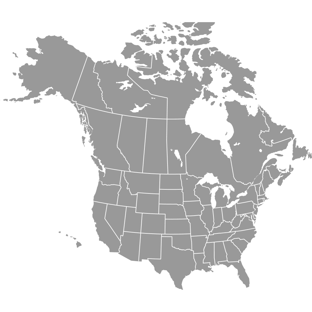
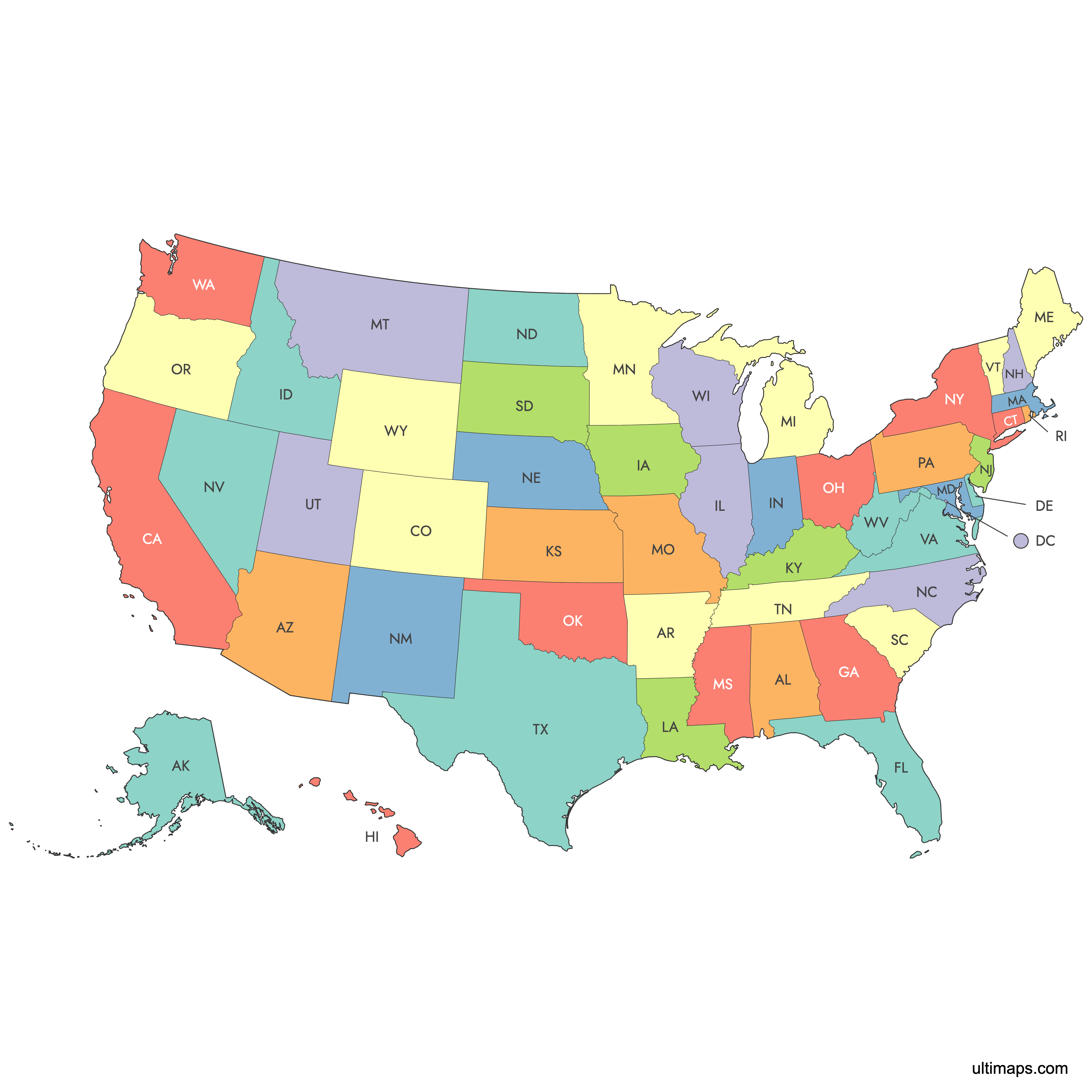
Map of the United States
The United States consists of 50 states, the federal capital district of Washington, D.C., and five major territories. Explore the regions and boundaries of the U.S. with our interactive maps below. Download free maps or learn how to create a custom map of the United States to visualize your own data.
Note: this version of the US map features lower 48 states, Alaska, Hawaii and D.C. Check out Map of United States with Outlying Territories for the version with territories.
Interactive Map of the United States
List of States (51)
| # | State |
|---|---|
| 1 | |
| 2 | |
| 3 | |
| 4 | |
| 5 | |
| 6 | |
| 7 | |
| 8 | |
| 9 | |
| 10 | |
| 11 | |
| 12 | |
| 13 | |
| 14 | |
| 15 | |
| 16 | |
| 17 | |
| 18 | |
| 19 | |
| 20 | |
| 21 | |
| 22 | |
| 23 | |
| 24 | |
| 25 | |
| 26 | |
| 27 | |
| 28 | |
| 29 | |
| 30 | |
| 31 | |
| 32 | |
| 33 | |
| 34 | |
| 35 | |
| 36 | |
| 37 | |
| 38 | |
| 39 | |
| 40 | |
| 41 | |
| 42 | |
| 43 | |
| 44 | |
| 45 | |
| 46 | |
| 47 | |
| 48 | |
| 49 | |
| 50 | |
| 51 |
United States Map: Key Facts
- Number of States: 50 states plus Washington, D.C.
- Largest State by Area: Alaska - 665,384 square miles (1,723,337 km²)
- Smallest State by Area: Rhode Island - 1,545 sq mi (4,001 km²)
- Most Populous State: California - about 39 million residents (2022)
- Least Populous State: Wyoming - approximately 581,000 residents (2022)
- Major Urban Centers: New York City, Los Angeles, Chicago, Houston, Phoenix, Philadelphia
- State Boundaries: Stable since 1959 with Hawaii's admission
- Neighboring Countries: Canada, Mexico, maritime borders with Russia, Cuba, Bahamas
- Time Zones: Six main time zones - Eastern, Central, Mountain, Pacific, Alaska, Hawaii-Aleutian
- Major Physical Features: Rocky Mountains, Appalachian Mountains, Great Lakes, Mississippi River, Gulf of America, Pacific and Atlantic Oceans
- Longest Land Border: U.S.-Canada border - 5,525 mi (8,891 km)
- Fun Fact: Alaska is larger than the next three largest states combined (Texas, California, Montana)
Free Downloads
You can download free blank Map of the United States and other maps in high resolution PNG, SVG and PDF formats from the blank maps section of the site: Download Blank Map of the United States
Custom Map Features
This map supports labels.
This map is divided into 51 states.
Updates
Oct 4, 2024:
- Added labels
Sep 28, 2023:
- Added map of the United States (with Alaska and Hawaii)
Frequently Asked Questions
There are 50 states in the United States, plus the federal district of Washington, D.C., and five major inhabited territories.
Alaska is the largest state, covering 665,384 square miles (1,723,337 km²).
Rhode Island is the smallest state, with an area of 1,545 sq mi (4,001 km²).
California is the most populous state, with 39,538,223 residents as of the 2020 Census.
Wyoming is the least populous state, with 576,851 residents as of the 2020 Census.
The U.S. shares land borders with Canada (north) and Mexico (south), and maritime borders with Russia, Cuba, and the Bahamas.
Use Ultimaps to create custom maps of the United States. Color-code states manually or upload data, place pins, customize the look and feel, and export to PNG, PDF, or SVG.
Yes, with Ultimaps, you can customize state boundaries, add labels, and adjust colors to create a personalized map.
The United States has six main time zones: Eastern, Central, Mountain, Pacific, Alaska, and Hawaii-Aleutian.