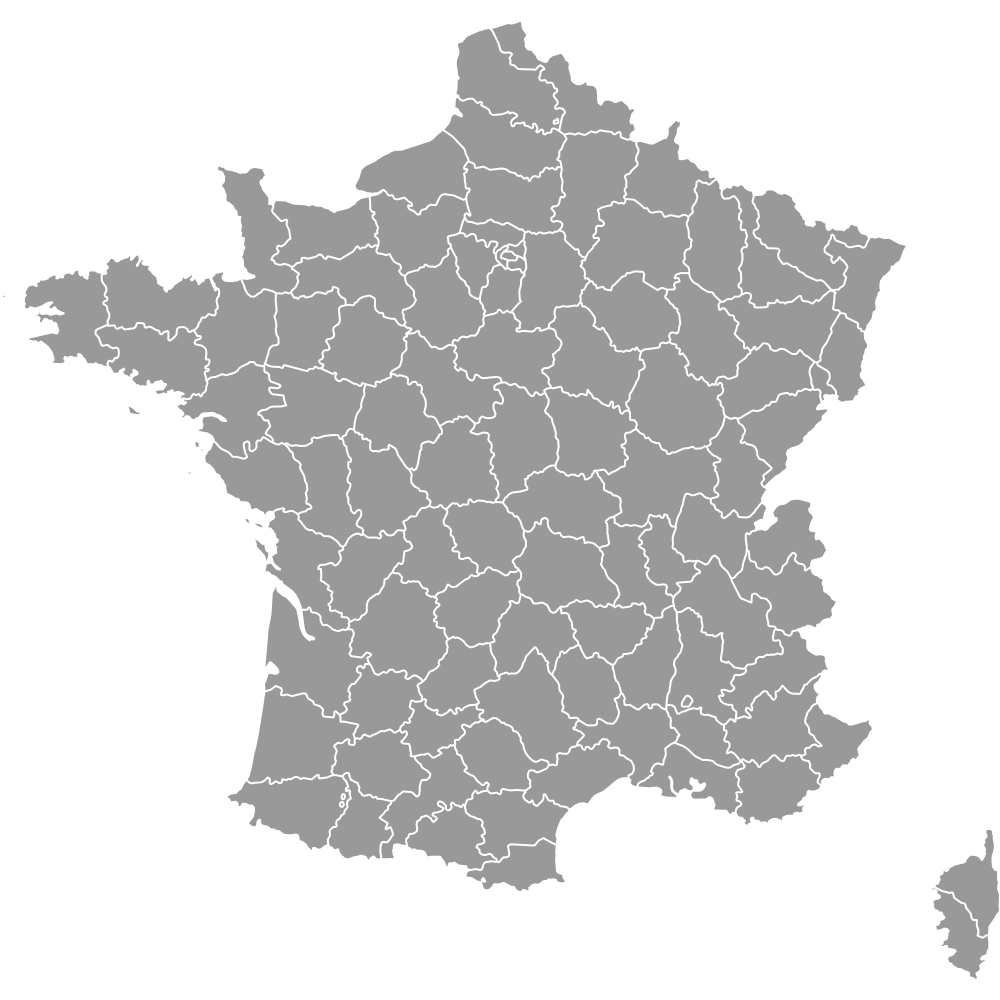
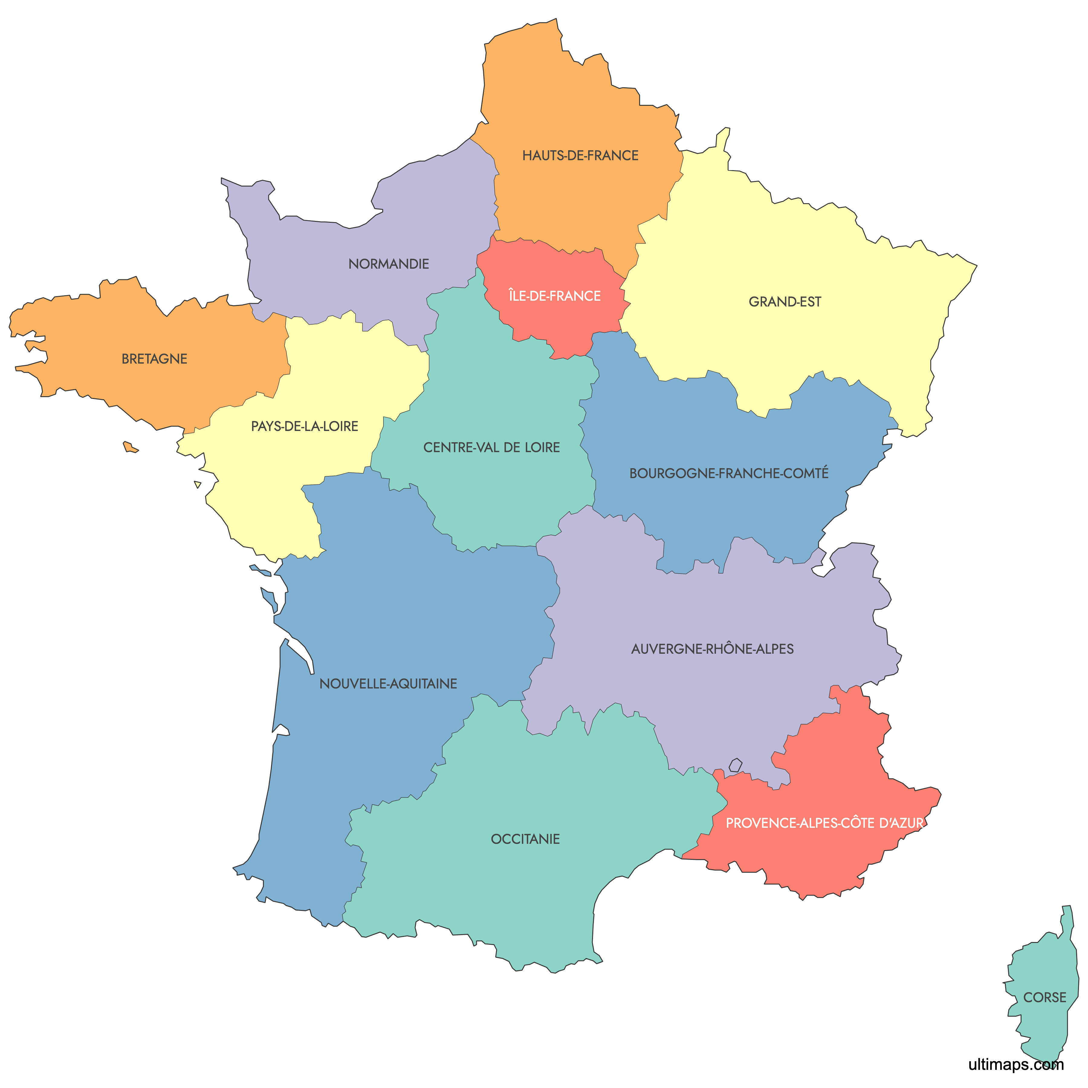
Map of France Regions
France is divided into 13 metropolitan regions (and 5 overseas regions that are not covered by this map). The 2016 regional reform reduced the number of metropolitan regions from 22 to 13 to improve administrative efficiency. Use the interactive maps below to explore these regions and their boundaries. Download free maps or learn more about creating a custom map of France to visualize your own data.
See also: Map of France Deparments
Interactive Map of France Regions
List of Regions (13)
| # | Region |
|---|---|
| 1 | |
| 2 | |
| 3 | |
| 4 | |
| 5 | |
| 6 | |
| 7 | |
| 8 | |
| 9 | |
| 10 | |
| 11 | |
| 12 | |
| 13 |
France Regions: Key Facts
- Total number of regions: 13 metropolitan and 5 overseas
- Most populous region: Île-de-France with 12 million residents
- Largest city: Paris, with a population of 2.24 million within 40 square miles
- Regions with major urban centers: Auvergne-Rhône-Alpes (Lyon, Grenoble), Grand Est (Strasbourg), Occitanie (Toulouse, Montpellier), Nouvelle-Aquitaine (Bordeaux)
- France borders with: Spain, Andorra, Monaco, Italy, Switzerland, Germany, Luxembourg, and Belgium
- 2016 Regional Reform: Reduced regions from 22 to 13 through strategic mergers
Interesting Facts
- Île-de-France accounts for 18% of France's total population
Free Downloads
You can download free blank Map of France Regions and other maps in high resolution PNG, SVG and PDF formats from the blank maps section of the site: Download Blank Map of France Regions
Custom Map Features
This map supports labels.
This map is divided into 13 regions.
Updates
Sep 28, 2023:
- Added map of France Regions
Frequently Asked Questions
France has 13 metropolitan regions and 5 overseas regions.
Île-de-France is the most populous region, with 12 million residents, accounting for 18% of France's population.
Use Ultimaps to create custom maps of France's regions. Customize colors, place pins, and export to PNG, PDF, or SVG.