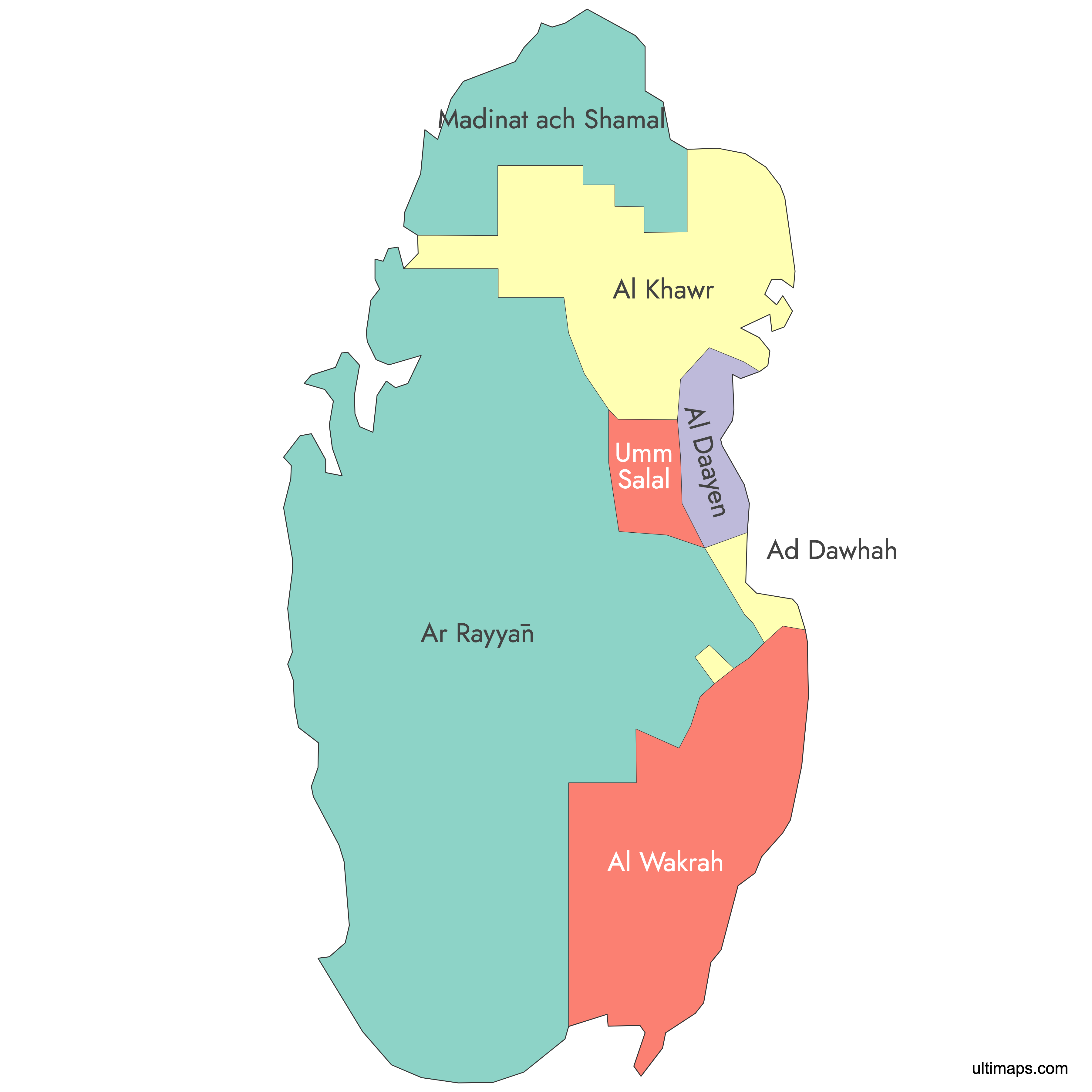
Map of Qatar Municipalities
Qatar is divided into 8 municipalities (baladiyat), ranging from the densely populated capital region of Doha to the sparsely settled northern tip at Al Shamal. Use the interactive maps below to explore municipal boundaries. Download free reference maps or learn more about creating a custom map of Qatar to visualize your own data.
Interactive Map of Qatar Municipalities
List of Municipalities (7)
| # | Municipality |
|---|---|
| 1 | |
| 2 | |
| 3 | |
| 4 | |
| 5 | |
| 6 | |
| 7 |
About Qatar's Municipalities
- Number of Municipalities: 8 municipalities: Ad Dawhah (Doha), Al Rayyan, Al Wakrah, Umm Salal, Al Daayen, Al Khor & Al Thakhira, Al Shahaniya, and Al Shamal.
- Largest Municipality by Area: Al Rayyan, approximately 2,700 km² (1,042 sq mi).
- Smallest Municipality by Area: Umm Salal, approximately 310 km² (120 sq mi).
- Most Populous Municipality: Ad Dawhah (Doha), with a population of 956,457 (2010 census period).
- Least Populous Municipality: Al Shamal, with a population of 8,794 (2010 census period).
- Capital: Doha, located in Ad Dawhah Municipality, serves as the national capital and primary economic center.
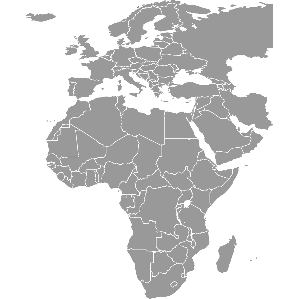
- Bordering Countries: Qatar shares a land border with Saudi Arabia to the south and southwest. It has maritime borders with Bahrain to the northwest, the United Arab Emirates to the east, and Iran to the northeast, all across the Persian Gulf (Arabian Gulf).
- Time Zone: Arabia Standard Time (AST), UTC+03:00. No daylight saving time is observed.
- Current Boundaries Established: The present 8-municipality structure has been in place since 2015, following major consolidations in 2004.
Interesting Facts
- Municipal populations range from under 10,000 in Al Shamal to nearly one million in Doha, reflecting Qatar's extreme concentration of people and services in the capital region.
- Al Daayen is the newest municipality, created in 2004 by Resolution No. 13 from parts of Umm Salal and Al Khor.
- The 2004 reorganization eliminated several smaller municipalities, including Al Ghuwariyah, Al Jumaliyah, Jarayan al Batnah, and Mesaieed, which were merged into larger units.
- Al Shahaniya is one of the few largely inland municipalities, historically known for desert landscapes and camel racing.
- Each of the 8 municipalities has its own Municipality Spatial Development Plan (MSDP) under the Qatar National Master Plan, guiding zoning and urban growth.
Free Downloads
You can download free blank Map of Qatar Municipalities and other maps in high resolution PNG, SVG and PDF formats from the blank maps section of the site: Download Blank Map of Qatar Municipalities
Custom Map Features
This map supports labels.
This map is divided into 7 municipalities.
Updates
Sep 12, 2024:
- Added labels
Apr 14, 2024:
- Added map of Qatar
Frequently Asked Questions
Qatar is divided into 8 municipalities (baladiyat). The current structure has been in place since 2015, following a major reorganization in 2004 that merged several smaller municipalities and created the new municipality of Al Daayen. The eight are Ad Dawhah (Doha), Al Rayyan, Al Wakrah, Umm Salal, Al Daayen, Al Khor & Al Thakhira, Al Shahaniya, and Al Shamal.
Al Rayyan is the largest municipality by area, covering approximately 2,700 km² (1,042 sq mi). It spans much of Qatar's western and southwestern interior, stretching from the suburbs west of Doha to the Saudi Arabian border. Its size grew further in 2004 when the former municipalities of Al Jumaliyah and part of Jarayan al Batnah were merged into it.
Umm Salal is the smallest municipality by area, covering approximately 310 km² (120 sq mi). It sits directly north of Doha and includes the settlements of Umm Salal Ali and Umm Salal Mohammed. Despite its small size, it forms part of the greater Doha metropolitan belt.
Ad Dawhah (Doha) is the most populous municipality, with a population of 956,457 as of the 2010 census period. It contains the national capital, Doha, which serves as Qatar's political, economic, and cultural center. The municipality is home to landmarks such as the Corniche, West Bay, and the Museum of Islamic Art.
Hamad International Airport and the Museum of Islamic Art are located in Ad Dawhah (Doha) Municipality. The city of Al Khor, a historic fishing and pearling center, is in Al Khor & Al Thakhira Municipality on the northeastern coast. Mesaieed Industrial City and Hamad Port, Qatar's major seaport, are both in Al Wakrah Municipality following the 2004 merger.
Qatar shares a land border with Saudi Arabia to the south and southwest. The country is a peninsula surrounded by the Persian Gulf (Arabian Gulf), with maritime borders shared with Bahrain to the northwest, the United Arab Emirates to the east, and Iran to the northeast. Six of Qatar's eight municipalities have coastline along the Gulf, with Al Shahaniya and parts of Al Rayyan being largely inland.
You can use Ultimaps to create custom maps of Qatar. Color-code municipalities manually or upload your data, place pins, customize the look, and export to PNG, PDF, or SVG. No sign-up required.