Map of Saudi Arabia Provinces
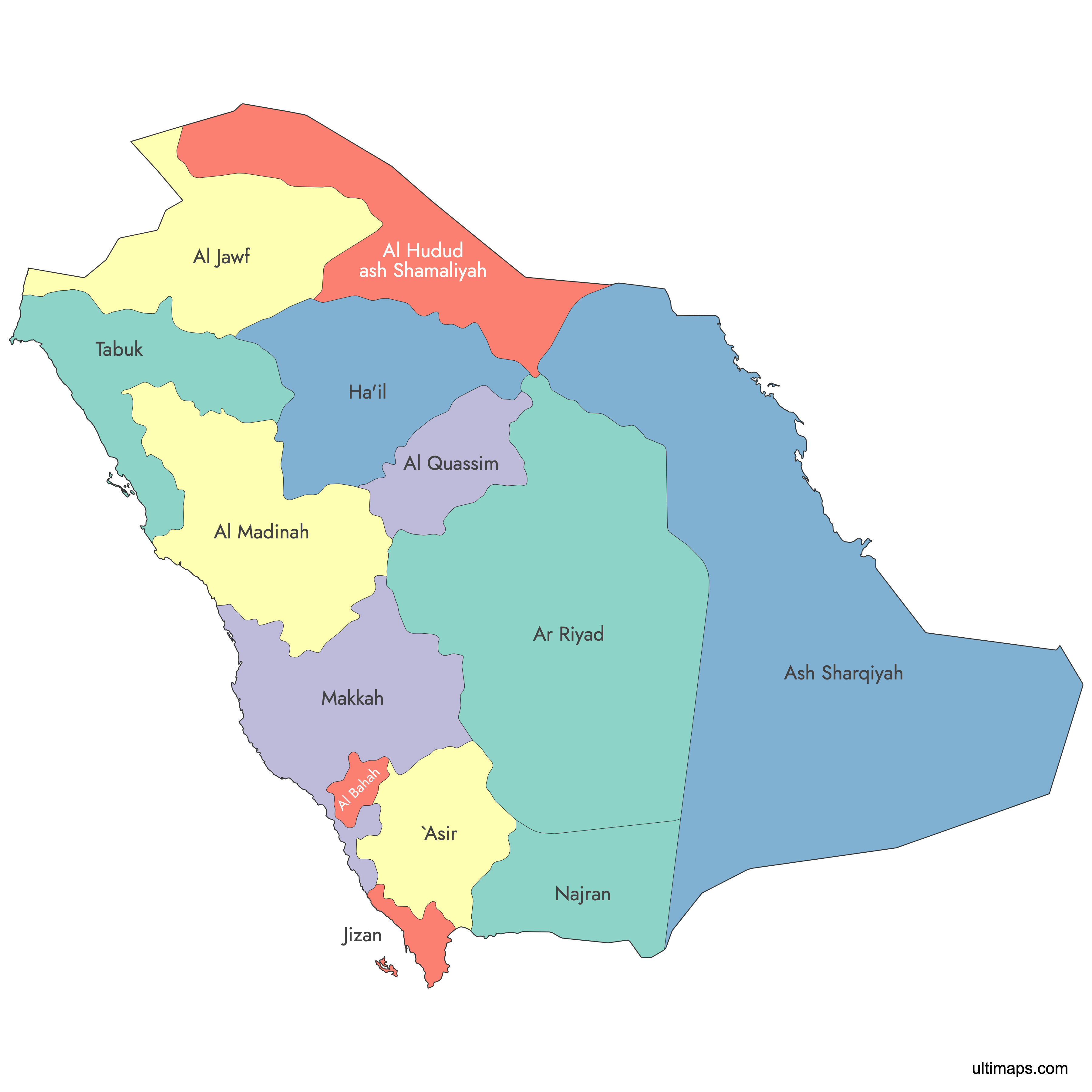
Saudi Arabia is divided into 13 provinces, the kingdom's first-level administrative divisions established by the Law of Provinces in 1992. Each province is governed by an emir and subdivided into a total of 136 governorates. Use the interactive maps below to explore provincial boundaries and major cities, download free reference maps, or learn more about creating a custom map of Saudi Arabia to visualize your own data.
Interactive Map of Saudi Arabia Provinces
List of Provinces (13)
| # | Province |
|---|---|
| 1 | |
| 2 | |
| 3 | |
| 4 | |
| 5 | |
| 6 | |
| 7 | |
| 8 | |
| 9 | |
| 10 | |
| 11 | |
| 12 | |
| 13 |
About Saudi Arabia's Provinces
- Number of Provinces: 13, also referred to as regions or emirates in Arabic administrative usage.
- Capital: Riyadh, the national capital and seat of Riyadh Province.
- Largest Province by Area: Eastern Province.
- Smallest Province by Area: Al-Bahah Province.
- Most Populous Province: Riyadh Province.
- Least Populous Province: Northern Borders Province.
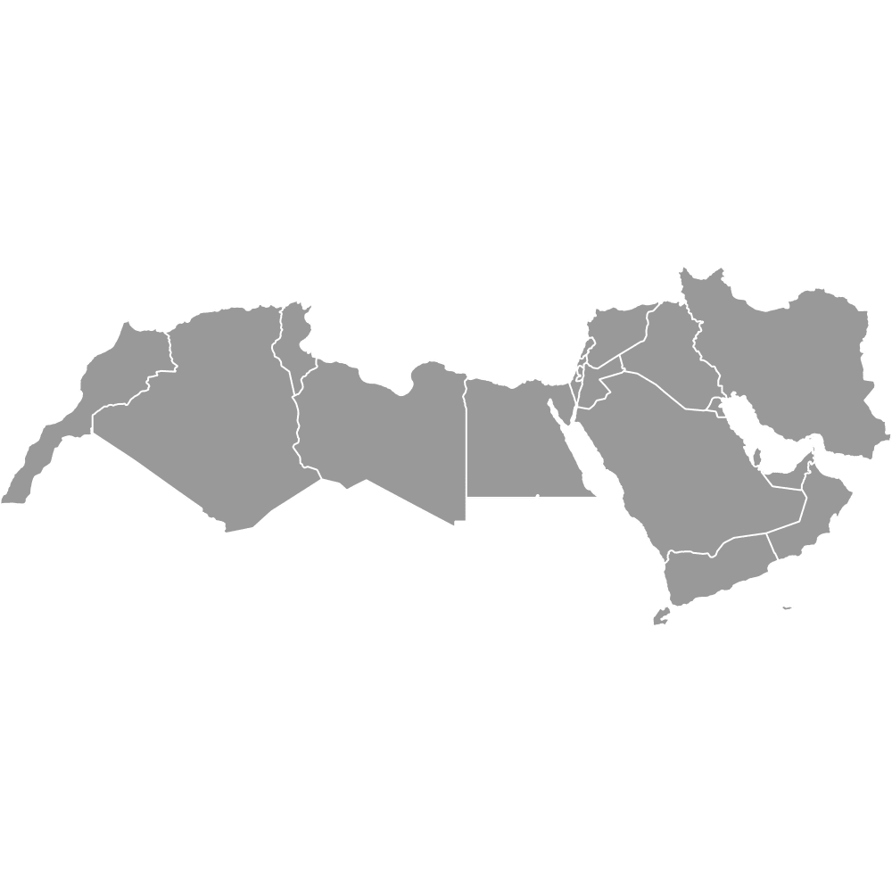
- Bordering Countries: Jordan, Iraq, Kuwait, Qatar, United Arab Emirates, Oman, and Yemen.
- Bordering Bodies of Water: Red Sea and Gulf of Aqaba to the west, Persian Gulf to the east.
- Time Zone: Arabia Standard Time (AST), UTC+3 year-round. Saudi Arabia does not observe daylight saving time.
- Current Boundaries Established: 1992, under the Law of Provinces.
Interesting Facts
- Each province is officially called an emirate in Arabic because it is headed by an emir (provincial governor) appointed by royal order.
- The 13 provinces are subdivided into 136 governorates, which are further broken down into municipal-level units.
- Makkah Province is home to Mecca, the holiest city in Islam, as well as Jeddah, Saudi Arabia's main commercial port on the Red Sea.
- Before the 1992 provincial system, Saudi Arabia was historically described as having four broad regions that do not match today's provincial boundaries.
- Asir Province covers approximately 76,693 km² (29,612 sq mi) and had a population of about 2,024,285, making it one of the more densely settled provinces outside the major urban centers.
Free Downloads
You can download free blank Map of Saudi Arabia Provinces and other maps in high resolution PNG, SVG and PDF formats from the blank maps section of the site: Download Blank Map of Saudi Arabia Provinces
Custom Map Features
This map is divided into 13 provinces.
Updates
Mar 11, 2025:
- Added labeled version
Apr 14, 2024:
- Added map of Saudi Arabia Provinces
Frequently Asked Questions
Saudi Arabia has 13 provinces, which are the kingdom's first-level administrative divisions. They were established under the Law of Provinces in 1992. Each province is headed by an emir and is further subdivided into a combined total of 136 governorates.
The Eastern Province is the largest province in Saudi Arabia by area. It stretches along the Persian Gulf coast and includes major cities such as Dammam, Al Khobar, Jubail, Al Ahsa, and Qatif.
Al-Bahah Province is the smallest province in Saudi Arabia by area. It is located in the southwestern part of the country and includes the cities of Al Bahah, Al Mandaq, and Baljurashi.
Riyadh Province is the most populous province in Saudi Arabia. It contains the national capital, Riyadh, which serves as the kingdom's largest inland urban center and the seat of government.
Mecca, the holiest city in Islam, is located in Makkah Province alongside Jeddah and Taif. Medina, the second holiest city, is in Al-Madinah Province. The Eastern Province hosts the industrial hub of Jubail and the historic Al Ahsa oasis.
Saudi Arabia shares land borders with seven countries: Jordan, Iraq, and Kuwait to the north, Qatar and the United Arab Emirates to the east, Oman to the southeast, and Yemen to the south. Its western coast faces the Red Sea and the Gulf of Aqaba, while its eastern coast lies along the Persian Gulf.
You can use Ultimaps to create custom maps of Saudi Arabia. Color-code provinces manually or upload your data, place pins, customize the look, and export to PNG, PDF, or SVG. No sign-up required.