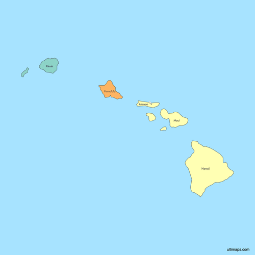
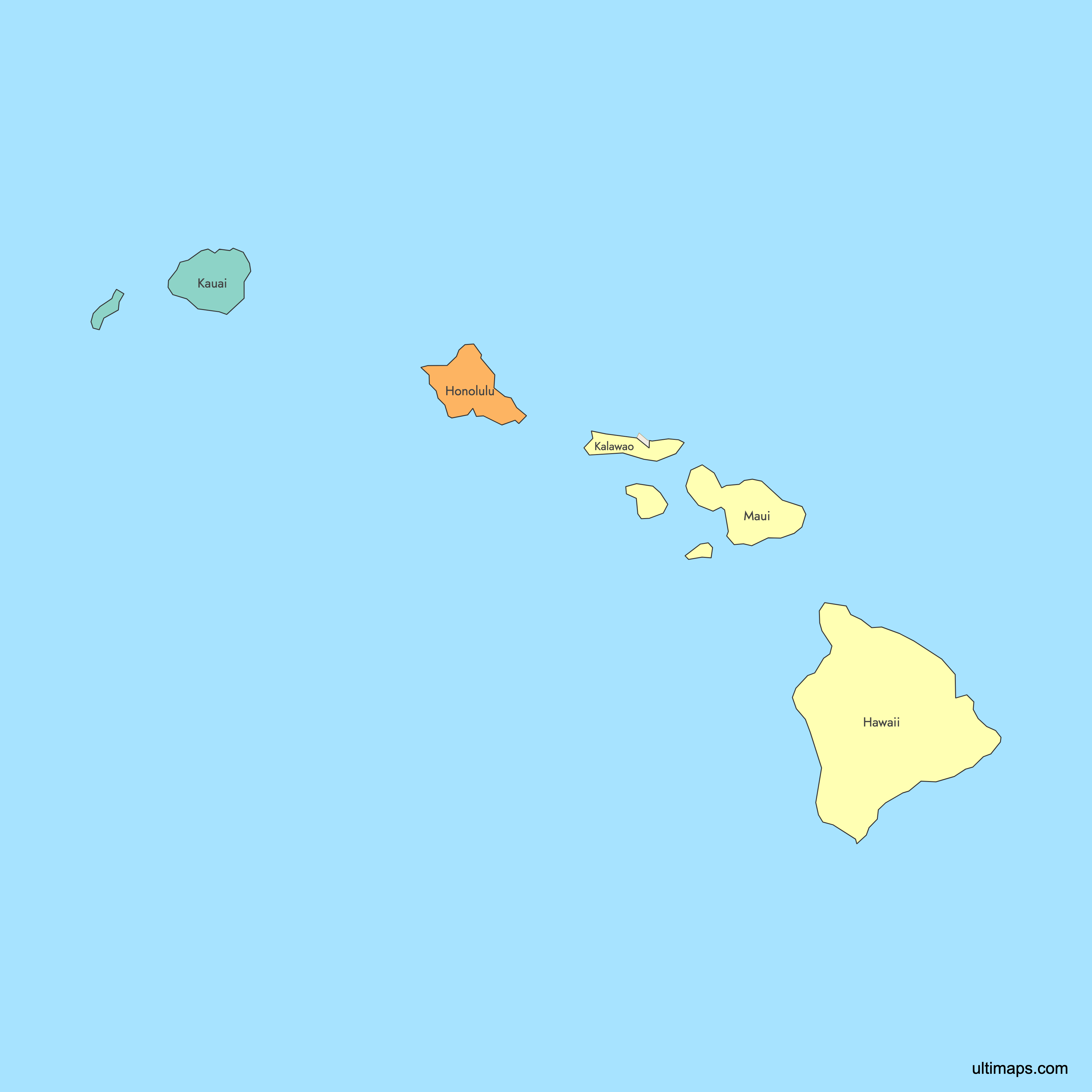
Map of Hawaii Counties
Hawaii is divided into just 5 counties, making it tied for the second-fewest counties of any U.S. state. Each county corresponds to one or more islands, and all regional governance operates at the county level with no municipal tier below it. Use the interactive maps below to explore Hawaii's counties and their boundaries. Download free maps or learn more about creating a custom map of Hawaii to visualize your own data.
Interactive Map of Hawaii Counties
List of Counties (5)
| # | County | County seat | Year founded |
|---|---|---|---|
| 1 | Hilo | 1905 | |
| 2 | Honolulu | 1905 | |
| 3 | Kalaupapa | 1905 | |
| 4 | Lihue | 1905 | |
| 5 | Wailuku | 1905 |
Hawaii Counties: Key Facts
- Total number of counties: 5 (tied for the second-fewest of any U.S. state, behind only Delaware)
- Most populous county: Honolulu County with 1,016,508 residents (2020 Census), home to the state capital Honolulu and Waikiki Beach
- Least populous county: Kalawao County with just 82 residents (2020 Census), the least populated county in the entire United States
- Largest county by area: Hawaii County (the Big Island) at 5,086.1 square miles (13,173 km²), larger than all other Hawaiian islands combined
- Smallest county by area: Kalawao County at 52.8 square miles (137 km²), covering only the Kalaupapa Peninsula on Molokai
- State capital: Honolulu, located in Honolulu County on the island of Oahu
- County seats: Hilo (Hawaii County), Honolulu (Honolulu County), Lihue (Kauai County), Wailuku (Maui County). Kalawao County has no county seat.
- Surrounding waters: Pacific Ocean on all sides
- Time zone: Hawaii-Aleutian Standard Time (HST), with no daylight saving time observed
- Boundaries established: All five counties were created in 1905 from unorganized territory, seven years after the Territory of Hawaii was formed
Interesting Facts
- Hawaii has no municipal governments at all. All regional administration happens at the county level, making it unique among U.S. states.
- Honolulu County is the only consolidated city-county in Hawaii and extends beyond Oahu to include the Northwestern Hawaiian Islands (except Midway Atoll).
- Kalawao County was historically used as a leper colony and quarantine zone. It lacks many elected officials found in other counties, and Maui County provides many of its services.
- Maui County spans five islands: Maui, Kahoolawe, Lanai, most of Molokai, and the tiny islet of Molokini.
- The Hawaiian word for county is "kalana," meaning a land division.
Free Downloads
 Colored Map of Hawaii Counties with Surrounding Areaspng183 KB
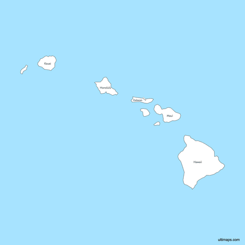 Labeled Map of Hawaii Counties with Surrounding Areaspng183 KB
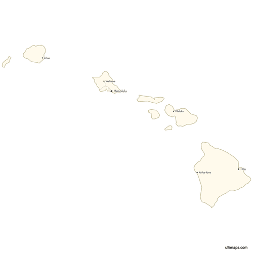 Map of Hawaii Counties with Citiespng204 KB


You can download free blank Map of Hawaii Counties and other maps in high resolution PNG, SVG and PDF formats from the blank maps section of the site: Download Blank Map of Hawaii Counties
Custom Map Features
This map supports labels.
This map supports surrounding areas, roads and cities. New
This map is divided into 5 counties.
Updates
Aug 26, 2024:
- Added map of Hawaii Counties
Frequently Asked Questions
Hawaii has 5 counties: Hawaii, Honolulu, Kalawao, Kauai, and Maui. This makes it tied for the second-fewest counties of any U.S. state, with only Delaware having fewer. All five counties were established in 1905 from unorganized territory.
Hawaii County, which encompasses the entire Big Island, is the largest at 5,086.1 square miles (13,173 km²). It is larger than all other Hawaiian islands combined. The county seat is Hilo.
Kalawao County is the smallest at 52.8 square miles (137 km²). It covers only the Kalaupapa Peninsula on the island of Molokai. It is also the least populated county in the entire United States, with just 82 residents as of the 2020 Census.
Honolulu County is the most populated with 1,016,508 residents according to the 2020 Census. It is home to Honolulu, the state capital, as well as Waikiki Beach and the majority of Hawaii's urban infrastructure and tourism industry.
Hawaii County covers the Big Island. Honolulu County includes Oahu and the Northwestern Hawaiian Islands (except Midway Atoll). Kauai County includes Kauai, Niihau, Lehua, and Kaula. Maui County spans Maui, Kahoolawe, Lanai, most of Molokai, and Molokini. Kalawao County covers only the Kalaupapa Peninsula on Molokai.
Hawaii is unique among U.S. states in that it has no municipal tier of government below the county level. All regional administration is handled by the five county governments. Honolulu County operates as the only consolidated city-county in the state, combining city and county functions into one government.
Kalawao County is the least populated county in the entire United States with just 82 residents (2020 Census). It was historically used as a leper colony and quarantine zone on the Kalaupapa Peninsula. It has no county seat, lacks many of the elected officials other counties have, and relies on Maui County for many of its services.
Honolulu, the state capital, and Waikiki Beach are in Honolulu County on the island of Oahu. Hilo, the county seat of Hawaii County, is on the Big Island. Lihue is the county seat of Kauai County, and Wailuku serves as the county seat of Maui County.
You can use Ultimaps to create custom maps of Hawaii. Color-code counties manually or upload your data, place pins, customize the look and feel, and export to PNG, PDF, or SVG. No sign-up required.


