Map of Delaware Counties
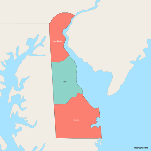
Delaware is divided into just 3 counties — New Castle, Kent, and Sussex — making it the U.S. state with the fewest counties. These three divisions date back to the 1680s and cover the northern portion of the Delmarva Peninsula, bordered by Pennsylvania, New Jersey, Maryland, and the Atlantic Ocean. Use the interactive maps below to explore Delaware's counties and their boundaries. Download free maps or learn more about creating a custom map of Delaware to visualize your own data.
Interactive Map of Delaware Counties
List of Counties (3)
| # | County | County seat | Year founded |
|---|---|---|---|
| 1 | Dover | 1680 | |
| 2 | Wilmington | 1664 | |
| 3 | Georgetown | 1664 |
Delaware Counties: Key Facts
- Total number of counties: 3 — the fewest of any U.S. state
- Most populous county: New Castle County — 588,093 residents (2020 Census), home to Wilmington and Newark
- Least populous county: Kent County — 192,690 residents (2020 Census), home to the state capital Dover
- Largest county by area: Sussex County at 1,196.4 square miles (3,098 km²)
- Smallest county by area: New Castle County at 494 square miles (1,279 km²)
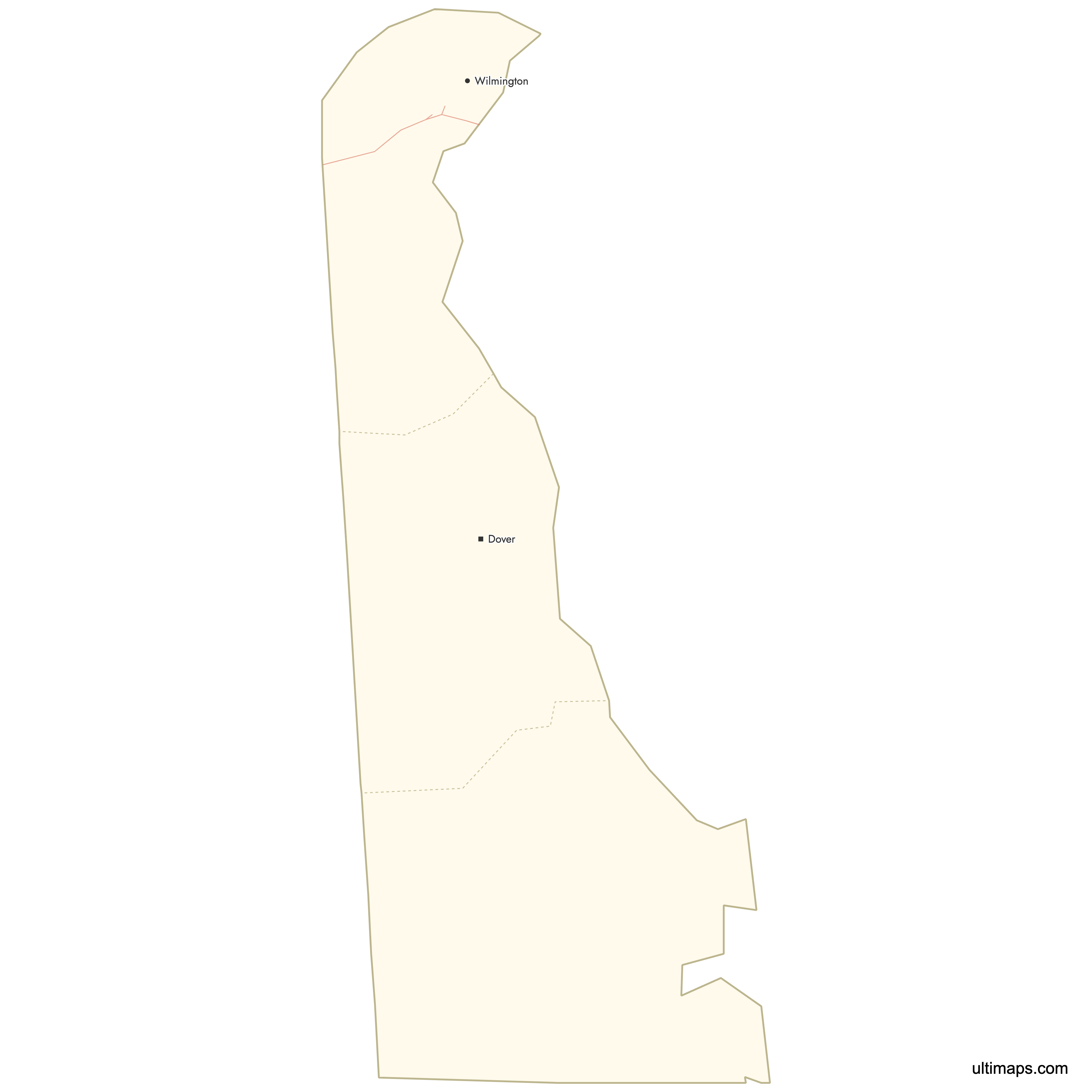
- Major urban centers: Wilmington and Newark in New Castle County; Dover in Kent County; Rehoboth Beach and Georgetown in Sussex County
- State capital: Dover, located in Kent County
- Borders: Pennsylvania to the north, New Jersey across the Delaware River and Bay to the northeast, Maryland to the west and south, and the Atlantic Ocean to the east
- Time zone: Eastern Time Zone (UTC-5 standard, UTC-4 daylight saving)
- Boundary history: Current county boundaries were established in 1682-1683 by William Penn, with minimal changes since. New Castle and Sussex counties originated from 1664 divisions, and Kent County was created in 1680.
Interesting Facts
- Delaware's 3 counties are older than the United States itself, dating to William Penn's division of his colonial holdings in 1683.
- The county names reflect Delaware's colonial heritage: New Castle was named in 1673 from the Dutch "Nieuw Amstel," while Kent and Sussex were renamed by Penn in 1682 after English counties.
- Each county has a distinct character: New Castle is urban and industrial along the I-95 corridor, Kent is agricultural with marshlands like Bombay Hook National Wildlife Refuge, and Sussex is known for Atlantic beaches and farmland.
- Despite being the smallest county by area, New Castle County holds more than half of Delaware's total population.
Free Downloads
 Colored Map of Delaware Counties with Surrounding Areaspng425 KB
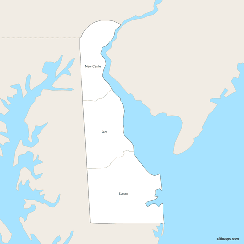 Labeled Map of Delaware Counties with Surrounding Areaspng425 KB
 Map of Delaware Counties with Citiespng195 KB


You can download free blank Map of Delaware Counties and other maps in high resolution PNG, SVG and PDF formats from the blank maps section of the site: Download Blank Map of Delaware Counties
Custom Map Features
This map supports labels.
This map supports surrounding areas, roads and cities. New
This map is divided into 3 counties.
Updates
Oct 2, 2025:
- Improved map quality
- Added support for surrounding areas and lakes
Aug 26, 2024:
- Added map of Delaware Counties
Frequently Asked Questions
Delaware has 3 counties: New Castle, Kent, and Sussex. This is the fewest of any U.S. state. The current boundaries were established in 1682-1683 by William Penn and have remained largely unchanged since.
Sussex County is the largest at 1,196.4 square miles (3,098 km²). It occupies the southern third of the state and includes the Atlantic coastline with popular beach towns like Rehoboth Beach and Bethany Beach.
New Castle County is the smallest at 494 square miles (1,279 km²). Despite its small size, it is the most populous county in the state with 588,093 residents as of the 2020 Census.
New Castle County is the most populated with 588,093 residents (2020 Census). It contains Wilmington, Delaware's largest city, as well as Newark, home to the University of Delaware. The county sits along the I-95 corridor in the northern part of the state.
Wilmington, Delaware's largest city, is in New Castle County. Dover, the state capital and home to Dover Air Force Base, is in Kent County. Sussex County features Cape Henlopen State Park, Delaware Seashore State Park, and beach towns like Rehoboth Beach and Lewes. Bombay Hook National Wildlife Refuge, known for its marshlands, is in Kent County.
Dover is the capital of Delaware and is located in Kent County, the central county of the state. Dover is also home to Dover Air Force Base and the Dover International Speedway. Kent County had a population of 192,690 as of the 2020 Census.
Delaware's 3 counties date back to the colonial era, with New Castle and Sussex established in 1664 and Kent in 1680. William Penn formalized the boundaries in 1682-1683. Because Delaware is the second-smallest U.S. state by area, there was never a practical need to subdivide further, and the original three divisions have persisted for over 340 years.
Delaware is bordered by Pennsylvania to the north, New Jersey across the Delaware River and Delaware Bay to the northeast, Maryland to the west and south, and the Atlantic Ocean to the east. The state occupies the northern portion of the Delmarva Peninsula.
You can use Ultimaps to create custom maps of Delaware. Color-code counties manually or upload your data, place pins, customize the look and feel, and export to PNG, PDF, or SVG. No sign-up required.


