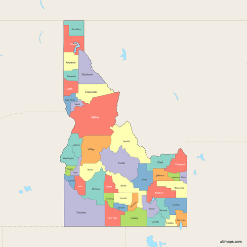
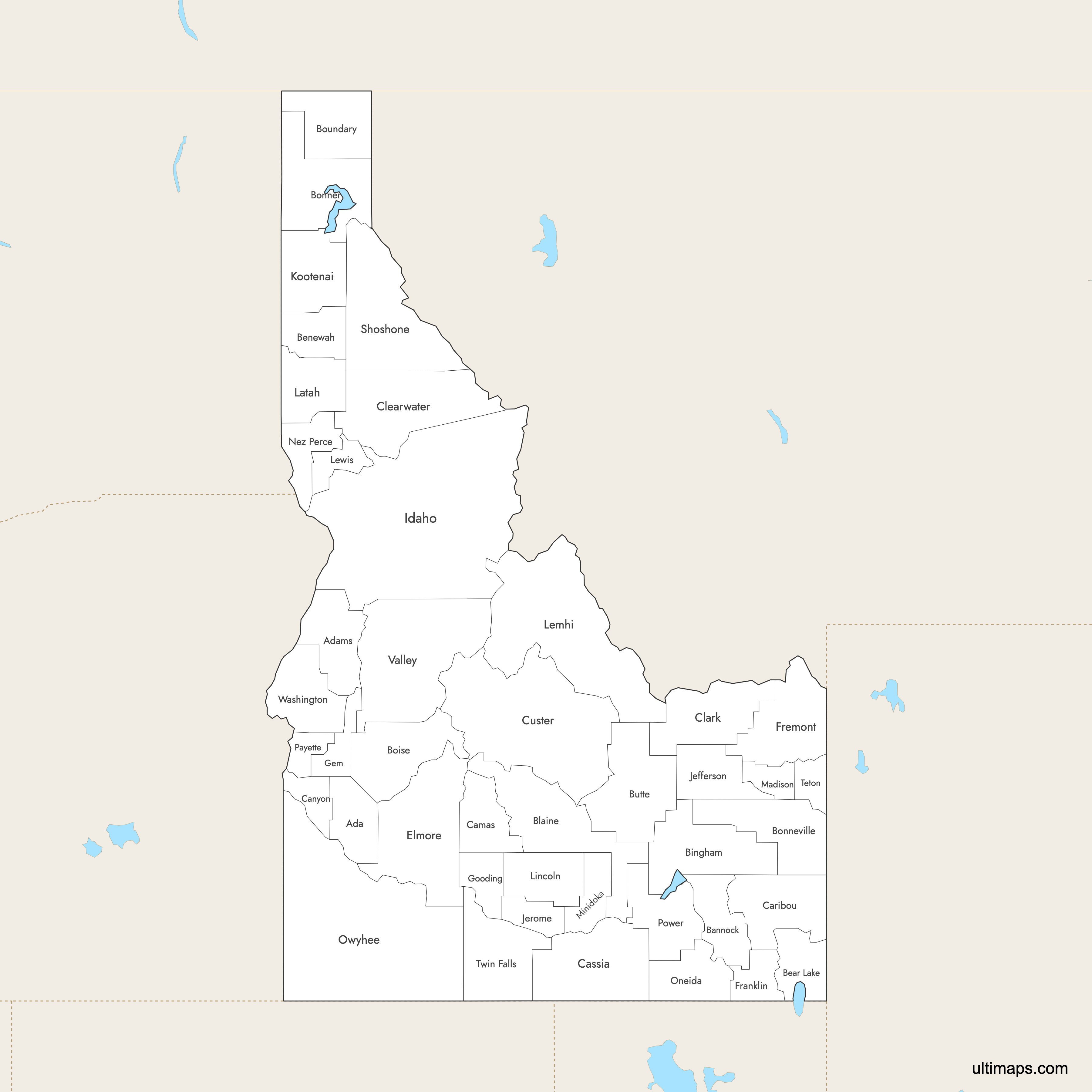
Map of Idaho Counties
Idaho is divided into 44 counties, stretching from the Canadian border panhandle in the north to the Snake River plains in the south. These counties serve as the primary administrative divisions of the state, covering a wide range of landscapes from rugged mountain wilderness to agricultural valleys. Use the interactive maps below to explore Idaho's counties and their boundaries. Download free maps or learn more about creating a custom map of Idaho to visualize your own data.
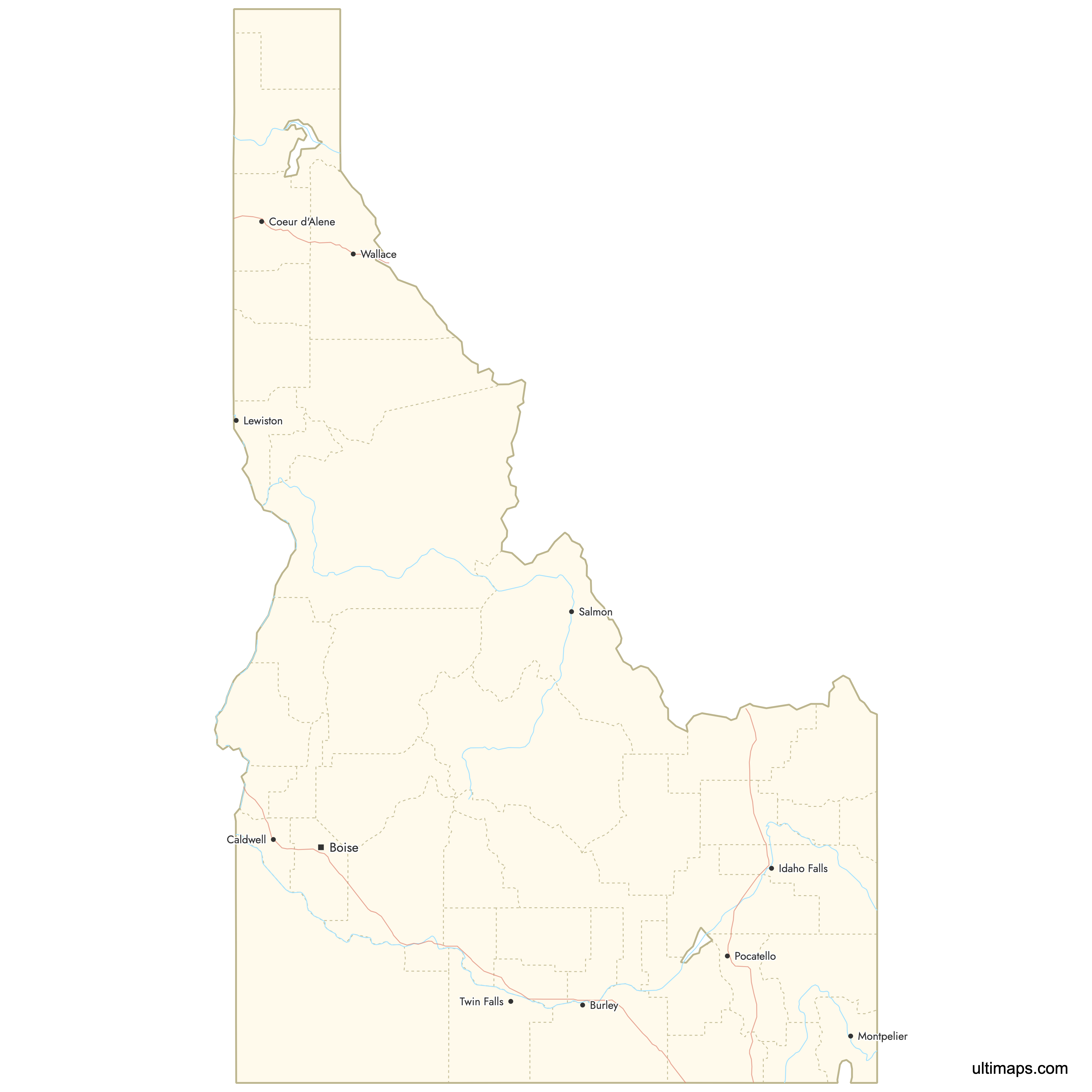
Interactive Map of Idaho Counties
List of Counties (44)
| # | County | County seat | Year founded |
|---|---|---|---|
| 1 | Boise | 1864 | |
| 2 | Council | 1911 | |
| 3 | Pocatello | 1893 | |
| 4 | Paris | 1893 | |
| 5 | St. Maries | 1915 | |
| 6 | Blackfoot | 1885 | |
| 7 | Hailey | 1895 | |
| 8 | Idaho City | 1864 | |
| 9 | Sandpoint | 1907 | |
| 10 | Idaho Falls | 1911 | |
| 11 | Bonners Ferry | 1915 | |
| 12 | Arco | 1917 | |
| 13 | Fairfield | 1917 | |
| 14 | Caldwell | 1892 | |
| 15 | Soda Springs | 1919 | |
| 16 | Burley | 1879 | |
| 17 | Dubois | 1919 | |
| 18 | Orofino | 1911 | |
| 19 | Challis | 1881 | |
| 20 | Mountain Home | 1889 | |
| 21 | Preston | 1913 | |
| 22 | Saint Anthony | 1893 | |
| 23 | Emmett | 1915 | |
| 24 | Gooding | 1913 | |
| 25 | Grangeville | 1864 | |
| 26 | Rigby | 1913 | |
| 27 | Jerome | 1919 | |
| 28 | Coeur d'Alene | 1864 | |
| 29 | Moscow | 1888 | |
| 30 | Salmon | 1869 | |
| 31 | Nezperce | 1911 | |
| 32 | Shoshone | 1895 | |
| 33 | Rexburg | 1913 | |
| 34 | Rupert | 1913 | |
| 35 | Lewiston | 1864 | |
| 36 | Malad City | 1864 | |
| 37 | Murphy | 1863 | |
| 38 | Payette | 1917 | |
| 39 | American Falls | 1913 | |
| 40 | Wallace | 1864 | |
| 41 | Driggs | 1915 | |
| 42 | Twin Falls | 1907 | |
| 43 | Cascade | 1917 | |
| 44 | Weiser | 1879 |
Idaho Counties: Key Facts
- Total number of counties: 44, more than neighboring Nevada (17) but fewer than Oregon (36 counties)
- Most populous county: Twin Falls County with 96,509 residents (2020 Census), though Ada County (home to Boise) is the state's primary urban center
- Least populous county: Oneida County with 4,976 residents (2020 Census)
- Largest county by area: Owyhee County at 7,678 square miles (19,886 km²)
- Smallest county by area: Payette County at 408 square miles (1,057 km²)
- Counties with major urban centers: Ada County (Boise, state capital), Canyon County (Nampa, Caldwell), Kootenai County (Coeur d'Alene), Bonneville County (Idaho Falls), Bannock County (Pocatello), Twin Falls County (Twin Falls), Nez Perce County (Lewiston), and Latah County (Moscow)
- Capital: Boise, located in Ada County
- Bordering states: Washington to the northwest, Oregon to the west, Nevada to the southwest, Utah to the southeast, Montana to the east and northeast, and Wyoming to the east
- Time zone: The entire state is in the Mountain Time Zone (UTC-7/-6)
- Boundary history: Idaho Territory was organized in March 1863. The first county, Owyhee, was established in December 1863. Most of the original counties date to 1864, with later splits creating counties like Twin Falls (1907 from Cassia), Teton (1915), and Payette (1917 from Canyon). The current 44-county structure has been stable since the early 20th century.
Interesting Facts
- Owyhee County, Idaho's largest, is named after an alternate spelling of "Hawaii," honoring Hawaiian fur trappers who explored the region in 1819-1820.
- Lewiston in Nez Perce County is Idaho's only inland port city, situated on the Snake River and accessible to ocean-going vessels via the Columbia River system.
- Early Idaho counties like Missoula (created in 1864) were transferred to Montana Territory in May 1864 when Montana was carved out as a separate territory.
- Shoshone County in the northern panhandle is home to historic mining towns along I-90, including Wallace, which claims every building downtown is on the National Register of Historic Places.
- Twin Falls County features Shoshone Falls on the Snake River, sometimes called the "Niagara of the West," which at 212 feet is actually higher than Niagara Falls.
Free Downloads
 Colored Map of Idaho Counties with Surrounding Areaspng476 KB
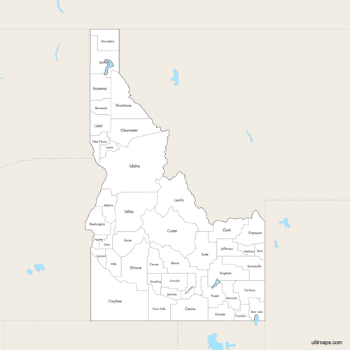 Labeled Map of Idaho Counties with Surrounding Areaspng470 KB
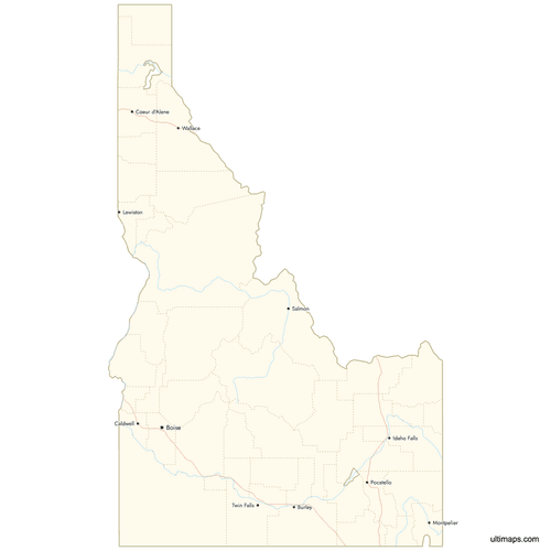 Map of Idaho Counties with Citiespng499 KB

You can download free blank Map of Idaho Counties and other maps in high resolution PNG, SVG and PDF formats from the blank maps section of the site: Download Blank Map of Idaho Counties
Custom Map Features
This map supports labels.
This map supports surrounding areas, roads, rivers and cities. New
This map is divided into 44 counties.
Updates
Aug 26, 2024:
- Added map of Idaho Counties
Frequently Asked Questions
Idaho has 44 counties. The first county, Owyhee, was established in December 1863, shortly after Idaho Territory was organized in March 1863. The current 44-county structure has been stable since the early 20th century, with Payette County (1917) being one of the last to be created.
Owyhee County is the largest county in Idaho at 7,678 square miles (19,886 km²). Located in the southwestern corner of the state, it borders both Oregon and Nevada. Its name comes from an alternate spelling of Hawaii, honoring Hawaiian fur trappers who explored the area in 1819-1820.
Payette County is the smallest county in Idaho at 408 square miles (1,057 km²). It was created in 1917 when it split from Canyon County. Despite its small size, Payette County sits in the productive agricultural region of western Idaho.
Twin Falls County is the most populous county with 96,509 residents according to the 2020 Census. Ada County, home to the state capital Boise and the largest city in Idaho, is the state's primary urban and economic center. Canyon County (Nampa, Caldwell) and Kootenai County (Coeur d'Alene) are also among the most populated.
Boise, the state capital and largest city, is in Ada County. Sun Valley, a world-famous ski resort, is in Blaine County near Hailey. Craters of the Moon National Monument, a volcanic landscape, is in Butte County near Arco. Twin Falls County features Shoshone Falls and the Perrine Bridge over the Snake River canyon. The Frank Church-River of No Return Wilderness spans parts of Custer, Lemhi, and Idaho Counties.
Idaho borders six states: Washington to the northwest, Oregon to the west, Nevada to the southwest, Utah to the southeast, Wyoming to the east, and Montana to the east and northeast. The Snake River forms part of the border with Washington. Idaho has no direct ocean access, though Lewiston in Nez Perce County serves as an inland port via the Snake and Columbia Rivers.
The entire state of Idaho is in the Mountain Time Zone (UTC-7 standard, UTC-6 daylight saving time). Unlike some states that span multiple time zones, all 44 Idaho counties observe the same time.
Boise, the state capital and largest city in Idaho, is located in Ada County. Ada County sits in southwestern Idaho along the Boise River and Interstate 84. Note that there is also a separate Boise County in central Idaho, which is a rural, mountainous county distinct from the county containing the city of Boise.
You can use Ultimaps to create custom maps of Idaho. Color-code counties manually or upload your data, place pins, customize the look and feel, and export to PNG, PDF, or SVG. No sign-up required.


