Map of Indiana Counties
Indiana is divided into 92 counties, serving as the primary local government divisions across the state. From the industrial shores of Lake Michigan in the northwest to the Ohio River border in the south, these counties encompass a wide range of urban centers, farmland, and natural landscapes. Use the interactive maps below to explore Indiana's counties and their boundaries. Download free maps or learn more about creating a custom map of Indiana to visualize your own data.
Interactive Map of Indiana Counties
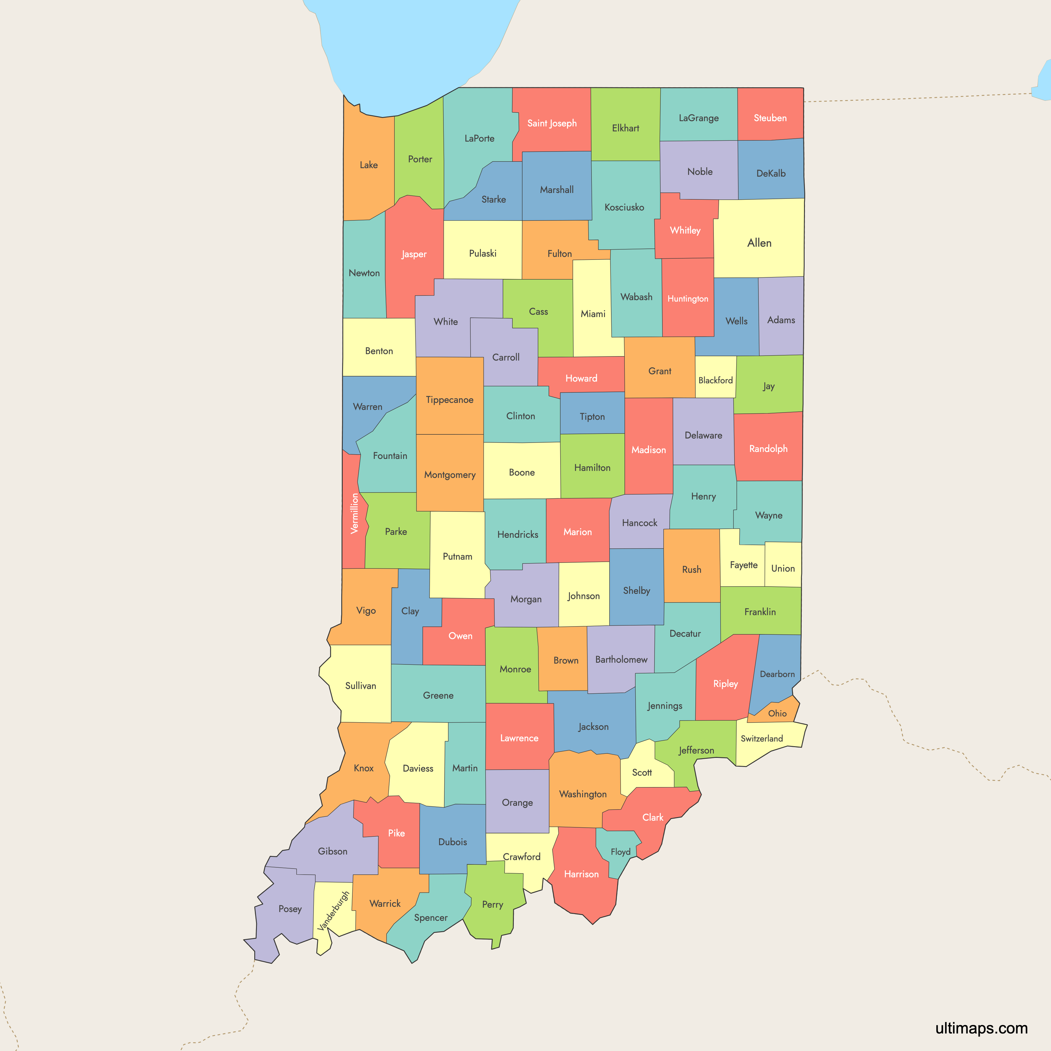
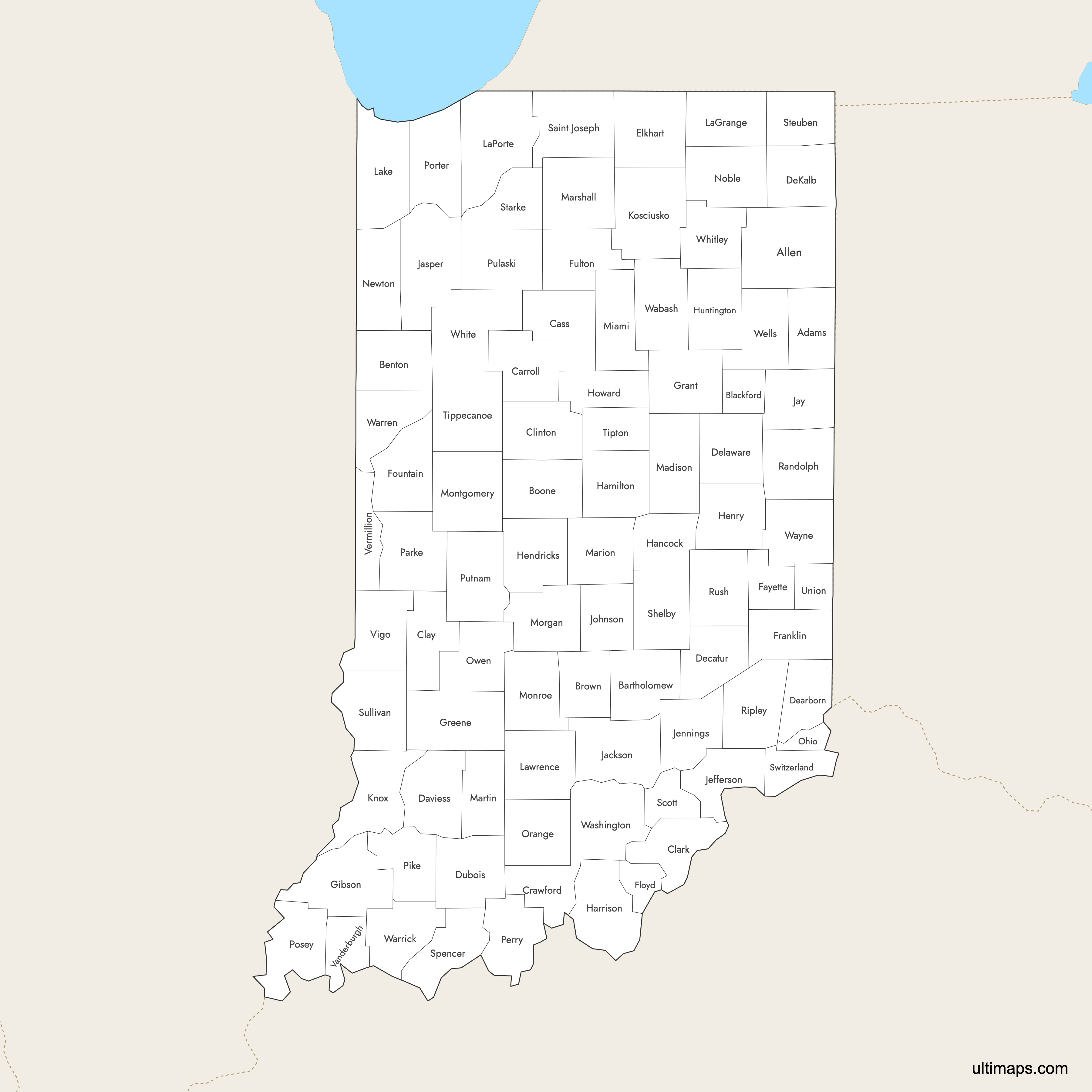
List of Counties (92)
| # | County | County seat | Year founded |
|---|---|---|---|
| 1 | Decatur | 1836 | |
| 2 | Fort Wayne | 1823 | |
| 3 | Columbus | 1821 | |
| 4 | Fowler | 1840 | |
| 5 | Hartford City | 1838 | |
| 6 | Lebanon | 1830 | |
| 7 | Nashville | 1836 | |
| 8 | Delphi | 1828 | |
| 9 | Logansport | 1828 | |
| 10 | Jeffersonville | 1801 | |
| 11 | Brazil | 1825 | |
| 12 | Frankfort | 1830 | |
| 13 | English | 1818 | |
| 14 | Washington | 1818 | |
| 15 | Lawrenceburg | 1803 | |
| 16 | Greensburg | 1821 | |
| 17 | Auburn | 1835 | |
| 18 | Muncie | 1827 | |
| 19 | Jasper | 1817 | |
| 20 | Goshen | 1830 | |
| 21 | Connersville | 1818 | |
| 22 | New Albany | 1819 | |
| 23 | Covington | 1825 | |
| 24 | Brookville | 1811 | |
| 25 | Rochester | 1836 | |
| 26 | Princeton | 1813 | |
| 27 | Marion | 1831 | |
| 28 | Bloomfield | 1821 | |
| 29 | Noblesville | 1823 | |
| 30 | Greenfield | 1828 | |
| 31 | Corydon | 1808 | |
| 32 | Danville | 1824 | |
| 33 | New Castle | 1821 | |
| 34 | Kokomo | 1844 | |
| 35 | Huntington | 1832 | |
| 36 | Brownstown | 1816 | |
| 37 | Rensselaer | 1835 | |
| 38 | Portland | 1835 | |
| 39 | Madison | 1810 | |
| 40 | Vernon | 1816 | |
| 41 | Franklin | 1823 | |
| 42 | Vincennes | 1790 | |
| 43 | Warsaw | 1835 | |
| 44 | LaGrange | 1832 | |
| 45 | Crown Point | 1837 | |
| 46 | LaPorte | 1832 | |
| 47 | Bedford | 1818 | |
| 48 | Anderson | 1823 | |
| 49 | Indianapolis | 1821 | |
| 50 | Plymouth | 1835 | |
| 51 | Shoals | 1820 | |
| 52 | Peru | 1833 | |
| 53 | Bloomington | 1818 | |
| 54 | Crawfordsville | 1822 | |
| 55 | Martinsville | 1822 | |
| 56 | Kentland | 1859 | |
| 57 | Albion | 1835 | |
| 58 | Rising Sun | 1844 | |
| 59 | Paoli | 1816 | |
| 60 | Spencer | 1818 | |
| 61 | Rockville | 1821 | |
| 62 | Tell City | 1814 | |
| 63 | Petersburg | 1816 | |
| 64 | Valparaiso | 1835 | |
| 65 | Mount Vernon | 1814 | |
| 66 | Winamac | 1835 | |
| 67 | Greencastle | 1822 | |
| 68 | Winchester | 1818 | |
| 69 | Versailles | 1816 | |
| 70 | Rushville | 1821 | |
| 71 | South Bend | 1830 | |
| 72 | Scottsburg | 1820 | |
| 73 | Shelbyville | 1821 | |
| 74 | Rockport | 1818 | |
| 75 | Knox | 1835 | |
| 76 | Angola | 1837 | |
| 77 | Sullivan | 1816 | |
| 78 | Vevay | 1814 | |
| 79 | Lafayette | 1826 | |
| 80 | Tipton | 1844 | |
| 81 | Liberty | 1821 | |
| 82 | Evansville | 1818 | |
| 83 | Newport | 1824 | |
| 84 | Terre Haute | 1818 | |
| 85 | Wabash | 1833 | |
| 86 | Williamsport | 1827 | |
| 87 | Boonville | 1813 | |
| 88 | Salem | 1813 | |
| 89 | Richmond | 1810 | |
| 90 | Bluffton | 1837 | |
| 91 | Monticello | 1834 | |
| 92 | Columbia City | 1835 |
Indiana Counties: Key Facts
- Total number of counties: 92, serving as the primary administrative divisions of the state.
- Most populous county: Lake County with 502,955 residents (2020 Census), home to Gary and Hammond near the Chicago metro area.
- Least populous county: Ohio County with 5,877 residents (2020 Census).
- Largest county by area: Lake County at 499 square miles (1,292 km²).
- Smallest county by area: Union County at 161 square miles (417 km²).
- Major urban centers: Marion County (Indianapolis, state capital and largest city), Allen County (Fort Wayne, second-largest city), St. Joseph County (South Bend), and Vanderburgh County (Evansville).
- State capital: Indianapolis, located in Marion County.
- Borders: Michigan to the north, Ohio to the east, Kentucky to the south, and Illinois to the west. Lake Michigan touches Lake County in the northwest corner.
- Time zone: Indiana is entirely in the Eastern Time Zone (UTC-5 standard, UTC-4 daylight saving).
- Historical boundaries: County boundaries were largely established by the 1850s. The earliest counties date to 1811 (e.g., Wayne County), while later additions like Lake County were created in 1837. No major boundary changes have occurred since 1900.
Interesting Facts
- Many Indiana counties are named after Revolutionary War heroes. Wayne County honors "Mad" Anthony Wayne, Rush County is named for Declaration of Independence signer Benjamin Rush, and Ripley County recognizes Eleazer Wheelock Ripley.
- Union County gets its name from the "union" of parts taken from Fayette, Franklin, and Wayne counties when it was formed.
- LaGrange County is named after the Marquis de Lafayette's estate in France.
- Vigo County is named for Francis Vigo, an Italian-born spy who aided the American cause during the Revolutionary War.
- Indiana's counties were formed in waves following Native American land cessions, including the Wabash New Purchase of the 1820s.
Free Downloads
 Colored Map of Indiana Counties with Surrounding Areaspng601 KB
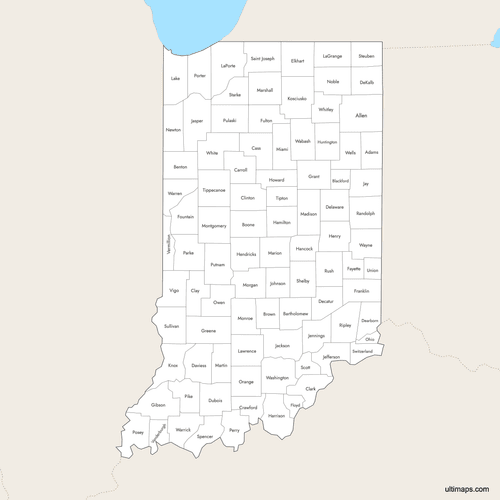 Labeled Map of Indiana Counties with Surrounding Areaspng578 KB
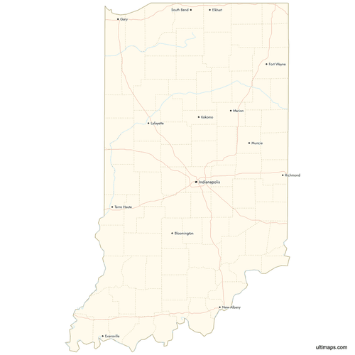 Map of Indiana Counties with Citiespng639 KB

You can download free blank Map of Indiana Counties and other maps in high resolution PNG, SVG and PDF formats from the blank maps section of the site: Download Blank Map of Indiana Counties
Custom Map Features
This map supports labels.
This map supports surrounding areas, roads, rivers and cities. New
This map is divided into 92 counties.
Updates
Aug 26, 2024:
- Added map of Indiana Counties
Frequently Asked Questions
Indiana has 92 counties, which function as the primary local government divisions across the state. County boundaries were mostly finalized by the 1850s, with the earliest counties established in 1811 and the latest formed in the late 1830s.
Lake County is the largest county in Indiana by area at 499 square miles (1,292 km²). Located in the northwest corner of the state along Lake Michigan, it is also the most populous county, home to cities like Gary and Hammond.
Union County is the smallest county in Indiana by area at 161 square miles (417 km²). It was formed by combining parts of Fayette, Franklin, and Wayne counties, which is how it got its name.
Lake County is the most populated county in Indiana with 502,955 residents according to the 2020 Census. It includes the cities of Gary and Hammond, both industrial hubs located near Chicago, Illinois.
Ohio County is the least populated county in Indiana with 5,877 residents according to the 2020 Census. Union County is the second-smallest by population with 6,884 residents.
Indianapolis, the state capital and home of the Indianapolis Motor Speedway (Indy 500), is in Marion County. Indiana Dunes National Park, featuring Lake Michigan beaches and sand dunes, spans Lake and Porter counties. South Bend, home to the University of Notre Dame, is in St. Joseph County. Brown County State Park, known as the "Little Smokies" for its fall foliage, is in Brown County.
Corydon, located in Harrison County, served as Indiana's first state capital. The historic capitol building still stands there today. The capital was later moved to Indianapolis in Marion County, where it remains.
Indiana borders four states: Michigan to the north, Ohio to the east, Kentucky to the south, and Illinois to the west. Lake Michigan also touches the state's northwest corner at Lake County.
Indiana is entirely in the Eastern Time Zone (UTC-5 standard, UTC-4 during daylight saving time). This applies to all 92 counties across the state.
You can use Ultimaps to create custom maps of Indiana. Color-code counties manually or upload your data, place pins, customize the look and feel, and export to PNG, PDF, or SVG. No sign-up required.


