Map of Wyoming Counties
Wyoming is divided into 23 counties, each serving as a local government unit within the state. Use the interactive maps below to explore county boundaries. Download free maps or learn more about creating a custom map of Wyoming to visualize your own data.
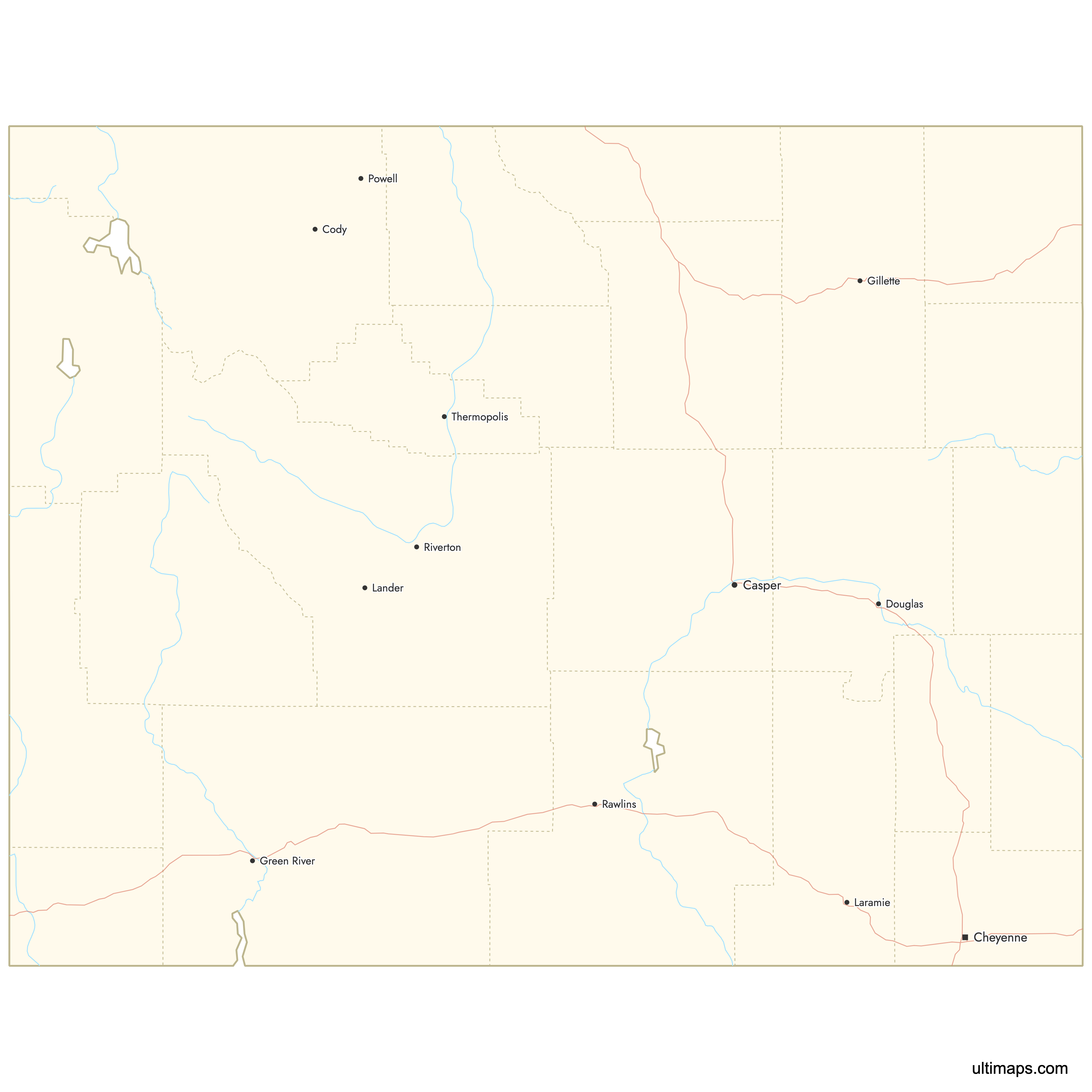
Interactive Map of Wyoming Counties
List of Counties (23)
| # | County | County seat | Year founded |
|---|---|---|---|
| 1 | Laramie | 1868 | |
| 2 | Basin | 1896 | |
| 3 | Gillette | 1911 | |
| 4 | Rawlins | 1868 | |
| 5 | Douglas | 1888 | |
| 6 | Sundance | 1875 | |
| 7 | Lander | 1884 | |
| 8 | Torrington | 1911 | |
| 9 | Thermopolis | 1911 | |
| 10 | Buffalo | 1875 | |
| 11 | Cheyenne | 1867 | |
| 12 | Kemmerer | 1911 | |
| 13 | Casper | 1888 | |
| 14 | Lusk | 1911 | |
| 15 | Cody | 1909 | |
| 16 | Wheatland | 1911 | |
| 17 | Sheridan | 1888 | |
| 18 | Pinedale | 1921 | |
| 19 | Green River | 1867 | |
| 20 | Jackson | 1921 | |
| 21 | Evanston | 1869 | |
| 22 | Worland | 1911 | |
| 23 | Newcastle | 1890 |
Wyoming Counties: Key Facts
- Total number of counties: 23
- Largest county by land area: Sweetwater County - 10,426 square miles (27,000 km²)
- Smallest county by area: Hot Springs County - 2,004 square miles (5,190 km²)
- Most populous county: Laramie County (Cheyenne)
- Least populous county: Niobrara County
- Major urban centers: Cheyenne (Laramie County), Casper (Natrona County), Gillette (Campbell County)
- State capital location: Laramie County (Cheyenne)
- Neighboring states: Montana, South Dakota, Nebraska, Colorado, Utah, Idaho
- Time zone: Mountain Time Zone
Interesting Facts
- Square, straight boundaries: Many counties are near-rectangular, reflecting the surveyed grid system common in the western U.S.
- High-elevation counties: Teton, Sublette, and Fremont counties include some of the highest peaks in the Rocky Mountains.
- Yellowstone adjacency: Teton, Park, and Fremont counties serve as gateways to Yellowstone National Park.
Free Downloads
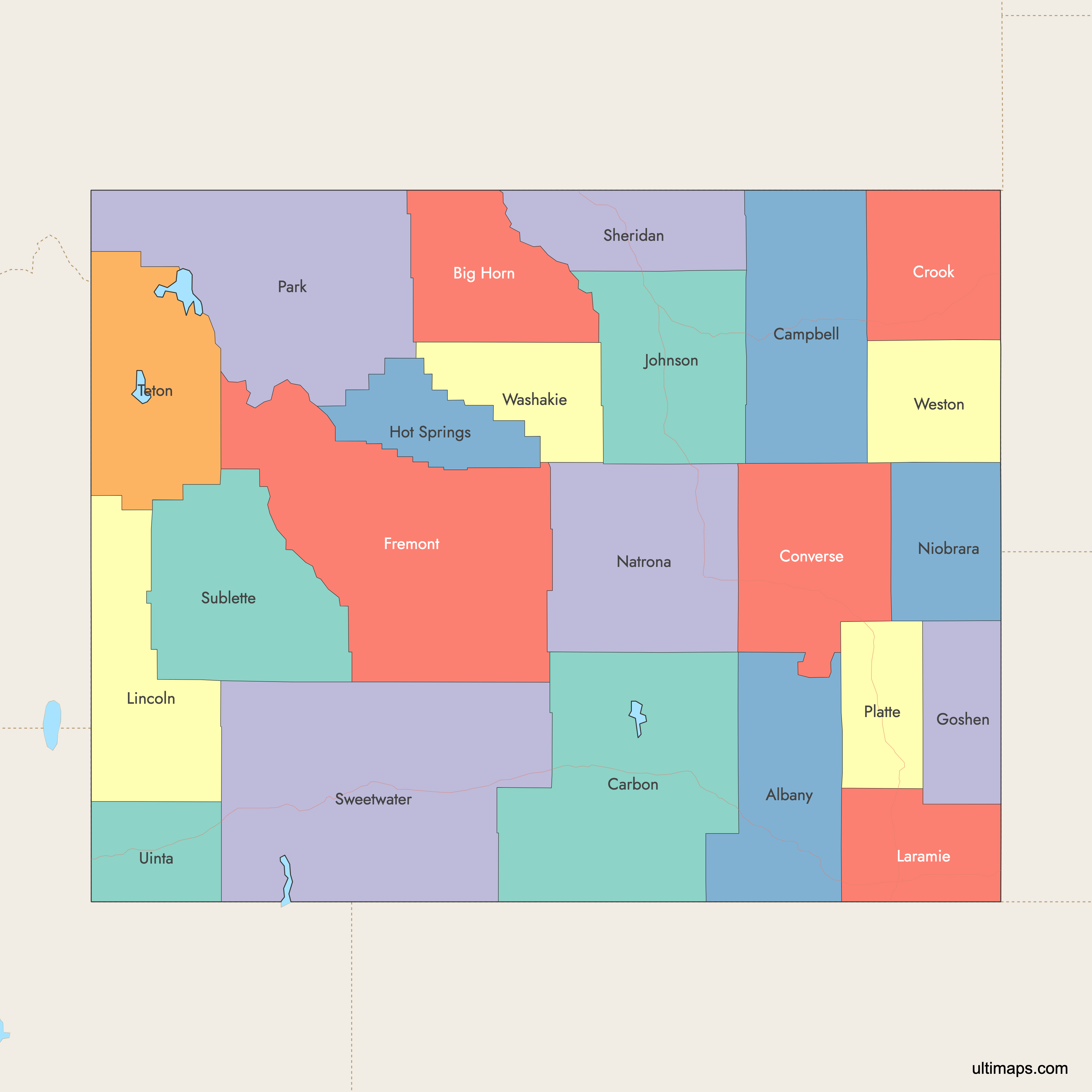
 Colored Map of Wyoming Counties with Surrounding Areaspng299 KB
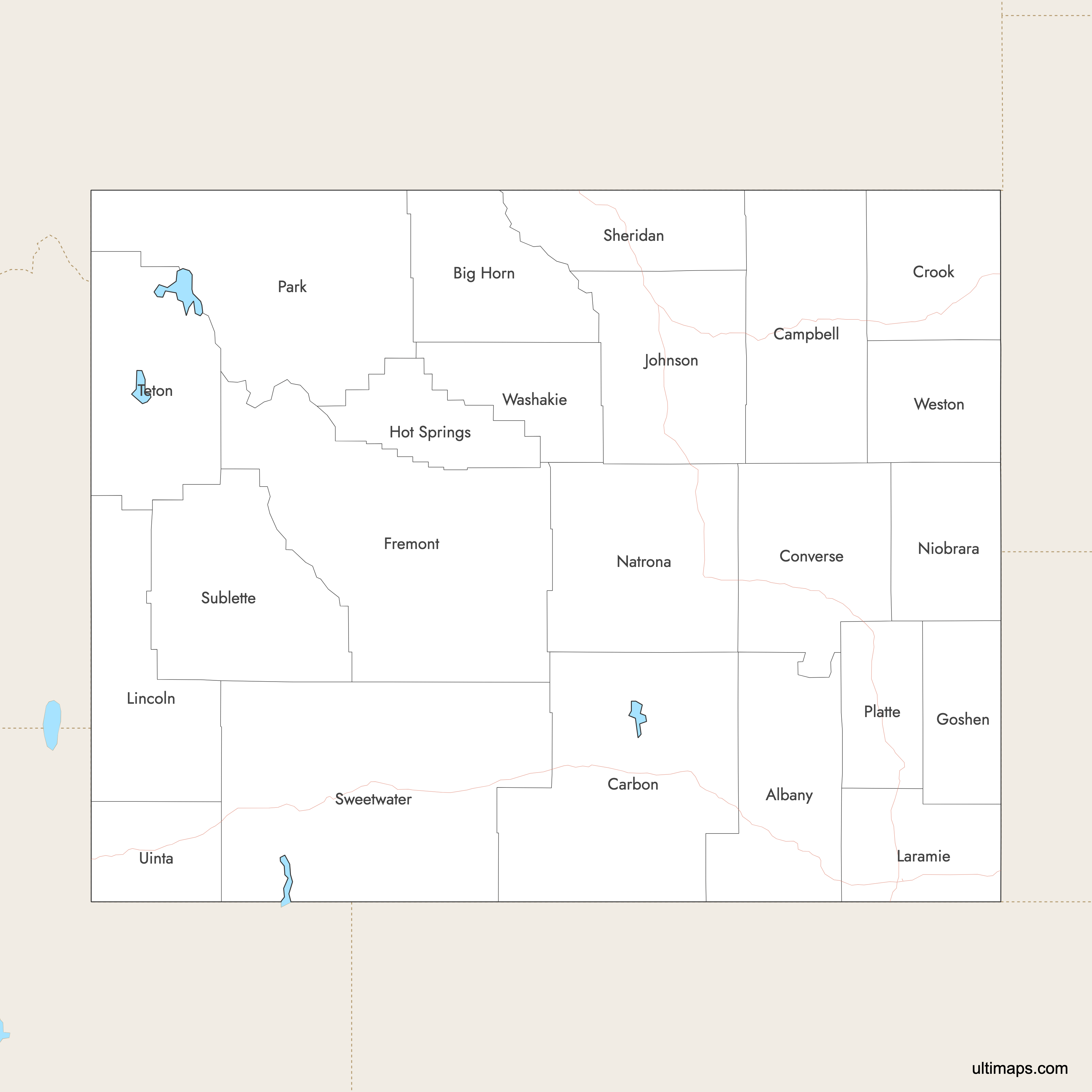
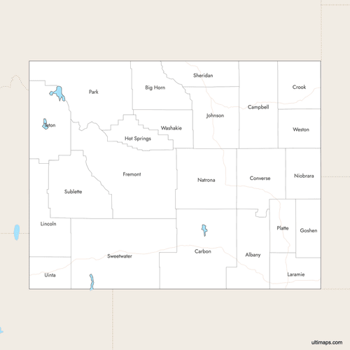 Labeled Map of Wyoming Counties with Surrounding Areaspng289 KB
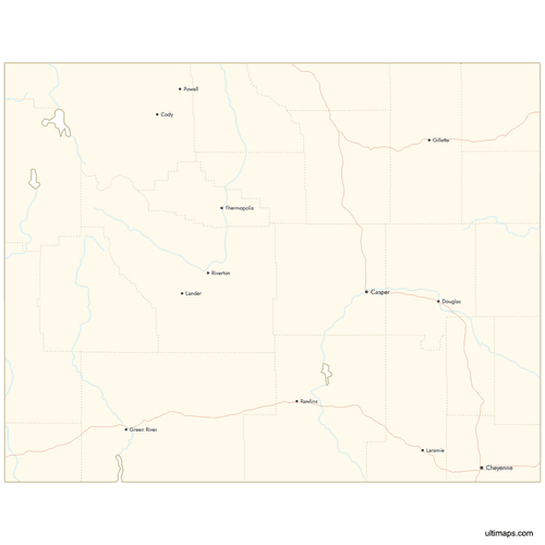 Map of Wyoming Counties with Citiespng491 KB
You can download free blank Map of Wyoming Counties and other maps in high resolution PNG, SVG and PDF formats from the blank maps section of the site: Download Blank Map of Wyoming Counties
Custom Map Features
This map supports labels.
This map supports surrounding areas, roads, rivers and cities. New
This map is divided into 23 counties.
Updates
Jan 12, 2026:
- Improved map quality
- Added support for surrounding areas and lakes
Aug 26, 2024:
- Added map of Wyoming Counties
Frequently Asked Questions
Wyoming has 23 counties. This total has been stable for many decades.
Sweetwater County is the largest county by area, covering approximately 10,426 square miles (27,000 km²).
The smallest county by area in Wyoming is Hot Springs County, covering approximately 2,004 square miles (5,190 km²).
Laramie County is Wyoming’s most populous county, including Cheyenne, the state capital.
Niobrara County is identified as Wyoming’s least populous county.
You can use Ultimaps to create custom maps of Wyoming. Color-code counties manually or upload data, place pins, customize look and feel, and export to PNG, PDF, or SVG.


