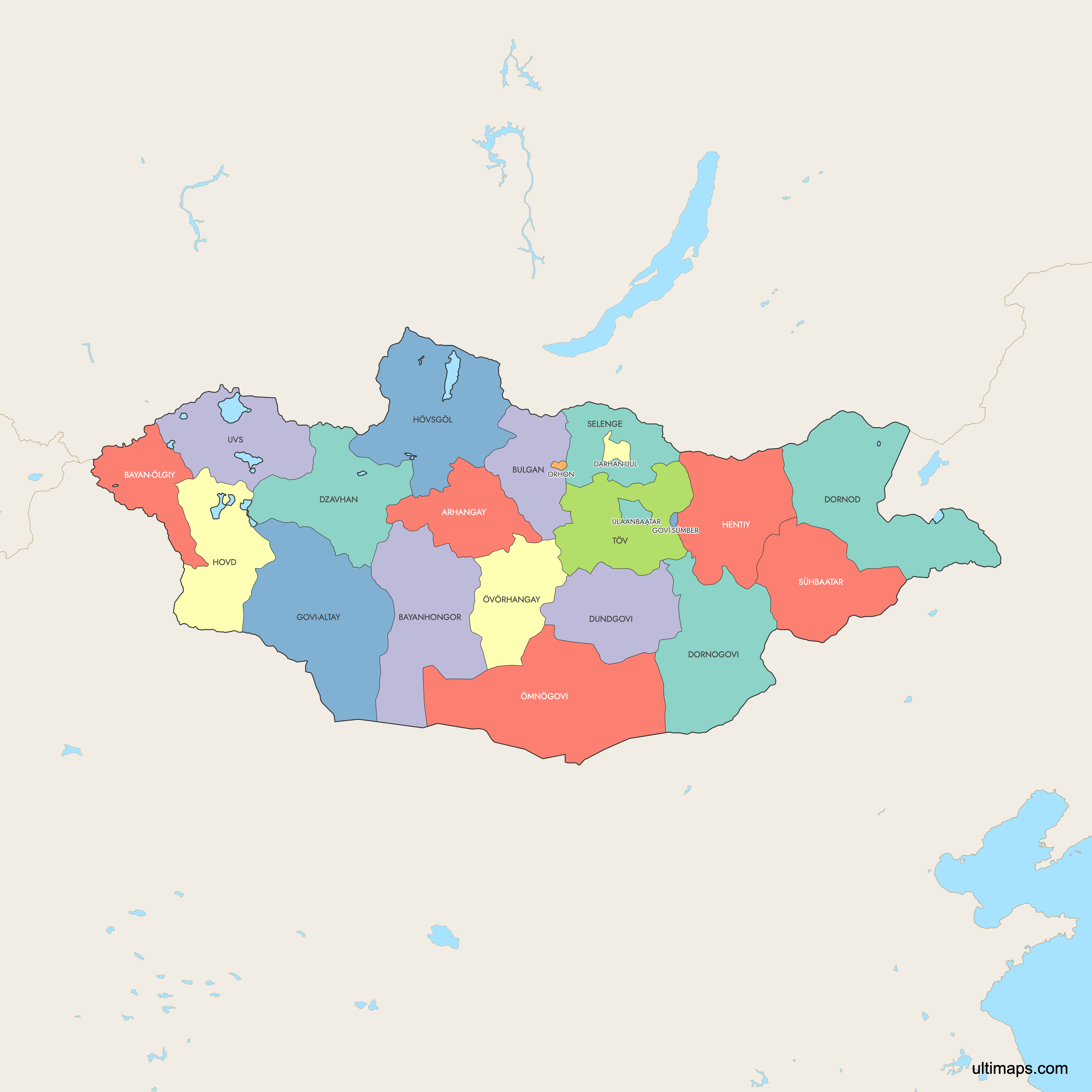
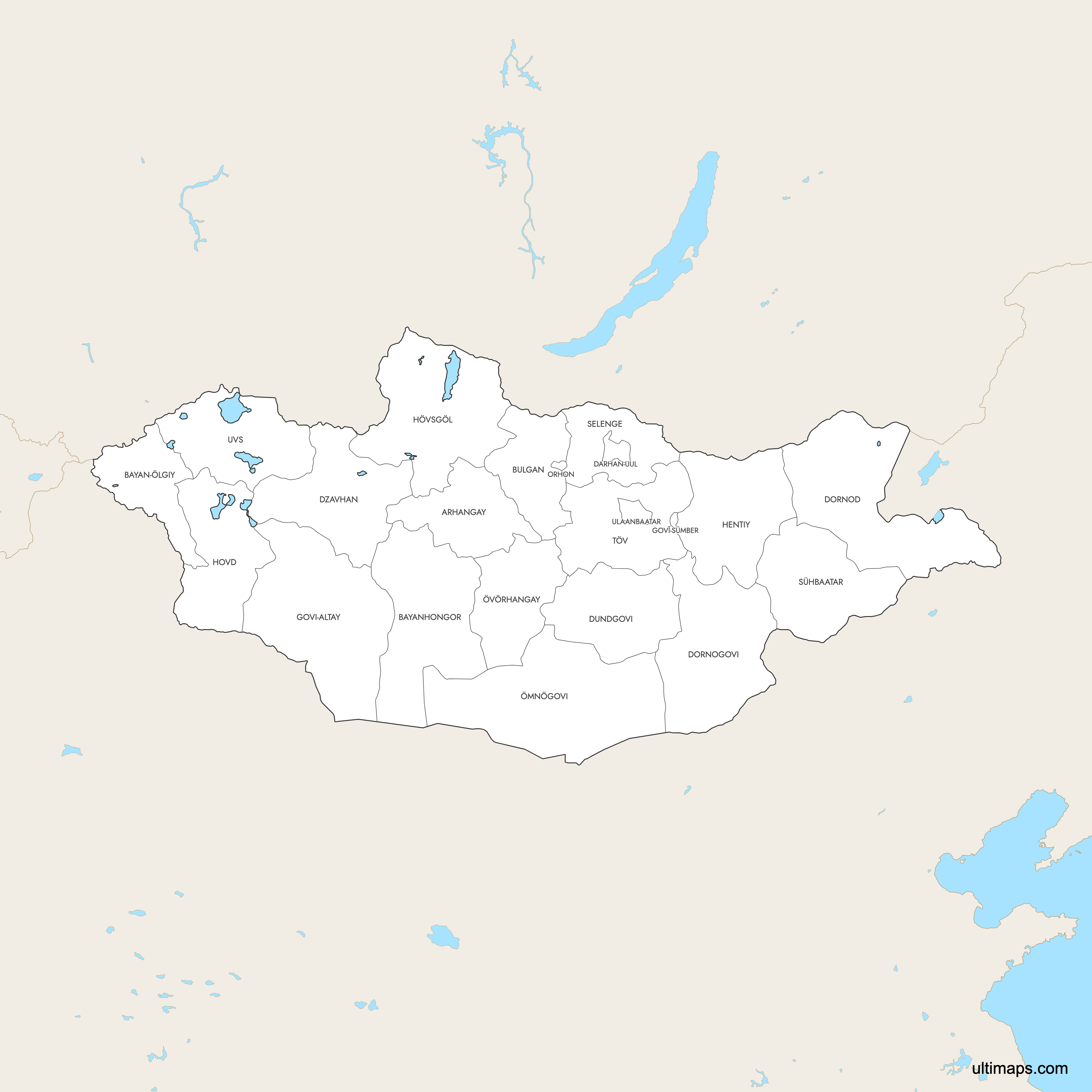
Map of Mongolia Provinces
Mongolia is divided into 21 provinces (aimags) and one provincial municipality, Ulaanbaatar. These provinces span from the Gobi Desert in the south to the forested mountains bordering Russia in the north, covering 1,564,116 km² (603,909 sq mi) of landlocked territory between Russia and China. Use the interactive maps below to explore Mongolia's provinces and their boundaries. Download free maps or learn more about creating a custom map of Mongolia to visualize your own data.
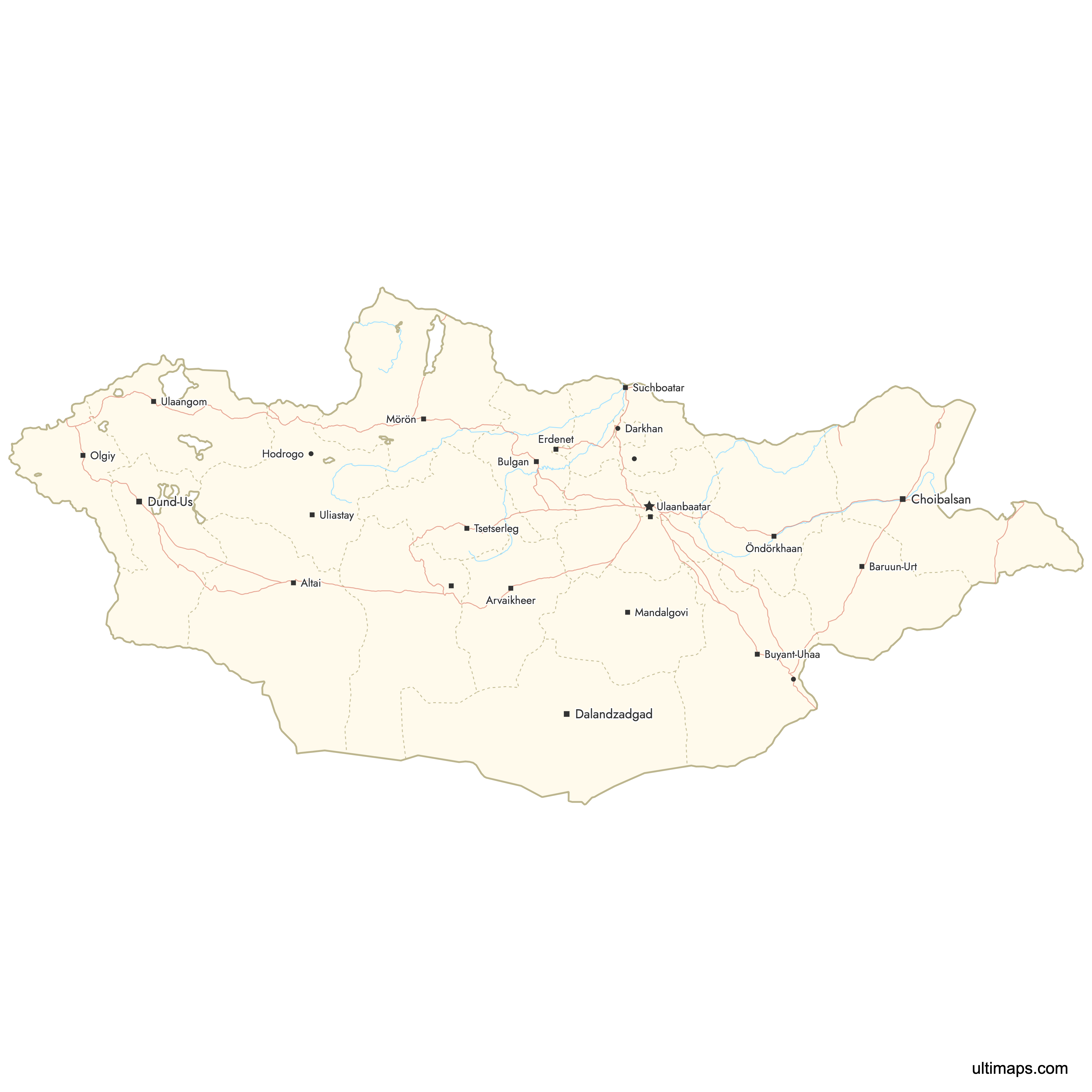
Interactive Map of Mongolia Provinces
List of Provinces (22)
| # | Province |
|---|---|
| 1 | |
| 2 | |
| 3 | |
| 4 | |
| 5 | |
| 6 | |
| 7 | |
| 8 | |
| 9 | |
| 10 | |
| 11 | |
| 12 | |
| 13 | |
| 14 | |
| 15 | |
| 16 | |
| 17 | |
| 18 | |
| 19 | |
| 20 | |
| 21 | |
| 22 |
Mongolia Provinces: Key Facts
- Total number of provinces: 21 aimags plus 1 provincial municipality (Ulaanbaatar), for 22 first-level divisions total.
- Most populous province: Khövsgöl Province with 135,095 residents (2020 Census). Ulaanbaatar, as a separate municipal entity, is home to roughly 1.5 million people, nearly half the national population.
- Least populous province: Arkhangai Province with 94,994 residents (2020 Census).
- Largest province by area: Ömnögovi Province at 165,380 km² (63,846 sq mi), covering much of the Gobi Desert.
- Smallest province by area: Orkhon Province at 844 km² (326 sq mi), home to Erdenet, Mongolia's second-largest city.
- Major urban centers: Ulaanbaatar (capital, ~1.5 million), Erdenet in Orkhon Province, Darkhan in Darkhan-Uul Province, Choibalsan in Dornod Province, and Mörön in Khövsgöl Province.
- Capital: Ulaanbaatar functions as a provincial municipality and sits as an enclave within Töv Province.
- Bordering countries: Russia to the north and China to the south, east, and west. Mongolia is entirely landlocked.
- Time zones: UTC+8 in western provinces (Bayan-Ölgii, Uvs, Khovd, Govi-Altai), UTC+7 in central provinces, and UTC+9 in eastern provinces (Dornod, Sükhbaatar).
- Boundary history: Modern provinces were established after Mongolia's 1921 independence from China. Most aimags were created between 1930 and 1942, with Darkhan-Uul and Orkhon added most recently in 1994.
Interesting Facts
- Mongolia is the world's least densely populated sovereign country outside Antarctica, averaging roughly 2 people per km² nationally.
- Bayan-Ölgii Province has a Kazakh majority of approximately 90%, the result of Soviet-era resettlement policies, making it culturally distinct from the rest of Mongolia.
- The Gobi Desert dominates the southern provinces of Ömnögovi and Dornogovi, covering about 30% of Mongolia's total land area.
- Mongolia's 21 provinces are subdivided into 331 districts (soums), which serve as the primary rural administrative units across the country.
- Khövsgöl Lake in Khövsgöl Province covers roughly 2,760 km² and holds nearly 70% of Mongolia's fresh water. It is designated a UNESCO Biosphere Reserve.
Free Downloads
 Colored Map of Mongolia Provinces with Surrounding Areaspng637 KB
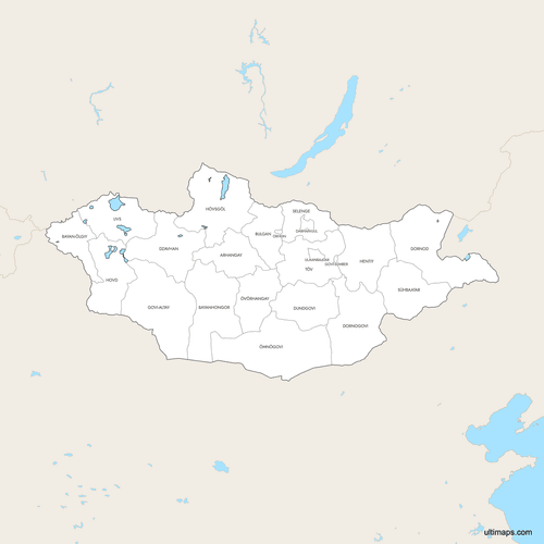 Labeled Map of Mongolia Provinces with Surrounding Areaspng617 KB
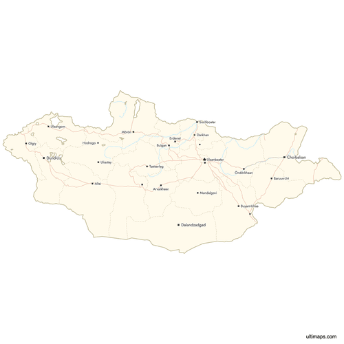 Map of Mongolia Provinces with Citiespng643 KB
You can download free blank Map of Mongolia Provinces and other maps in high resolution PNG, SVG and PDF formats from the blank maps section of the site: Download Blank Map of Mongolia Provinces
Custom Map Features
This map supports labels.
This map supports surrounding areas, roads, rivers and cities. New
This map is divided into 22 provinces.
Updates
May 14, 2026:
- Added map of Mongolia Provinces with surrounding countries, cities, roads, rivers and lakes
Frequently Asked Questions
Mongolia has 21 provinces, known as aimags, plus one provincial municipality (Ulaanbaatar), totaling 22 first-level administrative divisions. The provinces are further subdivided into 331 districts called soums. Most aimags were established between 1930 and 1942, with Darkhan-Uul and Orkhon created most recently in 1994.
Ömnögovi Province is the largest at 165,380 km² (63,846 sq mi). It covers a vast portion of the Gobi Desert in southern Mongolia. The province is home to Gobi Gurvansaikhan National Park, which contains the famous Flaming Cliffs where significant dinosaur fossils have been discovered.
Orkhon Province is the smallest at just 844 km² (326 sq mi). Despite its small size, it contains Erdenet, Mongolia's second-largest city. Orkhon Province was established in 1994 as one of Mongolia's newest administrative divisions.
Among the 21 aimags, Khövsgöl Province is the most populous with 135,095 residents according to the 2020 Census. Its capital, Mörön, serves as the main northern hub. However, the Ulaanbaatar provincial municipality far exceeds all provinces with approximately 1.5 million residents, nearly half of Mongolia's total population.
Khövsgöl Lake, a UNESCO Biosphere Reserve covering roughly 2,760 km², is in Khövsgöl Province. Gobi Gurvansaikhan National Park and the Flaming Cliffs are in Ömnögovi Province. The Orkhon Valley, a UNESCO World Heritage Site with ancient Mongol Empire ruins, spans Övörkhangai and Arkhangai provinces. Altai Tavan Bogd National Park, with glaciers and peaks over 4,000 meters, is in Bayan-Ölgii Province.
Mongolia spans three time zones. Western provinces including Bayan-Ölgii, Uvs, Khovd, and Govi-Altai use UTC+8. Central provinces operate on UTC+7. Eastern provinces such as Dornod and Sükhbaatar follow UTC+9.
Bayan-Ölgii is the only province in Mongolia with a Kazakh majority, at approximately 90% of the population. This demographic composition is the result of Soviet-era resettlement policies. The province is also home to Altai Tavan Bogd National Park, which features glaciers, peaks above 4,000 meters, and ancient petroglyphs.
Mongolia is bordered by Russia to the north and China to the south, east, and west. It is entirely landlocked with no coastline or access to open water. Mongolia is the world's least densely populated sovereign country outside Antarctica, with roughly 2 people per km².
You can use Ultimaps to create custom maps of Mongolia. Color-code provinces manually or upload your data, place pins, customize the look and feel, and export to PNG, PDF, or SVG. No sign-up required.