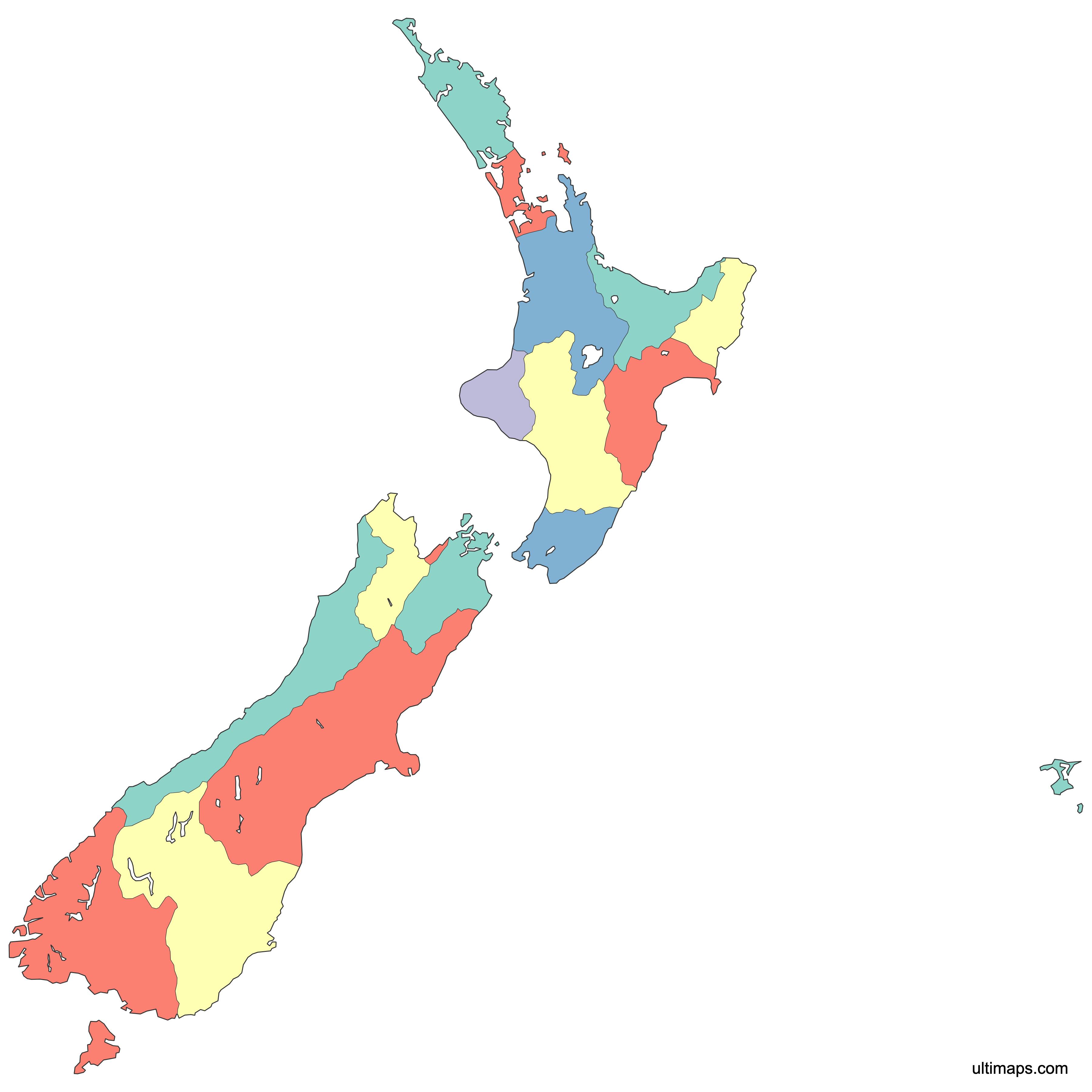
Map of New Zealand Regions
New Zealand is divided into 16 regions, each serving as a first-level administrative division of the country. These regions, established in 1989 based largely on drainage basins, span two main islands and cover a total area of 268,021 km² (103,483 sq mi). Use the interactive maps below to explore all 16 regions and their boundaries. Download free maps or learn more about creating a custom map of New Zealand to visualize your own data.
Interactive Map of New Zealand Regions
List of Regions (17)
| # | Region |
|---|---|
| 1 | |
| 2 | |
| 3 | |
| 4 | |
| 5 | |
| 6 | |
| 7 | |
| 8 | |
| 9 | |
| 10 | |
| 11 | |
| 12 | |
| 13 | |
| 14 | |
| 15 | |
| 16 | |
| 17 |
New Zealand Regions: Key Facts
- Total number of regions: 16, plus the Chatham Islands as a special territorial authority
- Most populous region: Auckland, the country's main economic and commercial hub
- Capital region: Wellington, home to the national capital city of Wellington on the North Island
- Largest region by area: Manawatū-Whanganui at 22,221 km² (8,580 sq mi)
- Smallest region by area: Nelson, one of five regions administered as a unitary authority
- Major urban centers: Auckland (primary economic center), Wellington (government and administration), Canterbury (agricultural powerhouse), Waikato (manufacturing and logistics)
- Bordering waters: Tasman Sea to the west, Pacific Ocean to the north, east, and south
- Nearest neighbor: Located over 1,500 km east of Australia across the Tasman Sea
- Time zone: NZST (UTC+12), with NZDT (UTC+13) during daylight saving
- Boundaries established: 1989, under the Local Government Act 1974, with boundaries drawn along drainage basins
Interesting Facts
- New Zealand has no land borders with any other country, making it one of the most geographically isolated nations in the world.
- Regional boundaries follow natural drainage basins rather than arbitrary lines, meaning each region largely corresponds to a watershed system.
- Lake Taupo, the largest lake by surface area in New Zealand, sits on the North Island's central plateau and was formed by a volcanic eruption roughly 26,500 years ago.
- Northland is home to Cape Reinga, a site of deep significance in Māori mythology, where spirits are believed to depart for the afterlife.
- Below the 16 regions, New Zealand is further divided into 15 cities and 58 districts, collectively known as territorial authorities.
Free Downloads

You can download free blank Map of New Zealand Regions and other maps in high resolution PNG, SVG and PDF formats from the blank maps section of the site: Download Blank Map of New Zealand Regions
Custom Map Features
This map supports labels.
This map is divided into 17 regions.
Updates
Apr 9, 2026:
- Added map of New Zealand regions with cities and roads
Frequently Asked Questions
New Zealand is divided into 16 regions. Eleven are administered by regional councils and five by unitary authorities. The Chatham Islands operate separately as a special territorial authority outside the standard regional structure.
Manawatū-Whanganui is the largest region by area at 22,221 km² (8,580 sq mi). Its council seat is Palmerston North. The region covers a large portion of the lower North Island.
Nelson is the smallest region in New Zealand by area. It is one of five regions governed as a unitary authority rather than by a separate regional council. Despite its small size, Nelson is known for its sunny climate and proximity to the Tasman region.
Auckland is the most populous region in New Zealand and serves as the country's primary economic and commercial hub. It is located on the North Island and is by far the largest urban center in the country.
Wellington, the national capital, is located in the Wellington region on the North Island. Cape Reinga, an important site in Māori mythology, is in the Northland region. Lake Taupo, the largest lake by surface area in New Zealand, sits on the central plateau of the North Island and was formed by a volcanic eruption around 26,500 years ago.
The current regional boundaries were established in 1989 through local government reform under the Local Government Act 1974. Unlike many countries that use arbitrary or historical lines, New Zealand's regions are drawn largely along drainage basins, meaning each region roughly corresponds to a natural watershed.
Regions are the first-level administrative divisions, numbering 16 in total. Below them, New Zealand is divided into 15 cities and 58 districts, collectively called territorial authorities. Eleven regions have separate regional councils, while five regions operate as unitary authorities that combine regional and territorial functions.
New Zealand consists of the North Island and the South Island, separated by the Cook Strait. Stewart Island lies to the south of the South Island. The North Island contains regions like Auckland, Wellington, and Waikato, while the South Island includes Canterbury, Otago, and the West Coast.
You can use Ultimaps to create custom maps of New Zealand. Color-code regions manually or upload your data, place pins, customize the look and feel, and export to PNG, PDF, or SVG. No sign-up required.