Spain Map with Autonomous Communities
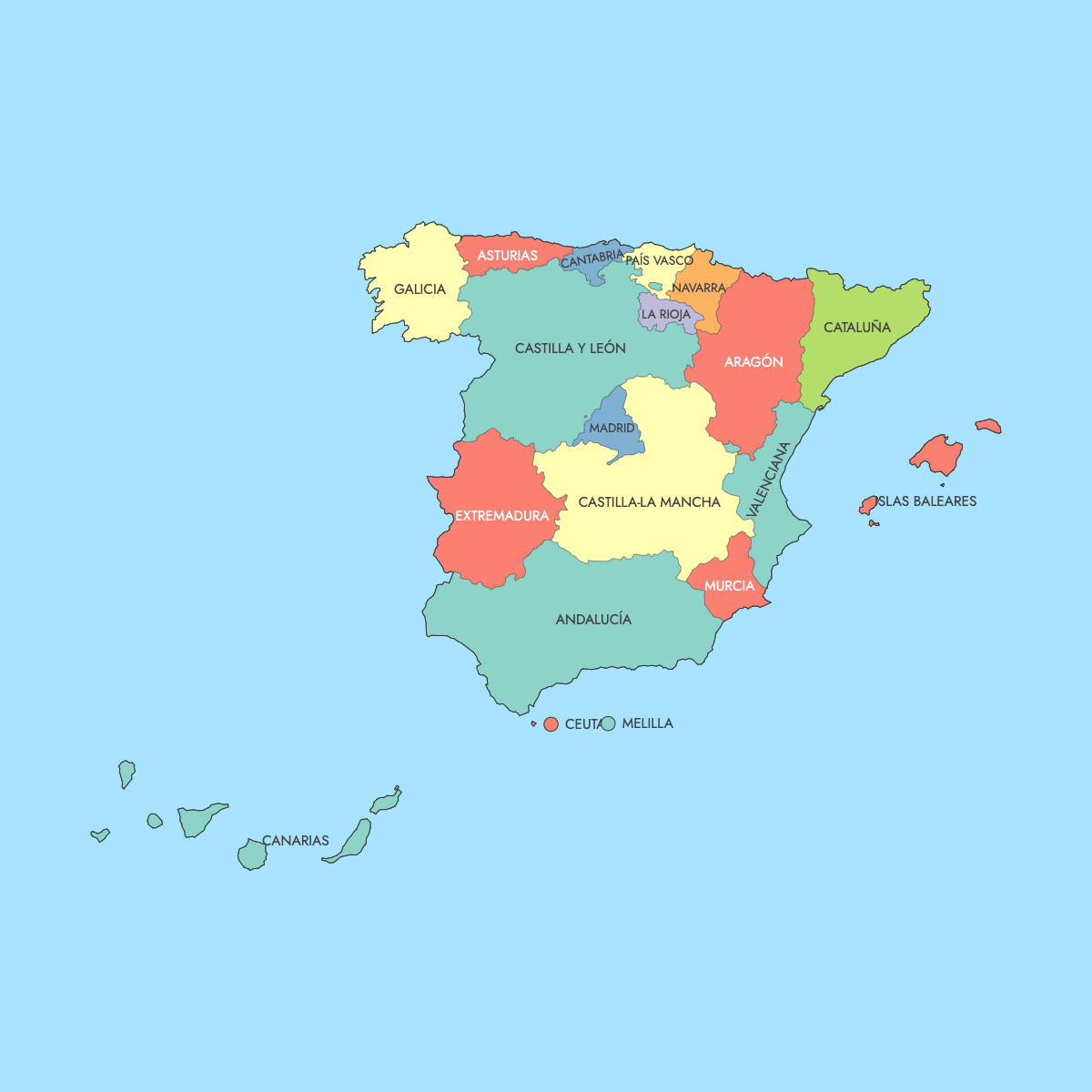
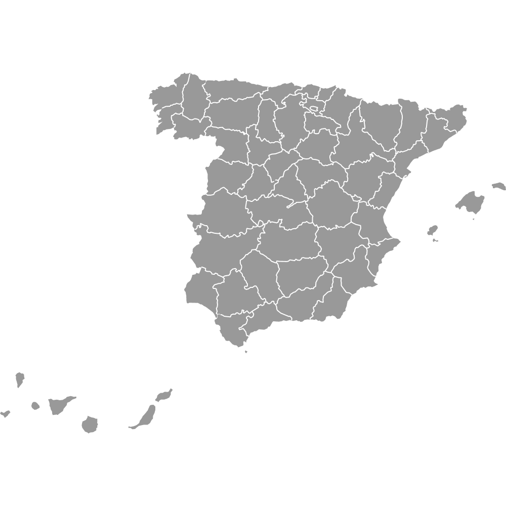
Spain is divided into 17 autonomous communities and two autonomous cities, Ceuta and Melilla, the 19 units drawn on this map of Spain. The structure comes from the 1978 Constitution, which allowed neighboring provinces to form self-governing regions with their own statutes and parliaments. Ceuta and Melilla, on the North African coast, received statutes of autonomy in 1995, but their assemblies have no legislative power, so their self-government is narrower than a community's.
Andalusia is the most populous community, with 8,676,713 residents on 1 January 2025 (Eurostat), ahead of Catalonia at 8,124,126 and the Community of Madrid at 7,113,886. Madrid is both the national capital and the capital of that single-province community. Area ranks differently: Castile and León is the largest community at 94,223 km² (36,380 sq mi) according to INE, while the Balearic Islands are the smallest at 4,992 km² (1,927 sq mi). The Canary Islands appear in an inset box, away from their real position in the Atlantic. In the editor, you can color all 19 units from figures you paste in.
Interactive Spain Map with Autonomous Communities
List of Communities (19)
| # | Community | Population (2025) | GDP per capita (EUR, 2024) | Unemployment rate (%, 2025) | Life expectancy at birth (years, 2024) |
|---|---|---|---|---|---|
| 1 | Andalucía | 8,676,713 | 24,500 | 15.20 | 82.90 |
| 2 | Aragón | 1,364,621 | 36,700 | 8 | 84.30 |
| 3 | Asturias | 1,015,128 | 29,700 | 8.80 | 83.40 |
| 4 | Canarias | 2,258,866 | 25,900 | 13.50 | 82.90 |
| 5 | Cantabria | 593,623 | 29,900 | 7.30 | 84 |
| 6 | Castilla y León | 2,401,221 | 30,900 | 8.60 | 84.80 |
| 7 | Castilla-La Mancha | 2,126,378 | 26,300 | 12.80 | 83.90 |
| 8 | Cataluña | 8,124,126 | 37,500 | 8.40 | 84.30 |
| 9 | Ceuta | 83,567 | 23,100 | 24.30 | 81.90 |
| 10 | Extremadura | 1,053,345 | 25,200 | 14.80 | 83.20 |
| 11 | Galicia | 2,714,741 | 30,200 | 8.40 | 84.20 |
| 12 | Islas Baleares | 1,249,844 | 36,100 | 8.80 | 83.50 |
| 13 | La Rioja | 326,803 | 34,100 | 8.10 | 83.90 |
| 14 | Madrid | 7,113,886 | 44,700 | 8 | 85.70 |
| 15 | Melilla | 87,067 | 21,100 | 24.90 | 83.30 |
| 16 | Murcia | 1,586,989 | 26,900 | 12.10 | 83.50 |
| 17 | Navarra | 683,854 | 39,100 | 7.70 | 84.70 |
| 18 | País Vasco | 2,242,343 | 41,000 | 7.30 | 84.70 |
| 19 | Valencia | 5,425,182 | 27,600 | 11.60 | 83.50 |
Data sources, all reuse with acknowledgement:
- Population: Eurostat, Population on 1 January (demo_r_pjanaggr3).
- GDP per capita: Eurostat, Gross domestic product at current market prices by NUTS 3 regions, euro per inhabitant (nama_10r_3gdp).
- Unemployment rate: Eurostat, Unemployment rates by NUTS 2 regions, ages 15-74 (lfst_r_lfu3rt).
- Life expectancy at birth: Eurostat, Life expectancy at birth by NUTS 2 regions (demo_r_mlifexp).
Spain's Autonomous Communities: Key Facts
- Units on this map: 19 in total, the 17 autonomous communities and the 2 autonomous cities of Ceuta and Melilla
- Most populous: Andalusia, 8,676,713 residents (Eurostat, 1 January 2025)
- Least populous community: La Rioja, 326,803 (Eurostat, 1 January 2025). Ceuta, with 83,567, is the smallest unit of the 19
- Combined population: 49,128,297 across all 19 units (Eurostat, 1 January 2025)
- Largest by area: Castile and León, 94,223 km² (36,380 sq mi), INE figures. Andalusia follows at 87,268 km² (33,694 sq mi)
- Smallest by area: Balearic Islands, 4,992 km² (1,927 sq mi). La Rioja, 5,045 km² (1,948 sq mi), is the smallest mainland community, and Melilla, about 12 km² (INE), is the smallest unit on the map
- Capital: Madrid, capital of Spain and of the Community of Madrid, which had 7,113,886 residents (Eurostat, 1 January 2025)
- Major urban centers: a selection includes Madrid, Barcelona (Catalonia), Valencia, Seville and Málaga (Andalusia), Zaragoza (Aragon), Murcia, Palma (Balearic Islands), Las Palmas de Gran Canaria (Canary Islands) and Bilbao (Basque Country)
- Provinces: 50, grouped into the communities. Seven communities consist of one province: Asturias, the Balearic Islands, Cantabria, the Community of Madrid, Murcia, Navarre and La Rioja
- Borders: land borders with Portugal, France, Andorra, Gibraltar (United Kingdom) and Morocco at Ceuta and Melilla. Coastlines on the Atlantic Ocean, the Cantabrian Sea and the Mediterranean Sea
- Time zones: CET (UTC+1) on the mainland and in the Balearic Islands, Ceuta and Melilla. The Canary Islands use WET (UTC+0)
- Boundaries established: by the 1978 Constitution, which set up the autonomous community framework. Ceuta and Melilla received their statutes of autonomy in 1995
- Map layout: the Canary Islands appear in an inset box, not in their true position in the Atlantic off northwest Africa
Interesting Facts
- Most communities reached autonomy by one of two routes: the Article 151 fast track, used by Andalusia and, through a related provision for historical nationalities, by the Basque Country, Catalonia and Galicia, or the Article 143 slow track. Navarre followed a third path by updating its historic fueros. The powers held by each community are therefore not identical.
- Navarre and the Basque Country operate foral tax regimes rooted in historic charters, collecting most of their own taxes and transferring an agreed payment to the state.
- Spain is transcontinental in administrative terms. The Canary Islands lie off northwest Africa, and Ceuta and Melilla are on the African mainland, bordering Morocco.
- Asturian and Aragonese are recognized and protected in their communities but are not co-official languages.
- Two communities keep the Castile name, Castile and León and Castile-La Mancha, both descended from the historic Crown of Castile.
Free Downloads
Free for personal and commercial use with a credit to Ultimaps. See the license terms for details.
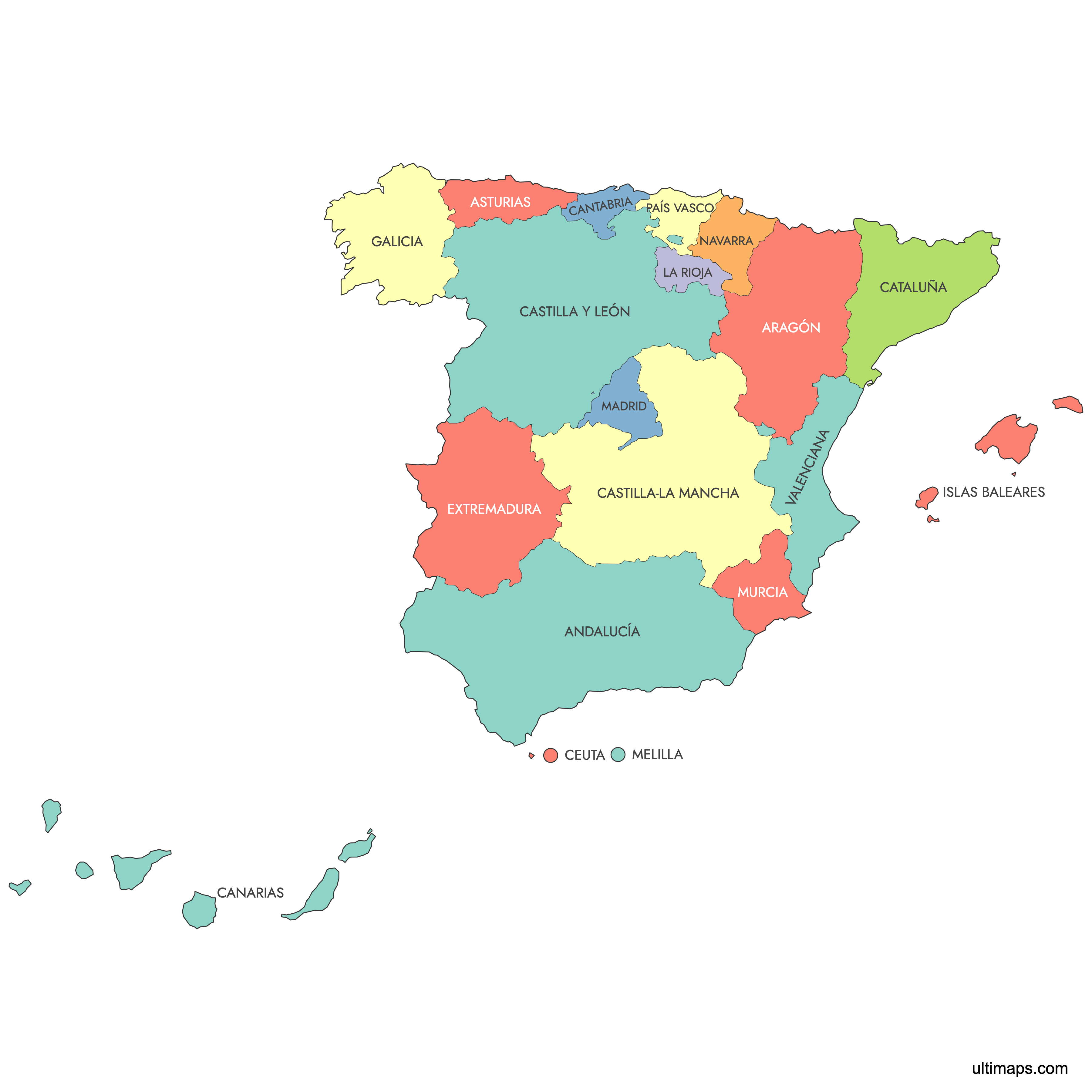
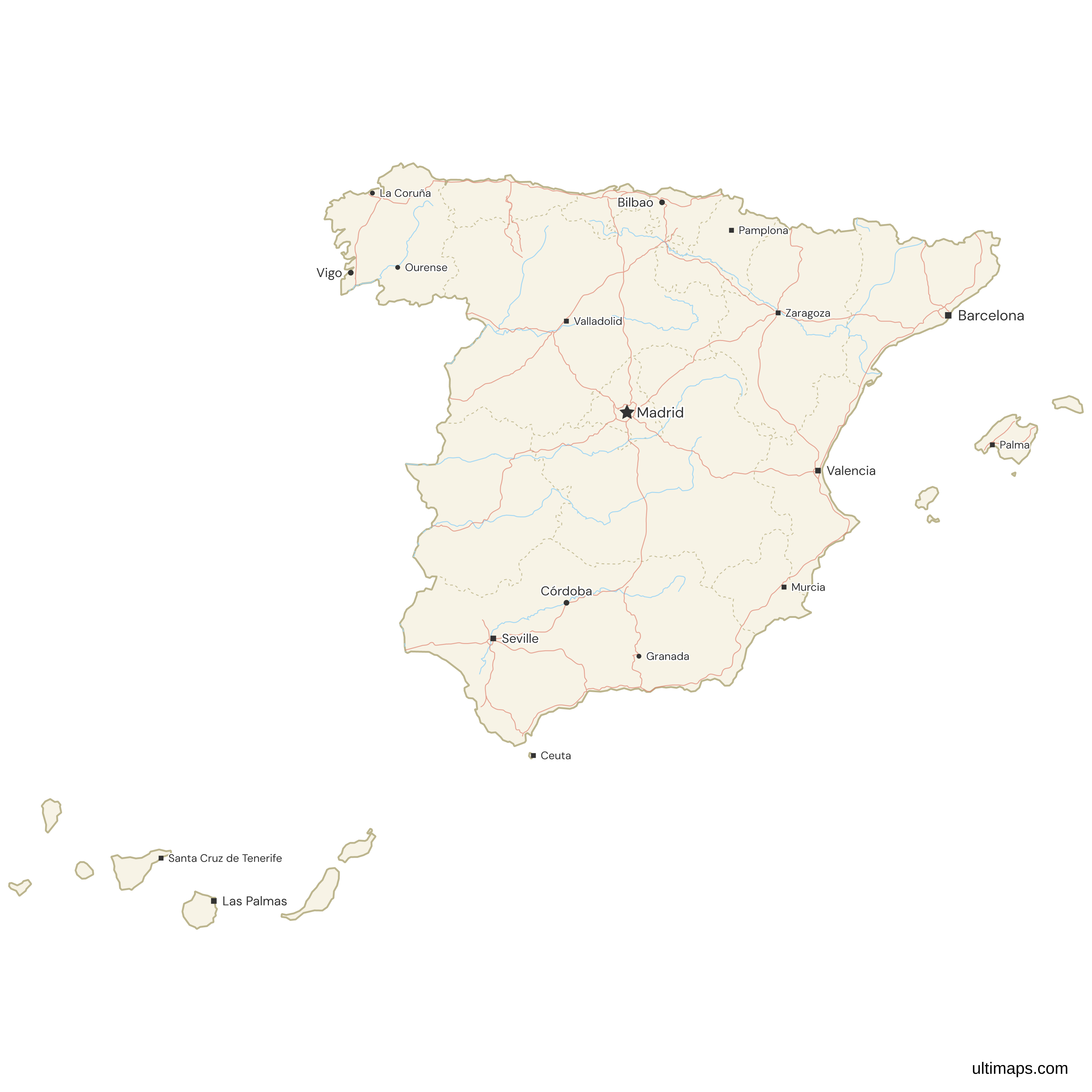
Need it without colors? The blank version of this map comes as a print-ready PDF (A4 and US Letter), a PNG and an editable SVG.
Custom Map Features
This map supports labels.
This map is divided into 19 communities.
Updates
Sep 28, 2023:
- Added map of Spain Communities
Frequently Asked Questions
Spain has 17 autonomous communities: Andalusia, Aragon, Asturias, the Balearic Islands, the Basque Country, the Canary Islands, Cantabria, Castile and León, Castile-La Mancha, Catalonia, Extremadura, Galicia, La Rioja, the Community of Madrid, Murcia, Navarre and the Valencian Community. Two autonomous cities, Ceuta and Melilla, complete the first-level administrative division, which is why 19 units appear on this map. The 1978 Constitution created the system after the end of the Franco era. Eurostat counted 49,128,297 people across the 19 units on 1 January 2025, and the communities in turn group Spain's 50 provinces.
Castile and León is the largest autonomous community in Spain at 94,223 km² (36,380 sq mi), using INE figures. Andalusia comes next at 87,268 km² (33,694 sq mi). Size and population do not match up here: Castile and León had 2,401,221 residents on 1 January 2025 (Eurostat), fewer than the Valencian Community or Catalonia, both much smaller in area. The smallest community is the Balearic Islands at 4,992 km² (1,927 sq mi), and Melilla, about 12 km² (INE), is the smallest unit on this map.
Andalusia is the most populated autonomous community in Spain, with 8,676,713 residents on 1 January 2025 (Eurostat). Seville is its capital, and Málaga, Granada and Córdoba are other major cities, home to the Alhambra and the Mezquita-Catedral. Catalonia ranks second at 8,124,126 with Barcelona as its capital, and the Community of Madrid third at 7,113,886. Andalusia also covers 87,268 km² (33,694 sq mi), second only to Castile and León. Its population grew by 3.4 percent between 1 January 2015 and 1 January 2025, more slowly than Catalonia (9.5 percent) or the Community of Madrid (11.6 percent), according to Eurostat.
Ceuta and Melilla are autonomous cities, not autonomous communities. Both are on the North African coast and border Morocco, and both received statutes of autonomy in 1995. Their assemblies cannot pass laws, and that is the main difference from the 17 communities. Melilla had 87,067 residents and Ceuta 83,567 on 1 January 2025 (Eurostat), making them the two smallest units on this map, and Melilla covers about 12 km² (INE). Through the two cities, Spain is the only European Union country with territory on the African mainland.
Spain has 50 provinces, and every one belongs to an autonomous community. Seven communities consist of a single province: Asturias, the Balearic Islands, Cantabria, the Community of Madrid, Murcia, Navarre and La Rioja. The others combine two or more provinces, while Ceuta and Melilla stand outside the provincial system. Provinces still define electoral districts and much of the statistical reporting, so they are the right unit when community-level data is too coarse for your work. You can map them on the Spain provinces map, which offers the same editing and export options as this page.
Several Spanish communities give official status to a second language. Catalan is co-official in Catalonia and the Balearic Islands, and the Valencian Community recognizes Valencian. Galician is co-official in Galicia, Basque in the Basque Country and in the Basque-speaking areas of Navarre, and Occitan, known as Aranese in the Aran Valley where it is mainly spoken, is co-official throughout Catalonia. Language policy is one of the powers the communities exercise under their statutes of autonomy, which is why signage, schooling and regional administration differ from one part of the country to another. Spanish is official everywhere in Spain.
Spain is a unitary state rather than a federation, so its top-level units are autonomous communities with devolved powers, not states. The 1978 Constitution created the model as part of the settlement after the Franco dictatorship, balancing national unity against long-standing demands for self-rule in Catalonia, the Basque Country, Galicia and elsewhere. Most communities followed one of two routes. The Article 151 fast track, used by Andalusia, and a related provision for the historical nationalities of the Basque Country, Catalonia and Galicia granted broad competences from the start. The Article 143 slow track provided for a more gradual transfer, and Navarre followed a third path by updating its historic fueros. As a result, powers vary from one community to another.
The Community of Madrid had the highest GDP per capita in Spain in 2024, 44,700 EUR (Eurostat). The next two were the Basque Country (41,000 EUR) and Navarre (39,100 EUR), the two communities with foral tax regimes, which collect most of their own taxes under historic charters and pay an agreed amount to the state. The lowest figures were in the south and in the two autonomous cities: Andalusia recorded 24,500 EUR, Ceuta 23,100 EUR and Melilla 21,100 EUR, the lowest of the 19 units. Madrid's figure was about 1.8 times Andalusia's in 2024.
Use the editor on this page to build your own map of Spain. Color communities one at a time, or paste a list with a value for each of the 19 units to get a choropleth with a legend. You can mark cities or stores with pins, rename or hide community labels, and set border thickness, typeface and background. No account is required to use the editor. Free users export a standard PNG that carries a small Ultimaps credit, and the Pro plan adds SVG, PDF and high-resolution PNG.