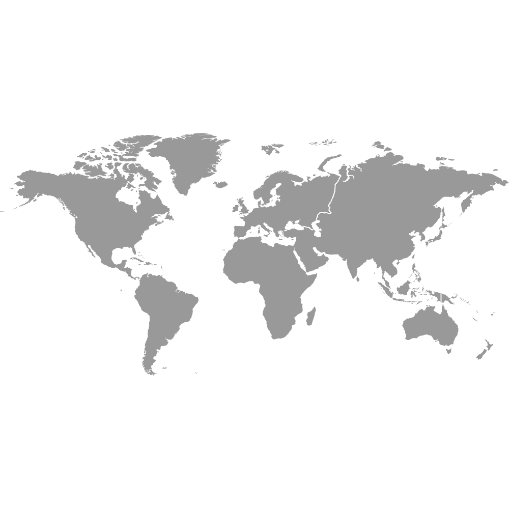
Map of the World
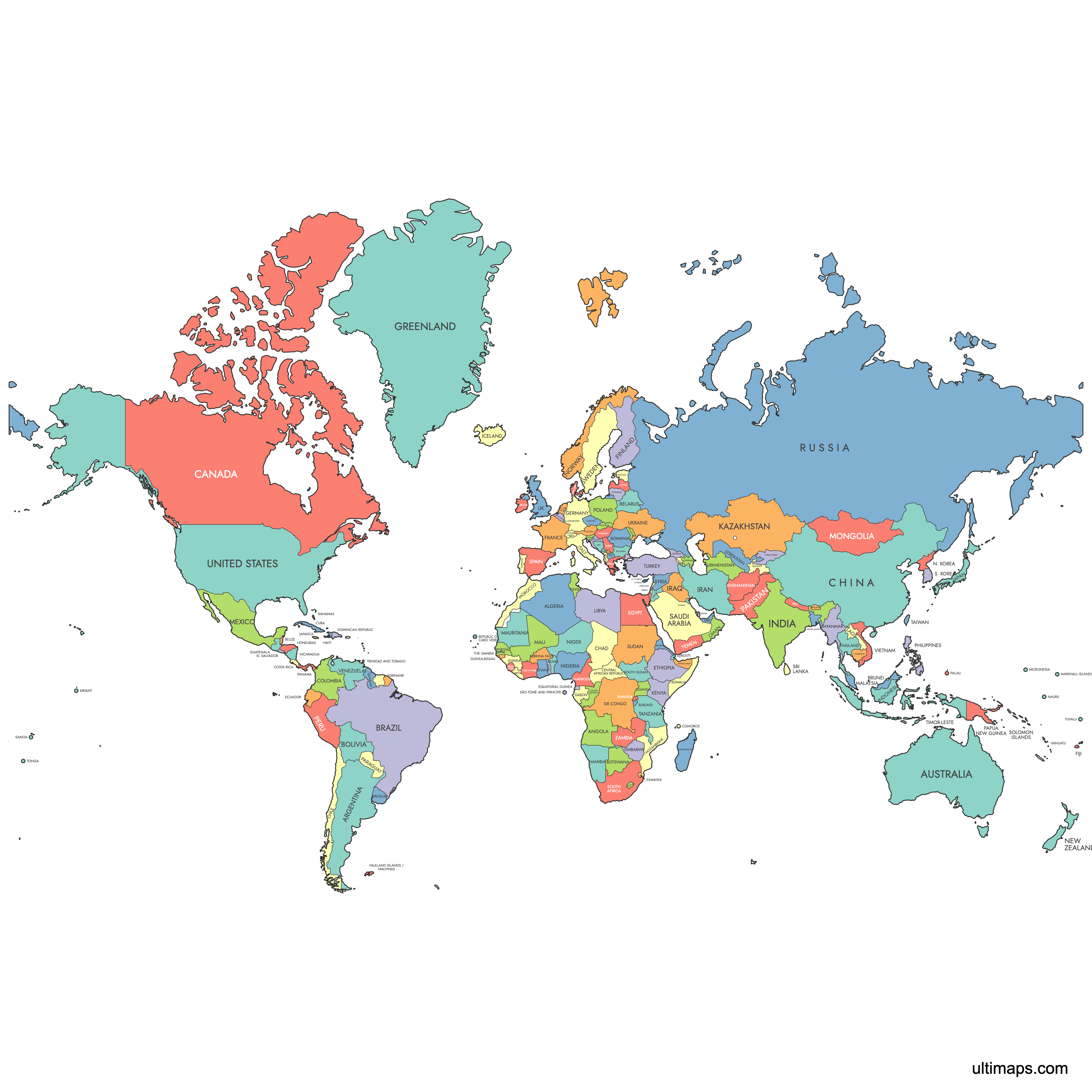
The world is made up of 195 internationally recognized countries spread across six continents: 54 in Africa, 48 in Asia, 44 in Europe, 33 in Latin America and the Caribbean, 14 in Oceania, and 2 in Northern America. These countries range from Russia at 17,098,242 km² (6,601,665 sq mi) to Vatican City at just 0.44 km² (0.17 sq mi). Use the interactive maps below to explore countries and their boundaries. Download free maps or learn more about creating a custom map of the world to visualize your own data.
Interactive Map of the World
List of Countries (210)
| # | Country |
|---|---|
| 1 | |
| 2 | |
| 3 | |
| 4 | |
| 5 | |
| 6 | |
| 7 | |
| 8 | |
| 9 | |
| 10 | |
| 11 | |
| 12 | |
| 13 | |
| 14 | |
| 15 | |
| 16 | |
| 17 | |
| 18 | |
| 19 | |
| 20 | |
| 21 | |
| 22 | |
| 23 | |
| 24 | |
| 25 | |
| 26 | |
| 27 | |
| 28 | |
| 29 | |
| 30 | |
| 31 | |
| 32 | |
| 33 | |
| 34 | |
| 35 | |
| 36 | |
| 37 | |
| 38 | |
| 39 | |
| 40 | |
| 41 | |
| 42 | |
| 43 | |
| 44 | |
| 45 | |
| 46 | |
| 47 | |
| 48 | |
| 49 | |
| 50 | |
| 51 | |
| 52 | |
| 53 | |
| 54 | |
| 55 | |
| 56 | |
| 57 | |
| 58 | |
| 59 | |
| 60 | |
| 61 | |
| 62 | |
| 63 | |
| 64 | |
| 65 | |
| 66 | |
| 67 | |
| 68 | |
| 69 | |
| 70 | |
| 71 | |
| 72 | |
| 73 | |
| 74 | |
| 75 | |
| 76 | |
| 77 | |
| 78 | |
| 79 | |
| 80 | |
| 81 | |
| 82 | |
| 83 | |
| 84 | |
| 85 | |
| 86 | |
| 87 | |
| 88 | |
| 89 | |
| 90 | |
| 91 | |
| 92 | |
| 93 | |
| 94 | |
| 95 | |
| 96 | |
| 97 | |
| 98 | |
| 99 | |
| 100 | |
| 101 | |
| 102 | |
| 103 | |
| 104 | |
| 105 | |
| 106 | |
| 107 | |
| 108 | |
| 109 | |
| 110 | |
| 111 | |
| 112 | |
| 113 | |
| 114 | |
| 115 | |
| 116 | |
| 117 | |
| 118 | |
| 119 | |
| 120 | |
| 121 | |
| 122 | |
| 123 | |
| 124 | |
| 125 | |
| 126 | |
| 127 | |
| 128 | |
| 129 | |
| 130 | |
| 131 | |
| 132 | |
| 133 | |
| 134 | |
| 135 | |
| 136 | |
| 137 | |
| 138 | |
| 139 | |
| 140 | |
| 141 | |
| 142 | |
| 143 | |
| 144 | |
| 145 | |
| 146 | |
| 147 | |
| 148 | |
| 149 | |
| 150 | |
| 151 | |
| 152 | |
| 153 | |
| 154 | |
| 155 | |
| 156 | |
| 157 | |
| 158 | |
| 159 | |
| 160 | |
| 161 | |
| 162 | |
| 163 | |
| 164 | |
| 165 | |
| 166 | |
| 167 | |
| 168 | |
| 169 | |
| 170 | |
| 171 | |
| 172 | |
| 173 | |
| 174 | |
| 175 | |
| 176 | |
| 177 | |
| 178 | |
| 179 | |
| 180 | |
| 181 | |
| 182 | |
| 183 | |
| 184 | |
| 185 | |
| 186 | |
| 187 | |
| 188 | |
| 189 | |
| 190 | |
| 191 | |
| 192 | |
| 193 | |
| 194 | |
| 195 | |
| 196 | |
| 197 | |
| 198 | |
| 199 | |
| 200 | |
| 201 | |
| 202 | |
| 203 | |
| 204 | |
| 205 | |
| 206 | |
| 207 | |
| 208 | |
| 209 | |
| 210 |
Map of the World: Key Facts
- Total number of countries: 195 (193 UN member states plus 2 observer states)
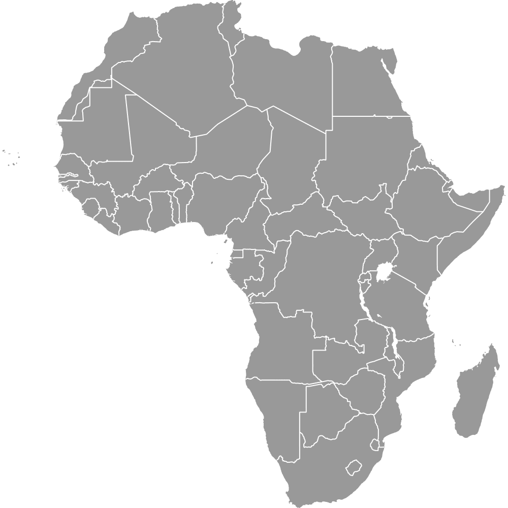
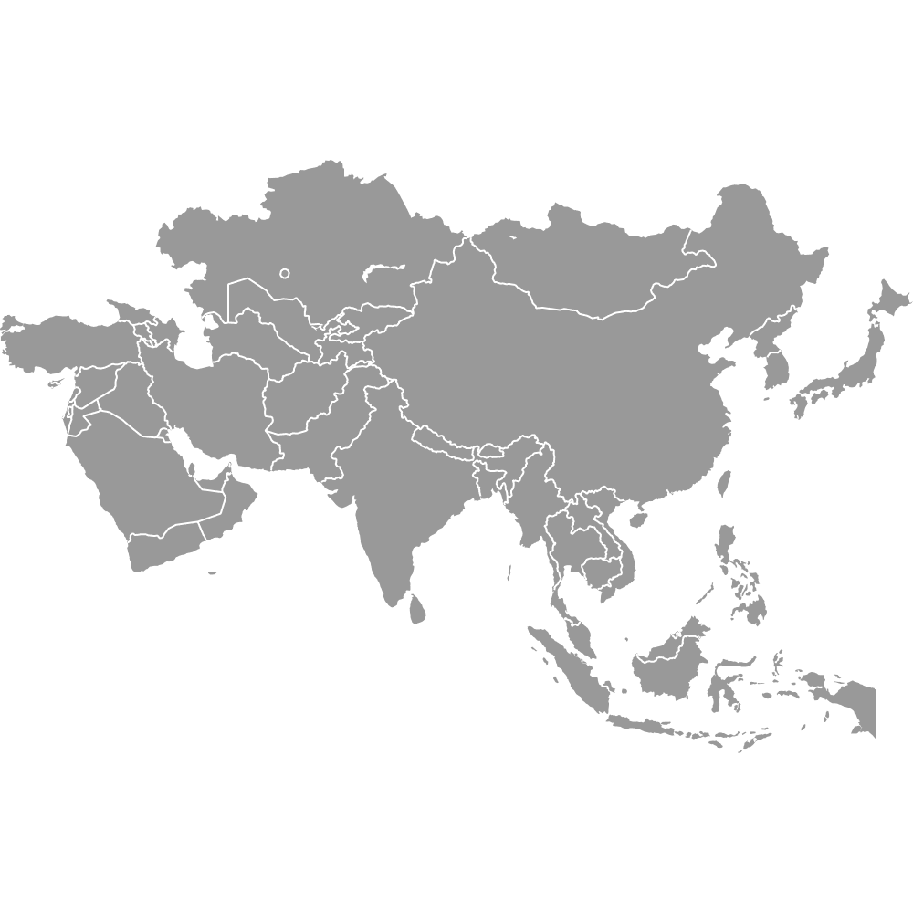
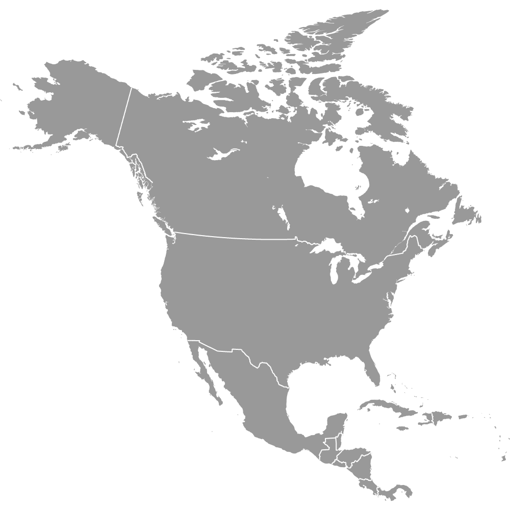
- Distribution by continent: Africa (54), Asia (48), Europe (44), Latin America and the Caribbean (33), Oceania (14), Northern America (2)
- Largest country by area: Russia at 17,098,242 km² (6,601,665 sq mi)
- Smallest country by area: Vatican City at 0.44 km² (0.17 sq mi)
- Major urban centers: Tokyo, Japan (approximately 37 million metro population), Delhi and Shanghai in Asia, London and Paris in Europe, New York City and Mexico City in the Americas
- Boundary changes: Political boundaries continue to evolve. The most recent country to gain independence was South Sudan in 2011. Current borders largely reflect post-WWII decolonization and subsequent geopolitical changes.
Interesting Facts
- Africa is large enough to fit the United States, China, India, Japan, Mexico, and much of Europe within its borders, yet traditional Mercator projection maps shrink it to appear roughly the same size as Greenland.
- Every world map distorts the 3D surface of the Earth when projected onto a 2D plane. No flat map can accurately preserve distances, shapes, areas, and directions all at once.
- The Equal Earth projection, introduced in 2018, better preserves the true relative sizes of continents compared to the widely used Mercator projection. Available in Ultimaps Studio
- Ancient world maps traced the rise and fall of empires over millennia, and comparing them to modern political maps reveals how dramatically borders have shifted.
Free Downloads
You can download free blank Map of the World and other maps in high resolution PNG, SVG and PDF formats from the blank maps section of the site: Download Blank Map of the World
Custom Map Features
This map supports labels.
This map is divided into 210 countries.
Updates
Nov 8, 2025:
- Added Equal Earth version
Mar 24, 2025:
- Added labeled version of the map of the World
Sep 28, 2023:
- Added map of the World
Frequently Asked Questions
The world has 195 internationally recognized countries. This total includes 193 United Nations member states plus 2 observer states (the Holy See and Palestine). These countries are distributed across six continents: 54 in Africa, 48 in Asia, 44 in Europe, 33 in Latin America and the Caribbean, 14 in Oceania, and 2 in Northern America.
Russia is the largest country in the world by area at 17,098,242 km² (6,601,665 sq mi). It spans two continents, Europe and Asia, and covers more than one-eighth of the Earth's inhabited land area. Russia also crosses 11 time zones from Kaliningrad in the west to Kamchatka in the east.
Vatican City is the smallest country in the world at just 0.44 km² (0.17 sq mi). It is an independent city-state enclosed entirely within Rome, Italy. Despite its tiny size, it serves as the headquarters of the Roman Catholic Church and is recognized as a sovereign state.
India and China are the two most populous countries, each with populations exceeding 1.4 billion. India surpassed China as the world's most populous country in 2023. Major cities include Delhi and Mumbai in India, and Shanghai and Beijing in China.
The Eiffel Tower is in Paris, France (Europe). The Great Wall stretches across northern China (Asia). Mount Everest sits on the Nepal-China border and is the world's highest peak. The Grand Canyon is in the United States (Northern America), and the Amazon Rainforest spans Brazil and several other countries in Latin America. Tokyo, Japan, is the world's most populous metropolitan area with roughly 37 million people.
You can use Ultimaps to create custom maps of the world. Color-code countries manually or upload your data, place pins, customize the look and feel, and export to PNG, PDF, or SVG. No sign-up required.
The two main types are political maps and physical maps. Political maps emphasize country borders, capitals, and major cities. Physical maps highlight terrain features like mountains, deserts, and rivers using color gradients (brown and gray for elevation, green for lowlands, blue for water). Many modern interactive maps combine both types.
All world maps distort the 3D surface of the Earth when projecting it onto a 2D plane. The Mercator projection, for example, preserves shapes but exaggerates the size of regions near the poles, making Greenland appear as large as Africa. The Equal Earth projection better preserves the true relative sizes of continents. No single projection can accurately show distances, shapes, areas, and directions simultaneously.
There are six commonly recognized continental groupings for the world's 195 countries. Africa has 54 countries (the most of any continent), Asia has 48, Europe has 44, Latin America and the Caribbean has 33, Oceania has 14, and Northern America has 2. The distribution reflects centuries of colonial history, decolonization, and geopolitical change.
South Sudan is the world's newest country, having gained independence from Sudan on July 9, 2011. Its creation followed a referendum in which nearly 99% of voters chose separation. Current world political boundaries largely reflect post-WWII decolonization, though changes continue to occur.
The world spans 24 primary time zones, ranging from UTC-12 to UTC+14. Many larger countries observe multiple time zones due to their geographic extent. Russia, for instance, covers 11 time zones, while China uses a single official time zone despite spanning five geographic ones.