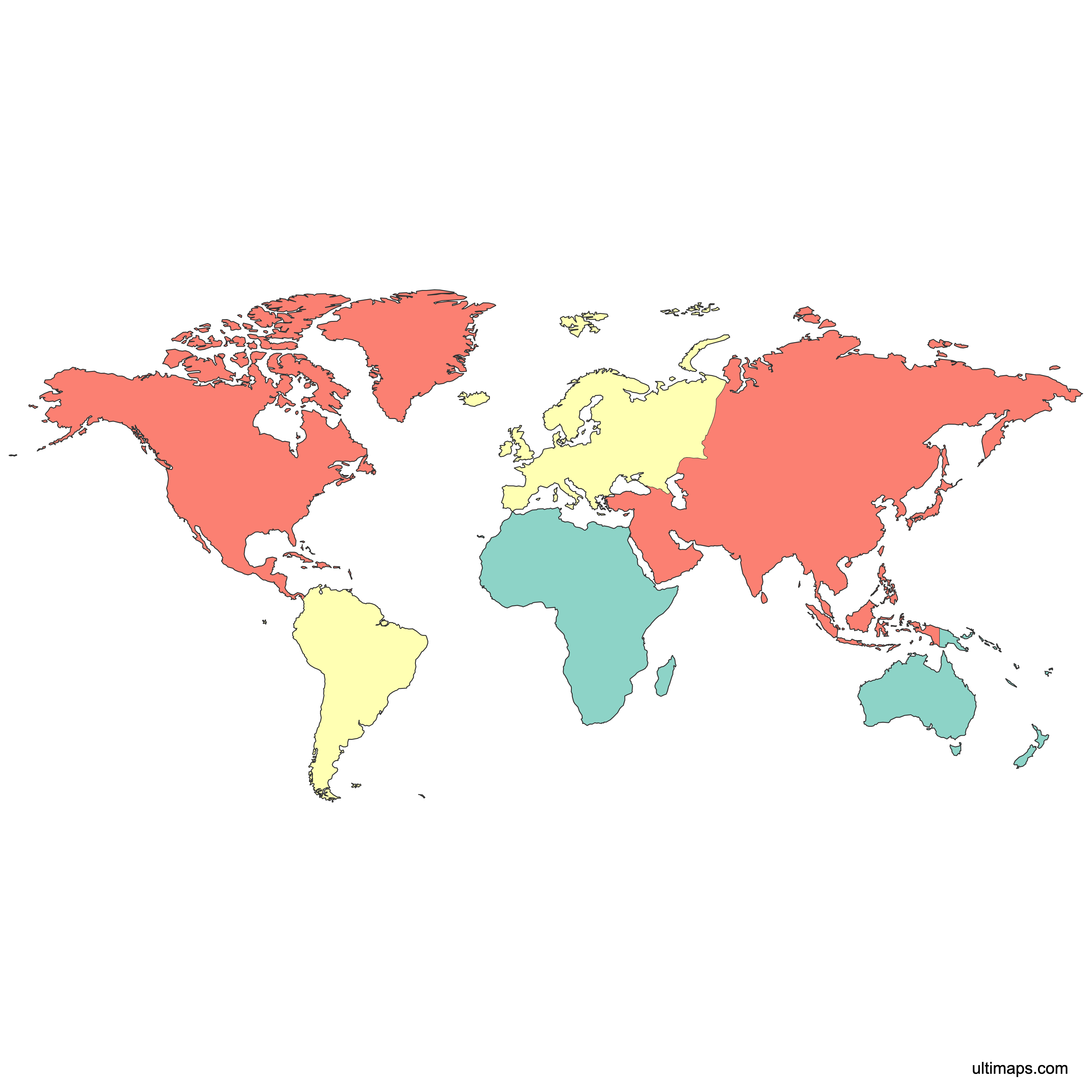
Map of the World Continents
The world is divided into 7 continents: Asia, Africa, North America, South America, Antarctica, Europe, and Australia/Oceania, each spanning vast and distinct regions of the globe. Use the interactive maps below to explore continental boundaries. Download free reference maps or learn more about creating a custom map of the world to visualize your own data.
Note: this world map is divided by continents, not countries. Check out Map of the World divided by countries
Interactive Map of the World Continents
List of Continents (6)
| # | Continent |
|---|---|
| 1 | |
| 2 | |
| 3 | |
| 4 | |
| 5 | |
| 6 |
About the World's Continents
- Number of Continents: 7 in the most widely used geographic model: Asia, Africa, North America, South America, Antarctica, Europe, and Australia/Oceania.
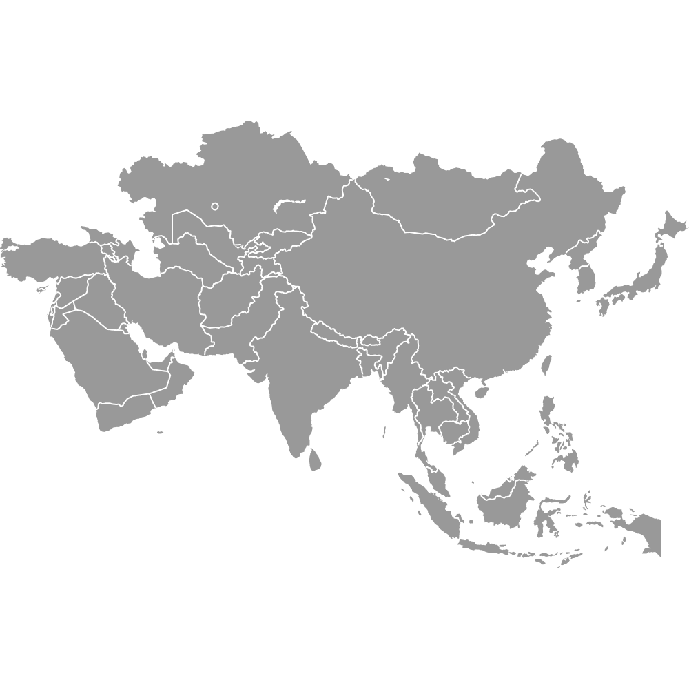
- Largest Continent by Area: Asia at 31,033,131 km² (11,981,251 sq mi).
- Smallest Continent by Area: Australia/Oceania at 8,486,460 km² (3,277,238 sq mi).
- Most Populous Continent: Asia with approximately 4,835,320,061 people (2025 estimate).
- Least Populous Continent: Antarctica with zero permanent population. Only rotating scientific staff occupy temporary research stations.
- Boundary Model: The seven-continent model became standard in most English-speaking school systems during the 19th and 20th centuries. Continental boundaries are defined by geographic and cultural convention, not by a single official date or legal act.
Interesting Facts
- The seven-continent model is not universal. Some traditions use 6 continents (combining Europe and Asia into Eurasia, or merging the Americas) or even 5 (the Olympic "inhabited continents" model).
- In 2017, geologists formally proposed Zealandia, a mostly submerged landmass that includes New Zealand, as a geological continent. It has not yet changed the standard seven-continent model used in school atlases.
- Antarctica is about 98% covered in ice, making it the coldest and windiest continent on Earth. It has no permanent civilian population and hosts only temporary research personnel.
- Asia is both the largest and most densely populated continent at roughly 156 people per km², while Australia/Oceania has one of the lowest densities at about 5 people per km².
Free Downloads
You can download free blank Map of the World Continents and other maps in high resolution PNG, SVG and PDF formats from the blank maps section of the site: Download Blank Map of the World Continents
Custom Map Features
This map is divided into 6 continents.
Frequently Asked Questions
The world has 7 continents in the most widely used geographic model: Asia, Africa, North America, South America, Antarctica, Europe, and Australia/Oceania. Some traditions recognize 6 or even 5 continents by combining Europe and Asia into Eurasia or merging the Americas into a single continent. The seven-continent model became standard in English-speaking school systems during the 19th and 20th centuries.
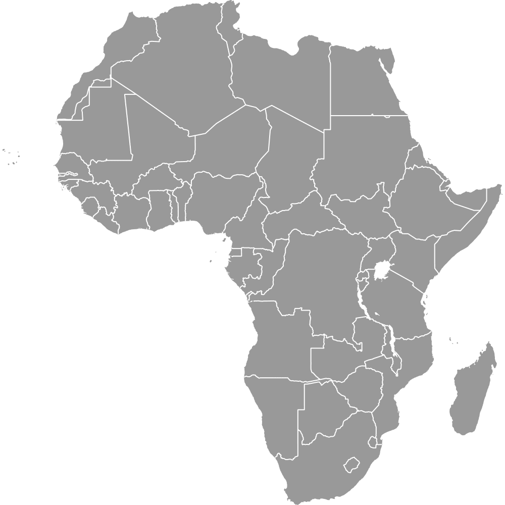
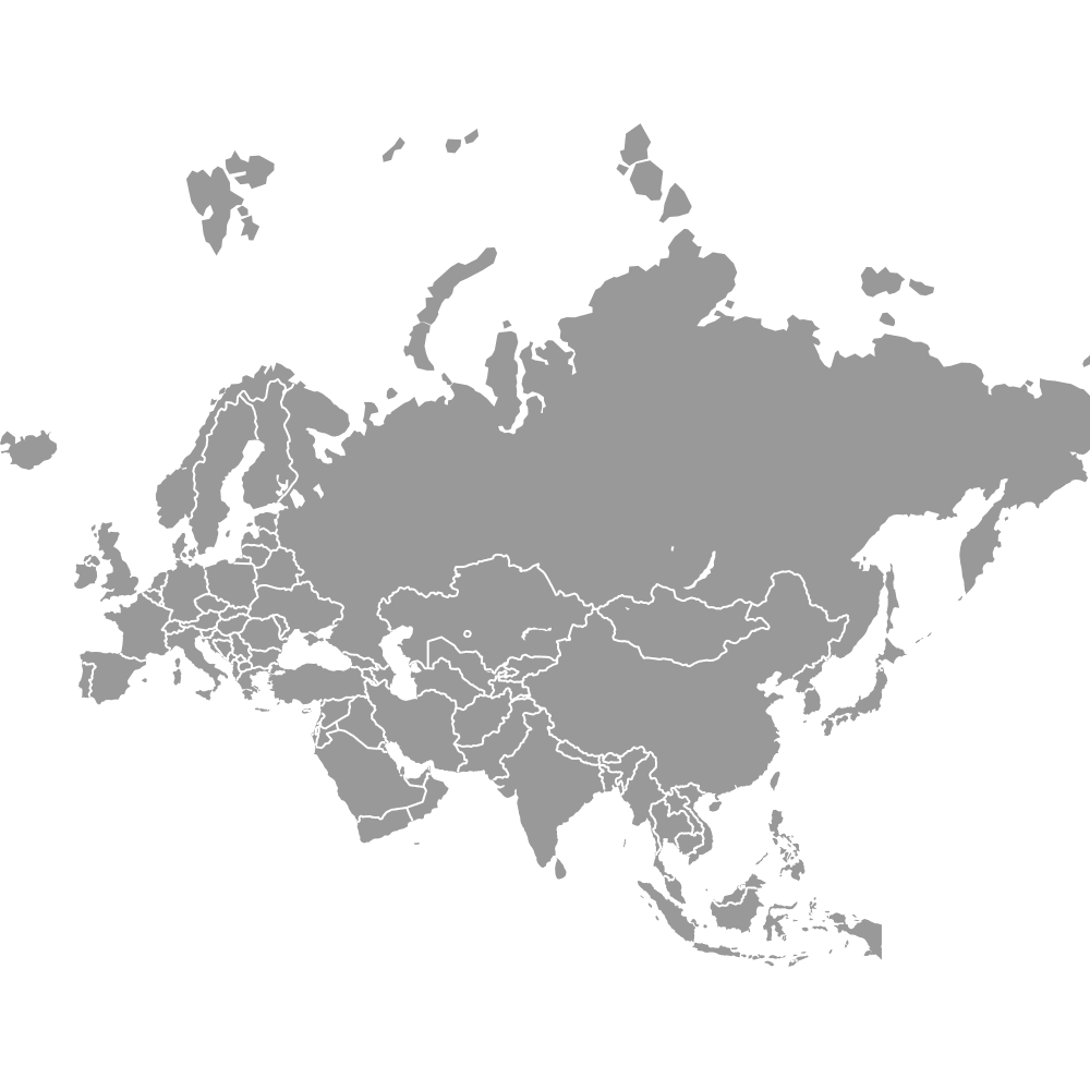
Asia is the largest continent by area at approximately 31,033,131 km² (11,981,251 sq mi). It stretches from the Ural Mountains in the west to the Pacific Ocean in the east, and from the Arctic Ocean in the north to the Indian Ocean in the south. Asia is home to about 4.84 billion people as of 2025, making it the most populous continent as well.
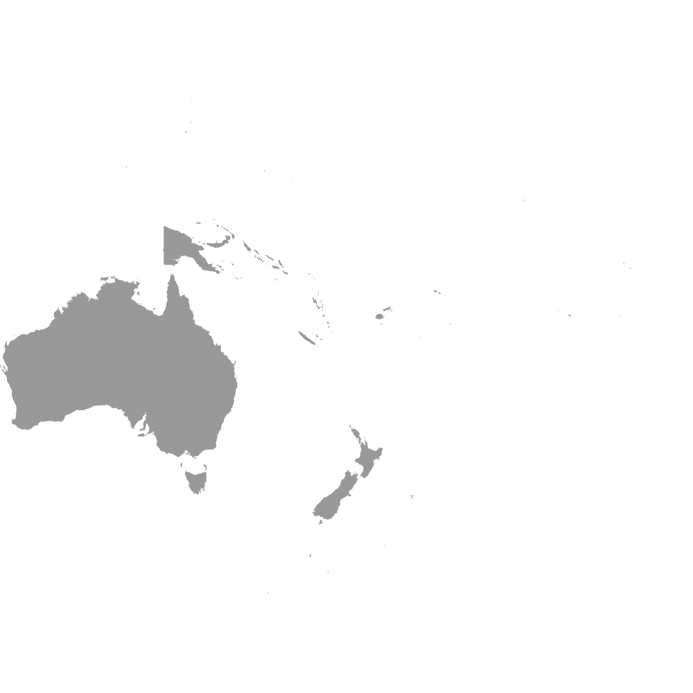
Australia/Oceania is the smallest continent by area at approximately 8,486,460 km² (3,277,238 sq mi). The main continental landmass is Australia, with the broader Oceania region including many Pacific island nations. It has a population of roughly 46,609,644 (2025 estimate) and one of the lowest population densities of any continent at about 5 people per km².
Asia is the most populous continent with approximately 4,835,320,061 people as of 2025. Major cities include Beijing, Tokyo, Delhi, Seoul, Jakarta, and Mumbai. Asia also has the highest population density among continents at roughly 156 people per km².
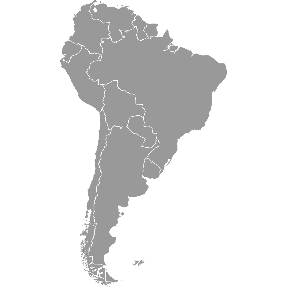
Mount Everest, the highest mountain on Earth, sits on the Nepal-China border in Asia. The Sahara Desert, the world's largest hot desert, stretches across North Africa. The Amazon Rainforest, the largest tropical rainforest, covers much of South America. In Europe, landmarks like the Eiffel Tower in Paris and Big Ben in London are among the most recognized structures in the world.
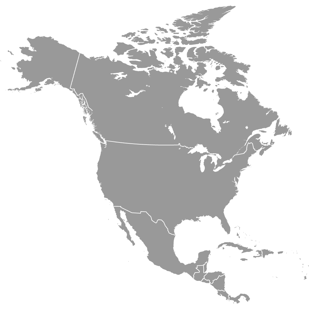
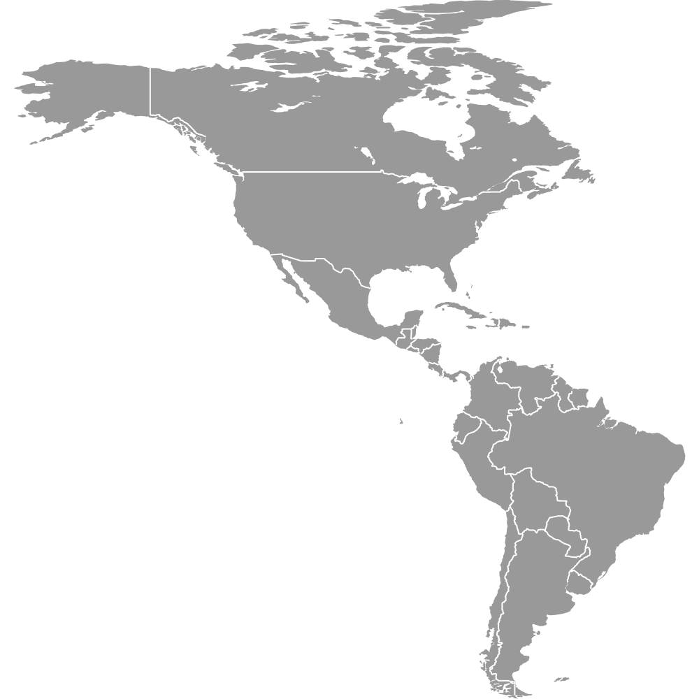
The Arctic Ocean borders Asia, Europe, and North America to the north. The Atlantic Ocean separates the Americas from Europe and Africa. The Pacific Ocean, the largest ocean, borders Asia, Australia/Oceania, North America, and South America. The Indian Ocean lies between Africa, Asia, and Australia/Oceania. The Southern Ocean encircles Antarctica entirely.
You can use Ultimaps to create custom maps of the world. Color-code continents manually or upload your data, place pins, customize the look, and export to PNG, PDF, or SVG. No sign-up required.