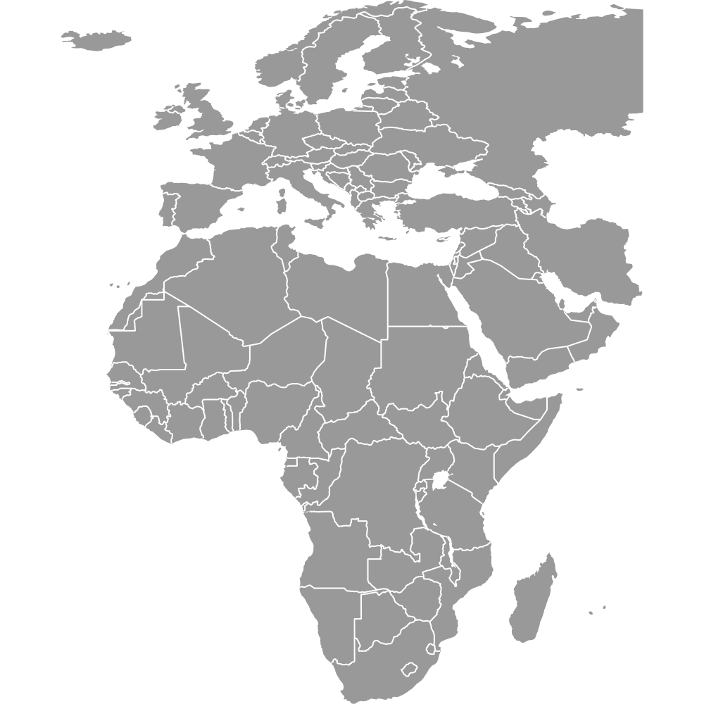
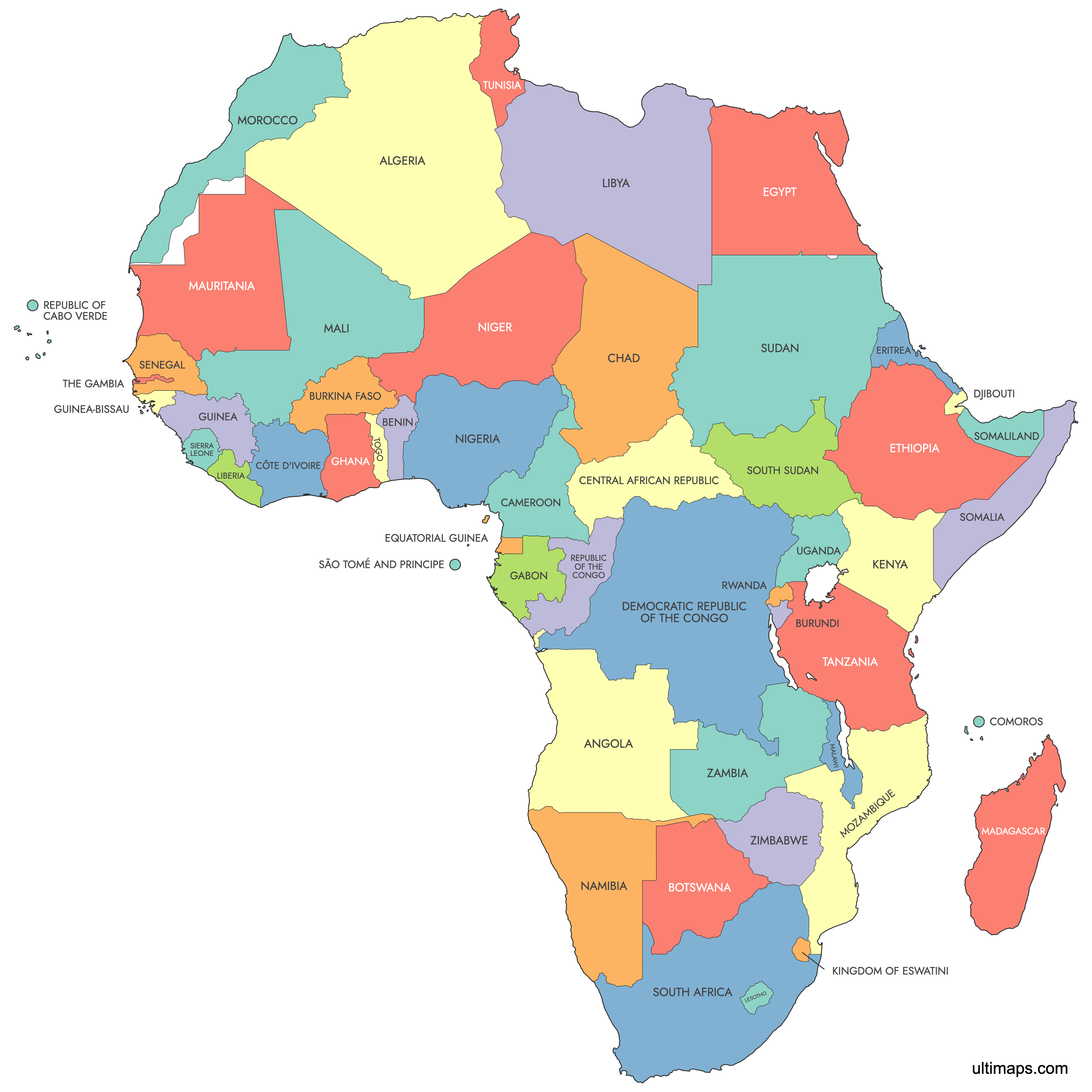
Map of Africa
Africa is the second-largest continent on Earth, divided into 54 internationally recognized sovereign countries spread across North, West, Central, East, and Southern Africa. The continent covers about 20% of Earth's land area and is home to over 1.4 billion people. Use the interactive maps below to explore Africa's countries in detail, download free reference maps, or create a custom map to visualize your own data.
Interactive Map of Africa
List of Countries (53)
| # | Country |
|---|---|
| 1 | |
| 2 | |
| 3 | |
| 4 | |
| 5 | |
| 6 | |
| 7 | |
| 8 | |
| 9 | |
| 10 | |
| 11 | |
| 12 | |
| 13 | |
| 14 | |
| 15 | |
| 16 | |
| 17 | |
| 18 | |
| 19 | |
| 20 | |
| 21 | |
| 22 | |
| 23 | |
| 24 | |
| 25 | |
| 26 | |
| 27 | |
| 28 | |
| 29 | |
| 30 | |
| 31 | |
| 32 | |
| 33 | |
| 34 | |
| 35 | |
| 36 | |
| 37 | |
| 38 | |
| 39 | |
| 40 | |
| 41 | |
| 42 | |
| 43 | |
| 44 | |
| 45 | |
| 46 | |
| 47 | |
| 48 | |
| 49 | |
| 50 | |
| 51 | |
| 52 | |
| 53 |
About Africa
- Countries: Africa comprises 54 recognized countries.
- Disputed Territories: There are several regions with disputed status, including Western Sahara.
- Islands: Notable islands include Madagascar, Seychelles, and Mauritius.
- Administrative Divisions: Countries in Africa have various administrative divisions, such as provinces, states, and regions.
Free Downloads
You can download free blank Map of Africa and other maps in high resolution PNG, SVG and PDF formats from the blank maps section of the site: Download Blank Map of Africa
Custom Map Features
This map supports labels.
This map is divided into 53 countries.
Updates
22 Jul, 2024:
- Added map of Africa
Frequently Asked Questions
Africa has 54 internationally recognized sovereign countries. The most recent addition was South Sudan, which gained independence from Sudan on 9 July 2011. The African Union includes 55 member states, counting the disputed territory of Western Sahara as the Sahrawi Arab Democratic Republic.
Algeria is the largest country in Africa by area, covering 2,381,741 km² (919,595 sq mi). It is located in North Africa along the Mediterranean coast. Algeria is also the largest country in the Arab world and the tenth largest in the world overall.
Seychelles is the smallest African country overall, with an area of just 459 km² (177 sq mi). It is an island nation in the Indian Ocean off the east coast of the continent. The smallest mainland African country is The Gambia, covering 11,295 km² (4,361 sq mi) in West Africa.
Nigeria is Africa's most populous country, with an estimated population of 237,527,782 as of 2025. Its largest city, Lagos, is one of the biggest metropolitan areas on the continent and a major economic hub in West Africa. The next most populous African countries are Ethiopia, Egypt, the Democratic Republic of the Congo, and Tanzania.
The Giza Pyramids and the Great Sphinx are located near Cairo, Egypt, and rank among the most famous ancient structures in the world. Victoria Falls sits on the Zambezi River at the border of Zambia and Zimbabwe. Table Mountain overlooks Cape Town, South Africa, while the Serengeti National Park in Tanzania is one of the world's most renowned wildlife areas.
Africa is bordered by the Mediterranean Sea to the north, the Red Sea and the Gulf of Aden to the northeast, the Indian Ocean to the southeast and east, and the Atlantic Ocean to the west. The continent connects to Asia at the Isthmus of Suez in Egypt, where the Suez Canal now runs. Its closest point to Europe is across the Strait of Gibraltar, between Morocco and Spain.
You can use Ultimaps to create custom maps of Africa. Color-code countries manually or upload your data, place pins, customize the look, and export to PNG, PDF, or SVG. No sign-up required.