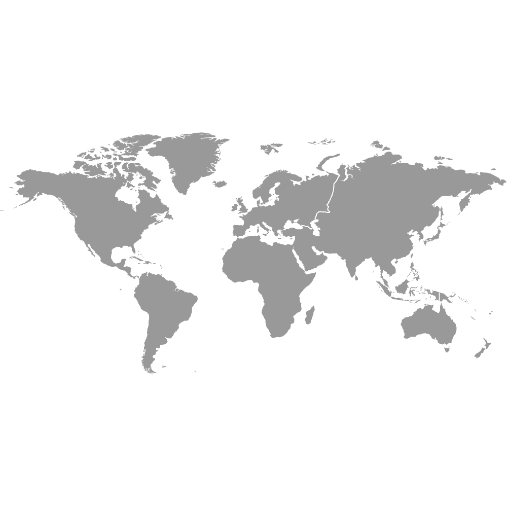
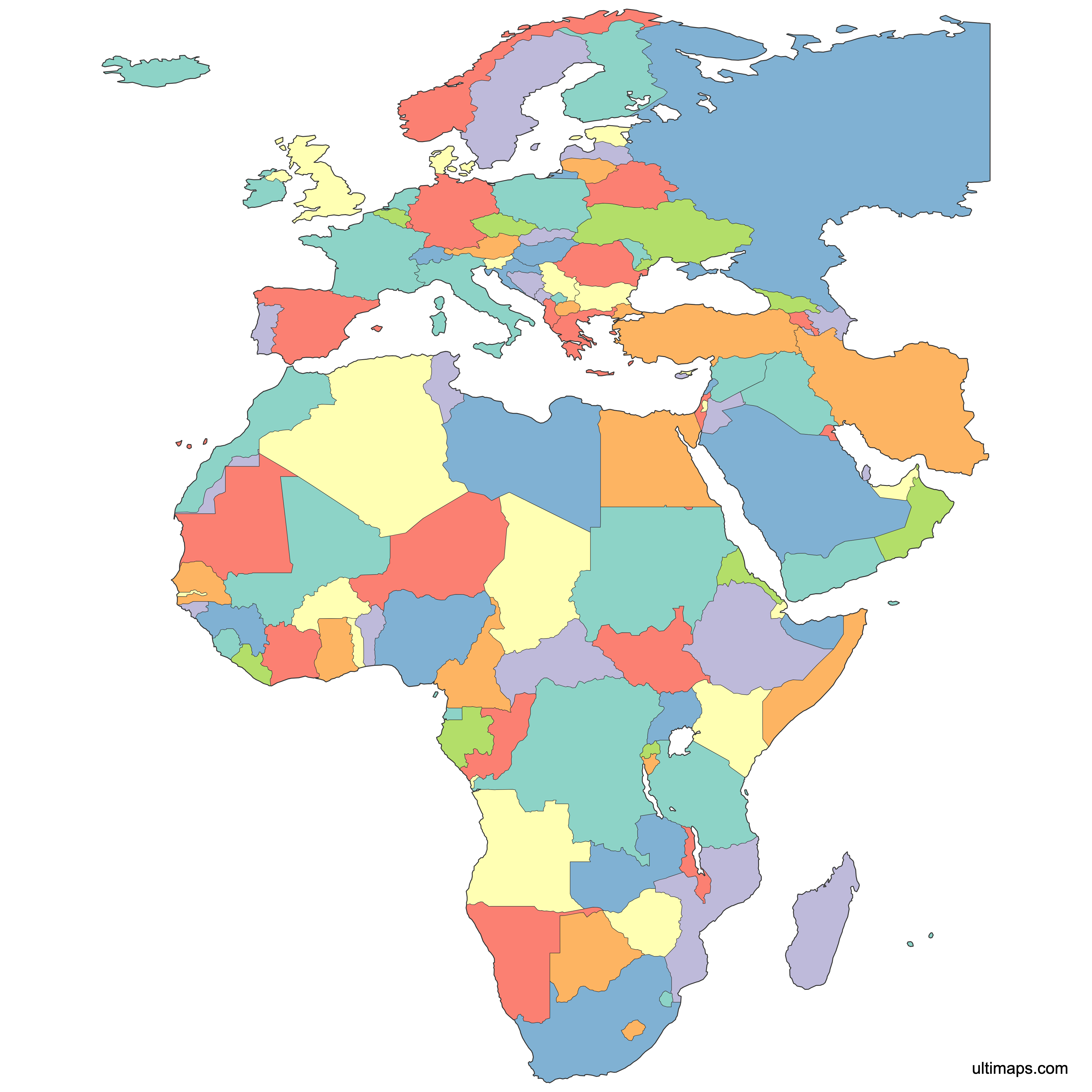
Map of EMEA Countries
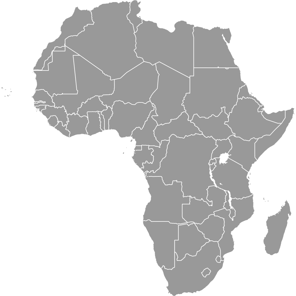
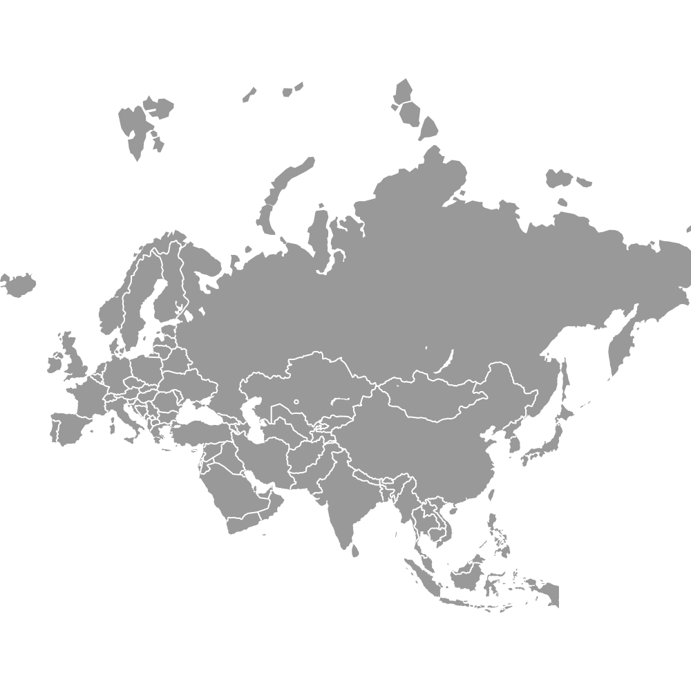
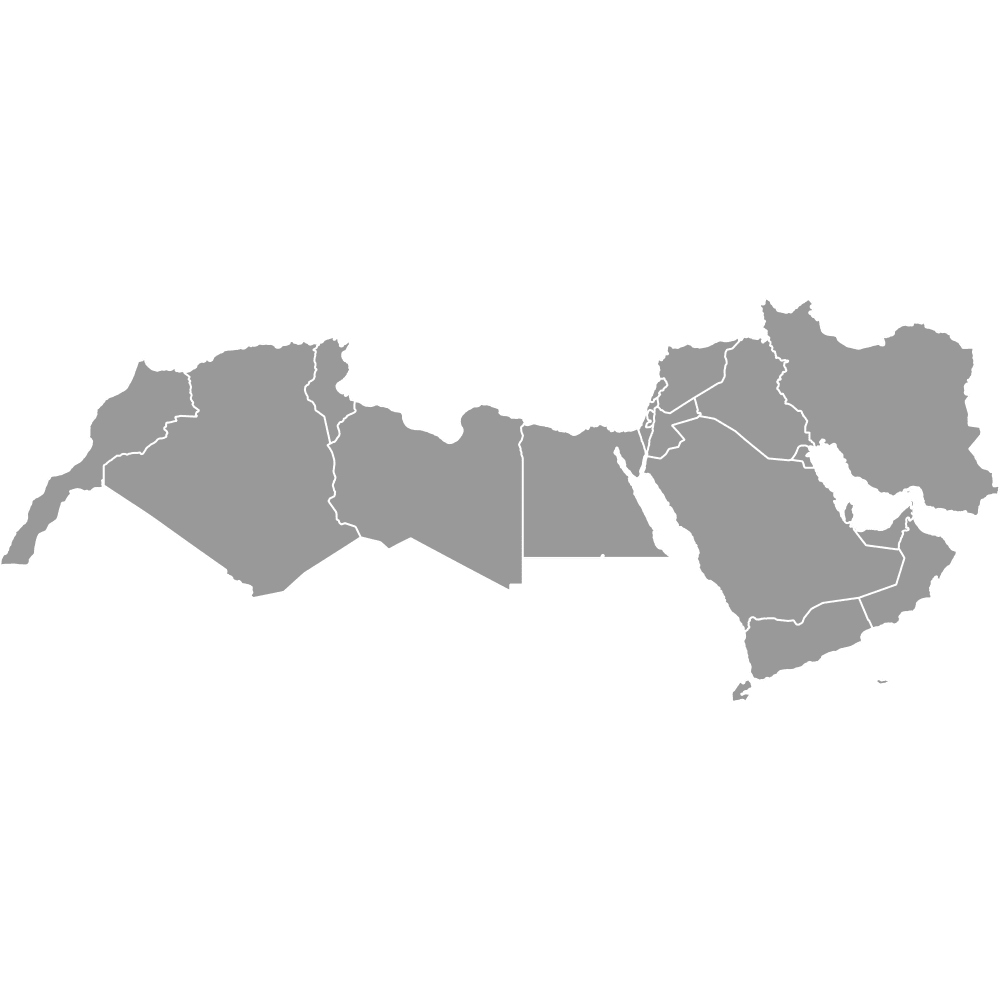
EMEA (Europe, the Middle East, and Africa) is a business region spanning roughly 115 sovereign countries and 17 additional territories across three continents. The map below shows every country in the region, from Russia in the north to South Africa in the south and from Iceland in the west to Iran in the east. Use the interactive map to explore EMEA in detail, download free maps, or create a custom map to visualize your own data.
Interactive Map of EMEA Countries
List of Countries (119)
| # | Country |
|---|---|
| 1 | |
| 2 | |
| 3 | |
| 4 | |
| 5 | |
| 6 | |
| 7 | |
| 8 | |
| 9 | |
| 10 | |
| 11 | |
| 12 | |
| 13 | |
| 14 | |
| 15 | |
| 16 | |
| 17 | |
| 18 | |
| 19 | |
| 20 | |
| 21 | |
| 22 | |
| 23 | |
| 24 | |
| 25 | |
| 26 | |
| 27 | |
| 28 | |
| 29 | |
| 30 | |
| 31 | |
| 32 | |
| 33 | |
| 34 | |
| 35 | |
| 36 | |
| 37 | |
| 38 | |
| 39 | |
| 40 | |
| 41 | |
| 42 | |
| 43 | |
| 44 | |
| 45 | |
| 46 | |
| 47 | |
| 48 | |
| 49 | |
| 50 | |
| 51 | |
| 52 | |
| 53 | |
| 54 | |
| 55 | |
| 56 | |
| 57 | |
| 58 | |
| 59 | |
| 60 | |
| 61 | |
| 62 | |
| 63 | |
| 64 | |
| 65 | |
| 66 | |
| 67 | |
| 68 | |
| 69 | |
| 70 | |
| 71 | |
| 72 | |
| 73 | |
| 74 | |
| 75 | |
| 76 | |
| 77 | |
| 78 | |
| 79 | |
| 80 | |
| 81 | |
| 82 | |
| 83 | |
| 84 | |
| 85 | |
| 86 | |
| 87 | |
| 88 | |
| 89 | |
| 90 | |
| 91 | |
| 92 | |
| 93 | |
| 94 | |
| 95 | |
| 96 | |
| 97 | |
| 98 | |
| 99 | |
| 100 | |
| 101 | |
| 102 | |
| 103 | |
| 104 | |
| 105 | |
| 106 | |
| 107 | |
| 108 | |
| 109 | |
| 110 | |
| 111 | |
| 112 | |
| 113 | |
| 114 | |
| 115 | |
| 116 | |
| 117 | |
| 118 | |
| 119 |
About the EMEA Region Map
EMEA refers to the combined regions of Europe, the Middle East, and Africa. This grouping covers a wide range of countries across three continents, each with distinct administrative divisions, languages, and boundary histories. The map includes all recognized sovereign states as well as select territories for accurate regional visualization and planning.
Key facts about the EMEA countries map:
- Includes every recognized country in Europe, the Middle East, and Africa
- Typically over 100 countries and territories represented
- Used for business purposes such as sales territories, service coverage, and data visualization
- Regional boundaries based on internationally accepted definitions and up-to-date geopolitical data
- Commonly used in global business analysis and reporting
- Countries cover a variety of administrative divisions and governance structures
- Some territories and disputed regions are included to provide a complete picture
- Neighboring regions outside EMEA: Asia-Pacific (APAC) and the Americas
Free Downloads
You can download free blank Map of EMEA Countries and other maps in high resolution PNG, SVG and PDF formats from the blank maps section of the site: Download Blank Map of EMEA Countries
Custom Map Features
This map is divided into 119 countries.
Updates
Oct 24, 2024:
- Added map of EMEA countries
Frequently Asked Questions
EMEA includes roughly 115 sovereign countries plus about 17 non-country territories such as Gibraltar, the Faroe Islands, and Mayotte. The exact count varies because EMEA is a business and analytical grouping, not a political entity, and different organizations define its membership differently. Common sub-regions within EMEA include Western Europe, the Nordics, Central and Eastern Europe, MENA (Middle East and North Africa), and Sub-Saharan Africa.
Russia is the largest country in EMEA with a total area of about 17,098,246 km² (6,601,670 sq mi). Although only the portion west of the Ural Mountains falls within Europe geographically, most business definitions treat Russia as a whole within EMEA. The next largest is Algeria at approximately 2,381,741 km² (919,595 sq mi).
Vatican City is the smallest sovereign state in EMEA, covering just 0.49 km² (0.19 sq mi). It is entirely enclosed within the city of Rome, Italy, and is also the smallest recognized country on Earth. Despite its size, it appears on most EMEA country lists used by businesses and data providers.
Nigeria is the most populous EMEA country with an estimated 242,431,832 people as of 2026. Lagos, its largest city, is one of Africa's major economic hubs and a center for technology and trade. Other highly populous EMEA countries include Ethiopia (138.9 million), Egypt (120.1 million), and the DR Congo (116.5 million).
EMEA contains many globally recognized landmarks. In Europe, Paris is home to the Eiffel Tower and the Louvre Museum, while Rome features the Colosseum and nearby Vatican City with St. Peter's Basilica. In the Middle East, Dubai in the United Arab Emirates has the Burj Khalifa, the world's tallest building, and in Africa, Cairo in Egypt sits near the Great Pyramids of Giza and the Sphinx.
EMEA covers more than 10 time zones, ranging from approximately UTC-1 in the far west (parts of Portugal's Atlantic islands and western Africa) to at least UTC+5 or UTC+6 in the east (eastern Russia and parts of Central Asia). Central Europe and much of Africa fall between UTC+1 and UTC+3. The exact span depends on which countries an organization includes in its EMEA definition.
You can use Ultimaps to create custom maps of EMEA. Color-code countries manually or upload your data, place pins, customize the look, and export to PNG, PDF, or SVG. No sign-up required.