Map of Alabama Counties
Alabama is divided into 67 counties, each with its unique features and administrative functions. Use the interactive maps below to explore Alabama counties and their boundaries. Download free maps or learn more about creating a custom map of Alabama to visualize your own data.
Interactive Map of Alabama Counties
List of Counties (67)
| # | County | County seat | Year founded |
|---|---|---|---|
| 1 | Prattville | 1818 | |
| 2 | Bay Minette | 1809 | |
| 3 | Clayton | 1832 | |
| 4 | Centreville | 1818 | |
| 5 | Oneonta | 1818 | |
| 6 | Union Springs | 1866 | |
| 7 | Greenville | 1819 | |
| 8 | Anniston | 1832 | |
| 9 | LaFayette | 1832 | |
| 10 | Centre | 1836 | |
| 11 | Clanton | 1868 | |
| 12 | Butler | 1847 | |
| 13 | Grove Hill | 1812 | |
| 14 | Ashland | 1866 | |
| 15 | Heflin | 1866 | |
| 16 | Elba | 1841 | |
| 17 | Tuscumbia | 1867 | |
| 18 | Evergreen | 1818 | |
| 19 | Rockford | 1832 | |
| 20 | Andalusia | 1821 | |
| 21 | Luverne | 1866 | |
| 22 | Cullman | 1877 | |
| 23 | Ozark | 1824 | |
| 24 | Selma | 1818 | |
| 25 | Fort Payne | 1836 | |
| 26 | Wetumpka | 1866 | |
| 27 | Brewton | 1868 | |
| 28 | Gadsden | 1868 | |
| 29 | Fayette | 1824 | |
| 30 | Russellville | 1818 | |
| 31 | Geneva | 1868 | |
| 32 | Eutaw | 1819 | |
| 33 | Greensboro | 1867 | |
| 34 | Abbeville | 1819 | |
| 35 | Dothan | 1903 | |
| 36 | Scottsboro | 1819 | |
| 37 | Birmingham | 1819 | |
| 38 | Vernon | 1867 | |
| 39 | Florence | 1818 | |
| 40 | Moulton | 1818 | |
| 41 | Opelika | 1866 | |
| 42 | Athens | 1818 | |
| 43 | Hayneville | 1830 | |
| 44 | Tuskegee | 1832 | |
| 45 | Huntsville | 1808 | |
| 46 | Linden | 1818 | |
| 47 | Hamilton | 1818 | |
| 48 | Guntersville | 1836 | |
| 49 | Mobile | 1812 | |
| 50 | Monroeville | 1815 | |
| 51 | Montgomery | 1816 | |
| 52 | Decatur | 1821 | |
| 53 | Marion | 1819 | |
| 54 | Carrollton | 1820 | |
| 55 | Troy | 1821 | |
| 56 | Wedowee | 1832 | |
| 57 | Phenix City | 1832 | |
| 58 | Pell City | 1818 | |
| 59 | Columbiana | 1818 | |
| 60 | Livingston | 1832 | |
| 61 | Talladega | 1832 | |
| 62 | Dadeville | 1832 | |
| 63 | Tuscaloosa | 1818 | |
| 64 | Jasper | 1823 | |
| 65 | Chatom | 1800 | |
| 66 | Camden | 1819 | |
| 67 | Double Springs | 1850 |
Alabama Counties: Key Facts
- Number of counties: 67
- Largest county by area: Baldwin County - 1,590 square miles (4,118 km²)
- Smallest county by area: Etowah County - 535 square miles (1,386 km²)
- Most populous county: Jefferson County - 665,409 residents (2020 Census)
- Least populous county: Greene County - 7,730 residents (2020 Census)
- Least densely populated county: Wilcox County - 11.1 people per square mile
- Counties with significant urban centers: Jefferson (Birmingham), Madison (Huntsville), Mobile (Mobile), Montgomery (Montgomery), Tuscaloosa (Tuscaloosa)
- Neighboring states: Tennessee, Georgia, Florida, Mississippi
- Time zone: Central Time Zone (CST/CDT)
Interesting Facts
- County creation requirement: New counties must have at least 600 square miles (1,600 km²)
- St. Clair County has two county seats: Ashville and Pell City
- Original counties established in 1818, before statehood in 1819
Free Downloads
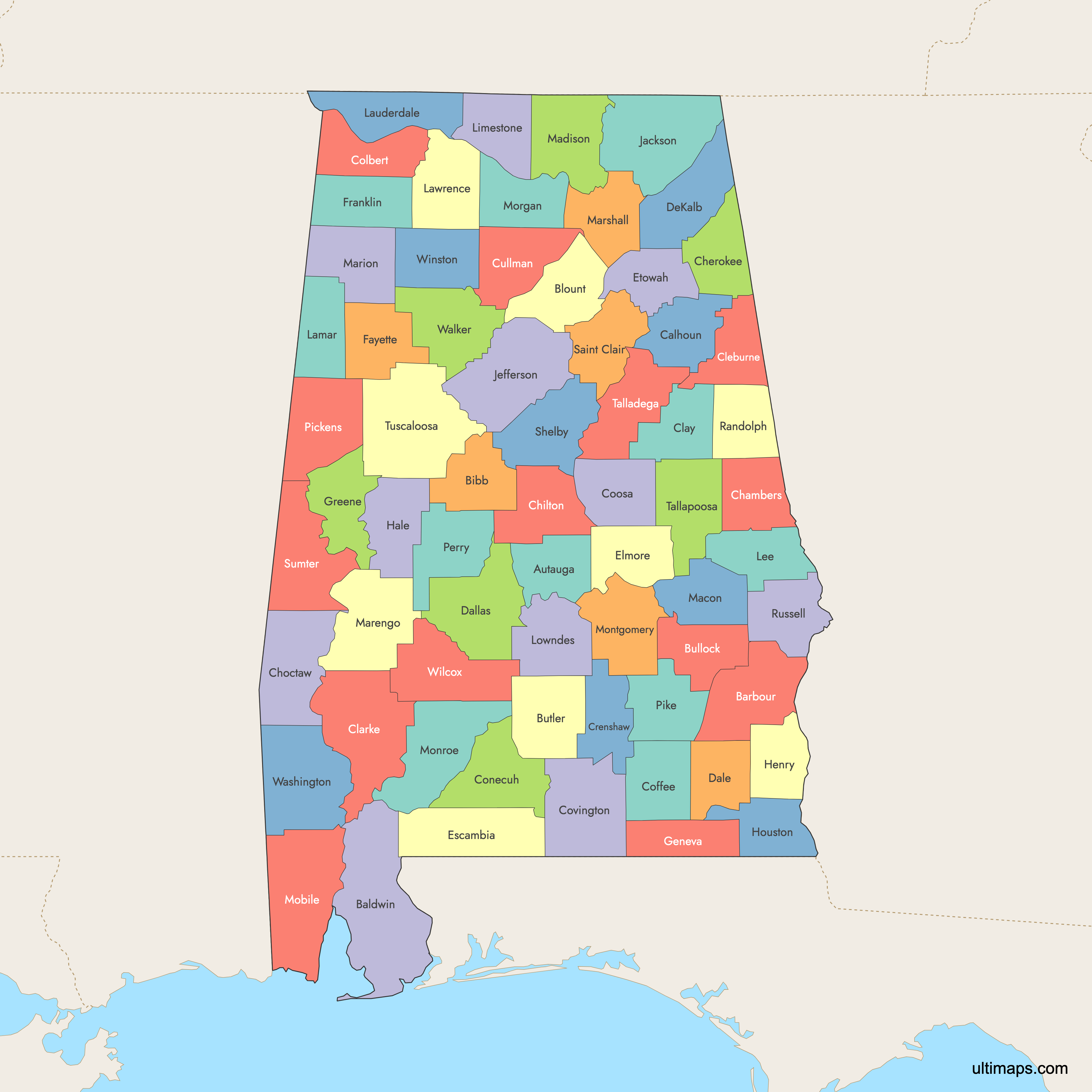
 Colored Map of Alabama Counties with Surrounding Areaspng751 KB
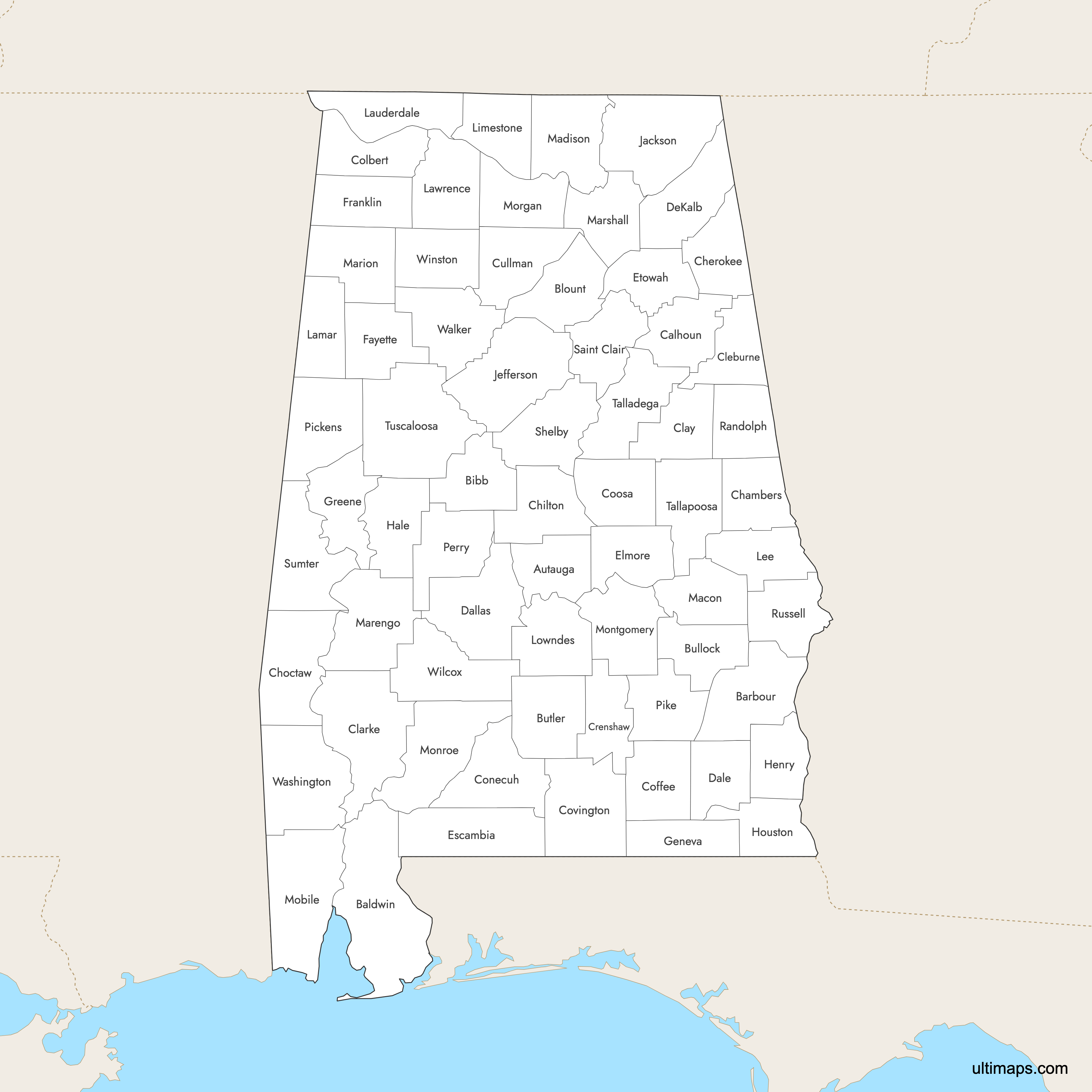
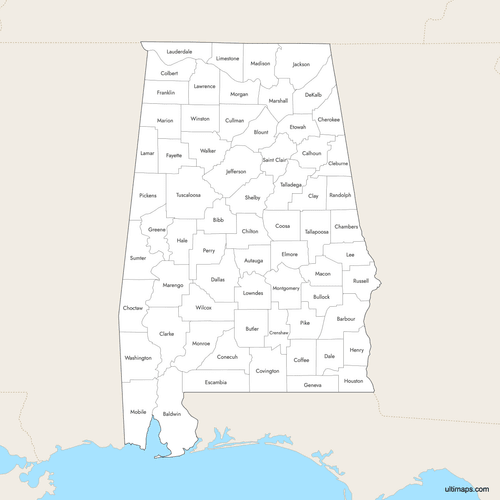 Labeled Map of Alabama Counties with Surrounding Areaspng735 KB
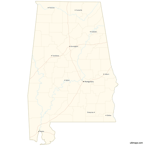 Map of Alabama Counties with Citiespng666 KB

You can download free blank Map of Alabama Counties and other maps in high resolution PNG, SVG and PDF formats from the blank maps section of the site: Download Blank Map of Alabama Counties
Custom Map Features
This map supports labels.
This map supports surrounding areas, roads, rivers and cities. New
This map is divided into 67 counties.
Updates
Sep 4, 2025:
- Improved map quality
- Added support for surrounding areas and lakes
Aug 26, 2024:
- Added map of Alabama Counties
Frequently Asked Questions
Alabama has 67 counties.
Baldwin County is the largest, covering 1,590 square miles (4,118 km²).
Jefferson County is the most populous, with 665,409 residents as of the 2020 census.
Etowah County is the smallest, at 535 square miles (1,386 km²).
St. Clair County has two county seats: Ashville and Pell City.
You can use Ultimaps to create custom maps of Alabama. Color-code counties manually or upload data, place pins, customize look and feel, and export to PNG, PDF or SVG.
Alabama borders Tennessee, Georgia, Florida, and Mississippi.
Alabama is in the Central Time Zone (CST/CDT).


