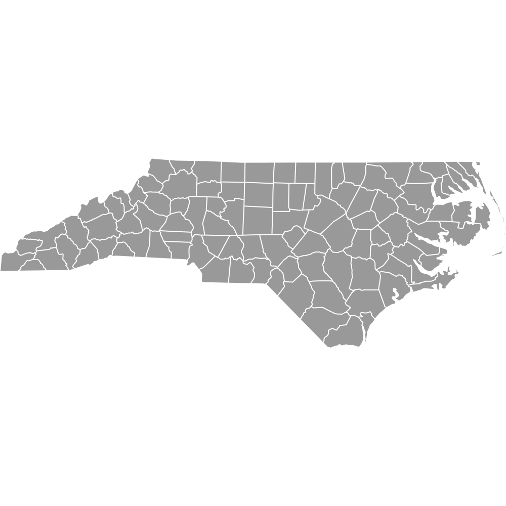
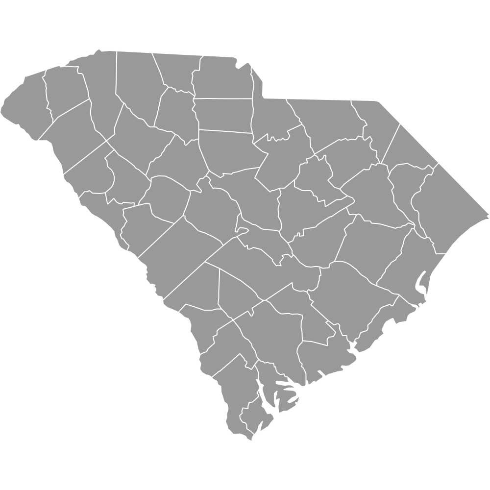
Map of Georgia Counties
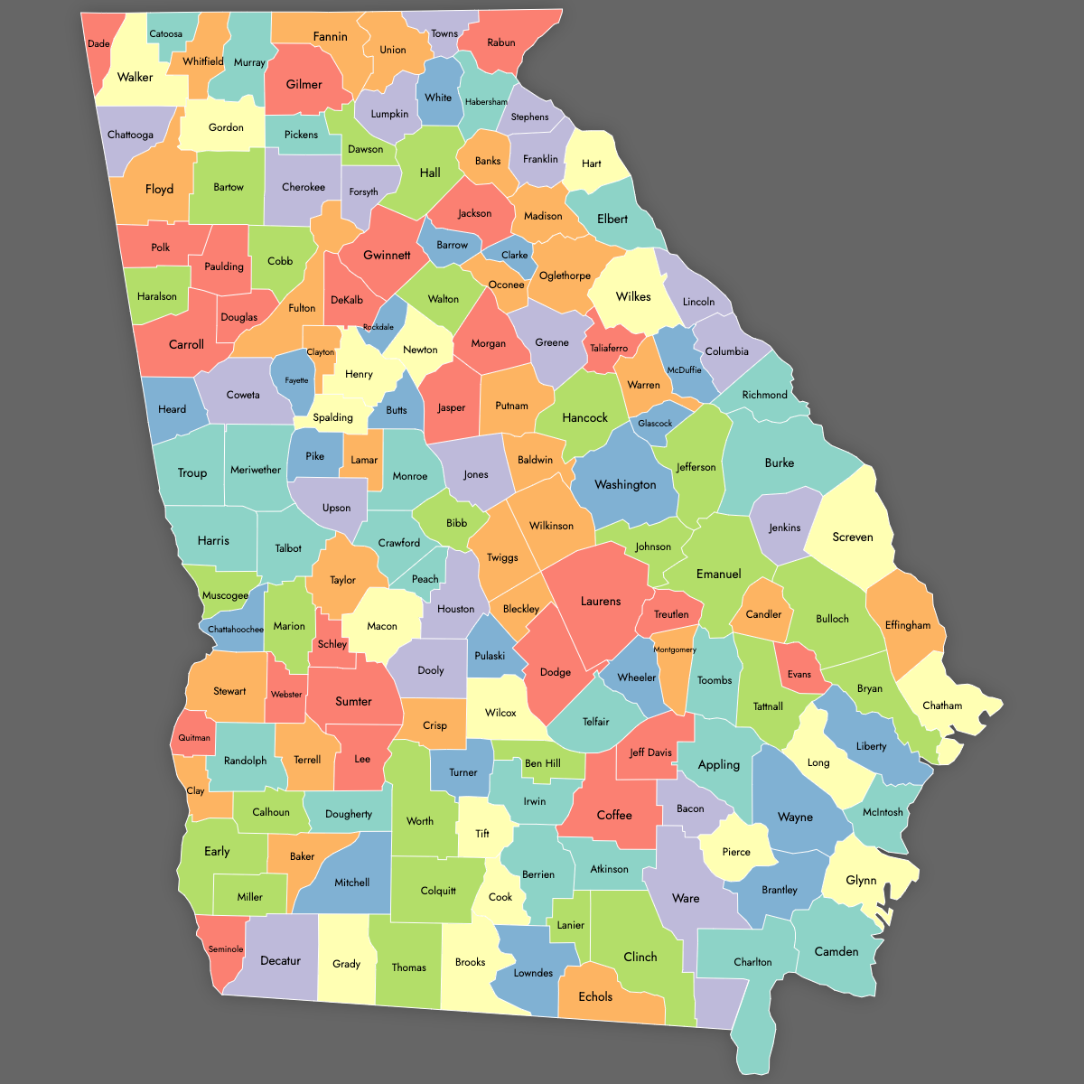
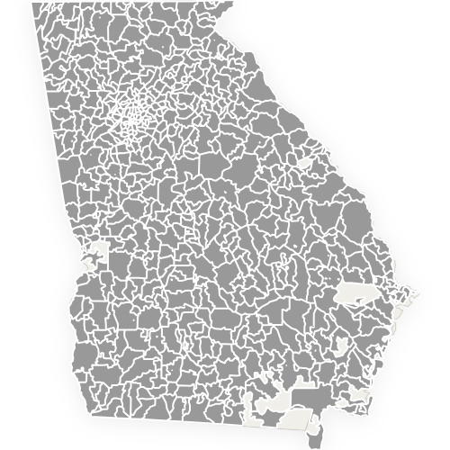
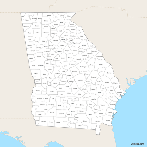
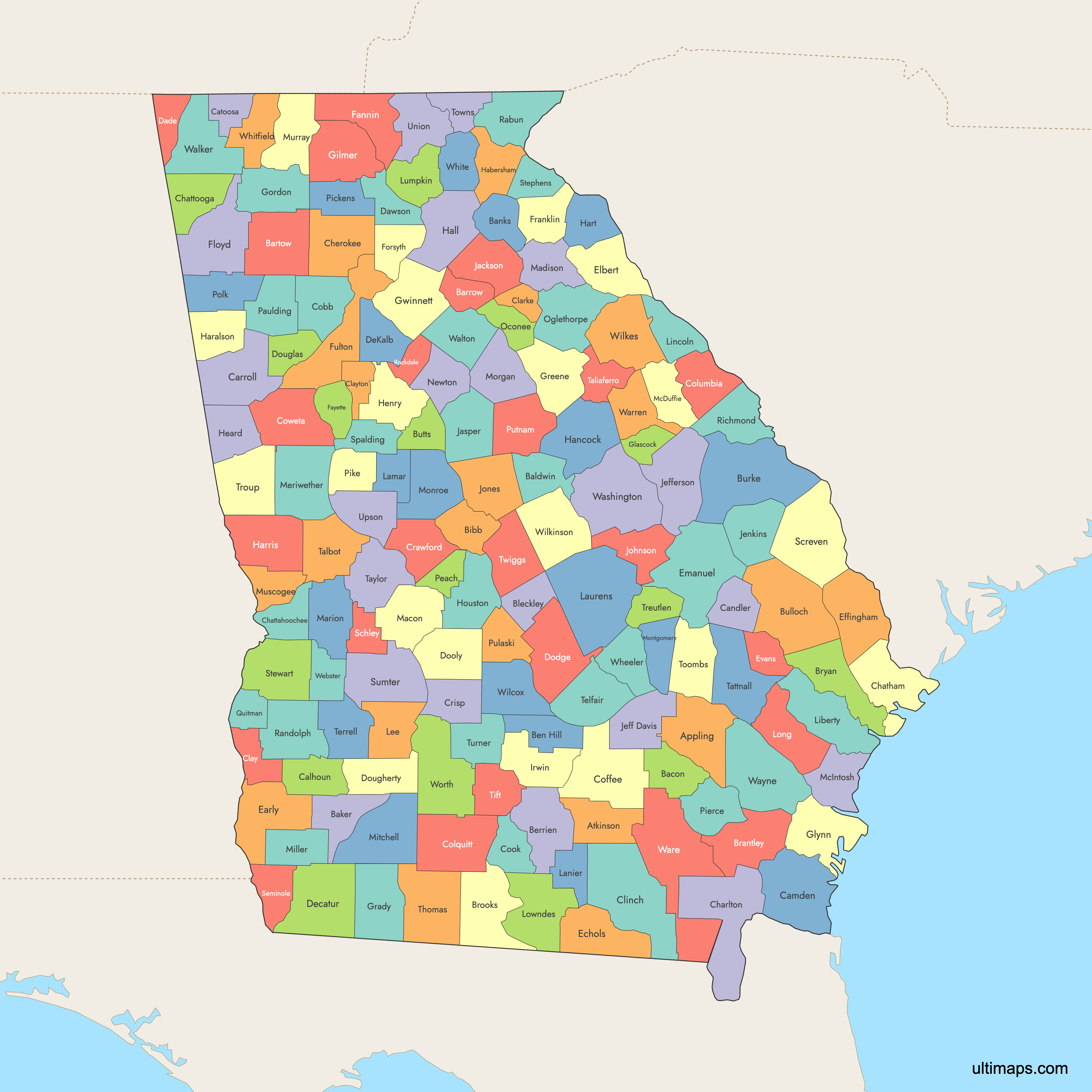
Georgia is divided into 159 counties, the second-highest number of counties in any U.S. state. Use the interactive maps below to explore counties and their boundaries. Download free maps or learn more about creating a custom map of Georgia to visualize your own data.
Interactive Map of Georgia Counties
List of Counties (159)
| # | County | County seat | Year founded |
|---|---|---|---|
| 1 | Appling | Baxley | 1818 |
| 2 | Atkinson | Pearson | 1917 |
| 3 | Bacon | Alma | 1914 |
| 4 | Baker | Newton | 1825 |
| 5 | Baldwin | Milledgeville | 1803 |
| 6 | Banks | Homer | 1858 |
| 7 | Barrow | Winder | 1914 |
| 8 | Bartow | Cartersville | 1832 |
| 9 | Ben Hill | Fitzgerald | 1906 |
| 10 | Berrien | Nashville | 1856 |
| 11 | Bibb | Macon | 1822 |
| 12 | Bleckley | Cochran | 1912 |
| 13 | Brantley | Nahunta | 1920 |
| 14 | Brooks | Quitman | 1858 |
| 15 | Bryan | Pembroke | 1793 |
| 16 | Bulloch | Statesboro | 1796 |
| 17 | Burke | Waynesboro | 1777 |
| 18 | Butts | Jackson | 1825 |
| 19 | Calhoun | Morgan | 1854 |
| 20 | Camden | Woodbine | 1777 |
| 21 | Candler | Metter | 1914 |
| 22 | Carroll | Carrollton | 1826 |
| 23 | Catoosa | Ringgold | 1853 |
| 24 | Charlton | Folkston | 1854 |
| 25 | Chatham | Savannah | 1777 |
| 26 | Chattahoochee | Cusseta | 1854 |
| 27 | Chattooga | Summerville | 1838 |
| 28 | Cherokee | Canton | 1831 |
| 29 | Clarke | Athens | 1801 |
| 30 | Clay | Fort Gaines | 1854 |
| 31 | Clayton | Jonesboro | 1858 |
| 32 | Clinch | Homerville | 1850 |
| 33 | Cobb | Marietta | 1832 |
| 34 | Coffee | Douglas | 1854 |
| 35 | Colquitt | Moultrie | 1856 |
| 36 | Columbia | Evans | 1790 |
| 37 | Cook | Adel | 1918 |
| 38 | Coweta | Newnan | 1826 |
| 39 | Crawford | Knoxville | 1822 |
| 40 | Crisp | Cordele | 1905 |
| 41 | Dade | Trenton | 1837 |
| 42 | Dawson | Dawsonville | 1857 |
| 43 | Decatur | Bainbridge | 1823 |
| 44 | DeKalb | Decatur | 1822 |
| 45 | Dodge | Eastman | 1870 |
| 46 | Dooly | Vienna | 1821 |
| 47 | Dougherty | Albany | 1853 |
| 48 | Douglas | Douglasville | 1870 |
| 49 | Early | Blakely | 1818 |
| 50 | Echols | Statenville | 1858 |
| 51 | Effingham | Springfield | 1777 |
| 52 | Elbert | Elberton | 1790 |
| 53 | Emanuel | Swainsboro | 1812 |
| 54 | Evans | Claxton | 1914 |
| 55 | Fannin | Blue Ridge | 1854 |
| 56 | Fayette | Fayetteville | 1821 |
| 57 | Floyd | Rome | 1832 |
| 58 | Forsyth | Cumming | 1832 |
| 59 | Franklin | Carnesville | 1784 |
| 60 | Fulton | Atlanta | 1853 |
| 61 | Gilmer | Ellijay | 1832 |
| 62 | Glascock | Gibson | 1857 |
| 63 | Glynn | Brunswick | 1777 |
| 64 | Gordon | Calhoun | 1850 |
| 65 | Grady | Cairo | 1905 |
| 66 | Greene | Greensboro | 1786 |
| 67 | Gwinnett | Lawrenceville | 1818 |
| 68 | Habersham | Clarkesville | 1818 |
| 69 | Hall | Gainesville | 1818 |
| 70 | Hancock | Sparta | 1793 |
| 71 | Haralson | Buchanan | 1856 |
| 72 | Harris | Hamilton | 1827 |
| 73 | Hart | Hartwell | 1853 |
| 74 | Heard | Franklin | 1830 |
| 75 | Henry | McDonough | 1821 |
| 76 | Houston | Perry | 1821 |
| 77 | Irwin | Ocilla | 1905 |
| 78 | Jackson | Jefferson | 1796 |
| 79 | Jasper | Monticello | 1812 |
| 80 | Jeff Davis | Hazlehurst | 1905 |
| 81 | Jefferson | Louisville | 1796 |
| 82 | Jenkins | Millen | 1905 |
| 83 | Johnson | Wrightsville | 1858 |
| 84 | Jones | Gray | 1807 |
| 85 | Lamar | Barnesville | 1920 |
| 86 | Lanier | Lakeland | 1920 |
| 87 | Laurens | Dublin | 1807 |
| 88 | Lee | Leesburg | 1825 |
| 89 | Liberty | Hinesville | 1777 |
| 90 | Lincoln | Lincolnton | 1796 |
| 91 | Long | Ludowici | 1920 |
| 92 | Lowndes | Valdosta | 1825 |
| 93 | Lumpkin | Dahlonega | 1832 |
| 94 | Macon | Oglethorpe | 1837 |
| 95 | Madison | Danielsville | 1811 |
| 96 | Marion | Buena Vista | 1827 |
| 97 | McDuffie | Thomson | 1870 |
| 98 | McIntosh | Darien | 1793 |
| 99 | Meriwether | Greenville | 1827 |
| 100 | Miller | Colquitt | 1856 |
| 101 | Mitchell | Camilla | 1857 |
| 102 | Monroe | Forsyth | 1821 |
| 103 | Montgomery | Mount Vernon | 1793 |
| 104 | Morgan | Madison | 1807 |
| 105 | Murray | Chatsworth | 1832 |
| 106 | Muscogee | Columbus | 1825 |
| 107 | Newton | Covington | 1821 |
| 108 | Oconee | Watkinsville | 1875 |
| 109 | Oglethorpe | Lexington | 1793 |
| 110 | Paulding | Dallas | 1832 |
| 111 | Peach | Fort Valley | 1924 |
| 112 | Pickens | Jasper | 1853 |
| 113 | Pierce | Blackshear | 1857 |
| 114 | Pike | Zebulon | 1822 |
| 115 | Polk | Cedartown | 1851 |
| 116 | Pulaski | Hawkinsville | 1808 |
| 117 | Putnam | Eatonton | 1807 |
| 118 | Quitman | Georgetown | 1858 |
| 119 | Rabun | Clayton | 1819 |
| 120 | Randolph | Cuthbert | 1828 |
| 121 | Richmond | Augusta | 1777 |
| 122 | Rockdale | Conyers | 1870 |
| 123 | Schley | Ellaville | 1857 |
| 124 | Screven | Sylvania | 1793 |
| 125 | Seminole | Donalsonville | 1920 |
| 126 | Spalding | Griffin | 1851 |
| 127 | Stephens | Toccoa | 1905 |
| 128 | Stewart | Lumpkin | 1830 |
| 129 | Sumter | Americus | 1831 |
| 130 | Talbot | Talbotton | 1827 |
| 131 | Taliaferro | Crawfordville | 1793 |
| 132 | Tattnall | Reidsville | 1801 |
| 133 | Taylor | Butler | 1852 |
| 134 | Telfair | McRae–Helena | 1807 |
| 135 | Terrell | Dawson | 1856 |
| 136 | Thomas | Thomasville | 1825 |
| 137 | Tift | Tifton | 1905 |
| 138 | Toombs | Lyons | 1905 |
| 139 | Towns | Hiawassee | 1856 |
| 140 | Treutlen | Soperton | 1918 |
| 141 | Troup | LaGrange | 1826 |
| 142 | Turner | Ashburn | 1905 |
| 143 | Twiggs | Jeffersonville | 1809 |
| 144 | Union | Blairsville | 1832 |
| 145 | Upson | Thomaston | 1824 |
| 146 | Walker | LaFayette | 1833 |
| 147 | Walton | Monroe | 1818 |
| 148 | Ware | Waycross | 1824 |
| 149 | Warren | Warrenton | 1793 |
| 150 | Washington | Sandersville | 1784 |
| 151 | Wayne | Jesup | 1808 |
| 152 | Webster | Preston | 1854 |
| 153 | Wheeler | Alamo | 1912 |
| 154 | White | Cleveland | 1857 |
| 155 | Whitfield | Dalton | 1851 |
| 156 | Wilcox | Abbeville | 1857 |
| 157 | Wilkes | Washington | 1777 |
| 158 | Wilkinson | Irwinton | 1803 |
| 159 | Worth | Sylvester | 1853 |
Georgia Counties: Key Facts
- Total number of counties: 159 (second most in the U.S.)
- Largest county by area: Ware County - 907.9 square miles (2,351.5 km²)
- Most populous county: Fulton County (Atlanta) - over 1 million people
- Least populous county: Taliaferro County - just over 1,500 people
- Counties with major urban centers: Fulton (Atlanta), DeKalb (Decatur), Cobb (Marietta)
- State Capital location: Fulton County (Atlanta)
- Neighboring states: Alabama, Florida, Tennessee, North Carolina, South Carolina
- Time zone: Eastern Time Zone
Interesting Facts
- Second-most counties in the U.S.: Georgia is only behind Texas in terms of number of counties.
- Bacon County: Named after Augustus Octavius Bacon, not the food.
Free Downloads
Free for personal and commercial use with a credit to Ultimaps. See the license terms for details.
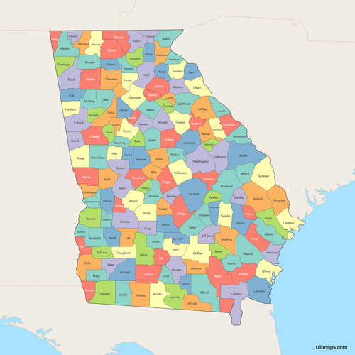 Colored Map of Georgia Counties with Surrounding Areaspng1212 KB
 Labeled Map of Georgia Counties with Surrounding Areaspng1174 KB
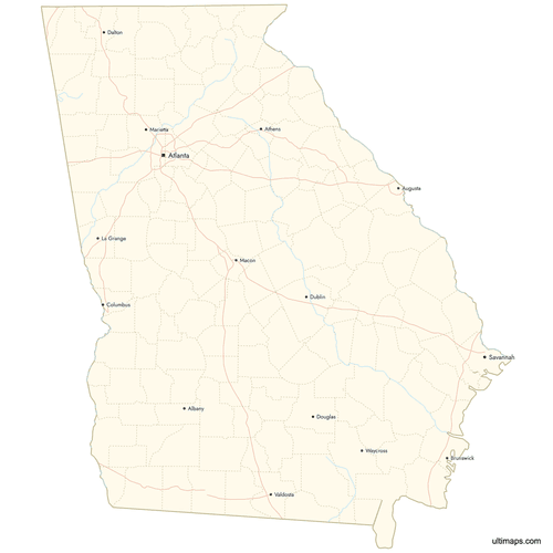 Map of Georgia Counties with Citiespng1098 KB
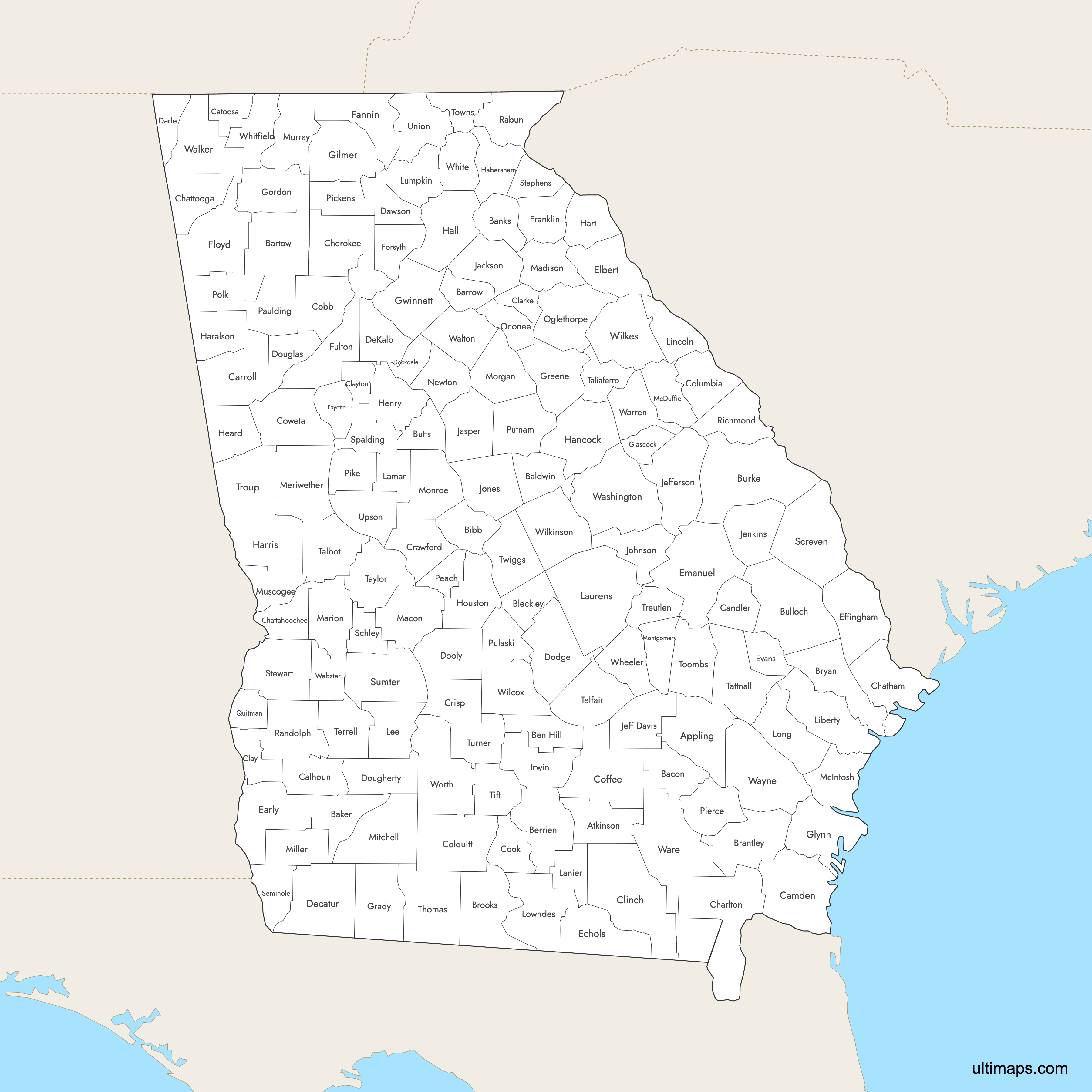
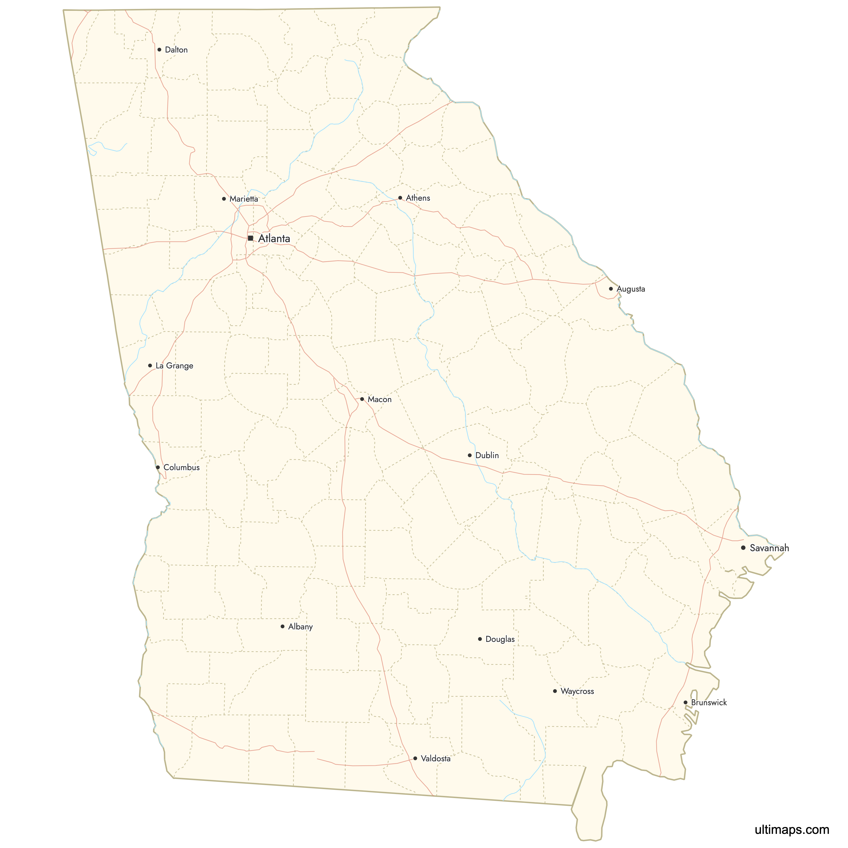
Need it without colors? The blank version of this map comes as a print-ready PDF (A4 and US Letter), a PNG and an editable SVG.
Custom Map Features
This map supports labels.
This map supports surrounding areas, roads, rivers and cities. New
This map is divided into 159 counties.
Updates
Aug 27, 2025:
- Improved map quality
- Added support for surrounding areas and lakes
Aug 26, 2024:
- Added map of Georgia Counties
Frequently Asked Questions
Georgia has 159 counties, the second-largest number of counties of any U.S. state after Texas.
The largest county by area in Georgia is Ware County, which covers 907.9 square miles (2,351.5 km²).
The least populated county in Georgia is Taliaferro County, with just over 1,500 people.
Major cities in Georgia include Atlanta in Fulton County, Savannah in Chatham County, and Columbus in Muscogee County, among others.
Fulton County is the most populous, with over 1 million people, including Atlanta.
Georgia borders Alabama, Florida, Tennessee, North Carolina, and South Carolina.
You can use Ultimaps to create custom maps of Georgia. Color-code counties manually or upload data, place pins, customize look and feel, and export to PNG, PDF, or SVG.