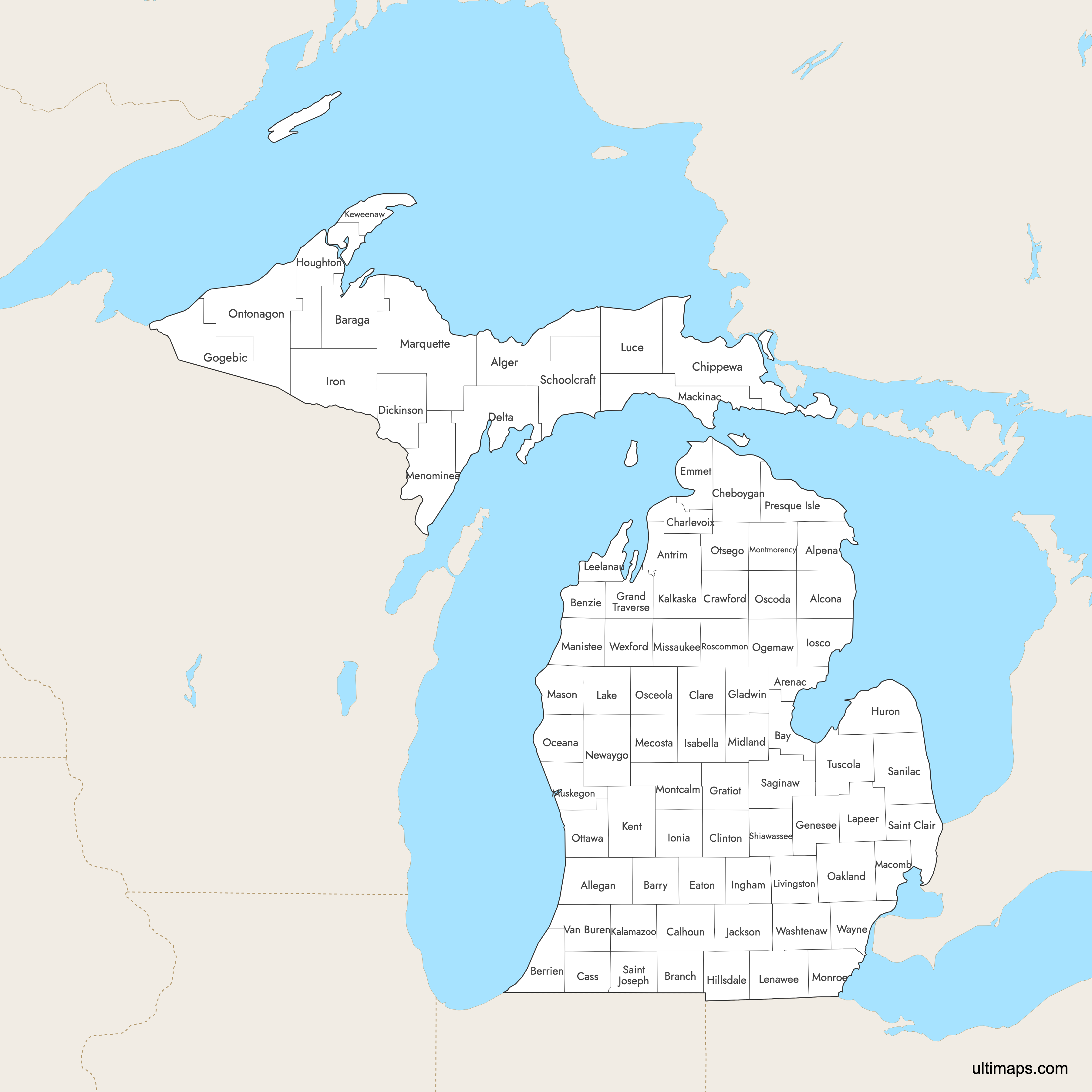
Map of Michigan Counties
Michigan State is divided into 83 counties spread across the Lower and Upper Peninsulas. Use the interactive maps below to explore Michingan counties and their boundaries. Download free maps or learn more about creating a custom Michigan county map to highlight your own data.
Interactive Map of Michigan Counties
List of Counties (83)
| # | County |
|---|---|
| 1 | |
| 2 | |
| 3 | |
| 4 | |
| 5 | |
| 6 | |
| 7 | |
| 8 | |
| 9 | |
| 10 | |
| 11 | |
| 12 | |
| 13 | |
| 14 | |
| 15 | |
| 16 | |
| 17 | |
| 18 | |
| 19 | |
| 20 | |
| 21 | |
| 22 | |
| 23 | |
| 24 | |
| 25 | |
| 26 | |
| 27 | |
| 28 | |
| 29 | |
| 30 | |
| 31 | |
| 32 | |
| 33 | |
| 34 | |
| 35 | |
| 36 | |
| 37 | |
| 38 | |
| 39 | |
| 40 | |
| 41 | |
| 42 | |
| 43 | |
| 44 | |
| 45 | |
| 46 | |
| 47 | |
| 48 | |
| 49 | |
| 50 | |
| 51 | |
| 52 | |
| 53 | |
| 54 | |
| 55 | |
| 56 | |
| 57 | |
| 58 | |
| 59 | |
| 60 | |
| 61 | |
| 62 | |
| 63 | |
| 64 | |
| 65 | |
| 66 | |
| 67 | |
| 68 | |
| 69 | |
| 70 | |
| 71 | |
| 72 | |
| 73 | |
| 74 | |
| 75 | |
| 76 | |
| 77 | |
| 78 | |
| 79 | |
| 80 | |
| 81 | |
| 82 | |
| 83 |
Michigan Counties: Key Facts
- Number of counties: 83
- Largest county by area: Marquette County - 3,426 square miles
- Smallest county by land area: Benzie County - 321 square miles
- Most populous county: Wayne County (Detroit) - approx. 1.8 million residents
- Counties with major cities: Wayne (Detroit), Kent (Grand Rapids), Oakland (Pontiac), Macomb (Warren)
- Time zones: 79 counties observe Eastern Time; 4 Upper Peninsula counties (Gogebic, Iron, Dickinson, Menominee) observe Central Time
- Highest elevation county seat: Ishpeming (Marquette County) at 1,436 ft
- Bordered by four of the Great Lakes: Superior, Michigan, Huron, and Erie
- Neighboring states: Ohio, Indiana, Wisconsin
- Great Lakes coastline: 40 counties border at least one of the Great Lakes or connecting waterways
- County names: 26 county names come from Native American languages; 12 honor figures from the War of 1812
- County boundaries largely unchanged since the creation of Dickinson County in 1891
Free Downloads
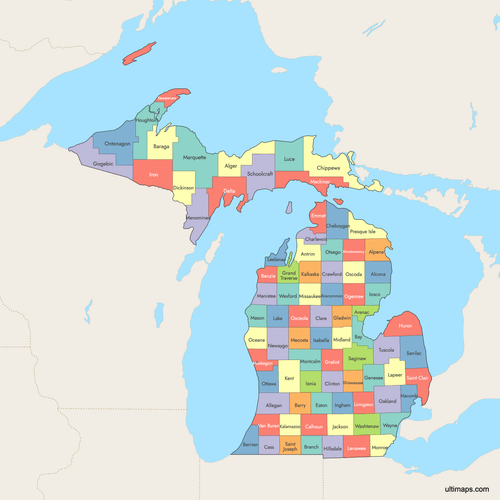 Colored Map of Michigan Counties with Surrounding Areaspng875 KB
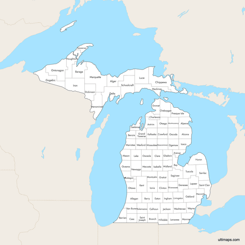 Labeled Map of Michigan Counties with Surrounding Areaspng849 KB
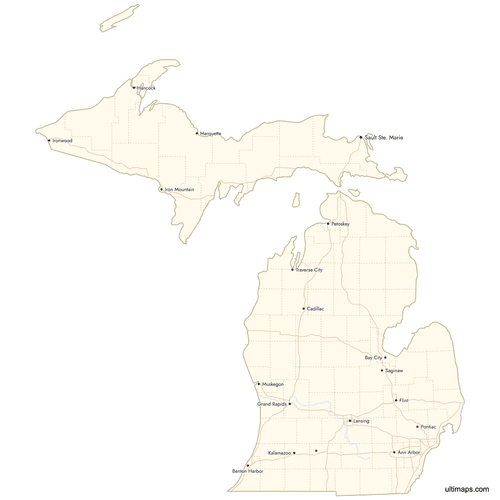 Map of Michigan Counties with Citiespng692 KB


You can download free blank Map of Michigan Counties and other maps in high resolution PNG, SVG and PDF formats from the blank maps section of the site: Download Blank Map of Michigan Counties
Custom Map Features
This map supports labels.
This map supports surrounding areas, roads, rivers and cities. New
This map is divided into 83 counties.
Updates
Jul 25, 2025:
- Improved map quality
- Added support for surrounding areas and lakes
Aug 26, 2024:
- Added map of Michigan Counties


