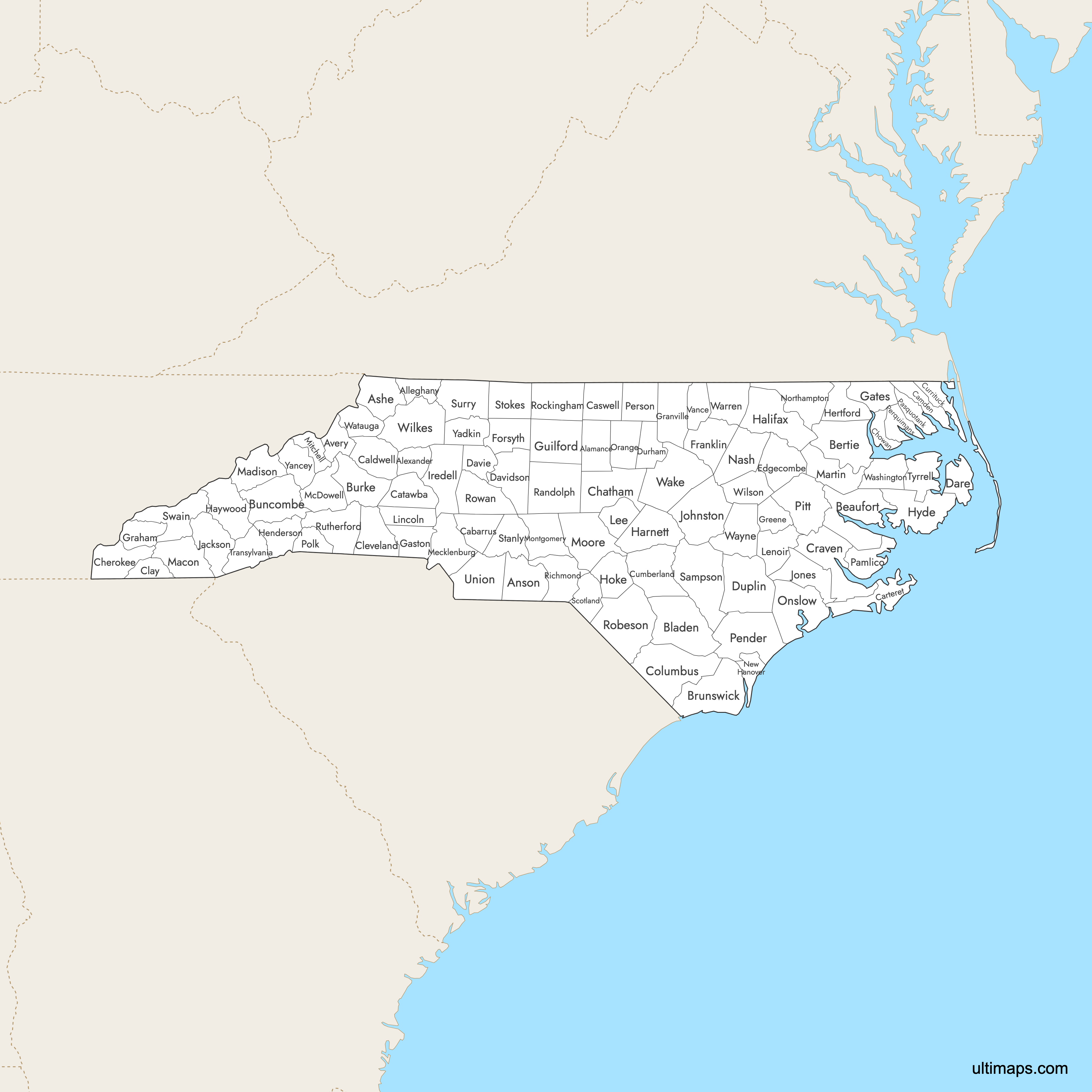
Map of North Carolina Counties
North Carolina is divided into 100 counties, from the Appalachian Mountains to the Atlantic Coast. Use interactive maps below to explore counties and their boundaries. Download free maps or learn more about creating a custom map of North Carolina to visualize your own data.
Interactive Map of North Carolina Counties
List of Counties (100)
| # | County | County seat | Year founded |
|---|---|---|---|
| 1 | Graham | 1849 | |
| 2 | Taylorsville | 1847 | |
| 3 | Sparta | 1859 | |
| 4 | Wadesboro | 1750 | |
| 5 | Jefferson | 1799 | |
| 6 | Newland | 1911 | |
| 7 | Washington | 1712 | |
| 8 | Windsor | 1722 | |
| 9 | Elizabethtown | 1734 | |
| 10 | Bolivia | 1764 | |
| 11 | Asheville | 1791 | |
| 12 | Morganton | 1777 | |
| 13 | Concord | 1792 | |
| 14 | Lenoir | 1841 | |
| 15 | Camden | 1777 | |
| 16 | Beaufort | 1722 | |
| 17 | Yanceyville | 1777 | |
| 18 | Newton | 1842 | |
| 19 | Pittsboro | 1771 | |
| 20 | Murphy | 1839 | |
| 21 | Edenton | 1668 | |
| 22 | Hayesville | 1861 | |
| 23 | Shelby | 1841 | |
| 24 | Whiteville | 1808 | |
| 25 | New Bern | 1705 | |
| 26 | Fayetteville | 1754 | |
| 27 | Currituck | 1668 | |
| 28 | Manteo | 1870 | |
| 29 | Lexington | 1822 | |
| 30 | Mocksville | 1836 | |
| 31 | Kenansville | 1750 | |
| 32 | Durham | 1881 | |
| 33 | Tarboro | 1741 | |
| 34 | Winston-Salem | 1849 | |
| 35 | Louisburg | 1779 | |
| 36 | Gastonia | 1846 | |
| 37 | Gatesville | 1779 | |
| 38 | Robbinsville | 1872 | |
| 39 | Oxford | 1746 | |
| 40 | Snow Hill | 1799 | |
| 41 | Greensboro | 1771 | |
| 42 | Halifax | 1758 | |
| 43 | Lillington | 1855 | |
| 44 | Waynesville | 1808 | |
| 45 | Hendersonville | 1838 | |
| 46 | Winton | 1759 | |
| 47 | Raeford | 1911 | |
| 48 | Swan Quarter | 1712 | |
| 49 | Statesville | 1788 | |
| 50 | Sylva | 1851 | |
| 51 | Smithfield | 1746 | |
| 52 | Trenton | 1779 | |
| 53 | Sanford | 1907 | |
| 54 | Kinston | 1791 | |
| 55 | Lincolnton | 1779 | |
| 56 | Franklin | 1828 | |
| 57 | Marshall | 1851 | |
| 58 | Williamston | 1774 | |
| 59 | Marion | 1842 | |
| 60 | Charlotte | 1762 | |
| 61 | Bakersville | 1861 | |
| 62 | Troy | 1779 | |
| 63 | Carthage | 1784 | |
| 64 | Nashville | 1777 | |
| 65 | Wilmington | 1729 | |
| 66 | Jackson | 1741 | |
| 67 | Jacksonville | 1734 | |
| 68 | Hillsborough | 1752 | |
| 69 | Bayboro | 1872 | |
| 70 | Elizabeth City | 1668 | |
| 71 | Burgaw | 1875 | |
| 72 | Hertford | 1668 | |
| 73 | Roxboro | 1791 | |
| 74 | Greenville | 1760 | |
| 75 | Columbus | 1855 | |
| 76 | Asheboro | 1779 | |
| 77 | Rockingham | 1779 | |
| 78 | Lumberton | 1787 | |
| 79 | Wentworth | 1785 | |
| 80 | Salisbury | 1753 | |
| 81 | Rutherfordton | 1779 | |
| 82 | Clinton | 1784 | |
| 83 | Laurinburg | 1899 | |
| 84 | Albemarle | 1841 | |
| 85 | Danbury | 1789 | |
| 86 | Dobson | 1771 | |
| 87 | Bryson City | 1871 | |
| 88 | Brevard | 1861 | |
| 89 | Columbia | 1729 | |
| 90 | Monroe | 1842 | |
| 91 | Henderson | 1881 | |
| 92 | Raleigh | 1771 | |
| 93 | Warrenton | 1779 | |
| 94 | Plymouth | 1799 | |
| 95 | Boone | 1849 | |
| 96 | Goldsboro | 1779 | |
| 97 | Wilkesboro | 1777 | |
| 98 | Wilson | 1855 | |
| 99 | Yadkinville | 1850 | |
| 100 | Burnsville | 1833 |
North Carolina Counties: Key Facts
- Total number of counties: 100
- Largest county by area: Robeson County - 951.3 square miles (2,463.9 km²)
- Smallest county by area: Clay County - 215.8 square miles (559.0 km²)
- Most populous county: Wake County (Raleigh) - 1,129,410 people (2020)
- Least populous county: Tyrrell County - 3,245 people (2020)
- Easternmost county: Dare County
- Westernmost county: Cherokee County
- State capital location: Wake County (Raleigh)
- Largest urban counties by population: Wake, Mecklenburg (Charlotte), Guilford (Greensboro), Durham, Forsyth (Winston‑Salem)
- Neighboring states: Virginia, Tennessee, Georgia, South Carolina
- Time zone: Eastern Time Zone (ET)
Interesting Facts
- Geographic Diversity: Counties cover Coastal Plain, Piedmont, and Appalachian Mountains.
- Outer Banks Counties: Include hurricane-prone Dare, Currituck, Hyde, and Carteret counties.
- Historic County Seats: Edenton and New Bern are among the oldest towns.
- Rural Dominance: Majority of counties are classified as rural despite urban population concentration.
- North Carolina has more counties than many larger states
Free Downloads
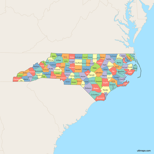 Colored Map of North Carolina Counties with Surrounding Areaspng1059 KB
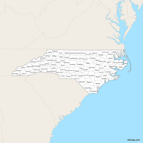 Labeled Map of North Carolina Counties with Surrounding Areaspng1025 KB
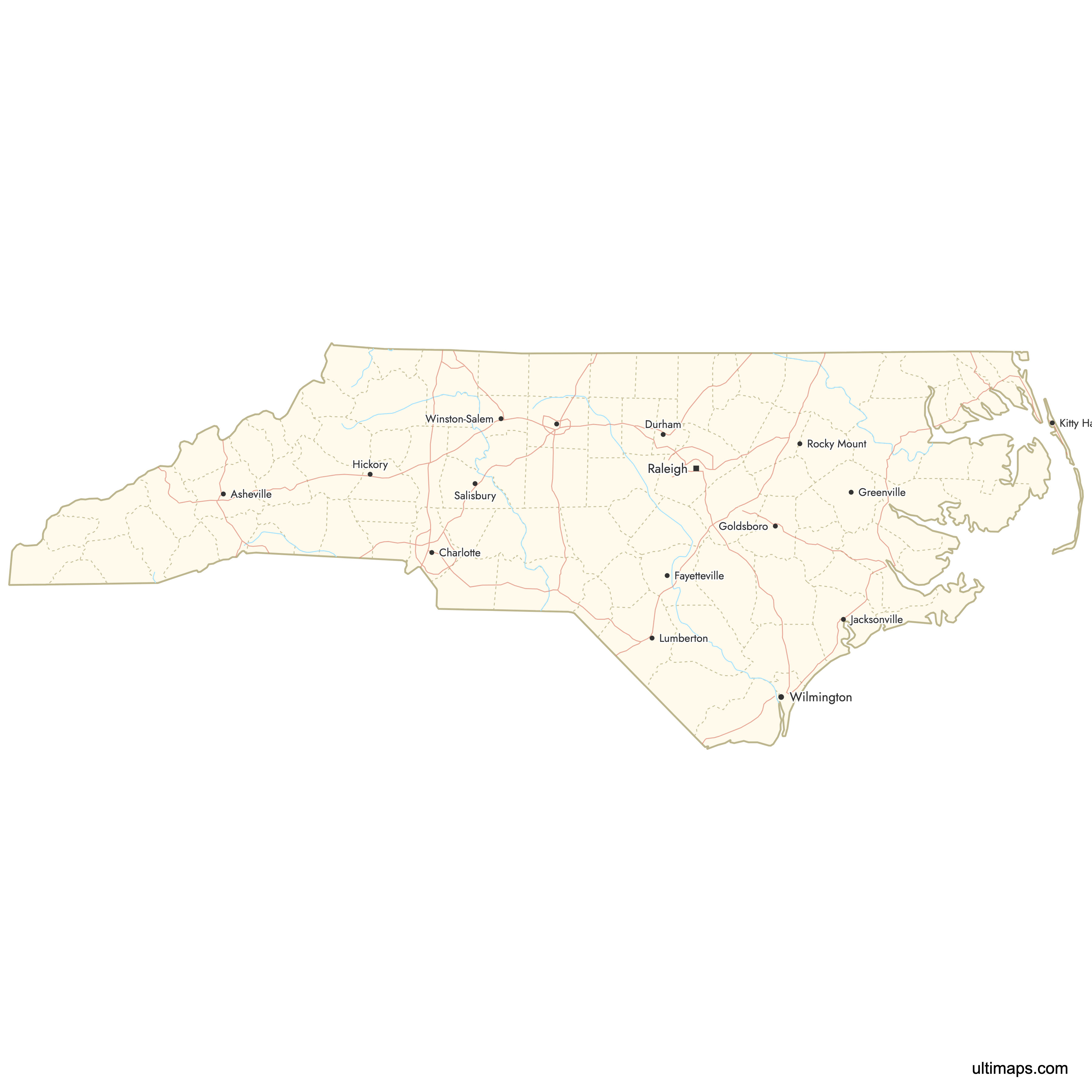
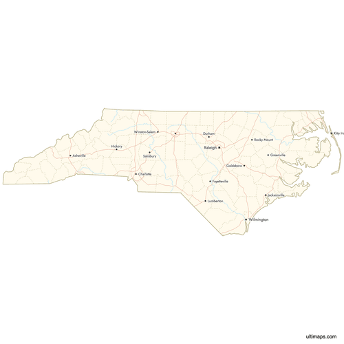 Map of North Carolina Counties with Citiespng724 KB

You can download free blank Map of North Carolina Counties and other maps in high resolution PNG, SVG and PDF formats from the blank maps section of the site: Download Blank Map of North Carolina Counties
Custom Map Features
This map supports labels.
This map supports surrounding areas, roads, rivers and cities. New
This map is divided into 100 counties.
Updates
Aug 14, 2025:
- Improved map quality
- Added support for surrounding areas and lakes
Aug 26, 2024:
- Added map of North Carolina Counties
Frequently Asked Questions
North Carolina has 100 counties. This number has been stable for roughly a century.
The largest county by area is Robeson County, with a land area of 951.3 square miles (2,463.9 km²).
The smallest county by area is Clay County, with an area of 215.8 square miles (559.0 km²).
Wake County is the most populous, with 1,129,410 residents in the 2020 Census. Its county seat is Raleigh, the state capital.
Tyrrell County has the smallest population in North Carolina, with 3,245 residents in 2020.
You can use Ultimaps to create custom maps of North Carolina. Color-code counties manually or upload data, place pins, customize look and feel, and export to PNG, PDF, or SVG.


