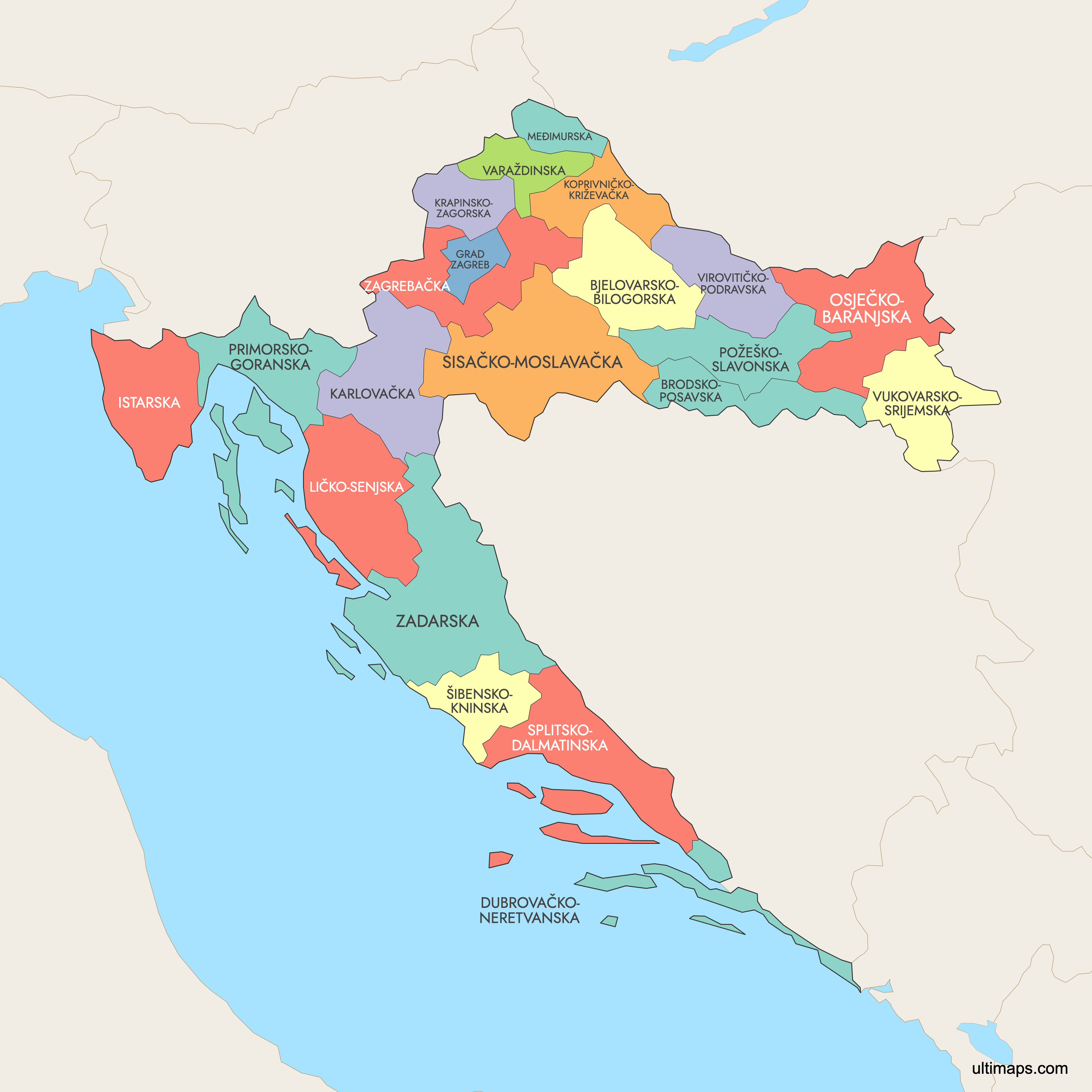
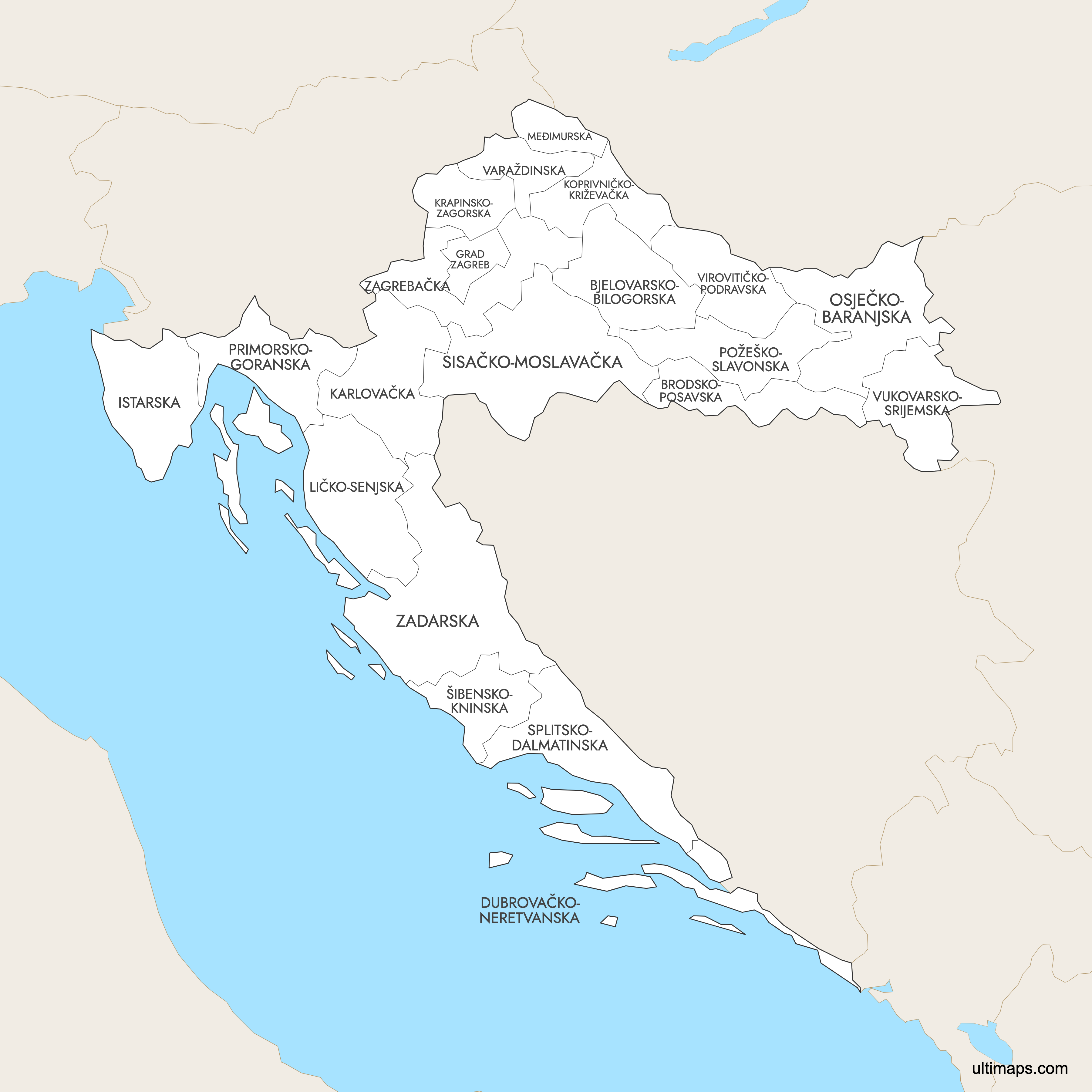
Map of Croatia Counties
Croatia is divided into 20 counties (županije) plus the City of Zagreb, which holds the special status of both a city and a county, for a total of 21 administrative units. These counties were re-established in 1992 following independence and span from the Adriatic coastline in the west to the Pannonian Plain in the east. Use the interactive maps below to explore Croatian counties and their boundaries. Download free maps or learn more about creating a custom map of Croatia to visualize your own data.
Interactive Map of Croatia Counties
List of Counties (21)
| # | County |
|---|---|
| 1 | |
| 2 | |
| 3 | |
| 4 | |
| 5 | |
| 6 | |
| 7 | |
| 8 | |
| 9 | |
| 10 | |
| 11 | |
| 12 | |
| 13 | |
| 14 | |
| 15 | |
| 16 | |
| 17 | |
| 18 | |
| 19 | |
| 20 | |
| 21 |
Croatia Counties: Key Facts
- Total number of counties: 21 administrative units (20 counties plus the City of Zagreb, which has dual city-county status)
- Most populous county: City of Zagreb at 688,163 (2021 census); among standard counties, Split-Dalmatia County leads with 454,798 (2021 census)
- Least populous county: Lika-Senj County at 50,264 (2021 census)
- Largest county by area: Lika-Senj County at 5,350 km² (2,065 sq mi)
- Smallest county by area: Međimurje County at 729 km² (282 sq mi)
- Counties with major urban centers: City of Zagreb (capital), Split-Dalmatia (Split), Primorje-Gorski Kotar (Rijeka), Osijek-Baranja (Osijek), Istria (Pula)
- Capital and administrative center: City of Zagreb
- Bordering countries and waters: Slovenia (northwest), Hungary (northeast), Serbia (east), Bosnia and Herzegovina (east and south), Montenegro (south), and the Adriatic Sea (west and southwest)
- Time zone: Central European Time (CET, UTC+1); Central European Summer Time (CEST, UTC+2) in summer
- Boundary history: The current county structure was re-established in 1992 after Croatia declared independence. Counties are further subdivided into 128 cities and 428 municipalities.
Interesting Facts
- Lika-Senj County is both the largest and least populous county, featuring karst landscapes and Plitvice Lakes National Park, a UNESCO World Heritage Site.
- Zagreb holds a unique dual status as both a city and a county since 1992, making it administratively separate from the surrounding Zagreb County.
- Croatia's counties are grouped into four statistical regions for EU purposes: Northern Croatia, Slavonia, Central Croatia, and Dalmatia (including Istria).
- Međimurje County, the smallest by area, is located in the far north between the Mura and Drava rivers and is known for its wine production.
- The post-1991 Yugoslav wars directly shaped some county boundaries, particularly in Vukovar-Srijem County in eastern Slavonia.
Free Downloads
 Colored Map of Croatia Counties with Surrounding Areaspng924 KB
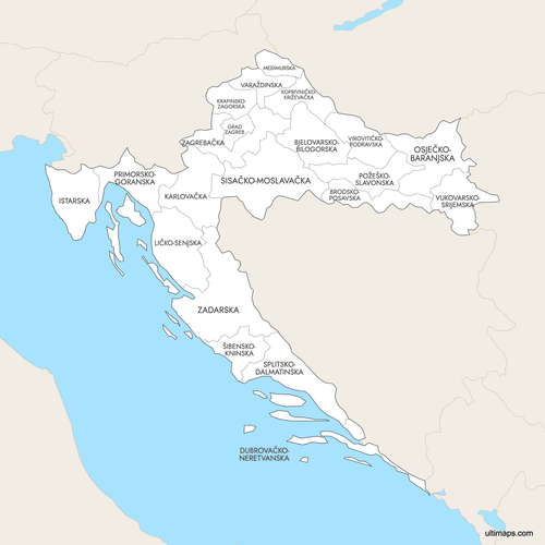 Labeled Map of Croatia Counties with Surrounding Areaspng908 KB
 Map of Croatia Counties with Citiespng774 KB
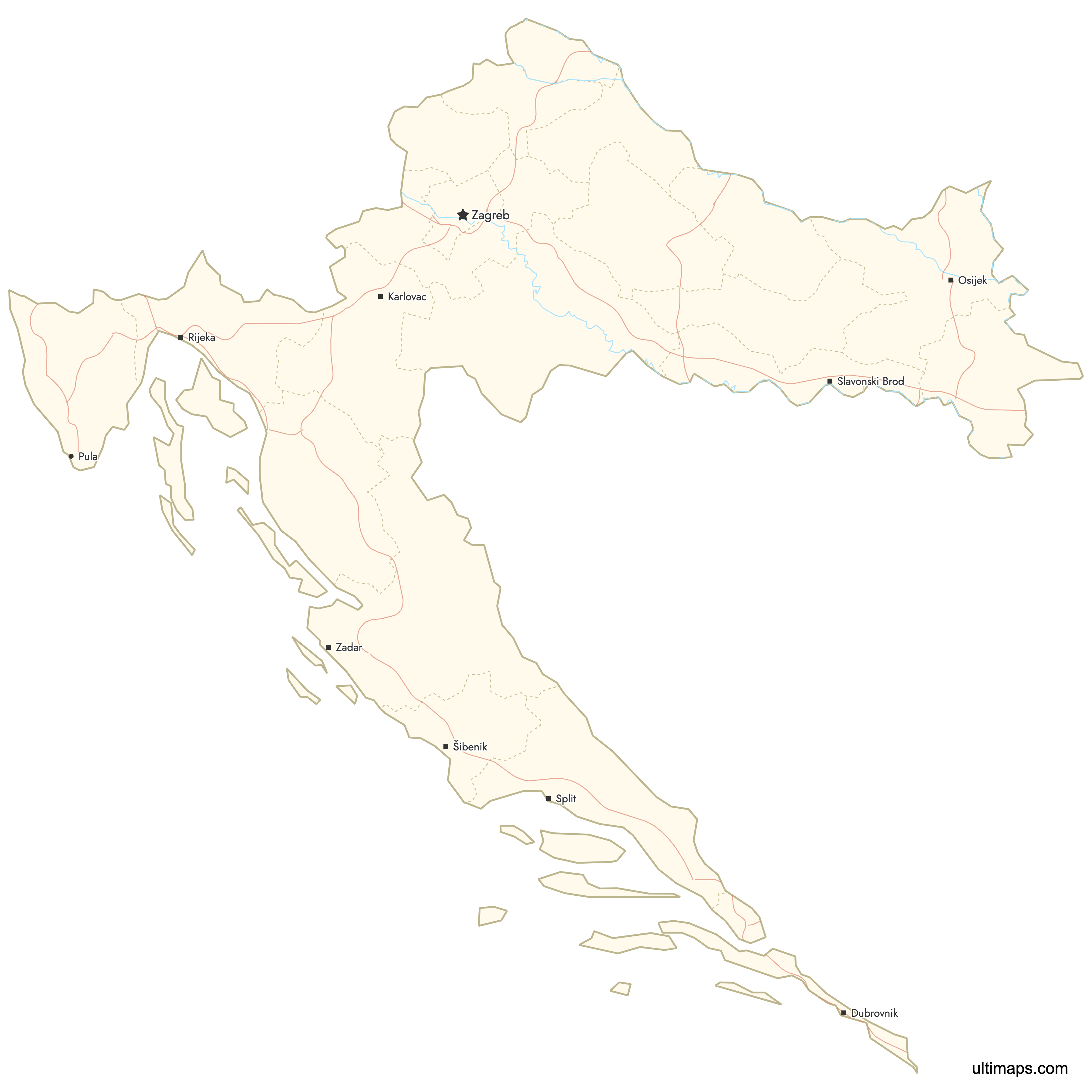
You can download free blank Map of Croatia Counties and other maps in high resolution PNG, SVG and PDF formats from the blank maps section of the site: Download Blank Map of Croatia Counties
Custom Map Features
This map supports labels.
This map supports surrounding areas, roads, rivers and cities. New
This map is divided into 21 counties.
Updates
Apr 23, 2026:
- Added map of Croatia counties with surrounding countries, cities and roads
Frequently Asked Questions
Croatia has 21 administrative units: 20 counties (županije) and the City of Zagreb, which holds the legal status of both a city and a county. This structure was re-established in 1992 after Croatian independence. The counties are further subdivided into 128 cities and 428 municipalities.
Lika-Senj County is the largest at 5,350 km² (2,065 sq mi). Despite its size, it is also the least populous county with just 50,264 residents according to the 2021 census. The county is home to Plitvice Lakes National Park.
Međimurje County is the smallest at 729 km² (282 sq mi). It is located in the far north of Croatia, between the Mura and Drava rivers. The county is known for its wine production and agricultural traditions.
The City of Zagreb is the most populous administrative unit with 688,163 residents (2021 census). Among standard counties, Split-Dalmatia County ranks first with 454,798 residents (2021 census) and contains Split, Croatia's second-largest city.
Plitvice Lakes National Park is in Lika-Senj County. Dubrovnik's UNESCO-listed Old Town is in Dubrovnik-Neretva County. Diocletian's Palace in Split is in Split-Dalmatia County, and the Roman amphitheater in Pula is in Istria County. Krka National Park falls within Šibenik-Knin County.
Since 1992, the City of Zagreb has held dual status as both a city and a county. This makes it administratively separate from the surrounding Zagreb County. As Croatia's capital and largest city with 688,163 residents (2021 census), it functions independently in terms of governance and local administration.
Croatia borders Slovenia to the northwest, Hungary to the northeast, Serbia to the east, Bosnia and Herzegovina to the east and south, and Montenegro to the south. The Adriatic Sea forms Croatia's western and southwestern coastline.
The current county structure was re-established in 1992 following Croatia's declaration of independence from Yugoslavia. The system of županije has historical roots in medieval Croatia, but the modern boundaries and administrative framework date to this 1992 reorganization.
Croatia's 21 counties are grouped into four statistical regions used for EU reporting and planning: Northern Croatia, Slavonia, Central Croatia, and Dalmatia (which includes Istria). These groupings help organize data collection and regional development funding.
You can use Ultimaps to create custom maps of Croatia. Color-code counties manually or upload your data, place pins, customize the look and feel, and export to PNG, PDF, or SVG. No sign-up required.