
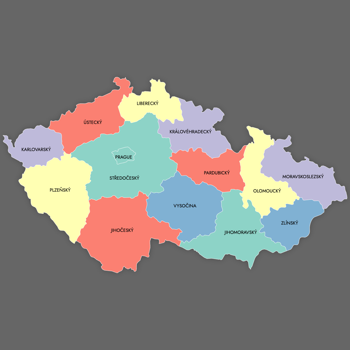
Map of Czech Republic Regions
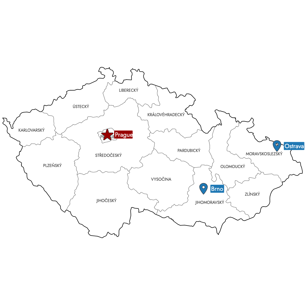
Create a custom map of Czech Republic divided by its regions, and export your design as a high-resolution PNG, SVG, or PDF for use in reports or presentations. Quickly import data from Excel, Google Sheets, or CSV files to automatically color each region based on your own dataset. You can also place pins to mark business locations or areas of interest within any region.
Manual coloring allows you to highlight specific regions directly in your browser. If you prefer a data-driven approach, you can let the app recommend colors based on your data.
For embeddable content, you can generate an interactive map that lets viewers click or hover over Czech Republic regions to access additional information or visualize key statistics.
Map Details
This map supports labels.
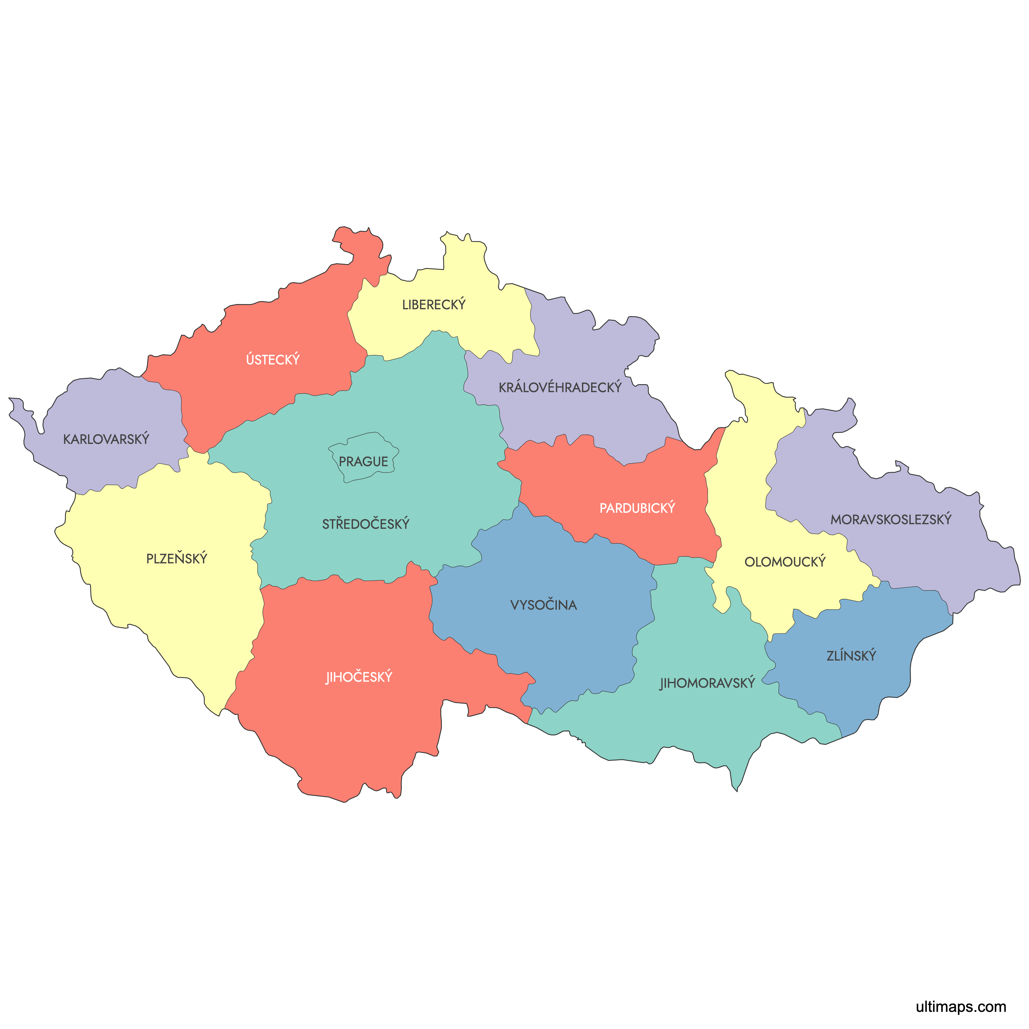
This map is divided into 14 regions:
- Jihočeský
- Jihomoravský
- Karlovarský
- Královéhradecký
- Liberecký
- Moravskoslezský
- Olomoucký
- Pardubický
- Plzeňský
- Prague
- Středočeský
- Ústecký
- Vysočina
- Zlínský
Check out the related maps below if you're looking for a different map of the same geographic region.
Related Maps

Free Downloads
You can download free blank Map of Czech Republic Regions and other maps in high resolution PNG, SVG and PDF formats from the blank maps section of the site: Download Blank Map of Czech Republic Regions
About the Czech Republic Regions
The Czech Republic is organized into 13 administrative regions, known as “kraje,” and one capital city region, Prague. Each region manages local governance, education, and infrastructure, and their boundaries have become an important reference for business planning, demographic analysis, and regional statistics.
Main facts about the Czech Republic regions:
- Number of regions: 13 plus the City of Prague (14 total)
- Largest region by area: Central Bohemian Region (Středočeský kraj)
- Most populous region: Central Bohemian Region
- Capital city region: Prague (Praha)
- Regions have been in place since the reform of territorial administration in 2000
- Neighboring countries: Germany, Austria, Slovakia, Poland
- Boundaries are used for elections, service area planning, and regional management
Each region has its own unique characteristics, administrative structure, and role in the national economy.
Updates
Sep 15:
- Added map of Czhechia with labels