Map of Norway Counties
Norway is divided into 15 counties, known as fylker, each serving as a primary administrative division. Explore the counties and their boundaries with our interactive maps. Download free maps or learn more about creating a custom map of Norway to highlight your own data.
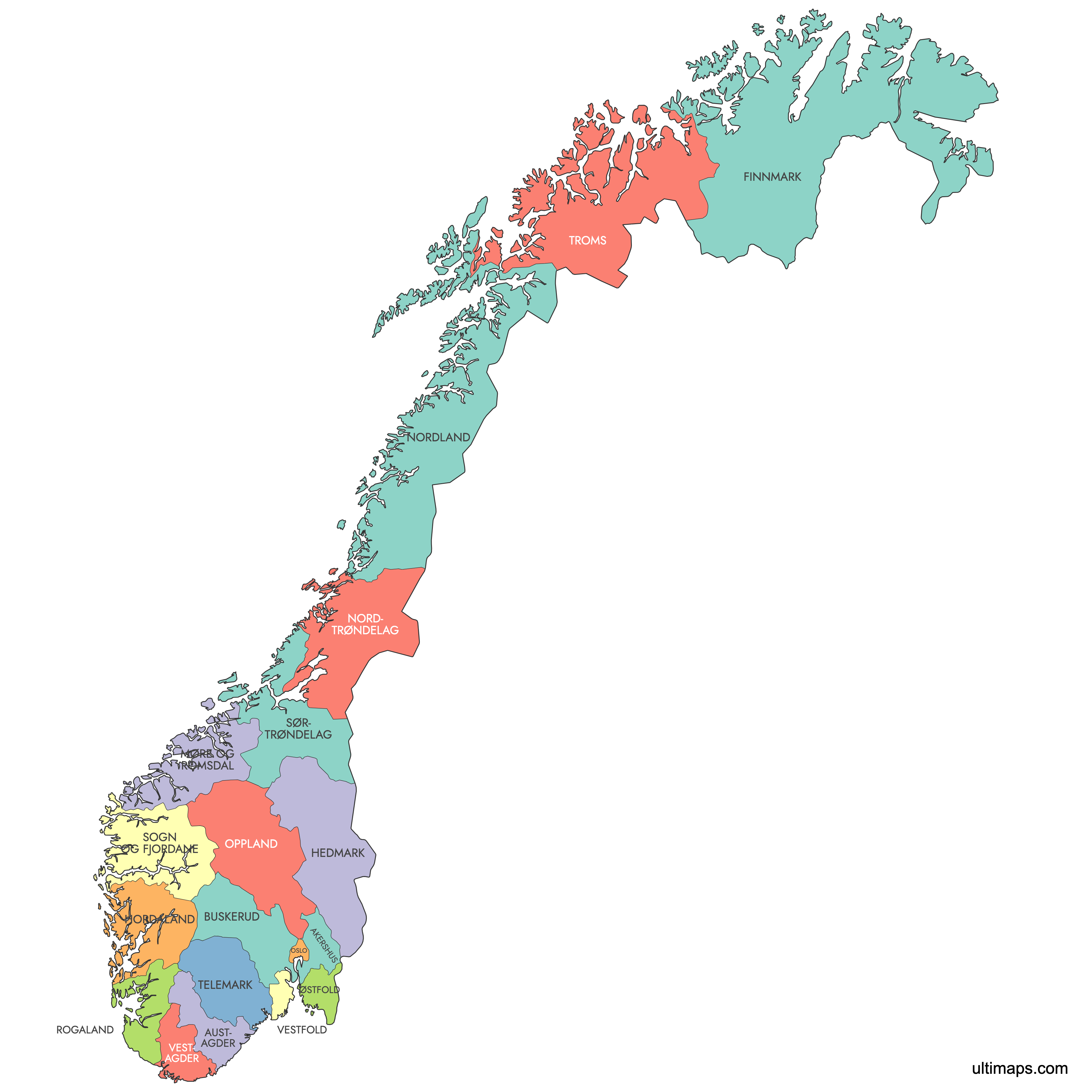
Interactive Map of Norway Counties
List of Counties (19)
| # | County |
|---|---|
| 1 | |
| 2 | |
| 3 | |
| 4 | |
| 5 | |
| 6 | |
| 7 | |
| 8 | |
| 9 | |
| 10 | |
| 11 | |
| 12 | |
| 13 | |
| 14 | |
| 15 | |
| 16 | |
| 17 | |
| 18 | |
| 19 |
Norway Counties: Key Facts
- Total number of counties: 15 (as of January 1, 2024)
- Largest county by area: Trøndelag - 42,201.59 square kilometers (16,297 square miles)
- Most populous county: Oslo - 717,710 residents
- Smallest county by area: Oslo - 454.12 square kilometers (175.3 square miles)
- Counties with major urban centers: Oslo (Oslo), Vestland (Bergen), Rogaland (Stavanger), Trøndelag (Trondheim)
- Recent administrative changes: Viken was abolished in 2024, returning to Akershus, Buskerud, and Østfold
- Governance: County councils elected every four years
- International border: with Russia, Finland and Sweden
Interesting Facts
- Oslo's unique status: Functions as both a municipality and a county
- Historical mergers: Trøndelag was formed in 2018 from Nord-Trøndelag and Sør-Trøndelag
Free Downloads
You can download free blank Map of Norway Counties and other maps in high resolution PNG, SVG and PDF formats from the blank maps section of the site: Download Blank Map of Norway Counties
Custom Map Features
This map supports labels.
This map is divided into 19 counties.
Updates
Jun 17, 2025:
- Added map of Norwegian counties and its labeled version
Frequently Asked Questions
Norway has 15 counties, known locally as fylker.
You can use Ultimaps to create custom maps of Norway. Color-code counties manually or upload data, place pins, customize look and feel, and export to PNG, PDF, or SVG.
