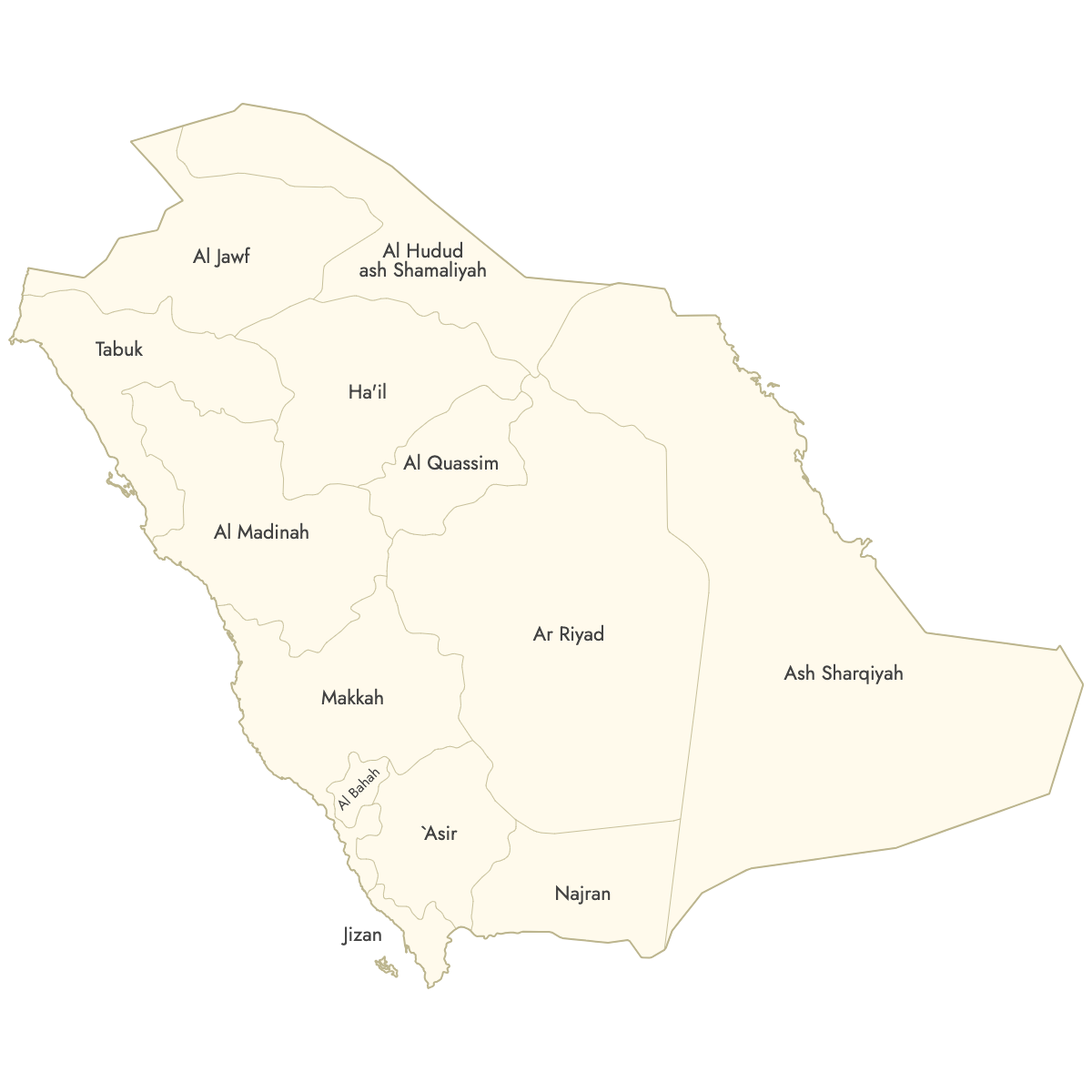
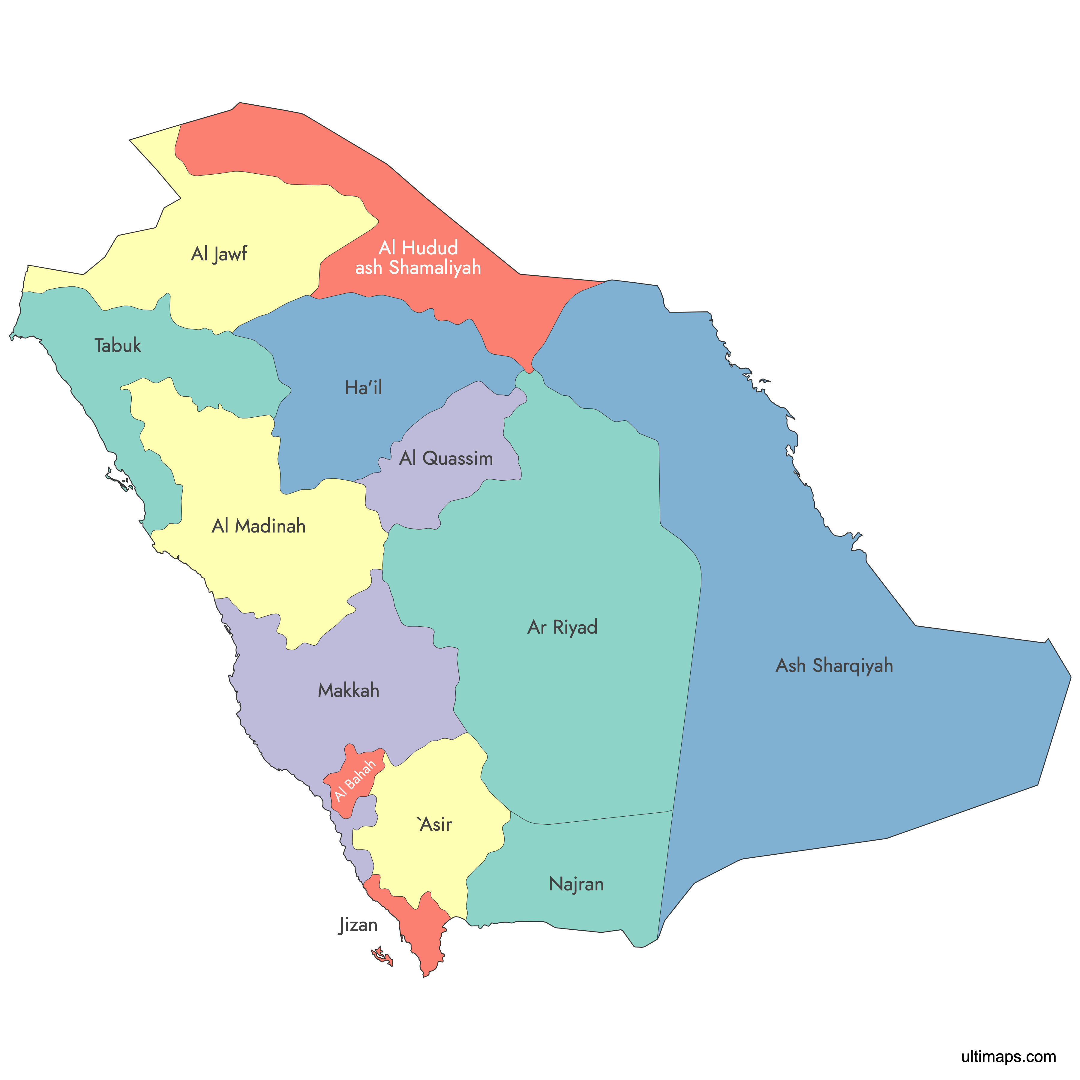
Map of Saudi Arabia Provinces
Create a custom map of Saudi Arabia's provinces with our customizable features, perfect for those looking to print or further personalize their maps. Export your visualizations in high-resolution PNG or SVG formats, making them ideal for professional presentations and educational use.
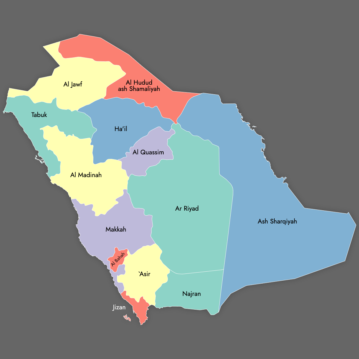
You can fill the provinces with colors based on data from Excel, Google Sheets, or CSV files, and add pins to highlight specific locations on the map. Alternatively, you can color the provinces manually or let our AI guide you in the process.
For web applications, create an interactive map of Saudi Arabian provinces that offers an additional layer of information. Users can explore the map by hovering over or clicking on specific regions, making it an excellent tool for online platforms that aim to engage users with in-depth geographical insights.
Map Details
This map is divided into 13 provinces:
- `Asir
- Al Bahah
- Al Hudud ash Shamaliyah
- Al Jawf
- Al Madinah
- Al Quassim
- Ar Riyad
- Ash Sharqiyah
- Ha'il
- Jizan
- Makkah
- Najran
- Tabuk
Check out the related maps below if you're looking for a different map of the same geographic region.
Related Maps
Free Downloads
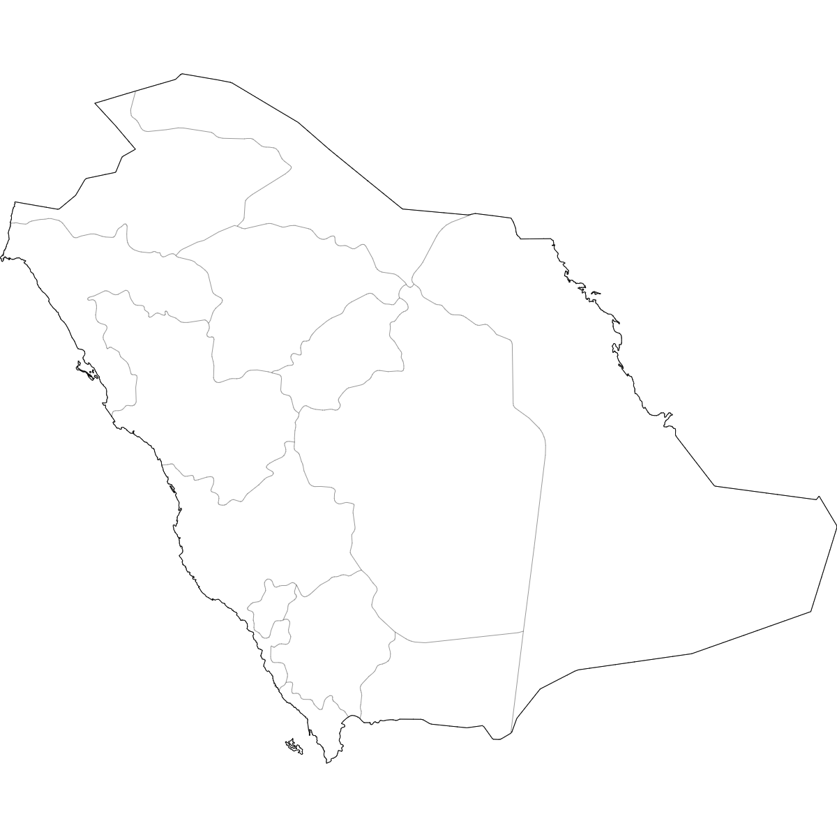
You can download free blank Map of Saudi Arabia Provinces and other maps in high resolution PNG, SVG and PDF formats from the blank maps section of the site: Download Blank Map of Saudi Arabia Provinces
Updates
Mar 11, 2025:
- Added labeled version
Apr 14, 2024:
- Added map of Saudi Arabia Provinces