Map of Greece Regions
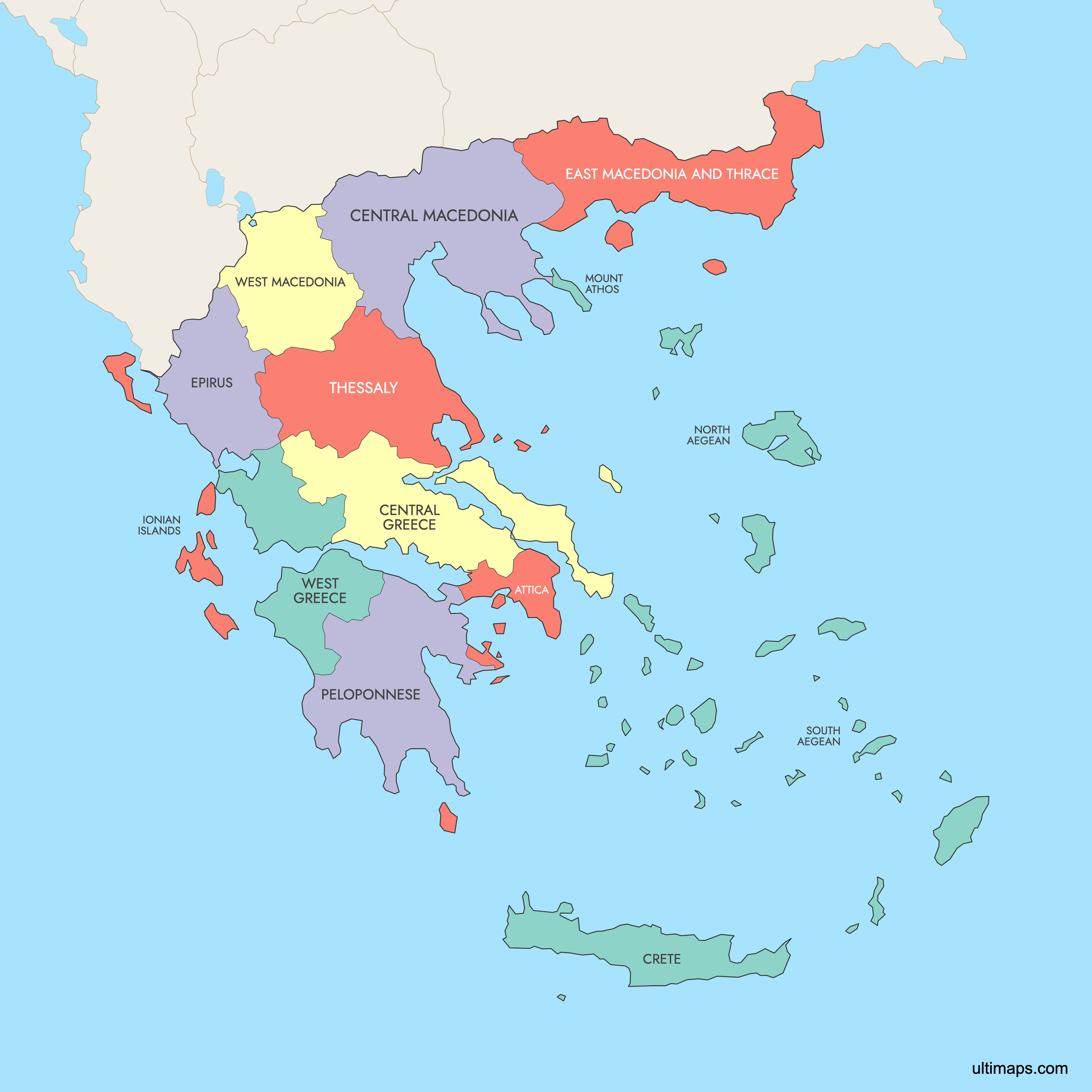
Greece is divided into 13 administrative regions (periféreies), plus the autonomous monastic state of Mount Athos. Established under the Kallikratis Plan in 2011, these regions replaced the older prefecture system and serve as the country's primary administrative divisions. They span from the mainland borders with Albania, North Macedonia, Bulgaria, and Turkey to hundreds of islands across the Aegean, Ionian, and Mediterranean seas. Use the interactive maps below to explore Greece's regions and their boundaries. Download free maps or learn more about creating a custom map of Greece to visualize your own data.
Interactive Map of Greece Regions
List of Regions (14)
| # | Region |
|---|---|
| 1 | |
| 2 | |
| 3 | |
| 4 | |
| 5 | |
| 6 | |
| 7 | |
| 8 | |
| 9 | |
| 10 | |
| 11 | |
| 12 | |
| 13 | |
| 14 |
Greece Regions: Key Facts
- Total number of regions: 13 administrative regions, plus the autonomous monastic state of Mount Athos
- Most populous region: Attica, home to Athens, with approximately 3.8 million residents (2021 census)
- Least populous region: Mount Athos with fewer than 2,000 residents (2021), almost entirely monks
- Largest region by area: Crete at 8,259 square miles (21,380 km²)
- Smallest region by area: Ionian Islands at approximately 1,006 square miles (2,607 km²)
- Major urban centers: Athens and Piraeus (Attica), Thessaloniki (Central Macedonia), Heraklion and Chania (Crete), Larissa (Thessaly), Patras (Peloponnese)
- Capital: Athens, located in the Attica region
- Borders: Albania, North Macedonia, Bulgaria, and Turkey on land; Ionian Sea (west), Mediterranean Sea (south), Aegean Sea (east), and Sea of Crete
- Time zone: Eastern European Time (EET, UTC+2), with summer time (EEST, UTC+3) from late March to late October
- Boundary history: The current 13-region structure was established in 2011 under the Kallikratis reform, replacing 54 prefectures. Before 1987, Greece used 9 traditional geographic regions.
Interesting Facts
- Mount Athos is the only place in the European Union where women are constitutionally forbidden from entering. This ban has been in place since the 10th century to preserve its monastic traditions. It is also a UNESCO World Heritage site with 20 Eastern Orthodox monasteries.
- Crete was the center of the Minoan civilization (circa 3000-1100 BCE), considered Europe's oldest advanced society. The Palace of Knossos near Heraklion is one of its most famous archaeological sites.
- Thessaly contains Greece's most fertile agricultural plain, producing around 35% of the country's cotton along with significant wheat harvests.
- The traditional region of Macedonia remains the largest by cultural-geographic area at 13,210 square miles (34,213 km²), even though it is now split across multiple administrative regions.
- Rhodes Medieval Old Town in the South Aegean region is the largest inhabited medieval town in Europe and a UNESCO World Heritage site.
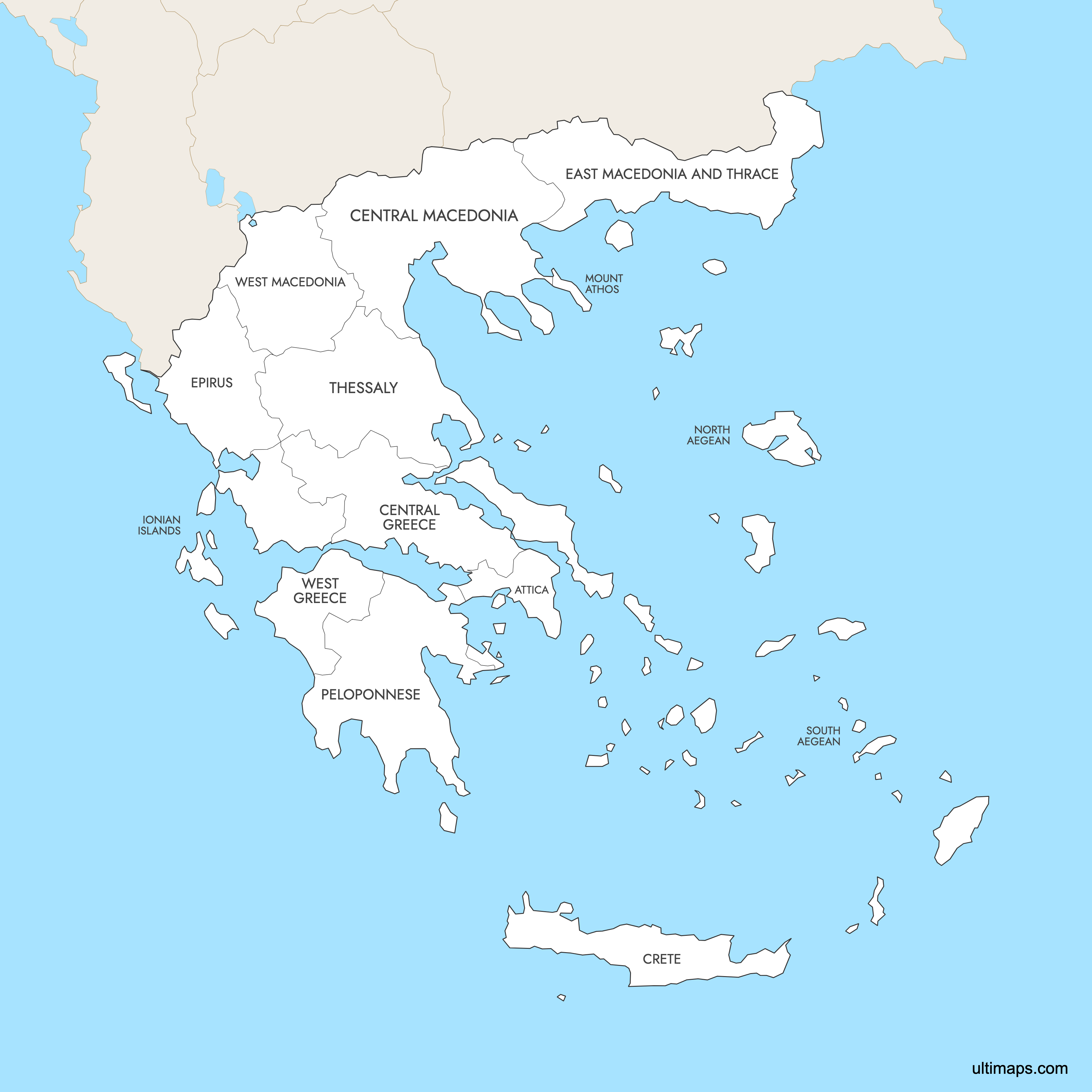
Free Downloads
 Colored Map of Greece Regions with Surrounding Areaspng777 KB
 Labeled Map of Greece Regions with Surrounding Areaspng765 KB
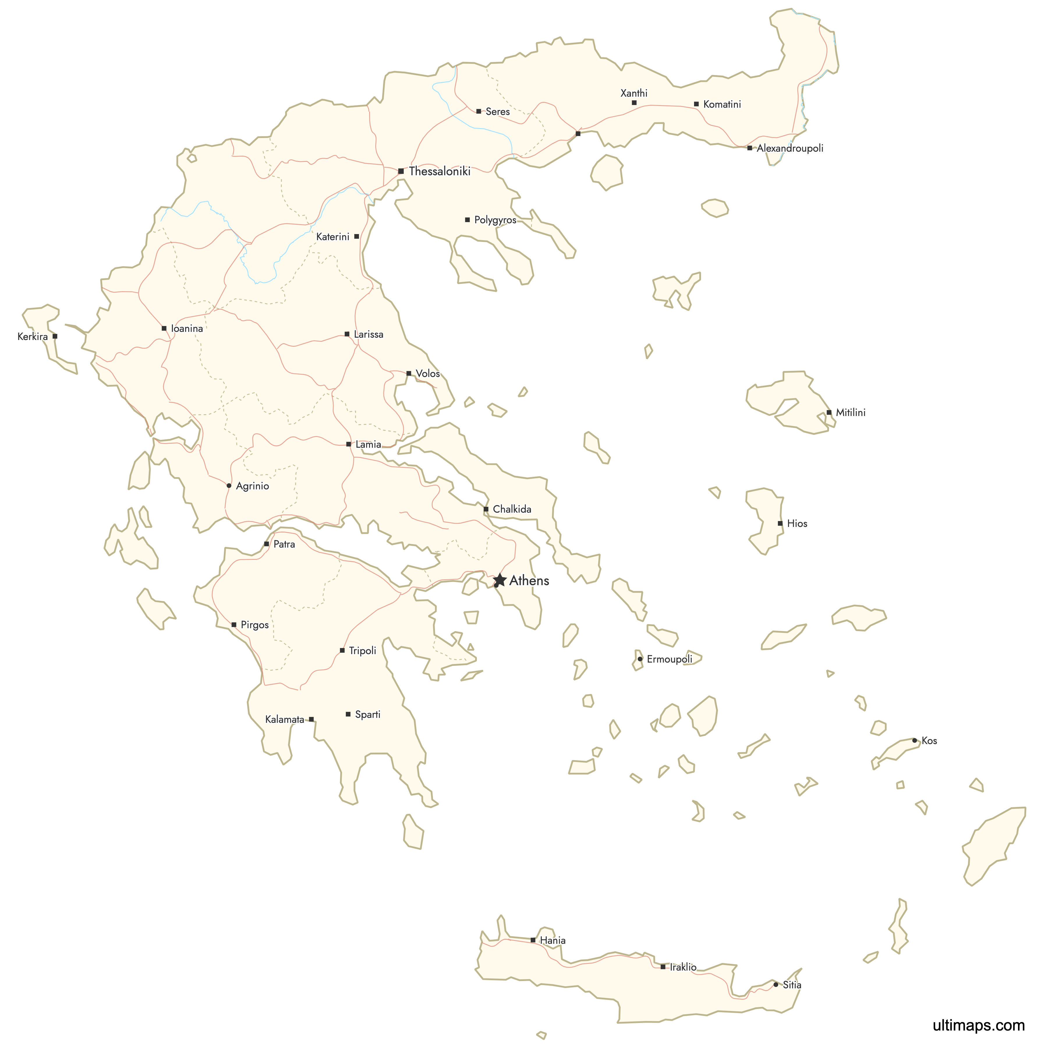
 Map of Greece Regions with Citiespng963 KB
You can download free blank Map of Greece Regions and other maps in high resolution PNG, SVG and PDF formats from the blank maps section of the site: Download Blank Map of Greece Regions
Custom Map Features
This map supports labels.
This map supports surrounding areas, roads, rivers and cities. New
This map is divided into 14 regions.
Updates
Apr 23, 2026:
- Added map of Greece Regions with surrounding countries, cities and roads
Frequently Asked Questions
Greece has 13 administrative regions (periféreies), plus the autonomous monastic state of Mount Athos. These were established in 2011 under the Kallikratis Plan, which replaced the previous system of 54 prefectures. The 13 regions are further divided into 74 regional units.
Crete is the largest region by area at 8,259 square miles (21,380 km²). It is also Greece's largest island and home to major cities like Heraklion and Chania. The traditional geographic region of Macedonia is even larger at 13,210 square miles (34,213 km²), but it is split across several modern administrative regions.
The Ionian Islands is the smallest region by area at approximately 1,006 square miles (2,607 km²). Located off the western coast of Greece, this region includes islands such as Corfu, whose Old Town is a UNESCO World Heritage site known for its Venetian architecture.
Attica is the most populated region with approximately 3.8 million residents according to the 2021 census. It contains Athens, the national capital, and the port city of Piraeus. Attica alone accounts for roughly one-third of Greece's total population.
Greece's regions are home to numerous world-famous landmarks. The Acropolis and Parthenon are in Attica (Athens). The Meteora Monasteries, a UNESCO site with monasteries perched on rock pillars, are in Thessaly. Delphi, the ancient sanctuary of Apollo, is in Central Greece. Olympia, birthplace of the Olympic Games in 776 BCE, is in the Peloponnese. Crete has the Palace of Knossos and Samaria Gorge, Europe's longest gorge at 10 miles (16 km).
The current 13-region structure was established on January 1, 2011, under the Kallikratis reform plan. This replaced the older system of 54 prefectures (nomoi) to streamline administration and reduce bureaucracy, partly in response to Greece's financial crisis. Before 1987, Greece used 9 traditional geographic regions.
Mount Athos is an autonomous monastic state on a peninsula in northeastern Greece. It functions as a distinct administrative entity separate from the 13 standard regions. Fewer than 2,000 people live there (2021 data), almost all of them monks in 20 Eastern Orthodox monasteries. It is a UNESCO World Heritage site and the only place in the EU where women are constitutionally forbidden from entering.
All of Greece, including its islands, uses Eastern European Time (EET, UTC+2). During summer, from late March to late October, clocks move forward to Eastern European Summer Time (EEST, UTC+3). There is no variation between regions.
Greece shares land borders with four countries: Albania and North Macedonia to the north, Bulgaria to the northeast, and Turkey to the east. It is surrounded by the Ionian Sea to the west, the Mediterranean Sea to the south, the Aegean Sea to the east, and the Sea of Crete between the mainland and the island of Crete.
You can use Ultimaps to create custom maps of Greece. Color-code regions manually or upload your data, place pins, customize the look and feel, and export to PNG, PDF, or SVG. No sign-up required.