Map of Denmark Regions
Denmark is divided into 5 regions (regioner), established by the 2007 Municipal Reform that replaced the former 13 counties. These regions span the Jutland peninsula and major islands like Zealand and Funen. Use the interactive maps below to explore Denmark's regions and their boundaries. Download free maps or learn more about creating a custom map of Denmark to visualize your own data.
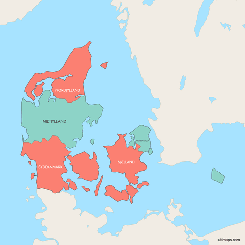
Interactive Map of Denmark Regions
List of Regions (5)
| # | Region |
|---|---|
| 1 | |
| 2 | |
| 3 | |
| 4 | |
| 5 |
Denmark Regions: Key Facts
- Total number of regions: 5, established by the 2007 Danish Municipal Reform which replaced the previous 13 counties and reduced municipalities from 270 to 98
- Most populous region: Capital Region of Denmark (Hovedstaden) with 1,867,948 residents (2022), home to Copenhagen
- Least populous region: North Denmark Region (Nordjylland) with 591,740 residents (2022)
- Largest region by area: Central Denmark Region (Midtjylland) at 13,000 km² (5,019 sq mi)
- Smallest region by area: Capital Region of Denmark (Hovedstaden) at 2,546.3 km² (983 sq mi)
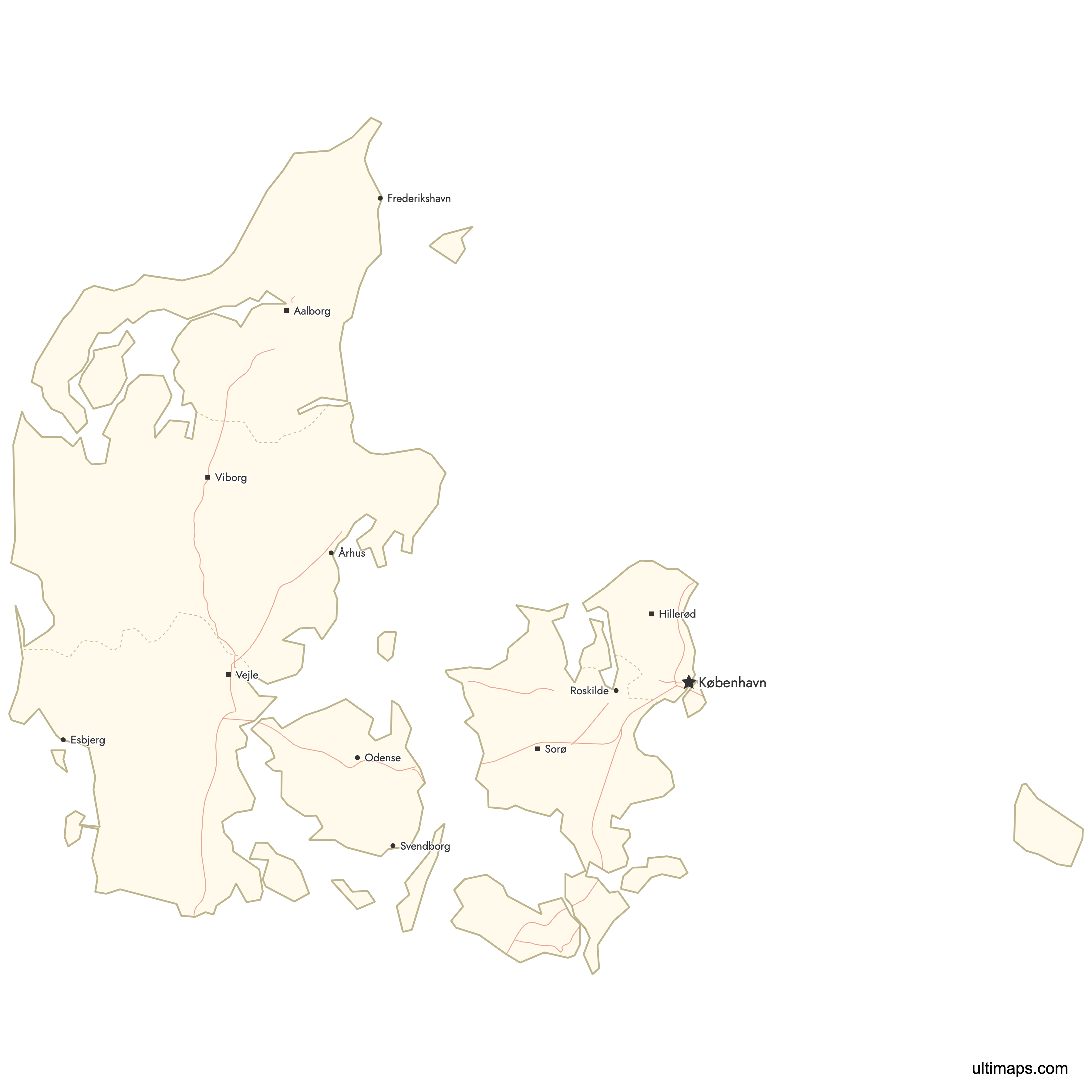
- Regions with major urban centers: Capital Region (Copenhagen), Central Denmark (Aarhus), Southern Denmark (Odense), North Denmark (Aalborg), Zealand (Roskilde)
- Capital of Denmark: Copenhagen, located in the Capital Region
- Administrative seats: Hillerød (Capital Region), Viborg (Central Denmark), Aalborg (North Denmark), Sorø (Zealand), Vejle (Southern Denmark)
- Borders and surroundings: Mainland Jutland borders Germany to the south; the country is surrounded by the North Sea (west), Skagerrak (northwest), Kattegat (northeast), and Baltic Sea (east)
- Time zone: Central European Time (CET, UTC+1), Central European Summer Time (CEST, UTC+2) in summer
- Boundaries established: January 1, 2007, with no major changes since
Interesting Facts
- Over 30% of Denmark's total population lives in the Capital Region, despite it being the smallest region by area at just 2,546.3 km² (983 sq mi). This gives it a population density of 734 per km², roughly seven times higher than any other region.
- Unlike the former counties they replaced, Denmark's regions do not have traditional coats of arms. Instead, each region uses a modern logotype for its visual identity.
- The primary responsibility of Denmark's regions is healthcare. They also manage public transport coordination, environmental planning, and education-related tasks, but they do not collect taxes directly.
- The island of Bornholm, located in the Baltic Sea far from the rest of Denmark, was incorporated into the Capital Region after the 2007 reform, despite being geographically closer to Sweden and Poland.
- Denmark's terrain is mostly low and flat with gently rolling plains. The country includes over 400 islands, of which about 70 are inhabited, spread across multiple regions.
Free Downloads
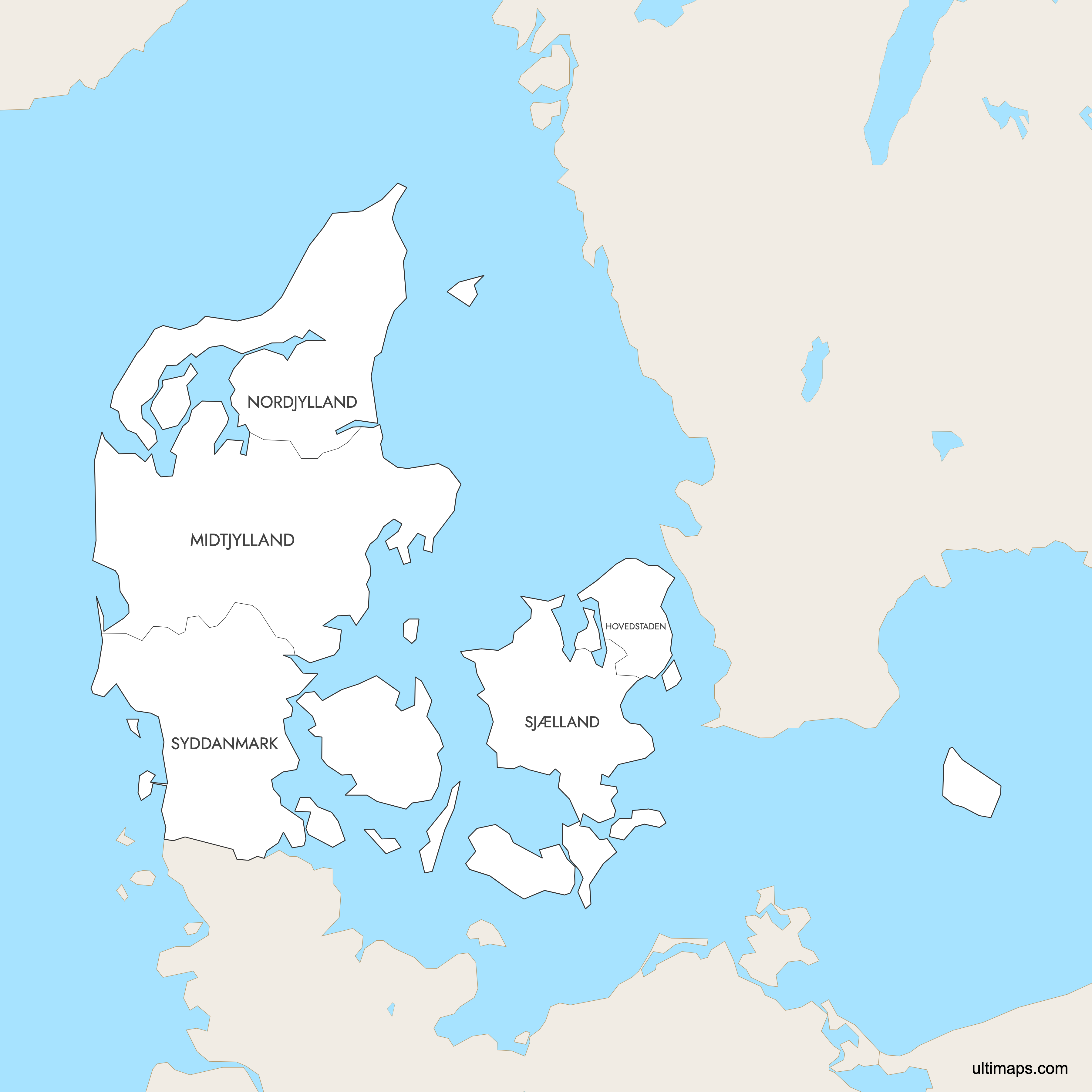
 Colored Map of Denmark Regions with Surrounding Areaspng700 KB
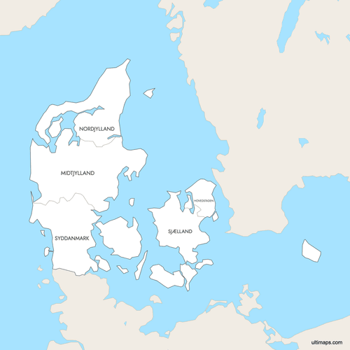 Labeled Map of Denmark Regions with Surrounding Areaspng702 KB
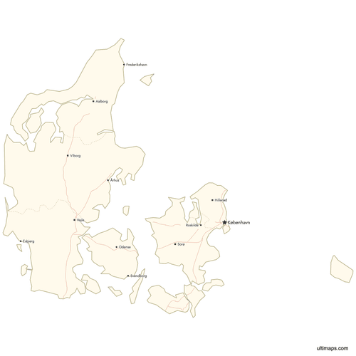 Map of Denmark Regions with Citiespng576 KB

You can download free blank Map of Denmark Regions and other maps in high resolution PNG, SVG and PDF formats from the blank maps section of the site: Download Blank Map of Denmark Regions
Custom Map Features
This map supports labels.
This map supports surrounding areas, roads and cities. New
This map is divided into 5 regions.
Updates
Apr 23, 2026:
- Added map of Denmark regions with surrounding countries, cities and roads
Frequently Asked Questions
Denmark has 5 regions (regioner). They were created on January 1, 2007, as part of the Danish Municipal Reform, which replaced the previous system of 13 counties (amter). The five regions are the Capital Region (Hovedstaden), Central Denmark (Midtjylland), North Denmark (Nordjylland), Zealand (Sjælland), and Southern Denmark (Syddanmark).
Central Denmark Region (Midtjylland) is the largest at 13,000 km² (5,019 sq mi). It covers a large portion of the Jutland peninsula and includes the city of Aarhus, Denmark's second-largest city. Its administrative seat is Viborg.
The Capital Region of Denmark (Hovedstaden) is the smallest at 2,546.3 km² (983 sq mi). Despite its small size, it is by far the most densely populated region with 734 people per km², as it contains Copenhagen and its surrounding metropolitan area.
The Capital Region of Denmark (Hovedstaden) is the most populated with 1,867,948 residents as of 2022. It is home to Copenhagen, the national capital and largest city. Over 30% of Denmark's total population of 5,873,420 lives in this region.
North Denmark Region (Nordjylland) is the least populated with 591,740 residents (2022). It covers the northern tip of the Jutland peninsula and has a population density of just 75 per km². Its largest city and administrative seat is Aalborg.
Copenhagen (Capital Region) features Tivoli Gardens, the Little Mermaid statue, and Christiansborg Palace. Roskilde (Zealand) has the UNESCO-listed Roskilde Cathedral and the Viking Ship Museum. Odense (Southern Denmark) is the birthplace of Hans Christian Andersen and home to his museum. Aarhus (Central Denmark) has the ARoS Art Museum and Den Gamle By open-air museum. Aalborg (North Denmark) features the Lindholm Høje Viking burial site.
Each region has a designated administrative seat: Hillerød (Capital Region), Viborg (Central Denmark), Aalborg (North Denmark), Sorø (Zealand), and Vejle (Southern Denmark). Notably, the administrative seat of the Capital Region is Hillerød, not Copenhagen, even though Copenhagen is the national capital and largest city in that region.
Denmark's regions are primarily responsible for healthcare, including hospitals and psychiatric services. They also handle regional public transport coordination, environmental planning, and education coordination. Unlike municipalities, regions do not collect taxes directly and are funded through state grants and municipal contributions.
The 2007 Danish Municipal Reform replaced the 13 former counties (amter) with 5 larger regions. At the same time, the number of municipalities was reduced from 270 to 98. This reform aimed to create larger, more efficient administrative units, particularly for healthcare delivery. The regional boundaries have remained unchanged since 2007.
You can use Ultimaps to create custom maps of Denmark. Color-code regions manually or upload your data, place pins, customize the look and feel, and export to PNG, PDF, or SVG. No sign-up required.