Map of Switzerland Cantons
Switzerland is divided into 26 cantons, each acting as a federal state with its own constitution and government. Use the interactive maps below to explore cantons and their boundaries. Download free maps or learn more about creating a custom map of Switzerland to visualize your own data.
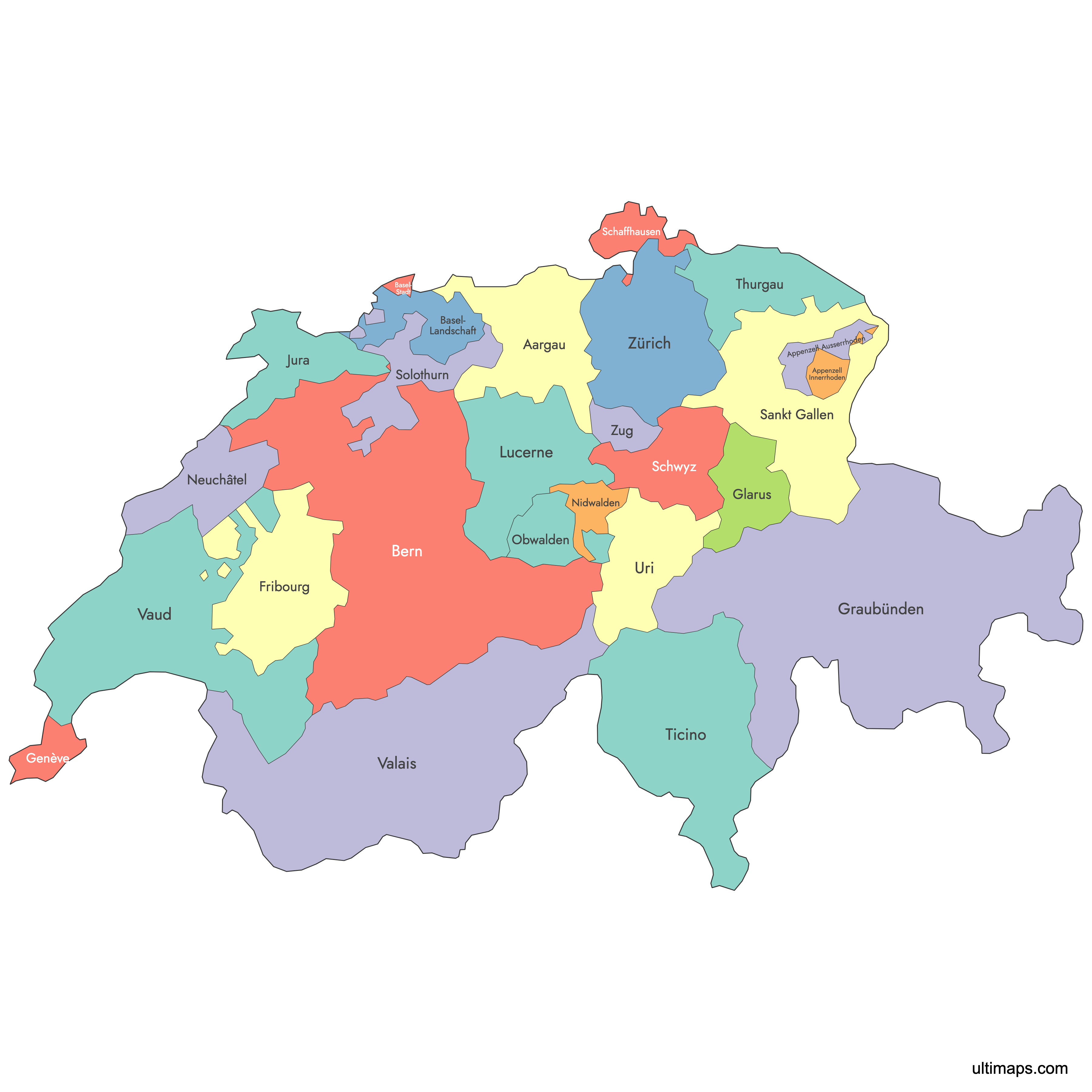
Interactive Map of Switzerland Cantons
List of Cantons (26)
| # | Canton |
|---|---|
| 1 | |
| 2 | |
| 3 | |
| 4 | |
| 5 | |
| 6 | |
| 7 | |
| 8 | |
| 9 | |
| 10 | |
| 11 | |
| 12 | |
| 13 | |
| 14 | |
| 15 | |
| 16 | |
| 17 | |
| 18 | |
| 19 | |
| 20 | |
| 21 | |
| 22 | |
| 23 | |
| 24 | |
| 25 | |
| 26 |
Switzerland Cantons: Key Facts
- Number of cantons: 26
- Largest canton by area: Grisons - 7,105 square kilometers (2,743 square miles)
- Smallest canton by area: Basel-Stadt - 37 square kilometers (15 square miles)
- Most populous canton: Zurich - 1.5 million residents
- Least populous canton: Appenzell Innerrhoden - 16,000 residents
- Language diversity: German, French, Italian, Romansh
- Historical development: Began with 3 cantons, expanded to 26 by the 1999 federal constitution
- Bordering countries: Austria, France, Germany
Interesting Facts
- The canton of Jura was the last to be added in 1979, after seceding from Bern.
- Switzerland's unique half-cantons are: Obwalden, Nidwalden, Basel-Stadt, Basel-Landschaft, Appenzell Ausserrhoden, Appenzell Innerrhoden
Free Downloads
You can download free blank Map of Switzerland Cantons and other maps in high resolution PNG, SVG and PDF formats from the blank maps section of the site: Download Blank Map of Switzerland Cantons
Custom Map Features
This map supports labels.
This map is divided into 26 cantons.
Updates
Sep 28, 2023:
- Added map of Switzerland Cantons
Frequently Asked Questions
Switzerland has 26 cantons, each serving as a federal state with its own government and constitution.
Grisons (Graubünden) is the largest canton by area, covering 7,105 square kilometers (2,743 square miles).
You can use Ultimaps to create custom maps of Switzerland. Highlight cantons, customize the appearance, add pins and export your map to PNG, PDF, or SVG.
The cantons use four official languages: German, French, Italian, and Romansh.
6 of 26 cantons are traditionally called "half-cantons" (Halbkanton): Obwalden, Nidwalden, Basel-Stadt, Basel-Landschaft, Appenzell Ausserrhoden, Appenzell Innerrhoden. The difference between half and full cantons is that half cantons get only 1 seat in the Council of States while full cantons get 2.
