Austria Map with States
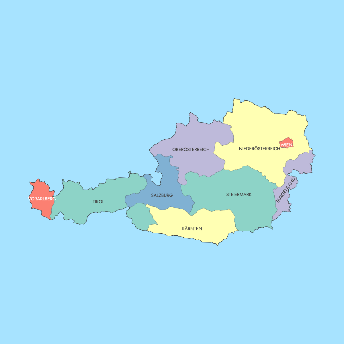
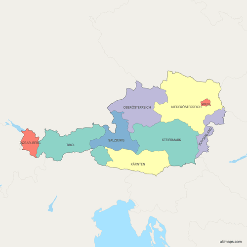
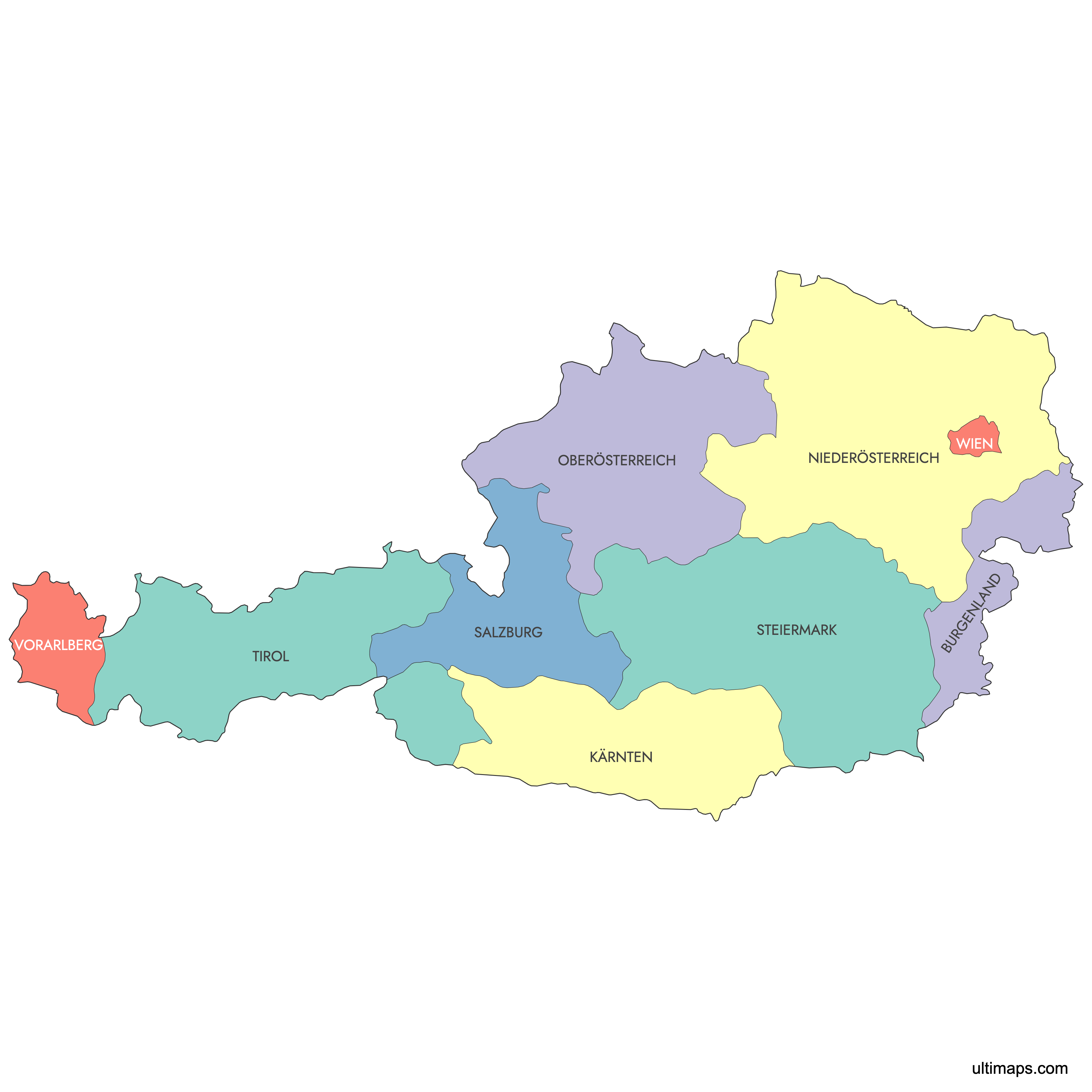
The map of Austria below shows all 9 federal states (Bundesländer), from Vorarlberg on Lake Constance in the west to Burgenland on the Hungarian border in the east. Vienna (Wien), the national capital, is also a state in its own right. It is the most populous state, with about 2.01 million residents (Statistik Austria, 1 January 2024), and the smallest by area at 415 km² (160 sq mi).
Lower Austria (Niederösterreich) surrounds Vienna on every side and is the largest state, covering 19,180 km² (7,405 sq mi) according to Statistik Austria. Burgenland was the last state to become part of Austria, when it was transferred from Hungary in 1921. You can use the editor to color each state from a list of numbers you paste in, and you don't need an account.
Interactive Austria Map with States
List of States (9)
| # | State |
|---|---|
| 1 | Burgenland |
| 2 | Kärnten |
| 3 | Niederösterreich |
| 4 | Oberösterreich |
| 5 | Salzburg |
| 6 | Steiermark |
| 7 | Tirol |
| 8 | Vorarlberg |
| 9 | Wien |
Austria's Federal States: Key Facts
- Total number of states: 9 Bundesländer. Below them are 94 districts, made up of 79 rural districts and 15 statutory cities
- Most populous state: Vienna (Wien), about 2.01 million (Statistik Austria, 1 January 2024)
- Least populous state: Burgenland, about 302,000 (Statistik Austria, 1 January 2024), with Eisenstadt as its capital
- Largest state by area: Lower Austria (Niederösterreich), 19,180 km² (7,405 sq mi), per Statistik Austria
- Smallest state by area: Vienna, 415 km² (160 sq mi), per Statistik Austria
- Major urban centers: Vienna, followed by Graz in Styria (Steiermark), Linz in Upper Austria (Oberösterreich), Salzburg in the state of the same name, and Innsbruck in Tyrol (Tirol)
- National capital: Vienna, in the northeast of the country, is a city-state that lies completely inside Lower Austria
- Borders: Austria is landlocked and borders 8 countries: Germany, the Czech Republic, Slovakia, Hungary, Slovenia, Italy, Switzerland and Liechtenstein. Vorarlberg has a shoreline on Lake Constance (Bodensee), which it shares with Germany and Switzerland
- Time zone: Central European Time (UTC+1), and Central European Summer Time (UTC+2) from late March to late October
- Historical note: The Federal Constitutional Law of 1 October 1920 set up the federal system. Burgenland joined in 1921, and Vienna became a separate state from Lower Austria on 1 January 1922. The states were restored in 1945 after Austria had been part of Germany from 1938 to 1945
Interesting Facts
- Tyrol has two separate parts. North Tyrol and East Tyrol lost their land connection in 1919, when the Treaty of Saint-Germain gave South Tyrol to Italy.
- Vienna remained Lower Austria's capital even after the two split, until Sankt Pölten was chosen in 1986. The state government moved there in 1997.
- Eisenstadt became Burgenland's capital in 1925. Sopron (Ödenburg), the planned capital, stayed in Hungary after a plebiscite in December 1921.
- The Fertő/Neusiedlersee Cultural Landscape around Lake Neusiedl, which Burgenland shares with Hungary, has been a UNESCO World Heritage Site since 2001.
- The Grossglockner, Austria's highest mountain at 3,798 m (12,461 ft), stands on the border between Carinthia and Tyrol.
Free Downloads
Free for personal and commercial use with a credit to Ultimaps. See the license terms for details.
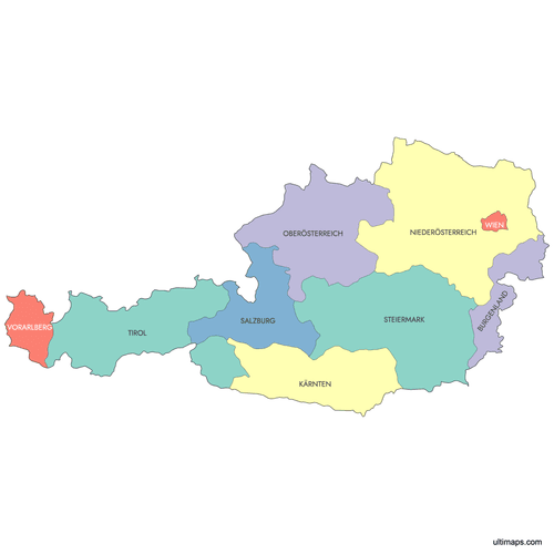 Colored Austria Map with Statespng330 KB
 Political Map of Austria with Statespng495 KB
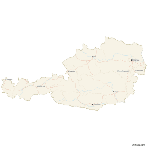 Map of Austria with Cities and Roadspng459 KB
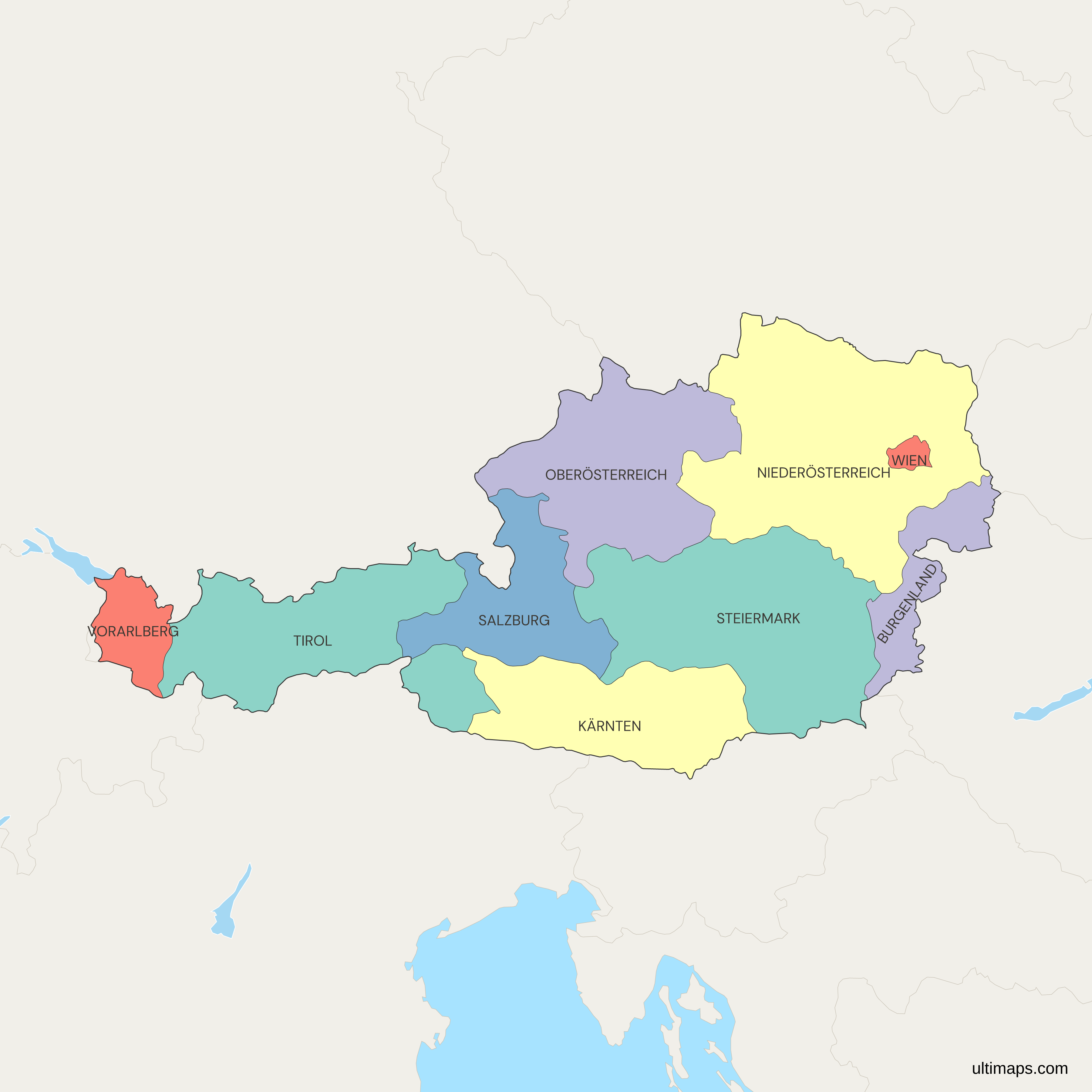
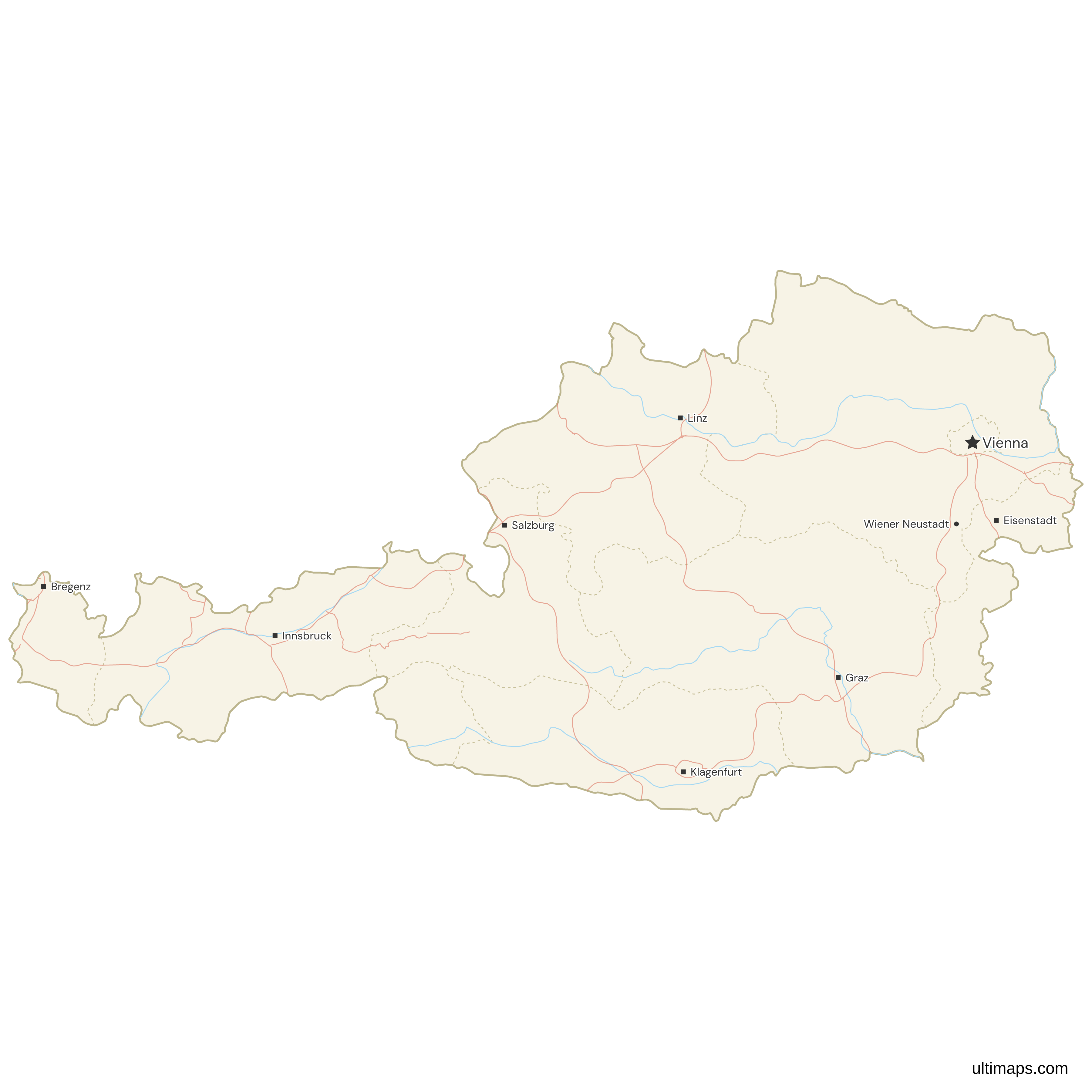
Need it without colors? The blank version of this map comes as a print-ready PDF (A4 and US Letter), a PNG and an editable SVG.
Custom Map Features
This map supports labels.
This map supports surrounding areas, roads, rivers and cities. New
This map is divided into 9 states.
Updates
Sep 15, 2025:
- Added map of Austrian states with labels
Frequently Asked Questions
Austria has 9 federal states, called Bundesländer or Länder in German. They are Burgenland, Carinthia (Kärnten), Lower Austria (Niederösterreich), Upper Austria (Oberösterreich), Salzburg, Styria (Steiermark), Tyrol (Tirol), Vorarlberg and Vienna (Wien). The map on this page shows all 9, which matches the official count. Each state has its own elected parliament (Landtag) and a government led by a governor (Landeshauptmann). The federal structure dates from the Federal Constitutional Law of 1920. Below the states, Austria is divided into 94 districts: 79 rural districts run by district authorities and 15 statutory cities that handle district administration themselves.
Lower Austria (Niederösterreich) is the largest Austrian state, covering 19,180 km² (7,405 sq mi) according to Statistik Austria. That is a little under a quarter of Austria's total area of about 83,880 km² (32,390 sq mi). The state lies in the northeast, surrounds Vienna completely, and borders the Czech Republic and Slovakia. The Danube runs through it from west to east, including the Wachau valley. Sankt Pölten has been the capital since 1986. Lower Austria is also the second most populous state, with about 1.72 million residents (Statistik Austria, 1 January 2024), after Vienna.
Vienna (Wien) is Austria's most populous state, with about 2.01 million residents (Statistik Austria, 1 January 2024). That is more than a fifth of the country's population of about 9.16 million on the same reference date. Vienna is also the national capital and the country's largest city. It passed 2 million residents in 2023 for the first time since the early 20th century. Vienna is also the smallest state by area, at 415 km² (160 sq mi), so it is by far the most densely populated. Lower Austria has the second-largest population, at about 1.72 million (Statistik Austria, 1 January 2024).
Vienna (Wien) is both. It is Austria's capital city and also one of the 9 federal states. It became a separate state on 1 January 1922, when it split from Lower Austria. Vienna's mayor also serves as the state governor, and the city council also sits as the state parliament. On the map, Vienna appears as a small unit of 415 km² (160 sq mi) inside Lower Austria, with no border on any other state or country. Lower Austria kept its government offices in Vienna for decades after the split, until they moved to Sankt Pölten in 1997.
Tyrol (Tirol) appears as two separate shapes on the map of Austria because of the peace settlement after World War I. The Treaty of Saint-Germain in 1919 gave South Tyrol to Italy, which cut the direct land link between North Tyrol, around the capital Innsbruck, and East Tyrol, around Lienz. Both parts still form one state with one government. A narrow section of Salzburg and Italian territory separates them, so a direct trip between them passes through Salzburg or Italy. When you color Tyrol in the editor, both parts take the same color.
The capitals of Austria's 9 states are Eisenstadt (Burgenland), Klagenfurt (Carinthia), Sankt Pölten (Lower Austria), Linz (Upper Austria), Salzburg (Salzburg), Graz (Styria), Innsbruck (Tyrol), Bregenz (Vorarlberg) and Vienna, which is a state capital as well as the national capital. Two of these capitals are recent choices. Eisenstadt became Burgenland's capital in 1925 because Sopron, the intended capital, stayed in Hungary. Sankt Pölten was chosen as the capital of Lower Austria in 1986, and the state government moved there from Vienna in 1997. Graz is the largest state capital after Vienna, and Linz is next.
Burgenland became part of Austria in 1921, which makes it the last state to join. The area had been part of the Kingdom of Hungary and had a mostly German-speaking population. The postwar treaties gave it to Austria, but a plebiscite in December 1921 kept the city of Sopron (Ödenburg) in Hungary. Without its largest town, Burgenland chose Eisenstadt as its capital in 1925. Today Burgenland is the least populous state, with about 302,000 residents (Statistik Austria, 1 January 2024). It covers 3,965 km² (1,531 sq mi) and borders Hungary, Slovakia and Slovenia.
Austria's states have German names that differ from the English names in 6 cases: Carinthia is Kärnten, Lower Austria is Niederösterreich, Upper Austria is Oberösterreich, Styria is Steiermark, Tyrol is Tirol and Vienna is Wien. Burgenland, Salzburg and Vorarlberg are the same in both languages. Official Austrian statistics use the German names. The ISO 3166-2 codes run from AT-1 to AT-9 in alphabetical order of the German names: AT-1 Burgenland, AT-2 Kärnten, AT-3 Niederösterreich, AT-4 Oberösterreich, AT-5 Salzburg, AT-6 Steiermark, AT-7 Tirol, AT-8 Vorarlberg and AT-9 Wien. You can use these codes to match rows in a spreadsheet to states.
Build your own map of Austria with the browser editor on this page, which needs no account. One option is to color states by hand, for example to set the western Alpine states apart from Vienna and its neighbors. The other is to type or paste a number for each of the 9 states, which produces a choropleth with a legend. Pins can mark towns or ski resorts, and labels, fonts, border style and background can all be changed. On the free plan you export a standard PNG that carries a small Ultimaps credit. SVG, PDF and high-resolution PNG need Pro.