Liechtenstein Map with Municipalities
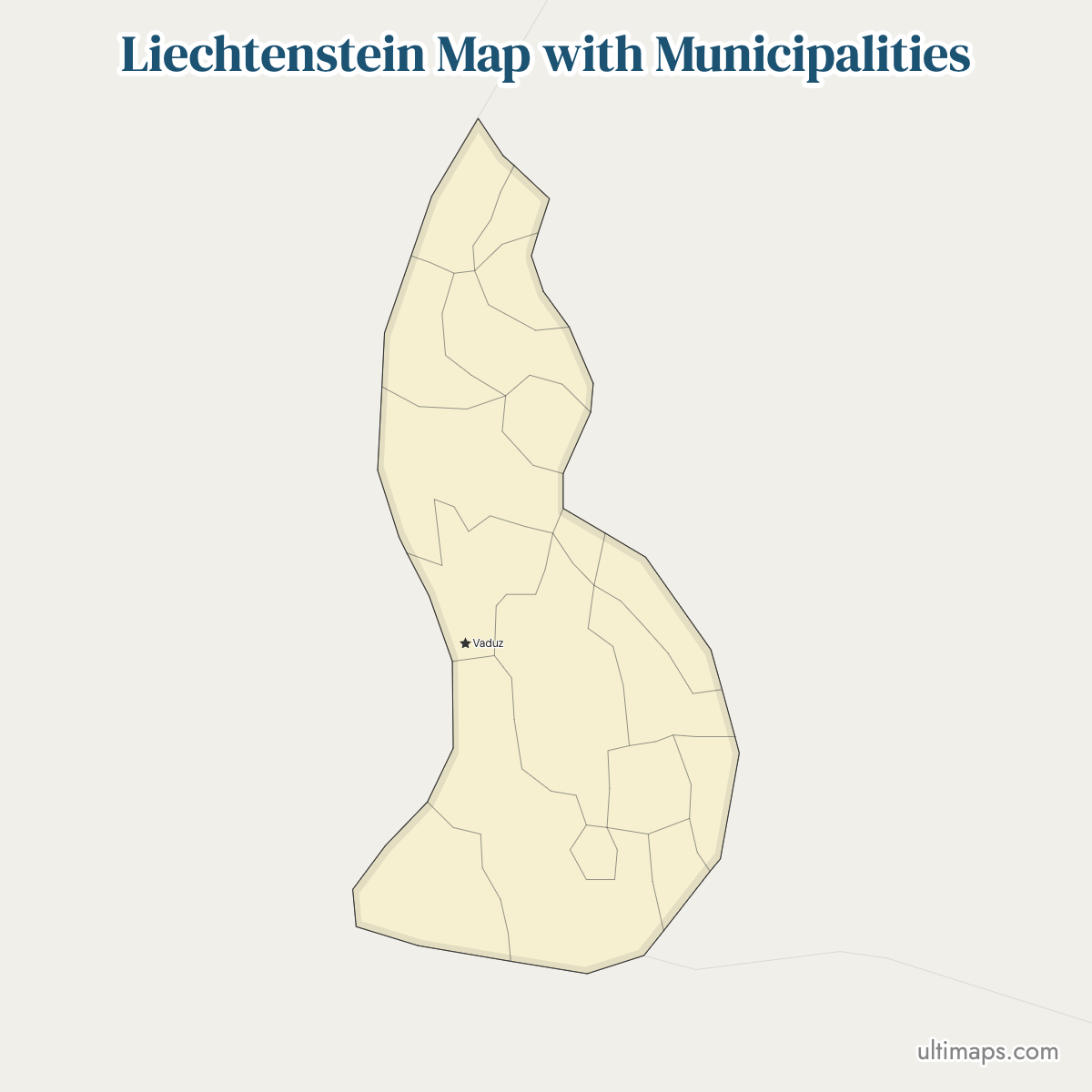
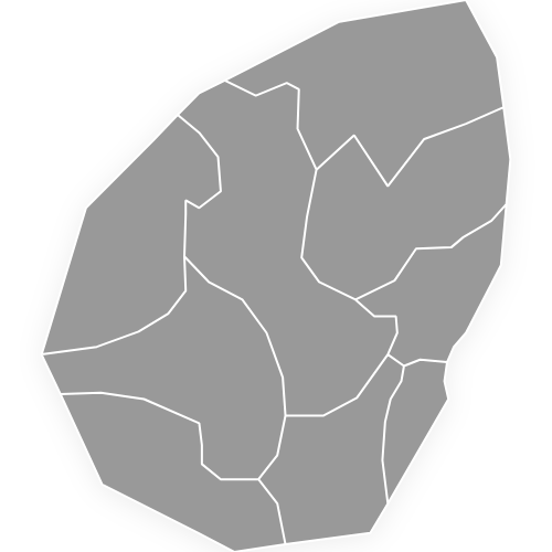
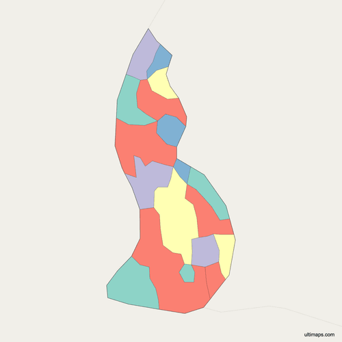
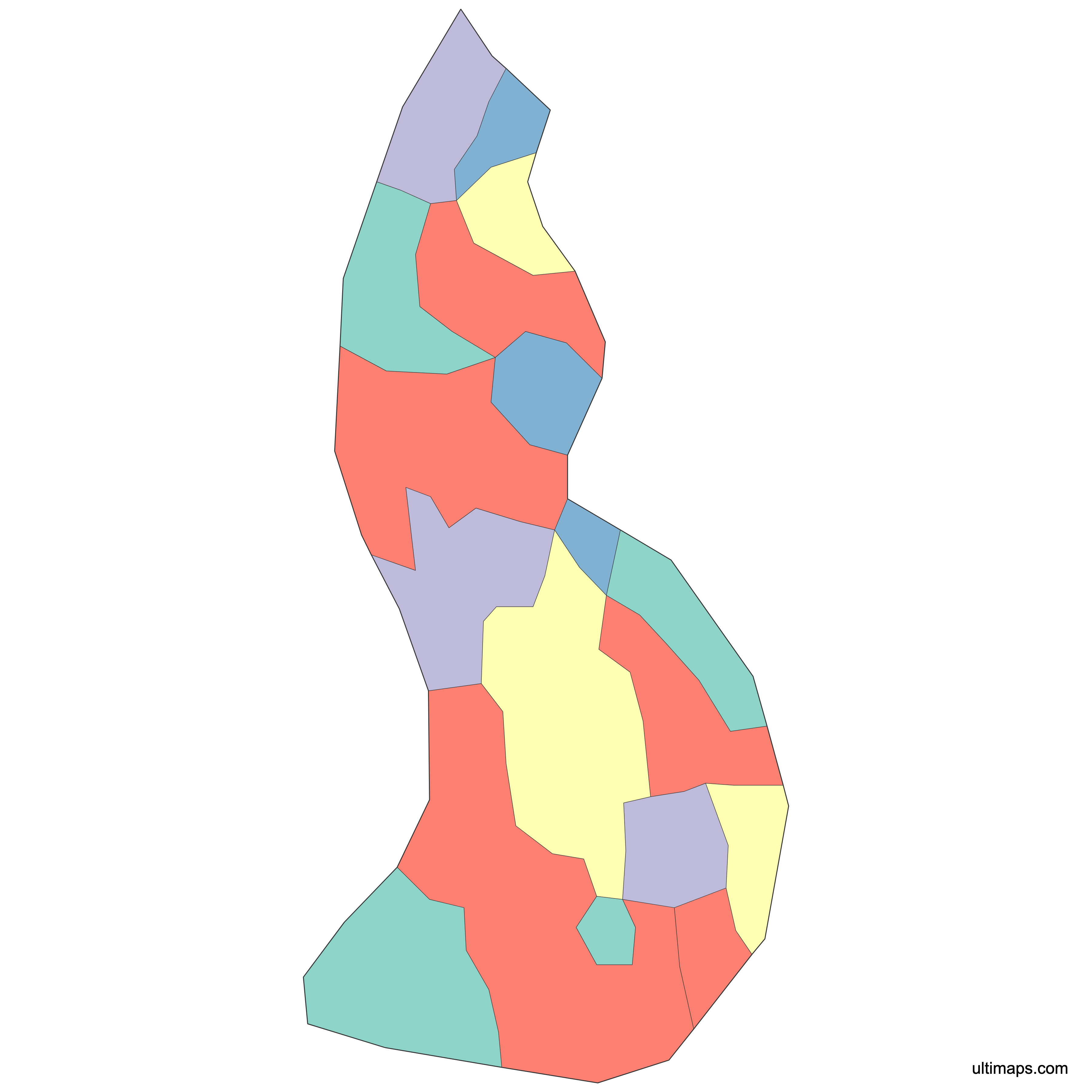
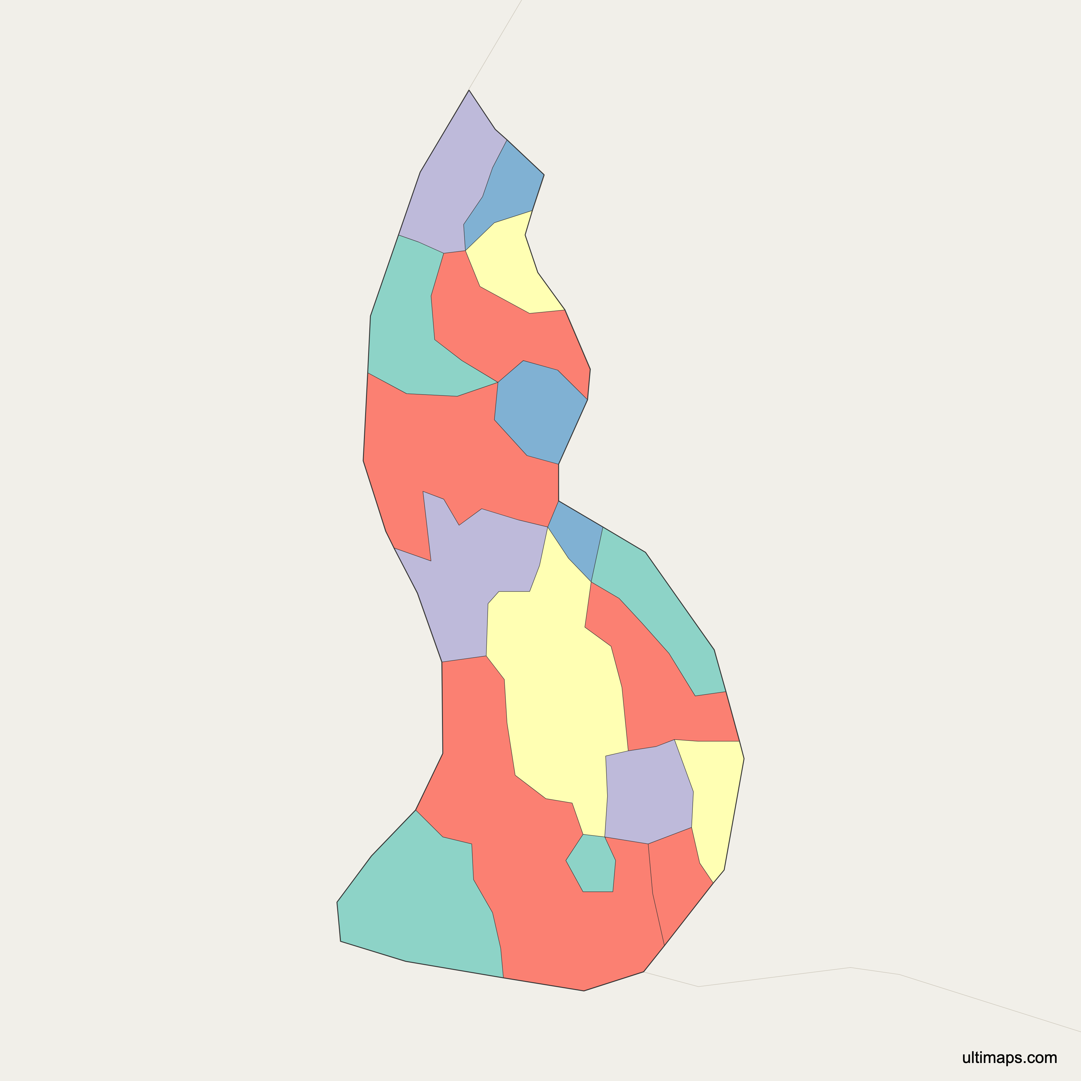
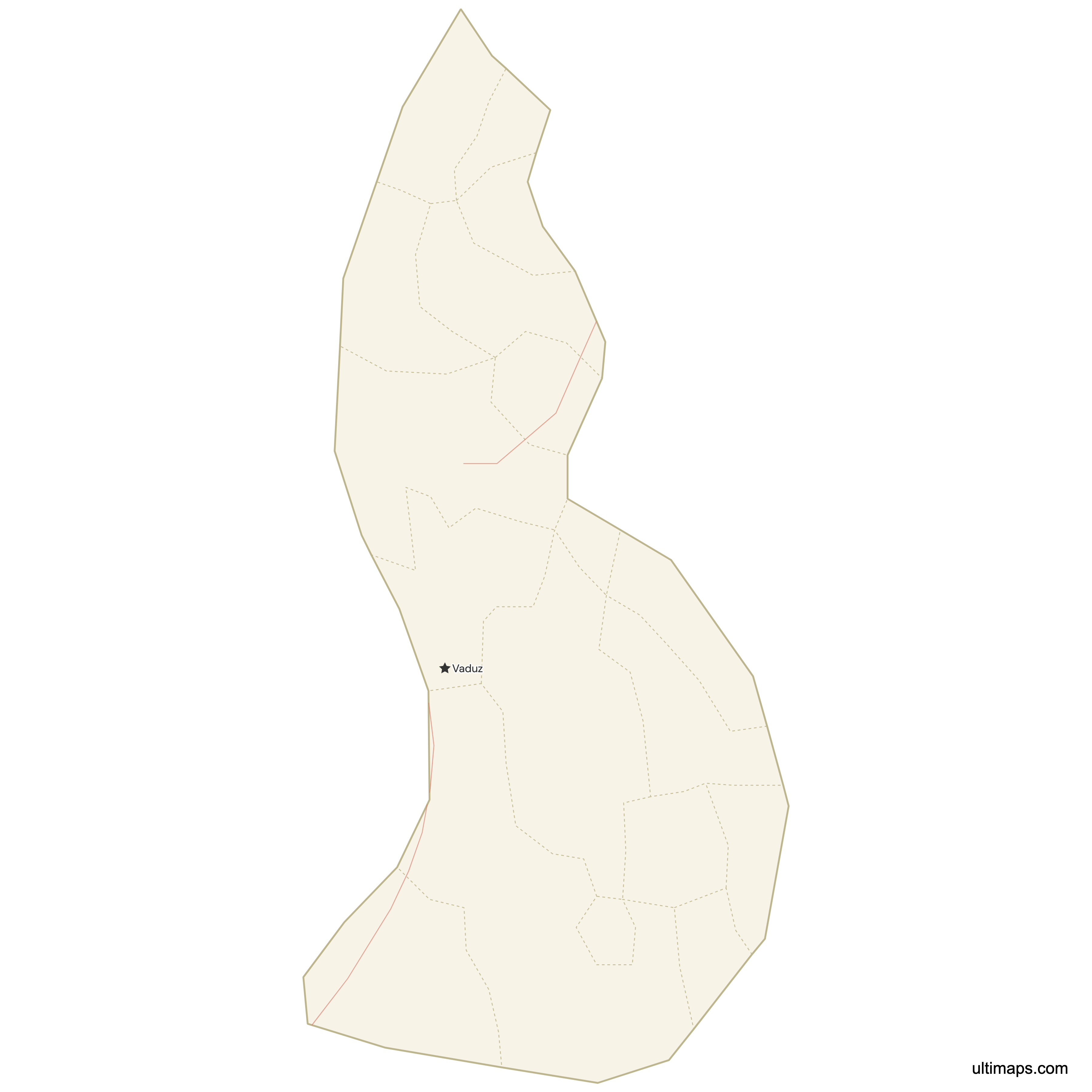
Liechtenstein is divided into 11 municipalities, known in German as Gemeinden, and this map draws all 11. They share a country of just 160.0 km² (61.8 sq mi) with 40,687 residents (June 30, 2024), squeezed between the Rhine and the Rätikon mountains. Six municipalities form the Oberland in the south (Balzers, Triesen, Triesenberg, Schaan, Planken and Vaduz, the national capital) and five form the Unterland in the north (Eschen, Mauren, Gamprin, Ruggell and Schellenberg). There is no province or district tier above them, so these 11 units carry the whole of local government. Use the interactive map below to check any boundary, from Ruggell at the northern tip down to Balzers in the south. The outline can be kept as a free reference file, or built into a data map where each of the 11 fills is determined by your figures.
Interactive Liechtenstein Map with Municipalities
List of Municipalities (11)
Liechtenstein Municipalities: Key Facts
- Total number of municipalities: 11 Gemeinden, the only administrative subdivision of the country
- Most populous municipality: Schaan, 6,250 residents (June 30, 2024)
- Least populous municipality: Planken, 492 residents (June 30, 2024)
- Largest municipality by area: Triesenberg, 29.8 km² (11.5 sq mi)
- Smallest municipality by area: Schellenberg, 3.5 km² (1.4 sq mi)
- National totals: 160.0 km² (61.8 sq mi) and 40,687 residents (June 30, 2024, Amt für Statistik)
- Capital and administrative center: Vaduz, seat of the government, parliament and national museums
- Municipalities with major settlement centers: Schaan, Vaduz, Triesen, Balzers (with Mäls), Eschen (with Nendeln), Mauren (with Schaanwald), Gamprin (with Bendern)
- Regional groupings: Oberland with 6 municipalities, Unterland with 5
- Borders: Switzerland to the west along the Rhine and to the south through the mountains, Austria to the east. Liechtenstein is landlocked and has no coastline.
- Time zone: CET (UTC+1), switching to CEST (UTC+2) in summer
- Historical note: The Oberland and Unterland groupings go back to the County of Vaduz and the Lordship of Schellenberg, united in 1719 to form the Principality of Liechtenstein. No boundary reform has changed the count: the same 11 municipalities have stood for decades under unchanged names.
Interesting Facts
- Triesenberg, the largest municipality at 29.8 km² (11.5 sq mi), takes up almost a fifth of the country's 160.0 km² (2024 municipal figures).
- Schaan has more residents than the capital: 6,250 against Vaduz's 6,002 (June 30, 2024). Across the national total of 40,687, the average municipality holds roughly 3,700 people.
- Malbun, Liechtenstein's alpine resort, is part of Triesenberg rather than a municipality in its own right, along with the mountain settlement of Steg.
- Official listings often pair a municipality with its main village, as in Eschen/Nendeln, Mauren/Schaanwald and Gamprin/Bendern. Each pair counts as one municipality on the map.
- Schellenberg covers only 3.5 km² (1.4 sq mi) yet lent its name to one of the two territories that became the principality in 1719.
Free Downloads
Free for personal and commercial use with a credit to Ultimaps. See the license terms for details.
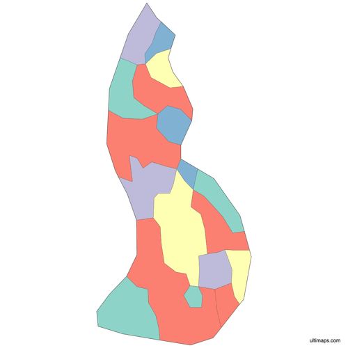 Colored Liechtenstein Map with Municipalitiespng341 KB
 Political Map of Liechtenstein with Municipalitiespng318 KB
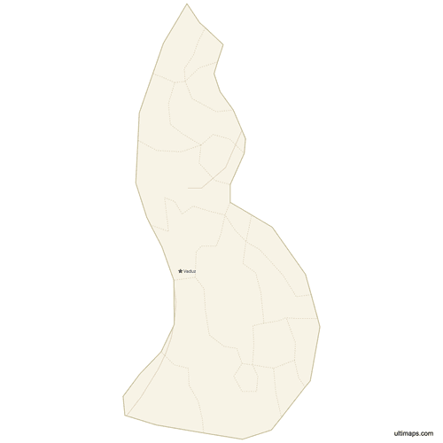 Map of Liechtenstein with Cities and Roadspng336 KB
Need it without colors? The blank version of this map comes as a print-ready PDF (A4 and US Letter), a PNG and an editable SVG.
Custom Map Features
This map supports surrounding areas, roads and cities. New
This map is divided into 11 municipalities.
Updates
May 14, 2026:
- Added map of Liechtenstein Municipalities with surrounding countries, cities and roads
Frequently Asked Questions
Liechtenstein has 11 municipalities, called Gemeinden in German, and the Ultimaps map draws all 11. They are Vaduz, Schaan, Triesen, Triesenberg, Balzers and Planken in the Oberland, plus Eschen, Mauren, Gamprin, Ruggell and Schellenberg in the Unterland. Together they cover 160.0 km² (61.8 sq mi) and held 40,687 residents on June 30, 2024. No province or district tier sits between the municipalities and the national government, so these 11 units are the country's single layer of subdivision. No boundary reform has altered the 11 municipalities or their names.
Triesenberg is the largest municipality in Liechtenstein by area at 29.8 km² (11.5 sq mi), close to a fifth of the country's 160.0 km² (61.8 sq mi). It stretches from the mountain terrace above the Rhine valley up into the alps and takes in the settlements of Malbun and Steg. Even so, Triesenberg stays smaller than many single rural communes elsewhere in Europe, because the whole principality fits into 61.7 square miles. Triesenberg is one of the six Oberland municipalities. The smallest by area is Schellenberg at 3.5 km² (1.4 sq mi).
Schaan is the most populated municipality in Liechtenstein, with 6,250 residents on June 30, 2024, out of a national total of 40,687. Schaan lies on the Rhine valley floor immediately north of Vaduz and serves as the country's main commercial and settlement center, so it outranks the capital in population. The least populated municipality is Planken, with 492 residents on the same date, a hillside village also in the Oberland. Spread across 11 municipalities, the average population works out to roughly 3,700 people per Gemeinde.
Schellenberg is the smallest municipality in Liechtenstein by area, at 3.5 km² (1.4 sq mi), sitting in the Unterland near the Austrian border. By population the smallest is Planken, with 492 residents on June 30, 2024. The two are separate places: Schellenberg belongs to the northern lowland group of five municipalities, while Planken is one of the six Oberland municipalities. Schellenberg carries the name of the medieval Lordship of Schellenberg, one of the two territories combined in 1719 to create the principality. Triesenberg, at 29.8 km² (11.5 sq mi), is the largest by area.
Vaduz is the capital of Liechtenstein and one of the 11 municipalities. It holds the national government, the Landtag, the main museums and the administrative core of the principality, with the Prince's castle above the town. Vaduz is not the country's biggest municipality by population, since Schaan just to the north counted 6,250 residents on June 30, 2024 against Vaduz's 6,002. Vaduz belongs to the Oberland, the southern group of six municipalities. On this map Vaduz is a separate shape, so you can shade or highlight it independently.
Oberland and Unterland are Liechtenstein's two traditional regions, which also serve as its electoral districts. The Oberland, or upper country, covers six municipalities in the south: Balzers, Triesen, Triesenberg, Vaduz, Schaan and Planken. The Unterland, or lower country, covers five in the north: Eschen, Mauren, Gamprin, Ruggell and Schellenberg. The division follows the historic County of Vaduz and Lordship of Schellenberg, joined in 1719 when the principality was formed. Both still send members to the national parliament. They are not an extra administrative layer, so the 11 municipalities remain the working subdivisions of the country.
In Liechtenstein, Malbun and Steg belong to Triesenberg, Nendeln belongs to Eschen, and Schaanwald belongs to Mauren. Two more pairings work the same way: Bendern is part of Gamprin and Mäls is part of Balzers. Official listings often write these as Eschen/Nendeln, Mauren/Schaanwald or Gamprin/Bendern, but each pair counts as one municipality, not two, so the total stays at 11. Malbun, the country's ski resort, sits high above the Rhine valley floor where most of Liechtenstein's 40,687 residents (June 30, 2024) live. Ruggell marks the northern end of the country.
Liechtenstein maps are edited on the Ultimaps site itself, directly in the browser; the free tier asks for no sign-up. With only 11 shapes, a data map needs just a short list of values: import a list of municipality names with one number each, and the color of every shape follows its value. Clicking any one municipality recolors just that shape, which suits a map that singles out Ruggell or Triesen. Palette and background choices are independent, as are label wording and boundary-line weight. Captions and markers can be attached to Vaduz, Schaan, Malbun or any typed coordinate. PNG, PDF and SVG are the available output formats.