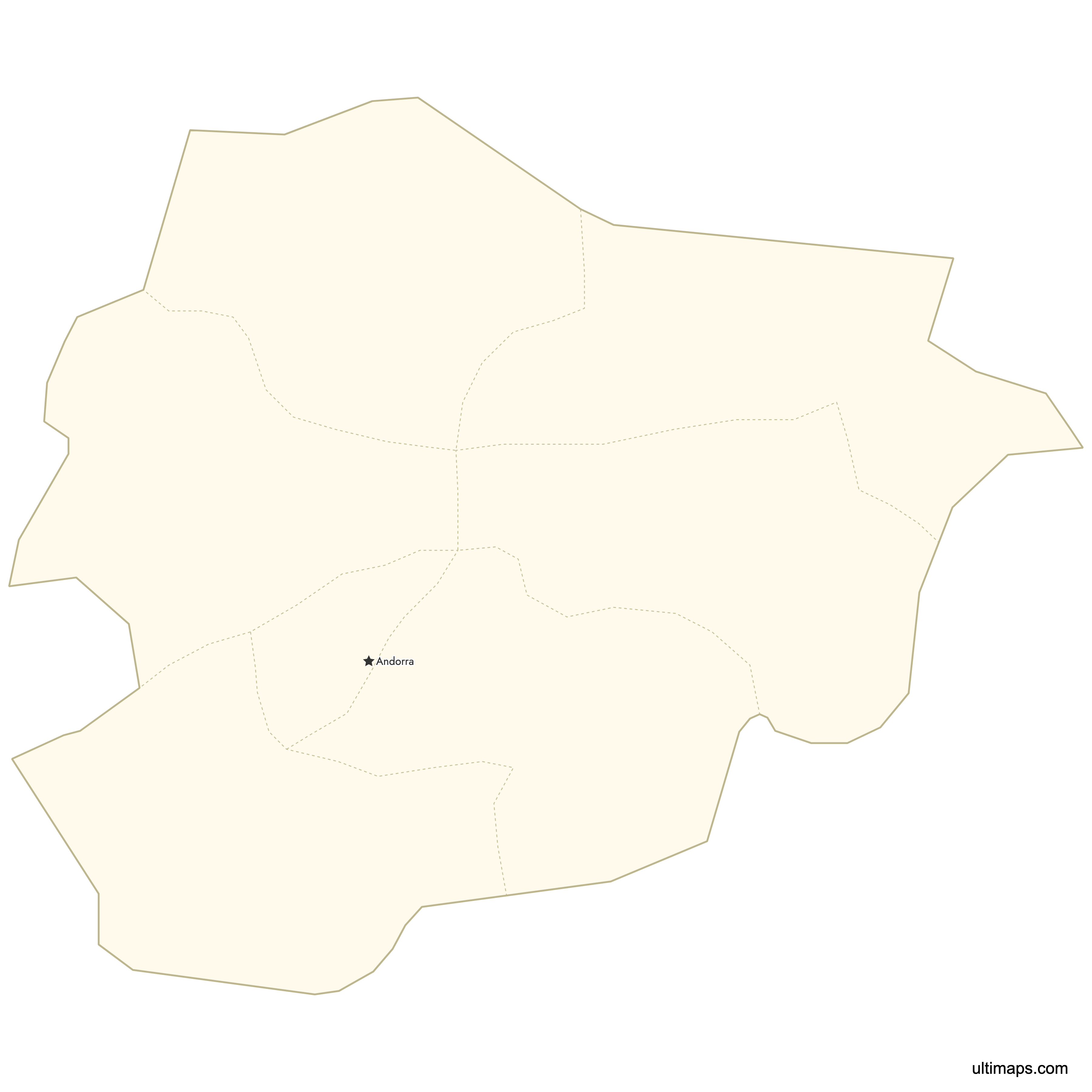
Andorra Map with Parishes
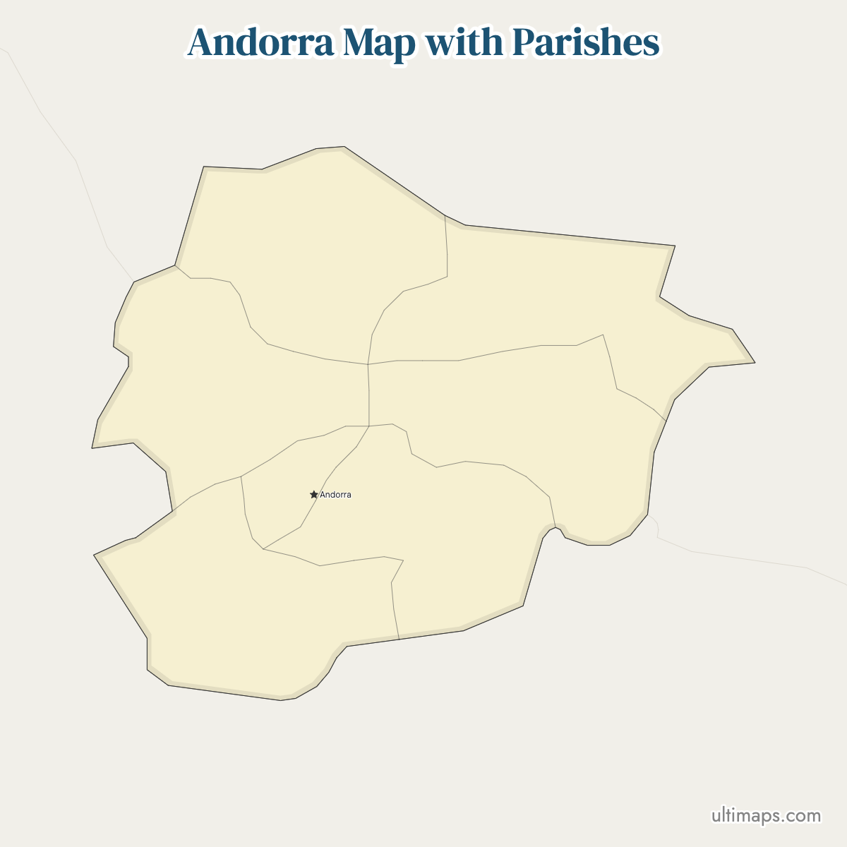
Andorra is divided into 7 parishes, or parròquies in Catalan, and they are the country's only first-level territorial division. The seven cover 468 km² (181 sq mi) of the eastern Pyrenees between France and Spain, and the arrangement has stood since 1978, when Escaldes-Engordany was separated from Andorra la Vella. Population sits mostly on the valley floor: Andorra la Vella, Escaldes-Engordany and Encamp together hold 54,518 of the country's 89,058 residents (2025 official estimate), while Canillo and Ordino spread across the high valleys with fewer than 6,500 people each.
Use the interactive map below to trace each parish boundary and locate the parish seats. Downloads of the plain outline are free, and uploading one value per parish produces a thematic version built from the same seven shapes.
Interactive Andorra Map with Parishes
List of Parishes (7)
| # | Parish |
|---|---|
| 1 | Andorra la Vella |
| 2 | Canillo |
| 3 | Encamp |
| 4 | Escaldes-Engordany |
| 5 | La Massana |
| 6 | Ordino |
| 7 | Sant Julià de Lòria |
Andorra Parishes: Key Facts
- Total number of parishes: 7, matching the official count used by Andorra's government. The map displays all seven.
- Most populous parish: Andorra la Vella, 24,836 residents (2025 official estimate), 28% of the national population
- Least populous parish: Ordino, 5,679 residents (2025 official estimate)
- Largest parish by area: Canillo, 121 km² (47 sq mi), about a quarter of the country
- Smallest parish by area: Andorra la Vella, 12 km² (4.6 sq mi)
- Full area ranking: Canillo 121 km² > Ordino 89 > Encamp 74 > La Massana 65 > Sant Julià de Lòria 60 > Escaldes-Engordany 47 > Andorra la Vella 12
- Parishes with major urban centers: Andorra la Vella (capital and commercial core), Escaldes-Engordany (Les Escaldes, spa and shopping district), Encamp (transport corridor), Sant Julià de Lòria (southern border town), La Massana (mountain resort access)
- National capital: Andorra la Vella, which is a parish and a city at the same time
- Borders: landlocked, with no coastline. France lies to the north and east and Spain to the south and west. Four parishes reach the French frontier (Canillo, Encamp, Ordino, La Massana) and five reach the Spanish one (Sant Julià de Lòria, Andorra la Vella, Escaldes-Engordany, La Massana, Encamp).
- Time zone: CET (UTC+1), moving to CEST (UTC+2) from late March to late October
- Boundaries established: 1978, when the seventh parish, Escaldes-Engordany, was created out of Andorra la Vella
Interesting Facts
- Canillo covers about ten times the area of Andorra la Vella (121 km² against 12 km²) but has 6,457 residents to the capital's 24,836, roughly 26% as many people (2025 official estimate).
- Density varies widely across the seven parishes: Andorra la Vella has about 2,000 residents per km², Canillo about 53 (2025 official estimate).
- The three adjoining valley-floor parishes of Andorra la Vella, Escaldes-Engordany and Encamp hold 54,518 people, close to 61% of the national total of 89,058 (2025 official estimate).
- Escaldes-Engordany is the newest parish, dating only from 1978, and is sixth of seven by area at 47 km² (18 sq mi).
- Canillo, the largest parish, accounts for about 7.2% of Andorra's population.
Free Downloads
Free for personal and commercial use with a credit to Ultimaps. See the license terms for details.
 Colored Andorra Map with Parishespng375 KB
 Political Map of Andorra with Parishespng355 KB
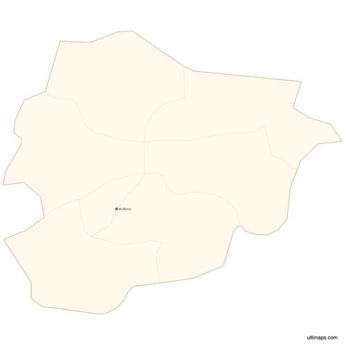 Map of Andorra with Citiespng296 KB


Need it without colors? The blank version of this map comes as a print-ready PDF (A4 and US Letter), a PNG and an editable SVG.
Custom Map Features
This map supports labels.
This map supports surrounding areas and cities. New
This map is divided into 7 parishes.
Updates
May 14, 2026:
- Added map of Andorra Parishes with surrounding countries, cities and lakes
Frequently Asked Questions
Andorra has 7 parishes: Canillo, Encamp, Ordino, La Massana, Andorra la Vella, Sant Julià de Lòria and Escaldes-Engordany. They are the country's first-level administrative units, known in Catalan as parròquies, and the Ultimaps map shows all seven. Together they cover 468 km² (181 sq mi) and hold 89,058 residents (2025 official estimate), which puts Andorra among the smallest states in Europe on both counts. The number has not changed since 1978. Each parish runs its own council, the comú, which handles local services and land within the parish boundary.
Canillo is the largest parish in Andorra at 121 km² (47 sq mi), roughly a quarter of the national territory of 468 km². It occupies the northeast of the country along the Valira d'Orient valley and reaches the French border. Canillo has only 6,457 residents (2025 official estimate), about 7.2% of Andorra's 89,058 people, so its density of roughly 53 people per km² is the lowest of the seven parishes. Ordino ranks second by area at 89 km² (34 sq mi), then Encamp at 74 km² (29 sq mi) and La Massana at 65 km² (25 sq mi).
Andorra la Vella is the most populous parish, with 24,836 residents (2025 official estimate), about 28% of the national total of 89,058. It is also the capital and the main commercial center, within an area of 12 km² (4.6 sq mi), which works out to roughly 2,000 residents per km². Escaldes-Engordany follows with 16,162 people and Encamp with 13,520. Those three neighboring parishes on the valley floor account for 54,518 residents between them, close to 61% of the country. Andorra la Vella holds about 4.4 times the population of Ordino, the least populous parish.
Andorra la Vella is the smallest parish in Andorra by area at 12 km² (4.6 sq mi), and Ordino is the smallest by population with 5,679 residents (2025 official estimate). Ordino sits in the northwest and covers 89 km² (34 sq mi), second only to Canillo, giving it a density of about 64 people per km². Canillo is next lowest by population at 6,457. By area the seven rank Canillo 121 km², Ordino 89, Encamp 74, La Massana 65, Sant Julià de Lòria 60, Escaldes-Engordany 47 and Andorra la Vella 12.
Andorra la Vella is the capital of Andorra and one of the seven parishes, so the name covers both a city and an administrative unit. The parish measures 12 km² (4.6 sq mi), the smallest in the country, and holds 24,836 people (2025 official estimate). The government district, the old town and the main shopping streets are all inside it. Escaldes-Engordany, whose main settlement is Les Escaldes, adjoins the capital, and the two form one continuous built-up area of just under 41,000 residents. Andorra la Vella also serves as the parish seat.
Andorra's regions are called parishes because the Catalan term for them is parròquia, plural parròquies, carried over from the historic church parishes of the Pyrenean valleys. English-language maps translate the word directly, which is why Andorra uses the label rather than province, canton or district. The seven are Canillo, Encamp, Ordino, La Massana, Andorra la Vella, Sant Julià de Lòria and Escaldes-Engordany. Each one is governed by a comú, its elected council. The parish is the only tier of territorial division between the state and local settlements, which keeps Andorra's administrative map unusually simple.
Andorra's current seven-parish map dates from 1978, the year Escaldes-Engordany was split off from Andorra la Vella to become the seventh unit. Before that the country had six parishes. No boundary has been redrawn since, so a map from 1978 and a map from today show the same seven outlines: Canillo, Encamp, Ordino, La Massana, Andorra la Vella, Sant Julià de Lòria and Escaldes-Engordany. The 1993 constitution confirmed the parishes as Andorra's territorial divisions and guaranteed the self-government of their comuns, which is why the count has stayed stable for decades.
Andorra is landlocked between France and Spain in the eastern Pyrenees, and every parish except two touches an international frontier. Four reach France along the northern and eastern watershed: Canillo, Encamp, Ordino and La Massana. Five reach Spain in the south and west: Sant Julià de Lòria, Andorra la Vella, Escaldes-Engordany, La Massana and Encamp. Only Canillo and Ordino have no Spanish boundary. Sant Julià de Lòria carries the main road crossing toward Catalonia, while the route into France leaves through Encamp in the northeast. Andorra has no coastline at any point.
Ultimaps opens the Andorra parish map in a browser tab, with no install and no sign-up. The quickest way to make a thematic map is a spreadsheet: one row per parish, one value beside it, and the seven shapes are colored on a graduated scale. You can also work parish by parish, selecting Ordino or Canillo and choosing its fill directly. Separate controls set the background, the palette, the border thickness and the wording and font of labels. Pins go on Andorra la Vella, Encamp or any latitude and longitude you supply, with captions if you want them. When the map is done, download it as a PNG, PDF or SVG file.