Paraguay Map with Departments
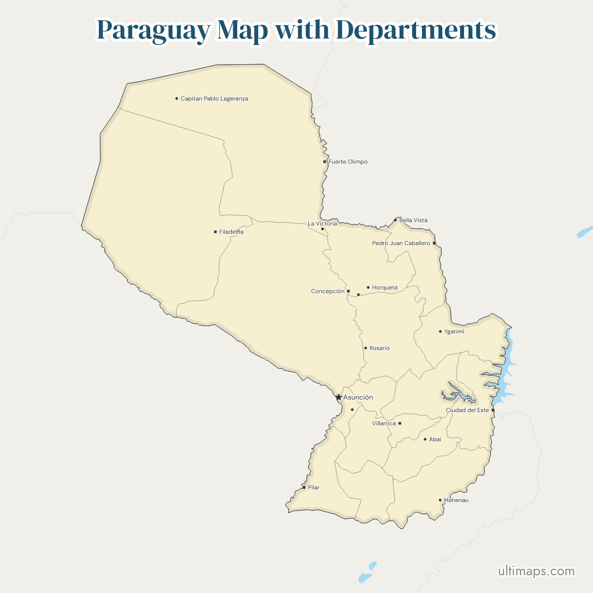
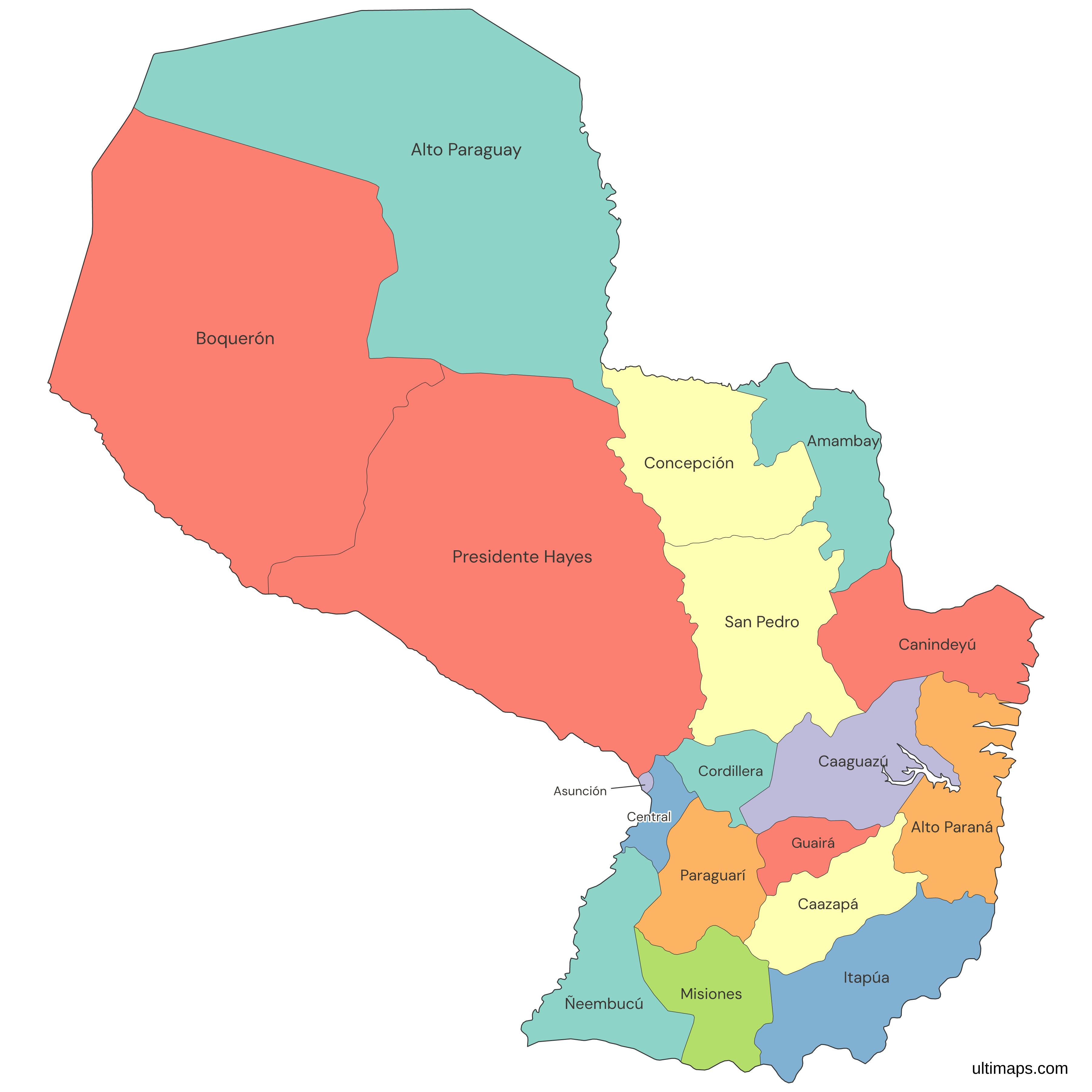
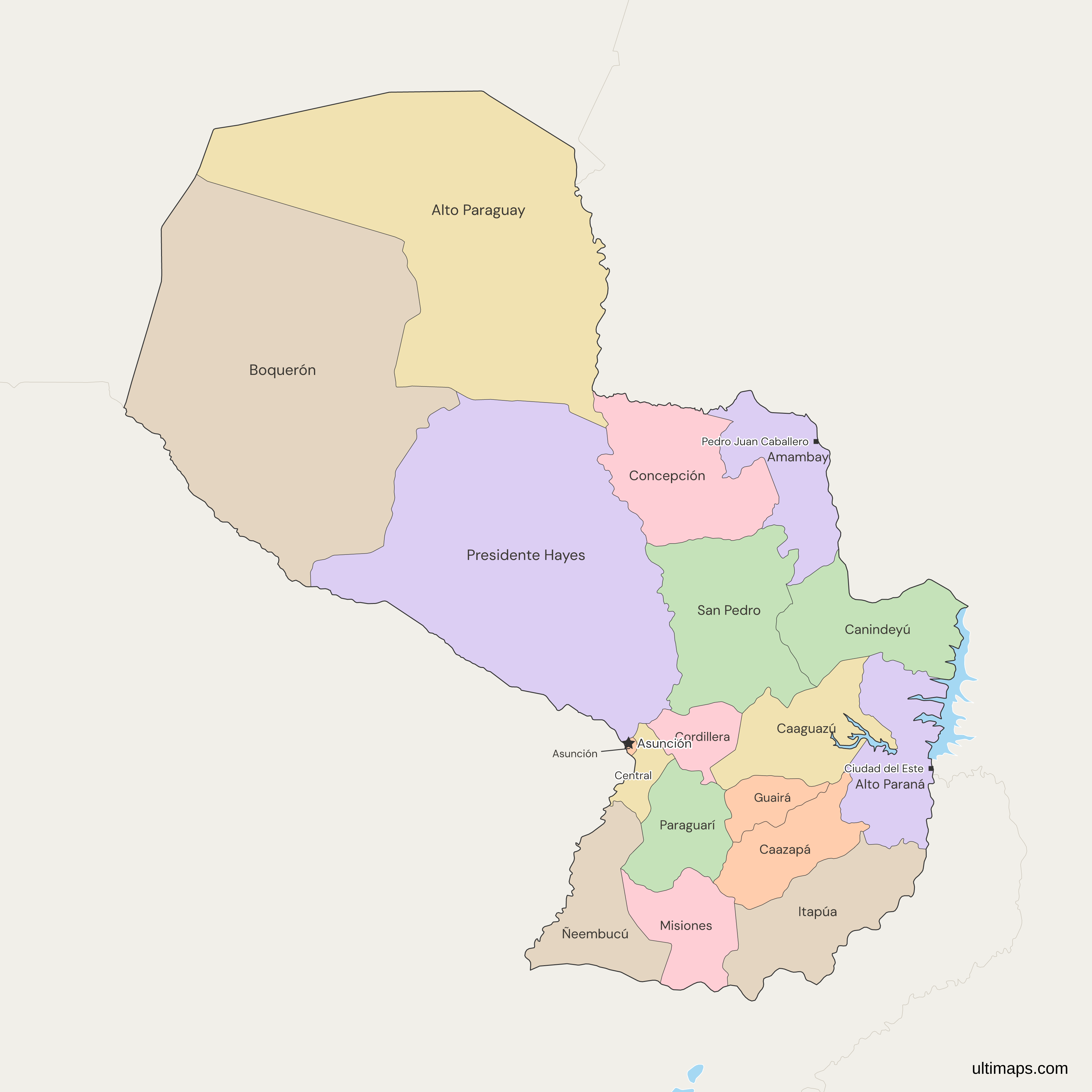
This map of Paraguay shows all 17 departments, a count fixed in 1992 when Ley 71 merged Nueva Asunción into Boquerón and Chaco into Alto Paraguay. Asunción, the national capital, is drawn beside them as a capital district of its own. Boquerón spans 91,669 km² (INE, 2024), more than any other department, while Central, the smallest at 2,465 km², holds the most residents, 2,019,842 (INE, 2026 estimate). Maps that show 19 departments predate the law.
Open the map in the free Ultimaps editor to make your own custom map of Paraguay. You can color the departments by your data, add pins and labels, and share or embed the finished map.
Interactive Paraguay Map with Departments
List of Departments (18)
| # | Department | Capital | Population (2026) | Area (km², 2024) |
|---|---|---|---|---|
| 1 | Alto Paraguay | Fuerte Olimpo | 19,007 | 82,349 |
| 2 | Alto Paraná | Ciudad del Este | 800,871 | 14,895 |
| 3 | Amambay | Pedro Juan Caballero | 178,296 | 12,933 |
| 4 | Asunción | Asunción | 461,227 | 117 |
| 5 | Boquerón | Filadelfia | 83,041 | 91,669 |
| 6 | Caaguazú | Coronel Oviedo | 463,494 | 11,474 |
| 7 | Caazapá | Caazapá | 151,628 | 9,496 |
| 8 | Canindeyú | Salto del Guairá | 210,359 | 14,667 |
| 9 | Central | Areguá | 2,019,842 | 2,465 |
| 10 | Concepción | Concepción | 223,684 | 18,051 |
| 11 | Cordillera | Caacupé | 281,074 | 4,948 |
| 12 | Guairá | Villarrica | 185,039 | 3,846 |
| 13 | Itapúa | Encarnación | 465,522 | 16,525 |
| 14 | Misiones | San Juan Bautista | 114,371 | 9,556 |
| 15 | Ñeembucú | Pilar | 78,591 | 12,147 |
| 16 | Paraguarí | Paraguarí | 208,246 | 8,705 |
| 17 | Presidente Hayes | Villa Hayes | 135,022 | 72,907 |
| 18 | San Pedro | San Pedro del Ycuamandyyú | 380,845 | 20,002 |
Data sources:
- Capital: Ley 426/1973 art. 3 (Paraguay), as amended to Ley 5328/2014; Constitución Nacional art. 157. License: facts compiled by Ultimaps, CC BY 4.0.
- Population: INE Paraguay, Estimaciones y Proyecciones Departamentales, 2000-2035. Revisión 2025, Cuadro 1. License: Licencia de Uso de la Información Pública.
- Area: INE Paraguay, Compendio Estadístico 2024, Cuadro 1.1 (Dirección del Servicio Geográfico Militar). License: Licencia de Uso de la Información Pública.
Paraguay Departments: Key Facts
- Number of units: 18 at the first level, made up of 17 departments and the Capital District of Asunción. Paraguay has no states or provinces. Asunción, the national capital, has its own code, PY-ASU, and borders Central and, across the Paraguay River, Presidente Hayes and Argentina.
- Department capitals: each department has one, set by Ley 426 of 1973 and later laws. Boquerón's is Filadelfia, Alto Paraguay's is Fuerte Olimpo and Central's is Areguá, since Ley 201 of 1993. Presidente Hayes returned its capital from Pozo Colorado to Villa Hayes in 2001.
- Area, largest to smallest: the three Chaco departments lead, Boquerón with 91,669 km², Alto Paraguay with 82,349 km² and Presidente Hayes with 72,907 km². At the small end, Central covers 2,465 km² and Guairá 3,846 km² (INE, 2024). Asunción, at 117 km², is smaller than any department.
- Population extremes: Alto Paraguay has the fewest residents, 19,007, then Ñeembucú with 78,591. At the top, Central has 2,019,842 and Alto Paraná 800,871 (INE, 2026 estimate). Asunción's 461,227 would rank fifth among the 18 units.
- Borders and coast: Paraguay touches three countries of South America. Argentina runs along the south and west and touches eight units: Boquerón, Presidente Hayes, Central, Asunción, Alto Paraná, Itapúa, Ñeembucú and Misiones. Brazil lies to the east and north and touches Alto Paraná, Canindeyú, Amambay, Concepción and Alto Paraguay. Bolivia touches only Boquerón and Alto Paraguay, in the northwest. No unit has a sea coast, and San Pedro, Caaguazú, Cordillera, Caazapá, Paraguarí and Guairá touch no other country either.
- Rivers and lakes: the map draws two reservoirs as water, cut out of the departments. The Itaipú reservoir lies on the Brazilian line along Alto Paraná and Canindeyú, and a second one lies on the Caaguazú-Alto Paraná line.
- Grouping: the Paraguay River splits the country into the Región Occidental, or Chaco, with 3 departments, and the Región Oriental, with 14 departments and Asunción. Both follow department lines.
- Last change to the set: Ley 71 of 1992 left 17 departments and the capital district, and no law since has added or removed one. Ley 5328 of 2014 moved the Chaco'i strip from Presidente Hayes to Concepción, and other laws created districts.
- Codes: ISO 3166-2 follows the 1973 law's numbering: PY-1 to PY-16, then PY-19 for Boquerón and PY-ASU for Asunción. Numbers 17 and 18 were Chaco and Nueva Asunción, abolished in 1992, so PY-17 and PY-18 are unused.
Interesting Facts
- The three Chaco departments hold about 61% of Paraguay's 406,752 km² (INE, 2024) but only 3.7% of its 6,460,159 residents (INE, 2026 estimate).
- Central and Asunción, 2,582 km² between them, hold about 38% of the population.
- The map draws the line from before Ley 5328 of 2014, so the Chaco'i strip, about 45 km², still sits in Presidente Hayes.
Free Downloads
Free for personal and commercial use with a credit to Ultimaps. See the license terms for details.
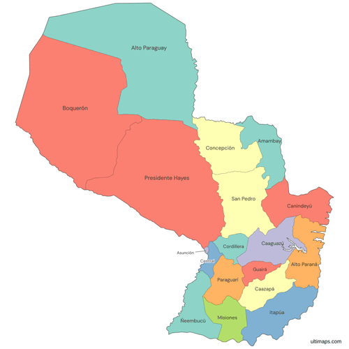 Colored Paraguay Map with Departmentspng483 KB
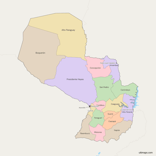 Political Map of Paraguay with Departmentspng497 KB
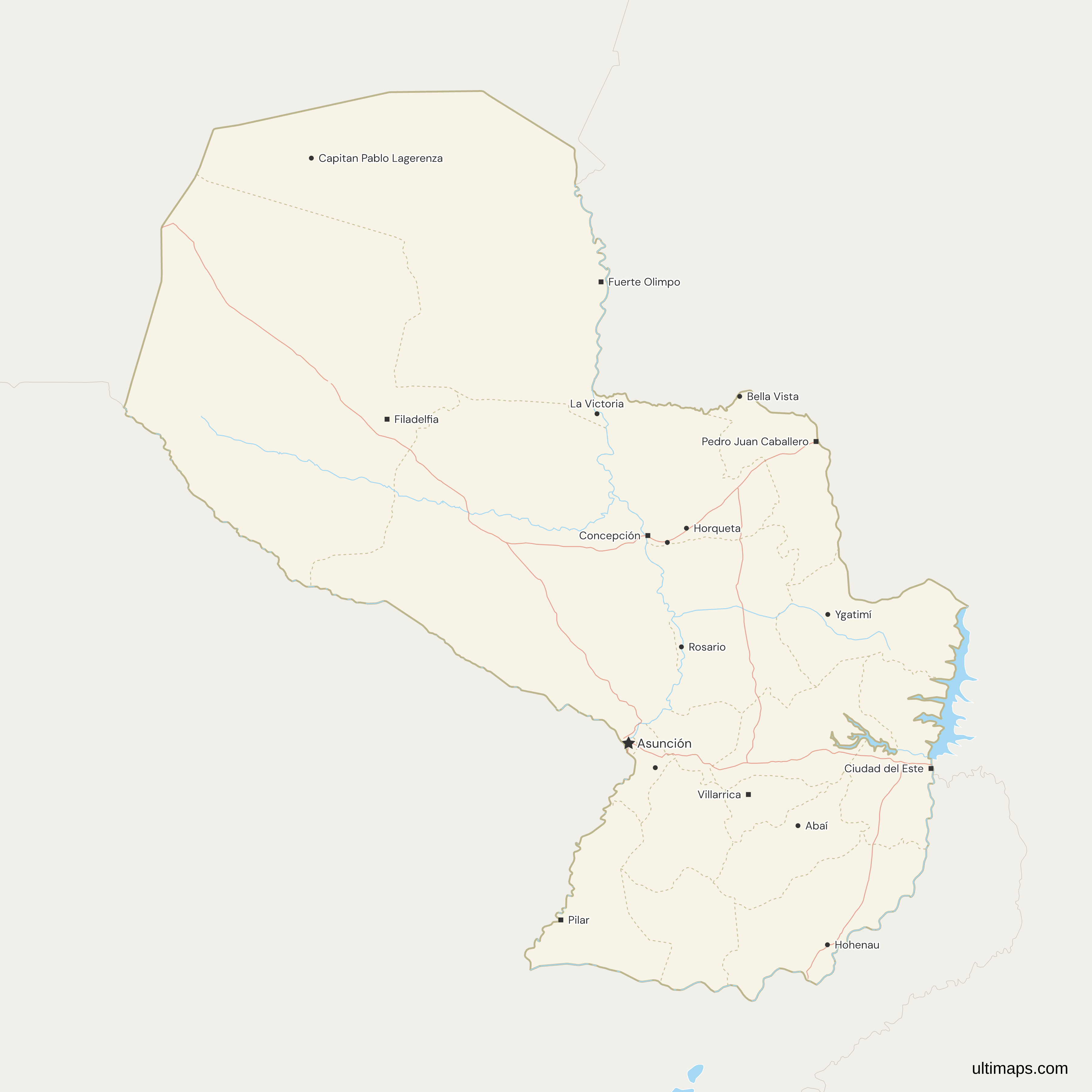
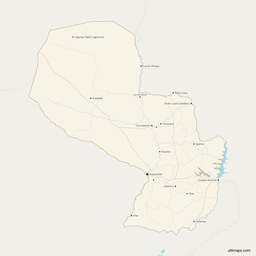 Map of Paraguay with Cities and Roadspng577 KB
Need it without colors? The blank version of this map comes as a print-ready PDF (A4 and US Letter), a PNG and an editable SVG.
Custom Map Features
This map supports labels.
This map supports surrounding areas, roads, rivers and cities. New
This map is divided into 18 departments.
Updates
Nov 11, 2026:
- Added map of Paraguay departments and the Capital District of Asunción
Frequently Asked Questions
Paraguay has 17 departments and the Capital District of Asunción, so the map draws 18 first-level units. The set of 17 departments has not changed since 1992, when Ley 71 reduced it from 19. The merger left a gap in the ISO codes: PY-17 and PY-18 are unused, and Boquerón carries PY-19. Maps that show 19 departments predate the law. A page that counts 18 departments is counting the capital district as one, because Asunción is a district with its own code, PY-ASU.
Two capitals differ from the usual guess. Central's is Areguá, not Asunción, and Alto Paraná's Ciudad del Este was named Presidente Stroessner in Ley 426 of 1973. The 17 departments and their capitals are Alto Paraguay (Fuerte Olimpo), Alto Paraná (Ciudad del Este), Amambay (Pedro Juan Caballero), Boquerón (Filadelfia), Caaguazú (Coronel Oviedo), Caazapá (Caazapá), Canindeyú (Salto del Guairá), Central (Areguá), Concepción (Concepción), Cordillera (Caacupé), Guairá (Villarrica), Itapúa (Encarnación), Misiones (San Juan Bautista), Ñeembucú (Pilar), Paraguarí (Paraguarí), Presidente Hayes (Villa Hayes) and San Pedro (San Pedro del Ycuamandyyú, as INE spells it). The map's capital symbol marks Asunción and seven of these.
The Paraguay River divides Paraguay into the Región Occidental and the Región Oriental. The Región Occidental, also called the Paraguayan Chaco, is the three departments west of the river: Presidente Hayes, Boquerón and Alto Paraguay. The Región Oriental is the other 14 departments and Asunción. The three western departments have 237,070 residents between them (INE, 2026 estimate), fewer than Itapúa alone. The wider Gran Chaco also reaches Argentina, Bolivia and a small part of Brazil, so it is larger than the Paraguayan Chaco.
Paraguay has neither states nor provinces. Its first level of division is the department, called departamento in Spanish, and there are 17 of them. The Capital District of Asunción sits at the same level and has its own ISO 3166-2 code, PY-ASU. Each department divides into districts, called distritos, which are the level below and are not drawn on this map. The Eastern and Western regions group the departments and do not replace them, so the first-level units stay the same whichever grouping is used.
Boquerón is the largest department in Paraguay, with an area of 91,669 km² (INE, 2024). Alto Paraguay is second at 82,349 km² and Presidente Hayes third at 72,907 km². All three lie in the Chaco, west of the Paraguay River. The next largest department, San Pedro, has only 20,002 km², so the gap after the third is wide, under a third of Presidente Hayes. Boquerón leads Alto Paraguay by 9,320 km² in INE's figures, and the map's own geometry ranks the two the same way.
Central is the smallest department in Paraguay, with an area of 2,465 km² (INE, 2024). Guairá follows at 3,846 km², then Cordillera at 4,948 km² and Paraguarí at 8,705 km². Asunción covers only 117 km², less than any department, but as a capital district it sits outside the department ranking. Central packs 2,019,842 residents (INE, 2026 estimate) into its small area, more than any other department, so it is also the most populous. The map colors Asunción and the 17 departments separately.
Central is the most populous department in Paraguay, with 2,019,842 residents, about 31% of the national total of 6,460,159 (INE, 2026 estimate). Alto Paraná is second with 800,871 and Itapúa third with 465,522. Asunción has 461,227 and would rank fifth if it counted as a department. Alto Paraguay has the fewest residents, 19,007, and Ñeembucú the next fewest, 78,591. Caaguazú is fourth with 463,494 and San Pedro fifth with 380,845. All figures are INE's 2026 estimates for the 17 departments and the capital district, based on the 2022 census.
No. Asunción is a capital district at the same level as the departments, not part of Central, whose capital is Areguá. Central borders it and has had that capital since 1993. The 1992 Constitution gives Asunción this separate status, which is why Paraguay is described as having 17 departments and one capital district. Asunción has 461,227 residents (INE, 2026 estimate) and an area of 117 km² (INE, 2024), and the map draws it as its own unit, so it can be colored separately from Central.
The free Ultimaps editor starts from this map, with Paraguay's departments and Asunción already drawn, and you need no account to begin. Paste or import a table with one row per department, or click departments to color them by hand. Rows match on the department name with or without accents (Boquerón or Boqueron), with Departamento de in front, or on an ISO code such as PY-19. Pins add places the map does not mark, such as Encarnación or Coronel Oviedo. A free account lets you save and publish the map, then share a link or embed it. A free export is a standard PNG with a small Ultimaps credit. High-resolution PNG, SVG and PDF files need Ultimaps Pro.