Jamaica Map with Parishes
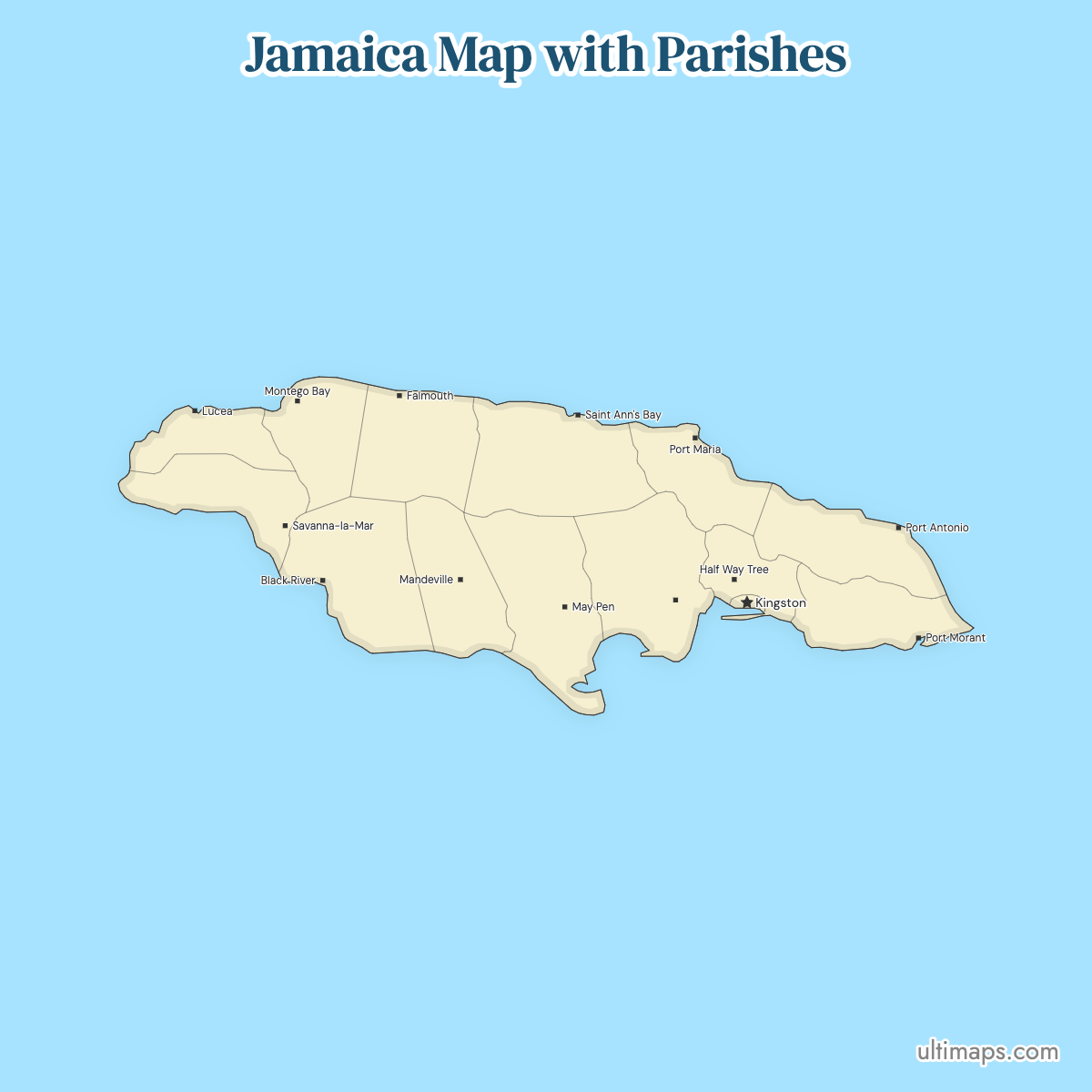
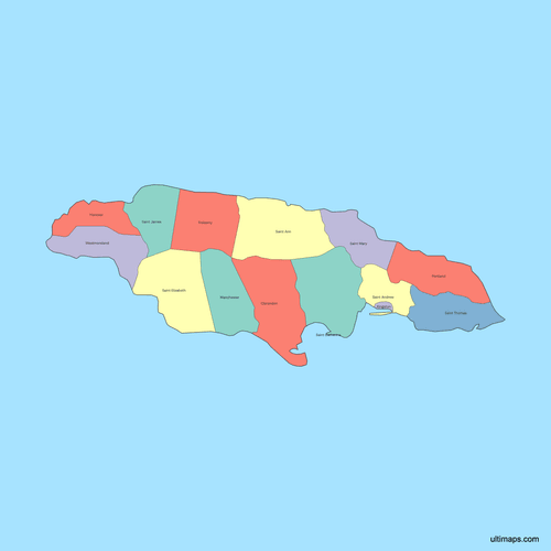
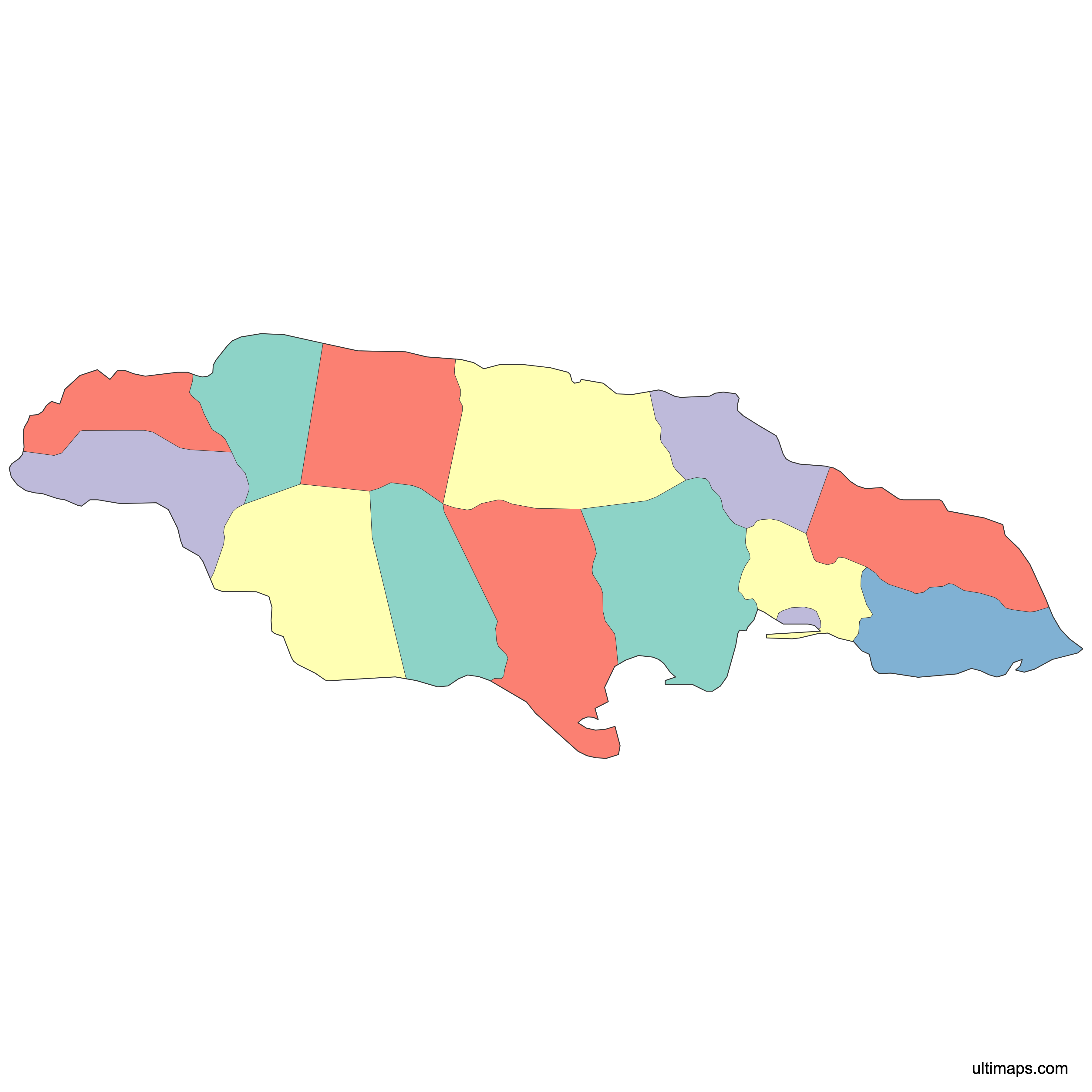
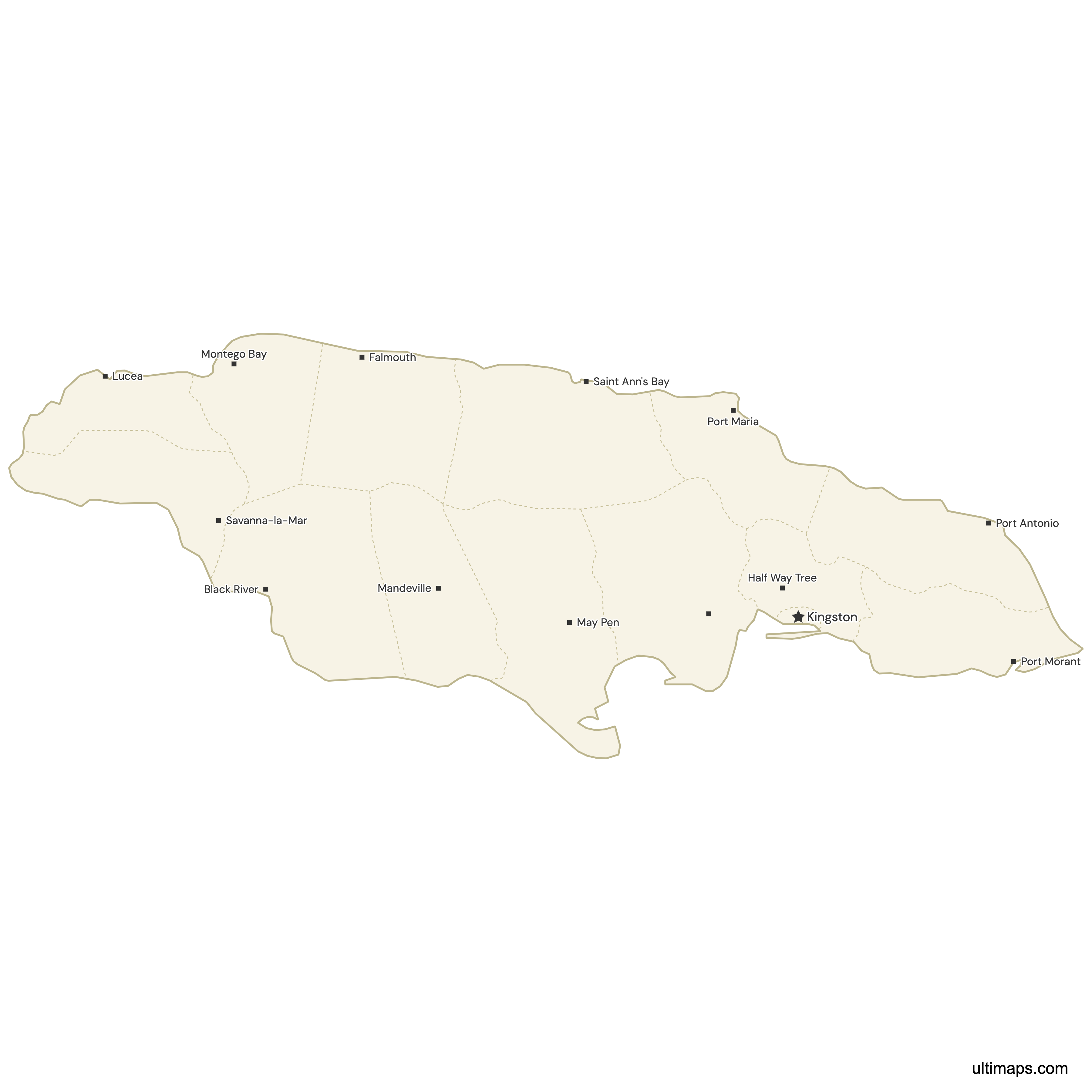
Jamaica is divided into 14 parishes, the country's primary tier of local government, and the map below shows all 14: Kingston, St. Andrew, St. Thomas, Portland, St. Mary, St. Ann, Trelawny, St. James, Hanover, Westmoreland, St. Elizabeth, Manchester, Clarendon and St. Catherine. This arrangement has been in place since 1 May 1867, when an earlier set of parishes was consolidated into the modern 14. In February 2025, Parliament passed legislation to make Portmore, currently part of St. Catherine, the 15th parish; the change takes effect only after a constitutional boundary review, and this map shows the long-standing 14-parish arrangement. The national capital, Kingston, is governed jointly with St. Andrew as the KSAMC. Each parish also has its own capital town, from Montego Bay in St. James to Black River in St. Elizabeth, and parish names are still used in Jamaican addresses, sports competitions and heritage records. Zoom the interactive map to check any boundary or stretch of coastline. The plain map is free to download, and if you add a column of parish figures, the parishes are colored from your values.
Interactive Jamaica Map with Parishes
List of Parishes (14)
| # | Parish |
|---|---|
| 1 | Clarendon |
| 2 | Hanover |
| 3 | Kingston |
| 4 | Manchester |
| 5 | Portland |
| 6 | Saint Andrew |
| 7 | Saint Ann |
| 8 | Saint Catherine |
| 9 | Saint Elizabeth |
| 10 | Saint James |
| 11 | Saint Mary |
| 12 | Saint Thomas |
| 13 | Trelawny |
| 14 | Westmoreland |
Jamaica Parishes: Key Facts
- Total number of parishes: 14, the country's primary tier of local-government subdivision (the map on this page shows all 14)
- Most populous parish: St. Andrew, 583,718 residents (2022 census); combined with Kingston Parish under the Kingston and St. Andrew Municipal Corporation (KSAMC), the metropolitan total reaches 672,904 (2022)
- Least populous parish: Hanover, 69,780 residents (2022)
- Largest parish by area: St. Ann, 1,212.6 km² (468 sq mi), ahead of St. Elizabeth by roughly 0.2 km² (Statistical Institute of Jamaica figures)
- Smallest parish by area: Kingston, about 22 km² (8.5 sq mi) (Statistical Institute of Jamaica figures)
- Main towns by parish: Kingston and St. Andrew (metropolitan Kingston), St. Catherine (Spanish Town and Portmore), St. James (Montego Bay), Clarendon (May Pen), Manchester (Mandeville), St. Ann (Ocho Rios), Portland (Port Antonio)
- Capital: Kingston, which is both the national capital and a parish in its own right
- Borders: none by land. Jamaica is an island in the Caribbean Sea, with Cuba about 145 km to the north across the Cayman Trench and Haiti to the east across the Jamaica Channel
- Time zone: Eastern Standard Time (UTC−5) all year, with no daylight saving changeover
- Historical note: the 14-parish structure came into force on 1 May 1867 and the boundaries have remained recognizable ever since
Interesting Facts
- St. Ann (1,212.6 km²) exceeds St. Elizabeth (1,212.4 km²) by roughly 0.2 km², the narrowest area gap between any two parishes.
- St. Ann covers about 55 times the ground of Kingston Parish, yet Kingston's 22 km² holds 89,186 people (2022) at one of the highest densities on the island.
- Seven of the 14 parish names begin with "St.": St. Andrew, St. Ann, St. Catherine, St. Elizabeth, St. James, St. Mary and St. Thomas.
- The three historic counties of Cornwall, Middlesex and Surrey still appear on printed maps and in everyday usage, but they lost every administrative function long ago.
- St. Catherine's capital, Spanish Town, served as Jamaica's capital before Kingston took the role, which is why Spanish Town retains one of the island's largest concentrations of colonial-era architecture.
Free Downloads
Free for personal and commercial use with a credit to Ultimaps. See the license terms for details.
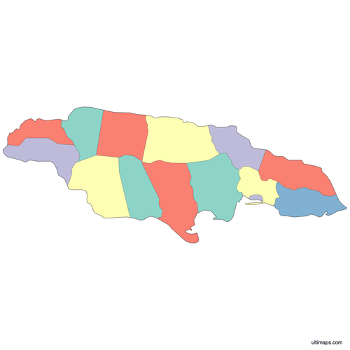 Colored Jamaica Map with Parishespng282 KB
 Political Map of Jamaica with Parishespng293 KB
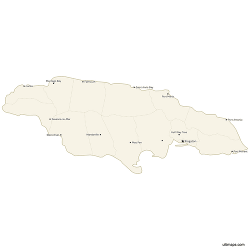 Map of Jamaica with Citiespng333 KB
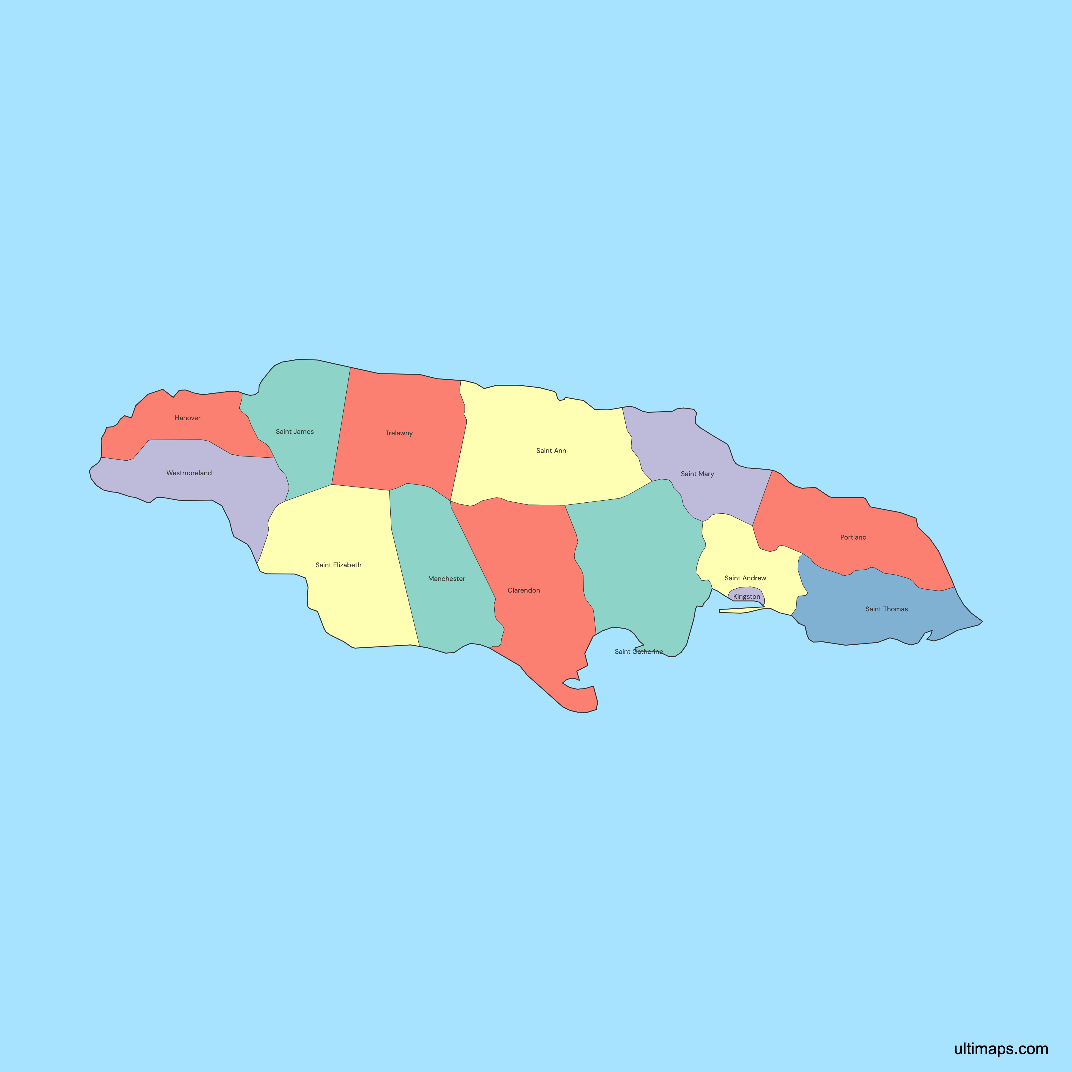
Need it without colors? The blank version of this map comes as a print-ready PDF (A4 and US Letter), a PNG and an editable SVG.
Custom Map Features
This map supports surrounding areas and cities. New
This map is divided into 14 parishes.
Updates
May 15, 2026:
- Added map of Jamaica parishes
Frequently Asked Questions
Jamaica has 14 parishes, and this map displays all 14 of them. They are Kingston, St. Andrew, St. Thomas, Portland, St. Mary, St. Ann, Trelawny, St. James, Hanover, Westmoreland, St. Elizabeth, Manchester, Clarendon and St. Catherine. Parishes are the island's primary tier of local government, administered by elected municipal corporations (Kingston and St. Andrew share one), each with a capital town. Seven of the names begin with "St." The count has been stable since 1 May 1867, when an earlier, larger set of parishes was merged into the present 14, though legislation passed in February 2025 would make Portmore the 15th parish once a constitutional boundary review completes. The historic counties of Cornwall, Middlesex and Surrey group them but govern nothing.
St. Ann is Jamaica's largest parish by area at 1,212.6 km² (468 sq mi) according to the Statistical Institute of Jamaica's parish figures. The margin is very small: St. Elizabeth covers 1,212.4 km², a difference of roughly 0.2 km², so older or differently rounded sources sometimes name St. Elizabeth instead. St. Ann sits on the north coast, is administered from St. Ann's Bay, and includes resort and heritage areas along the shoreline plus interior hill country. For scale, the parish is about 55 times the size of Kingston Parish, the smallest of the 14.
St. Andrew is Jamaica's most populous parish with 583,718 residents recorded in the 2022 census. Its capital is Half Way Tree, and the parish surrounds Kingston Parish on the land side, taking in the metropolitan suburbs and the hillside districts rising toward the Blue Mountains. Kingston Parish itself holds only 89,186 people (2022). The frequently quoted figure of 672,904 is the combined Kingston and St. Andrew Municipal Corporation total, which merges both parishes because the built-up city crosses the boundary between them. The least populous parish is Hanover on the northwest coast, with 69,780 residents (2022).
Kingston is the smallest parish in Jamaica, covering about 22 km² (8.5 sq mi) per the Statistical Institute of Jamaica's parish figures. It occupies the harbor-side core of the capital, including the government district, the port and the main cultural institutions. The wider built-up city extends past it into neighboring St. Andrew. Despite that small area, Kingston Parish counted 89,186 residents in 2022. By area it is a small fraction of St. Ann, the largest parish at 1,212.6 km² (468 sq mi), so Kingston stands apart from the other 13 parishes on any size comparison.
Yes, Kingston is one of Jamaica's 14 parishes as well as the national capital, and it is small: about 22 km² (8.5 sq mi) with 89,186 residents (2022). St. Andrew is the separate parish surrounding it, home to 583,718 people (2022) and administered from Half Way Tree. Because the built-up area crosses the parish boundary, the two are jointly run by the Kingston and St. Andrew Municipal Corporation (formerly KSAC), and statistical tables often report them as a single unit of 672,904 people (2022). On maps, though, they remain two distinct parishes with their own outlines.
Jamaica's three historic counties are Cornwall in the west, Middlesex in the center and Surrey in the east. Introduced during the colonial period, they group the 14 parishes into blocks and still appear on printed reference maps, in school geography lessons and in older records. They carry no administrative power today: no county councils, no county officials, no county-level budgets. All local government runs through the parishes, which have been fixed in their present form since 1 May 1867. Surrey covers Kingston, St. Andrew, St. Thomas and Portland; Middlesex holds five parishes; Cornwall covers the five western parishes.
Jamaica's modern parish system dates to 1 May 1867, when the island's older and more numerous parishes were consolidated into the 14 that exist today. Parishes themselves are far older, having been set up as ecclesiastical and civil districts during English colonial rule in the 17th century, but the 1867 reorganization produced the boundaries you see on this map. Continuity since then has been strong enough that FamilySearch's Jamaica research guide still illustrates parish boundaries with a 1927 map. That stability is one reason parish names remain central to Jamaican addresses and local identity.
Each Jamaican parish has its own capital town. They are Kingston (Kingston), Half Way Tree (St. Andrew), Morant Bay (St. Thomas), Port Antonio (Portland), Port Maria (St. Mary), St. Ann's Bay (St. Ann), Falmouth (Trelawny), Montego Bay (St. James), Lucea (Hanover), Savanna-la-Mar (Westmoreland), Black River (St. Elizabeth), Mandeville (Manchester), May Pen (Clarendon) and Spanish Town (St. Catherine). Montego Bay and Spanish Town are among the island's largest cities, and Spanish Town served as Jamaica's capital before Kingston. Mandeville is the main inland commercial center, sitting on the Manchester plateau away from the coast.
A Jamaica parish map is built in Ultimaps directly in the browser, with no download and no sign-up. Color comes from one of two sources: you select a parish and choose its fill, or you paste a column of values beside the 14 parish names and a graduated scale is applied across them. From there you can change the palette, edit label text, set fonts, adjust border thickness and swap the background. Markers can be placed on Kingston, Mandeville, Falmouth or any coordinates you type in, each with its own caption. The finished map exports to PNG, PDF or SVG.