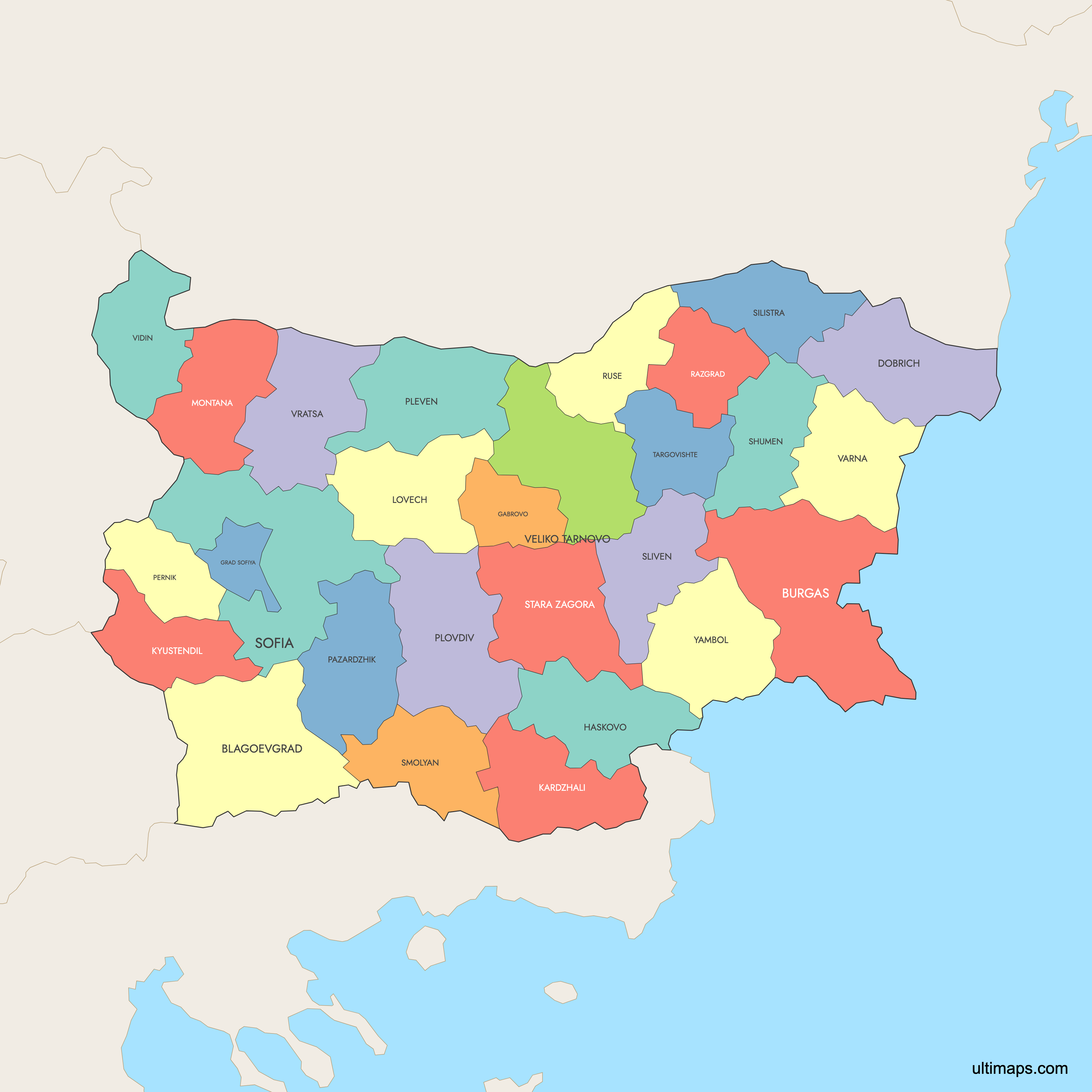
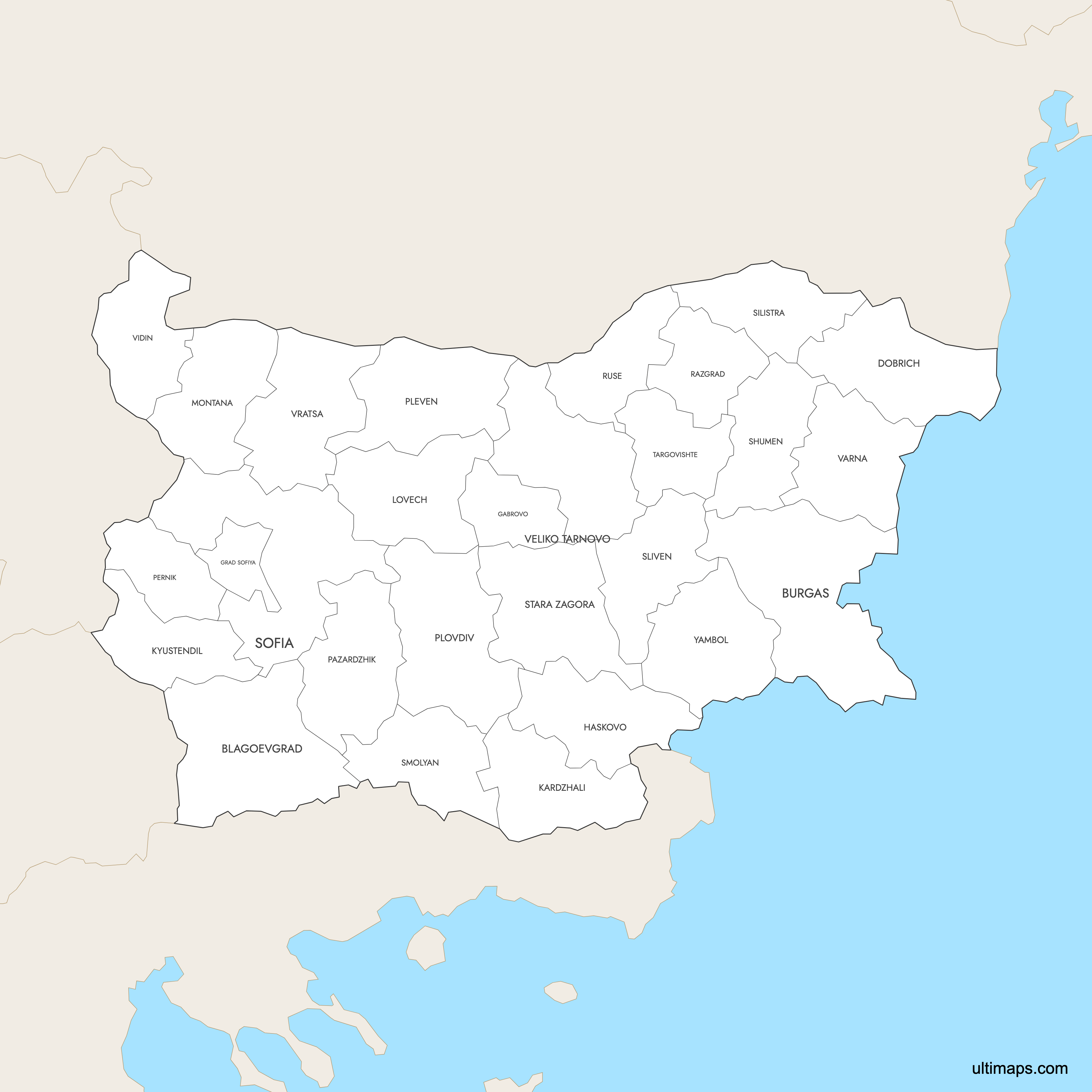
Map of Bulgaria Provinces
Bulgaria is divided into 28 provinces (oblasti), which are further subdivided into 265 municipalities (obshtini). These provinces serve as the primary administrative divisions of the country, spanning from the Danube River border with Romania in the north to the Greek and Turkish borders in the south, and the Black Sea coast in the east. Use the interactive maps below to explore Bulgaria's provinces and their boundaries. Download free maps or learn more about creating a custom map of Bulgaria to visualize your own data.
Interactive Map of Bulgaria Provinces
List of Provinces (28)
| # | Province |
|---|---|
| 1 | |
| 2 | |
| 3 | |
| 4 | |
| 5 | |
| 6 | |
| 7 | |
| 8 | |
| 9 | |
| 10 | |
| 11 | |
| 12 | |
| 13 | |
| 14 | |
| 15 | |
| 16 | |
| 17 | |
| 18 | |
| 19 | |
| 20 | |
| 21 | |
| 22 | |
| 23 | |
| 24 | |
| 25 | |
| 26 | |
| 27 | |
| 28 |
Bulgaria Provinces: Key Facts
- Total number of provinces: 28 (oblasti), further divided into 265 municipalities (obshtini)
- Most populous province: Sofia City Province (Sofia-grad), home to the capital Sofia with approximately 1.2 million residents (2021 estimate). Among non-capital provinces, Plovdiv Province is the largest with 634,497 people (2021 census).
- Least populous province: Vidin Province with 75,408 residents (2021 census), a decline of 25.4% from the 2011 figure of 101,018
- Largest province by area: Blagoevgrad Province at 6,449.47 km² (2,490.13 sq mi)
- Smallest province by area: Sofia City Province (Sofia-grad) at approximately 1,349 km² (521 sq mi), the most compact and densely populated province
- Provinces with major urban centers: Sofia-grad (Sofia, capital and largest city), Plovdiv (second largest city), Varna (third largest city and Black Sea port), Burgas (Black Sea resort hub), and Ruse (Danube River port)
- Capital and administrative center: Sofia, which serves as the administrative center for both Sofia City Province and Sofia Province
- Bordering countries and bodies of water: Romania (north, along the Danube River), Serbia (west), North Macedonia (west), Greece (south), Turkey (southeast), and the Black Sea (east)
- Time zone: Eastern European Time (EET, UTC+2), with Eastern European Summer Time (EEST, UTC+3) observed in summer
- Current boundaries established: 1999, when the country reverted from 9 large provinces created in 1987 back to 28 provinces matching the pre-1987 districts
Interesting Facts
- Bulgaria's total population declined from 7,364,570 in 2011 to 6,519,789 in 2021, a drop of 11.5%. Rural provinces like Vidin experienced the sharpest losses at 25.4%.
- Provinces in Bulgaria do not have official legal names. They are formally described as "oblast with administrative centre [City]" rather than given distinct province names.
- Sofia City Province is unique among all 28 provinces: it consists solely of Sofia Capital Municipality, including the city of Sofia and 34 surrounding villages, with over 90% urban population.
- Bulgaria's Black Sea coast provinces of Varna and Burgas have become major tourist destinations since the country joined the EU in 2007, attracting visitors with beaches and affordable prices.
- The Varna Archaeological Museum houses the world's oldest worked gold, dating to the 5th millennium BCE, discovered in the Varna Necropolis.
Free Downloads
 Colored Map of Bulgaria — Provinces with Surrounding Areaspng709 KB
 Labeled Map of Bulgaria — Provinces with Surrounding Areaspng697 KB
 Map of Bulgaria — Provinces with Citiespng767 KB
You can download free blank Map of Bulgaria Provinces and other maps in high resolution PNG, SVG and PDF formats from the blank maps section of the site: Download Blank Map of Bulgaria Provinces
Custom Map Features
This map supports labels.
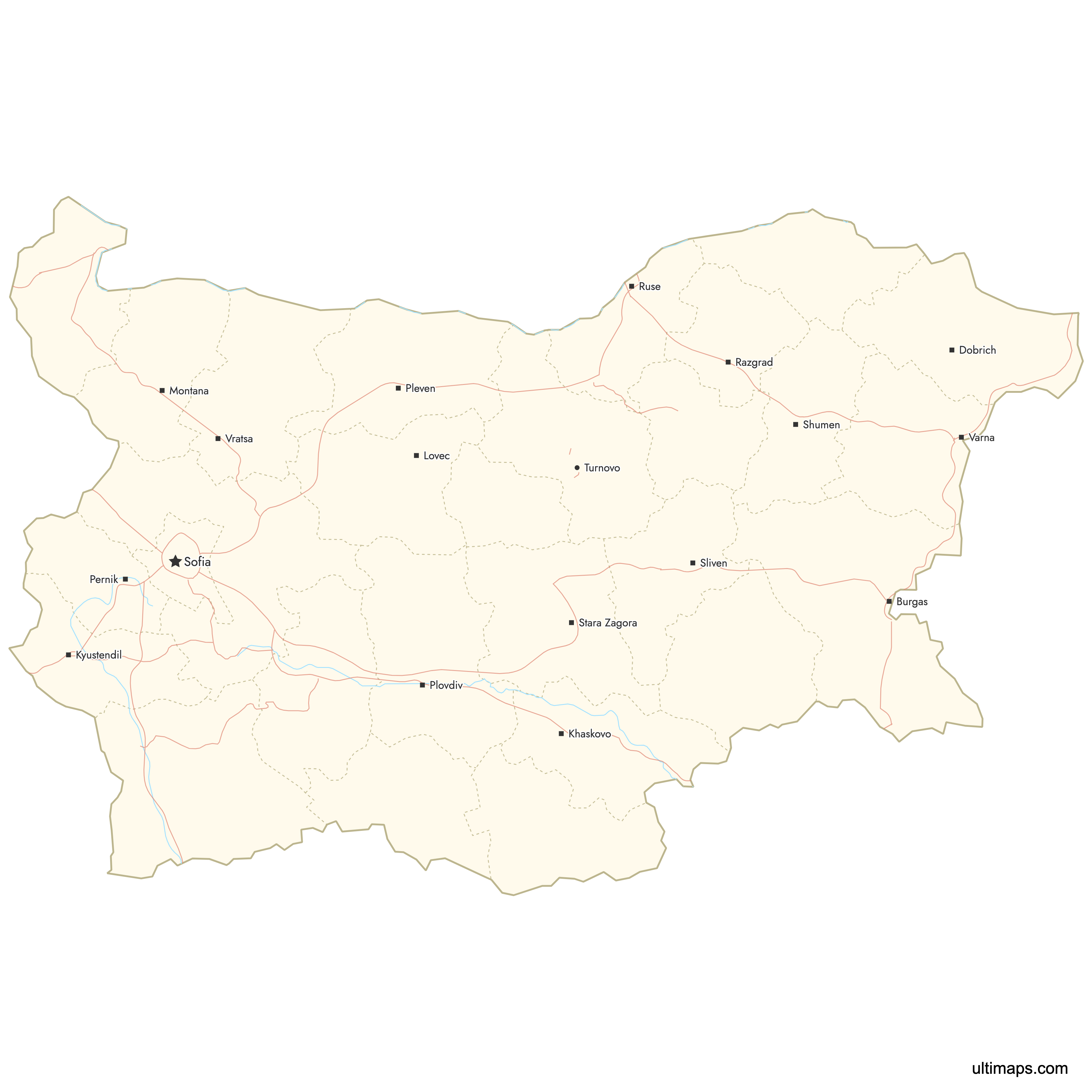
This map supports surrounding areas, roads, rivers and cities. New
This map is divided into 28 provinces.
Updates
May 14, 2026:
- Added map of Bulgaria Provinces with surrounding countries, cities and roads
Frequently Asked Questions
Bulgaria has 28 provinces, known as oblasti in Bulgarian. These provinces are further subdivided into 265 municipalities (obshtini). The current 28-province structure was established in 1999 after the country reverted from a system of 9 larger provinces created in 1987 under communist rule.
Blagoevgrad Province is the largest by area at 6,449.47 km² (2,490.13 sq mi). It is located in southwestern Bulgaria and is home to major landmarks including the Rila Monastery (a UNESCO World Heritage Site) and Pirin National Park, which features Mount Vihren at 2,915 meters.
Sofia City Province (Sofia-grad) is the smallest at approximately 1,349 km² (521 sq mi). Despite its small size, it is the most densely populated province in the country, as it encompasses the capital city of Sofia with roughly 1.2 million residents.
Sofia City Province (Sofia-grad) is the most populated, with over 1.2 million residents as of 2021. It consists solely of Sofia Capital Municipality and is the political, economic, and cultural center of the country. Plovdiv Province is the second most populous with 634,497 people according to the 2021 census.
Vidin Province is the least populated with just 75,408 residents as of the 2021 census. Its population dropped 25.4% from 101,018 in 2011, making it one of the fastest-declining provinces in the country. Despite the population loss, Vidin is home to the Belogradchik Rocks, a dramatic natural sandstone formation.
Bulgaria's landmarks are spread across many provinces. The Rila Monastery and Pirin National Park are in Blagoevgrad Province. The ancient Roman Theatre of Plovdiv (2nd century AD) is in Plovdiv Province. The Madara Rider, an 8th-century UNESCO rock relief, is in Shumen Province. The ancient city of Nessebar, a 3,000-year-old UNESCO site, is in Burgas Province on the Black Sea coast.
Bulgaria borders Romania to the north along the Danube River, Serbia to the west, North Macedonia to the southwest, Greece to the south, and Turkey to the southeast. The Black Sea forms the country's entire eastern coastline, with Varna and Burgas provinces serving as the main coastal regions.
The current 28-province structure was established in 1999. Bulgaria originally had 28 districts (okrazi) before 1987, when the communist government consolidated them into 9 larger provinces. After democratization, the country reverted to 28 provinces in 1999, roughly matching the pre-1987 boundaries.
Bulgaria covers a total area of 111,001.71 km² (42,855 sq mi). The country's population was 6,519,789 according to the 2021 census, down 11.5% from 7,364,570 in 2011. The average population density across all 28 provinces is approximately 58.73 people per km².
You can use Ultimaps to create custom maps of Bulgaria. Color-code provinces manually or upload your data, place pins, customize the look and feel, and export to PNG, PDF, or SVG. No sign-up required.