Zimbabwe Map with Provinces
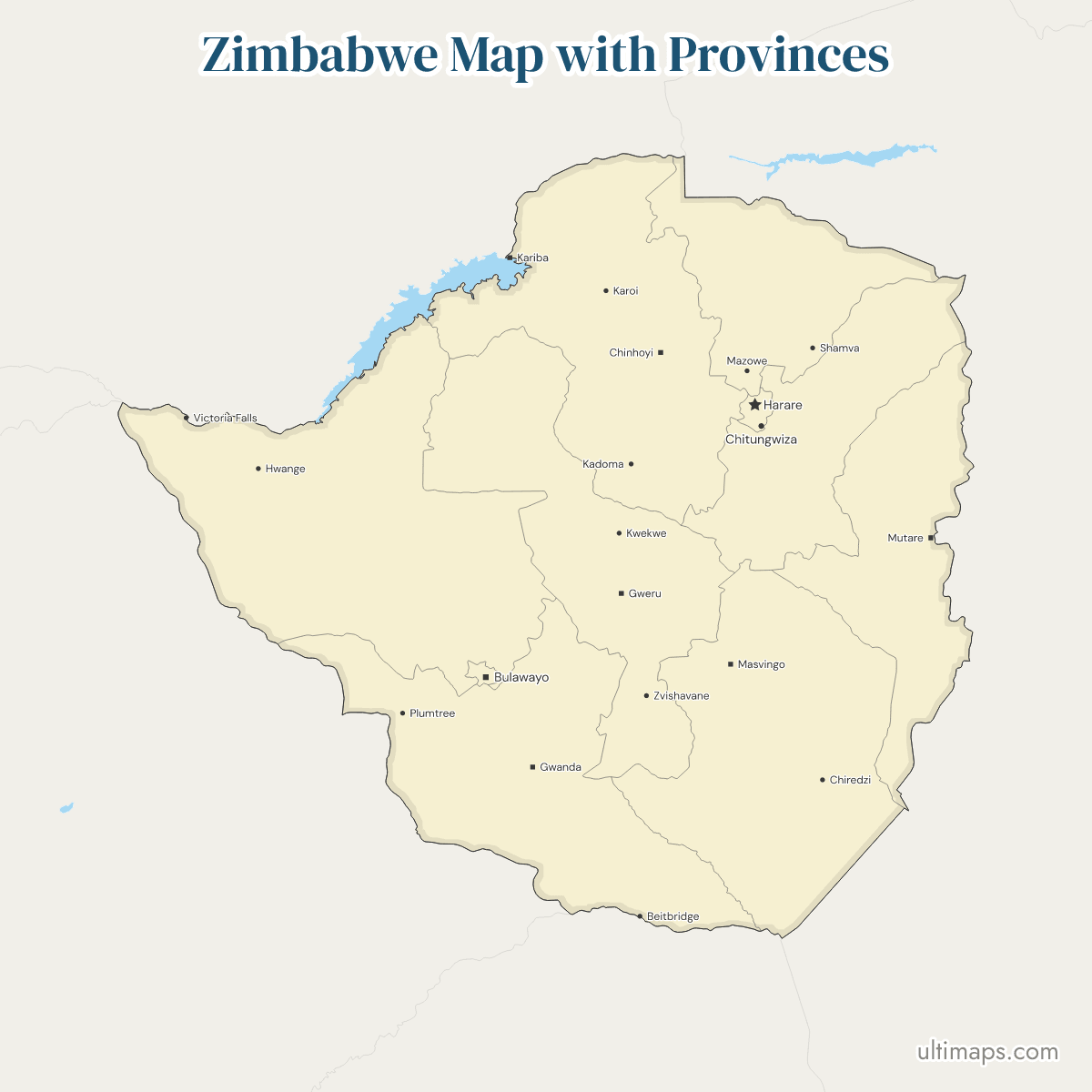
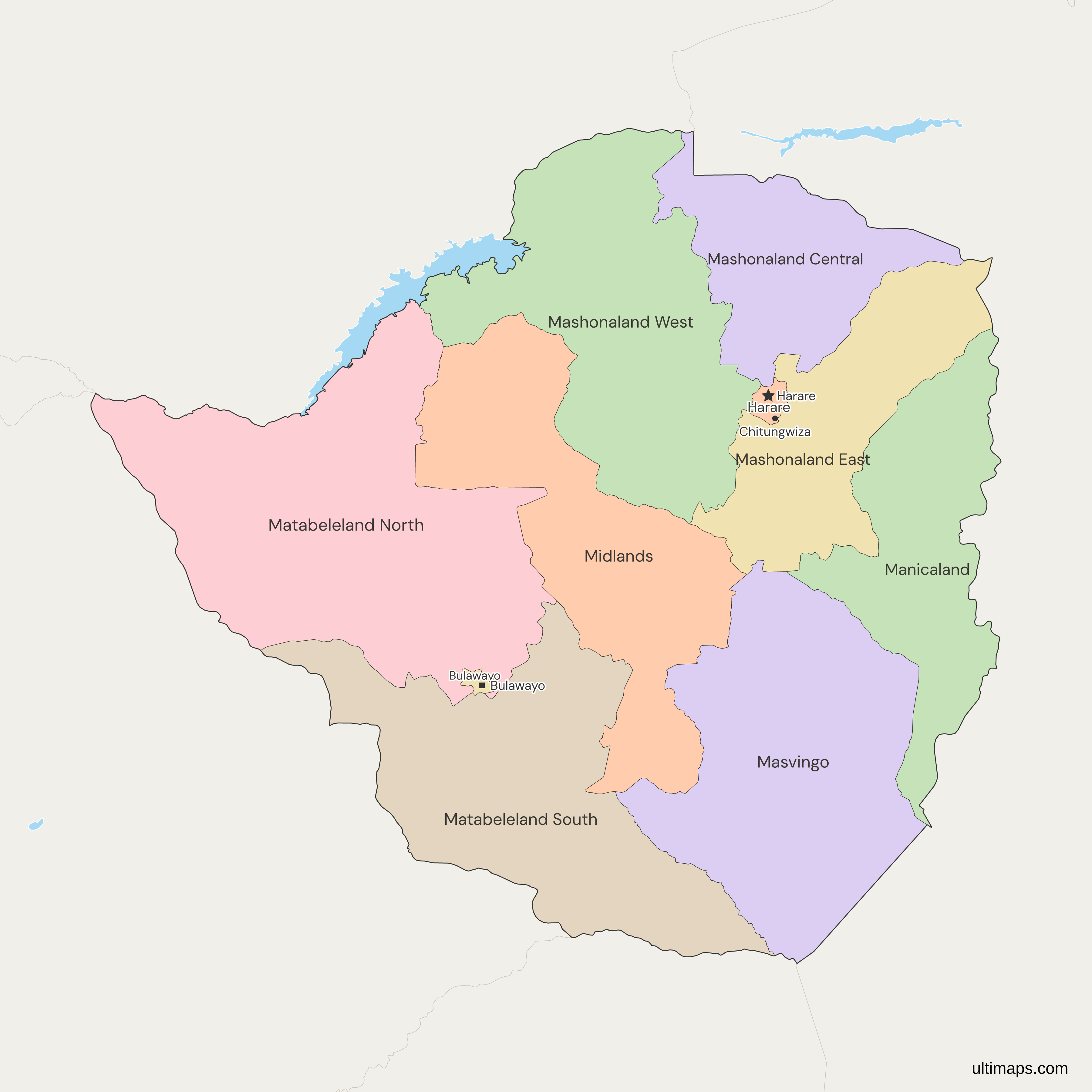
This map of Zimbabwe shows all 10 provinces, a set in which Harare and Bulawayo have ranked as metropolitan provinces since 1997, which is why some sources count 8 provinces and 2 cities. The capital's province dominates the count: Harare holds 2,427,231 of the 15,178,957 people in the 2022 census (ZIMSTAT), about 16%, while Bulawayo, the least populous, has 665,952. Harare province, home to the national capital, is the second smallest, at 872 km² (ZIMSTAT, 2022), while Matabeleland North is the largest at 75,025 km².
Open the map in the free Ultimaps editor to make your own custom map of Zimbabwe. You can color the provinces by your data, add pins and labels, and share or embed the finished map.
Interactive Zimbabwe Map with Provinces
List of Provinces (10)
| # | Province | Capital | Population (2022) | Area (km², 2022) |
|---|---|---|---|---|
| 1 | Bulawayo | Bulawayo | 665,952 | 479 |
| 2 | Harare | Harare | 2,427,231 | 872 |
| 3 | Manicaland | Mutare | 2,037,703 | 36,459 |
| 4 | Mashonaland Central | Bindura | 1,384,891 | 28,347 |
| 5 | Mashonaland East | Marondera | 1,731,173 | 32,230 |
| 6 | Mashonaland West | Chinhoyi | 1,893,584 | 57,441 |
| 7 | Masvingo | Masvingo | 1,638,528 | 56,566 |
| 8 | Matabeleland North | Lupane | 827,645 | 75,025 |
| 9 | Matabeleland South | Gwanda | 760,345 | 54,172 |
| 10 | Midlands | Gweru | 1,811,905 | 49,166 |
Data sources:
- Capital: Government of Zimbabwe, Zimbabwe Government Portal, province pages. License: facts compiled by Ultimaps, CC BY 4.0.
- Population and Area: ZIMSTAT, 2022 Population and Housing Census Report, Table 2.9. License: no reuse licence published.
Zimbabwe Provinces: Key Facts
- Number of provinces: 10, made up of 8 provinces and the 2 metropolitan provinces of Harare and Bulawayo, all listed in section 267(1) of the 2013 Constitution.
- Capital: Harare, the national capital, which lies in Harare Metropolitan Province.
- Largest province by area: Matabeleland North, 75,025 km² total area (ZIMSTAT, 2022). Mashonaland West (57,441 km²) and Masvingo (56,566 km²) follow.
- Smallest province by area: Bulawayo, 479 km² (ZIMSTAT, 2022), a little over half the 872 km² of Harare.
- Most populous province: Harare, 2,427,231 residents in the 2022 census (ZIMSTAT). Manicaland is second with 2,037,703.
- Least populous province: Bulawayo, 665,952 residents in the 2022 census (ZIMSTAT). Matabeleland South is next, with 760,345.
- Total population: 15,178,957 in the 2022 census (ZIMSTAT), with 20 April 2022 as census night.
- Borders: Zimbabwe borders Mozambique (Manicaland, Mashonaland East, Mashonaland Central and Masvingo), Botswana (Matabeleland North and Matabeleland South), Zambia (Matabeleland North, Mashonaland West and Mashonaland Central) and South Africa (Matabeleland South and Masvingo).
- Coast: none. Zimbabwe is landlocked and no province touches the sea.
- Lakes: Lake Kariba, on the Zambian border, forms part of the edge of Matabeleland North and Mashonaland West. The map cuts the lake out of the country.
- Grouping: Mashonaland Central, East and West share the Mashonaland prefix, and Matabeleland North and South the Matabeleland one. Manicaland, Masvingo, Midlands, Harare and Bulawayo carry no such prefix, but Harare lies within Mashonaland and Bulawayo within Matabeleland.
- Codes: ISO 3166-2 gives each province a two-letter code, such as ZW-MN for Matabeleland North, ZW-HA for Harare and ZW-BU for Bulawayo. Zimbabwe also appears on the Map of Africa and the Map of the World.
Interesting Facts
- Victoria Province: Masvingo was called Victoria Province until the early 1980s, and the old name still matches in the editor.
- Ruwa: Some sources place the town of Ruwa in Harare Metropolitan Province. The census tables and this map keep it in Mashonaland East.
- Metropolitan status: Harare and Bulawayo became provinces in 1997, and the 2013 Constitution kept them at the same tier as the other eight, so the map has one level.
Free Downloads
Free for personal and commercial use with a credit to Ultimaps. See the license terms for details.
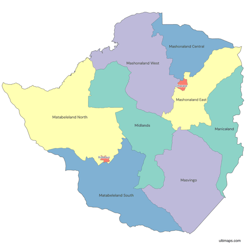 Colored Zimbabwe Map with Provincespng457 KB
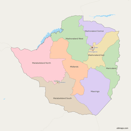 Political Map of Zimbabwe with Provincespng499 KB
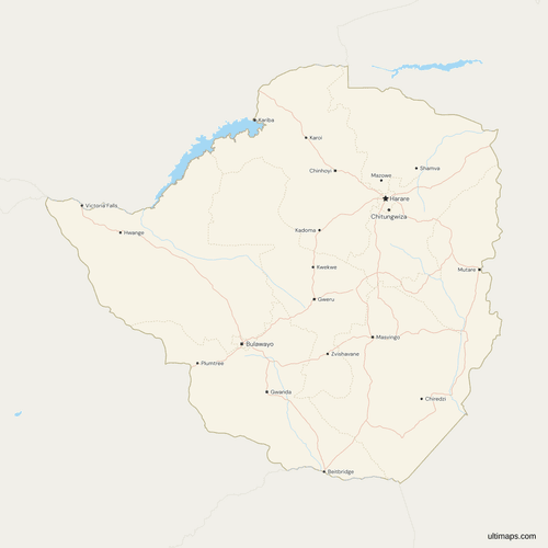 Map of Zimbabwe with Cities and Roadspng658 KB
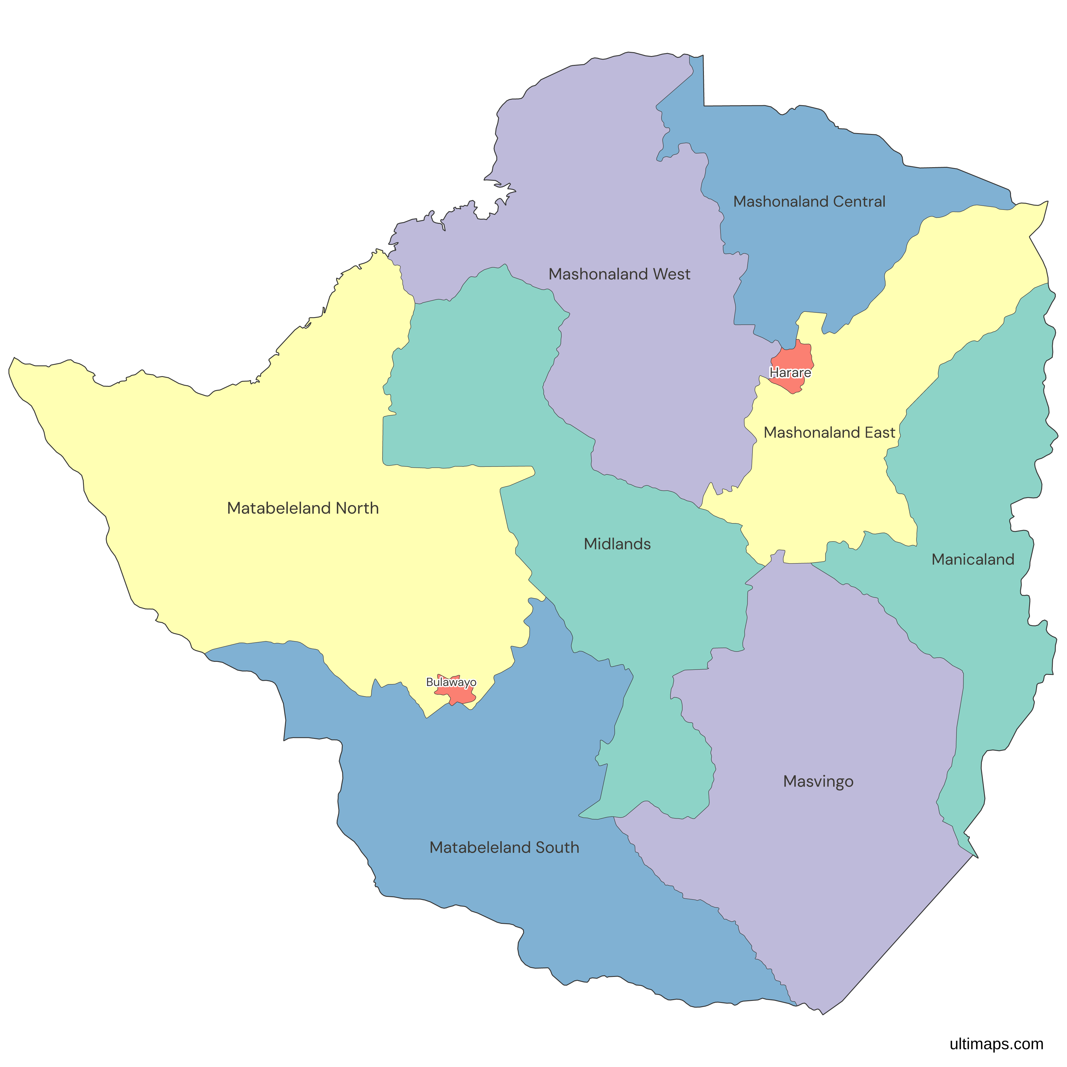
Need it without colors? The blank version of this map comes as a print-ready PDF (A4 and US Letter), a PNG and an editable SVG.
Custom Map Features
This map supports labels.
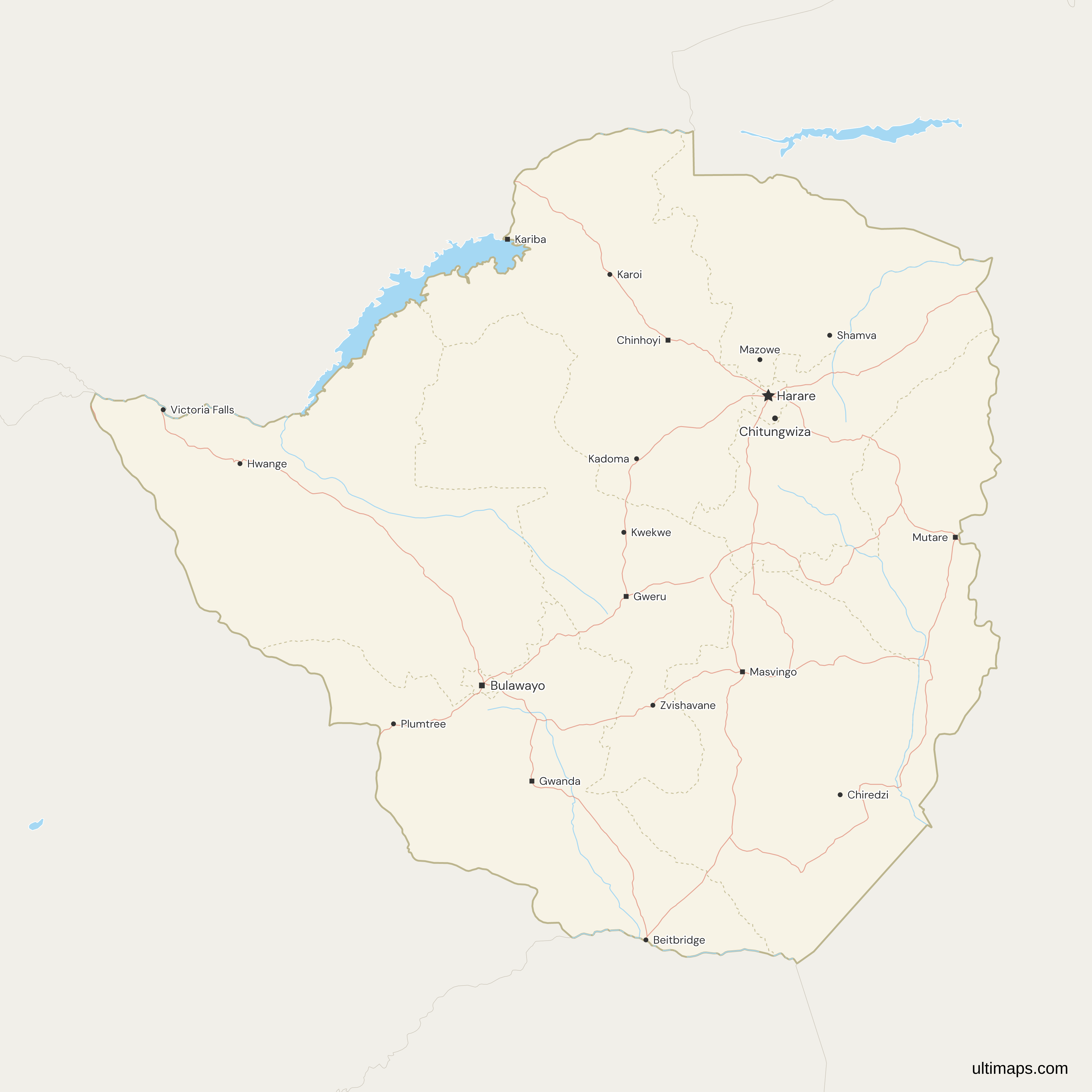
This map supports surrounding areas, roads, rivers and cities. New
This map is divided into 10 provinces.
Updates
Nov 5, 2026:
- Added map of Zimbabwe provinces
Frequently Asked Questions
Zimbabwe has 10 provinces. Eight are the geographic provinces such as Manicaland, Masvingo and Midlands, and two are the metropolitan provinces of Harare and Bulawayo, which are built around the two largest cities. All 10 are named in section 267(1) of the 2013 Constitution, which is why sources that count 8 provinces and 2 cities with provincial status describe the same set. Harare and Bulawayo became provinces in 1997. This map draws all 10 at one level, with each metropolitan province shown as its own unit beside the other eight.
Matabeleland and Mashonaland are the two regions whose names five of Zimbabwe's 10 provinces carry. Mashonaland, in the northeast, takes in Mashonaland Central, Mashonaland East, Mashonaland West and Harare. Matabeleland, in the southwest, takes in Matabeleland North, Matabeleland South and Bulawayo. Manicaland, Masvingo and Midlands belong to neither. The map draws the 10 provinces, so you can show either region by giving its provinces the same color or the same value. Neither name is a province of its own, so there is no single Matabeleland or Mashonaland row in a table.
No, the Zimbabwe map stops at the 10 provinces, so the districts and wards under them are not drawn. Each province, the metropolitan ones included, is one shape, and a table with one row per province is the easiest data to color it with. To mark a particular district, write its name as a label by hand in the editor, and the provinces stay the units you color. A district-level dataset can still be used here if you total its values by province first.
In the west, between Botswana and Zambia, Matabeleland North covers 75,025 km² of total area, the most of any province in the 2022 census report of ZIMSTAT, and part of its northern edge follows Lake Kariba. Mashonaland West is second at 57,441 km², followed by Masvingo at 56,566 km². Matabeleland North holds about 19% of the 390,757 km² that the report gives for the whole country. Apart from the two metropolitan provinces, only Mashonaland Central falls below 30,000 km², at 28,347 km².
Bulawayo covers 479 km², a little over half the 872 km² of Harare, while the next smallest, Mashonaland Central, has 28,347 km² (2022 census report of ZIMSTAT). Both are metropolitan provinces built around their cities, which is why they are so much smaller than the other eight. Bulawayo sits in the southwest, enclosed by Matabeleland North and Matabeleland South, while Harare is bordered by the three Mashonaland provinces. Bulawayo also has the fewest residents, 665,952 in the 2022 census, so it is the smallest province by both area and population.
Of every six people counted in Zimbabwe in 2022, about one lived in Harare province: 2,427,231 of 15,178,957 (ZIMSTAT). Manicaland follows with 2,037,703 and Mashonaland West with 1,893,584, so Harare's share is far larger than Manicaland's, which is about 13%. Harare province, which contains the national capital, covers only 872 km², so it is by far the densest province. The least populous is Bulawayo, with 665,952 residents, and Matabeleland South is next with 760,345. All figures count people present on the census night of 20 April 2022.
Not as of November 2026. ZANU-PF adopted a conference resolution in October 2024 to rename the provinces, but no bill, gazette notice or Cabinet decision followed. The 10 provinces are currently set by section 267 of the 2013 Constitution, so a rename would need an amendment to that section. Constitution Amendment No. 3, signed into law in July 2026, changed how the President is elected, terms of office, the Senate and several constitutional bodies, and it left section 267 untouched.
Open this map in the Ultimaps editor, which is free and needs no account, and give each of the 10 provinces a value or a color. You can add pins and labels, then share or embed the result. Free exports are PNG files that carry a small Ultimaps credit. Pro drops the credit and adds high-resolution PNG, SVG and PDF. To color from a table, enter one row per province, using names such as Matabeleland North or codes such as ZW-MN. Names like Harare Metropolitan Province and the misspelling Matebeleland also match.