South Africa Map with Provinces
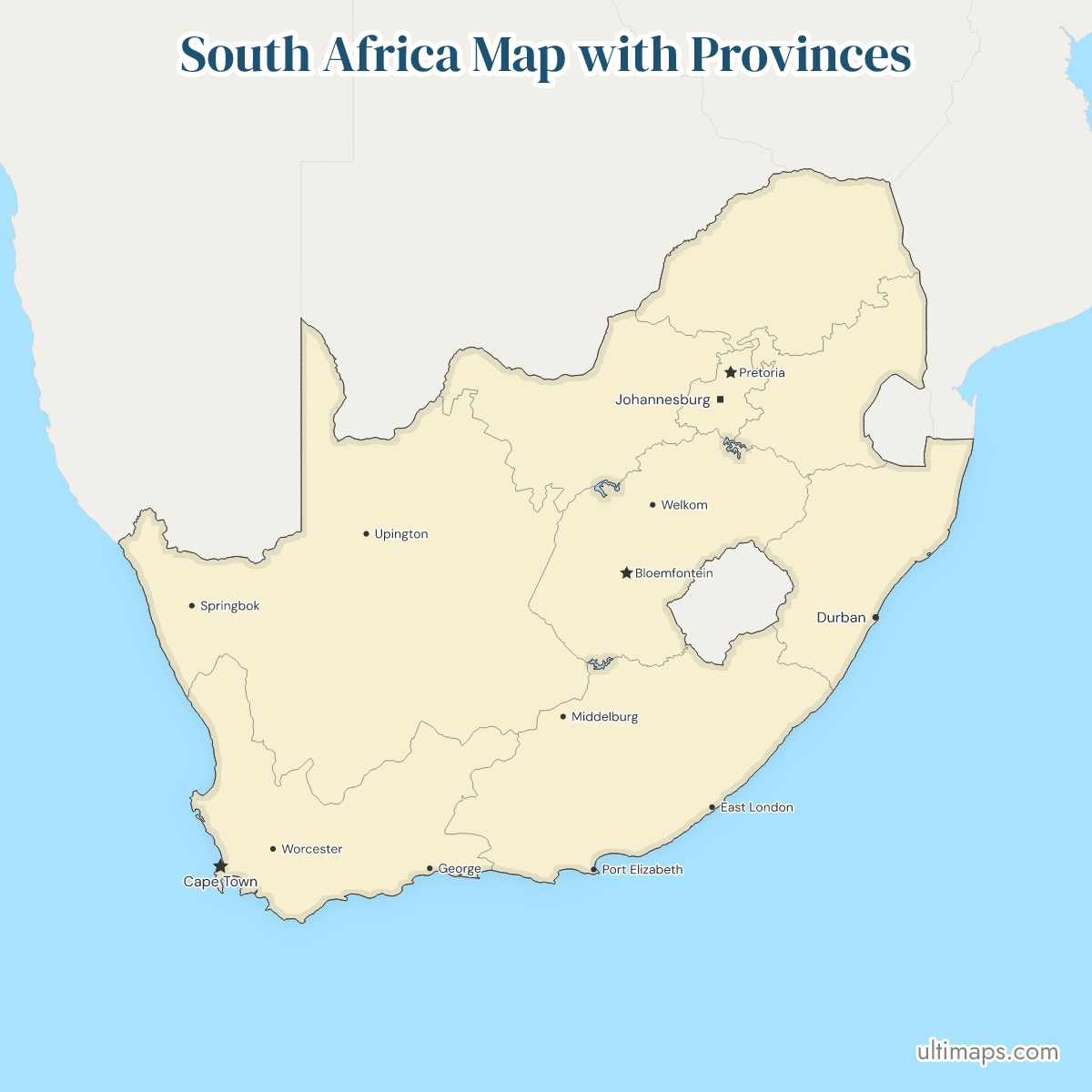
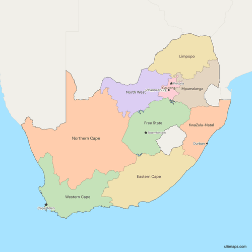
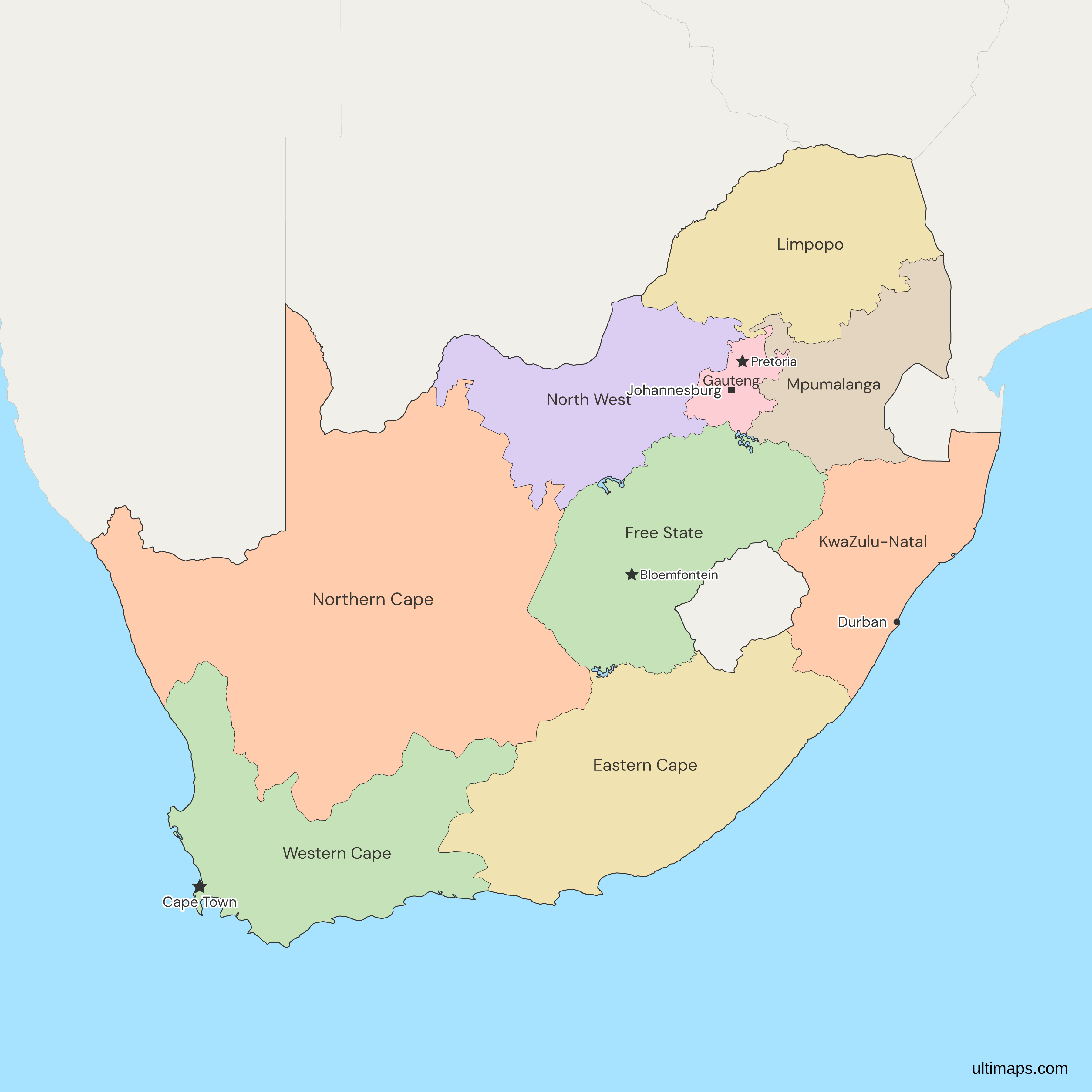
This map of South Africa shows all 9 provinces, in place since 1994. South Africa has three capitals: Pretoria (executive), Cape Town (legislative) and Bloemfontein (judicial). Gauteng covers only 18,178 km² (Stats SA, Census 2011) but holds 15.9 million people (Stats SA, 2024 mid-year estimate), against 372,889 km² and 1.4 million people in Northern Cape. Merafong's return to Gauteng in 2009 was the last boundary change. This map divides South Africa into its nine provinces and lets you color each one.
Open the map in the free Ultimaps editor to make your own custom map of South Africa. Upload a table of province names and values and the map colors itself.
Interactive South Africa Map with Provinces
List of Provinces (9)
| # | Province | Capital | Population (2024) | Area (km², 2011) |
|---|---|---|---|---|
| 1 | Eastern Cape | Bhisho | 7,176,230 | 168,966 |
| 2 | Free State | Bloemfontein | 3,044,050 | 129,825 |
| 3 | Gauteng | Johannesburg | 15,931,824 | 18,178 |
| 4 | KwaZulu-Natal | Pietermaritzburg | 12,312,712 | 94,361 |
| 5 | Limpopo | Polokwane | 6,402,594 | 125,754 |
| 6 | Mpumalanga | Mbombela | 5,057,662 | 76,495 |
| 7 | North West | Mahikeng | 4,155,303 | 104,882 |
| 8 | Northern Cape | Kimberley | 1,372,943 | 372,889 |
| 9 | Western Cape | Cape Town | 7,562,588 | 129,462 |
Data sources:
- Capital: South African Government (gov.za), South Africa's provinces. License: facts compiled by Ultimaps, CC BY 4.0.
- Population: Stats SA, Mid-year population estimates 2024 (P0302), Appendix 1. License: reuse with acknowledgement.
- Area: Stats SA, Census 2011, Census in brief, Table 1.1. License: reuse with acknowledgement.
South Africa Provinces: Key Facts
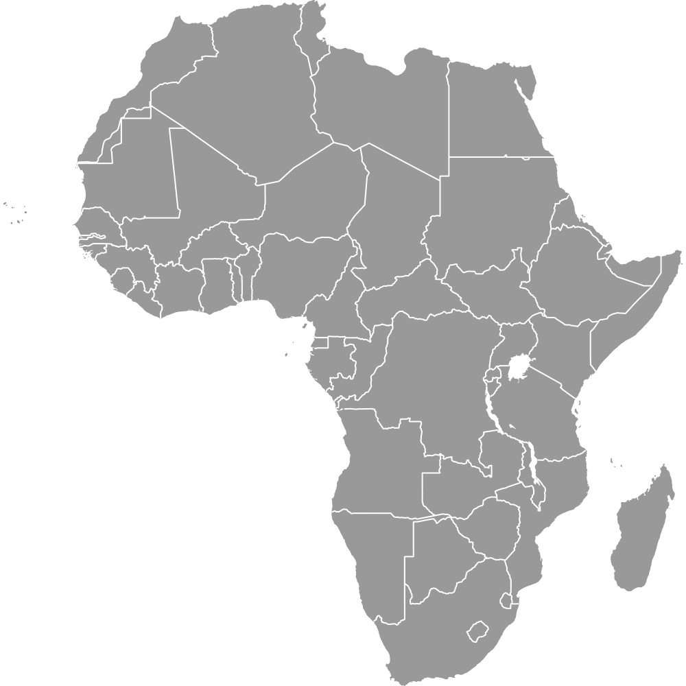
- Number of provinces: 9 (see the map of Africa), in place since 27 April 1994.
- Provincial capitals: Bhisho (Eastern Cape), Bloemfontein (Free State), Johannesburg (Gauteng), Pietermaritzburg (KwaZulu-Natal), Polokwane (Limpopo), Mbombela (Mpumalanga), Mahikeng (North West, formerly Mafikeng), Kimberley (Northern Cape) and Cape Town (Western Cape).
- Area range: Northern Cape at 372,889 km² down to Gauteng at 18,178 km² (Stats SA, Census 2011).
- Population range: Gauteng with 15,931,824 people down to Northern Cape with 1,372,943 (Stats SA, 2024 mid-year estimates).
- Borders: Namibia and Botswana touch Northern Cape, and Botswana also touches North West and Limpopo. Limpopo meets Zimbabwe and Mozambique. Mpumalanga and KwaZulu-Natal border both Mozambique and Eswatini. Lesotho is surrounded by KwaZulu-Natal, Free State and Eastern Cape.
- Coast: Northern Cape and Western Cape on the Atlantic, Western Cape, Eastern Cape and KwaZulu-Natal on the Indian Ocean.
- Lakes on the map: three dams on provincial boundaries are drawn: Gariep Dam between Free State and Eastern Cape, Bloemhof Dam between Free State and North West, and Vaal Dam on the edges of Free State, Gauteng and Mpumalanga.
- Last boundary change: the Constitution Sixteenth Amendment Act of 2009. No provincial boundary has changed since.
- Not drawn: the Prince Edward Islands, and the metropolitan and district municipalities inside the provinces.
Interesting Facts
- Limpopo was called Northern Province until 2003.
- Gauteng and KwaZulu-Natal changed their ISO 3166-2 codes on 2 March 2020, from ZA-GT to ZA-GP and from ZA-NL to ZA-KZN.
Free Downloads
Free for personal and commercial use with a credit to Ultimaps. See the license terms for details.
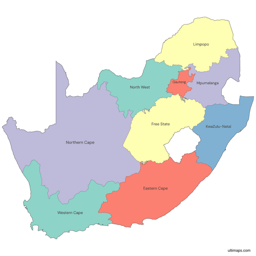 Colored South Africa Map with Provincespng453 KB
 Political Map of South Africa with Provincespng476 KB
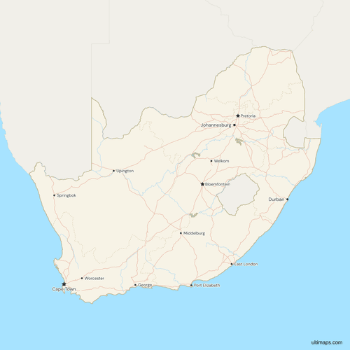 Map of South Africa with Cities and Roadspng774 KB
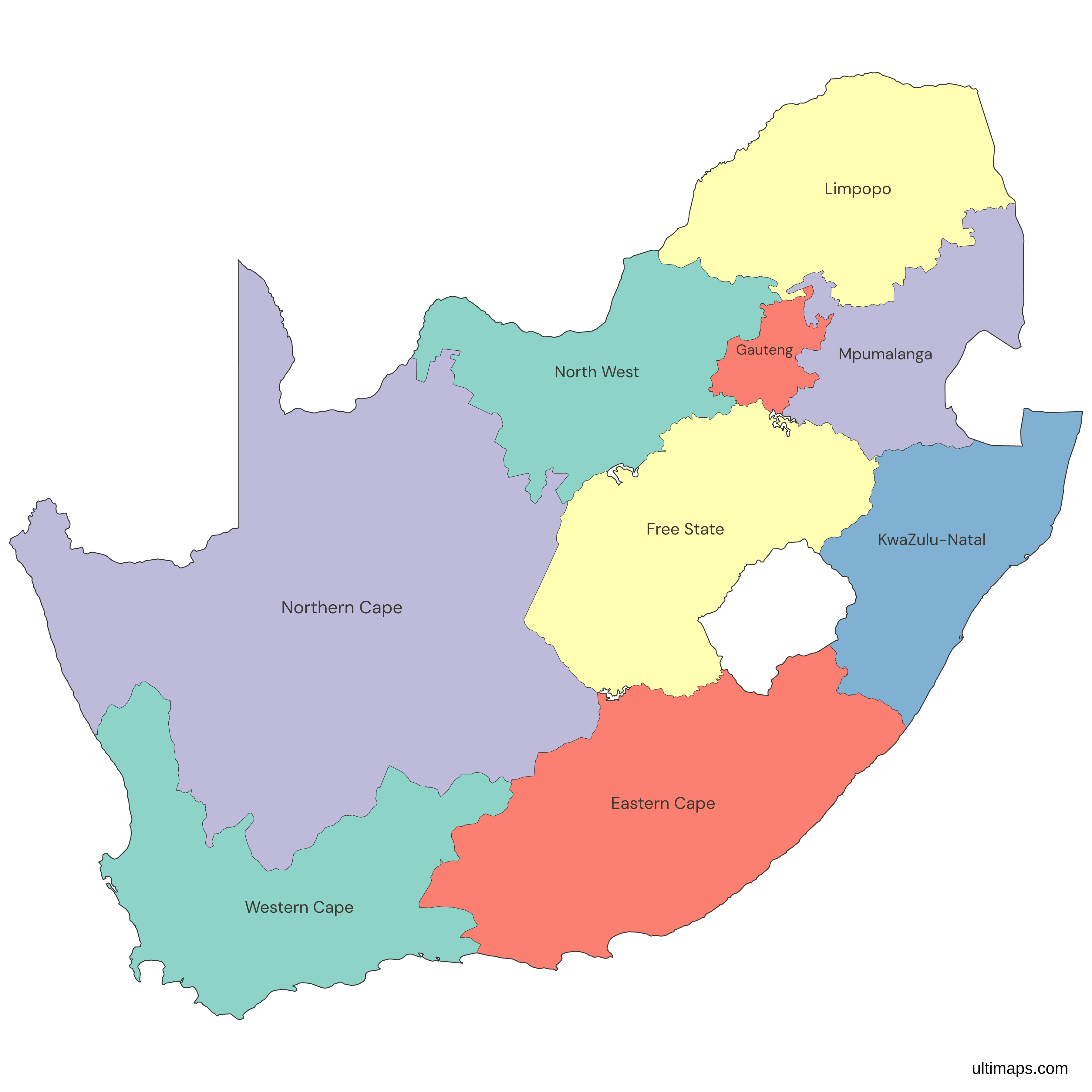
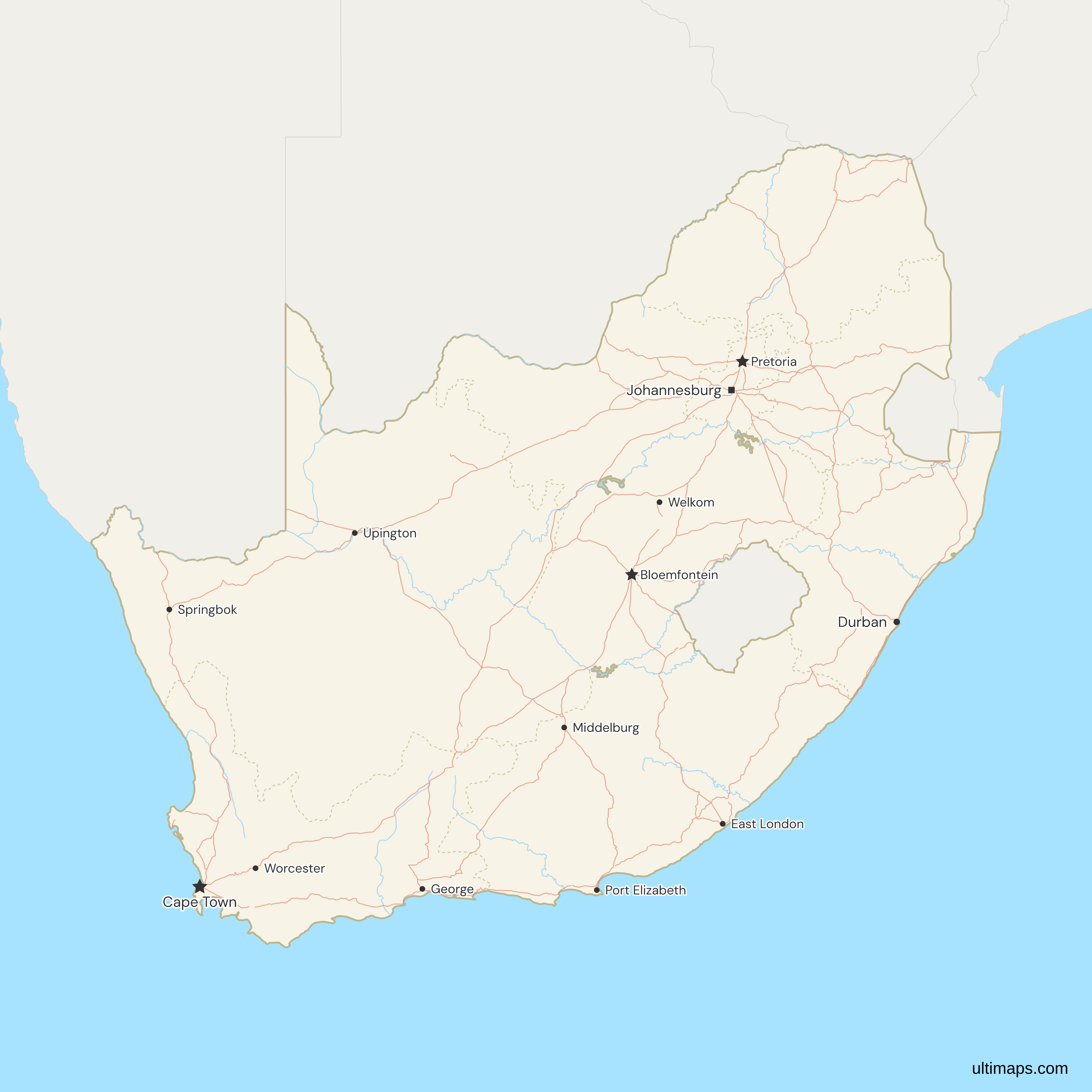
Need it without colors? The blank version of this map comes as a print-ready PDF (A4 and US Letter), a PNG and an editable SVG.
Custom Map Features
This map supports labels.
This map supports surrounding areas, roads, rivers and cities. New
This map is divided into 9 provinces.
Updates
Nov 5, 2026:
- Added map of South Africa provinces
Frequently Asked Questions
South Africa has 9 provinces: Eastern Cape, Free State, Gauteng, KwaZulu-Natal, Limpopo, Mpumalanga, North West, Northern Cape and Western Cape. The nine date from 27 April 1994, when the interim Constitution replaced the earlier four provinces and the ten homelands. Each province has its own legislature and a premier who heads its executive. Merafong was moved from Gauteng to North West in 2005 and returned to Gauteng in 2009 under the Sixteenth Amendment, the last change to any provincial boundary.
South Africa has three capitals, each seating one branch of government. Pretoria, in Gauteng, is the executive capital. Cape Town, in Western Cape, is the legislative capital, where Parliament sits. Bloemfontein, in Free State, is the judicial capital, home to the Supreme Court of Appeal. The arrangement dates from the Union of 1910. Johannesburg, the largest city in the country, is the capital of Gauteng province but not a national capital. The map labels all three national capitals and Johannesburg.
Northern Cape alone makes up roughly 30 percent of South Africa's total area of 1,220,813 km², with 372,889 km² (Stats SA, Census 2011), which is about 20 times the size of Gauteng. Northern Cape is larger than Eastern Cape and Free State together, which come to 298,791 km². It borders Namibia and Botswana and has the Atlantic coast on its west. Eastern Cape ranks second at 168,966 km² and Free State third at 129,825 km². These three provinces together cover about 55 percent of the country.
Gauteng has the smallest area of any South African province, 18,178 km² (Stats SA, Census 2011), or about 1.5 percent of the national total. It has no sea coast and no international border, so all four of its neighbors are other provinces: Free State, Limpopo, North West and Mpumalanga. Its only lake shore on the map is the Vaal Dam, which it shares with Free State and Mpumalanga. Its ISO 3166-2 code is ZA-GP. The code was ZA-GT until 2 March 2020, and the map still uses the old id internally.
Gauteng, with 15,931,824 people (Stats SA, 2024 mid-year estimate), has more residents than Limpopo, Mpumalanga and North West combined, which come to 15,615,559. That is about a quarter of the national total. KwaZulu-Natal, at 12,312,712, is the only other province above 10 million, and the two together hold about 45 percent of South Africans. Northern Cape has the fewest, 1,372,943, about one twelfth of Gauteng's figure. The nine estimates add up to 63,015,906, and they are mid-year estimates, not census counts.
The nine provincial capitals are Bhisho in Eastern Cape, Bloemfontein in Free State, Johannesburg in Gauteng, Pietermaritzburg in KwaZulu-Natal, Polokwane in Limpopo, Mbombela in Mpumalanga, Mahikeng in North West, Kimberley in Northern Cape and Cape Town in Western Cape. Mbombela was formerly called Nelspruit and Polokwane was formerly Pietersburg. Mahikeng and the adjoining town of Mmabatho were merged after 1994, so some sources give Mmabatho. Of the nine provincial capitals, the map labels only Cape Town, Bloemfontein and Johannesburg, so use this list for the other six.
Lesotho is not part of South Africa. It is an independent country that South Africa surrounds on all sides, and it is drawn in grey on this map. Its border runs along KwaZulu-Natal, Free State and Eastern Cape. Eswatini, on the north-eastern edge of South Africa beside Mpumalanga and KwaZulu-Natal, is also an independent country and also drawn in grey, so the nine provinces stand out. Together with Namibia, Botswana, Zimbabwe and Mozambique, they are South Africa's six land neighbors.
The map shows mainland South Africa. The Prince Edward Islands remain South African territory and belong to Western Cape for legal and electoral purposes. They lie about 1,800 km south-east of the mainland and are left off so the provinces fill the frame. Marion Island and Prince Edward Island cover about 340 km² together, so even Gauteng, the smallest drawn province at 18,178 km², is more than 50 times larger. This map draws Western Cape without them, as its mainland part only.
Open the map in the free Ultimaps editor. It is free to use and needs no account. You can click a province to color it by hand, or upload a table of province names and values to color the provinces by your data. Add pins and labels, then share the finished map by link or embed it on a website. A free export is a standard PNG with a small Ultimaps credit. High-resolution PNG, SVG and PDF export are Pro features.