Rwanda Map with Provinces
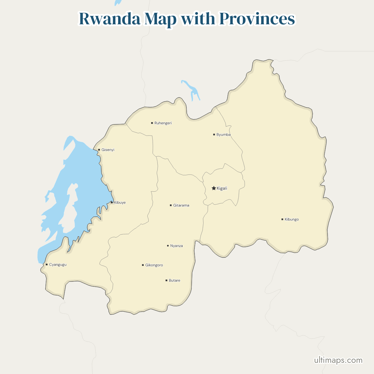
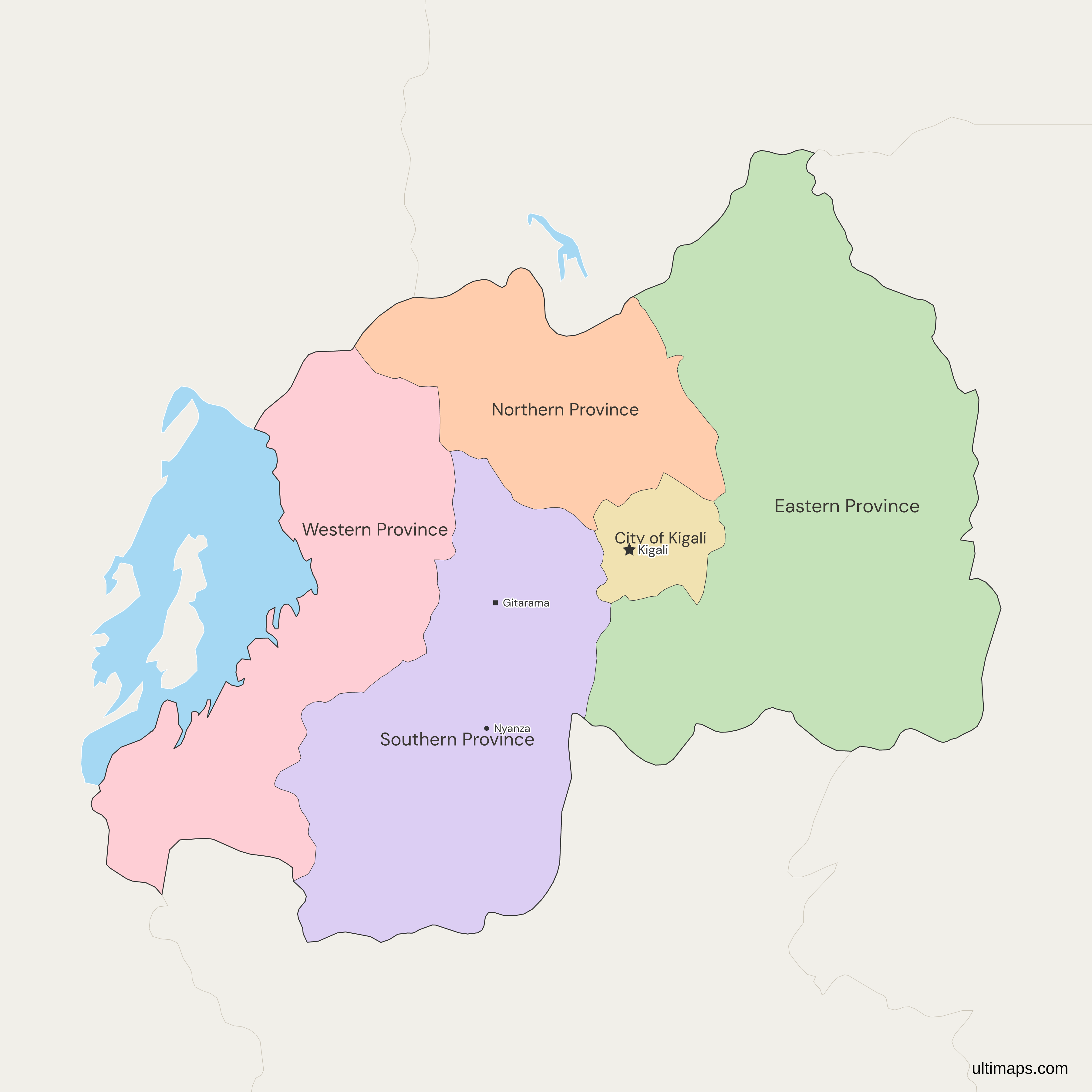
This map of Rwanda shows all four provinces and the City of Kigali, the set that Organic Law 29/2005 introduced on 1 January 2006 in place of 12 former prefectures. Eastern Province has the most residents, 3,563,145 in the 2022 census (NISR), about 27% of the national total of 13,246,394, and the City of Kigali has the fewest, 1,745,555. Kigali, the national capital, is the City of Kigali itself, a province-level city rather than a province. Lake Kivu is cut out of Western Province along the border with the Democratic Republic of the Congo.
Open the map in the free Ultimaps editor to make your own custom map of Rwanda. You can color the provinces by your data, add pins and labels, and share or embed the finished map.
Interactive Rwanda Map with Provinces
List of Provinces (5)
| # | Province | Capital | Population (2022) |
|---|---|---|---|
| 1 | City of Kigali | Kigali | 1,745,555 |
| 2 | Eastern Province | Rwamagana | 3,563,145 |
| 3 | Northern Province | Musanze | 2,038,511 |
| 4 | Southern Province | Nyanza | 3,002,699 |
| 5 | Western Province | Karongi | 2,896,484 |
Data sources:
Rwanda Provinces: Key Facts
- Number of units: 5, made up of 4 provinces (Northern, Southern, Eastern and Western) and the City of Kigali, a province-level city. The ISO 3166-2 category of the City of Kigali is City, not province.
- Capital: Kigali, the national capital, which is the City of Kigali itself.
- Largest and smallest by area: Eastern Province is the largest unit and the City of Kigali the smallest. Among the four provinces proper, Northern Province is the smallest.
- Most and least populous: Eastern Province has the most, 3,563,145 residents (NISR, 2022 census), and the City of Kigali the fewest, 1,745,555, below Northern Province with 2,038,511.
- Borders: Rwanda borders Burundi, Tanzania, Uganda and the Democratic Republic of the Congo. By unit, Eastern Province reaches Uganda, Tanzania and Burundi. Western Province meets Burundi and the Democratic Republic of the Congo, Southern Province meets Burundi only, and Northern Province meets Uganda and the Democratic Republic of the Congo.
- Region: Rwanda is a landlocked country in East Africa, and it also appears on the world map. The Kenya counties map covers a neighbor of the region at a similar level of detail.
- Coast: no unit reaches the sea.
- Lakes: Western Province has the shore of Lake Kivu, which it shares with the Democratic Republic of the Congo. The map cuts the lake out of the province and does not draw the smaller lakes such as Muhazi, Burera or Mugesera.
- Last reform: the set dates from 1 January 2006 (Organic Law 29/2005). Organic Law 04/2010/OL rewrote the article that lists the units and kept the same five, with unchanged boundaries.
- Level below: the 30 districts listed in Annex II of Organic Law 29/2005. This map has no district boundaries.
- Codes: RW-01 City of Kigali, RW-02 Eastern, RW-03 Northern, RW-04 Western and RW-05 Southern (ISO 3166-2).
Interesting Facts
- The 12 provinces of 2002 were the former prefectures, renamed without a change in the set. Organic Law 29/2005 replaced them with the current units.
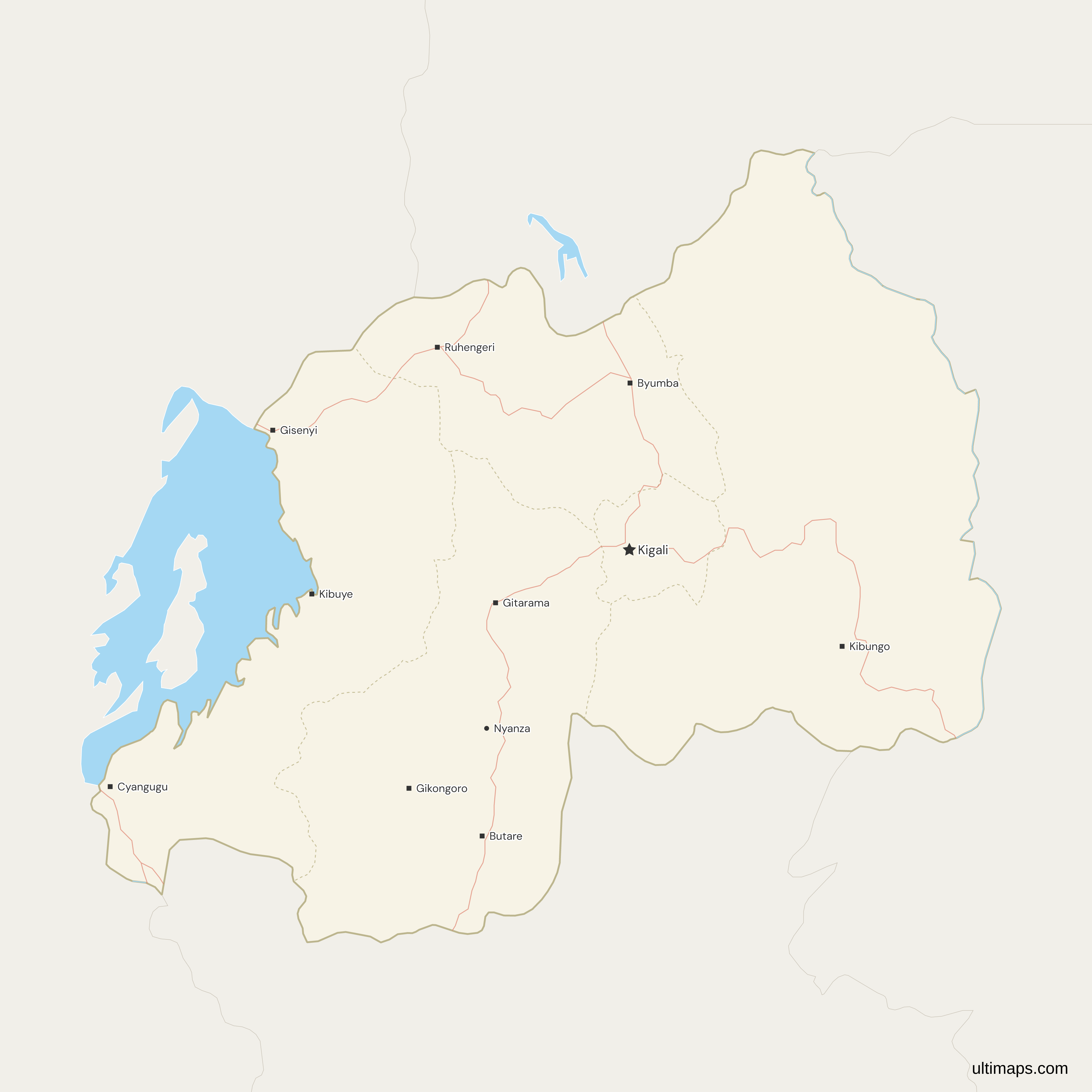
- Some towns on the map carry names from before 2006, such as Ruhengeri for Musanze, Gisenyi for Rubavu and Butare for Huye. The capital symbols on the map mark nine pre-2006 prefecture seats, so nine symbols stand for four provinces.
Free Downloads
Free for personal and commercial use with a credit to Ultimaps. See the license terms for details.
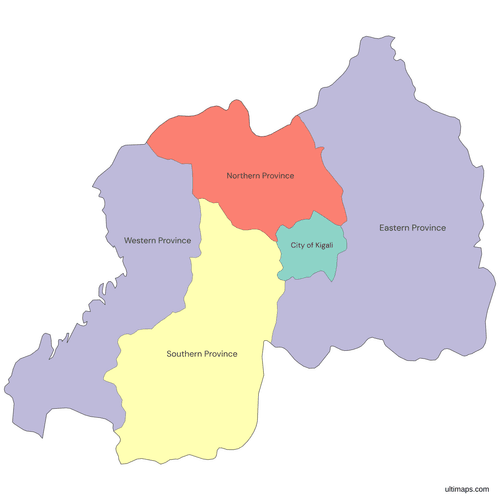 Colored Rwanda Map with Provincespng346 KB
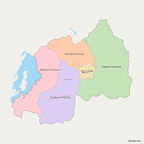 Political Map of Rwanda with Provincespng441 KB
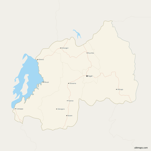 Map of Rwanda with Cities and Roadspng502 KB
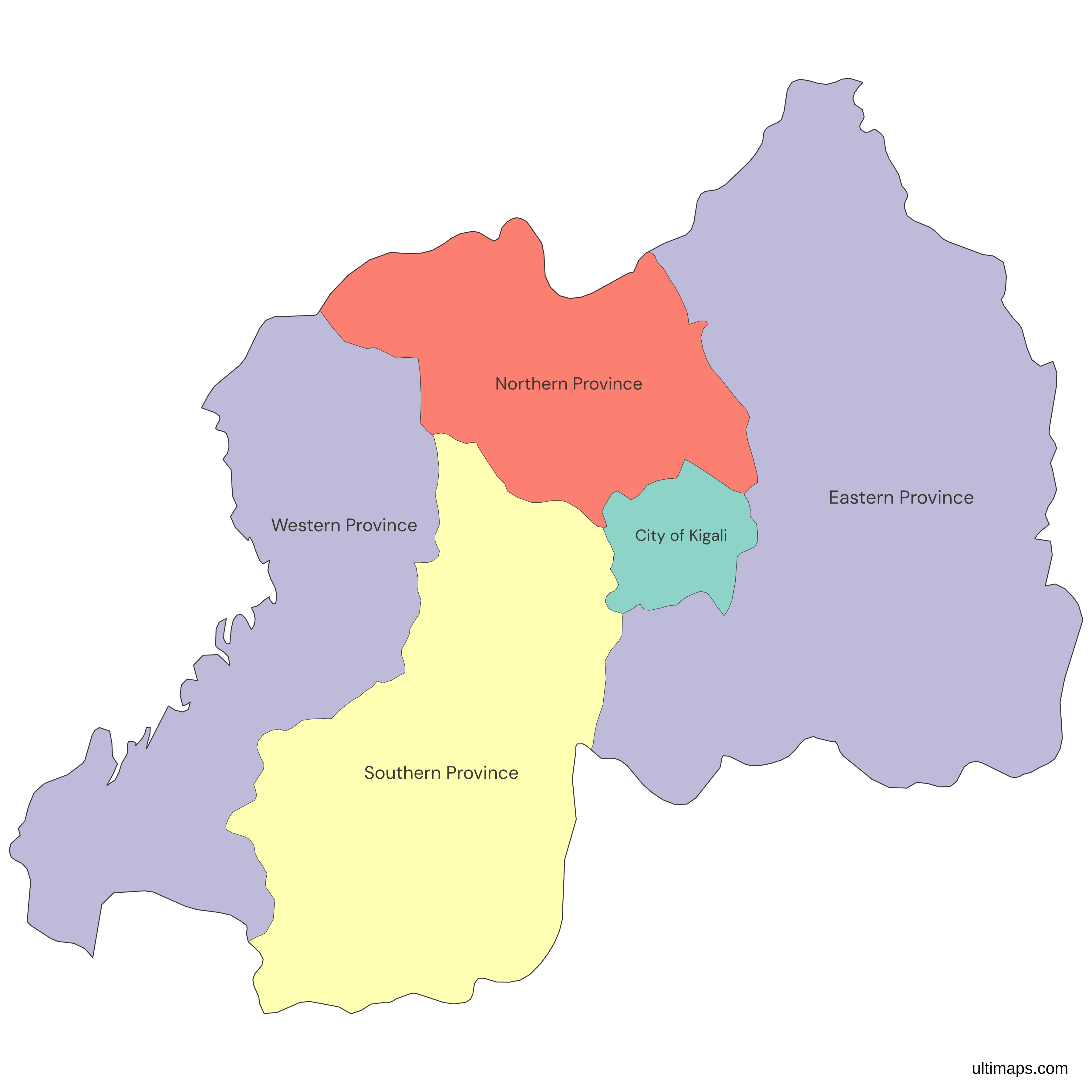
Need it without colors? The blank version of this map comes as a print-ready PDF (A4 and US Letter), a PNG and an editable SVG.
Custom Map Features
This map supports labels.
This map supports surrounding areas, roads, rivers and cities. New
This map is divided into 5 provinces.
Updates
Nov 5, 2026:
- Added map of Rwanda provinces and the City of Kigali
Frequently Asked Questions
Rwanda has four provinces: Northern, Southern, Eastern and Western. The City of Kigali is a fifth unit at the same level, a province-level city, which is why many sources say five provinces and this map shows five units. The set dates from 1 January 2006, when Organic Law 29/2005 replaced the 12 earlier provinces, the former prefectures. Organic Law 04/2010/OL later rewrote the article listing the units and kept the same five with unchanged boundaries. ISO 3166-2 lists the same five codes, RW-01 to RW-05, and records no change to them since 2007.
The 30 districts of Rwanda are not on this map, which stops at the four provinces and the City of Kigali. Annex II of Organic Law 29/2005 lists the districts, and they form the level directly below the provinces. The City of Kigali is itself divided into three districts, Gasabo, Kicukiro and Nyarugenge, so even the capital appears as a single shape here. Figures for those three districts belong together in the one City of Kigali row. A separate map with district boundaries is needed to color the districts themselves.
Kigali is not a province. The City of Kigali is a province-level city with its own status in ISO 3166-2, where it carries the code RW-01, and it contains the national capital of the same name. With 1,745,555 residents in the 2022 census (NISR) it is also the least populous, while each of the four provinces has more than 2 million. Its provincial-level status is the reason the map has five units and not four. On the map it touches Eastern, Southern and Northern provinces and has no international border.
Eastern Province is the largest province of Rwanda by area. It is also the largest of the five units on the map, ahead of Southern Province and Western Province, and it borders Uganda, Tanzania and Burundi. Eastern Province is the only unit that touches Tanzania. It also has the most residents, 3,563,145 in the 2022 census (NISR), about 27% of the national total. Its neighbors inside Rwanda are Southern Province, Northern Province and the City of Kigali, so it forms the whole eastern side of the country.
Northern Province is the smallest of Rwanda's four provinces by area. The City of Kigali is smaller still, but it is a province-level city and not a province. Northern Province lies in the north of the country and touches Uganda and the Democratic Republic of the Congo. It had 2,038,511 residents in the 2022 census (NISR), which makes it the second least populous unit after the City of Kigali. On the map it also touches Eastern, Southern and Western provinces, as well as the City of Kigali.
In the 2022 census (NISR), Eastern Province had the most residents of any province in Rwanda, 3,563,145. Southern Province follows with 3,002,699 and Western Province with 2,896,484. Northern Province has 2,038,511, and the City of Kigali has the fewest at 1,745,555. The five units add up to 13,246,394, the national total that NISR enumerated as of 15 August 2022. Eastern Province therefore holds about 27% of Rwanda's residents, and the City of Kigali about 13%. Southern Province is the only other unit above 3 million, and the four provinces together hold about 87% of residents.
Rwanda's four provinces and the City of Kigali replaced the former prefectures on 1 January 2006, under Organic Law 29/2005 of 31 December 2005. The prefectures had become 12 provinces in 2002 without any change to the set. Organic Law 29/2005 replaced them with four provinces and the City of Kigali and reduced the districts from 106 to 30. ISO 3166-2 then replaced the old codes RW-B to RW-M with RW-01 to RW-05. Older maps that show Butare, Byumba or Gisenyi as provinces predate 2006.
The Ultimaps editor is free and needs no account. Open this map, then give each of the 5 units a value or a color by hand, and add pins and labels before you share or embed the result. A free export is a standard PNG with a small Ultimaps credit, and high-resolution PNG, SVG and PDF exports are part of the Pro plan. To color from a table, enter one row per unit, with names such as Eastern Province or the codes RW-01 to RW-05. List the City of Kigali as its own row, not inside a province.