Nigeria Map with States
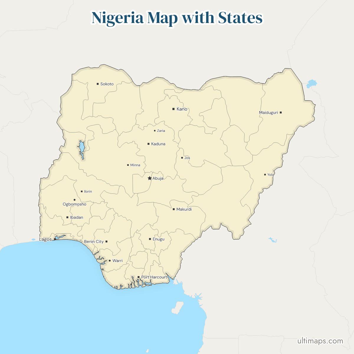
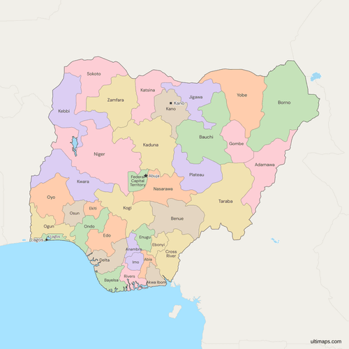
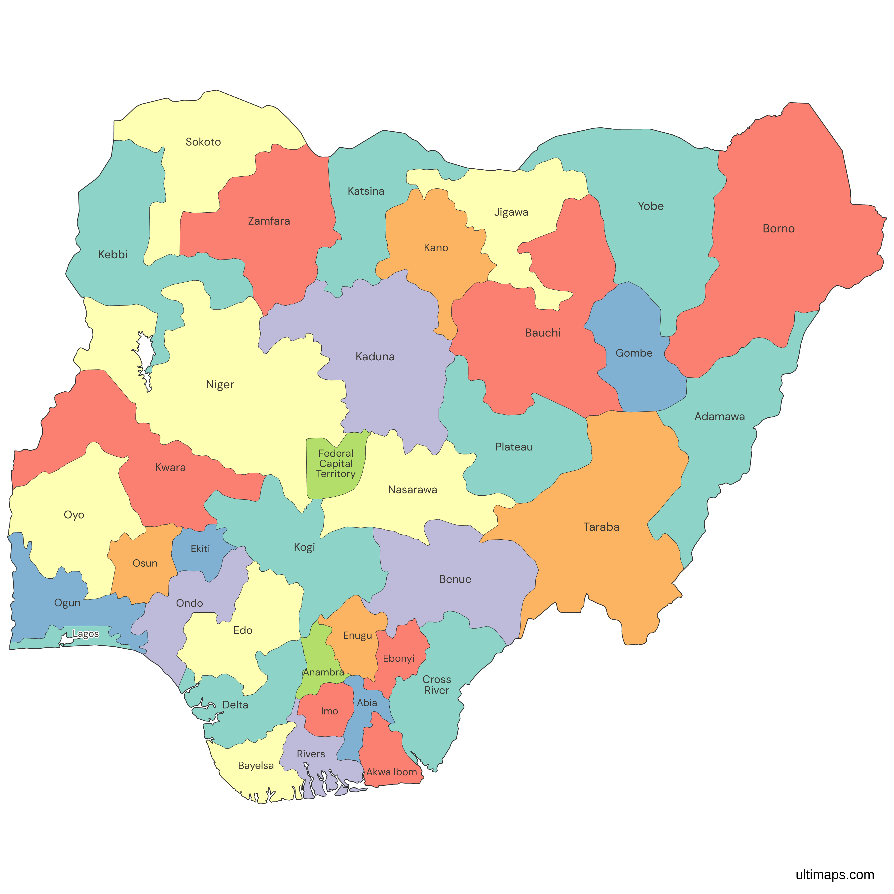
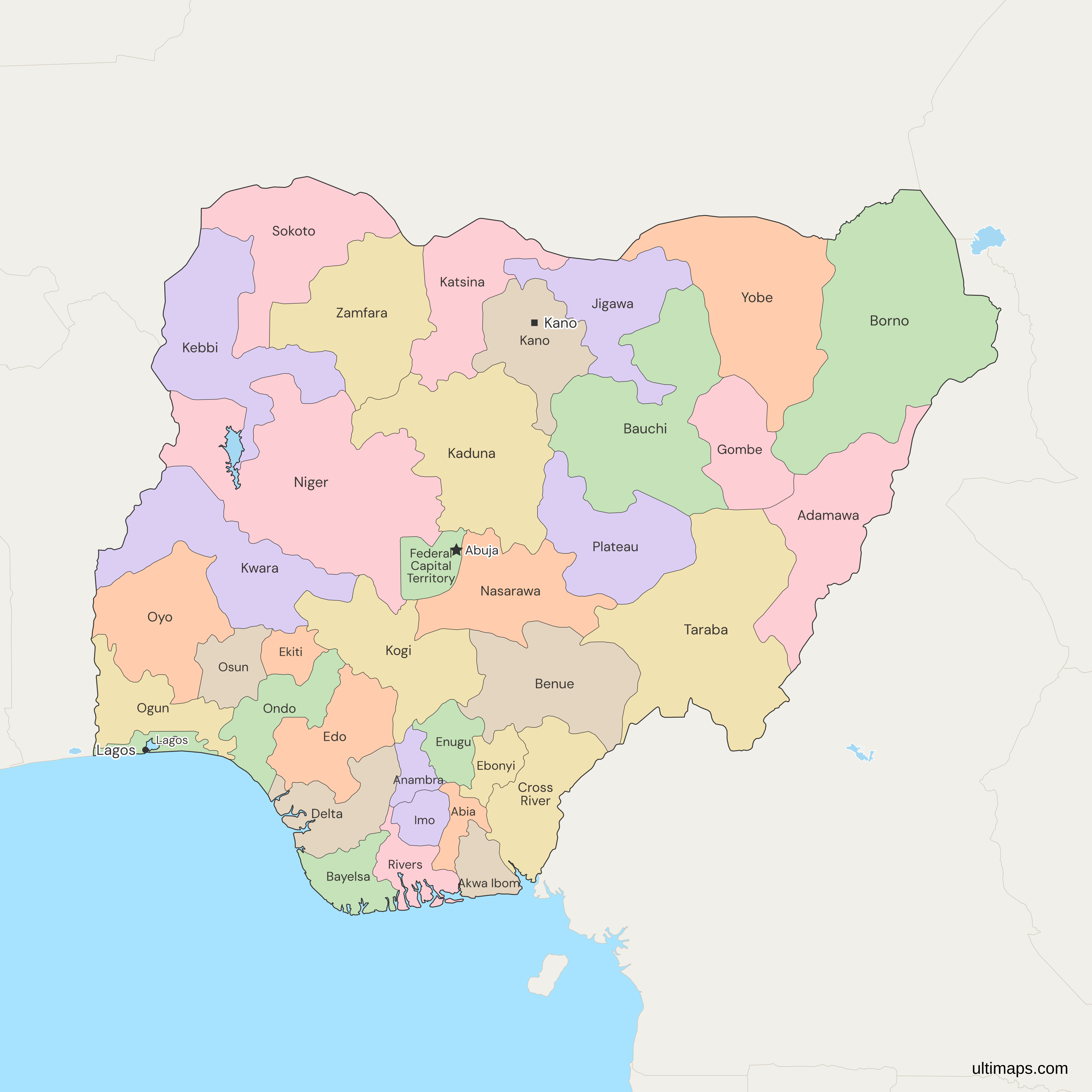
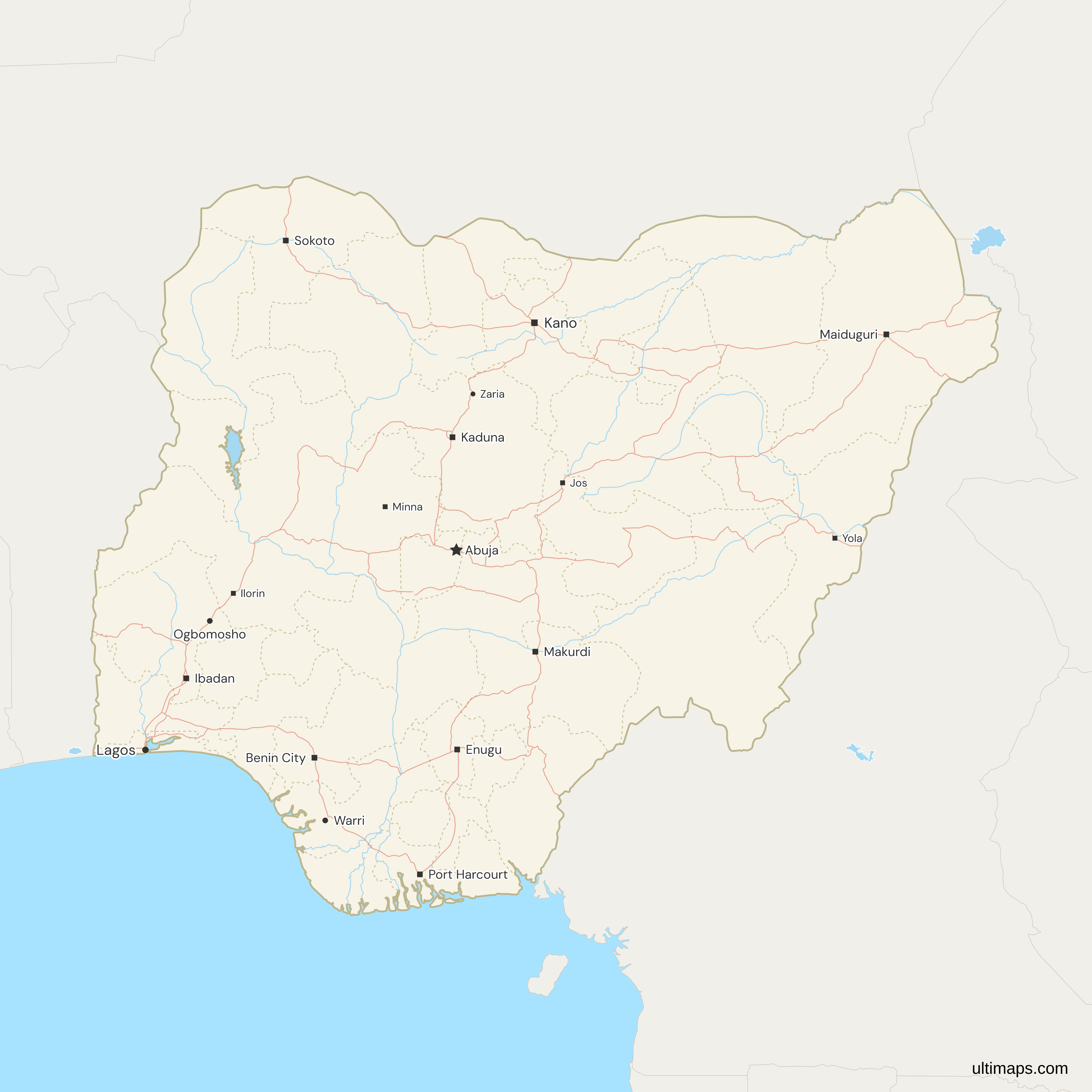
This map of Nigeria shows all 36 states and the Federal Capital Territory, a list of states fixed in October 1996 by the creation of Bayelsa, Ebonyi, Ekiti, Gombe, Nasarawa and Zamfara. The territory around Abuja, the national capital, is run by the federal government and is not a state. In the National Population Commission's projections, Kano has the most people and Bayelsa the fewest. Lagos, second by population, is the smallest state by area. Nigeria's 36 states and their capitals make up the List of States table on this page, with the Federal Capital Territory as a 37th row.
Open the map in the free Ultimaps editor to make your own custom map of Nigeria. You can color the states by your data, add pins and labels, and share or embed the finished map.
Interactive Nigeria Map with States
List of States (37)
| # | State | Capital |
|---|---|---|
| 1 | Abia | Umuahia |
| 2 | Adamawa | Yola |
| 3 | Akwa Ibom | Uyo |
| 4 | Anambra | Awka |
| 5 | Bauchi | Bauchi |
| 6 | Bayelsa | Yenagoa |
| 7 | Benue | Makurdi |
| 8 | Borno | Maiduguri |
| 9 | Cross River | Calabar |
| 10 | Delta | Asaba |
| 11 | Ebonyi | Abakaliki |
| 12 | Edo | Benin City |
| 13 | Ekiti | Ado-Ekiti |
| 14 | Enugu | Enugu |
| 15 | Federal Capital Territory | Abuja |
| 16 | Gombe | Gombe |
| 17 | Imo | Owerri |
| 18 | Jigawa | Dutse |
| 19 | Kaduna | Kaduna |
| 20 | Kano | Kano |
| 21 | Katsina | Katsina |
| 22 | Kebbi | Birnin Kebbi |
| 23 | Kogi | Lokoja |
| 24 | Kwara | Ilorin |
| 25 | Lagos | Ikeja |
| 26 | Nasarawa | Lafia |
| 27 | Niger | Minna |
| 28 | Ogun | Abeokuta |
| 29 | Ondo | Akure |
| 30 | Osun | Oshogbo |
| 31 | Oyo | Ibadan |
| 32 | Plateau | Jos |
| 33 | Rivers | Port Harcourt |
| 34 | Sokoto | Sokoto |
| 35 | Taraba | Jalingo |
| 36 | Yobe | Damaturu |
| 37 | Zamfara | Gusau |
Data source for Capital: Constitution of the Federal Republic of Nigeria 1999, First Schedule Part I and s. 298. License: facts compiled by Ultimaps, CC BY 4.0.
Nigeria States: Key Facts
- Number of states: 36. The Federal Capital Territory is a separate, 37th region.
- Capital: Abuja, in the Federal Capital Territory. It replaced Lagos as the seat of the federal government in December 1991.
- Largest and smallest by area: Borno, Niger State and Taraba are the three largest states, and Lagos, Anambra and Abia the three smallest, in the official figures of the Office of the Surveyor-General.
- Most and least populous: In the National Population Commission projections, Kano leads, ahead of Lagos and Katsina, and Bayelsa and Nasarawa are the least populous states. Only those two have fewer people than the Federal Capital Territory. The projections build on the 2006 census, the last one Nigeria has held.
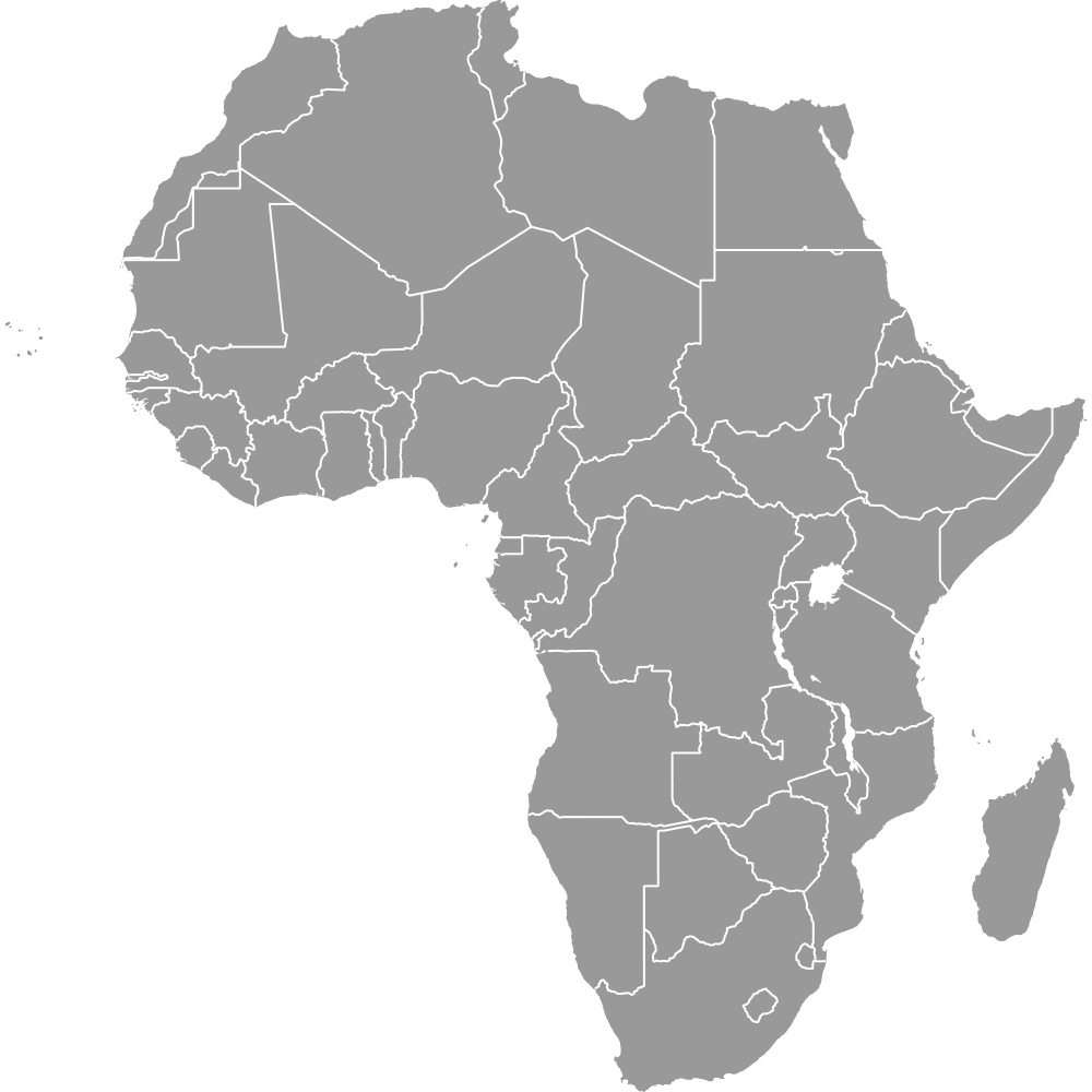
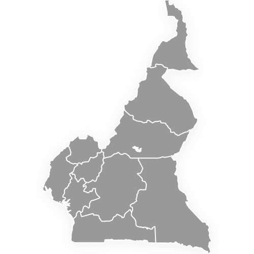
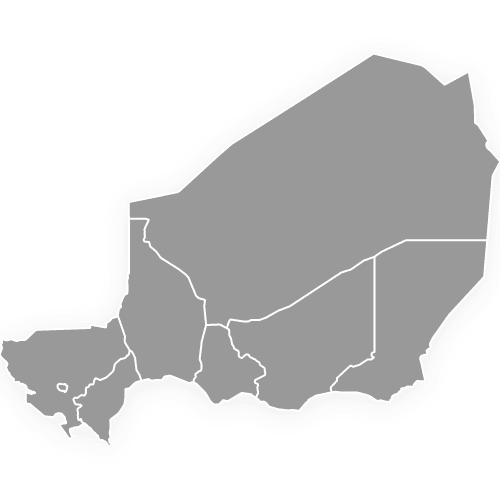
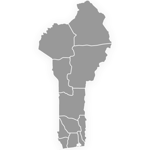
- Borders: four countries. The Republic of Niger lies north of Sokoto, Kebbi, Zamfara, Katsina, Jigawa, Yobe and Borno. The Cameroon border runs south from Borno through Adamawa, Taraba and Benue to Cross River. To the west, Benin meets Kebbi, Niger State, Kwara, Oyo, Ogun and Lagos. Chad's only Nigerian neighbor is Borno, along a short line in the Lake Chad basin, so Borno is the one state that touches three countries.
- Coast: 8 states reach the Gulf of Guinea on this map: Lagos, Ogun, Ondo, Delta, Bayelsa, Rivers, Akwa Ibom and Cross River. Some lists also count Edo as coastal, but this map draws Edo without a coastline.
- Lakes: Lake Chad's open water shrank sharply after 1960, so the lake the map draws lies just east of Borno, not inside it.
- Geopolitical zones: 6 groups of whole states: North Central (6 states and the FCT), North East (6), North West (7), South East (5), South South (6) and South West (6). The zones are a grouping, not a level of government, so this map does not outline them.
- State creation: In 1967, 12 states replaced the Northern, Eastern, Western and Mid-Western regions. The count reached 19 in 1976, 21 in 1987, 30 in 1991 and 36 in October 1996. Nigeria has no provinces or regions as units of government under the 1999 constitution, and its section 8 sets the steps for any further state.
- Local government: Section 3(6) of the constitution sets 768 local government areas in the states and 6 area councils in the territory, 774 in all. The map stops at the states and the FCT.
- Codes: ISO 3166-2:NG, such as NG-LA for Lagos and NG-FC for the Federal Capital Territory. Nasarawa is NG-NA, spelled Nassarawa in the standard until 2014.
Interesting Facts
- Niger State: the second largest state in the official area figures takes its name from the Niger River, as Nigeria's northern neighbor does, but the two do not touch. Abroad it borders Benin alone, and Kebbi and Zamfara lie between it and the country called Niger. The Republic of Niger is a separate country, shown with its 7 regions and the city of Niamey on the Niger map.
- Lagos: the city of Lagos appears on the map as an ordinary city, without a capital star, because the federal capital is now Abuja. Lagos State is governed from Ikeja.
- Bakassi: Cross River lost the Bakassi Peninsula in August 2008, when Nigeria handed it to Cameroon under the International Court of Justice's 2002 judgment and the 2006 Greentree Agreement. This map shows the peninsula as part of Cameroon.
Free Downloads
Free for personal and commercial use with a credit to Ultimaps. See the license terms for details.
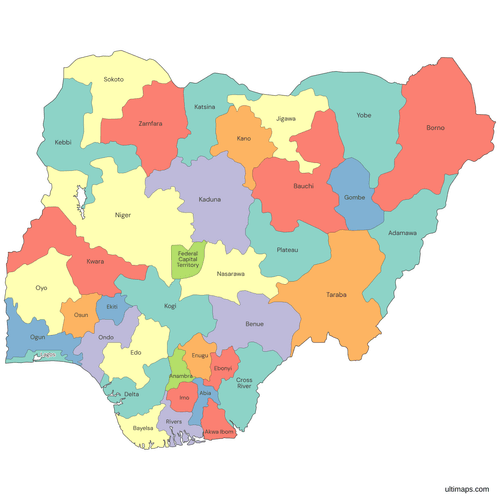 Colored Nigeria Map with Statespng688 KB
 Political Map of Nigeria with Statespng737 KB
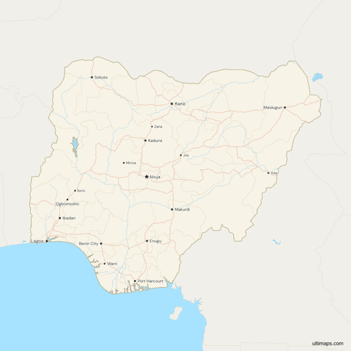 Map of Nigeria with Cities and Roadspng867 KB
Need it without colors? The blank version of this map comes as a print-ready PDF (A4 and US Letter), a PNG and an editable SVG.
Custom Map Features
This map supports labels.
This map supports surrounding areas, roads, rivers and cities. New
This map is divided into 37 states.
Updates
Nov 5, 2026:
- Added map of Nigeria states
Frequently Asked Questions
Nigeria has 36 states. The 37th area on this map is the Federal Capital Territory, Abuja, which is a territory, not a state. The last six states date from October 1996: Bayelsa came out of Rivers, Ebonyi out of Abia and Enugu, Ekiti out of Ondo, Gombe out of Bauchi, Nasarawa out of Plateau and Zamfara out of Sokoto. In October 2025 the National Assembly's joint committee on constitution review backed one more South-East state without naming it. Campaigners for Anioma State want it carved from Delta North, in the South South, as the South East's sixth state. No new state had passed either house of the National Assembly by November 2026, so the map still has 36 states.
In Nigeria, the capital of Lagos State is Ikeja, not the city of Lagos. Other capitals that differ from the state name include Port Harcourt (Rivers), Ibadan (Oyo), Calabar (Cross River), Asaba (Delta), Uyo (Akwa Ibom), Umuahia (Abia) and Lafia (Nasarawa). In seven states the capital and the state have one name: Bauchi, Enugu, Gombe, Kaduna, Kano, Katsina and Sokoto. The map draws 13 state capitals as cities, Kano, Ibadan, Port Harcourt and Maiduguri among them, and also marks Abuja, the national capital. The List of States table on this page gives all 36 capitals, plus a row for the Federal Capital Territory, Abuja.
The Federal Capital Territory is the area that holds Abuja, the national capital, and it is not one of Nigeria's 36 states. It has no governor or state assembly. Under section 299 of the 1999 constitution, the National Assembly makes its laws and the President holds its executive powers, which are delegated to the Minister of the Federal Capital Territory. Abuja has been the seat of the federal government since December 1991, when it took over from Lagos. It is smaller than most states, and in the National Population Commission's projections only Bayelsa and Nasarawa have fewer people. Data rows named Abuja or FCT match the territory, which is a single region on the map.
Nigeria's six geopolitical zones place every state in one of three northern and three southern groups. Jigawa, Kaduna, Kano, Katsina, Kebbi, Sokoto and Zamfara form the North West, and Adamawa, Bauchi, Borno, Gombe, Taraba and Yobe the North East. North Central takes Benue, Kogi, Kwara, Nasarawa, Niger, Plateau and the FCT. These three zones hold Nigeria's 19 northern states. Ekiti, Lagos, Ogun, Ondo, Osun and Oyo make up the South West, and Abia, Anambra, Ebonyi, Enugu and Imo the South East. Akwa Ibom, Bayelsa, Cross River, Delta, Edo and Rivers form the South South. To show the zones, color this map's states by zone. The Niger Delta Development Commission's nine states are the South South, Abia, Imo and Ondo.
Borno is Nigeria's largest state in the official figures of the Office of the Surveyor-General, which the National Bureau of Statistics publishes in its Annual Abstract of Statistics. Many other lists use different area figures and rank Niger State first, so the answer depends on the source. In the official table Niger State and Taraba take second and third place, followed by Bauchi, Yobe and Kaduna. Borno lies in the far north-east and is the one state that borders three countries: Niger, Chad and Cameroon. The official table carries no date, and the 2010 to 2012 editions of the abstract print the same figures.
Lagos is the smallest of Nigeria's 36 states in the official area figures of the Office of the Surveyor-General, and Anambra and Abia are the next smallest. Imo and Ekiti come after them, so all five of the smallest states are in the south. Gombe is the smallest of the 19 northern states. Lagos is also second by population in the National Population Commission's projections, which makes it by far the most densely populated state. Lagos State is governed from Ikeja, and the city of Lagos is no longer the federal capital.
Kano is Nigeria's most populous state in the National Population Commission's projections, ahead of Lagos. Next come Katsina, Kano's northwestern neighbor, then Kaduna and Bauchi, which leaves Lagos as the only southern state in the top five. Bayelsa has the fewest people of any state. Nigeria as a whole has the largest population in Africa. It has held no census since 2006, and the Lagos State government rejected the 2006 count for Lagos, so every state figure is a projection from a disputed base.
Nigeria has 774 local government areas, a number fixed in section 3(6) of the 1999 constitution: 768 across the 36 states and 6 area councils in the Federal Capital Territory. Kano is divided into 44 local government areas, more than any other state, and Bayelsa has the fewest, 8. This map does not draw them. Its 37 regions are the 36 states and the FCT, the level directly below the federal government. You can still map data kept by local government area once you total it for each state and the FCT.
You can start a custom map of Nigeria without an account by opening this map in the free Ultimaps editor. Color the 36 states and the Federal Capital Territory by hand, or import or paste a table of states and values. Names match with or without the word State, as do codes such as NG-LA. Add pins for places the map does not mark, such as Ikeja, and labels for any other text. Saving and publishing take a free account, and a published map can be shared by link or embedded on a website. Free exports are a standard PNG with a small Ultimaps credit, and Ultimaps Pro adds high-resolution PNG, SVG and PDF.