Benin Map with Departments
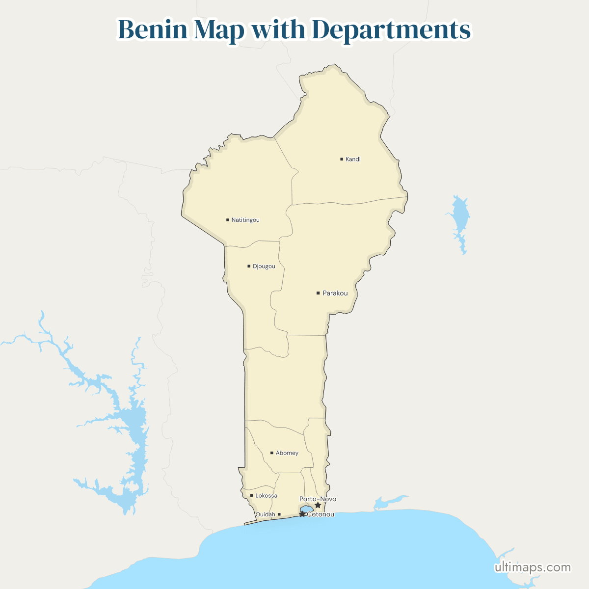
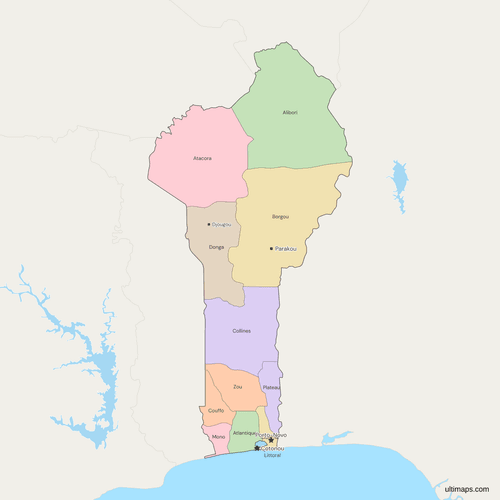
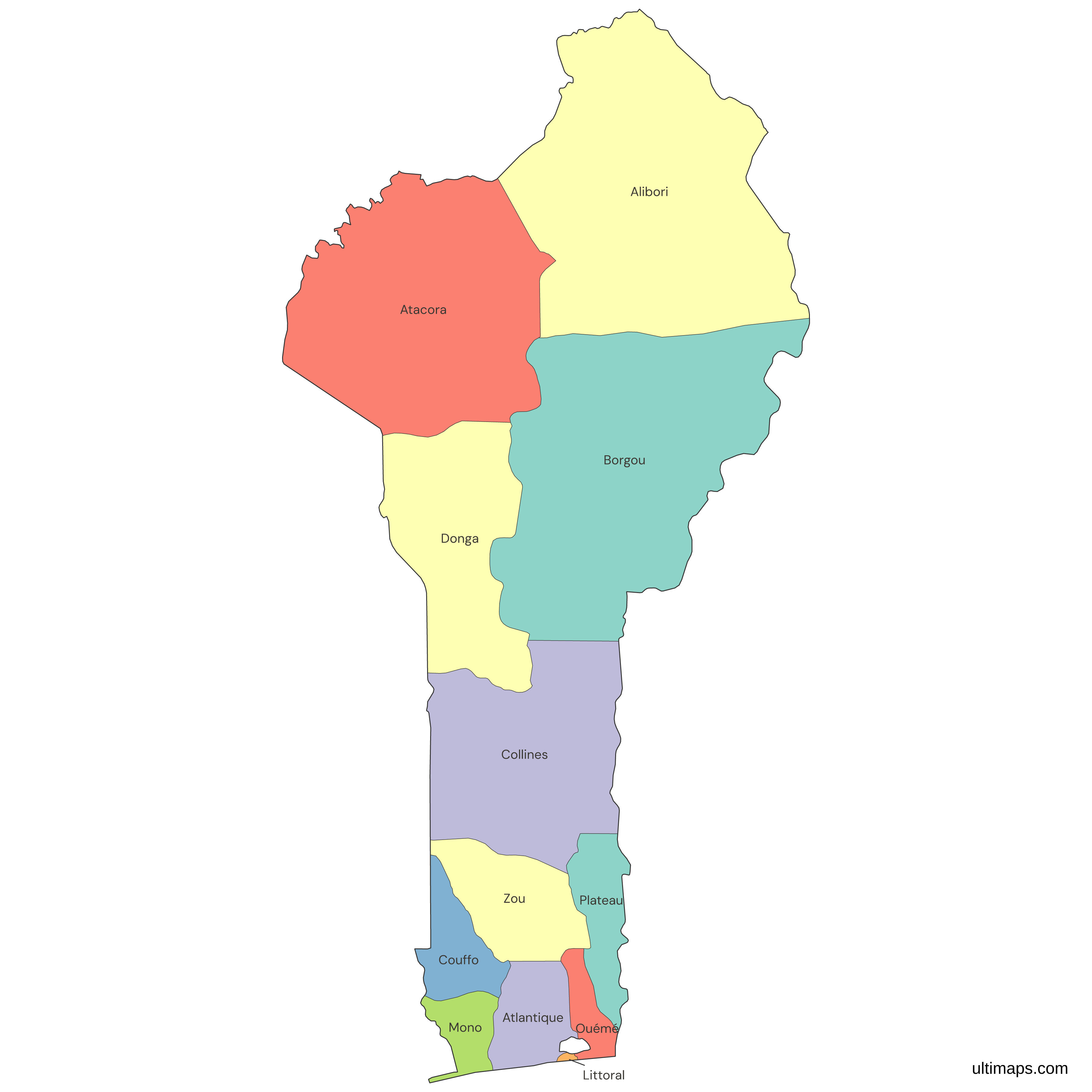
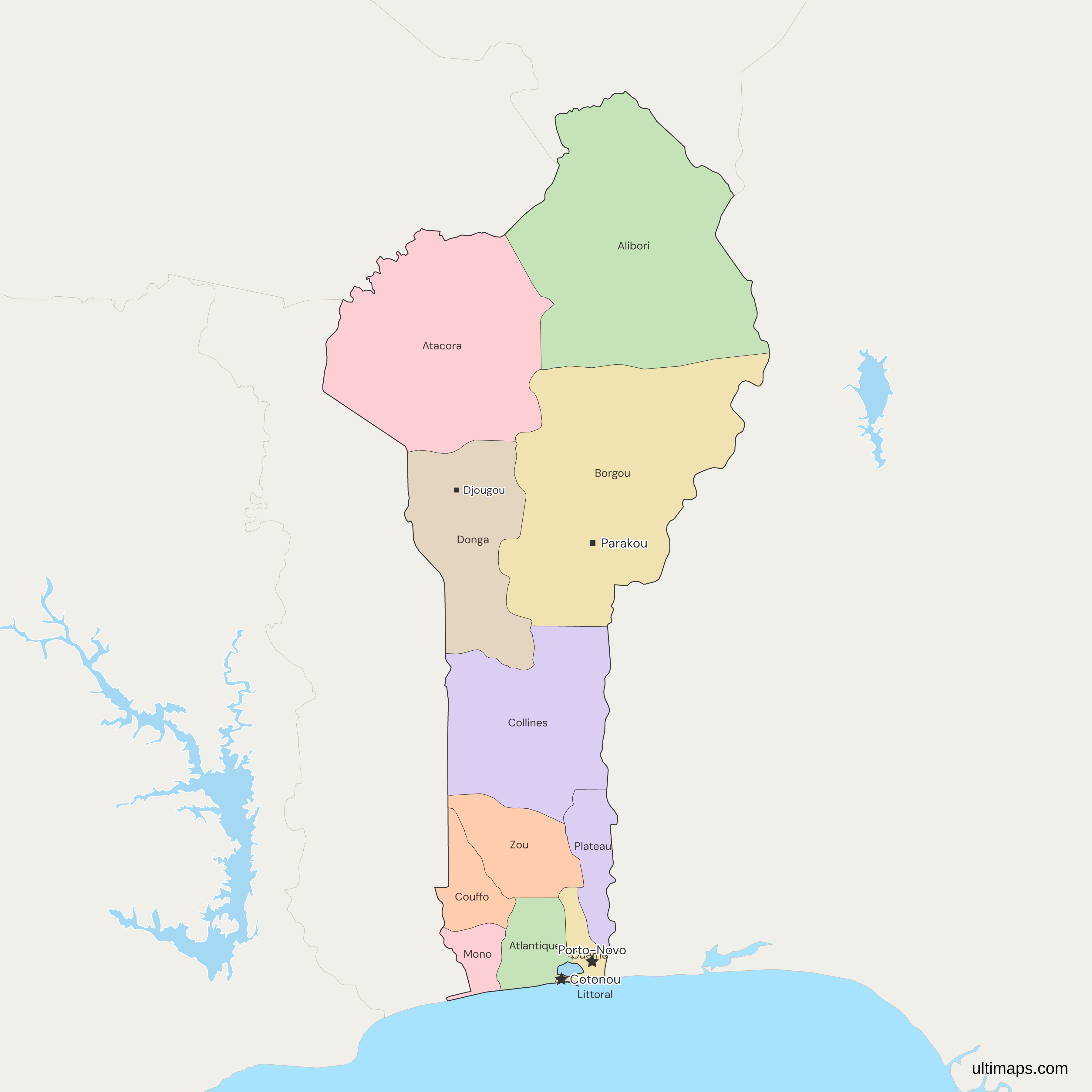
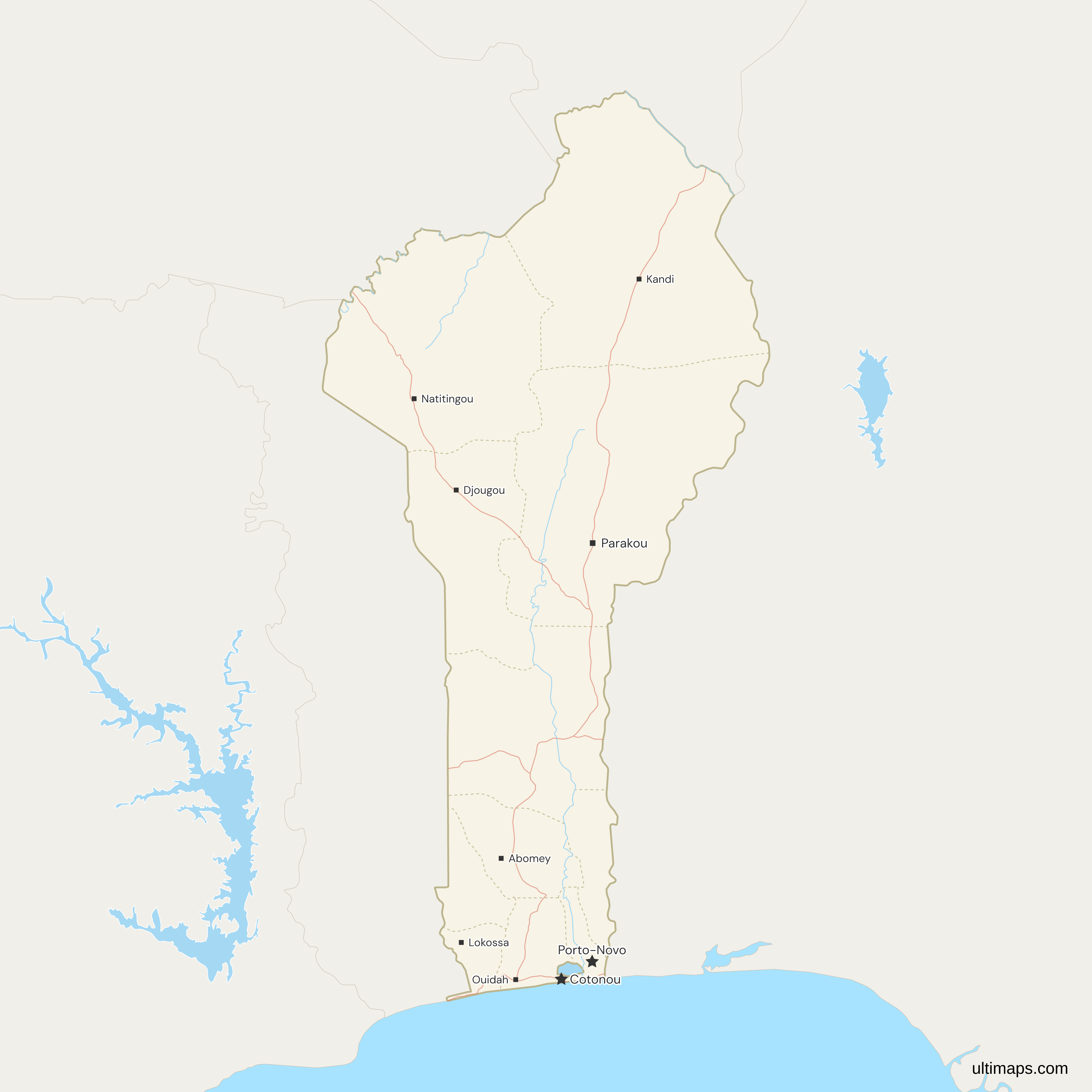
This map of Benin shows all 12 departments, the first-level units created in 1999 when a law split each of the six older departments, also called provinces, in two. Alibori in the north is the largest at 26,242 km² (INStaD, 2013), and Littoral, which is the city of Cotonou, is the smallest at 79 km². Atlantique has the most residents, 1,398,229 in the 2013 census (INSAE). Porto-Novo, in Ouémé, is the capital under the constitution, and Cotonou is the seat of government. The 77 communes inside the departments are not drawn.
Open the map in the free Ultimaps editor to make your own custom map of Benin. You can color the departments by your data, add pins and labels, and share or embed the finished map.
Interactive Benin Map with Departments
List of Departments (12)
| # | Department | Capital | Population (2013) | Area (km², 2013) |
|---|---|---|---|---|
| 1 | Alibori | Kandi | 867,463 | 26,242 |
| 2 | Atacora | Natitingou | 772,262 | 20,499 |
| 3 | Atlantique | Allada | 1,398,229 | 3,233 |
| 4 | Borgou | Parakou | 1,214,249 | 25,856 |
| 5 | Collines | Dassa-Zoumè | 717,477 | 13,931 |
| 6 | Couffo | Aplahoué | 745,328 | 2,404 |
| 7 | Donga | Djougou | 543,130 | 11,126 |
| 8 | Littoral | Cotonou | 679,012 | 79 |
| 9 | Mono | Lokossa | 497,243 | 1605 |
| 10 | Ouémé | Porto-Novo | 1,100,404 | 1281 |
| 11 | Plateau | Pobè | 622,372 | 3,264 |
| 12 | Zou | Abomey | 851,580 | 5,243 |
Data sources:
- Capital: Décret n° 2016-397 du 7 juillet 2016 (Benin), chefs-lieux des départements. License: facts compiled by Ultimaps, CC BY 4.0.
- Population: INSAE (now INStaD), RGPH-4 2013 final results, Tableau 1. License: free reuse with source credit (INStaD terms).
- Area: INStaD, Annuaire statistique 2024, Tableau 03.07. License: free reuse with source credit (INStaD terms).
Benin Departments: Key Facts
- Number of departments: 12. Littoral is a single commune, Cotonou, and ranks as a department like the others.
- Capital: Porto-Novo, in the Ouémé department, is the constitutional capital. Cotonou, the Littoral department, hosts the presidency and most ministries, and the map marks both as national capitals.
- Largest department: Alibori, 26,242 km² in the 2013 area figures of INStaD, followed by Borgou at 25,856 km² and Atacora at 20,499 km².
- Smallest department: Littoral, 79 km² (INStaD, 2013). Ouémé is next smallest at 1,281 km², then Mono at 1,605 km².
- Most populous department: Atlantique, 1,398,229 people in the 2013 census (INSAE, RGPH-4), ahead of Borgou with 1,214,249 and Ouémé with 1,100,404. The least populous is Mono with 497,243, and the 12 departments total 10,008,749.
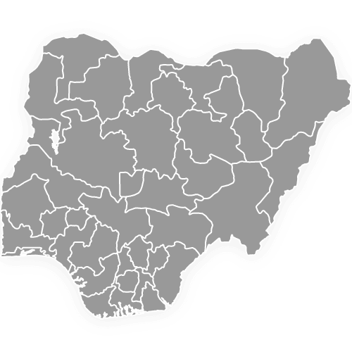
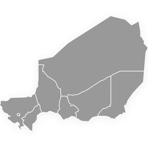
- Borders: Nigeria to the east, Togo to the west, Burkina Faso and Niger to the north. Alibori is the only department that borders three countries: Niger, Burkina Faso and Nigeria. Atacora touches Burkina Faso and Togo.
- Coast: the Atlantic coast belongs to Mono, Atlantique, Littoral and Ouémé, from west to east, and the other eight departments are inland. Lake Nokoué is drawn and cut out of the country, and it touches Ouémé, Atlantique and Littoral.
- Department seats: each department has a chef-lieu set by a 2016 decree, such as Parakou for Borgou, Djougou for Donga and Allada for Atlantique.
- Reform history: a law of 15 January 1999 created the 12 departments. Loi n° 2021-14 of 20 December 2021 kept the same 12 and the 77 communes. Prefects were appointed to all 12 in June 2026.
- Codes: the ISO 3166-2 codes run from BJ-AK (Atacora) to BJ-ZO (Zou).
Interesting Facts
- Older maps and datasets spell two departments Atakora and Kouffo. The official spellings, used in Loi 2021-14 and in ISO 3166-2 since 2015, are Atacora and Couffo.
- Each 1999 department was cut from one of six older ones: Alibori from Borgou, Collines from Zou, Couffo from Mono, Donga from Atacora, Littoral from Atlantique and Plateau from Ouémé.
Free Downloads
Free for personal and commercial use with a credit to Ultimaps. See the license terms for details.
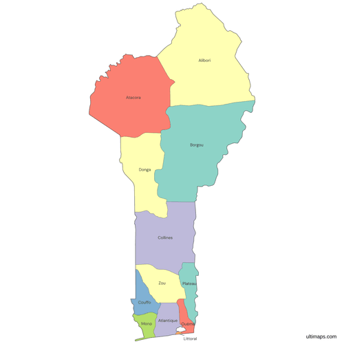 Colored Benin Map with Departmentspng277 KB
 Political Map of Benin with Departmentspng501 KB
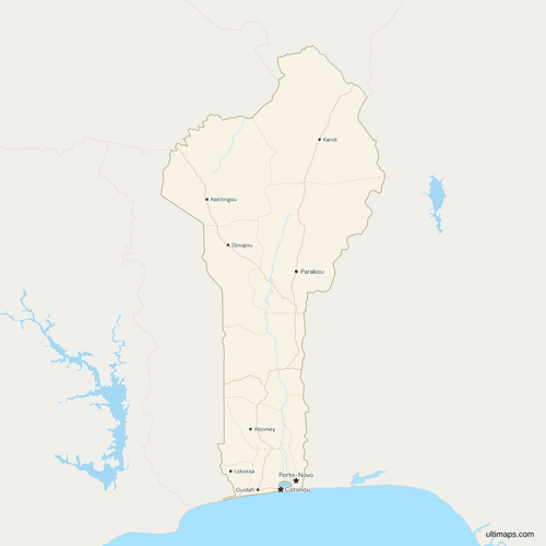 Map of Benin with Cities and Roadspng577 KB
Need it without colors? The blank version of this map comes as a print-ready PDF (A4 and US Letter), a PNG and an editable SVG.
Custom Map Features
This map supports labels.
This map supports surrounding areas, roads, rivers and cities. New
This map is divided into 12 departments.
Updates
Nov 5, 2026:
- Added map of Benin departments
Frequently Asked Questions
Porto-Novo, in the Ouémé department, is Benin's capital under the constitution, and Cotonou, which forms the Littoral department, is the seat of government. Cotonou is also the largest city, and the presidency and most ministries sit there. Because both cities play a national role, the map marks each one with the national-capital symbol. Each of the 12 departments also has its own chef-lieu, a separate administrative seat fixed by a 2016 decree, for example Parakou for Borgou and Kandi for Alibori.
Benin has 12 departments: Alibori, Atacora, Atlantique, Borgou, Collines, Couffo, Donga, Littoral, Mono, Ouémé, Plateau and Zou. Article 4 of Loi n° 2021-14 of 20 December 2021 states the number, and it repeats the 12 set by a law of 15 January 1999. The departments are divided into 77 communes, and together they hold the 10,008,749 residents counted in the 2013 census. Older maps may show six departments, which was the count before 1999. Loi n° 2021-14 did not change the number.
No. Benin has 12 departments, not states, although some searches for Benin Republic use the word states. Each department is run by a prefect appointed by the government. Nigeria, Benin's eastern neighbor, does have states, and Nigerian searches often use that word for Benin's departments. Before 1999 Benin also used the word province for its six larger units. The 12 departments are the units drawn on this map. Departments are the only first-level division in force today, and the 77 communes sit below them as the second level.
Alibori is the largest department of Benin, with 26,242 km² according to INStaD's 2013 figures, and it is the only department that borders three countries: Niger, Burkina Faso and Nigeria. Borgou (25,856 km²) and Atacora (20,499 km²) are the only others above 20,000 km². These three departments together cover most of the national total of 114,763 km², the sum of the 12 department figures. The four coastal departments, Mono, Atlantique, Littoral and Ouémé, are among the smallest, from 79 km² for Littoral to 3,233 km² for Atlantique.
Littoral is the smallest department of Benin, with 79 km² in INStaD's 2013 figures. It is the same area as the city of Cotonou, since the department is a single commune. Littoral sits between Atlantique and Ouémé on the Atlantic coast, and part of its edge runs along Lake Nokoué. The next smallest department, Ouémé, has 1,281 km², which is more than 16 times as much. Mono, at 1,605 km², is the only other department under 2,000 km², and Couffo is next at 2,404 km².
Atlantique is the most populous department of Benin, with 1,398,229 people in the 2013 census (RGPH-4, INSAE). Only Borgou (1,214,249) and Ouémé (1,100,404) come close. Littoral fits 679,012 residents into 79 km², which makes it the most crowded. Mono has the fewest people, 497,243, about a third of Atlantique's count, and the 12 departments total 10,008,749. This is the latest departmental count available, because the fifth census had published no results by November 2026. Until it does, the 2013 figures stand.
A law of 15 January 1999 (Loi n° 97-028) split each of Benin's six older departments in two. The new departments were Alibori, Collines, Couffo, Donga, Littoral and Plateau, each taken from a larger one. Alibori, for example, was taken from Borgou, and Collines from Zou, so every new unit has one parent. In 2016 the six new departments received their own prefects and chefs-lieux by decree, with no change to boundaries. Loi n° 2021-14 then replaced the 1999 laws and kept the same 12 departments.
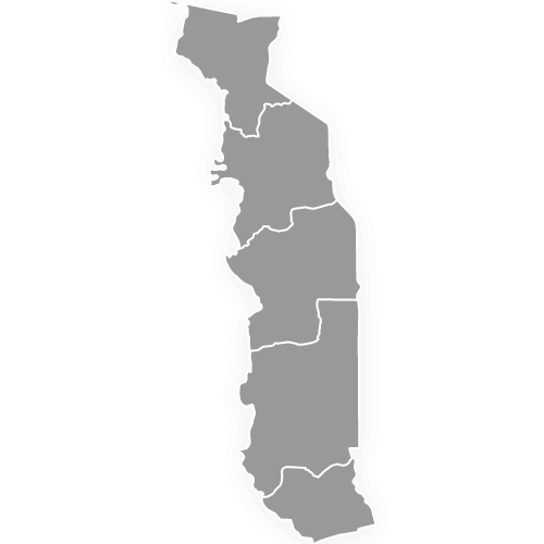
No. This map of Benin shows the 12 departments only. It does not draw the 77 communes inside them. Cotonou is the one commune that also forms a department, so the map shows it as Littoral, with no separate Cotonou outline. The six development poles announced on 23 September 2026 group communes for economic planning and do not change department or commune boundaries, so they are not drawn either. This map shows Benin's 12 departments, with Togo in grey on its western border. Togo's 5 regions have their own map.
Open the map in the Ultimaps editor, which is free and needs no account. Add one value per department, such as population or sales, and the map colors each department by its value. Pins, labels, sharing and embedding all work from the same editor, and each department can carry its own tooltip text, which viewers see on hover in a shared or embedded map. A free export is a standard PNG with a small Ultimaps credit. High-resolution PNG, SVG and PDF exports are part of the Pro plan.