Senegal Map with Regions
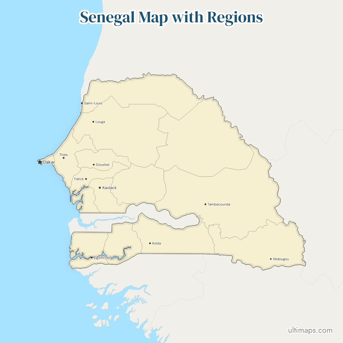
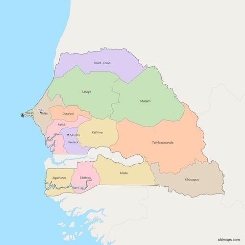
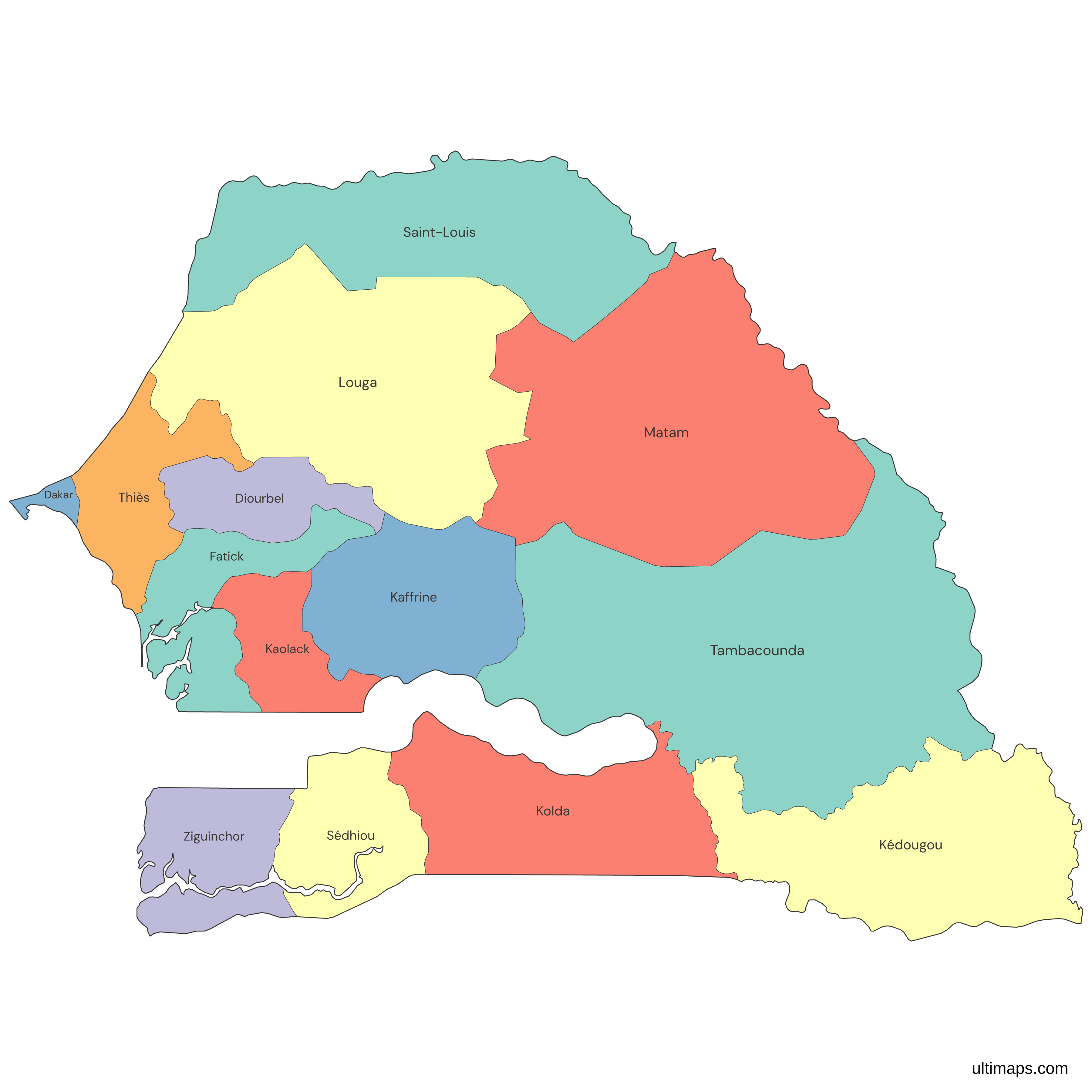
This map of Senegal shows all 14 regions, three of them younger than the rest: Kaffrine, Kédougou and Sédhiou, which a 2008 law carved out of Kaolack, Tambacounda and Kolda and which came into being on 10 September 2008. Population and area run in opposite directions. Dakar, the national capital, lies in the region of the same name, which packs 4,004,426 residents (ANSD, 2023 census) into 535 km², while Tambacounda spreads over 42,613 km². The map follows the 14-region set in force since 2008 and leaves out the departments below it.
Open the map in the free Ultimaps editor to make your own custom map of Senegal. You can color the regions by your data, add pins and labels, and share or embed the finished map.
Interactive Senegal Map with Regions
List of Regions (14)
| # | Region | Capital | Population (2023) | Area (km², 2023) |
|---|---|---|---|---|
| 1 | Dakar | Dakar | 4,004,426 | 535 |
| 2 | Diourbel | Diourbel | 2,080,333 | 4,860 |
| 3 | Fatick | Fatick | 906,918 | 7,010 |
| 4 | Kaffrine | Kaffrine | 820,405 | 11,057 |
| 5 | Kaolack | Kaolack | 1,336,720 | 5,310 |
| 6 | Kédougou | Kédougou | 245,147 | 16,904 |
| 7 | Kolda | Kolda | 914,798 | 13,752 |
| 8 | Louga | Louga | 1,125,908 | 25,619 |
| 9 | Matam | Matam | 831,630 | 28,830 |
| 10 | Saint-Louis | Saint-Louis | 1,202,441 | 19,010 |
| 11 | Sédhiou | Sédhiou | 589,266 | 7,353 |
| 12 | Tambacounda | Tambacounda | 987,152 | 42,613 |
| 13 | Thiès | Thiès | 2,463,677 | 6,586 |
| 14 | Ziguinchor | Ziguinchor | 617,567 | 7,329 |
Data sources:
- Capital: Décret n° 2021-689 du 28 mai 2021 (Senegal), Article premier. License: facts compiled by Ultimaps, CC BY 4.0.
- Population: ANSD, RGPH-5 2023, Rapport définitif, Tableau I-21. License: CC BY 4.0.
- Area: ANSD, RGPH-5 2023, Rapport définitif, Tableau I-22. License: CC BY 4.0.
Senegal Regions: Key Facts
- Number of regions: 14, up from 11 before the 2008 law. The national capital has no district of its own and lies in one of the 14.
- Capital: Dakar, in the Dakar region, which holds the departments of Dakar, Pikine, Guédiawaye, Rufisque and Keur Massar.
- Largest region: Tambacounda covers 42,613 km² (ANSD, 2023), nearly one and a half times the area of Matam, the runner-up.
- Smallest region: Dakar, with 535 km² (ANSD, 2023). No other region falls below 4,800 km².
- Most and least populous: Dakar has 4,004,426 residents and Kédougou has 245,147 (ANSD, 2023). The 14 regions add up to 18,126,388.
- Borders: five neighboring countries, all in West Africa. Mauritania lies to the north and east of Saint-Louis, Matam and Tambacounda, and Mali to the east of Tambacounda and Kédougou. Guinea touches Kédougou, Tambacounda and Kolda, Guinea-Bissau touches Kolda, Sédhiou and Ziguinchor, and The Gambia runs along Fatick, Kaolack, Kaffrine, Tambacounda, Kolda, Sédhiou and Ziguinchor.
- The Gambia: a separate country that follows the Gambia River inland. It lies between Fatick, Kaolack, Kaffrine and Tambacounda in the north and east and Ziguinchor, Sédhiou and Kolda in the south, and belongs to none of the 14 regions.
- Atlantic coast: The Gambia splits it in two. Saint-Louis, Louga, Thiès, Dakar and Fatick face the sea north of it, and Ziguinchor faces it to the south.
- Names: each region takes its name from its capital city.
- Last change to the set: 10 September 2008, when Kaffrine, Kédougou and Sédhiou came into being. Since the 2013 Acte III reform the regions are administrative units of the state, no longer elected local governments.
- Codes: the ISO 3166-2 list has 14 entries, from SN-DB for Diourbel to SN-ZG for Ziguinchor.
Interesting Facts
- Dakar was called Cap-Vert and Tambacounda was called Sénégal Oriental until 1984. Both old names still work as aliases when you color from a table.
- A planned reform would group the 14 regions into 8 development poles, a tier above the regions. It had not become law as of mid-2026, and this map does not draw it.
Free Downloads
Free for personal and commercial use with a credit to Ultimaps. See the license terms for details.
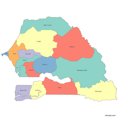 Colored Senegal Map with Regionspng428 KB
 Political Map of Senegal with Regionspng540 KB
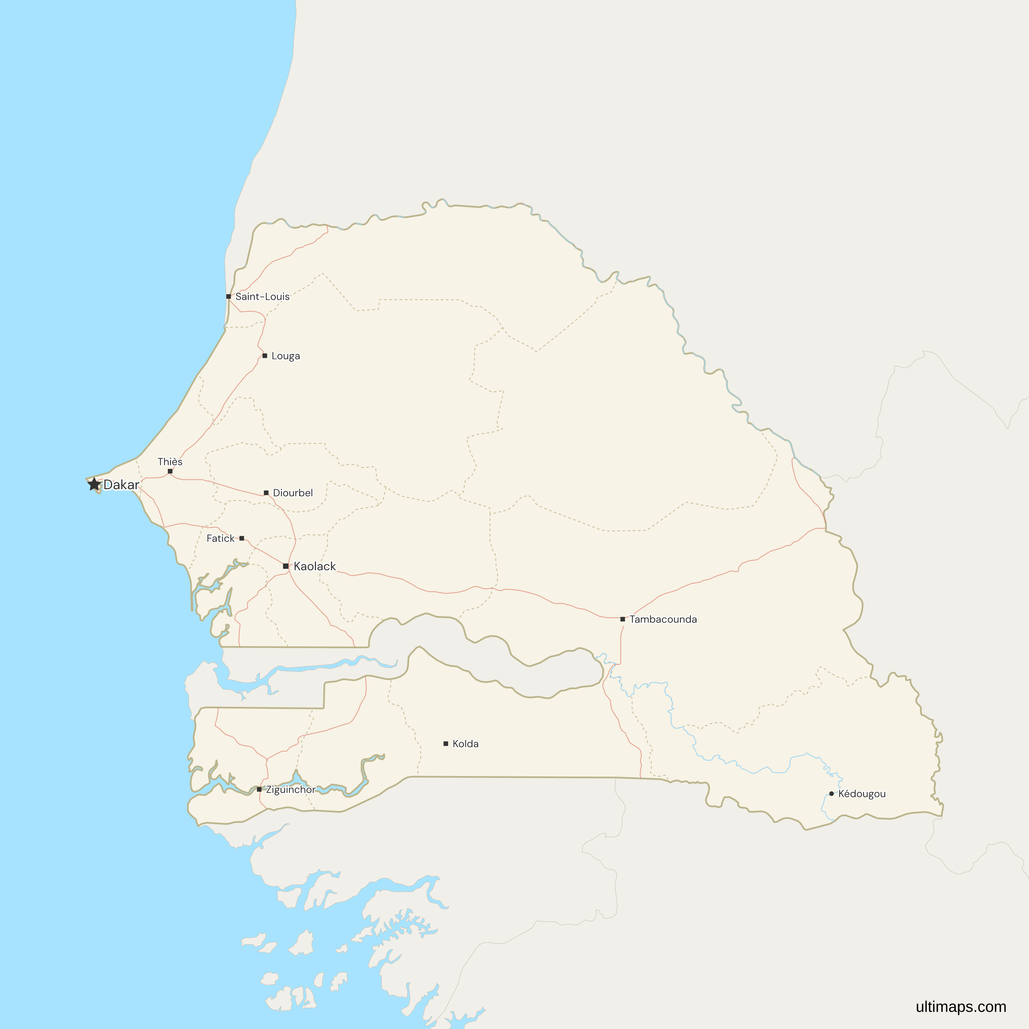
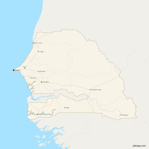 Map of Senegal with Cities and Roadspng597 KB
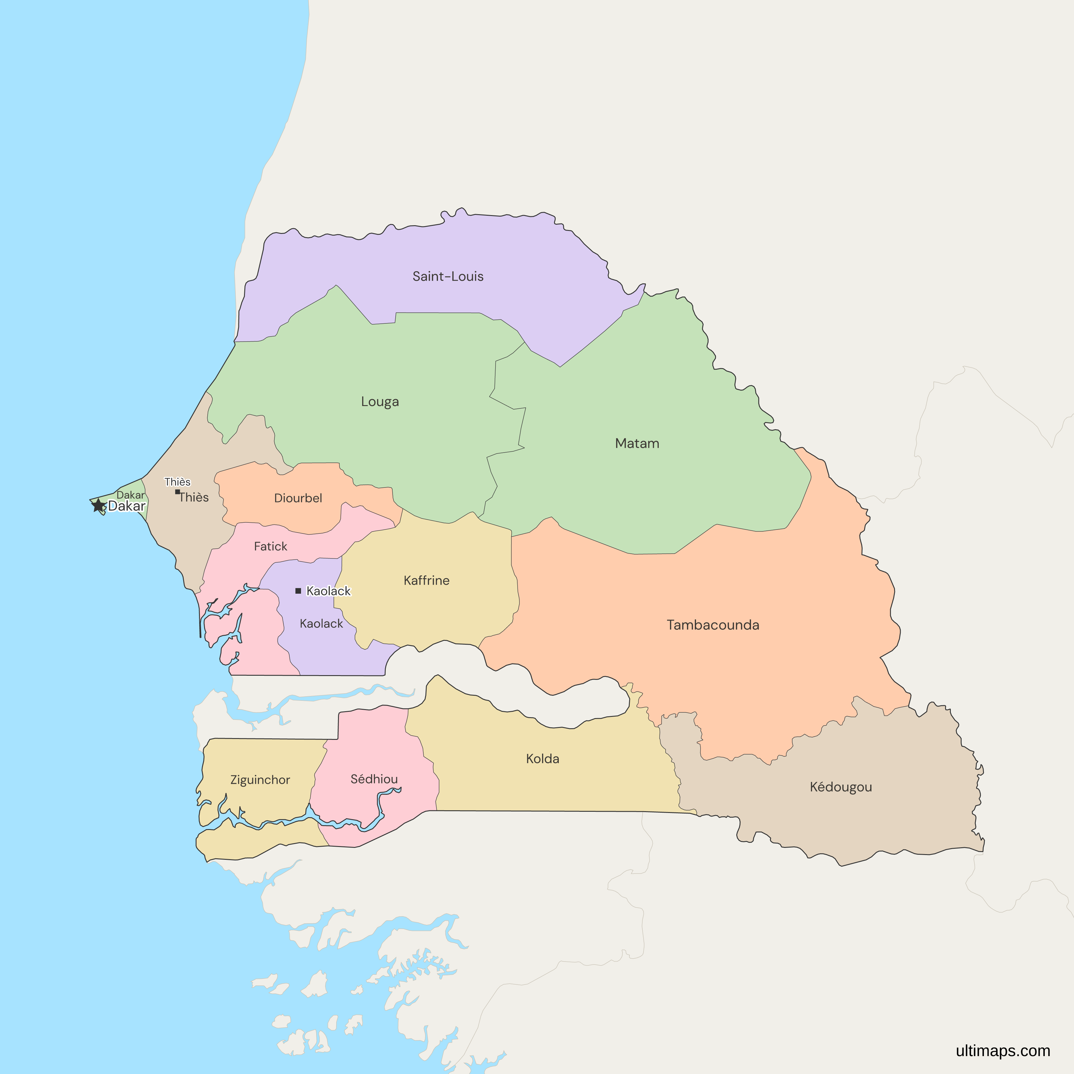
Need it without colors? The blank version of this map comes as a print-ready PDF (A4 and US Letter), a PNG and an editable SVG.
Custom Map Features
This map supports labels.
This map supports surrounding areas, roads, rivers and cities. New
This map is divided into 14 regions.
Updates
Nov 5, 2026:
- Added map of Senegal regions
Frequently Asked Questions
Senegal has 14 regions, and it has had 14 since 2008. Loi n° 2008-14 created Kaffrine, Kédougou and Sédhiou out of Kaolack, Tambacounda and Kolda, and the change took effect on 10 September 2008. Older sources that list 7, 10 or 11 regions describe the country before that law. The other 11 are Dakar, Diourbel, Fatick, Kaolack, Kolda, Louga, Matam, Saint-Louis, Tambacounda, Thiès and Ziguinchor. All 14 are drawn on this map as separate regions, each with its own code beginning SN-, and the departments inside them are not drawn.
Tambacounda takes the most space of the 14 regions, covering 42,613 km² in the ANSD's 2023 census report. Matam follows with 28,830 km² and Louga with 25,619 km². The region sits in the east and touches Mauritania, Mali, Guinea and The Gambia. It is smaller than it once was: Kédougou, which covers 16,904 km² in the 2023 figures, was split from it in 2008, so figures from before that year show a larger Tambacounda than the one drawn on this map.
At 535 km² in the ANSD's 2023 census report, Dakar is the smallest of Senegal's regions. It occupies the Cap-Vert peninsula, with the sea on three sides and Thiès as its only land neighbor, so it has no foreign border. The next smallest, Diourbel at 4,860 km², is about nine times as large, and Tambacounda is roughly eighty times larger. Because Dakar is so small, it is easy to miss at country scale, so zoom in or add a pin when you want it to stand out.
Dakar has 4,004,426 residents in the 2023 census (ANSD), more than any other region and about 22% of the 18,126,388 residents counted across the 14 regions. They share 535 km², the smallest region in the country. Thiès comes next with 2,463,677 residents and Diourbel with 2,080,333, so these three regions together hold roughly 47% of all residents, while the other 11 share the remaining 53%. At the other end, Kédougou has 245,147 residents, under 2% of the total, in the southeast corner beside Mali and Guinea.
Each of Senegal's 14 regions has a capital with the same name as the region. Under the decree of 28 May 2021 the pairs are Dakar, Diourbel, Fatick, Kaffrine, Kaolack, Kédougou, Kolda, Louga, Matam, Saint-Louis, Sédhiou, Tambacounda, Thiès and Ziguinchor. Dakar is also the national capital. The map's city layer marks only some of these towns, so Kaffrine, Matam and Sédhiou do not appear as points, although their regions are drawn. Kédougou is drawn without the capital flag, but its region is colored like the rest.
No. Senegal's departments are the level below the regions, and this map draws only the regions. Counts for the departments vary between sources, so the page gives no figure for them. The Dakar region alone contains five: Dakar, Pikine, Guédiawaye, Rufisque and Keur Massar. If your data is by department, add the departments up to their region before you color the map. The 2023 census report publishes its area table by region, so the region figures on this page match it.
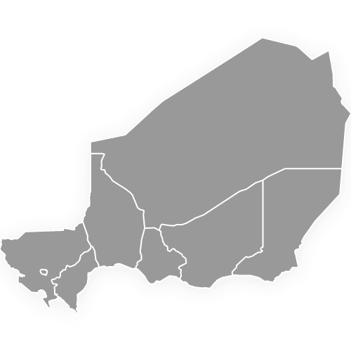
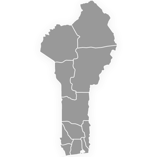
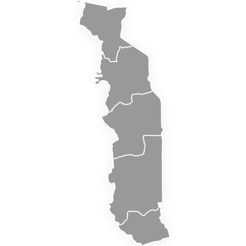
No. Senegal has no states or provinces. Its first-level divisions are the 14 regions, a set unchanged since 2008, when Kaffrine, Kédougou and Sédhiou were added. Since the 2013 Acte III reform the regions have no elected council: the Code général des collectivités locales names only the department and the commune as local governments, so local budgets and elections sit at those two levels. Other West African countries in this series use their own words, with departments in Benin and regions in Niger and Togo, as in Senegal.
You can make a custom map of Senegal in the Ultimaps editor, which is free and needs no account. Start from this map, color the 14 regions by your own figures or by hand, add pins for towns such as Touba or Saint-Louis, and share or embed the result. Free exports are standard PNG files with a small Ultimaps credit. High-resolution PNG, SVG and PDF come with the Pro plan. To color from a table, enter one value per region, using names or codes such as SN-TC. The former names Cap-Vert and Sénégal Oriental also match.