Gabon Map with Provinces
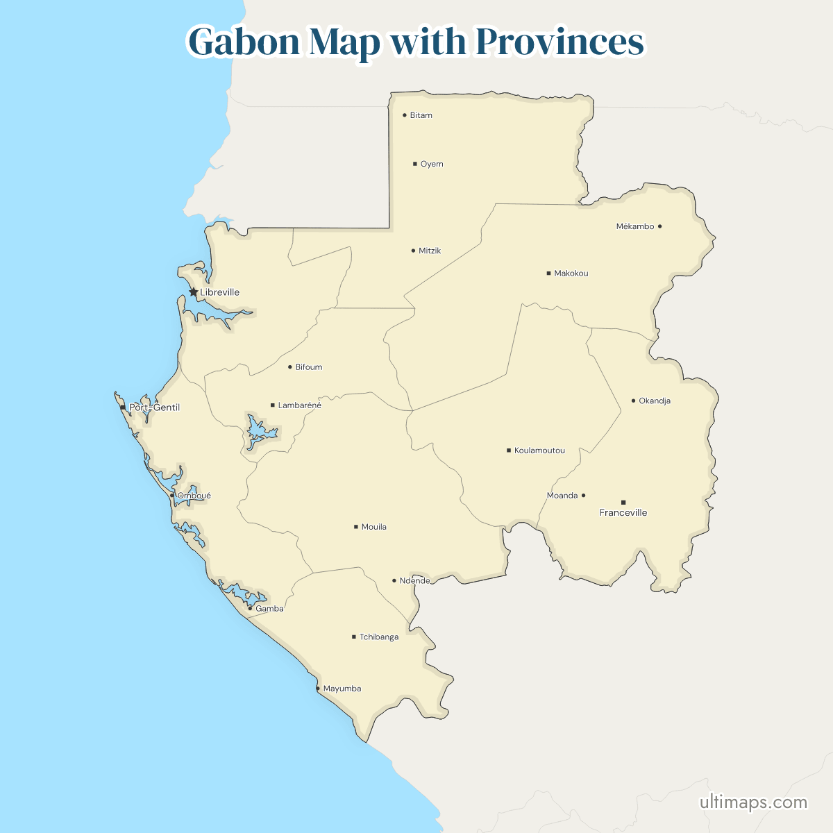
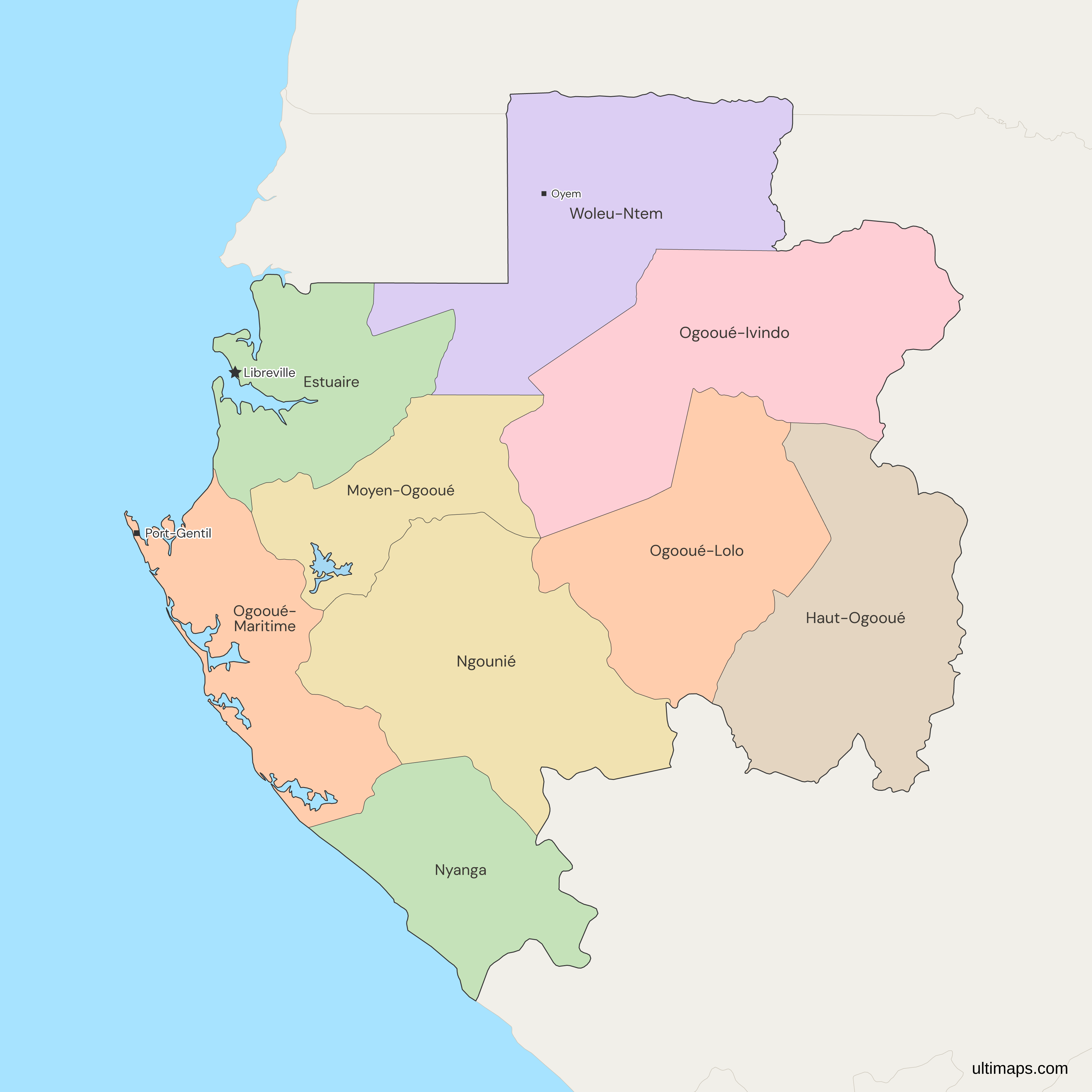
This map of Gabon shows all 9 provinces, each run by a governor under the territorial law of 15 April 1996. Estuaire has the most residents, 2,184,908 in the 2026 census (INSTAT, preliminary results), about 62% of the national total of 3,518,621, and Nyanga has the fewest, 68,215. Libreville, the national capital, lies in Estuaire. The nine provinces are the same units as the colonial regions, renamed around 1975, and the departments inside them are not drawn.
Open the map in the free Ultimaps editor to make your own custom map of Gabon. You can color the provinces by your data, add pins and labels, and share or embed the finished map.
Interactive Gabon Map with Provinces
List of Provinces (9)
| # | Province | Capital | Population (2026) |
|---|---|---|---|
| 1 | Estuaire | Libreville | 2,184,908 |
| 2 | Haut-Ogooué | Franceville | 297,100 |
| 3 | Moyen-Ogooué | Lambaréné | 105,703 |
| 4 | Ngounié | Mouila | 159,404 |
| 5 | Nyanga | Tchibanga | 68,215 |
| 6 | Ogooué-Ivindo | Makokou | 93,482 |
| 7 | Ogooué-Lolo | Koulamoutou | 75,128 |
| 8 | Ogooué-Maritime | Port-Gentil | 292,652 |
| 9 | Woleu-Ntem | Oyem | 242,029 |
Data sources:
- Capital: INSTAT Gabon, Annuaire Statistique du Gabon 2016-2020. License: facts compiled by Ultimaps, CC BY 4.0.
- Population: INSTAT Gabon, Recensement général de la population 2026, résultats préliminaires. License: no reuse licence published.
Gabon Provinces: Key Facts
- Number of provinces: 9, numbered GA-1 (Estuaire) to GA-9 (Woleu-Ntem) in ISO 3166-2.
- Capital: Libreville, the national capital, lies in Estuaire.
- Provincial seats: Port-Gentil (Ogooué-Maritime), Franceville (Haut-Ogooué), Oyem (Woleu-Ntem), Mouila (Ngounié), Lambaréné (Moyen-Ogooué), Makokou (Ogooué-Ivindo), Koulamoutou (Ogooué-Lolo) and Tchibanga (Nyanga). The 1996 law named no seat for Estuaire.
- Largest and smallest by area: Ogooué-Ivindo is the largest and Moyen-Ogooué the smallest. Both the older table and the UN data agree on these two. The FAQ below explains why no figures are given.
- Most and least populous: Estuaire has 2,184,908 residents and Nyanga 68,215 (INSTAT, 2026 census, preliminary results).
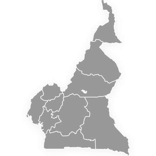
- Borders: the Republic of the Congo to the east and south, Equatorial Guinea to the northwest and Cameroon to the north. Woleu-Ntem touches all three. Estuaire also touches Equatorial Guinea. Ogooué-Ivindo, Haut-Ogooué, Ogooué-Lolo, Ngounié and Nyanga touch the Republic of the Congo. Cameroon has its own regions map.
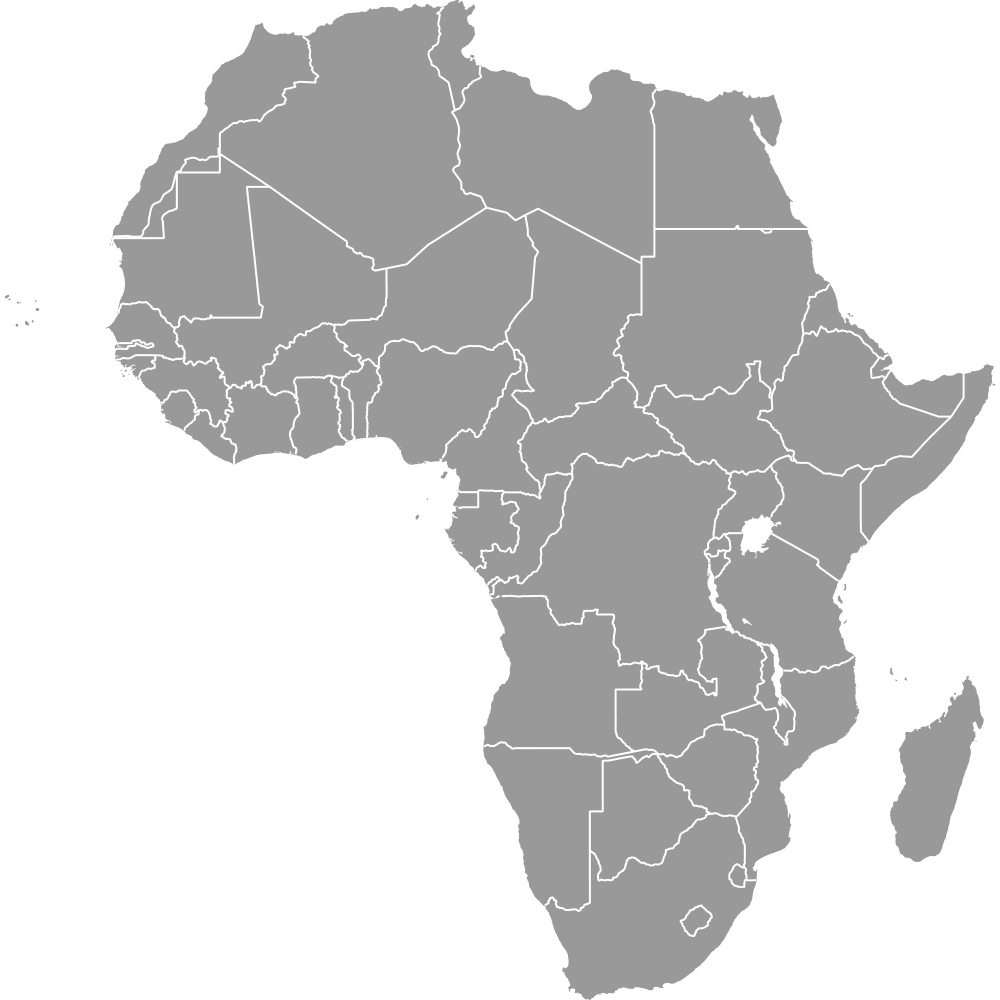
- Coast: Estuaire, Ogooué-Maritime and Nyanga face the Atlantic Ocean, on the western edge of the Africa map.
- Lakes: only Lac Onangué, in Moyen-Ogooué, is drawn. The map leaves out Gabon's other lakes and lagoons, such as Lac Azingo and the Fernan Vaz lagoon.
- Basis of the set: Loi n° 14/96 of 15 April 1996 on territorial reorganization, which keeps nine provinces under governors.
- Last reform: none since 2000 has changed the provinces or their boundaries. In his May 2025 inaugural speech, President Oligui Nguema listed a new administrative division among urgent measures. No bill, law or decree on it had been found as of November 2026.
Interesting Facts
- Two code systems: ISO 3166-2 numbers the provinces GA-1 to GA-9, and Gabon's own codes G1 to G9, seen on older vehicle plates and used in administration, follow the same order.
- A court ruling that moved no province: on 19 May 2025 the International Court of Justice ruled that Equatorial Guinea holds title to the islets of Mbanié, Cocotiers and Conga. The map draws none of the three, and no province outline changed.
- A split province: Ogooué-Maritime is drawn in two parts, the mainland and a small island in the Ogooué delta.
Free Downloads
Free for personal and commercial use with a credit to Ultimaps. See the license terms for details.
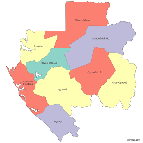 Colored Gabon Map with Provincespng477 KB
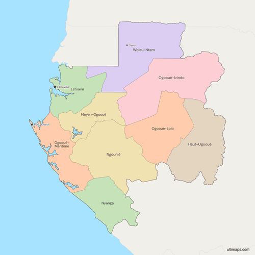 Political Map of Gabon with Provincespng478 KB
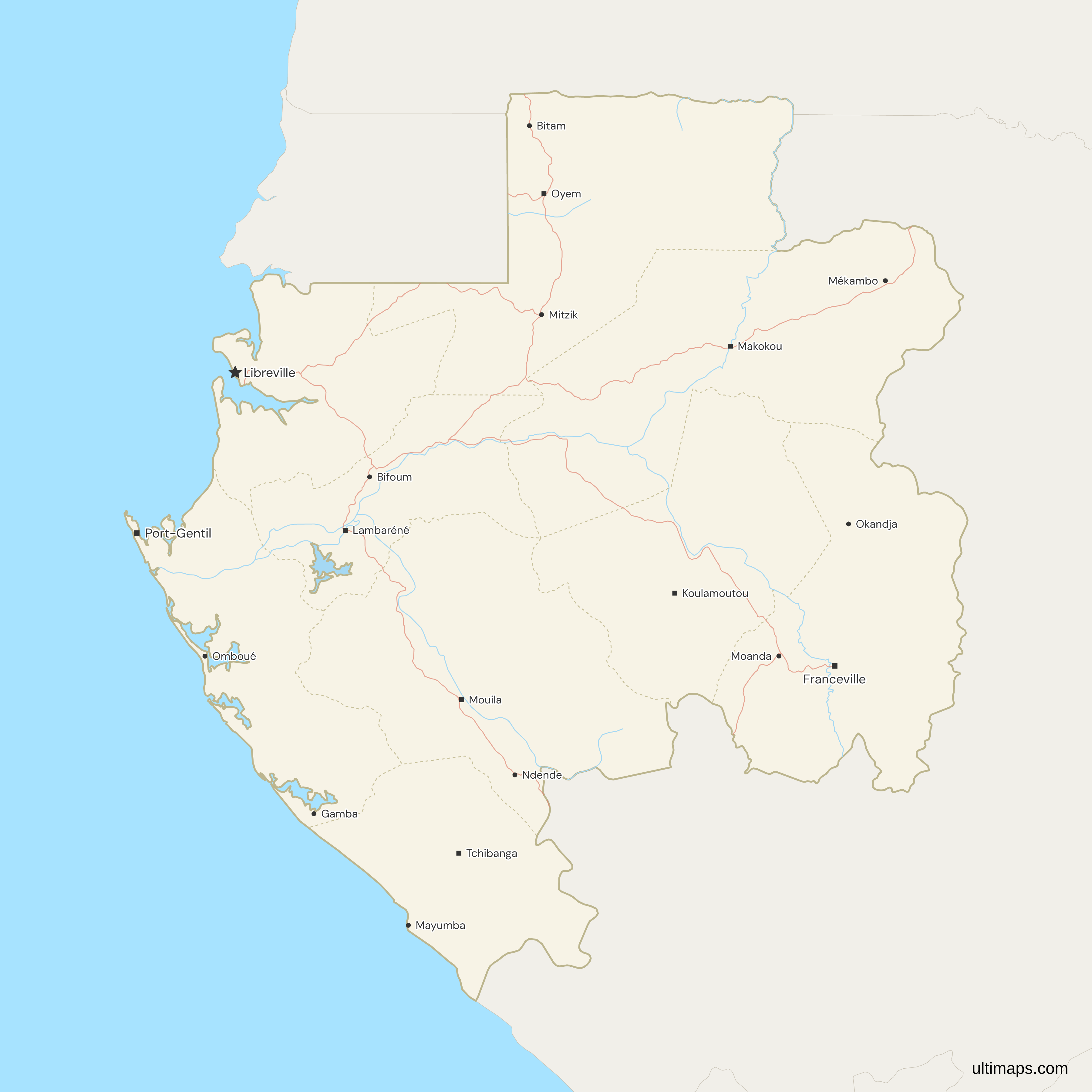
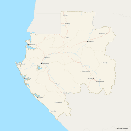 Map of Gabon with Cities and Roadspng624 KB
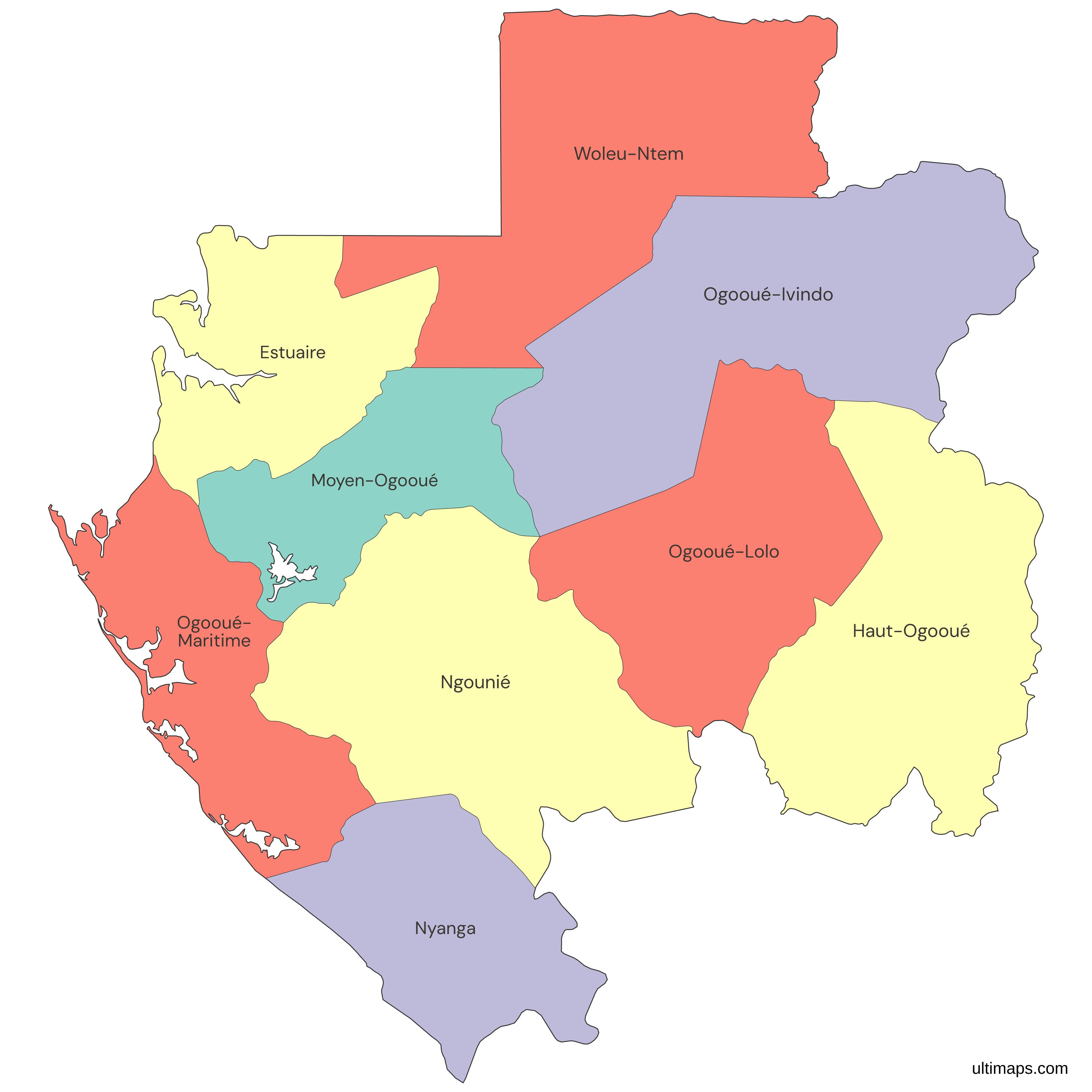
Need it without colors? The blank version of this map comes as a print-ready PDF (A4 and US Letter), a PNG and an editable SVG.
Custom Map Features
This map supports labels.
This map supports surrounding areas, roads, rivers and cities. New
This map is divided into 9 provinces.
Updates
Nov 5, 2026:
- Added map of Gabon provinces
Frequently Asked Questions
Gabon has 9 provinces: Estuaire, Haut-Ogooué, Moyen-Ogooué, Ngounié, Nyanga, Ogooué-Ivindo, Ogooué-Lolo, Ogooué-Maritime and Woleu-Ntem. They were set by Loi n° 14/96 of 15 April 1996 on the territorial reorganization of the republic, which places each one under a governor. The 2026 census reports the same nine, running from Estuaire on the coast to Woleu-Ntem on the northern border, and Libreville, the national capital, lies in Estuaire. ISO 3166-2 codes them GA-1 to GA-9. Older sources call them regions, and a table of regions or states for Gabon refers to these same nine provinces.
Gabon's provincial seats are Franceville for Haut-Ogooué, which some sources list as Masuku, Lambaréné for Moyen-Ogooué, Mouila for Ngounié, Tchibanga for Nyanga, Makokou for Ogooué-Ivindo, Koulamoutou for Ogooué-Lolo, Port-Gentil for Ogooué-Maritime and Oyem for Woleu-Ntem (INSTAT yearbook, 2016 to 2020). Estuaire contains Libreville, the national capital. The 1996 law named no seat for Estuaire, and a bill adopted by the Council of Ministers on 14 April 2022 proposed Akanda, with no vote or promulgation found since. Estuaire is the one province whose seat is still open to question.
Gabon has provinces. The nine units were colonial regions before they were renamed provinces around 1975, which is why older sources and some searches still say regions. Loi n° 14/96 of 15 April 1996 keeps the name province, and each province is run by a governor. Below the provinces sit the departments, and this map draws only the first level, so a table of regions or states for Gabon refers to the same nine provinces shown here. Towns such as Franceville and Oyem are provincial seats, not separate units.
Ogooué-Ivindo is the largest province of Gabon by area, and it touches the Republic of the Congo. Sources disagree on exact square-kilometer figures and on second place: Woleu-Ntem in the older table (Statoids, from 1983), Ngounié in the newer UN boundary data (FAO GAUL 2024). The two differ most for Ogooué-Lolo, Ogooué-Ivindo and Haut-Ogooué, so this page names no figure for any province. The older table and the UN data agree that Ogooué-Ivindo is the largest and Moyen-Ogooué the smallest.
Moyen-Ogooué is the smallest province of Gabon by area. It lies along the Ogooué river around Lambaréné, its seat, and does not touch any other country. The only lake drawn on the map, Lac Onangué, is cut out of its territory. Estuaire, which holds Libreville, is the next smallest by area, although it is by far the largest by population. Moyen-Ogooué shares borders with Woleu-Ntem, Ogooué-Ivindo, Ngounié, Estuaire and Ogooué-Maritime. Both the older table and the UN data rank it last.
In the 2026 census (INSTAT, preliminary results), Estuaire, the province that contains Libreville, counts 2,184,908 residents, more than any other. Haut-Ogooué follows with 297,100 and Ogooué-Maritime with 292,652. Nyanga has the fewest, 68,215. INSTAT still labels the 2026 figures preliminary, although the Constitutional Court validated the national result on 27 August 2026. Estuaire is also the only province above one million residents. Ogooué-Lolo has 75,128. Treat the ranking as a snapshot of those preliminary figures rather than a final count.
This map shows Gabon's nine provinces. It does not draw the departments inside them. The provinces are the first administrative level under Loi n° 14/96 of 15 April 1996, and the departments are the second level. Some sources count 50 departments, and that number is not used on this page. For a country drawn at department level, see the Benin departments map. The editor matches provinces by name, by GA-1 to GA-9 or by G1 to G9. Each province on this page is one whole unit, so pick the province level when you compare figures across the map.
No law since 2000 has changed Gabon's provinces or their boundaries. In April 2022 the Council of Ministers adopted a bill on provincial seats that named Akanda for Estuaire, with no vote or promulgation found since. In his May 2025 inaugural speech, President Oligui Nguema listed a new administrative division among urgent measures. No bill, law or decree on it had been found as of November 2026. On 19 May 2025 the International Court of Justice ruled that Equatorial Guinea holds title to Mbanié, Cocotiers and Conga. The map draws none of them, and no province outline changed.
You can make a custom map of Gabon in the Ultimaps editor, which is free and needs no account. Start from this map, color the 9 provinces by your own figures or by hand, add pins for towns such as Port-Gentil or Franceville, and share or embed the result. Free exports are PNG files carrying a small Ultimaps credit, while high-resolution PNG, SVG and PDF exports are part of the Pro plan. To color from a table, enter one value per province, using names, GA-1 to GA-9 or G1 to G9. Both Woleu-Ntem and the variant Wouleu-Ntem are matched.