Niger Map with Regions
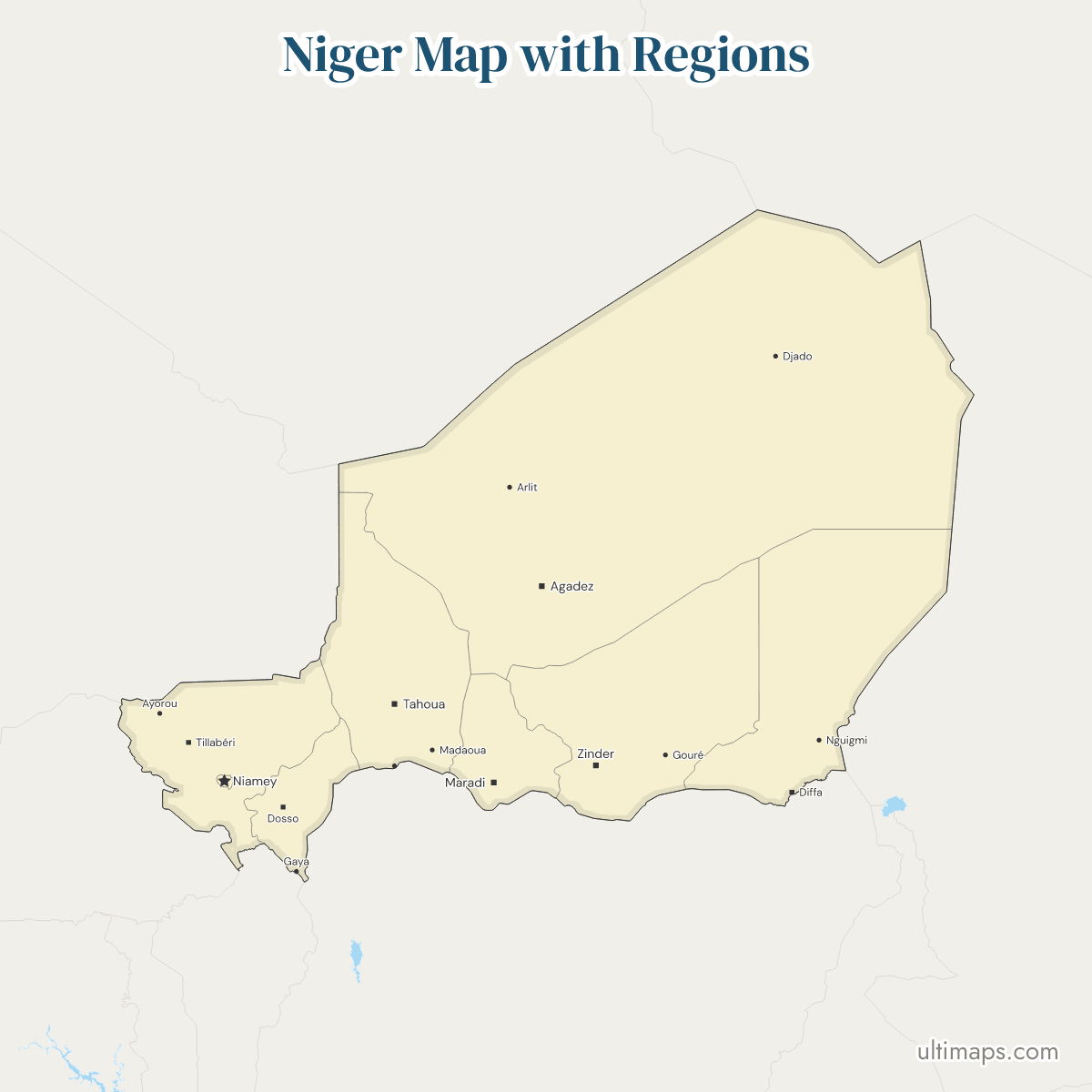
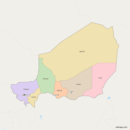
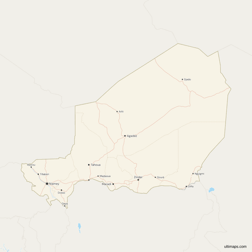
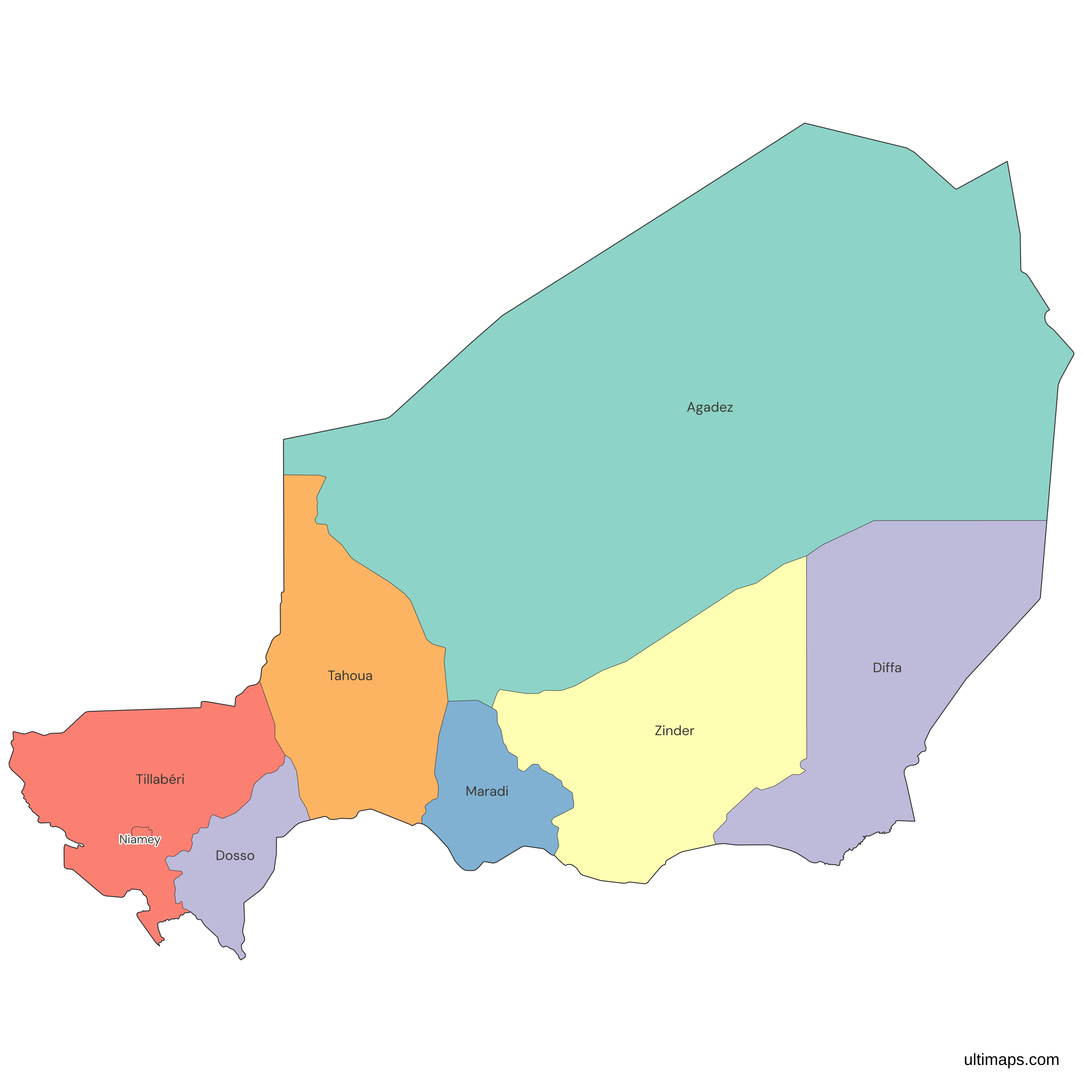
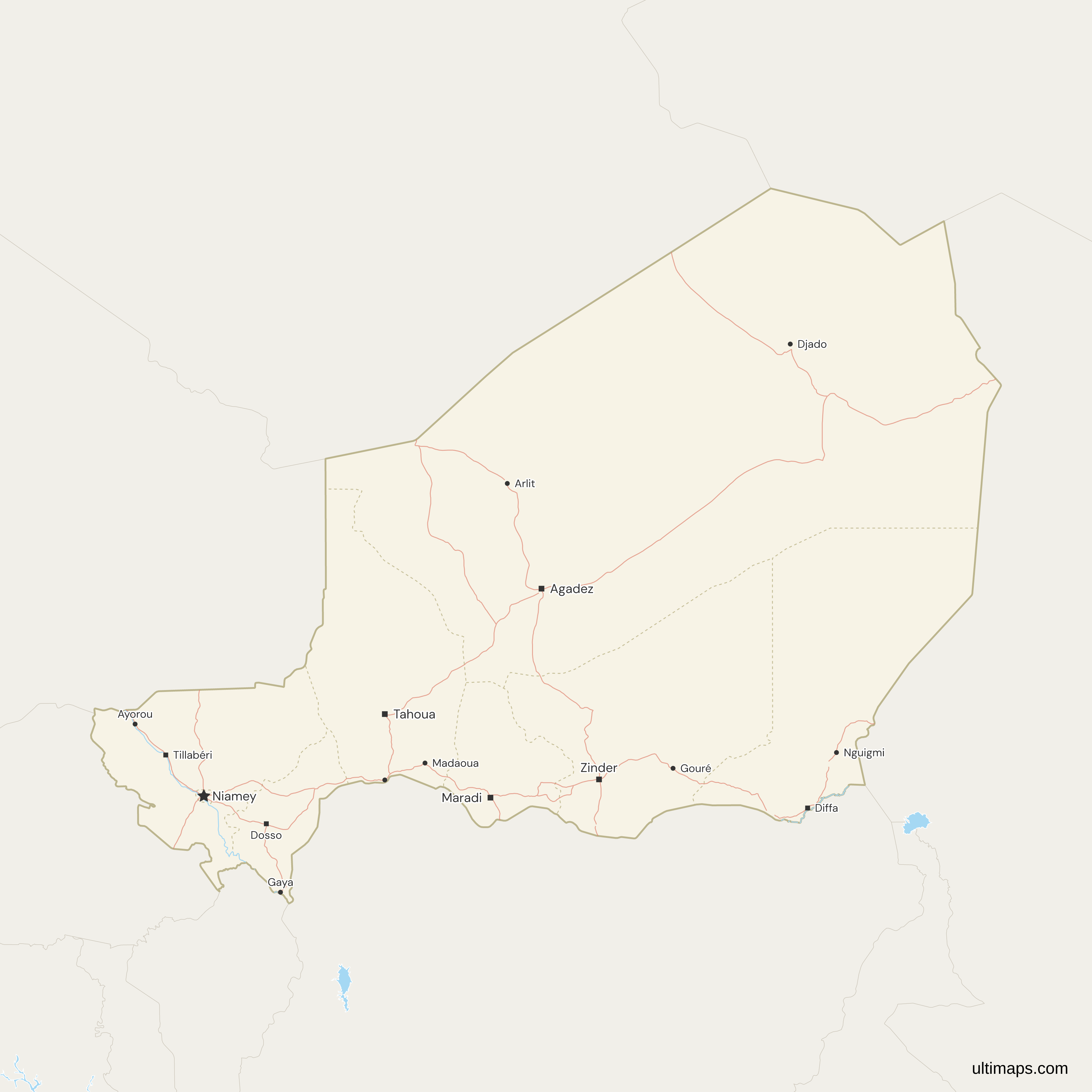
This map of Niger shows all 8 regions, the seven former departments that became regions in August 2001 and the capital district of Niamey. Agadez in the north is the largest by far at 667,799 km² (INS Niger, 2012), and Zinder has the most residents, 5,468,989 in the INS 2024 projection. Niamey, the national capital, is a unit of its own and belongs to no region. The map draws these 8 units and not the 63 departments inside the regions. A draft presented on 12 May 2026 would replace them with 19 regions, and it was still unadopted in November 2026.
Open the map in the free Ultimaps editor to make your own custom map of Niger. You can color the regions by your data, add pins and labels, and share or embed the finished map.
Interactive Niger Map with Regions
List of Regions (8)
Data sources:
- Capital: INS Niger, Annuaire statistique 2020-2024 (2025 edition). License: facts compiled by Ultimaps, CC BY 4.0.
- Population: INS Niger, Annuaire statistique 2020-2024, Tableau 07.01.c (2024 projection). License: INS Open Data Licence. Source : Institut National de la Statistique. Contient des informations sous licence conformément à l'Accord de licence de données ouvertes de l'INS.
- Area: INS Niger, RGP/H 2012, État et structure de la population du Niger, Tableau 6. License: INS Open Data Licence. Source : Institut National de la Statistique. Contient des informations sous licence conformément à l'Accord de licence de données ouvertes de l'INS.
Niger Regions: Key Facts
- Number of regions: 8 first-level units, which are 7 regions and Niamey. Niamey is a first-level unit of its own, coded NE-8 in ISO 3166-2, but is not one of the seven regions.
- Capital: Niamey is the national capital and its own unit. Tillabéri is the only unit that touches it on the map.
- Regional seats: each of the seven regions has a seat named like the region: Agadez, Diffa, Dosso, Maradi, Tahoua, Tillabéri and Zinder.
- Largest region: Agadez, 667,799 km² in the 2012 census report of INS Niger, ahead of Diffa at 156,906 km² and Zinder at 155,778 km².
- Smallest unit: Niamey, 255 km² in the 2012 census report of INS Niger, though other sources give different figures.
- Most populous region: Zinder, 5,468,989 in the 2024 projection of INS Niger. Agadez has the fewest, 714,509. The 8 units total 26,312,034.
- Borders: Niger, in Africa, has land borders with seven countries. Nigeria touches Tahoua, Dosso, Diffa, Maradi and Zinder. Chad touches Diffa and Agadez. Mali touches Tahoua, Tillabéri and Agadez. Benin touches Dosso and Tillabéri. Algeria and Libya touch only Agadez, and Burkina Faso touches only Tillabéri.
- Coast: none. Niger is landlocked, and no unit has a sea coast.
- Legal basis: Loi n° 2001-023 of 10 August 2001 turned the 7 departments into regions with the same boundaries. In 2011 the second level, the departments, rose from 36 to 63 while the regions stayed the same.
- Codes: ISO 3166-2 runs from NE-1 (Agadez) to NE-8 (Niamey). Diffa is NE-2, Dosso NE-3, Maradi NE-4, Tahoua NE-5, Tillabéri NE-6 and Zinder NE-7.
- Pending change: a draft redistricting presented on 12 May 2026 would split Niger into 19 regions. It was not law as of November 2026.
Interesting Facts
- Natural Earth, a common data source, still labels the seven regions "Department", their name before 2001.
- Tillabéri is also spelled Tillabéry, including by the state news agency, and Agadez appears as Agadès in older French sources. Both spellings match on this map.
- Besides the units, the map draws the Niger River, the Komadugu Yobe and Lake Chad.
Free Downloads
Free for personal and commercial use with a credit to Ultimaps. See the license terms for details.
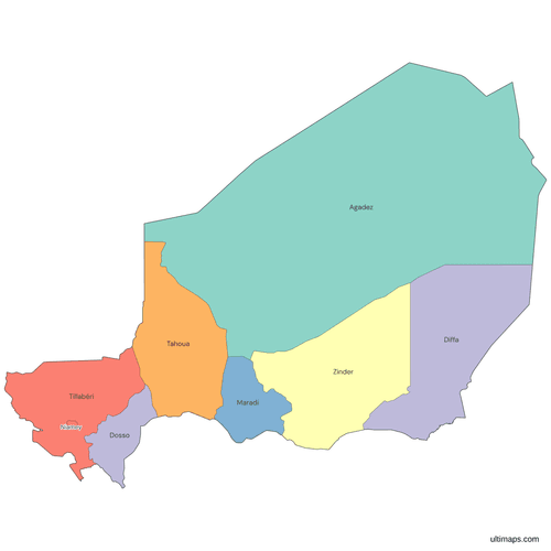 Colored Niger Map with Regionspng277 KB
 Political Map of Niger with Regionspng368 KB
 Map of Niger with Cities and Roadspng481 KB
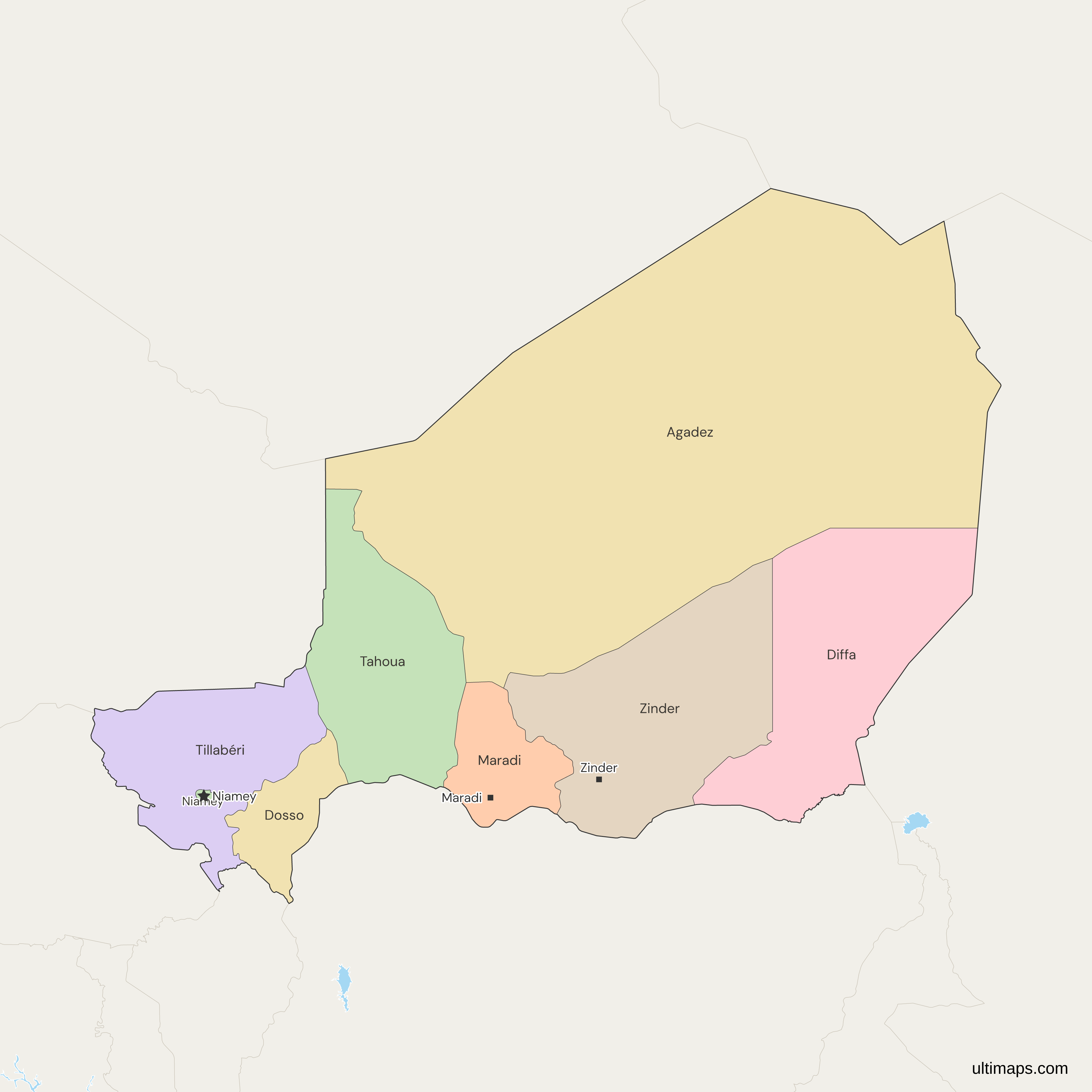
Need it without colors? The blank version of this map comes as a print-ready PDF (A4 and US Letter), a PNG and an editable SVG.
Custom Map Features
This map supports labels.
This map supports surrounding areas, roads, rivers and cities. New
This map is divided into 8 regions.
Updates
Nov 5, 2026:
- Added map of Niger regions
Frequently Asked Questions
Niamey is the capital of Niger. On this map it is a unit of its own, the Ville de Niamey, and not part of any region. It was split from the old Niamey department in 1992, and since 2010 it has been a city with special status. The INS Niger projection for 1 July 2024 gives it 1,492,414 residents, the sixth most of the eight units. With 255 km² in the 2012 census report, it is also the smallest of the eight by area.
Niger has 8 first-level units, which are 7 regions and the capital district of Niamey. The regions are Agadez, Diffa, Dosso, Maradi, Tahoua, Tillabéri and Zinder. Loi n° 2001-023 of 10 August 2001 turned the 7 former departments into regions, with the same set and boundaries. The 63 departments below them are not counted among the 8. ISO 3166-2 codes the units NE-1 to NE-8, with Niamey as NE-8. Natural Earth, the source of the boundaries on this map, matches all 8 units one to one by code and name.
The Republic of Niger has no states. It has seven regions and the capital district of Niamey. The two are often confused because they share a name. Niger State, with its capital at Minna, is one of the 36 states of Nigeria and is on the Nigeria map, not this one. Separately, Niger's regions Tahoua, Dosso, Diffa, Maradi and Zinder face Nigeria's northern states along a long border. A search for Niger states therefore often returns Nigerian results. For Nigeria's units, see the Nigeria map with states.
A draft redistricting for Niger was presented on 12 May 2026. The Interior Ministry showed it to the Conseil consultatif de la Refondation. It would replace the 8 units with 19 regions and the 63 departments with 82. Agadez would split into Abzine and Kawar, Diffa into Mangari and Komadougou, and Dosso into Arewa and Zigui. Maradi, Tahoua, Tillabéri and Zinder would each become three regions, and Niamey would stay as it is. In November 2026 the draft was still unadopted, and the 8 existing units are the ones drawn here.
Agadez, the northern region, takes up more than half of Niger: 667,799 km² in the 2012 census report of INS Niger. It borders Algeria, Libya, Chad and Mali, and it is larger than the other seven units put together. Diffa and Zinder, the next two in size, are each under a quarter of that area, Tahoua is fourth at 113,371 km², and Niamey covers less than 0.1 percent of it. The figures are total area as published by INS Niger.
Niger's smallest first-level unit is its capital, Niamey, which is a unit of its own and not a region. Published figures for its area differ. The 2012 census report of INS Niger gives 255 km², while other sources give 402 and 552 km². Among the seven true regions, Dosso is the smallest at 33,844 km² in that report, followed by Maradi at 41,796 km². Both are far smaller than Agadez, Diffa or Zinder. The region table on this page uses the 255 km² census figure.
The 8 units of Niger hold 26,312,034 residents in the 1 July 2024 projection of INS Niger, and Zinder has the largest share with 5,468,989. Maradi at 5,249,420 and Tahoua at 5,138,552 are the only others above 5 million. Tillabéri has 4,202,834 and Dosso 3,172,644. Niamey has 1,492,414 and Diffa 872,672. Agadez has the fewest at 714,509, though it is the largest by area. The five units from Zinder to Dosso hold about 88 percent of the total. The 2012 census gives the same two ends of the ranking.
This map shows the 7 regions of Niger and Niamey. It does not draw the 63 departments inside them. Departments have two meanings in Niger. Before 2001 the seven regions were themselves called departments, and some datasets still use that word for them. Today the departments are the second level. In 2011 their number rose from 36 to 63, while the regions stayed the same. The draft of May 2026 would raise the departments to 82. Only the first level is drawn here.
Open the map in the Ultimaps editor, which is free and needs no account. Color the 8 units by your own figures or by hand, then add pins and labels and share or embed the result. A free export is a standard PNG with a small Ultimaps credit, and high-resolution PNG, SVG and PDF exports are part of the Pro plan. To color from a table, enter one value per unit, such as population or sales. If your table lists the 63 departments, add them up to their region first, and give Niamey its own row.