Cameroon Map with Regions
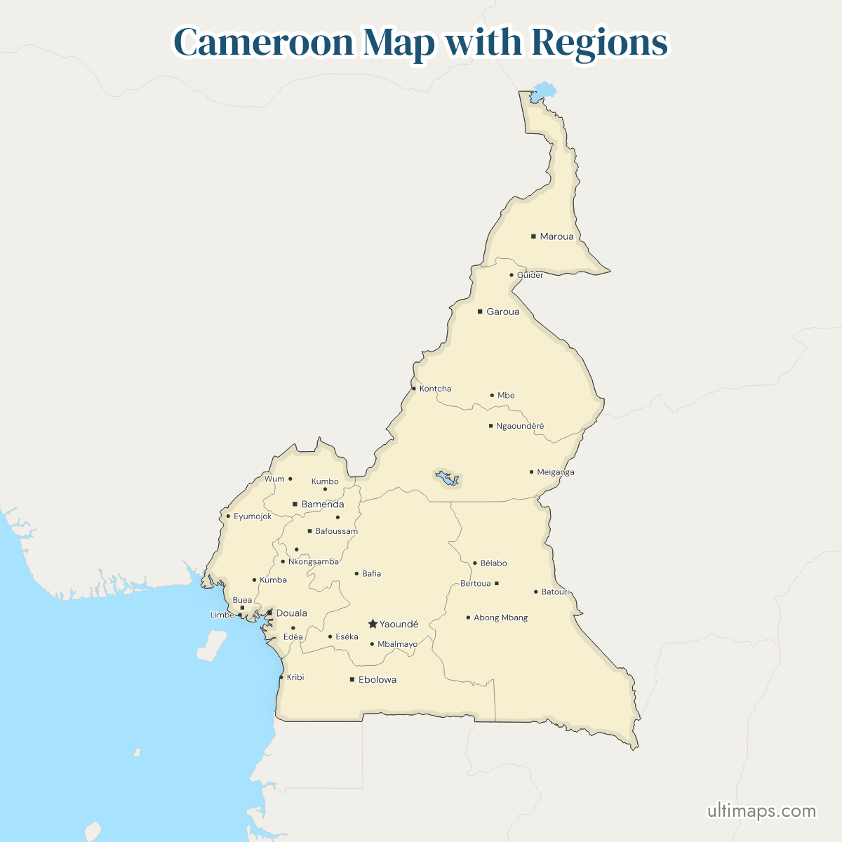
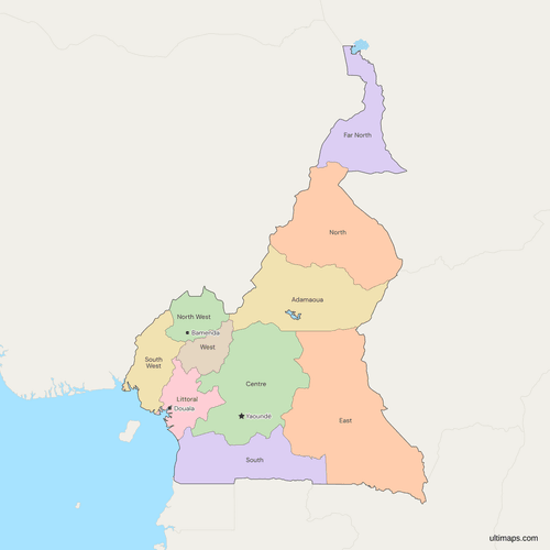
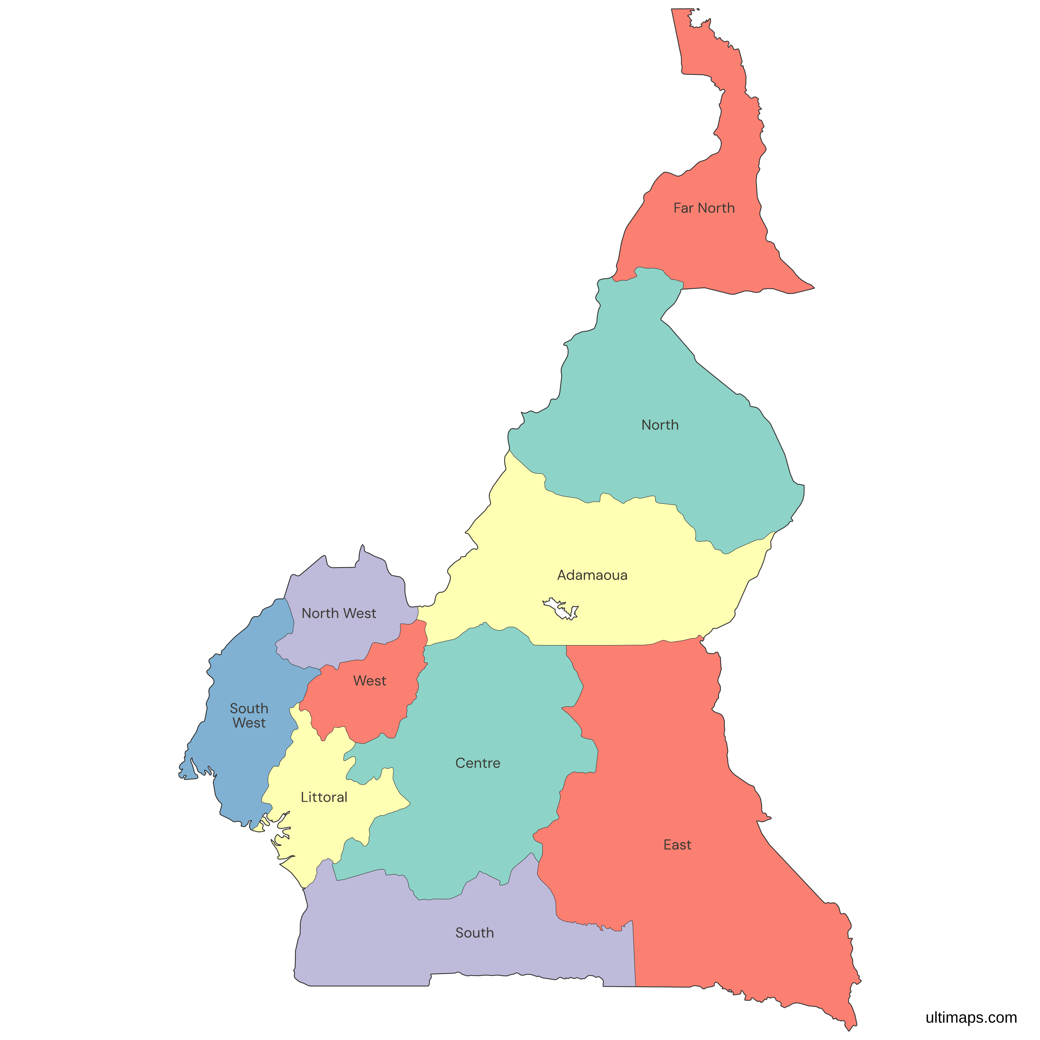
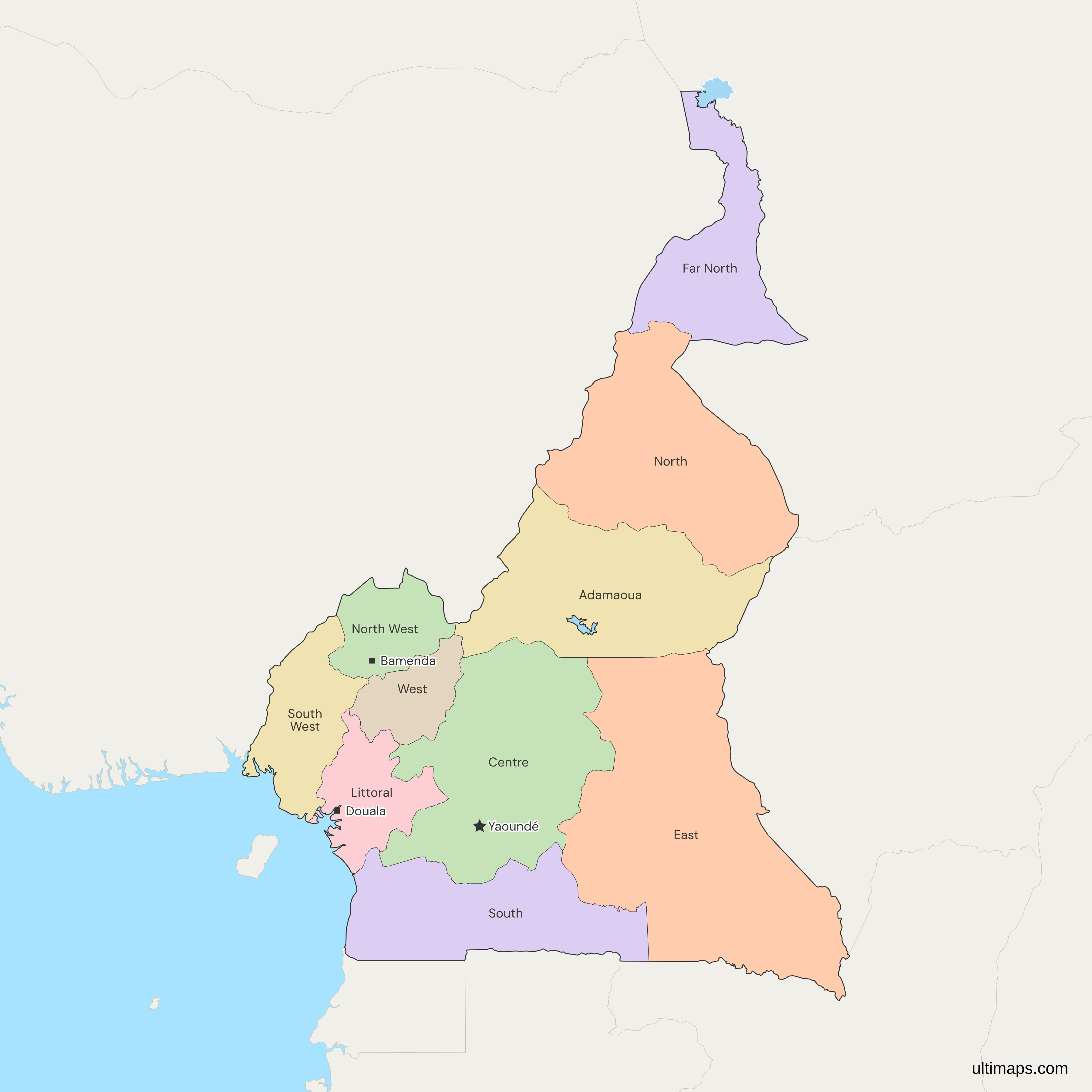
This map of Cameroon shows all 10 regions, each one a former province. Décret n° 2008/376 of 12 November 2008 turned the provinces into regions and left their limits unchanged. East is the largest at 109,002 km² (BUCREP, 2005) and West the smallest at 13,892 km². Far North has the most residents, 3,111,792 in the 2005 census (BUCREP). Yaoundé, in Centre, is the national capital. The departments inside the regions are not drawn.
Open the map in the free Ultimaps editor to make your own custom map of Cameroon. You can color the regions by your data, add pins and labels, and share or embed the finished map.
Interactive Cameroon Map with Regions
List of Regions (10)
| # | Region | Capital | Population (2005) | Area (km², 2005) |
|---|---|---|---|---|
| 1 | Adamaoua | Ngaoundéré | 884,289 | 63,701 |
| 2 | Centre | Yaoundé | 3,098,044 | 68,953 |
| 3 | East | Bertoua | 771,755 | 109,002 |
| 4 | Far North | Maroua | 3,111,792 | 34,263 |
| 5 | Littoral | Douala | 2,510,263 | 20,248 |
| 6 | North | Garoua | 1,687,959 | 66,090 |
| 7 | North West | Bamenda | 1,728,953 | 17,300 |
| 8 | South | Ebolowa | 634,655 | 47,191 |
| 9 | South West | Buea | 1,316,079 | 25,410 |
| 10 | West | Bafoussam | 1,720,047 | 13,892 |
Data sources:
Cameroon Regions: Key Facts
- Number of regions: 10, listed in Article 61(1) of the 1996 Constitution as amended in 2008. They were called provinces until Décret n° 2008/376 of 12 November 2008.
- National capital: Yaoundé, in the Centre region. Douala is the capital of Littoral, not of the country.
- Largest region by area: East, at 109,002 km² (BUCREP, 2005). Centre follows at 68,953 km² and North at 66,090 km².
- Smallest region by area: West, at 13,892 km² (BUCREP, 2005), just behind North West at 17,300 km² and Littoral at 20,248 km².
- Most and least populous: Far North with 3,111,792 residents and South with 634,655 (BUCREP, 2005 census).
- Borders: Cameroon sits in central Africa and borders Nigeria, Chad, the Central African Republic, the Republic of the Congo, Gabon and Equatorial Guinea. Nigeria touches five regions: Far North, North, Adamaoua, North West and South West. Gabon and Equatorial Guinea border South only. East faces the Central African Republic and the Republic of the Congo.
- Coast: South, Littoral and South West, on the Gulf of Guinea. The other seven regions are inland.
- Lake Chad: Far North holds Cameroon's short shore on Lake Chad.
- English-speaking regions: North West and South West, which have had a special status since Law 2019/024 of December 2019.
- Codes: ISO 3166-2 runs from CM-AD for Adamaoua to CM-SW for South West, with CM-OU for West and CM-EN for Far North.
Interesting Facts
- The Bakassi Peninsula, transferred from Nigeria in August 2008, is drawn inside South West.
- On this map, Adamaoua shares a border with Nigeria's Adamawa State. Adamaoua is the French spelling, and some English sources, as well as Natural Earth, write the Cameroonian region as Adamawa.
- The presidents of all 10 regional councils met in Garoua on 14 to 16 September 2026, at the general assembly of the Association des Régions du Cameroun.
Free Downloads
Free for personal and commercial use with a credit to Ultimaps. See the license terms for details.
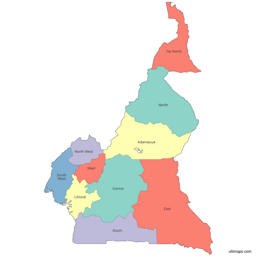 Colored Cameroon Map with Regionspng360 KB
 Political Map of Cameroon with Regionspng452 KB
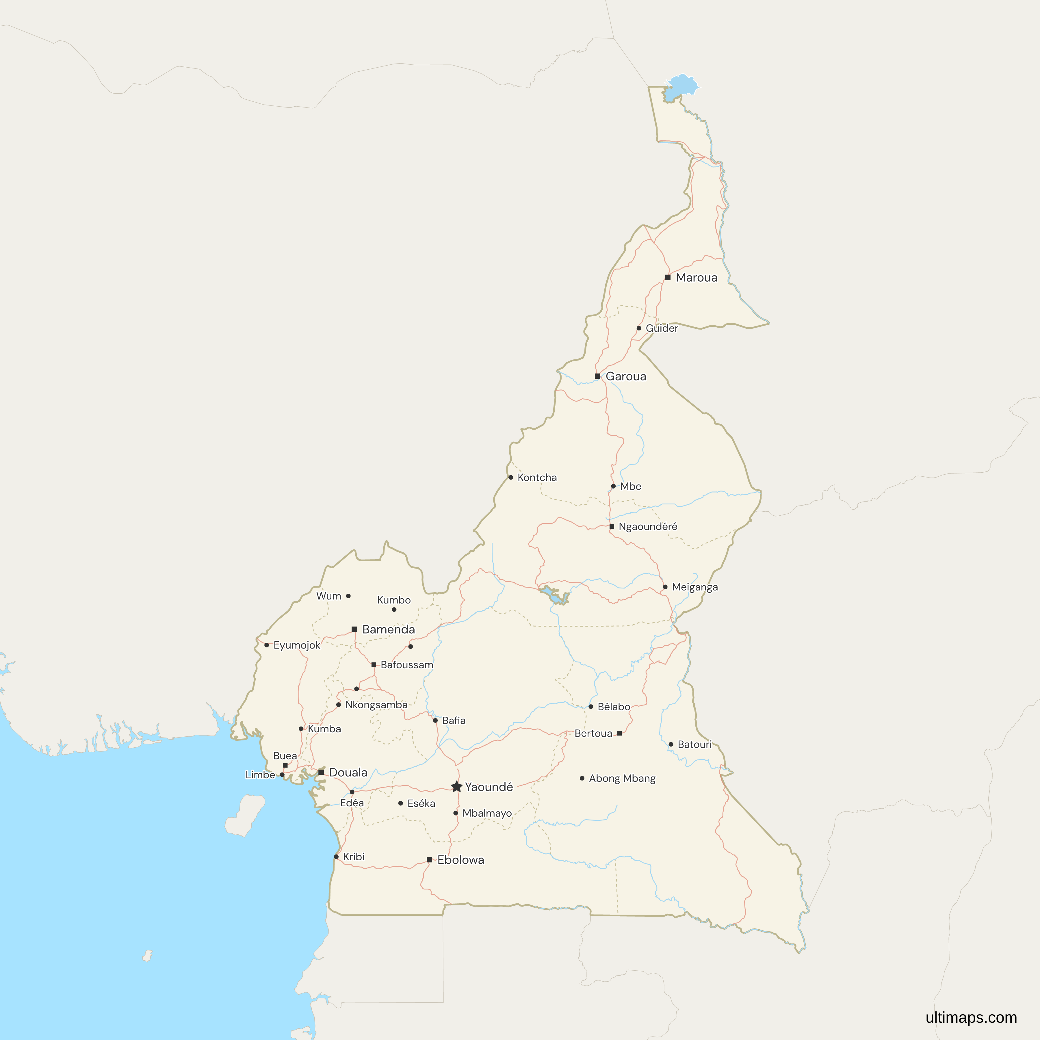
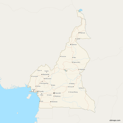 Map of Cameroon with Cities and Roadspng696 KB
Need it without colors? The blank version of this map comes as a print-ready PDF (A4 and US Letter), a PNG and an editable SVG.
Custom Map Features
This map supports labels.
This map supports surrounding areas, roads, rivers and cities. New
This map is divided into 10 regions.
Updates
Nov 5, 2026:
- Added map of Cameroon regions
Frequently Asked Questions
Cameroon has 10 regions: Adamaoua, Centre, East, Far North, Littoral, North, North West, South, South West and West. Article 61(1) of the 1996 Constitution, as amended in 2008, lists them. The President can rename, redraw or create regions by decree under Article 61(2), but no source reports a change to the list since 2008, and the presidents of all 10 regional councils met in Garoua in September 2026. This map draws all 10 and adds a table of them below the map.
No. This map shows Cameroon's 10 regions. It does not draw the departments, which English sources also call divisions, and which sit one level below the regions. Cameroon is usually given as having 58 of them, spread unevenly across the regions. Below the departments are the arrondissements, the third level, which the map does not draw either. The table under the map lists the 10 regions with their ISO 3166-2 codes. If you need data by department, color the 10 regions and add pins for the towns you care about.
Cameroon's regional capitals are Ngaoundéré for Adamaoua, Yaoundé for Centre, Bertoua for East, Maroua for Far North, Douala for Littoral, Garoua for North, Bamenda for North West, Ebolowa for South, Buea for South West and Bafoussam for West (BUCREP). Yaoundé is both the national capital and a regional capital, and it lies in Centre. Douala is the capital of Littoral but not of the country. Ngaoundéré, Garoua and Maroua head the three northern regions, Adamaoua, North and Far North, while Bamenda and Buea head the two English-speaking ones.
Cameroon has regions, not states or provinces. Some English sources call them states, and older ones, including a JICA report, call them provinces. That was correct until Décret n° 2008/376 of 12 November 2008, which turned the 10 provinces into regions with the same boundaries. The French names are Extrême-Nord, Nord-Ouest and Sud-Ouest for three of them. The map accepts both the English and French spellings, so a table keyed to either one will match without renaming columns or rows by hand.
North West and South West are Cameroon's two English-speaking regions. Cameroon administers both with a special status under Law 2019/024 of December 2019, the General Code of Regional and Local Authorities. Separatist groups claim the two regions as Ambazonia. The map draws them as two of Cameroon's 10 regions and takes no position on the claim. North West has its capital at Bamenda and South West at Buea, and the Bakassi Peninsula, transferred from Nigeria in 2008, lies inside South West.
East is the largest region of Cameroon, with 109,002 km² of total area in the 2005 census (BUCREP). It borders the Central African Republic and the Republic of the Congo, with the longest stretch of each frontier, and it has no coast. Its 771,755 residents in 2005 (BUCREP) rank it ninth of the 10 by population. East alone is more than five times the size of the entire Littoral region, which has 20,248 km², and nearly eight times the size of West.
West lies between North West, South West, Littoral, Centre and Adamaoua, with Bafoussam as its capital, and at 13,892 km² (BUCREP, 2005) it is the smallest region of Cameroon. North West is the next smallest at 17,300 km², followed by Littoral at 20,248 km². Despite its size, West is not among the least populous regions, with 1,720,047 residents in the 2005 census (BUCREP), fifth of the 10. Its area is about an eighth of East's 109,002 km², and its ISO 3166-2 code is CM-OU.
Far North is the most populous region of Cameroon, with 3,111,792 residents in the 2005 census (BUCREP). Centre trails it by only 13,748, at 3,098,044, and Littoral is third with 2,510,263. The 2005 census is the latest with published regional results: the fourth census ended on 15 September 2026 and has published none yet. Newer estimates put Centre ahead of Far North. Maroua is the capital of Far North and Yaoundé lies in Centre, so the two most populous regions sit in the far north and around the national capital.
Open the Cameroon map in the Ultimaps editor, which is free and needs no account. You can color the 10 regions by your own figures or by hand, add pins and labels, and share or embed the finished map. A free export is a standard PNG with a small Ultimaps credit. High-resolution PNG, SVG and PDF exports are part of the Pro plan. To color from a table, enter one value per region, such as population or sales, using region names or ISO codes such as CM-OU for West.