New Caledonia Map with Provinces
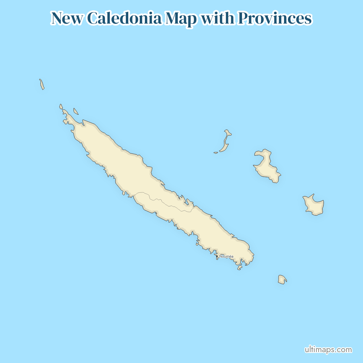
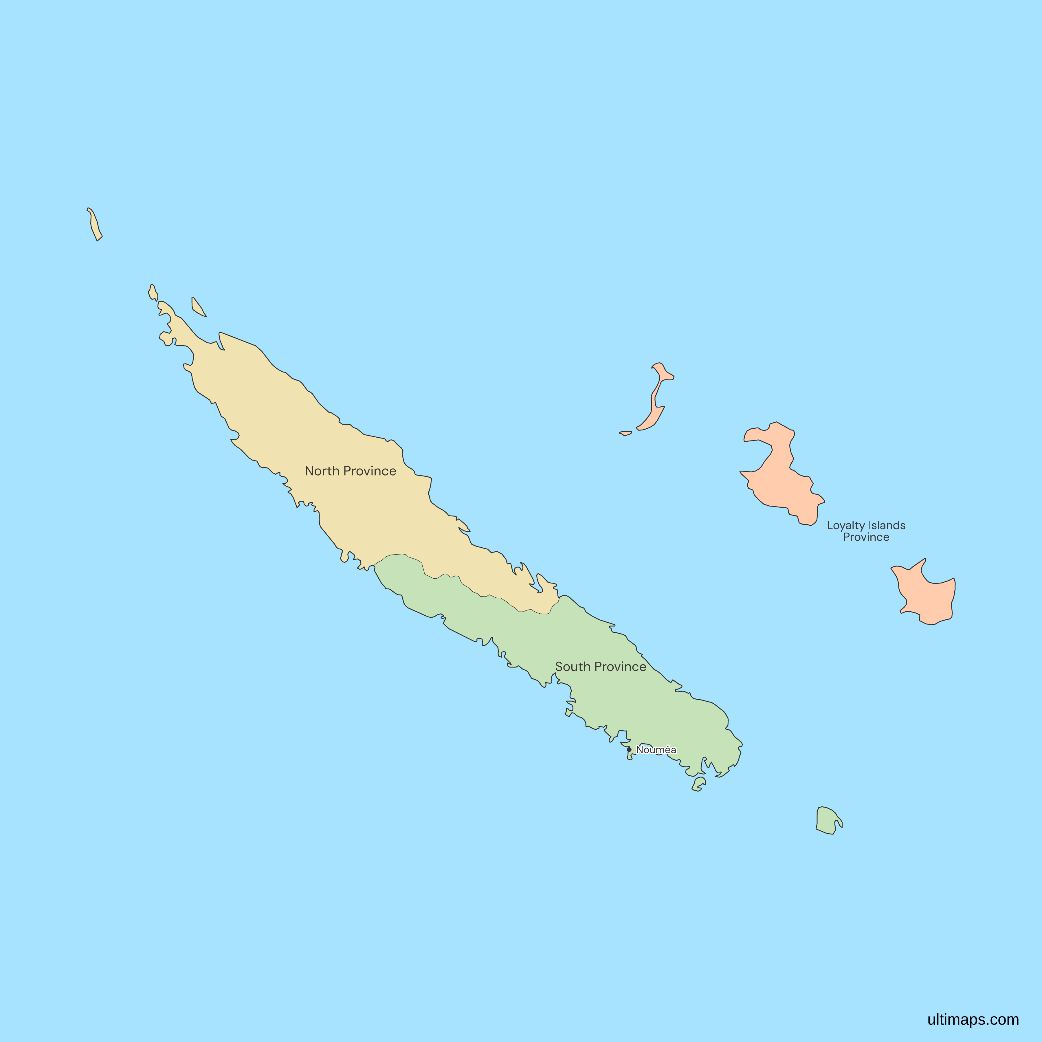
This map of New Caledonia shows all 3 provinces, North, South and Loyalty Islands, which replaced the territory's four regions in 1988. South Province holds 194,978 of the 264,596 residents (INSEE, 2025 reference population), and Nouméa, the capital of New Caledonia, lies within it. North Province has 50,947 residents and the Loyalty Islands Province 18,671. Remote islets outside the provinces' communes, such as the Chesterfield Islands, are not drawn.
Open the map in the free Ultimaps editor to make your own custom map of New Caledonia. You can color the provinces by your data, add pins and labels, and share or embed the finished map.
Interactive New Caledonia Map with Provinces
List of Provinces (3)
| # | Province | Capital | Population (2025) |
|---|---|---|---|
| 1 | Loyalty Islands Province | Wé | 18,671 |
| 2 | North Province | Koné | 50,947 |
| 3 | South Province | Nouméa | 194,978 |
Data sources:
New Caledonia Provinces: Key Facts
- Number of provinces: 3. North Province covers the northern part of Grande Terre and the Belep islands, among other islets. South Province covers the southern part, Île des Pins, Île Ouen and other islets. The Loyalty Islands Province is chiefly Ouvéa, Lifou and Maré, with Tiga and smaller islets.
- Capital: Nouméa is the capital of New Caledonia and also the seat of South Province. New Caledonia is a French overseas collectivity, so it has a capital but no national one.
- Provincial seats: Koné for North Province, Wé, on Lifou, for the Loyalty Islands Province and Nouméa for South Province. The map marks Nouméa only.
- Largest and smallest by area: By the map's own geometry, North Province ranks first, South Province second and the Loyalty Islands Province third. No area figures are printed, because the page uses no area dataset.
- Most and least populous: South Province, with 194,978 residents, holds about 74% of the territory's population. The Loyalty Islands Province has the fewest, 18,671 (INSEE, 2025 reference population).
- Communes: North Province has 16 communes, South Province 13 and the Loyalty Islands Province 3. The commune of Poya is split between North and South by decree.
- Borders: New Caledonia has no land border. Its nearest neighboring country is Vanuatu, to the north-east, outside the map's frame.
- Region: New Caledonia is drawn as one territory on the Oceania and world maps, while this map splits it into its 3 provinces.
- Established: 9 November 1988, by the referendum law that put the Matignon Accords into effect. It replaced the territory's four regions.
- Legal basis: Organic Law no. 99-209 of 19 March 1999 names the three provinces. A change to a provincial limit needs a decree of the Conseil d'État, and none has been issued.
- Codes: ISO 3166-2 lists no subdivisions of New Caledonia, which is FR-NC as a whole, so this map has no province codes.
Interesting Facts
- The Loyalty Islands Province is the only one with no part of Grande Terre, and its seat, Wé, is on Lifou.
- Matthew and Hunter lie over 300 km east of the provinces, outside the map's frame, and the map draws neither as part of a province.
Free Downloads
Free for personal and commercial use with a credit to Ultimaps. See the license terms for details.
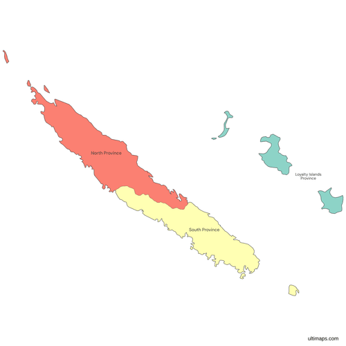 Colored New Caledonia Map with Provincespng253 KB
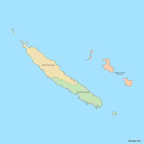 Political Map of New Caledonia with Provincespng237 KB
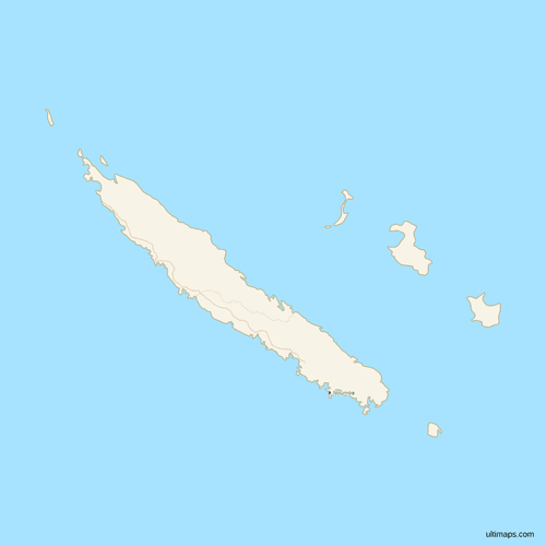 Map of New Caledonia with Cities and Roadspng229 KB
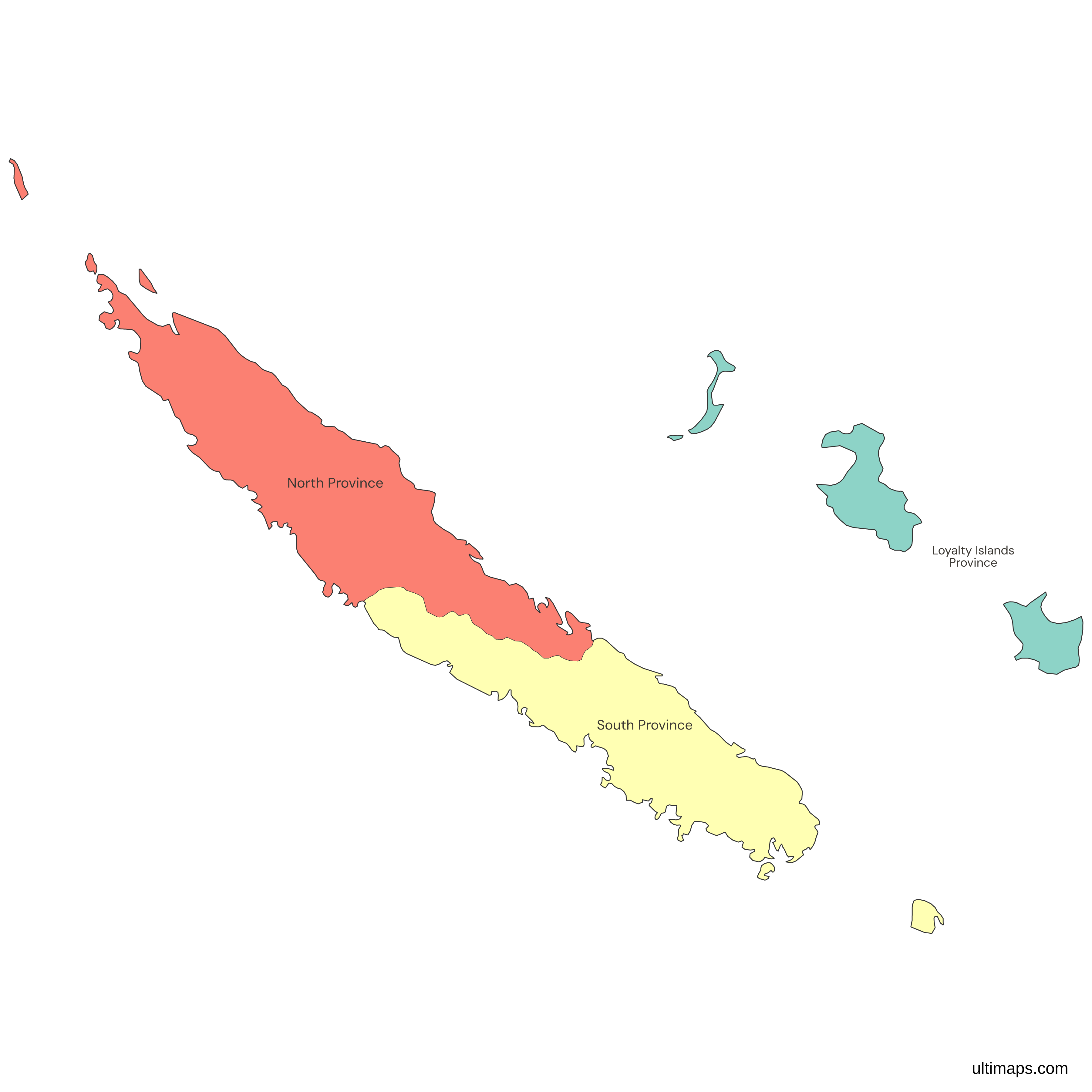
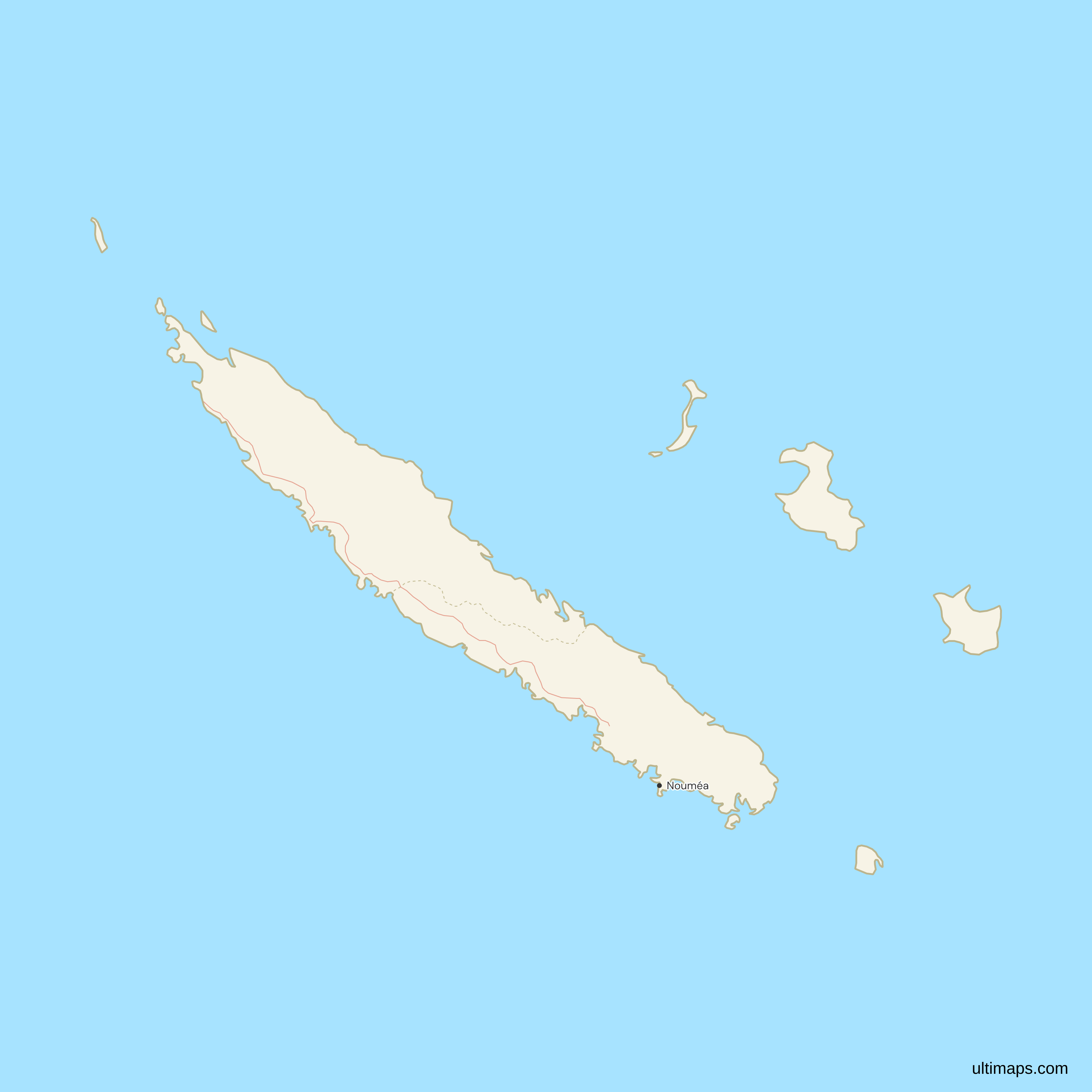
Need it without colors? The blank version of this map comes as a print-ready PDF (A4 and US Letter), a PNG and an editable SVG.
Custom Map Features
This map supports labels.
This map supports surrounding areas, roads and cities. New
This map is divided into 3 provinces.
Updates
Nov 5, 2026:
- Added map of New Caledonia provinces
Frequently Asked Questions
New Caledonia has 3 provinces: North Province, South Province and the Loyalty Islands Province. The loi référendaire of 9 November 1988, which put the Matignon Accords into effect, created them in place of the territory's four regions. Organic Law no. 99-209 of 19 March 1999 names them today. North Province has 16 communes, South Province 13 and the Loyalty Islands Province 3, and the commune of Poya is split between North and South by decree. No reform since 2000 has changed the number of provinces or a provincial limit.
The capital of New Caledonia is Nouméa, which is also the seat of South Province. Each of the other two provinces has its own seat. Koné is the seat of North Province, and Wé, on the island of Lifou, is the seat of the Loyalty Islands Province. Some sources write the Loyalty Islands seat as Lifou, which is the commune that contains Wé. Because New Caledonia is a French overseas collectivity and not a sovereign state, Nouméa is the capital of the territory rather than a national capital, and the provincial seats sit below it.
By area, North Province ranks first among New Caledonia's provinces on this map. It takes in the northern part of Grande Terre, the main island, and three islets off its north-west tip, including the Belep islands. South Province ranks second and holds Île des Pins and Île Ouen as well as the southern part of Grande Terre. No area figures are printed, because the page uses no area dataset, so the order comes from the map's own geometry. Population runs the other way: South Province is smaller but far more populous, with 194,978 residents against 50,947 in North Province.
The Loyalty Islands Province has no part of Grande Terre, and that is why it ranks last by area among New Caledonia's three provinces. It is made of islands, chiefly Ouvéa, Lifou and Maré, with Tiga and smaller islets. Lifou is the largest of the three main islands. The province lies east of Grande Terre and has 3 communes, one for each main island. The Loyalty Islands Province is also the least populous, with 18,671 residents (INSEE, 2025 reference population), against 50,947 in North Province and 194,978 in South Province.
The ranking by residents puts South Province first, on the figures in Décret n° 2025-966, which count the northern part of Poya in North Province and the southern part in South Province. South Province has 194,978 residents (INSEE, 2025 reference population), about 74% of the 264,596 counted in all three provinces. The reason is Nouméa, the capital, which is in this province. North Province follows with 50,947, about 19% of the total, and the Loyalty Islands Province has the fewest, 18,671.
The Loyalty Islands are a group of islands east of Grande Terre that form one of New Caledonia's three provinces, the Loyalty Islands Province. The three main islands are Ouvéa, Lifou and Maré, and each is a commune. The province seat is Wé, on Lifou, and the province is the only one made of islands alone. French sources name it Province des îles Loyauté. The province had 18,671 residents in the INSEE 2025 reference population, the fewest of the three. The map draws Ouvéa, Lifou and Maré and a small islet at the southern end of Ouvéa. Smaller islands such as Tiga are not drawn.
New Caledonia is a French overseas collectivity with its own status, under Organic Law no. 99-209 of 19 March 1999. Its three provinces have their own assemblies. The Bougival accord of July 2025 and the Élysée-Oudinot accord of January 2026 would change the provinces' powers and finances, not their number or limits. The National Assembly rejected the constitutional bill that would carry them out on 2 April 2026. The provincial elections of 28 June 2026 were held under the three-province framework.
No island outside the three provinces is drawn. Matthew and Hunter, two small islands over 300 km east of the provinces, lie outside the map's frame. France administers them as part of New Caledonia, and Vanuatu claims them as part of Tafea Province, as the page for Vanuatu's provinces also says. The Chesterfield Islands, the Huon and Surprise reefs and Walpole are remote islets outside the provinces' communes and are not drawn either. None of these belongs to a province on this map.
The free Ultimaps editor opens from this page with the 3 provinces already drawn, and you need no account to start. Paste or import a table with one row per province, or click provinces to color them by hand. Rows match on the English name, on the French name such as Province Nord or Province des îles Loyauté, or on the short forms Nord, Sud and Îles Loyauté. Pins add places the map does not mark, such as Koné or Lifou. A free account lets you save and publish the map, then share a link or embed it. A free export is a standard PNG with a small Ultimaps credit. High-resolution PNG, SVG and PDF files need Ultimaps Pro.