Vanuatu Map with Provinces
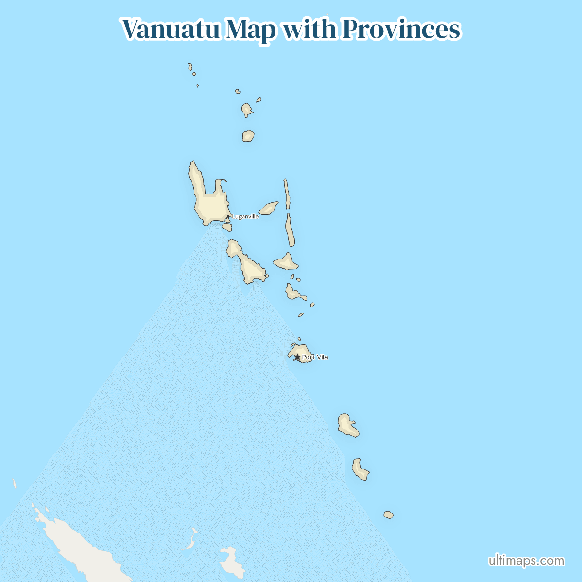
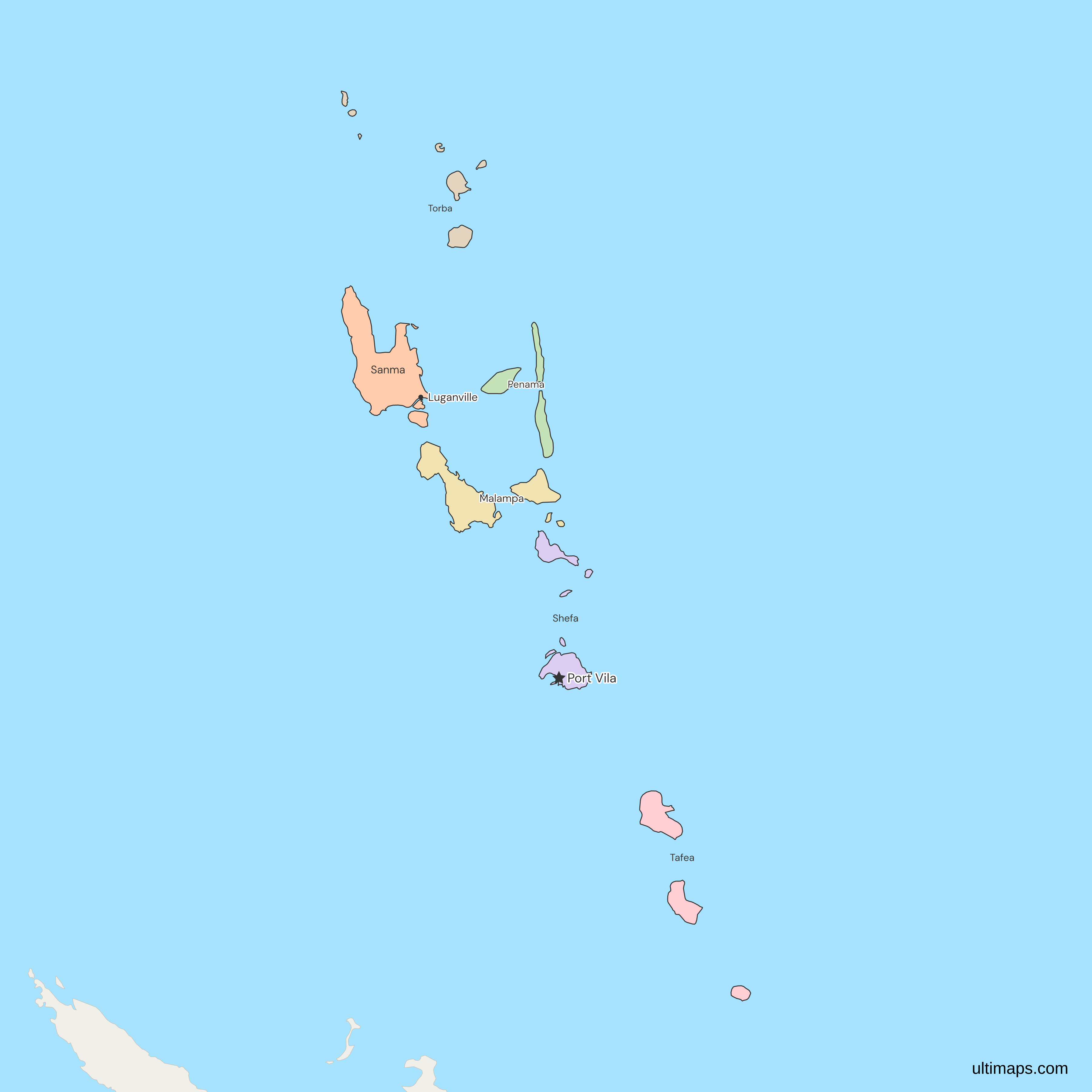
This map of Vanuatu shows all 6 provinces, Torba, Sanma, Penama, Malampa, Shefa and Tafea, which were declared in 1994 to replace the eleven island regions of 1985. Shefa has the most residents at 103,987 of the 300,021 people in the six provinces (VBoS, 2020 census), and Torba, the northern group of the Torres and Banks islands, has the fewest at 11,330. Port Vila, the national capital, lies on Efate in Shefa. The map draws the main islands of every province and leaves out small ones such as Futuna and Aniwa in Tafea. Matthew and Hunter islands, which Vanuatu claims as part of Tafea and France administers as part of New Caledonia, are not drawn.
Open the map in the free Ultimaps editor to make your own custom map of Vanuatu. You can color the provinces by your data, add pins and labels, and share or embed the finished map.
Interactive Vanuatu Map with Provinces
List of Provinces (6)
Data sources:
- Capital: Department of Local Authorities (Vanuatu), provincial profiles (2023–2025). License: facts compiled by Ultimaps, CC BY 4.0.
- Population: VBoS, 2020 National Population and Housing Census, Basic Tables Report Vol. 1, Table 1 (towns and rural parts summed by Ultimaps). License: no reuse licence published.
Vanuatu Provinces: Key Facts
- Number of provinces: 6, namely Torba, Sanma, Penama, Malampa, Shefa and Tafea. Vanuatu has no capital district, and every province has its own council.
- Capital: Port Vila, on Efate, within Shefa's area. It is a municipality with its own council, outside the provincial government, and the map counts it with Shefa, as the census province totals do.
- Largest province by area: Sanma, which includes Espiritu Santo, the largest island of Vanuatu. Malampa ranks second.
- Smallest province by area: Torba, the island group at the northern end of the chain.
- Most populous province: Shefa, with 103,987 residents (VBoS, 2020 census), about 1.7 times as many as second-placed Sanma with 60,884.
- Least populous province: Torba, with 11,330 residents (VBoS, 2020 census). The six provinces total 300,021.
- Borders: Vanuatu has no land border. Its maritime neighbors are the Solomon Islands to the north-west, Fiji to the east and New Caledonia (France) to the south-west, and only the northern tip of New Caledonia appears in the frame, in its bottom-left corner. The country sits in Oceania. New Caledonia has its own province map.
- Island groups: Torba holds the Torres and Banks islands, Sanma holds Santo, Malo and Aore, Penama holds Ambae, Maewo and Pentecost, Malampa holds Malekula, Ambrym and Paama, Shefa holds Efate, Epi and the Shepherd Islands, and Tafea holds Tanna, Erromango, Aneityum, Futuna and Aniwa.
- Established: 1994, under the Decentralization Act [Cap 230]. The Act has called the units Provincial Government Regions since a 2013 amendment, and a 2025 amendment bill does not add, remove or redraw a province.
- Codes: ISO 3166-2 runs VU-MAP, VU-PAM, VU-SAM, VU-SEE, VU-TAE and VU-TOB. The ISO names carry accents (Pénama, Shéfa, Taféa), while the Vanuatu government and census write Penama, Shefa and Tafea.
Interesting Facts
- Names built from islands: Torba is Torres plus Banks, Sanma is Santo plus Malo, Shefa is Shepherds plus Efate, and Tafea is Tanna, Aniwa, Futuna, Erromango and Aneityum. Penama and Malampa are formed the same way.
- Contested islands: Matthew and Hunter, south-east of Tafea, are claimed by Vanuatu and administered by France as part of New Caledonia.
Free Downloads
Free for personal and commercial use with a credit to Ultimaps. See the license terms for details.
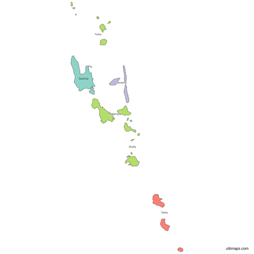 Colored Vanuatu Map with Provincespng197 KB
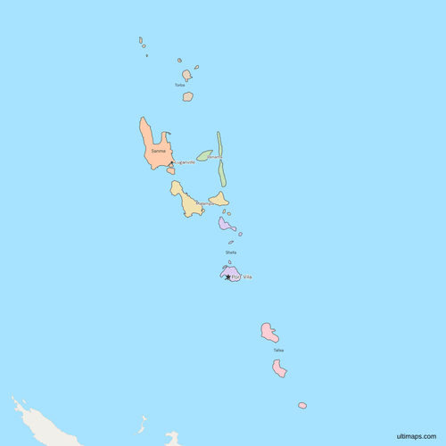 Political Map of Vanuatu with Provincespng218 KB
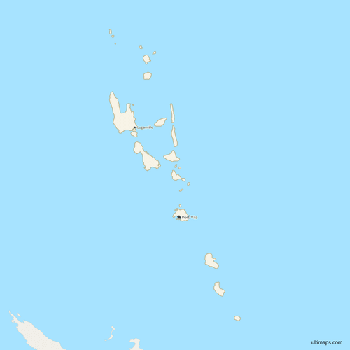 Map of Vanuatu with Citiespng196 KB
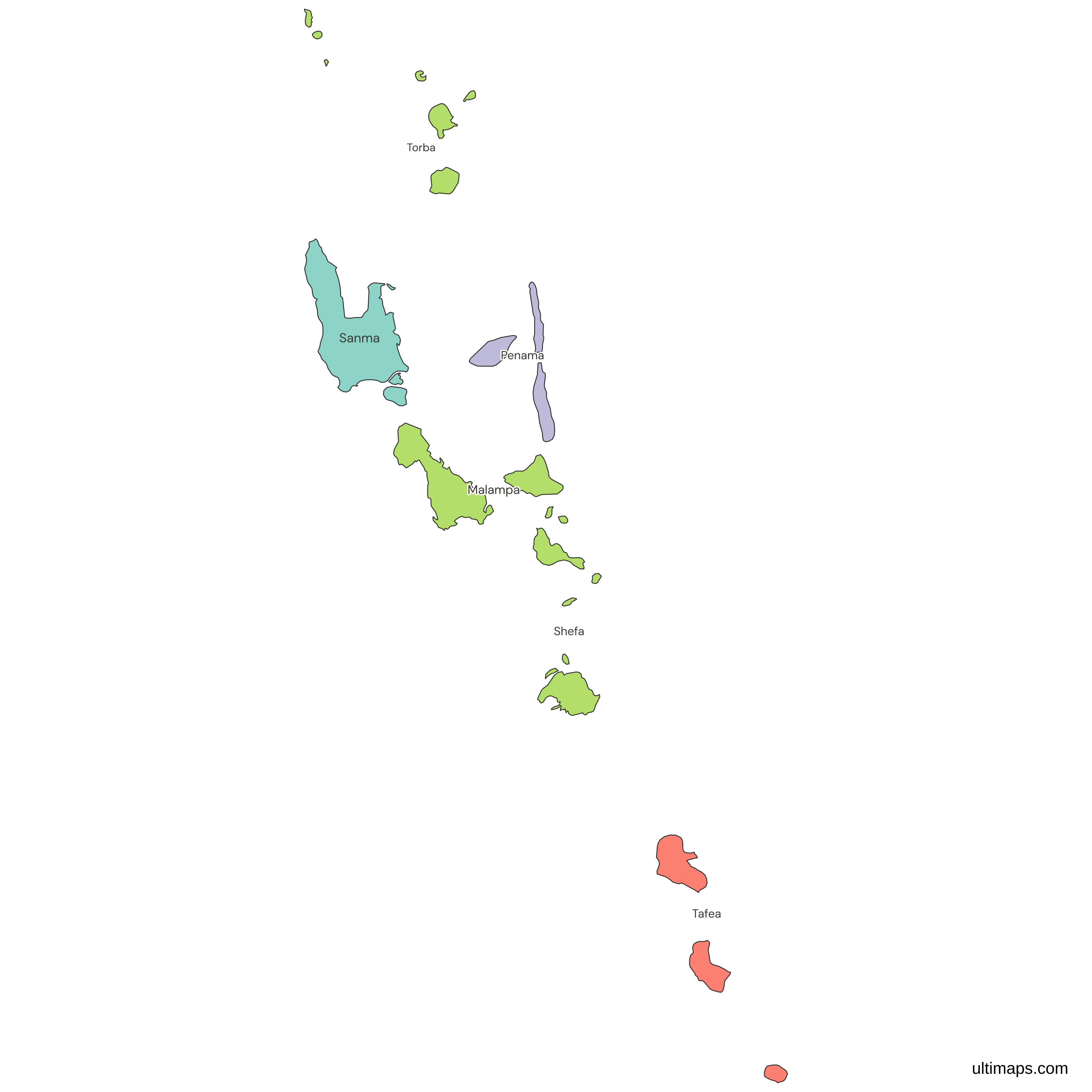
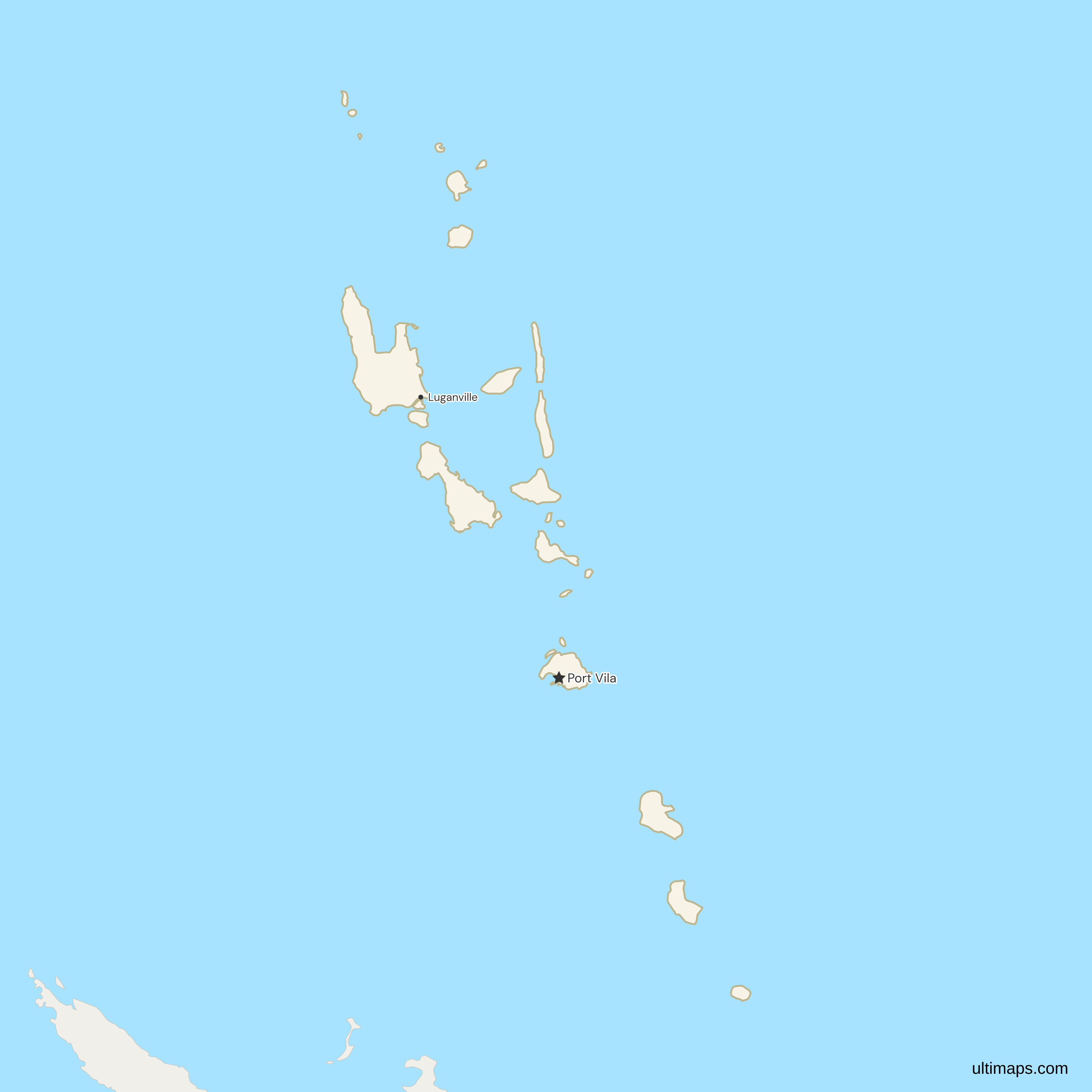
Need it without colors? The blank version of this map comes as a print-ready PDF (A4 and US Letter), a PNG and an editable SVG.
Custom Map Features
This map supports labels.
This map supports surrounding areas and cities. New
This map is divided into 6 provinces.
Updates
Nov 5, 2026:
- Added map of Vanuatu provinces
Frequently Asked Questions
Vanuatu has 6 provinces: Torba, Sanma, Penama, Malampa, Shefa and Tafea. They became the first-level division in 1994, when they were declared under the Decentralization Act [Cap 230] in place of the eleven island regions of 1985. Each one is set up by an order of the Prime Minister, which also establishes its provincial council. The Act has called the units Provincial Government Regions since a 2013 amendment, and a 2025 amendment bill does not add, remove or redraw a province.
Port Vila is the capital of Vanuatu, on the island of Efate. It is a municipality with its own council, outside the provincial government, and the map counts it with Shefa. Luganville, on Espiritu Santo, is the second city, also a municipality, and the seat of Sanma Province. Lakatoro is the seat of Malampa, Saratamata, on Ambae, of Penama, Isangel of Tafea and Sola of Torba. The map marks only Port Vila and Luganville, so pins can add the other four seats. The country is also on the world map.
Tanna is in Tafea, Espiritu Santo is in Sanma and Efate is in Shefa. Espiritu Santo is the largest island of Vanuatu, and Efate is the island of Port Vila. Ambae lies close to Santo but belongs to Penama, so the two islands sit in different provinces. Shefa also holds Nguna, Moso, Tongoa, Emae and Epi besides Efate itself, and Malekula, Ambrym and Paama belong to Malampa. Every island on the map belongs to exactly one province, following the island-to-province lists of the government.
Vanuatu, which sits in Oceania, is usually described as having about 83 islands, and 27 island polygons are drawn on this map. Several islets in the Torres, Banks and Shepherd groups are among those not drawn. Every province has at least one island on the map, so all six provinces can be colored. Torba, the smallest province, keeps its main Torres and Banks islands, and Sanma keeps Espiritu Santo and Malo. The 83 figure counts islands of any size, while the 27 polygons are the ones the source map draws.
Espiritu Santo, the largest island in Vanuatu, puts Sanma first among the provinces by area. Malampa, which covers Malekula, Ambrym and Paama, comes second. Tafea, Shefa and Penama follow in that order, and Torba is the smallest. In population Sanma is also second, with 60,884 residents (VBoS, 2020 census), behind Shefa. Its seat is Luganville, a municipality on Santo. The map's own boundaries give the same order of area, with Sanma first and Malampa second. Penama, fifth by area, is also fifth in population.
Torba had 11,330 residents in the 2020 census (VBoS), fewer than any other province, and it is also the smallest by area. It is made up of the Torres and Banks groups at the northern end of Vanuatu, and its seat is Sola, on Vanua Lava. Those residents are about 3.8% of the 300,021 counted in the six provinces. The next smallest province is Penama, which is fifth by both area and population, with 35,607 residents. Luganville alone, with 17,719 residents, has more people than the whole of Torba.
Port Vila had 49,034 residents in the 2020 census (VBoS), nearly half of the 103,987 counted in Shefa, the most populous province of Vanuatu. Shefa outside the capital has 54,953, which would still place it second, behind Sanma with 60,884 and ahead of Tafea with 45,714. Malampa has 42,499, Penama 35,607 and Torba 11,330. The census counts Luganville, on Santo, with Sanma in the same way as Port Vila with Shefa, so the totals for Shefa and Sanma are each the sum of two census rows.
The free Ultimaps editor opens from this page with the 6 provinces already drawn, and you need no account to start. Paste or import a table with one row per province, or click provinces to color them by hand. Rows match on the province name, with or without accents (Shefa or Shéfa), or on an ISO code such as VU-SEE. Pins add places the map does not mark, such as Isangel or Lakatoro. Saving and publishing the map, then sharing a link or embedding it, needs a free account. A free export is a standard PNG with a small Ultimaps credit, and high-resolution PNG, SVG and PDF files need Ultimaps Pro.