Map of Lithuania Counties
Lithuania is divided into 10 counties (apskritys), which serve as the country's primary territorial and statistical divisions. Established in 1990 and retained for statistical purposes after 2010, each county is named after its capital city and together they encompass 60 municipalities. Use the interactive maps below to explore county boundaries and administrative centers, download free reference maps, or create a custom map of Lithuania to visualize your own data.
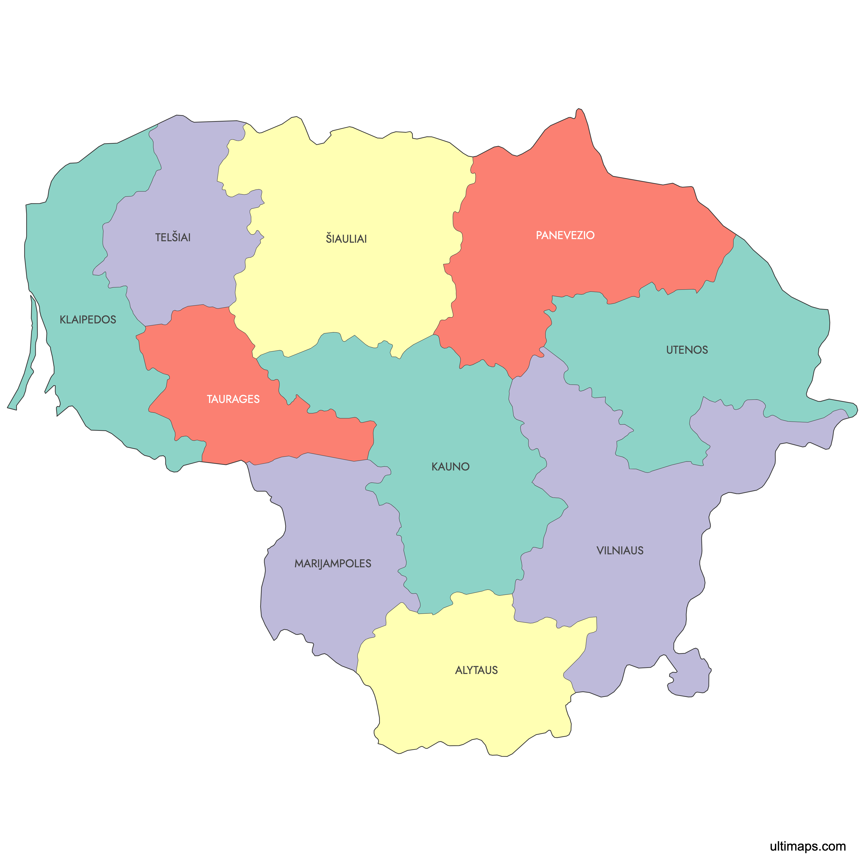
Interactive Map of Lithuania Counties
List of Counties (10)
| # | County |
|---|---|
| 1 | |
| 2 | |
| 3 | |
| 4 | |
| 5 | |
| 6 | |
| 7 | |
| 8 | |
| 9 | |
| 10 |
About Lithuania Counties
Lithuania is subdivided into 10 counties, known locally as "apskritys." Each county is an administrative region encompassing several municipalities. Counties serve as key regional divisions for governmental and statistical purposes. Since 2010, counties no longer have their own government administration, but the boundaries remain in use for territorial and data analysis.
Key facts about the Lithuania counties map:
- Number of counties: 10
- Largest county by area: Vilnius County
- Most populous county: Vilnius County
- Smallest county by area: Alytus County
- Counties are further divided into municipalities (district and city)
- Lithuania shares borders with Latvia, Belarus, Poland, and Russia (Kaliningrad region)
- The counties reflect historical and cultural regions
Free Downloads
You can download free blank Map of Lithuania Counties and other maps in high resolution PNG, SVG and PDF formats from the blank maps section of the site: Download Blank Map of Lithuania Counties
Custom Map Features
This map supports labels.
This map is divided into 10 counties.
Updates
Sep 15, 2025:
- Added map of Lithuania counties with labels
Frequently Asked Questions
Lithuania has 10 counties (apskritys): Alytus, Kaunas, Klaipėda, Marijampolė, Panevėžys, Šiauliai, Tauragė, Telšiai, Utena, and Vilnius. The modern county system was introduced in 1990. Since 1 July 2010, county administrations have been abolished, but the boundaries are retained for statistical and EU NUTS reporting purposes.
Vilnius County is the largest, covering 9,731 km² (3,757 sq mi). It is both the most extensive and the most populous county in Lithuania. The county shares borders with Belarus to the east and with Utena, Panevėžys, Kaunas, and Alytus counties internally.
Telšiai County is the smallest, covering 4,350 km² (1,680 sq mi). It sits in the Samogitian highlands of western Lithuania and has some Baltic Sea and Curonian Lagoon frontage. The next smallest counties are Tauragė at 4,411 km² and Marijampolė at 4,463 km².
Vilnius County is the most populous, with approximately 837,000 inhabitants as of 2023. Its capital, Vilnius, is also the national capital and Lithuania's largest city. The least populous county is Tauragė, with around 84,000 inhabitants in 2023.
The Vilnius Old Town, a UNESCO World Heritage Site, and Trakai Island Castle are both in Vilnius County. The Hill of Crosses, one of Lithuania's most recognized cultural landmarks, is located near Šiauliai in Šiauliai County. The Curonian Spit, a UNESCO World Heritage Site shared with Russia's Kaliningrad Oblast, lies along the coast in Klaipėda County.
Lithuania borders Latvia to the north, Belarus to the east and southeast, Poland to the south, Russia's Kaliningrad Oblast to the southwest, and the Baltic Sea to the west. Panevėžys, Šiauliai, and Utena counties border Latvia. Vilnius, Alytus, and Utena counties border Belarus. Marijampolė County borders Poland, and Tauragė County borders Kaliningrad. Klaipėda County holds the main Baltic Sea coastline.
You can use Ultimaps to create custom maps of Lithuania. Color-code counties manually or upload your data, place pins, customize the look, and export to PNG, PDF, or SVG. No sign-up required.