Guyana Map with Regions
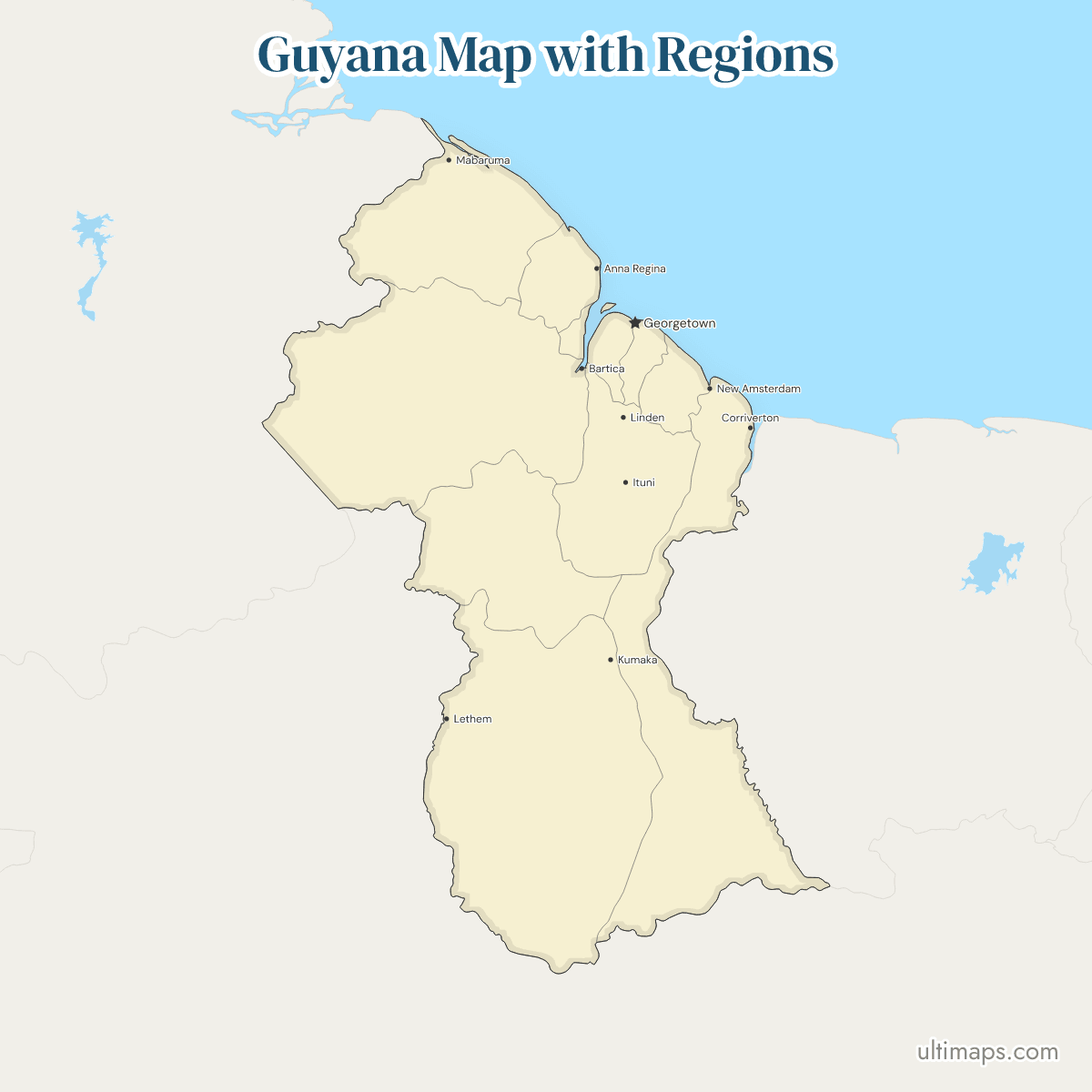
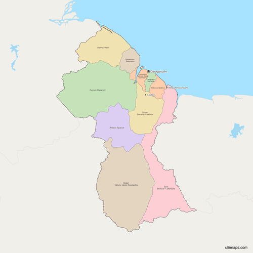
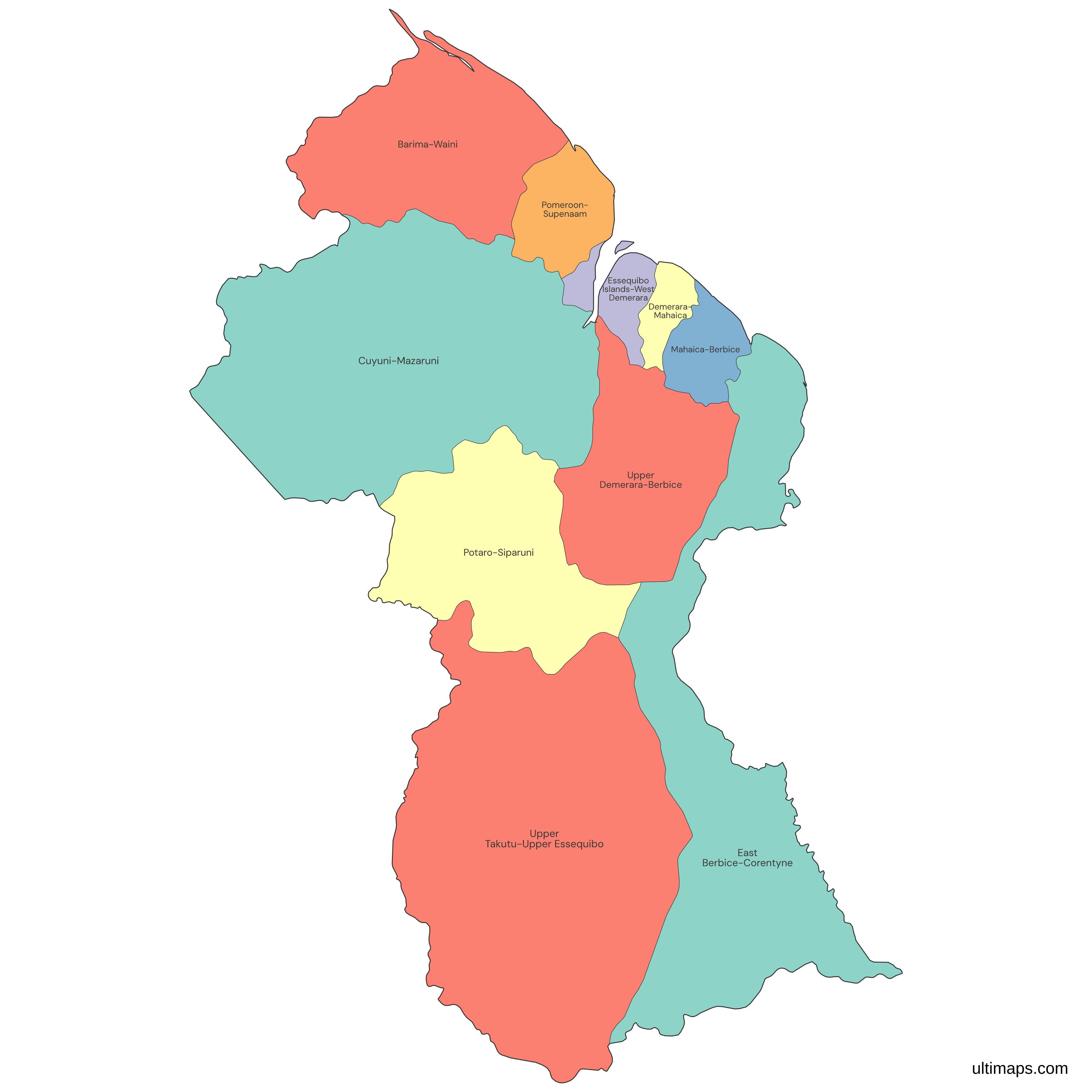
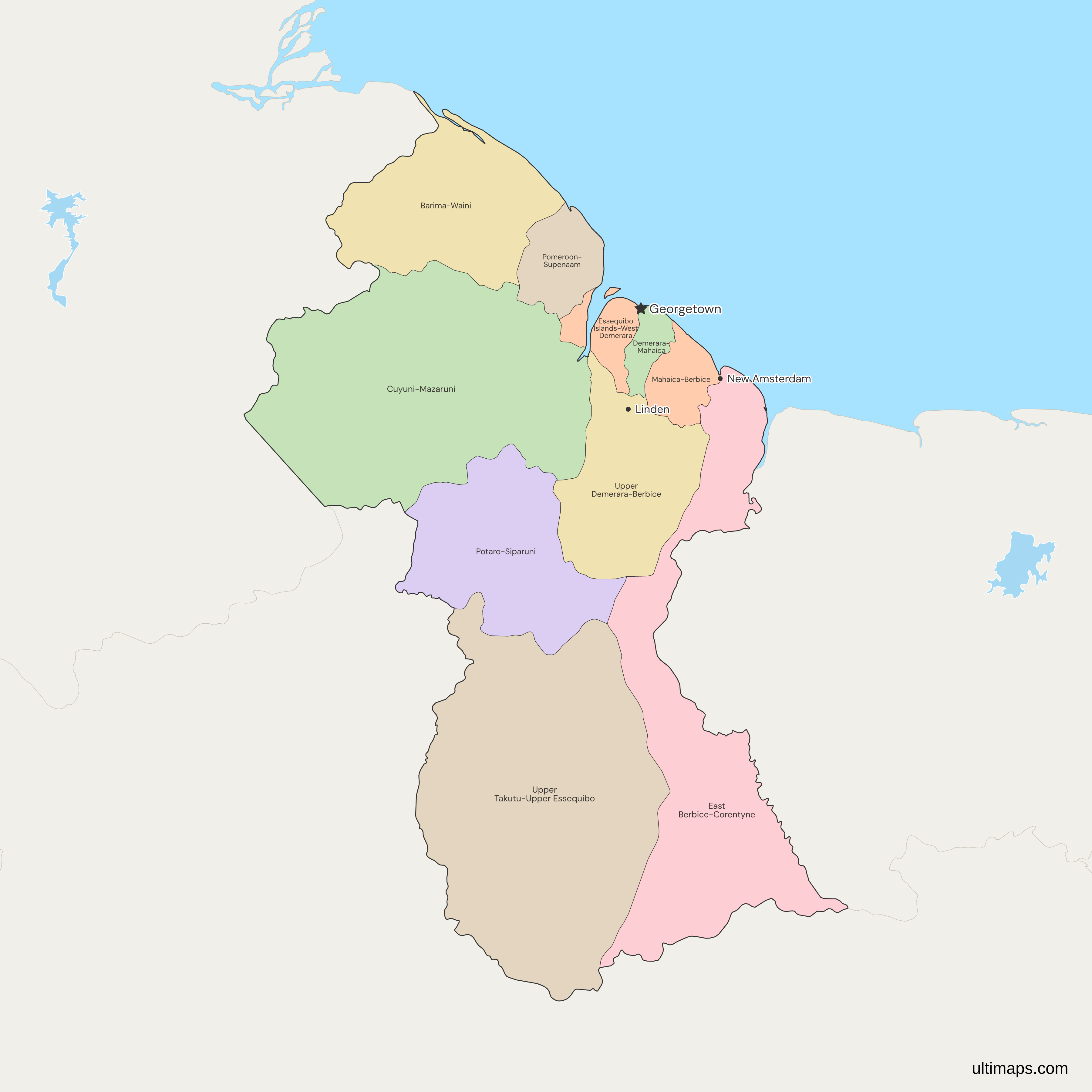
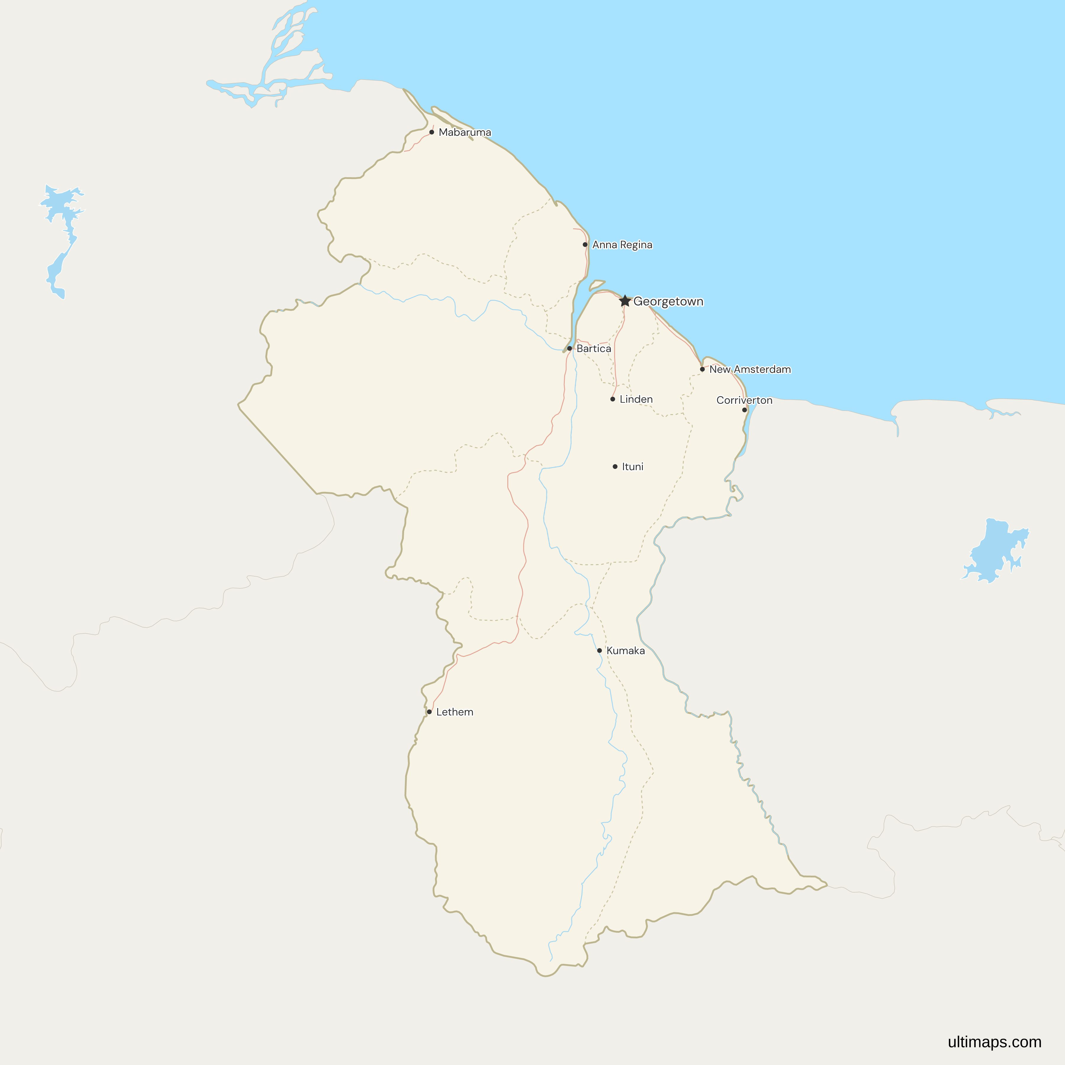
This map of Guyana shows all 10 regions, numbered 1 to 6 along the Atlantic coast from west to east and 7 to 10 away from the coast. Demerara-Mahaica, Region 4, contains Georgetown, the national capital. Region 4 is both the smallest region and the most populous: 2,232 km² and 347,759 residents in the preliminary 2022 census count (Bureau of Statistics Guyana). The largest region, Region 9 (Upper Takutu-Upper Essequibo), spans 57,750 km² and had 29,944 residents in 2022. The map draws the land west of the Essequibo River inside Guyana, which administers it. Venezuela claims that land, and the boundary case is before the International Court of Justice.
Open the map in the free Ultimaps editor to make your own custom map of Guyana. You can color the regions by your data, add pins and labels, and share or embed the finished map.
Interactive Guyana Map with Regions
List of Regions (10)
| # | Region | Capital | Population (2022) | Area (km², 2022) |
|---|---|---|---|---|
| 1 | Barima-Waini | Mabaruma | 38,956 | 20,339 |
| 2 | Cuyuni-Mazaruni | Bartica | 30,324 | 47,213 |
| 3 | Demerara-Mahaica | Georgetown | 347,759 | 2,232 |
| 4 | East Berbice-Corentyne | New Amsterdam | 114,574 | 36,234 |
| 5 | Essequibo Islands-West Demerara | Vreed-en-Hoop | 143,884 | 3,755 |
| 6 | Mahaica-Berbice | Fort Wellington | 57,667 | 4,190 |
| 7 | Pomeroon-Supenaam | Anna Regina | 56,469 | 6,195 |
| 8 | Potaro-Siparuni | Mahdia | 13,598 | 20,051 |
| 9 | Upper Demerara-Berbice | Linden | 45,499 | 17,040 |
| 10 | Upper Takutu-Upper Essequibo | Lethem | 29,944 | 57,750 |
Data sources:
- Capital: Government of Guyana portal, Regional Democratic Council pages. License: facts compiled by Ultimaps, CC BY 4.0.
- Population: Bureau of Statistics Guyana, Census 2022 Preliminary Report, Table 1.2. License: Open Licence Agreement. Source: Bureau of Statistics, Guyana. Contains information licenced under the Central Statistical Office's Open Licence Agreement.
- Area: Bureau of Statistics Guyana, Census 2022 Preliminary Report, Table 1.10. License: Open Licence Agreement. Source: Bureau of Statistics, Guyana. Contains information licenced under the Central Statistical Office's Open Licence Agreement.
Guyana Regions: Key Facts
- Number of regions: 10, all of the same rank: 1 Barima-Waini, 2 Pomeroon-Supenaam, 3 Essequibo Islands-West Demerara, 4 Demerara-Mahaica, 5 Mahaica-Berbice, 6 East Berbice-Corentyne, 7 Cuyuni-Mazaruni, 8 Potaro-Siparuni, 9 Upper Takutu-Upper Essequibo and 10 Upper Demerara-Berbice. The Local Democratic Organs Act 1980 lets the minister divide Guyana into regions by order, and the order of October 1980 drew the present ten. They have not changed since.
- Capital: Georgetown, in Demerara-Mahaica (Region 4), where the Demerara River meets the Atlantic.
- Largest and smallest by area: The two largest are Upper Takutu-Upper Essequibo (57,750 km²) and Cuyuni-Mazaruni (47,213 km²). Demerara-Mahaica (2,232 km²) and Essequibo Islands-West Demerara (3,755 km²) are the smallest (Bureau of Statistics Guyana, 2022 census report). The ten add up to 214,999 km², Guyana's own figure for the territory it administers, including the areas Venezuela and Suriname claim.
- Most and least populous: Demerara-Mahaica had 347,759 people and Potaro-Siparuni 13,598 in the preliminary 2022 census count, out of 878,674 nationally (Bureau of Statistics Guyana).
- Sea coast: Regions 1 to 6 face the Atlantic and held 759,309 people in 2022, 86% of the count. Regions 7 to 10 have no coast. They cover 142,054 km², 66% of the country's area, and held 119,365 people. The census uses a different split: the Bureau of Statistics counts Regions 1, 7, 8 and 9, with 67.6% of the area, as hinterland and Region 10 as coastland.
- Borders: Brazil has the longest border with Guyana and meets four regions: Upper Takutu-Upper Essequibo, Potaro-Siparuni, Cuyuni-Mazaruni and East Berbice-Corentyne. Venezuela adjoins Barima-Waini and Cuyuni-Mazaruni in the west, and the three countries meet on Mount Roraima, in Cuyuni-Mazaruni. Across the Corentyne River, Suriname faces East Berbice-Corentyne only.
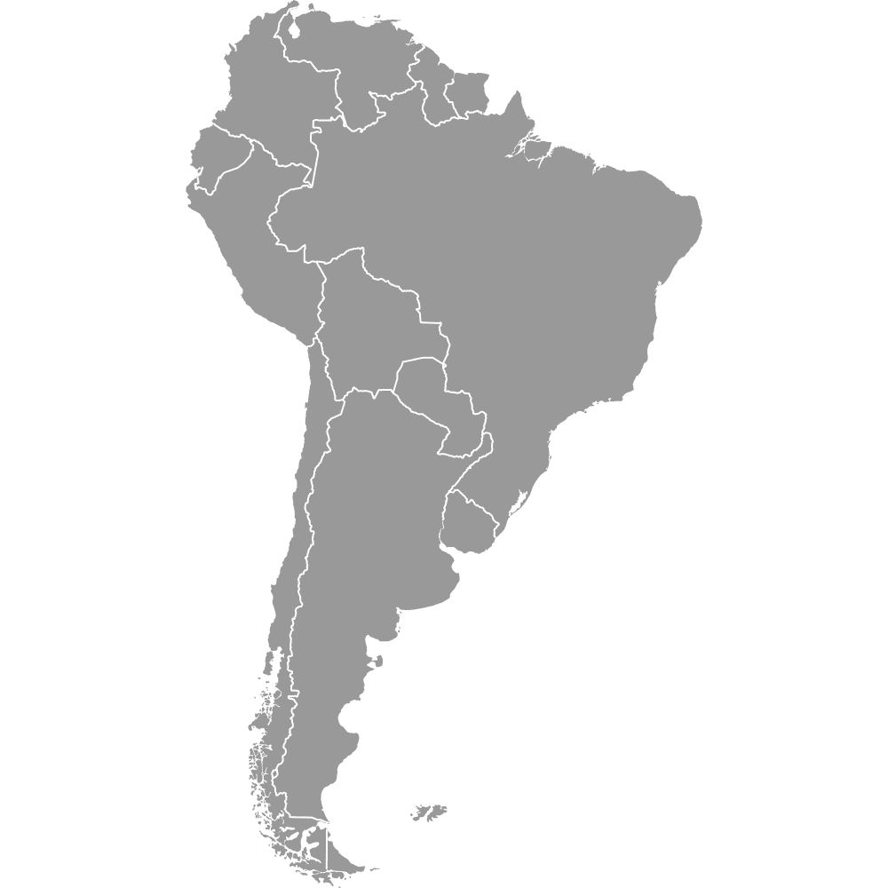
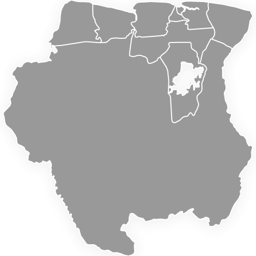
- Territorial claims: Venezuela claims the land west of the Essequibo River, and Suriname claims the New River Triangle in the far south-east, between the New River and the Kutari. Guyana administers both areas. On this map and the map of South America, both lie within Guyana's outline, the triangle as part of East Berbice-Corentyne. The Suriname map follows the same line, so the triangle is not part of its Sipaliwini district. This map has no boundary line for either claim. Regions 1, 2, 7 and 8 lie wholly inside Venezuela's claim. The claim also covers most of Region 9 and part of Region 3, so coloring whole regions cannot trace its line exactly.
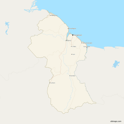
- Regional capitals: Mabaruma (Region 1), Anna Regina (2), Vreed-en-Hoop (3), Georgetown (4), Fort Wellington (5), New Amsterdam (6), Bartica (7), Mahdia (8), Lethem (9) and Linden (10). Region 4's Regional Democratic Council has its office outside Georgetown, at Triumph on the East Coast of Demerara, where it moved from Paradise after a fire in 2006. The map marks seven of the ten: Georgetown, as the national capital, and Mabaruma, Anna Regina, New Amsterdam, Bartica, Lethem and Linden.
- Below the regions: Neighbourhood Democratic Councils and towns form the next level of local government, and the map does not draw them. Boundary changes made in late 2022, before the local government elections of June 2023, adjusted councils inside Regions 1 to 6 and left the regions as they were.
- Codes: ISO 3166-2:GY builds each code from the region's name rather than its number, so Region 1 is GY-BA and Region 4 is GY-DE.
Interesting Facts
- Corrected names: Natural Earth, the public dataset behind the outlines, attaches the names of 8 of the 10 regions to the wrong shapes. A map cut straight from it would put Georgetown in East Berbice-Corentyne. This map gives each region its correct name, checked against Guyana's official areas and the towns inside each region.
- Region 3 in three parts: Essequibo Islands-West Demerara has three separate pieces on the map. West Demerara lies between the Essequibo and the Demerara. A strip runs along the Essequibo's west bank. The third is Leguan Island, in the river mouth. Wakenaam and Hog Island, also part of Region 3, are missing from Natural Earth, so the map shows them as water.
Free Downloads
Free for personal and commercial use with a credit to Ultimaps. See the license terms for details.
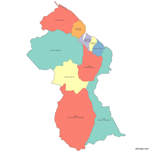 Colored Guyana Map with Regionspng379 KB
 Political Map of Guyana with Regionspng462 KB
 Map of Guyana with Cities and Roadspng508 KB
Need it without colors? The blank version of this map comes as a print-ready PDF (A4 and US Letter), a PNG and an editable SVG.
Custom Map Features
This map supports labels.
This map supports surrounding areas, roads, rivers and cities. New
This map is divided into 10 regions.
Updates
Nov 5, 2026:
- Added map of Guyana regions
Frequently Asked Questions
Guyana has 10 regions, numbered Region 1 to Region 10. Their boundaries come from an order of October 1980 under the Local Democratic Organs Act 1980, and no region has been added or redrawn since. Each region has a Regional Democratic Council, headed by a chairman. All ten regions elected their Regional Democratic Councils on 1 September 2025, alongside the general election. Guyana's four natural regions, from the coastal plain to the interior savannas, are physical zones rather than administrative units, so they have no outlines on this map.
Region 4 is Demerara-Mahaica, the region that contains Georgetown, Guyana's capital. The numbers start on the coast at the Venezuelan border, run east to the Corentyne River and then continue inland: Region 1 Barima-Waini, Region 2 Pomeroon-Supenaam, Region 3 Essequibo Islands-West Demerara, Region 4 Demerara-Mahaica, Region 5 Mahaica-Berbice, Region 6 East Berbice-Corentyne, Region 7 Cuyuni-Mazaruni, Region 8 Potaro-Siparuni, Region 9 Upper Takutu-Upper Essequibo and Region 10 Upper Demerara-Berbice. The census report and the names of the Regional Democratic Councils use these numbers. Region 1, Barima-Waini, lies in the north-west next to Venezuela, and its council is based in Mabaruma. Region 6, East Berbice-Corentyne, is the eastern region around New Amsterdam and Corriverton, on the Suriname border.
Georgetown is the capital of Guyana and is not a region of its own. It lies in Demerara-Mahaica, Region 4, on the Atlantic coast at the mouth of the Demerara River. It is also the capital of Region 4, although the regional council's office is at Triumph, outside the city. Region 4's density, 155.8 people per km² in the preliminary 2022 census count (Bureau of Statistics Guyana), is the highest of the ten regions. For Guyana as a whole, the figure is about 4.1.
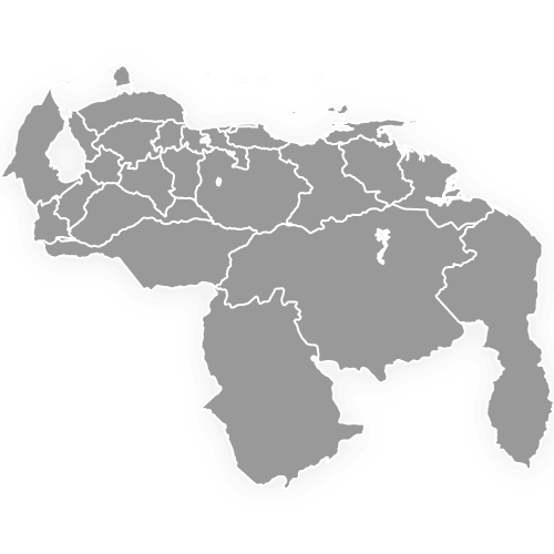
Yes. This map of Guyana follows the line Guyana administers, so the land west of the Essequibo River falls within its regions. Venezuela's claim takes in Regions 1, 2, 7 and 8, most of Region 9 and the part of Region 3 on the river's west bank. A Venezuelan law of April 2024 declares that land a state, Guayana Esequiba. Guyana asks the International Court of Justice to uphold the 1899 arbitral award on the boundary, and Venezuela contests the award. The court heard the merits in May 2026, and its judgment is pending. The map of Venezuela shows the same land as Guayana Esequiba, one of the states on that map.
Guyana has no states, counties or provinces. Regions are its only first-level unit, and the 1980 regions order and the census number the ten on this map from 1 to 10. Counties belong to the colonial period: an ordinance of 1838 divided British Guiana into three, Berbice, Demerara and Essequibo, each named after a river. Those names survive in six of the ten region names, from Mahaica-Berbice to Upper Takutu-Upper Essequibo. Of Guyana's neighbors, Brazil and Venezuela have states, and Suriname has districts.
The largest region in Guyana is Region 9, Upper Takutu-Upper Essequibo, which covers more than a quarter of the country: 57,750 km² (Bureau of Statistics Guyana, 2022 census report). It covers the south along the Brazilian border and takes its name from the upper courses of the Takutu and Essequibo rivers. Lethem, a town near the Takutu River and the border, is the seat of the Region 9 council. With 29,944 residents in the preliminary 2022 count, Region 9 has about one person for every 2 km². Most of Region 9 lies in the land Venezuela claims. Region 7, Cuyuni-Mazaruni, has the next largest area, 47,213 km².
At 2,232 km² (Bureau of Statistics Guyana, 2022 census report), Region 4, Demerara-Mahaica, is the smallest of Guyana's ten regions. It lies on the Atlantic coast east of the Demerara River and covers about 1% of the country by area. Region 3, Essequibo Islands-West Demerara (3,755 km²), and Region 5, Mahaica-Berbice (4,190 km²), follow. The same three regions ranked first, second and fourth by population in the preliminary 2022 count, with 549,310 people between them on under 5% of Guyana's area.
In the preliminary 2022 census count, the most populous region in Guyana was Region 4, Demerara-Mahaica, home to 347,759 people. The Bureau of Statistics Guyana published that count in January 2026. Region 4's share of the national count of 878,674 was 39.6%. Next comes Essequibo Islands-West Demerara, across the Demerara River from Georgetown, with 143,884. The lowest count, 13,598, was in Potaro-Siparuni, in the interior. The total includes 102,466 people the Bureau estimated for households its enumerators could not reach, and the Bureau expects only small revisions.
The free Ultimaps editor turns this map into a custom map of Guyana, and you can start without an account. Color each region by hand, or paste or import a table of values. A row labeled Region 4 or Region Four colors Demerara-Mahaica, and names without hyphens, such as Barima Waini, or codes such as GY-CU match too. Pins mark places the map does not show, such as Mahdia, and labels add other text. Saving, publishing, sharing a link and embedding the map on a website take a free account. Without Pro, you can export a standard PNG that carries a small Ultimaps credit. High-resolution PNG, SVG and PDF are available on Ultimaps Pro.