Djibouti Map with Regions
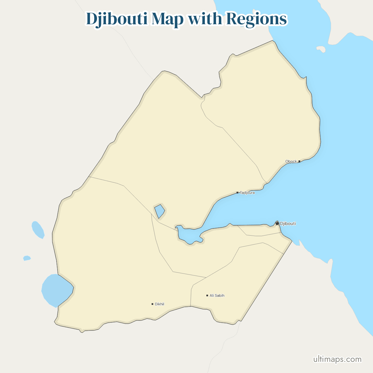
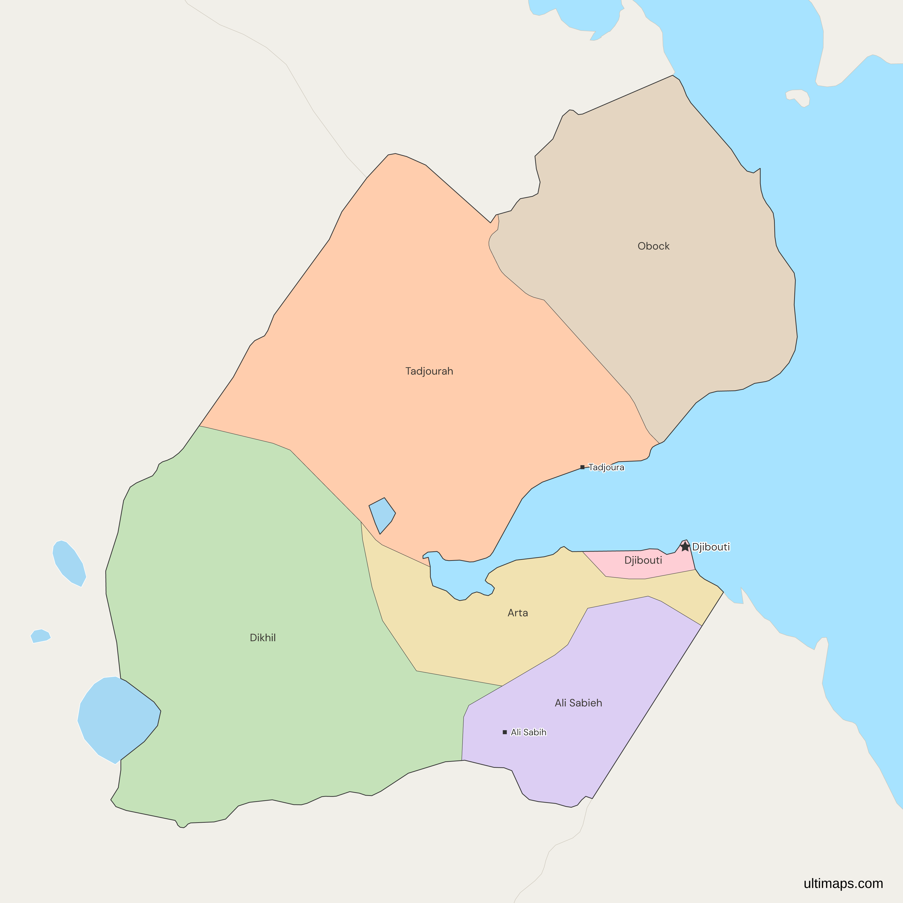
Arta, carved from parts of the Dikhil and Djibouti districts, is the newest region on this map of Djibouti. The decentralization law of 7 July 2002 created the set of five regions and gave the City of Djibouti the same rank, and a decree of 9 April 2003 fixed the boundaries drawn here. The City of Djibouti holds 767,250 of the country's 1,066,809 residents in the 2024 census (INSTAD), about 72%, and Obock has the fewest, 47,382.
Open the map in the free Ultimaps editor to make your own custom map of Djibouti. You can color the regions by your data, add pins and labels, and share or embed the finished map.
Interactive Djibouti Map with Regions
List of Regions (6)
Data sources:
- Capital: Loi n°174/AN/02/4ème L (Djibouti), as amended by Loi n°139/AN/06/5ème L; Statoids. License: facts compiled by Ultimaps, CC BY 4.0.
- Population: INSTAD Djibouti, RGPH-3 2024, Rapport des résultats définitifs (November 2025), Tableau n°5. License: no reuse licence published.
Djibouti Regions: Key Facts
- Number of regions: five regions (Ali Sabieh, Arta, Dikhil, Obock and Tadjourah) plus the City of Djibouti, six in all. Until 2002 there were five districts: Ali Sabieh, Dikhil, Obock and Tadjourah became regions, Djibouti became the City, and Arta was added from parts of Dikhil and Djibouti.
- Capital: Djibouti, the national capital, is the City of Djibouti, ranked level with the regions.
- Regional seats: the map labels Ali Sabieh, Dikhil, Obock and Tadjourah and has no point for Arta, whose seat is the town of Arta. The City of Djibouti is its own capital.
- Largest and smallest: Dikhil and Tadjourah are the two largest and close in size, and the City of Djibouti is the smallest unit. Arta is the smallest of the five regions. Published areas differ, so no figures are given.
- Most and least populous: the City of Djibouti has 767,250 residents and Obock 47,382 (INSTAD, 2024 census). Ali Sabieh, with 76,414, is the most populous of the five regions.
- Borders: Ethiopia touches Ali Sabieh, Dikhil and Tadjourah, Eritrea touches Tadjourah and Obock, and Somalia touches Ali Sabieh and Arta. The self-declared Republic of Somaliland administers that side of the border, which Somalia claims. The City of Djibouti has no land border.
- Coast: Obock, Tadjourah, Arta and the City of Djibouti face the Gulf of Tadjoura and the Gulf of Aden, and Obock also faces the Bab-el-Mandeb strait at the mouth of the Red Sea. Ali Sabieh and Dikhil are inland.
- Lakes: Lake Assal lies in Tadjourah, close to where it meets Arta and Dikhil, and Djibouti's part of Lake Abbe in Dikhil, on the Ethiopian border. Both are cut out of the regions.
- Basis of the set: Loi n°174/AN/02/4ème L of 7 July 2002 on decentralization, with boundaries fixed by the decree of 9 April 2003.
- Place on the continent: Djibouti is drawn in context on the Africa map and the world map, each as a single country. The MENA and EMEA maps also show Djibouti as a single country. This map divides Djibouti into its five regions and the City of Djibouti.
- Codes: ISO 3166-2 uses DJ-AS, DJ-AR, DJ-DI, DJ-TA, DJ-OB and DJ-DJ, and the City of Djibouti keeps the title Djibouti.
Interesting Facts
- Not on older maps: a 2018 humanitarian boundary dataset still shows 5 districts and no Arta, because its units follow the division from before the 2002 law.
- No islands: Moucha and Maskali in the Gulf of Tadjoura and the Seven Brothers off Obock are too small for the source data, so each unit is a single polygon.
- Yemen across the strait: the frame draws Yemen and its island of Perim, about 25 km off Obock, as neighbors by sea only.
Free Downloads
Free for personal and commercial use with a credit to Ultimaps. See the license terms for details.
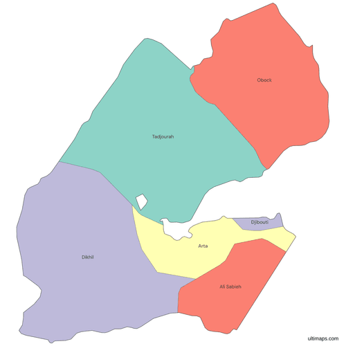 Colored Djibouti Map with Regionspng325 KB
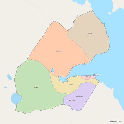 Political Map of Djibouti with Regionspng378 KB
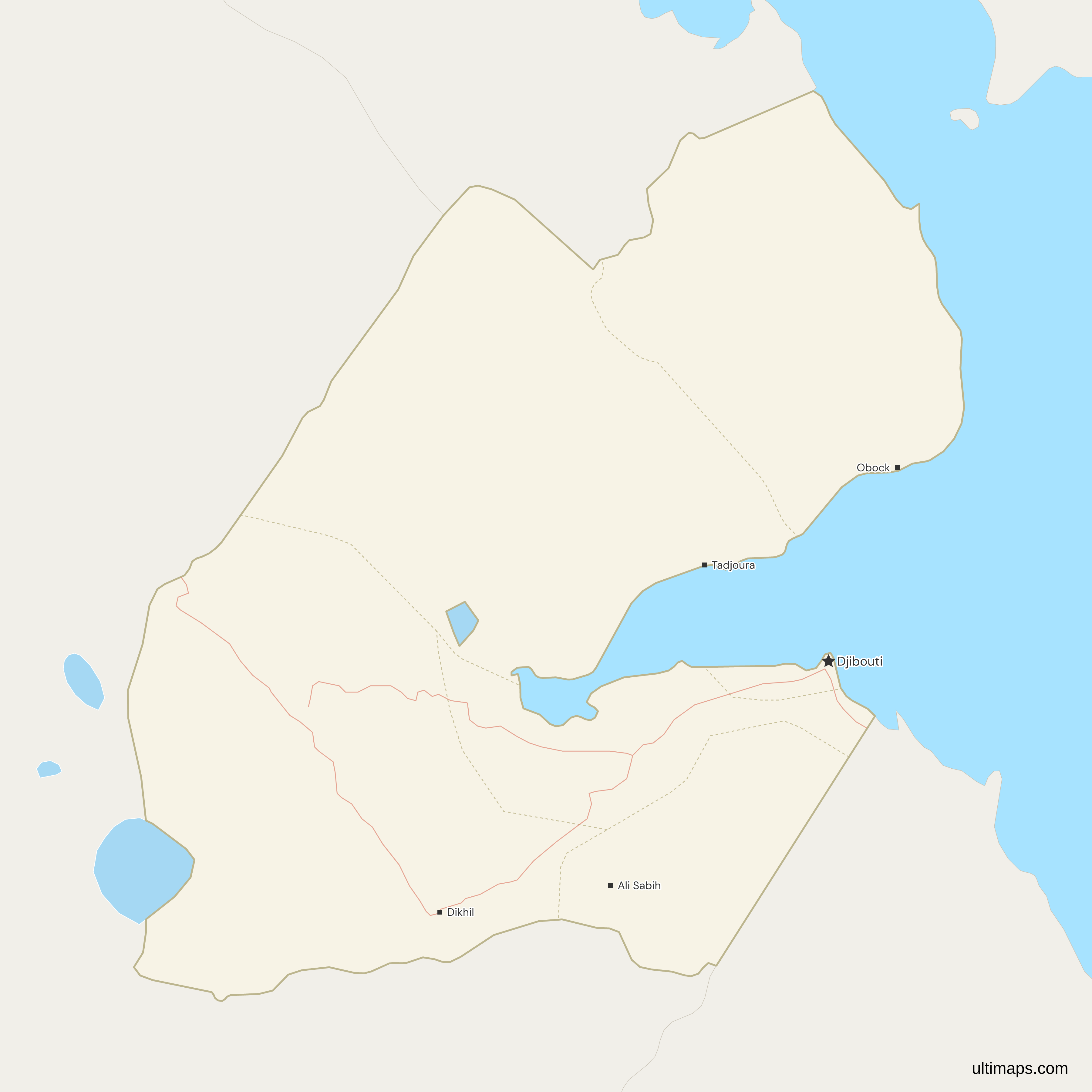
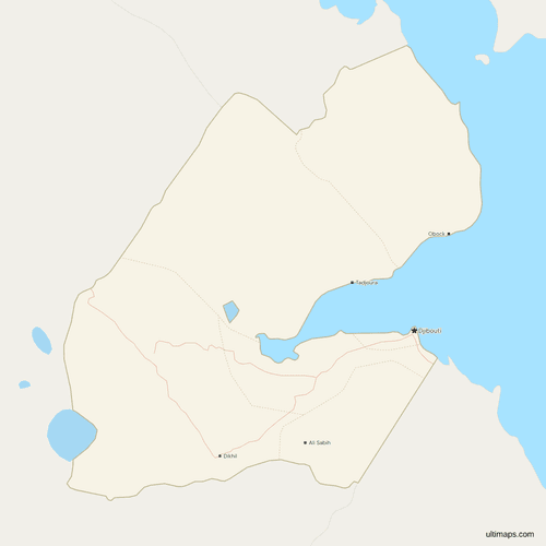 Map of Djibouti with Cities and Roadspng395 KB
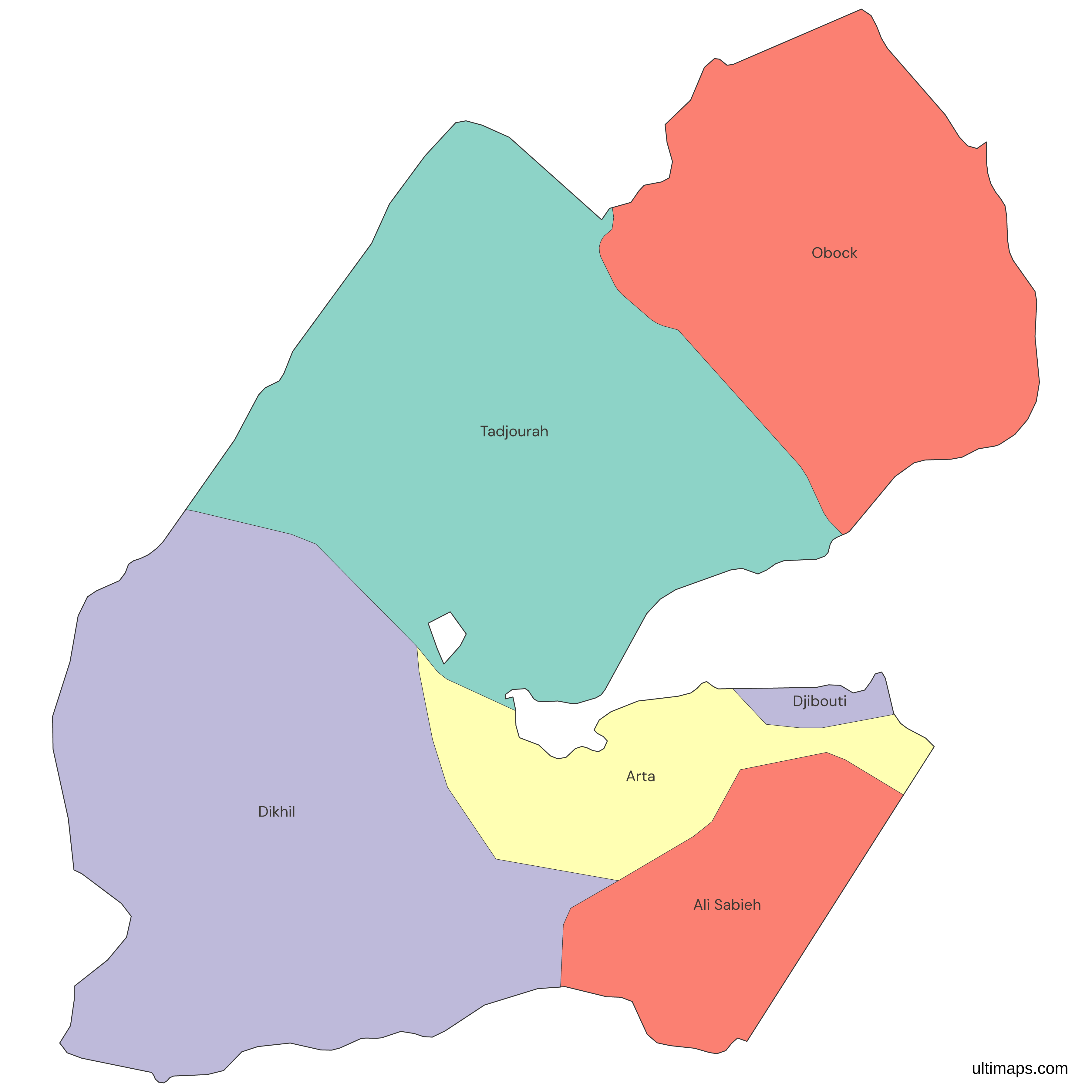
Need it without colors? The blank version of this map comes as a print-ready PDF (A4 and US Letter), a PNG and an editable SVG.
Custom Map Features
This map supports labels.
This map supports surrounding areas, roads and cities. New
This map is divided into 6 regions.
Updates
Nov 5, 2026:
- Added map of Djibouti regions
Frequently Asked Questions
Djibouti has five regions, Ali Sabieh, Arta, Dikhil, Obock and Tadjourah, plus the City of Djibouti, which has the same rank, so sources that say six regions and sources that say five regions and one city describe the same set. The decentralization law of 7 July 2002 turned four of the five districts (Ali Sabieh, Dikhil, Obock and Tadjourah) into regions, made the Djibouti district a city at the same tier, and created Arta from parts of the Dikhil and Djibouti districts. A decree of 9 April 2003 fixed the boundaries. This map draws all six.
The capital of Djibouti is Djibouti, usually called Djibouti City. The country, its capital and one of its six units carry the same name, which causes most of the confusion. The City of Djibouti is a first-level unit ranked beside the five regions, not part of any of them, so a table of regional data needs it as a separate row. It sits on the Gulf of Tadjoura. On the map it is the small coastal unit east of Arta, and it carries the national-capital star.
Lake Assal is in the Tadjourah region, in central-western Djibouti at the western end of the Gulf of Tadjoura. It lies close to where Tadjourah meets Arta and Dikhil. It is the lowest point in Africa, about 155 meters below sea level. The map cuts the lake out of Tadjourah as a hole. Djibouti's other large lake, Lake Abbe, lies in Dikhil on the border with Ethiopia, which shares it, and the map cuts that out of Dikhil in the same way. Lakes Gemeri and Adobed, nearby, are in Ethiopia and are not part of any Djibouti region on this map.
The Ultimaps map labels four regional seats, Ali Sabieh, Dikhil, Obock and Tadjourah, plus the capital, since the City of Djibouti is its own capital. Arta's seat, the town of Arta, has no label, because the source data holds no point for it. Ali Sabieh and Tadjourah are spelled Ali Sabih and Tadjoura on the labels, which follow the source spelling rather than the region titles. Tables that join on region titles should use the titles, Ali Sabieh and Tadjourah, and not the label spellings, so the labels are the only place the source spellings show.
Dikhil is usually listed as the largest region of Djibouti, narrowly ahead of Tadjourah, though sources that measure the borders differently put the two in either order. Dikhil lies in the south-west along the Ethiopian border and includes Djibouti's share of Lake Abbe. Tadjourah stretches along the northern shore of the Gulf of Tadjoura, holds Lake Assal, and is the only region that touches both Ethiopia and Eritrea. Obock is the third largest, in the far north on the Eritrean border, and Ali Sabieh and Arta follow.
The smallest unit of Djibouti is the City of Djibouti, a coastal unit around the capital. The smallest of the five regions is Arta, which lies between the city and Ali Sabieh and Dikhil. Ali Sabieh is the next smallest. Arta is also the youngest region, created under the 2002 law. Population does not track area either, since Arta has more residents than the much larger Obock. Ali Sabieh, the next smallest region, has the most residents of the five.
The City of Djibouti is the most populous unit of Djibouti, with 767,250 residents in the 2024 census (INSTAD), about 72% of the national total of 1,066,809. Among the five regions, Ali Sabieh has the most residents, 76,414, followed by Dikhil with 66,196, Tadjourah with 60,645 and Arta with 48,922. Obock has the fewest in the country, 47,382. The five regions together hold the remaining 299,559 residents, and INSTAD published these as final results in November 2025, in the report of the third general census, whose count date was 20 May 2024.
Arta became a region of Djibouti under the decentralization law of 7 July 2002, which took parts of the Dikhil and Djibouti districts to form it. The decree of 9 April 2003 fixed its boundaries, and an arrêté of 2004 attached Damerjog to it. Some sources date Arta's start to 2003 or 2004, so the law and the decree are the dates to cite. A map that lacks Arta shows the division from before the reform and should not be used as a current one.
Start from this map in the Ultimaps editor, which is free and needs no account, and color the 6 units by your own figures or by hand. Add pins for places such as Tadjoura or Dikhil, then share or embed the result. The free export is a standard PNG with a small Ultimaps credit, while the Pro plan adds high-resolution PNG, SVG and PDF. To color from a table, give each unit a row named by its title or a code such as DJ-TA. List the City of Djibouti as its own row, and Djibouti City or Ville de Djibouti also match.