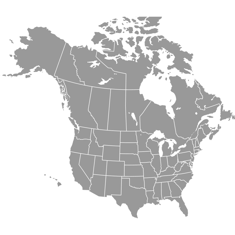
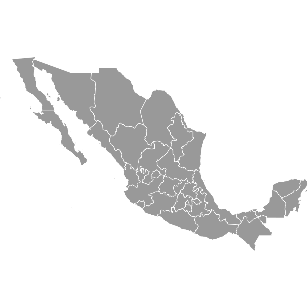
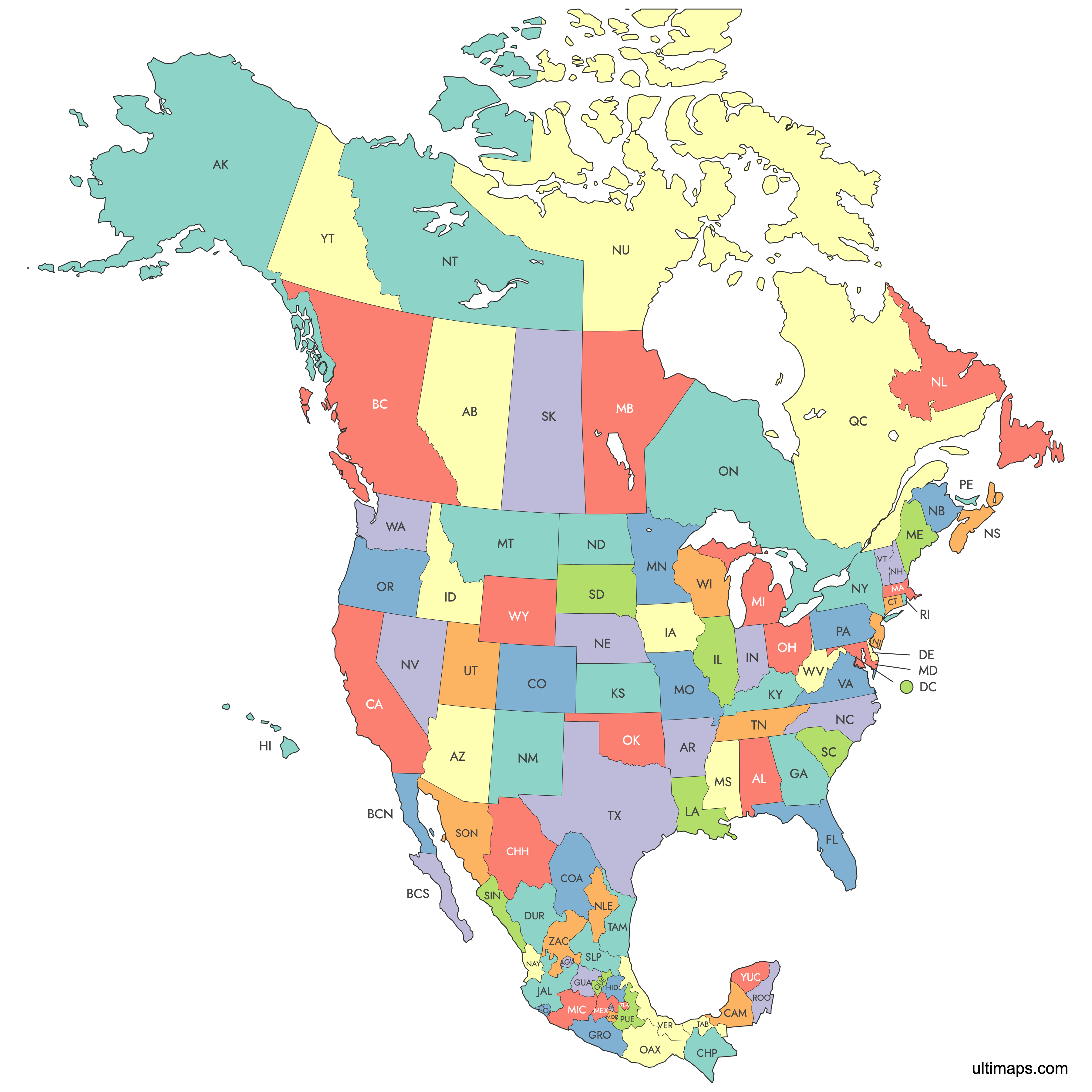
Map of Canada, USA and Mexico
The United States, Canada and Mexico together contain 97 first-level administrative divisions: 50 U.S. states plus the District of Columbia, 10 Canadian provinces and 3 territories, and 32 Mexican states including Mexico City. Use the interactive maps below to explore state and province boundaries. Download free reference maps or learn more about creating a custom map to visualize your own data.
Interactive Map of Canada, USA and Mexico
List of States/Provinces (97)
| # | State/Province |
|---|---|
| 1 | |
| 2 | |
| 3 | |
| 4 | |
| 5 | |
| 6 | |
| 7 | |
| 8 | |
| 9 | |
| 10 | |
| 11 | |
| 12 | |
| 13 | |
| 14 | |
| 15 | |
| 16 | |
| 17 | |
| 18 | |
| 19 | |
| 20 | |
| 21 | |
| 22 | |
| 23 | |
| 24 | |
| 25 | |
| 26 | |
| 27 | |
| 28 | |
| 29 | |
| 30 | |
| 31 | |
| 32 | |
| 33 | |
| 34 | |
| 35 | |
| 36 | |
| 37 | |
| 38 | |
| 39 | |
| 40 | |
| 41 | |
| 42 | |
| 43 | |
| 44 | |
| 45 | |
| 46 | |
| 47 | |
| 48 | |
| 49 | |
| 50 | |
| 51 | |
| 52 | |
| 53 | |
| 54 | |
| 55 | |
| 56 | |
| 57 | |
| 58 | |
| 59 | |
| 60 | |
| 61 | |
| 62 | |
| 63 | |
| 64 | |
| 65 | |
| 66 | |
| 67 | |
| 68 | |
| 69 | |
| 70 | |
| 71 | |
| 72 | |
| 73 | |
| 74 | |
| 75 | |
| 76 | |
| 77 | |
| 78 | |
| 79 | |
| 80 | |
| 81 | |
| 82 | |
| 83 | |
| 84 | |
| 85 | |
| 86 | |
| 87 | |
| 88 | |
| 89 | |
| 90 | |
| 91 | |
| 92 | |
| 93 | |
| 94 | |
| 95 | |
| 96 | |
| 97 |
About United States, Canada and Mexico
- Total States and Provinces: 97 first-level divisions (51 U.S., 13 Canadian, 32 Mexican).
- Largest Region by Area: Nunavut (Canada) at approximately 808,185 sq mi (2,093,190 km²).
- Smallest Region by Area: Rhode Island (USA) at approximately 1,214 sq mi (3,144 km²).
- Most Populous Region: California (USA) with about 39.5 million residents (2020 census).
- Least Populous Region: Yukon (Canada) with about 40,232 residents (2021 census).
- National Capitals: Washington, D.C. (United States), Ottawa, Ontario (Canada), Mexico City (Mexico).
- Bordering Countries: The United States borders Canada to the north and Mexico to the south. Canada borders only the United States. Mexico borders the United States to the north and Guatemala and Belize to the southeast.
- Bordering Bodies of Water: Atlantic Ocean, Pacific Ocean, Arctic Ocean, Gulf of Mexico, Caribbean Sea.
- Time Zones: Spans from Newfoundland Time (UTC-3:30) in eastern Canada to Hawaii-Aleutian Time (UTC-10) in the western United States, with at least 10 distinct time zones across the three countries.
- Current Boundaries Established: The U.S. 50-state configuration has been stable since 1959. Canada's most recent boundary change was the creation of Nunavut in 1999. Mexico's Distrito Federal was reconstituted as Mexico City with full state-like status in 2016.
Interesting Facts
- The U.S.-Canada border stretches roughly 5,525 miles and is the longest international land border in the world.
- Nunavut is the largest first-level division on this map yet one of the least densely populated administrative regions on Earth.
- Alaska is larger than any single U.S. state and bigger than most countries, yet it is separated from the contiguous 48 states by Canadian territory.
- Prince Edward Island, the smallest Canadian province at about 2,185 sq mi (5,660 km²), is still larger than Rhode Island.
- Estado de México nearly encircles Mexico City and is the most populous Mexican state with about 16.99 million people (2020 census), which can make the two hard to distinguish on a map without clear labeling.
Free Downloads
You can download free blank Map of Canada, USA and Mexico and other maps in high resolution PNG, SVG and PDF formats from the blank maps section of the site: Download Blank Map of Canada, USA and Mexico
Custom Map Features
This map supports labels.
This map is divided into 97 states/provinces.
Updates
Feb 7, 2025:
- Added map of Canada, USA and Mexico states/provinces
Frequently Asked Questions
Together they contain 97 first-level administrative divisions. The United States has 50 states plus the District of Columbia (51 units), Canada has 10 provinces and 3 territories (13 units), and Mexico has 32 states including Mexico City.
Nunavut in Canada is the largest at approximately 808,185 sq mi (2,093,190 km²). The next largest is Alaska at about 665,384 sq mi (1,723,337 km²), followed by Quebec at roughly 595,391 sq mi (1,542,056 km²).
Rhode Island is the smallest at about 1,214 sq mi (3,144 km²). The smallest Mexican state is Tlaxcala at approximately 1,558 sq mi (4,016 km²), and the smallest Canadian province is Prince Edward Island at about 2,185 sq mi (5,660 km²).
California is the most populous region across all three countries, with about 39.5 million residents as of the 2020 U.S. Census. Its largest city is Los Angeles. In Canada, Ontario leads with about 14.8 million people (2021 census), and in Mexico, Estado de México tops the list at roughly 16.99 million (2020 census).
New York City is in New York state, the Grand Canyon is in Arizona, and Yellowstone National Park spans mainly Wyoming with portions in Montana and Idaho. In Canada, Toronto (Ontario) and Vancouver (British Columbia) are the largest cities. In Mexico, Guadalajara is in Jalisco and Cancun is in Quintana Roo.
The three countries collectively border the Atlantic Ocean, Pacific Ocean, Arctic Ocean, Gulf of Mexico, and Caribbean Sea. Canada shares its only land border with the United States. Mexico borders the United States to the north and Guatemala and Belize to the southeast. The U.S.-Canada border is the longest international land border in the world.
You can use Ultimaps to create custom maps of United States, Canada and Mexico. Color-code states/provinces manually or upload your data, place pins, customize the look, and export to PNG, PDF, or SVG. No sign-up required.