Estonia Map with Counties
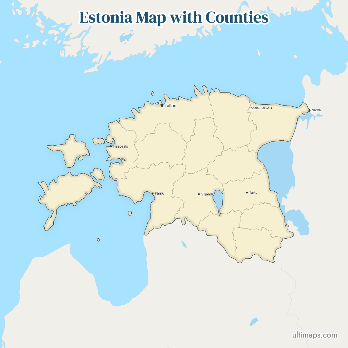
Estonia's first level of administrative division consists of 15 counties, known in Estonian as maakonnad. Names appear in two forms, so Harju and Harjumaa mean the same county. Harju County holds Tallinn, the national capital, and 646,315 of Estonia's 1,374,687 residents, nearly half the country's population (Statistics Estonia, January 2024). Pärnu County is the largest by area at 5,419 km² (2,092 sq mi). Hiiu and Saare cover the large western islands, and Ida-Viru stretches along the Russian border in the northeast, taking in Narva and Kohtla-Järve. Since the 2017 administrative reform, counties have had no government bodies of their own, but they remain the standard geography for statistics, planning and addresses.
Start with the interactive map below if you need to check which county a town falls in. Saving the blank version is free, and a county-by-county spreadsheet turns the same outlines into a shaded statistical map.
Interactive Estonia Map with Counties
List of Counties (15)
Estonia Counties: Key Facts
- Total number of counties: 15 (maakonnad), Estonia's first-level administrative units, five more than neighboring Lithuania's 10 counties
- Most populous county: Harju County, home to Tallinn, with 644,758 residents (2026, Statistics Estonia)
- Least populous county: Hiiu County, on the island of Hiiumaa, with 8,330 residents (2026, Statistics Estonia)
- Largest county by area: Pärnu County, 5,419 km² (2,092 sq mi) on post-2017 boundaries, followed by Harju at 4,327 km² (1,671 sq mi)
- Smallest county by area: Hiiu County, 1,032 km² (398 sq mi)
- Counties with major urban centers: Harju (Tallinn), Tartu (Tartu), Ida-Viru (Narva, Kohtla-Järve, Jõhvi), Pärnu (Pärnu), Lääne-Viru (Rakvere), Saare (Kuressaare), Lääne (Haapsalu)
- Capital: Tallinn, which serves as both the national capital and the seat of Harju County
- Borders: Russia to the east and Latvia to the south, with the Baltic Sea to the west, the Gulf of Finland to the north and Finland and Sweden across the water
- Time zone: Eastern European Time (UTC+2), moving to Eastern European Summer Time (UTC+3) during daylight saving
- Boundary history: the set of 15 counties has been stable for decades. The 2017 local government reform merged the municipalities underneath, abolished the state-appointed county governments as of 1 January 2018, and shifted several county lines where merged municipalities crossed old boundaries — Pärnu County, for example, grew when Lääneranna joined it. The Estonian Land Board maintains the official administrative division (last revised January 2026).
Interesting Facts
- Eight counties share a name with their county town: Jõgeva, Pärnu, Põlva, Rapla, Tartu, Valga, Viljandi and Võru.
- Two counties are entirely insular. Hiiu covers Hiiumaa, Saare covers Saaremaa and its neighboring islands, with Kärdla and Kuressaare as their county towns.
- Northern Estonia is usually defined as the three northernmost counties together: Harju, Ida-Viru and Lääne-Viru.
- Harju County holds more than 75 times the population of Hiiu County: 644,758 against 8,330 (2026, Statistics Estonia).
- Ida-Viru is unusual in that its county town, Jõhvi, is smaller than two other cities in the same county, Narva and Kohtla-Järve.
Free Downloads
Free for personal and commercial use with a credit to Ultimaps. See the license terms for details.
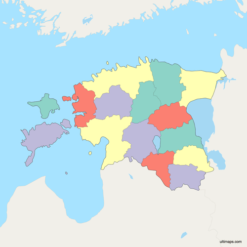
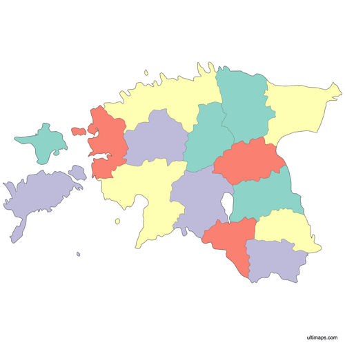 Colored Estonia Map with Countiespng502 KB
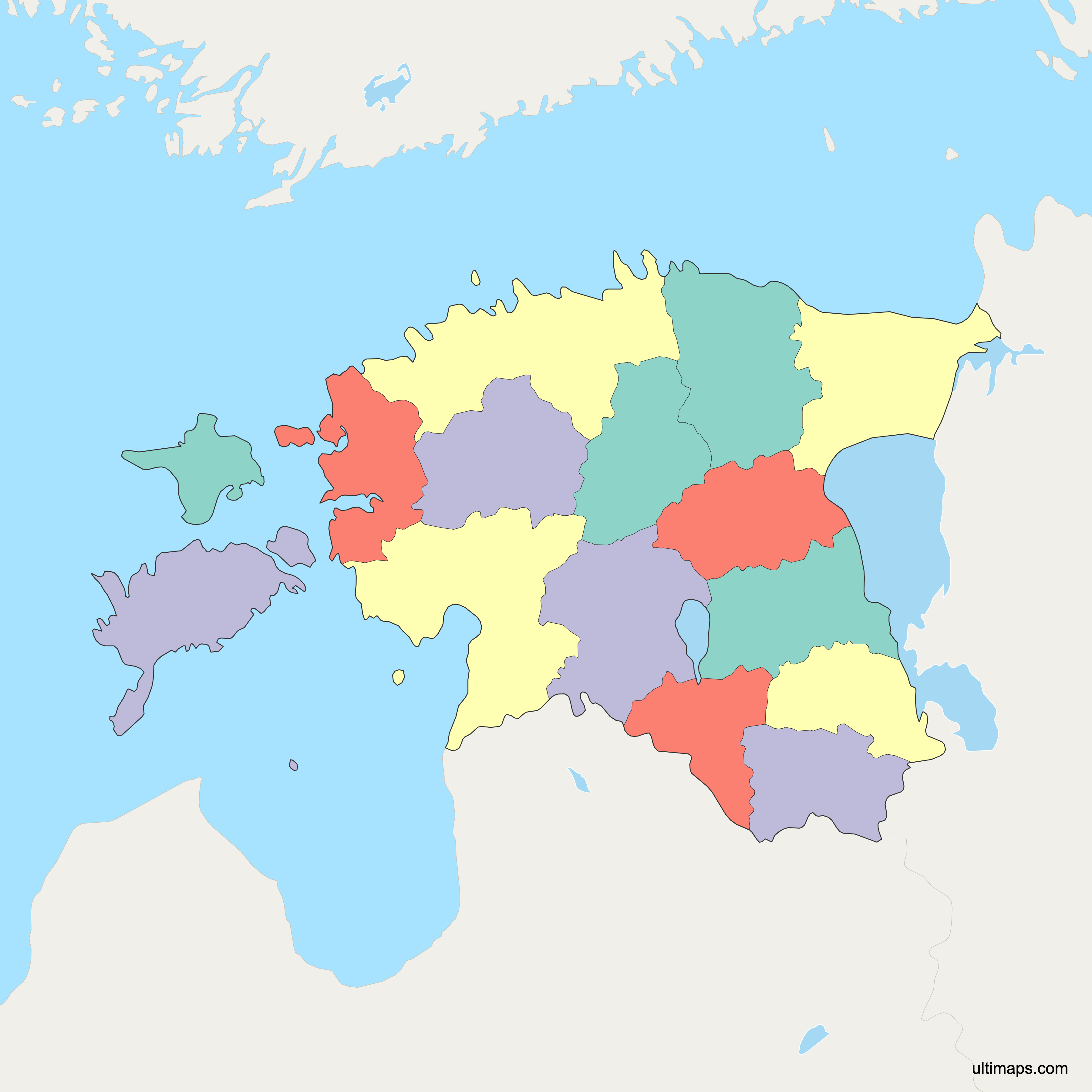
 Political Map of Estonia with Countiespng712 KB
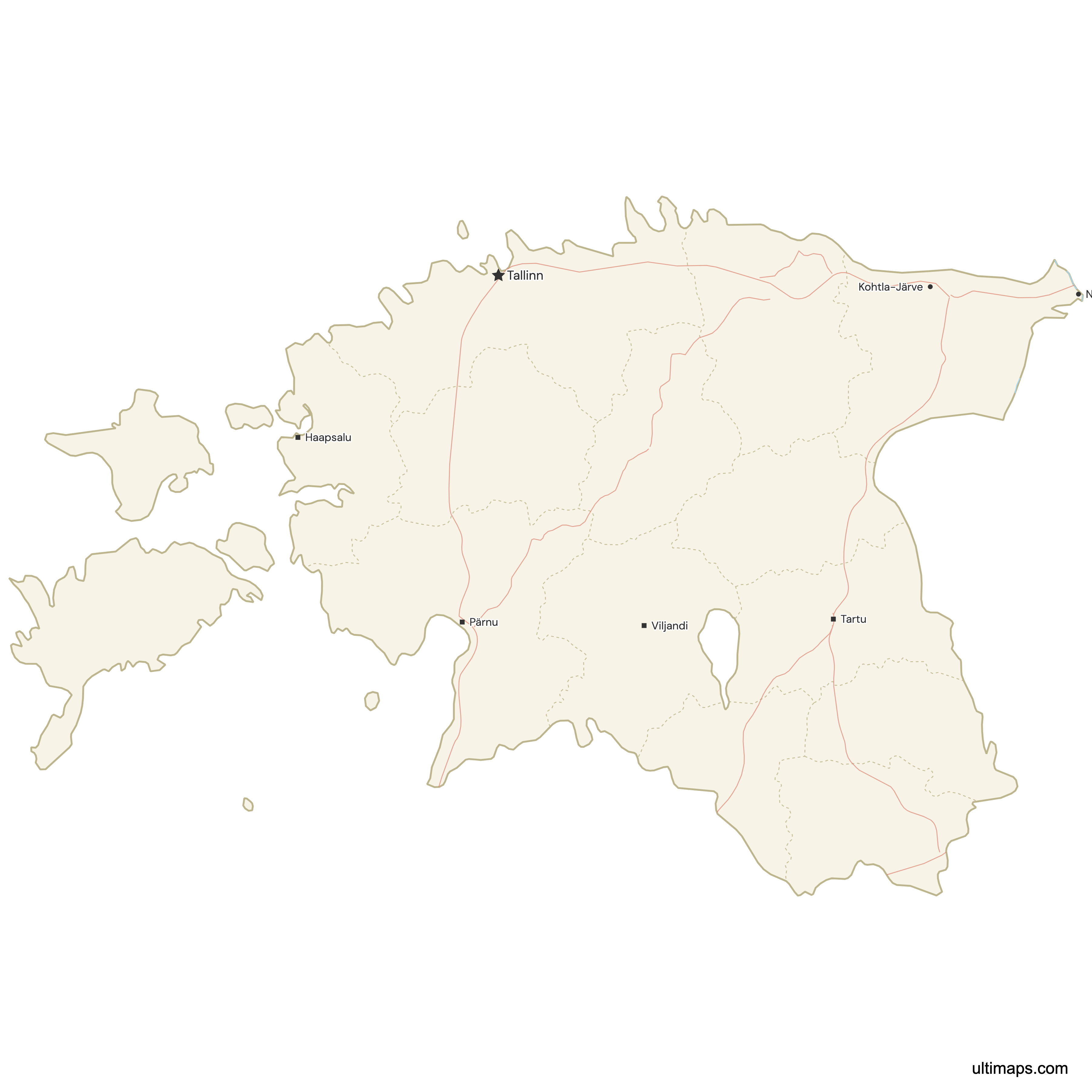
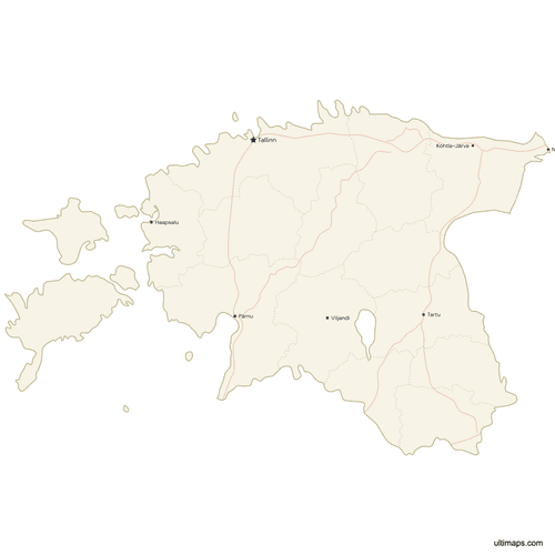 Map of Estonia with Cities and Roadspng588 KB
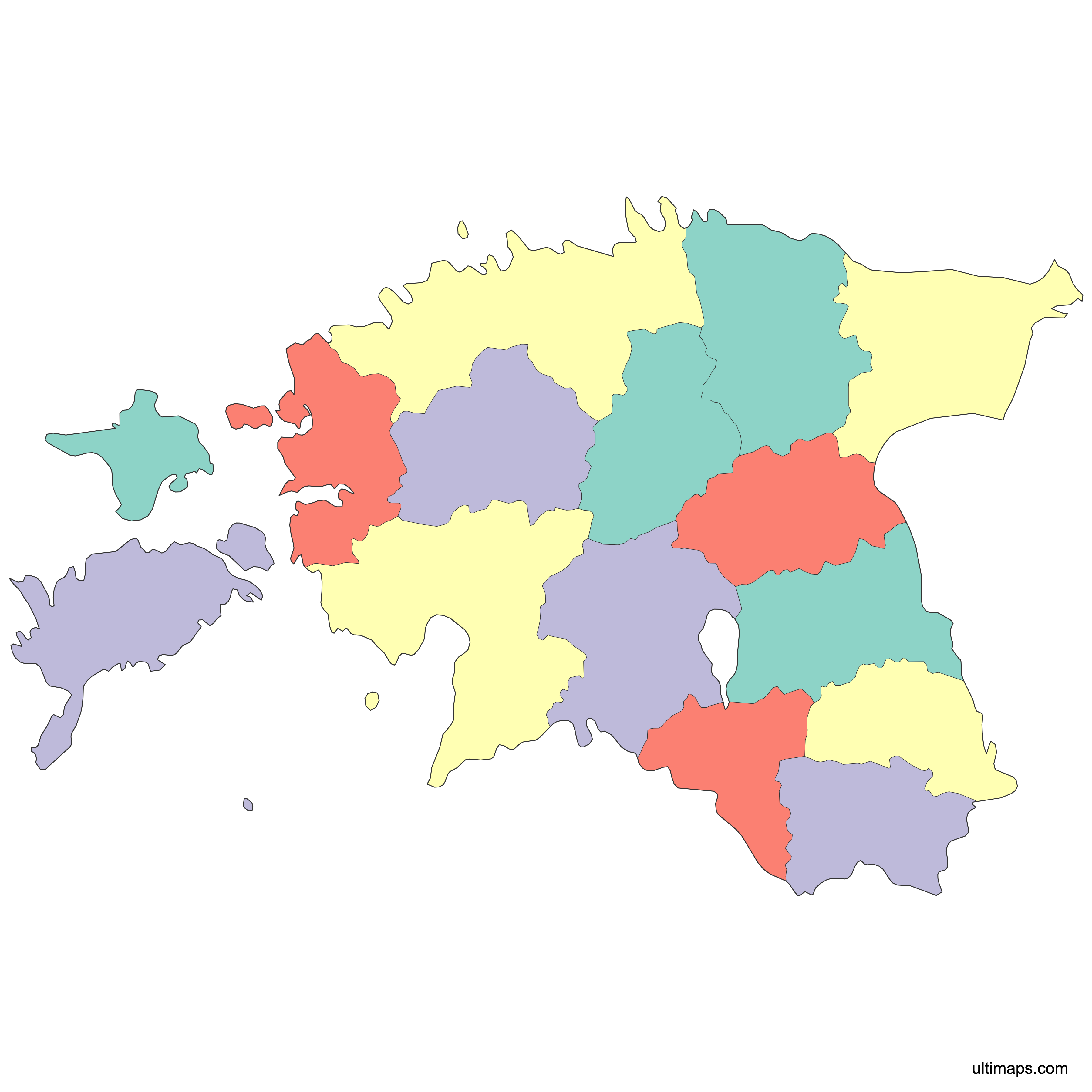
Need it without colors? The blank version of this map comes as a print-ready PDF (A4 and US Letter), a PNG and an editable SVG.
Custom Map Features
This map supports surrounding areas, roads, rivers and cities. New
This map is divided into 15 counties.
Updates
May 14, 2026:
- Added map of Estonia Counties with surrounding countries, cities, roads, rivers and lakes
Frequently Asked Questions
Estonia has 15 counties, called maakonnad in Estonian, and they form the country's first level of administrative division. The map on this page shows all 15. In alphabetical order they are Harju, Hiiu, Ida-Viru, Järva, Jõgeva, Lääne, Lääne-Viru, Pärnu, Põlva, Rapla, Saare, Tartu, Valga, Viljandi and Võru. Each has a county town, from Tallinn in Harju to Kuressaare on the island of Saaremaa. Below the counties sit the municipalities, the rural parishes and towns that carry out local government following the 2017 reform.
Pärnu County is the largest Estonian county by area at 5,419 km² (2,092 sq mi) on post-2017 boundaries, covering the southwestern coast around the resort city of Pärnu, which is also its county town. Harju County comes next at 4,327 km² (1,671 sq mi), and Tartu County measures 3,349 km² (1,293 sq mi). At the other end, Hiiu County covers 1,032 km² (398 sq mi), so Pärnu is more than five times its size. Area rankings differ from population rankings: Pärnu had 87,015 residents in 2026, far fewer than Harju.
Harju County is the most populous county in Estonia, recorded at 644,758 residents (2026, Statistics Estonia). Tallinn, the national capital and the country's largest city, sits inside it. Tartu County ranks second with 164,825, Ida-Viru County third with 127,909 and Pärnu County fourth with 87,015 (all 2026). Smaller counties such as Lääne (20,200) and Saare (31,521) fall well behind, and close to half of Estonia's population lives in Harju alone.
Hiiu County is the smallest Estonian county on both measures. It covers 1,032 km² (398 sq mi) and has 8,330 residents (2026, Statistics Estonia), about a fifth of the area of Pärnu County and little over one percent of Harju County's population. Hiiu consists of Hiiumaa, the second largest Estonian island, plus surrounding islets, and its county town is Kärdla. For comparison, Lääne County holds 20,200 and Valga County 27,034 (2026), so Hiiu is the smallest by a wide margin.
No. Estonian counties and municipalities sit on different levels. The 15 counties are first-level territorial units used for statistics, state administration and regional planning. Municipalities, made up of rural parishes (vallad) and towns (linnad), are the second level, and they are where elected local government actually operates. The 2017 local government reform merged many municipalities into larger units and abolished the state-appointed county governments, which is why published municipality counts vary depending on the date and the classification used. A few county lines moved where merged municipalities crossed old boundaries, but the set of 15 counties itself was unchanged.
Estonian counties no longer have their own administrations. The 2017 local government reform reorganized municipalities and abolished the state-appointed county governments as of 1 January 2018, transferring their functions to the merged municipalities and to state agencies. The 15 counties continue to exist as territorial and statistical units, they still appear on official mapping from the Estonian Land Board, and county names remain in everyday use for addresses, regional planning and reporting. What changed is governance, not the county set: Estonia had 15 counties before the reform and has 15 today, though a few lines shifted where merged municipalities crossed old boundaries.
Two of Estonia's 15 counties are island counties. Hiiu County covers Hiiumaa and its surrounding islets, spans 1,032 km² (398 sq mi) and is administered from Kärdla. Saare County covers Saaremaa, Muhu and nearby islands, with Kuressaare as its county town and 31,521 residents (2026, Statistics Estonia). Both lie off the western coast in the Baltic Sea. Other counties, including Lääne, Pärnu and Harju, include smaller offshore islands but are mainly mainland territory. On the map the two island counties are separated from the rest by open water.
Harju and Harjumaa refer to the same Estonian county. Estonian county names are built with the suffix -maa, meaning land, so Harjumaa is the full native form while Harju is the short stem used in English and in many datasets. The same applies across the country: Saare and Saaremaa, Tartu and Tartumaa, Ida-Viru and Ida-Virumaa. If you upload a spreadsheet to color the map, keep the naming consistent with the labels on the map, since a mix of Harju and Harjumaa in the same column can leave counties unmatched.
Estonia county maps are edited in Ultimaps straight from a browser, and neither an install nor a login is involved. Two coloring routes exist. One is manual: select Saare, Võru or any other county and pick its fill. The other starts from data. Add one value per county and the 15 fills follow a graduated scale. Styling is granular: the palette and background are chosen separately, labels can be reworded or set in a different typeface, and outline thickness is adjusted on its own. You can also drop captioned markers on Tallinn, Tartu, Narva, Kuressaare or coordinates you type. The finished map downloads as PNG, PDF or SVG.